Regional overview
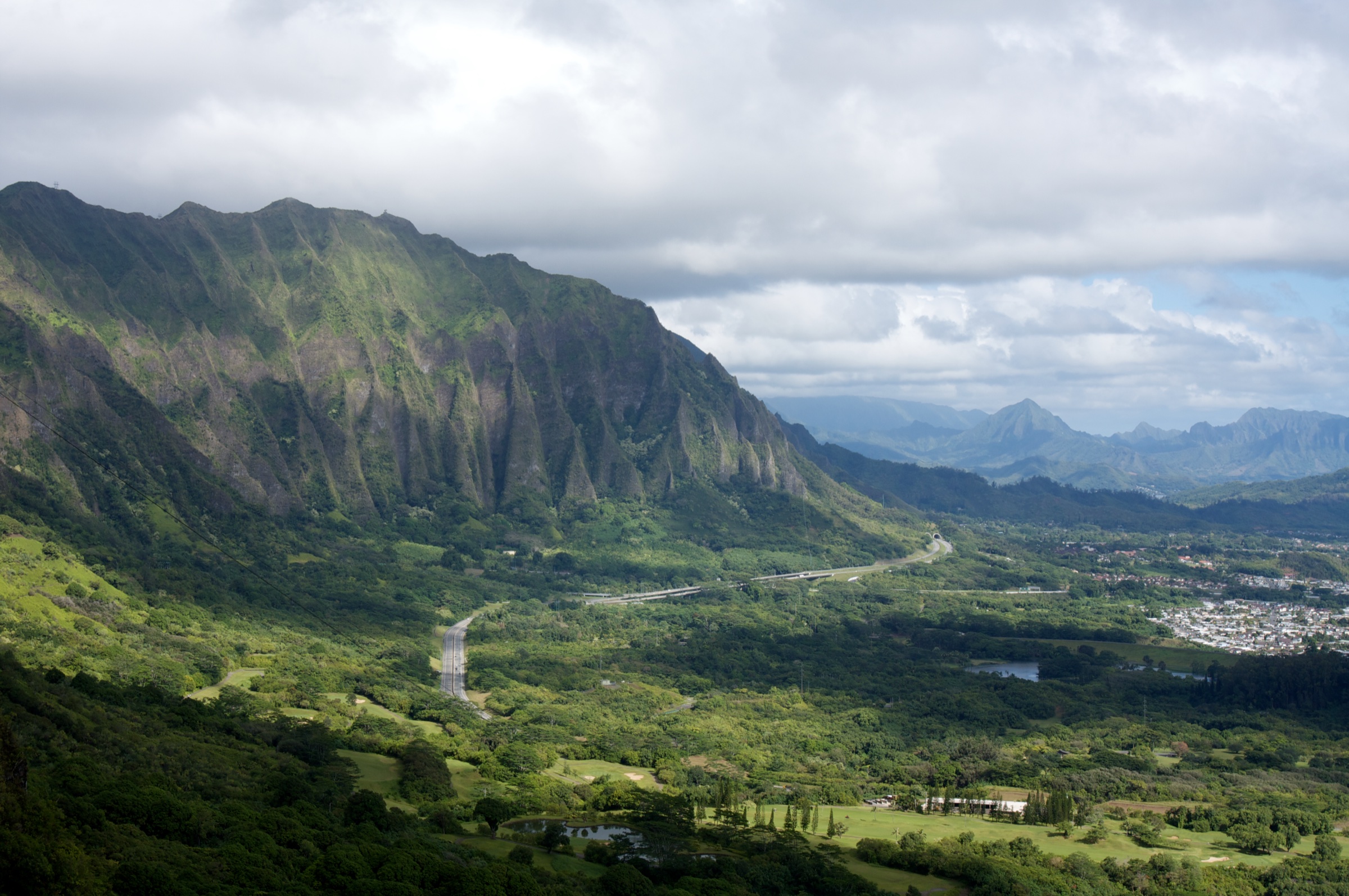
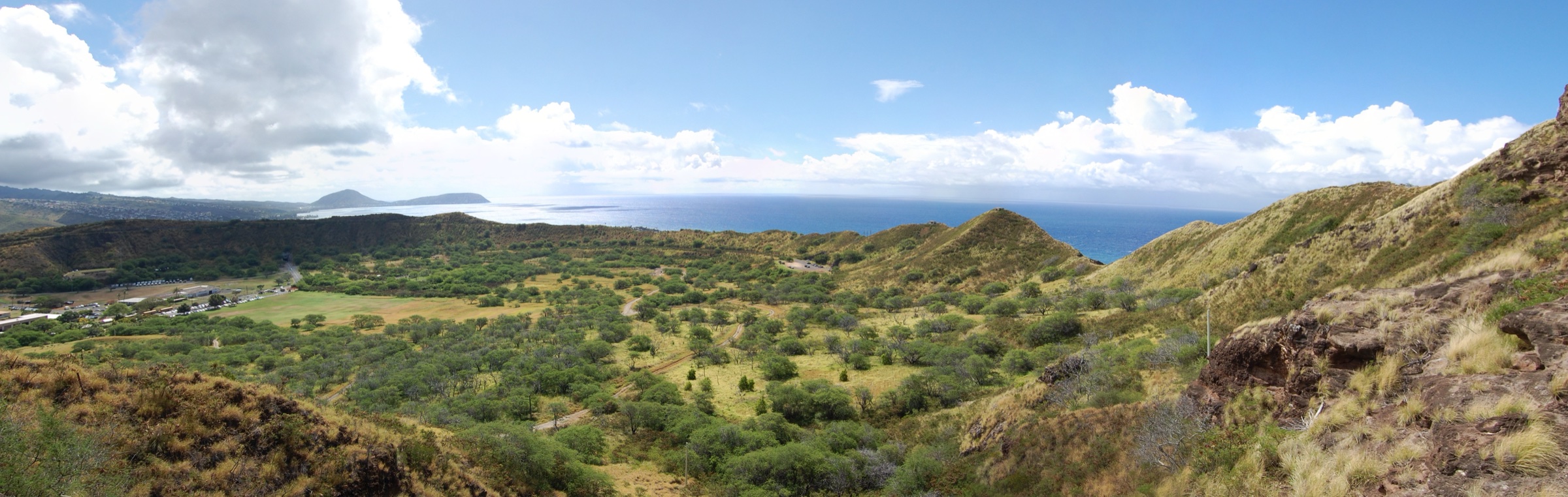
The hills that rise directly behind Honolulu are the eroded southern flank of the Koʻolau Range — an ancient shield volcano that collapsed and eroded over roughly two million years — with a scatter of much younger tuff cones and cinder cones from the Honolulu Volcanics rejuvenated-stage eruptions, dating from about 400,000 to 70,000 years ago. Diamond Head (Lēʻahi, 232 m / 762 ft) and Koko Crater (Kohelepelepe / Puʻu Mai, 368 m / 1,208 ft) are tuff cones from that late series; Mount Tantalus (614 m / 2,014 ft) and neighbouring Puʻu ʻUalakaʻa are cinder cones on the ridges above the city. Between them lies the Honolulu Mauka Trail System, a network of forested trails threading Makiki, Pauoa and Mānoa valleys and managed jointly by Nā Ala Hele and the Division of State Parks.
The five hikes in this catalogue cover four distinct front-hills experiences: a paved-and-stair climb up a coastal-defence tuff cone (Diamond Head Summit Trail); a wooden-tie stairway up a former WWII tramway (Koko Head Crater Trail); a rainforest waterfall walk in Mānoa Valley (Mānoa Falls Trail); a forested cliff-and-ridge loop above the city (the Makiki – Manoa Cliff – Puʻu ʻŌhiʻa loop); and an ironwood-and-native ridge above St Louis Heights (Waʻahila Ridge Trail). Land ownership is mixed — Diamond Head is a State Monument (DSP), Koko Head Crater Trail sits within Koko Head Regional Park (City & County of Honolulu Department of Parks and Recreation) and is maintained under volunteer contract by the Kokonut Koalition, Waʻahila Ridge lies within a State Recreation Area, and the Makiki / Manoa Cliff / Puʻu ʻŌhiʻa trails run through the Round Top Forest Reserve on Nā Ala Hele trails with the Hawaiʻi Nature Center serving as the practical trailhead.
Currency notes (July 2026): the biggest access change is the Diamond Head reservation system — non-residents must book an entry-and-parking slot 30 days in advance at midnight HST via gostateparks.hawaii.gov; Hawaiʻi residents are exempt with valid ID. Non-resident entry is US$5 per person, parking US$10 per vehicle. Koko Head Crater Trail reopened on 10 July 2025 after a brief closure following a summit incident; the City sealed the summit bunker openings with metal bars in late 2025. Mānoa Falls uses the private Paradise Park lot (approximately US$7 / vehicle, US$4 residents/military as of 2026); the Hawaiʻi Department of Health advises against wading or swimming in freshwater pools statewide due to leptospirosis risk.
Selection rationale
Five routes are presented to give balanced front-hills coverage. Diamond Head Summit Trail is Hawaiʻi’s most-recognised summit and the archetypal Honolulu day-hike. Koko Head Crater Trail is the classic short-and-brutal stairway climb up a WWII tramway. Mānoa Falls Trail is the accessible rainforest waterfall walk directly behind U-Mānoa. The Makiki – Manoa Cliff – Puʻu ʻŌhiʻa loop is the definitive forested Tantalus outing above the city. Waʻahila Ridge Trail is the pine-scented, city-facing ridge between Mānoa and Pālolo. Together they cover a coastal tuff cone, a stair scramble, a rainforest waterfall, a long forested loop and an ironwood ridge — the range of front-hills terrain in five routes.
Summary
| # | Hike | Trailhead | Route type | Distance | Gain | Max elevation | Difficulty |
|---|---|---|---|---|---|---|---|
| 1 | Diamond Head (Lēʻahi) Summit Trail | Diamond Head State Monument | Out-and-back | 2.6 km / 1.6 mi | ~170 m / 560 ft | 232 m / 762 ft | Moderate |
| 2 | Koko Head Crater Trail | Koko Head District Park, Hawaiʻi Kai | Out-and-back stair climb | ~2.5 km / 1.6 mi | ~300 m / 1,000 ft | 368 m / 1,208 ft | Strenuous |
| 3 | Mānoa Falls Trail | End of Mānoa Rd, upper Mānoa | Out-and-back | 2.6 km / 1.6 mi | ~150 m / 500 ft | ~240 m / 800 ft | Easy–moderate |
| 4 | Makiki – Manoa Cliff – Puʻu ʻŌhiʻa loop | Hawaiʻi Nature Center, Makiki Heights | Loop | 9.5 km / 5.9 mi (extended) | ~455 m / 1,500 ft | ~610 m / 2,000 ft | Moderate |
| 5 | Waʻahila Ridge Trail | Waʻahila Ridge SRA, St Louis Heights | Out-and-back | 7.7 km / 4.8 mi | ~152 m / 500 ft | ~490 m / 1,600 ft | Moderate–hard |
1. Diamond Head (Lēʻahi) Summit Trail
Snapshot
Itinerary
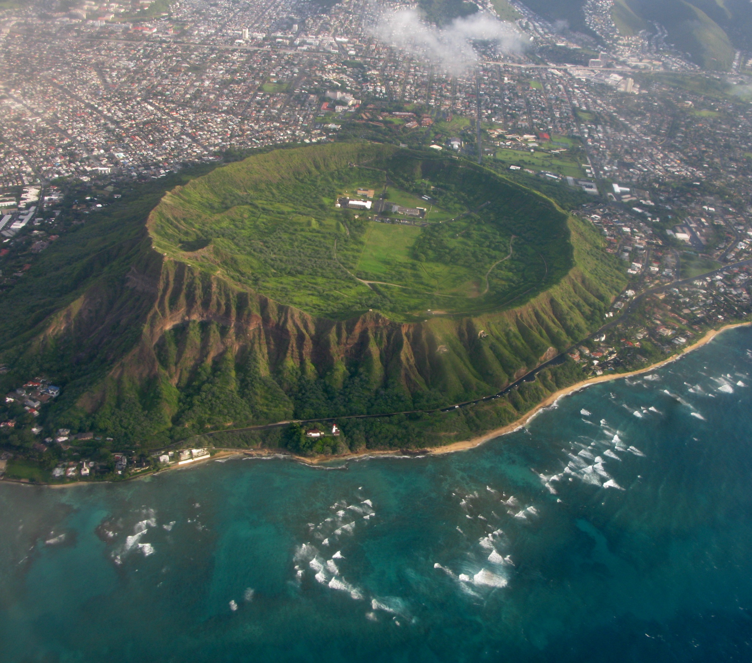
From the crater floor a concrete path climbs gently for the first 300 m, then turns to natural tuff and switchbacks up the interior slope. The upper section is a set of steep concrete-and-metal stairs, a 69 m lighted tunnel driven through the crater rim and a spiral staircase into the 1911 Fire Control Station on the rim. The summit platform sits atop WWII bunkers, adjoining the 1917 navigational lighthouse structure, with 360° views from Koko Head east to the Waiʻanae Range and — in winter months (December–April) — humpback whales working the channel offshore.
Why it is essential
Lēʻahi is Hawaiʻi’s most-recognised summit and the archetypal Honolulu day-hike — a compact climb through 300,000-year-old tuff and coastal-defence history with a definitive Waikiki-to-Koko-Head panorama at the top.
Equipment
- Sturdy trainers
- ≥1 L water per person
- Sun hat and sunscreen
- Optional headlamp for the tunnel
Hazards and notes
- Reservation required for non-residents — book 30 days ahead at 00:00 HST via gostateparks.hawaii.gov
- Hours 06:00–18:00 daily; last reservation 16:00, last entry 16:30, gate locked 18:00
- Heat and sun exposure — the crater is hot, dry, treeless
- Steep stairs and uneven tuff — the tunnel is lighted but low-ceilinged
- No dogs, no bikes
2. Koko Head Crater Trail
Snapshot
Itinerary
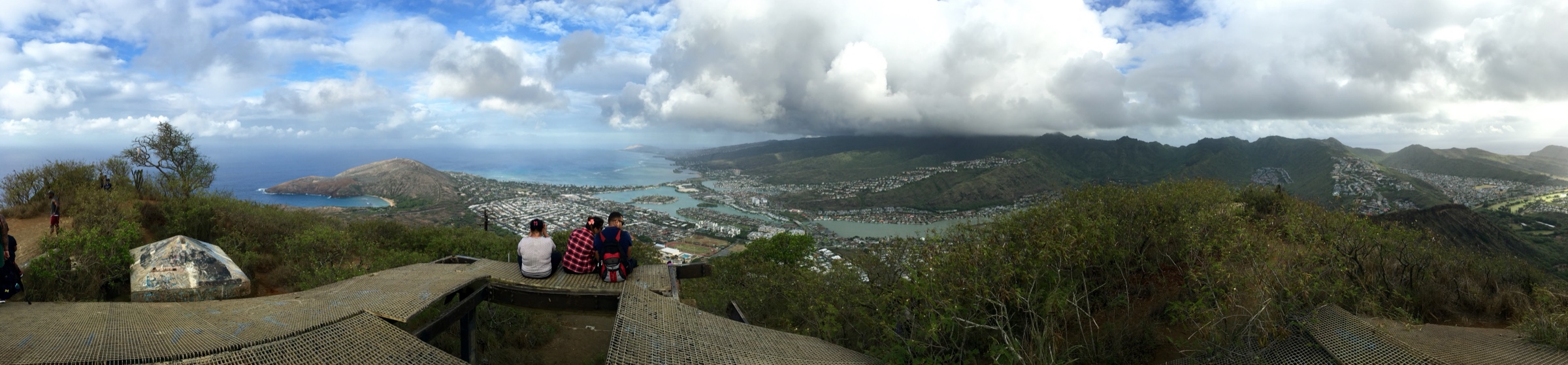
The route follows the wooden-tie roadbed of a WWII military tramway that supplied bunkers and radar stations on the crater rim. A short gravel road leads from the parking lot to the base of the ties; the climb is essentially a single line straight up the west flank of the crater. The mid-section crosses an eroded gully where the ties become a raised open trestle — the “bridge”, the crux for anyone uncomfortable with exposure — then continues at grade to the summit bunker complex, with 360° views from Diamond Head west to Makapuʻu east and Molokaʻi across the channel. The commonly cited tie count from the Kokonut Koalition volunteer maintainers is 1,048.
Why it is essential
No other Honolulu-side hike delivers the same short-and-brutal stair grade or the same top-out panorama over Hanauma Bay, the Koʻolau front and the Waikiki skyline. The wooden-tie surface is unique on Oʻahu.
Equipment
- Trail runners or approach shoes with rand protection
- ≥1.5 L water
- Hat and sunscreen
- Headlamp for pre-dawn starts
Hazards and notes
- Steep exposed stairway with no handrail
- Loose or broken ties — Kokonut Koalition volunteers rebuild sections periodically but storm damage recurs
- Bridge section has open gaps between ties
- Extreme sun and heat exhaustion risk — no water on route
- Summit bunker openings were sealed with metal bars in late 2025
3. Mānoa Falls Trail
Snapshot
Itinerary
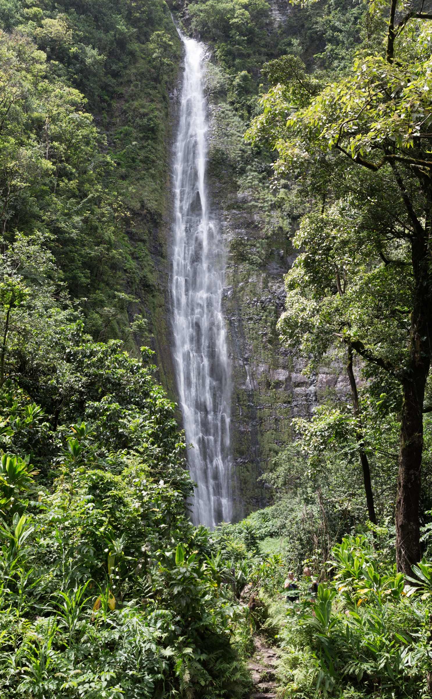
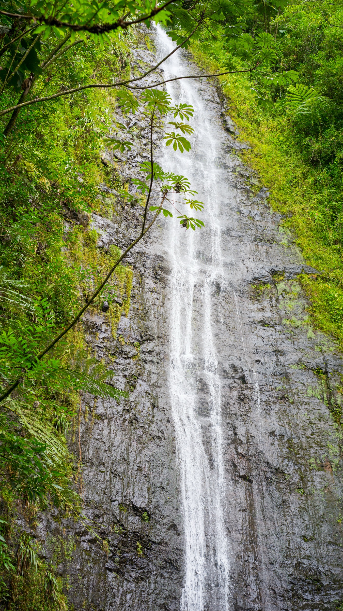
The trail begins at a fire-lane gate past Paradise Park, crosses a footbridge and passes a grove of Eucalyptus robusta before entering closed rainforest canopy — dense bamboo, banyan, kukui and hau. It contours gently up the east side of upper Mānoa Valley alongside a stream. At about 1.3 km it reaches the pool at the base of the 46 m Mānoa Falls, where a safety cable and viewing area mark the trail terminus; access to the pool and rock ledges beyond has been closed by DLNR due to falling-rock hazard. The Aihualama Trail branches left roughly 45 m before the falls, offering a bamboo-forest connector to Pauoa Flats and the wider Honolulu Mauka network.
Why it is essential
Mānoa Falls is the most accessible tropical rainforest waterfall walk on Oʻahu, on a well-maintained Nā Ala Hele trail directly behind the University of Hawaiʻi at Mānoa — a low-commitment introduction to the mauka Koʻolau front.
Equipment
- Grippy footwear (trail runners or hiking shoes)
- Light rain layer
- ≥750 mL water
- Insect repellent
Hazards and notes
- Leptospirosis risk — the Hawaiʻi Department of Health advises against wading, swimming or contact with freshwater pools; do not enter the pool at the falls
- Falling rocks in the amphitheatre — stay outside the closed area
- Slippery mud and exposed roots — especially after rain
- Flash-flood risk during and after heavy rain — do not enter the stream when it is brown or rising
- Vehicle break-ins reported at the Paradise Park lot
4. Makiki – Manoa Cliff – Puʻu ʻŌhiʻa Loop
Snapshot
Itinerary
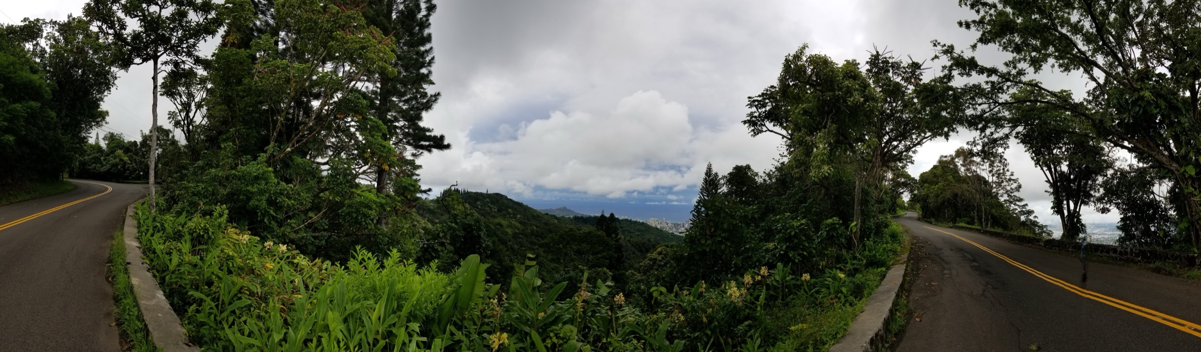
From the Hawaiʻi Nature Center the standard loop begins on the Maunalaha Trail, crossing a bridge past taro loʻi and climbing the east ridge of Makiki Valley to a four-way junction. It turns west onto the Makiki Valley Trail, contours across the valley through eucalyptus, kukui and paperbark forest, then rejoins the Kanealole Trail to descend along Kanealole Stream back to the trailhead. The extended version continues up the Moleka Trail to Round Top Drive, crosses the road onto the Manoa Cliff Trail — a 3.7 km contour along the head of Mānoa Valley through native ʻōhiʻa, koa and the Manoa Cliff restoration plots — with an optional detour up the Puʻu ʻŌhiʻa Trail to the summit ridge, then returns via the Kalawahine Trail and a short road walk.
Why it is essential
The Makiki–Manoa Cliff loop is the definitive forested Tantalus outing above Honolulu, sampling 1930s CCC reforestation history, the Manoa Cliff native-species restoration and the city-facing overlooks around Puʻu ʻUalakaʻa. It is the only route in the group that combines rainforest, ridge and lookout in a single loop.
Equipment
- Grippy hiking shoes or trail runners
- Insect repellent
- 1 L water
- Light rain shell
Hazards and notes
- Slick mud and clay after rain, especially on Manoa Cliff and Kanealole
- Vehicle break-ins reported at the trailhead
- Leptospirosis risk in Kanealole Stream crossings — cover cuts
- Mosquitoes on the valley floor
- Nature Center parking gate may be closed at weekends; overflow on Makiki Heights Drive is legal
5. Waʻahila Ridge Trail
Snapshot
Itinerary
From the SRA parking lot the trail passes beneath a powerline, drops briefly, then climbs onto the ridge crest between Mānoa and Pālolo valleys. The lower two-thirds run through Cook pine (Araucaria columnaris) and Norfolk-island-pine plantings mixed with strawberry guava and Christmas berry — an ironwood-scented, needle-carpeted forest floor. Native koa and ʻōhiʻa reappear in the upper third. The trail ends at a signed junction with the Kolowalu Trail; DLNR signage prohibits continuing beyond the junction toward Mount Olympus / Awaʻawaloa, which lies inside a Restricted Watershed Area.
Why it is essential
Waʻahila Ridge is the most alpine-feeling route above the city — a needle-covered ridge with periodic open views across Mānoa, Pālolo and central Honolulu — and the least-crowded of the five, with a genuine forest character absent from the coastal cones.
Equipment
- Sturdy hiking shoes
- 1 L water
- Light rain shell
Hazards and notes
- Steep drop-offs on the narrow ridge sections
- Slick clay and roots after rain
- Watershed boundary — do not proceed past the Kolowalu junction toward Mount Olympus without appropriate permit; unauthorised entry is trespass
- Dogs prohibited in the park itself but permitted (leashed) transiting to the trail
Further reading
| Resource | Link |
|---|---|
| DLNR — Division of State Parks: Oʻahu | dlnr.hawaii.gov/dsp/parks/oahu |
| DLNR — Diamond Head State Monument | dlnr.hawaii.gov/dsp/parks/oahu/diamond-head-state-monument |
| Diamond Head reservation system | gostateparks.hawaii.gov/diamondhead/about |
| DLNR — Diamond Head Summit Trail | dlnr.hawaii.gov/dsp/hiking/oahu/diamond-head-summit-trail |
| DLNR — Waʻahila Ridge SRA | dlnr.hawaii.gov/dsp/parks/oahu/waahila-ridge-state-recreation-area |
| DLNR — Waʻahila Ridge Trail | dlnr.hawaii.gov/dsp/hiking/oahu/waahila-ridge-trail |
| Nā Ala Hele — Honolulu Mauka Trail System PDF | Honolulu Mauka map (PDF) |
| Kokonut Koalition — Koko Head Crater Trail volunteers | kokonutkoalition.org |
| City & County of Honolulu Department of Parks and Recreation | honolulu.gov/parks |
| Hawaiʻi Nature Center (Makiki) | hawaiinaturecenter.org |
| Lyon Arboretum (Mānoa Falls parking context) | manoa.hawaii.edu/lyon |
| Hawaiʻi Department of Health — leptospirosis | health.hawaii.gov |
| TheBus (Oʻahu public transport) | thebus.org |
| Wikimedia Commons — Diamond Head | commons.wikimedia.org |