Regional overview
Kohala is the oldest major volcano on Hawaiʻi Island. Its windward face has been carved into deep, plunging valleys — Pololū at the end of the road being the best-known — while the leeward coast runs dry through coastal heiau, fishing-village ruins and fragments of the Ala Kahakai National Historic Trail. Day hiking here is less about alpine summits and more about legal access to a small number of high-quality coast-and-valley walks at the ends of the Kohala peninsula.
Many enticing interior mountain, waterfall and ditch routes are private, permit-only, guided-only, or not published as routine public day hikes. The five entries below stay within state parks, NPS units and clearly legal coastal access. For the rainforest-and-waterfall side of Hawaiʻi Island immediately to the south-east, see the Hāmākua and Waipiʻo highlands essentials.
Selection rationale
The five hikes were chosen for legal independent access, recognisability and landscape variety: a windward valley descent, a state-park coastal village trail, two adjacent national-historic-site cultural walks linked by the Ala Kahakai, and a leeward lava-shoreline reserve. Several entries carry candidate-only or partially-verified status because official pages provide access descriptions without full route geometry.
Summary table
| # | Hike | Route type | Distance | Gain | Difficulty |
|---|---|---|---|---|---|
| 1 | Pololū Valley Lookout to beach | Out-and-back | Unresolved | Unresolved | Moderate |
| 2 | Lapakahi Village Interpretive Trail | Loop | 1.1 mi / 1.8 km (official field; page text also says 0.5 mi) | 15 m | Easy |
| 3 | Puʻukoholā Heiau NHS Loop Trail | Loop | 0.8 km | Minimal | Easy |
| 4 | Puʻukoholā to Mauʻumae / Hāpuna via Ala Kahakai | Out-and-back / point-to-point | 1.2 km to Mauʻumae; ~4.8 km to Hāpuna one way | Unresolved | Easy-moderate |
| 5 | Kīholo State Park Reserve coastal walk | Out-and-back / shoreline | Unresolved | Minimal | Easy-moderate |
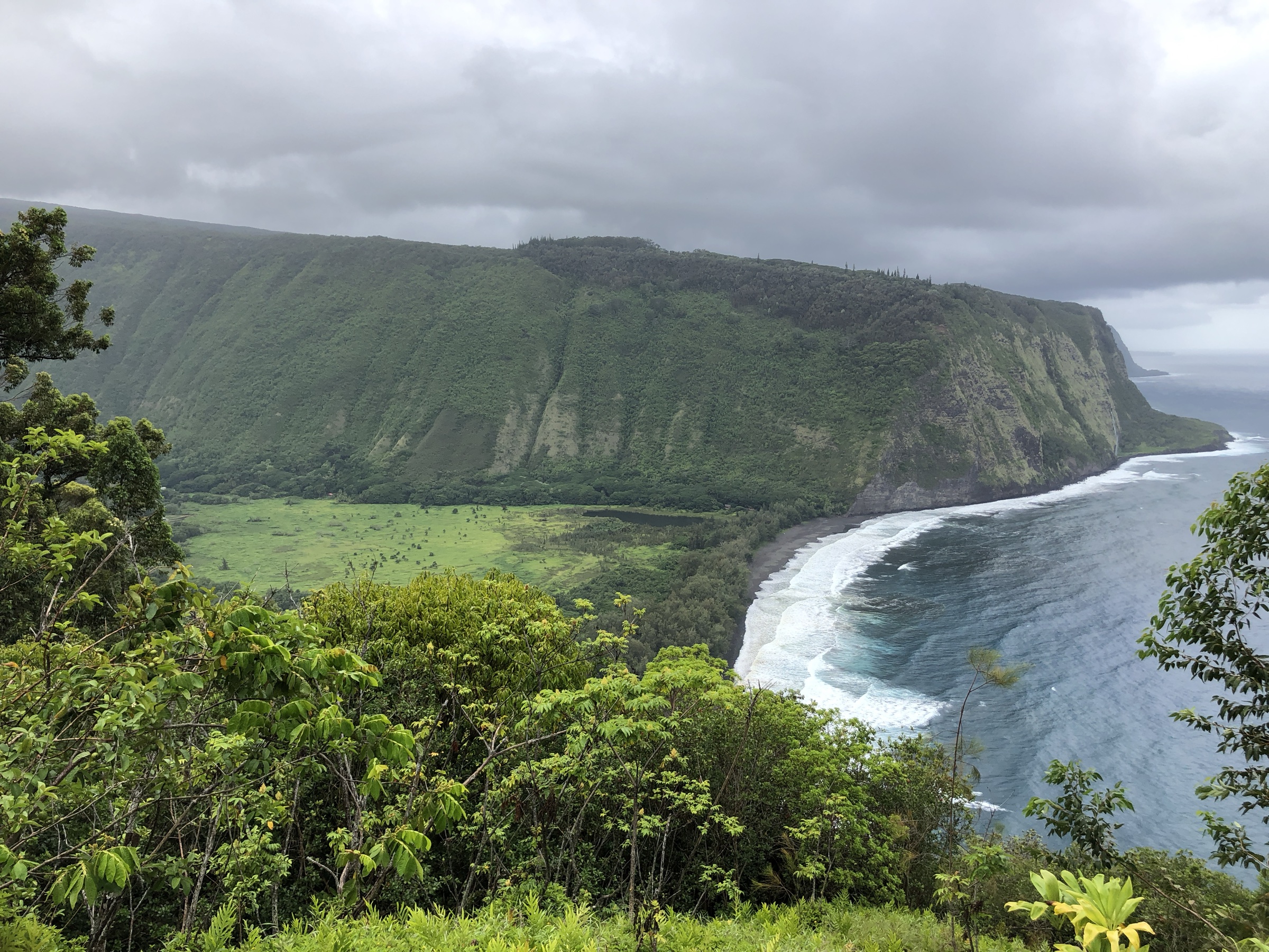
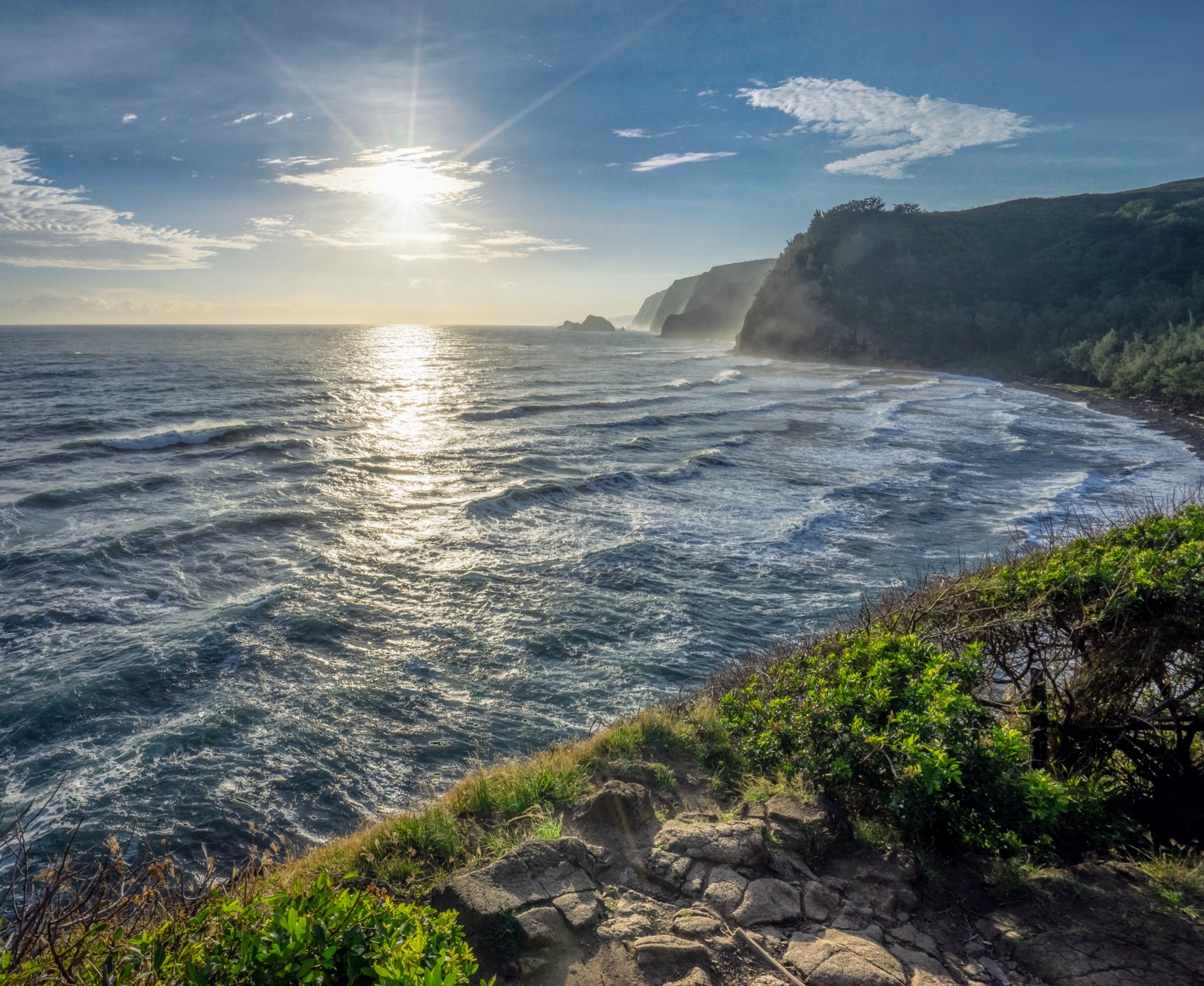
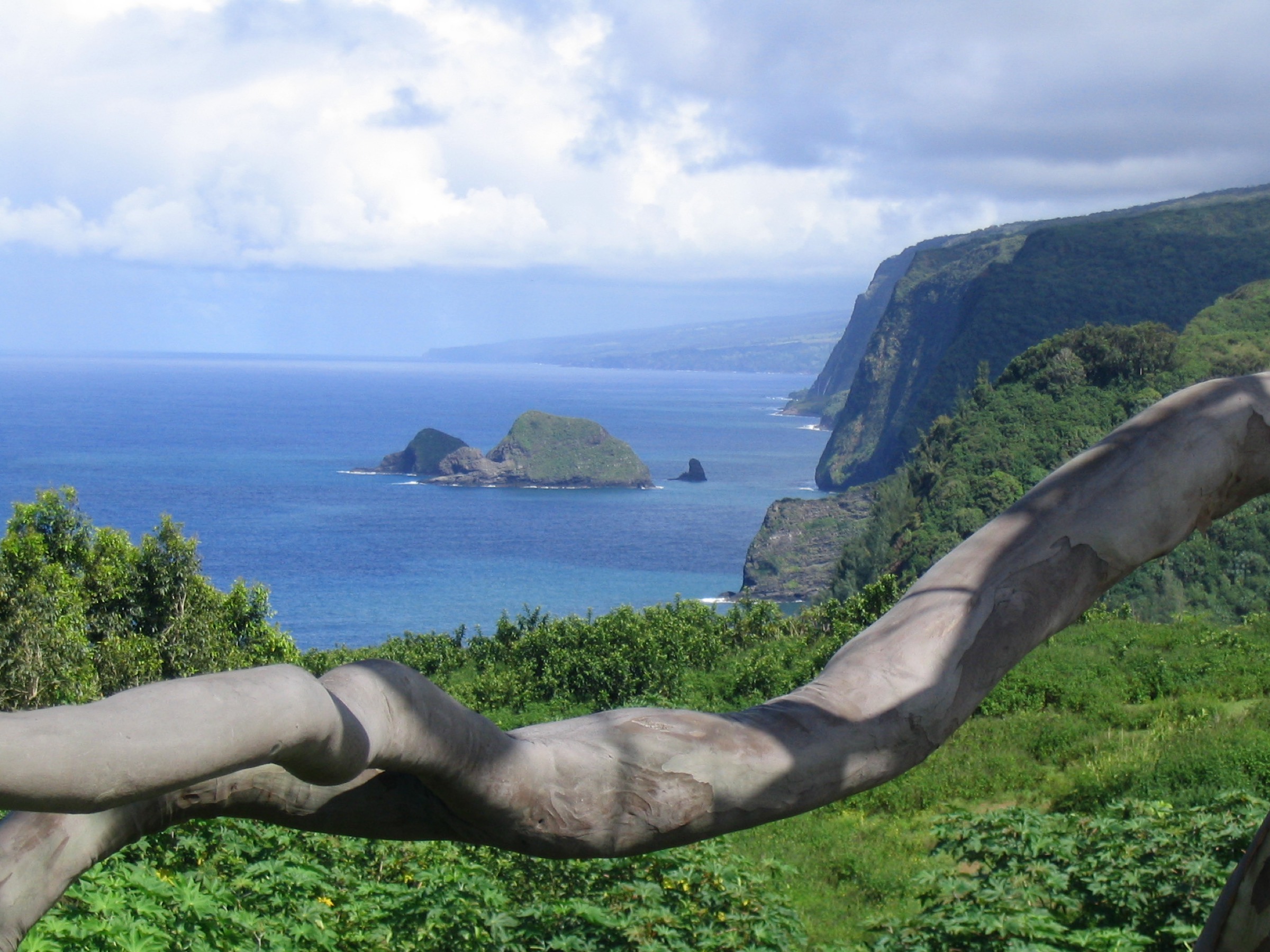
1. Pololū Valley Lookout to beach
Snapshot
Itinerary
From the Pololū Valley Lookout, follow the established switchback path down to the valley floor and black-sand beach, then return by the same path. This entry stops at the beach and does not include onward valley or ridge extensions, which may cross private or sensitive land and should not be assumed open.
Why it is essential
Pololū is the iconic public North Kohala valley descent: a short but dramatic walk from a high lookout to a remote shoreline at the end of the road.
Equipment, hazards and notes
Carry shoes with traction, sun protection, water and a rain layer; mud and stream conditions can change quickly. Parking and community impact at the lookout are significant — stay on the established route, respect stewards and signs, and do not continue beyond the public access without current local permission.
GPX / route file
| Source | URL | Format | Reuse status |
|---|---|---|---|
| Hawaiʻi DLNR — North Kohala access notes | dlnr.hawaii.gov | Page | Access context only; no GPX |
| OpenStreetMap — search “Pololū Valley Trail” | openstreetmap.org | OSM | Cross-check only |
Further reading
2. Lapakahi Village Interpretive Trail
Snapshot
Itinerary
Follow the self-guided interpretive loop through the remains of the coastal fishing settlement, with numbered cultural features and shoreline views.
Why it is essential
Lapakahi is the cultural and archaeological face of Kohala hiking: a short, legal, state-managed walk through a traditional Hawaiian coastal settlement landscape.
Equipment, hazards and notes
Carry a sun hat, sunscreen, water and comfortable walking shoes. Do not climb on or disturb cultural features. The leeward coast is exposed and hot, especially midday.
GPX / route file
| Source | URL | Format | Reuse status |
|---|---|---|---|
| Hawaiʻi DLNR — Lapakahi State Historical Park | dlnr.hawaii.gov | Park page | Source map only |
| Hawaiʻi DLNR — Lapakahi Village Interpretive Trail | dlnr.hawaii.gov | Route page | Source map only |
Further reading
- Hawaiʻi DLNR — Lapakahi State Historical Park
- Hawaiʻi DLNR — Lapakahi Village Interpretive Trail
- Wikipedia — Lapakahi State Historical Park
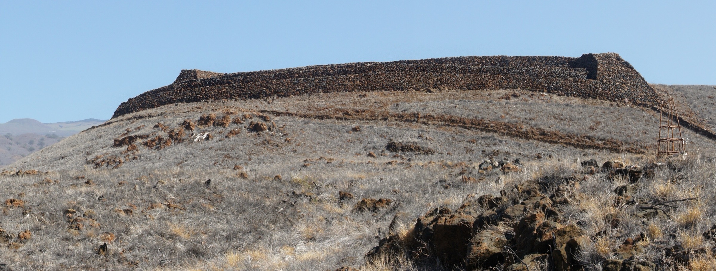
3. Puʻukoholā Heiau NHS Loop Trail
Snapshot
Itinerary
Walk the national historic site’s loop from the visitor center to views of Puʻukoholā Heiau, Mailekini Heiau, the Pelekane shoreline and the surrounding cultural landscape, returning to the visitor center.
Why it is essential
This is the key short cultural walk of South Kohala and one of the best official interpretive routes for understanding the Kamehameha-era history of the island.
Equipment, hazards and notes
Carry water, sun protection and comfortable walking shoes. Stay on trail and respect cultural sites; the coast is hot and exposed.
GPX / route file
Further reading
- NPS — Puʻukoholā Heiau National Historic Site
- NPS — Puʻukoholā outdoor activities
- Wikipedia — Puʻukoholā Heiau National Historic Site
4. Puʻukoholā to Mauʻumae / Hāpuna via Ala Kahakai
Snapshot
Itinerary
From Puʻukoholā, follow the Ala Kahakai National Historic Trail south along the coast. NPS identifies the section to Mauʻumae Beach as about 0.75 mi and the longer walk to Hāpuna Beach as about 3 mi. Return the same way or arrange a pickup at Hāpuna.
Why it is essential
This is the most direct way to turn the Puʻukoholā cultural stop into a real Kohala coastal hike on the national historic trail.
Equipment, hazards and notes
Carry a sun hat, sunscreen, plenty of water, shoes that handle rough lava and coastal tread, and navigation. Heat, sun exposure and rough coastal footing are the main hazards. Follow current NPS and State access instructions, and do not cross closed cultural or private areas.
GPX / route file
Further reading
- NPS — Ala Kahakai National Historic Trail
- NPS — Puʻukoholā outdoor activities
- Hawaiʻi DLNR — Hāpuna Beach State Recreation Area
5. Kīholo State Park Reserve coastal walk
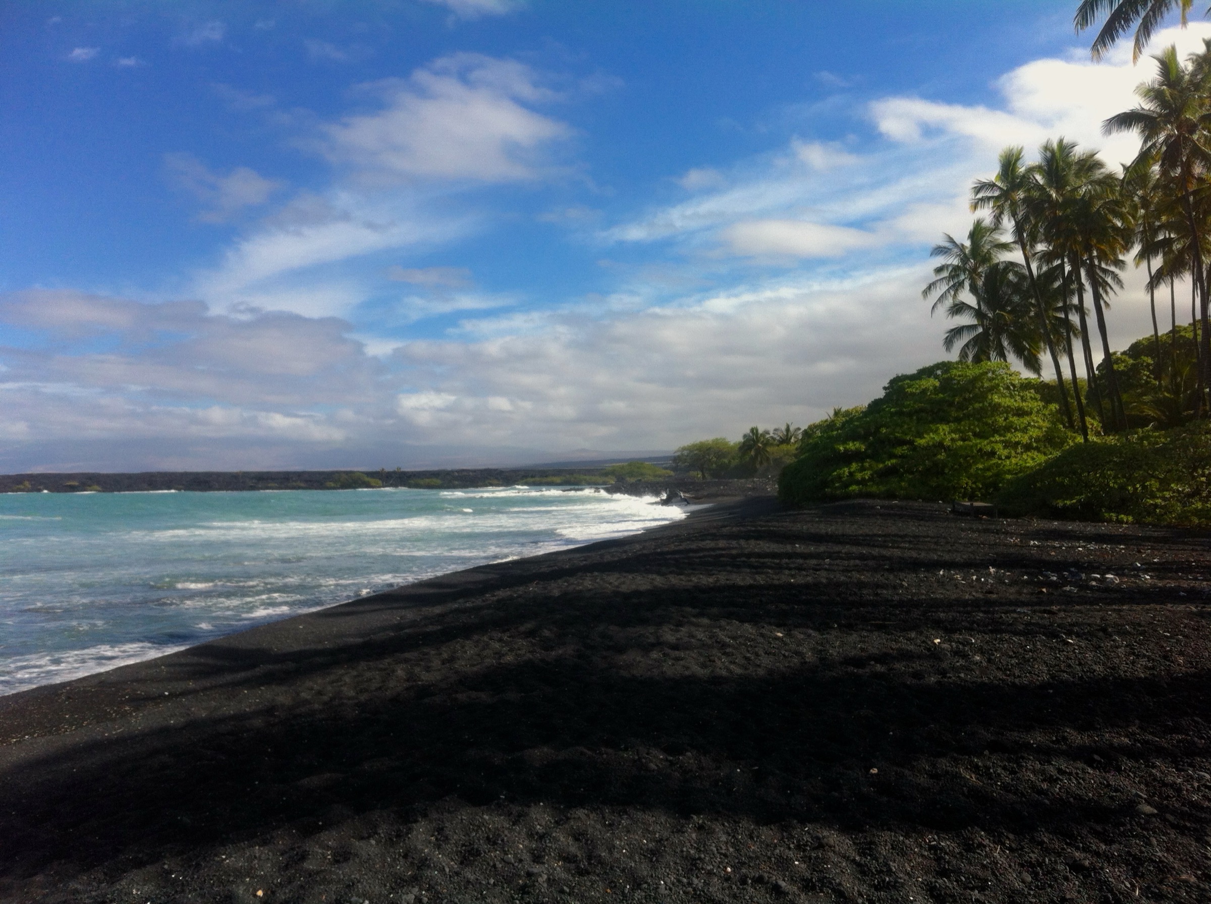
Snapshot
Itinerary
Use the state-park reserve access for a legal coastal walk at Kīholo, turning around before any closed, private or culturally sensitive areas. The official state page verifies the reserve and access context, but does not provide a GPX-style hiking route.
Why it is essential
Kīholo adds the lava-shoreline, lagoon and coastal-reserve landscape of the South Kohala / North Kona boundary, broadening the region’s five walks beyond the cultural parks and the Pololū descent.
Equipment, hazards and notes
Carry water, sun protection, and shoes for rough lava and coastal tread. Respect closures, cultural sites, private boundaries and wildlife. Shoreline conditions, heat and lack of shade can make even short distances tiring.
GPX / route file
| Source | URL | Format | Reuse status |
|---|---|---|---|
| Hawaiʻi DLNR — Kīholo State Park Reserve | dlnr.hawaii.gov | Park / access page | Source map only |
| OpenStreetMap — search “Kīholo Bay” | openstreetmap.org | OSM | Cross-check only |