Regional overview
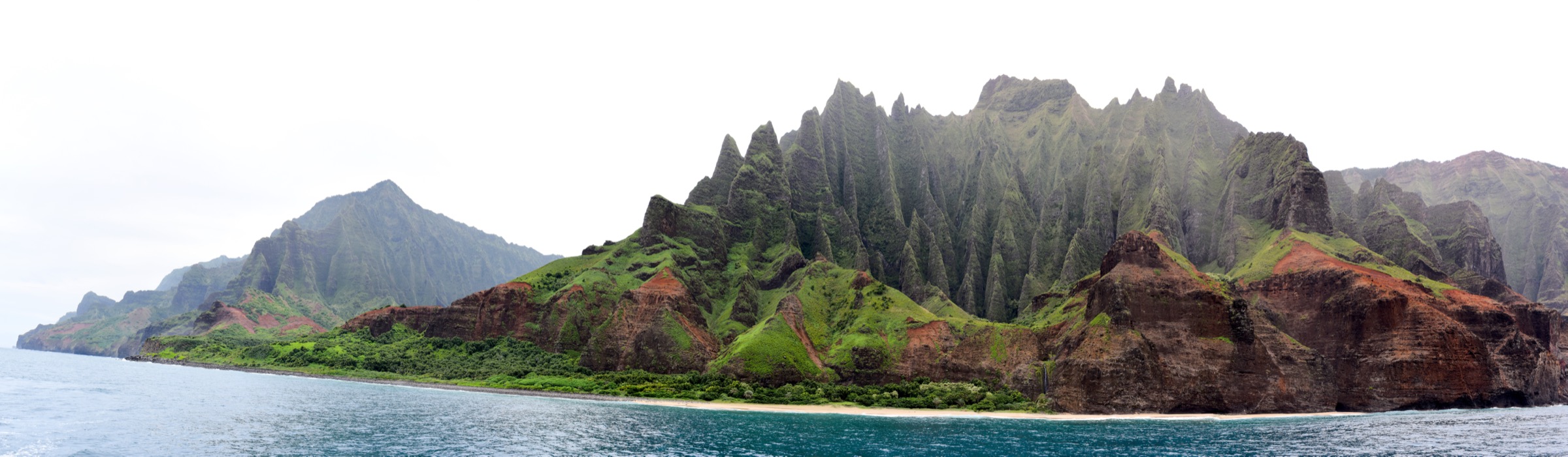
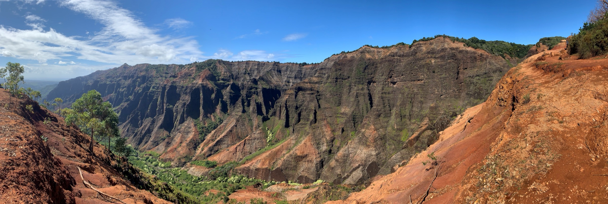
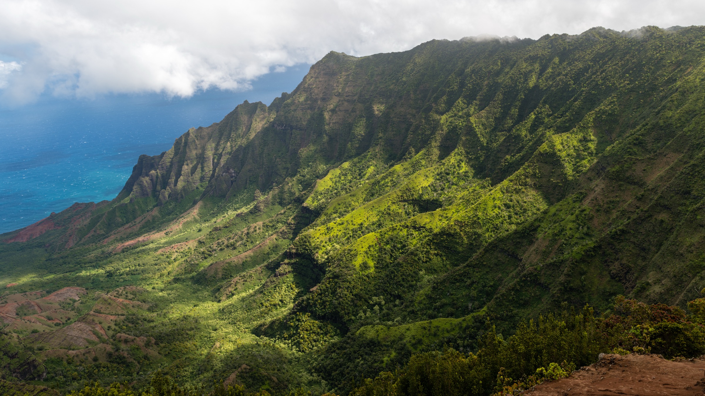
The Kōkeʻe highlands are the cool, mist-fed plateau at the top of Kauaʻi’s western upland — roughly 1,000 to 1,300 m of elevation, drained by streams that fall over the Nā Pali cliffs to the north-west and cut the Waimea Canyon system to the south. The road-accessible core of the plateau is Kōkeʻe State Park, managed by the Hawaiʻi Department of Land and Natural Resources (DLNR), Division of State Parks. Kōkeʻe is contiguous with the Nā Pali–Kona Forest Reserve and the Alakaʻi Wilderness Preserve, both administered by DLNR’s Division of Forestry and Wildlife and mapped by the Nā Ala Hele trails programme.
Access is by Kōkeʻe Road (Highway 550), the continuation of Waimea Canyon Drive. The plateau’s two anchor viewpoints — Kalalau Lookout and Puʻu o Kila Lookout — sit at the end of the road above the head of the Kalalau Valley. From those lookouts the Pihea Trail runs east along the pali rim into the Alakaʻi Swamp boardwalks, one of the wettest places on Earth. From the Kōkeʻe HQ area a set of ridge trails — Awaʻawapuhi and Nualolo — descend the outer edge of the plateau to belvederes that hang directly over the Nā Pali Coast valleys. Kawaikoi Stream and the Berry Flat / Puʻu ka Ohelo loop stay inside the plateau forest.
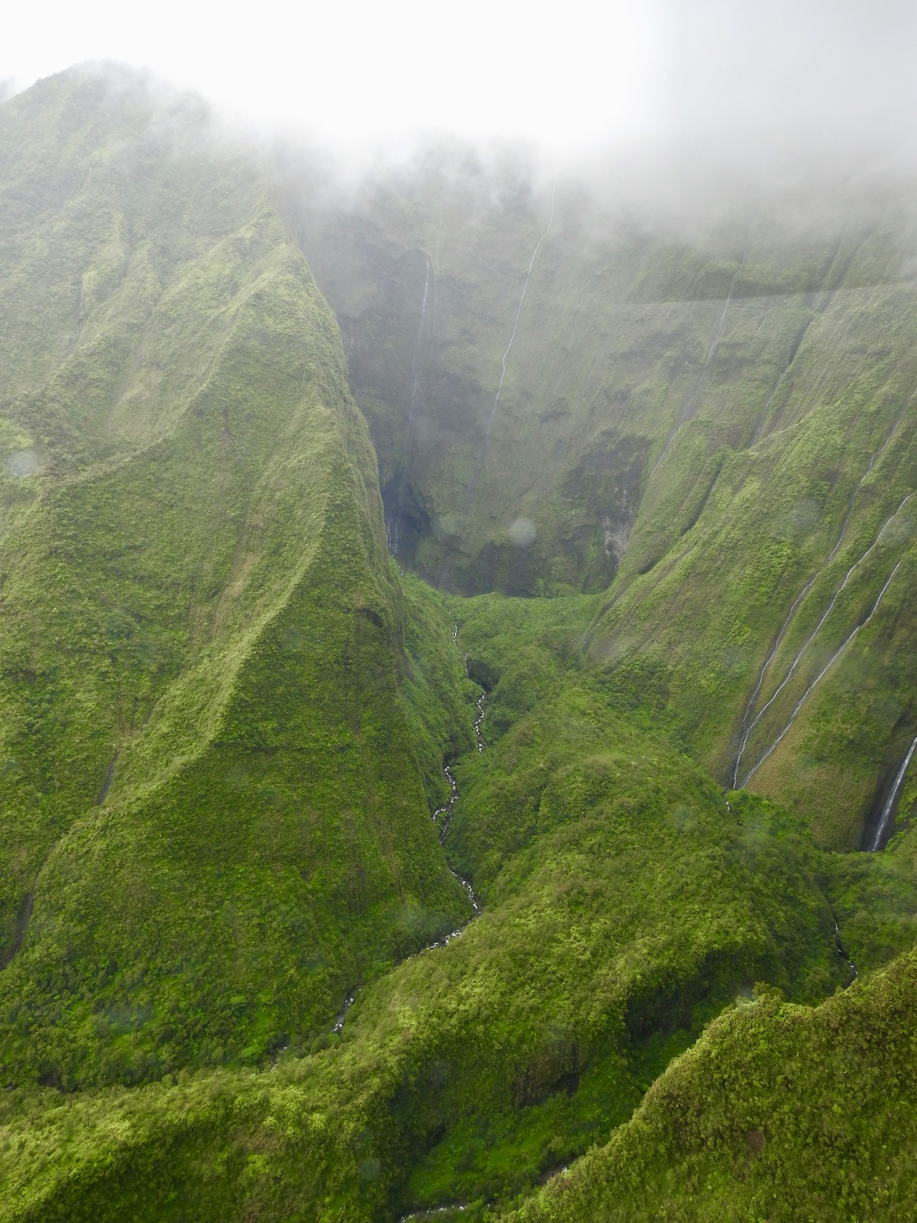
The plateau is much cooler and wetter than the coast. Temperatures at Puʻu o Kila can be 10 °C below sea level; boardwalks and clay stretches are slick in mist and rain. The May–September dry window is the most reliable. Consult the current DLNR State Parks alerts before travel — Kalalau Lookout has undergone construction closures in the 2020s and the Alakaʻi boardwalks are periodically closed for repair.
Related entries: Waimea Canyon day-hikes covers the canyon rim and canyon-floor descent that share the same access road; Nā Pali Coast day-hikes covers the coastal Kalalau Trail and roadside lookout walks at the north end.
Selection rationale
Pihea + Alakaʻi Swamp to Kilohana is the region’s canonical plateau walk and the only maintained access to Alakaʻi. Awaʻawapuhi and the Nualolo–Awaʻawapuhi loop are the two essential ridge descents to the outer pali rim; the loop is the longer and more committing option, Awaʻawapuhi alone the shorter. Berry Flat / Puʻu ka Ohelo is the essential forest loop for those who want plateau flora without a serious commitment, and Kawaikoi Stream is the essential streamside walk. Together the five span the plateau’s three distinct habitats — pali-rim rainforest, mid-elevation ridge, and swamp.
Summary table
| # | Hike | Country | Route type | Distance | Gain | Max elevation | Difficulty |
|---|---|---|---|---|---|---|---|
| 1 | Pihea + Alakaʻi Swamp to Kilohana Lookout | USA | Out-and-back | ~ 13 km | ~ 240 m | ~ 1,270 m | Moderate to strenuous |
| 2 | Awaʻawapuhi Trail | USA | Out-and-back | ~ 10 km | ~ 480 m | ~ 1,220 m | Strenuous |
| 3 | Nualolo, Nualolo Cliff and Awaʻawapuhi Loop | USA | Loop | ~ 18 km | ~ 640 m | ~ 1,220 m | Strenuous |
| 4 | Berry Flat / Puʻu ka Ohelo Loop | USA | Loop | ~ 3 km | ~ 90 m | ~ 1,100 m | Easy to moderate |
| 5 | Kawaikoi Stream Trail | USA | Loop | ~ 3.5 km | ~ 90 m | ~ 1,100 m | Moderate |
1. Pihea + Alakaʻi Swamp to Kilohana Lookout
Snapshot
Itinerary
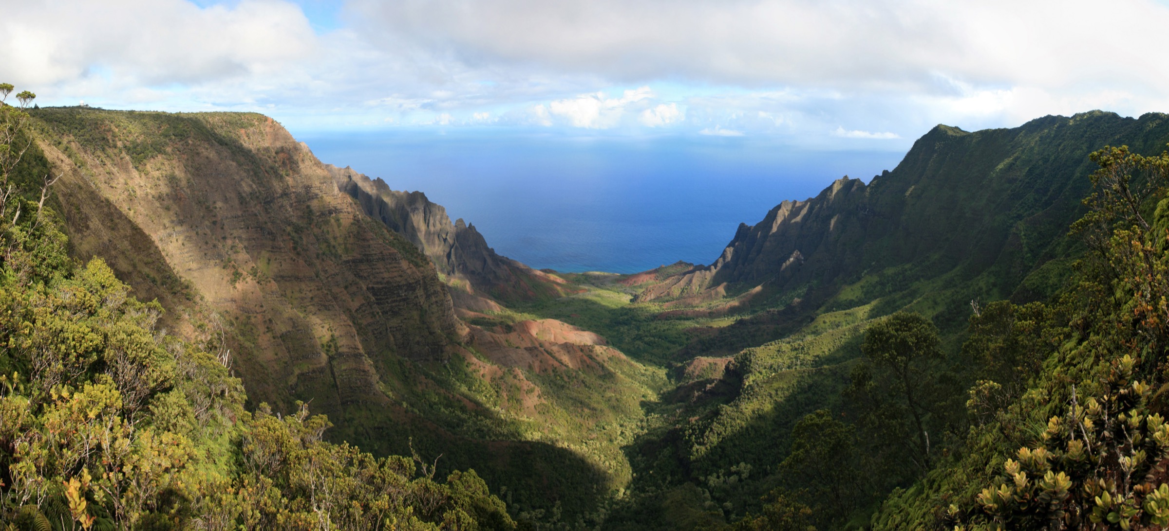
From the Puʻu o Kila Lookout car park, the Pihea Trail leaves the pavement and follows the rim of the Kalalau Valley east through native ʻōhiʻa forest. After roughly 1.6 km the trail turns inland at Pihea Vista and joins the Alakaʻi Swamp Trail. The route runs east on boardwalk and short muddy sections through the Alakaʻi Swamp — a high-elevation bog of stunted ʻōhiʻa and native ferns — to the Kilohana Lookout on the north-eastern rim, where the plateau falls away toward the Wainiha Valley and the North Shore. Return the same way. On a clear morning the view from Kilohana includes Hanalei; low cloud is more usual.
Why it is essential
The route pairs the pali rim above Kalalau with the only maintained access to the interior of Alakaʻi Wilderness Preserve. It is the region’s most complete plateau day-hike and the only walk that reaches the north-eastern edge of the highlands on foot.
Equipment
Waterproof boots, waterproof shell and warm layer, water, food, headtorch, and gaiters or high socks; expect wet feet even in nominal dry season. The boardwalks are slick when wet — trekking poles help.
Hazards and notes
The mid-section boardwalks are periodically closed for repair; verify status. Do not step off the boardwalk into the surrounding bog — the vegetation is fragile and holds unstable pockets of mud. Weather can turn cold and wet within an hour; the plateau is exposed. Kalalau Lookout access has been construction-restricted in recent years — the Pihea trailhead at Puʻu o Kila has still been usable but the road ends have sometimes been reduced.
GPX / route file
| Source | URL | Format / access | Reuse status |
|---|---|---|---|
| DLNR — Pihea Trail | dlnr.hawaii.gov | Official route page | Public agency; no GPX published |
| DLNR — Alakaʻi Swamp Trail | dlnr.hawaii.gov | Official route page | Public agency; no GPX published |
| Nā Ala Hele | hawaiitrails.ehawaii.gov | Official trails portal | Public agency; interactive map |
Further reading
2. Awaʻawapuhi Trail
Snapshot
Itinerary
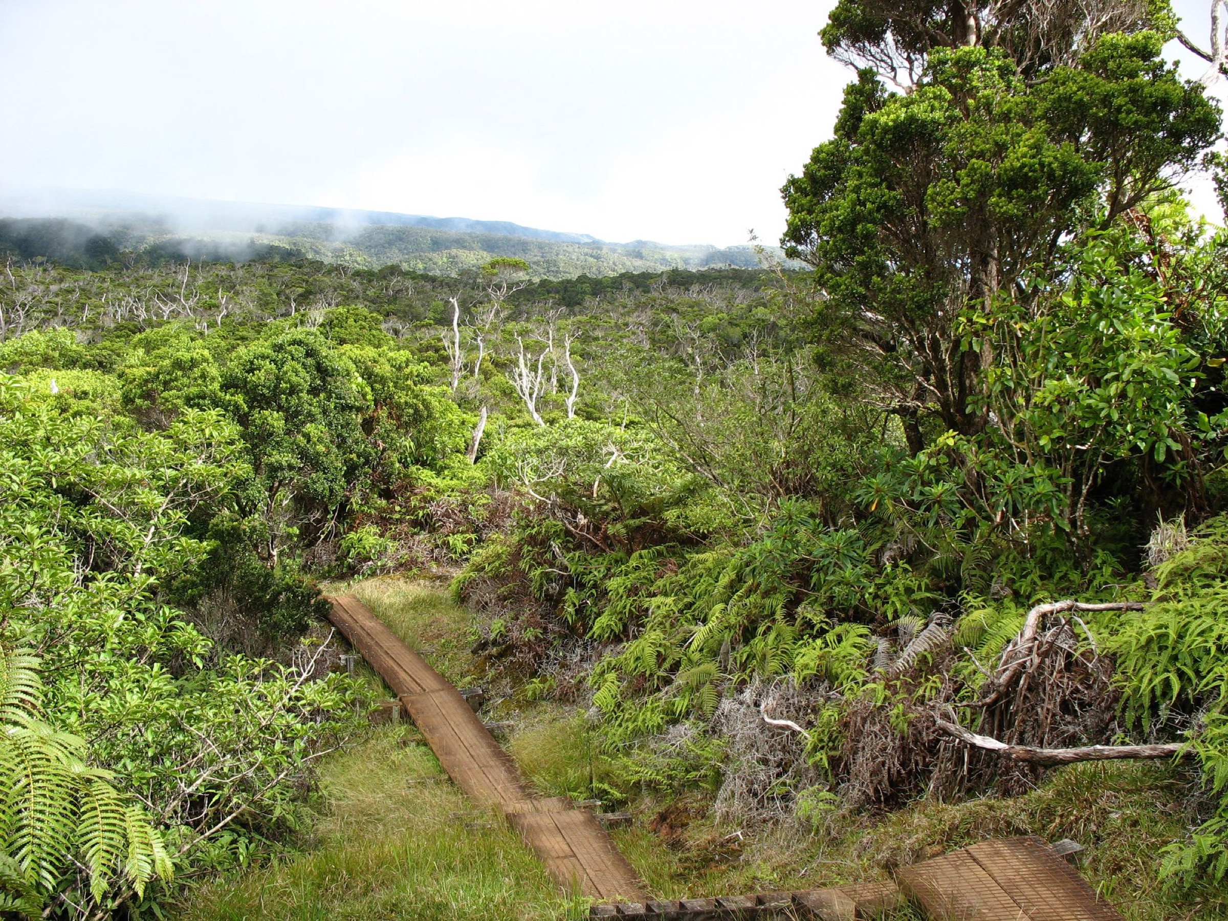
The Awaʻawapuhi Trail leaves the highway and descends a broad forested ridge, first through introduced conifers and koa, then through progressively drier scrub as the ridge narrows. The final kilometre is on a steep, exposed spine that ends at an unfenced belvedere directly above the Awaʻawapuhi and Nualolo valleys on the Nā Pali Coast. Return the same way — the climb back is the crux.
Why it is essential
Awaʻawapuhi is the shortest of the plateau’s two ridge descents and gives the essential aerial view of a Nā Pali valley from the pali rim. Together with the Kalalau lookouts, it is the plateau’s canonical Nā Pali view walk.
Equipment
Sturdy trail shoes, at least 3 litres of water, sun protection, rain shell, and — for the final ridge — a comfortable margin around exposure. The re-ascent takes longer than most hikers estimate.
Hazards and notes
The final belvedere is unfenced and the drop is unbroken; do not approach the edge in wind or wet weather. The re-ascent in mid-afternoon heat is the most common source of trouble. Do not attempt in low cloud — the view is the reason for the walk. The trail is inside the Nā Pali–Kona Forest Reserve, where hunting is permitted seasonally.
GPX / route file
| Source | URL | Format / access | Reuse status |
|---|---|---|---|
| DLNR — Awaʻawapuhi Trail | dlnr.hawaii.gov | Official route page | Public agency; no GPX published |
| Nā Ala Hele | hawaiitrails.ehawaii.gov | Official trails portal | Public agency; interactive map |
Further reading
3. Nualolo, Nualolo Cliff and Awaʻawapuhi Loop
Snapshot
Itinerary
Start at the Nualolo trailhead by Kōkeʻe HQ. The Nualolo Trail descends a broad ridge south-west through native forest to an unfenced belvedere above the Nualolo Valley. Return uphill a short distance to the Nualolo Cliff connector, then traverse east across a mid-slope goat track to the Awaʻawapuhi Trail. Climb Awaʻawapuhi back to Kōkeʻe Road at mile marker 17, then walk about 2 km south on the road shoulder to the start. The Awaʻawapuhi belvedere can be added as an out-and-back before the return climb.
Why it is essential
The loop links both of the plateau’s Nā Pali ridge descents in a single day and gives the widest range of Nā Pali–facing views on foot. It is the region’s longest legal single-day traverse.
Equipment
Sturdy trail shoes with grip, at least 4 litres of water, food, GPS or paper map, sun protection, rain shell, and route-finding margin for the connector.
Hazards and notes
The Nualolo Cliff connector is the crux: it crosses steep mid-slope on a narrow, sometimes overgrown track with limited views. Skip the loop and return via Nualolo alone if the connector is unclear or muddy. The final road link has no shoulder in places — walk facing traffic. All three belvederes are unfenced.
GPX / route file
| Source | URL | Format / access | Reuse status |
|---|---|---|---|
| DLNR — Nualolo Trail | dlnr.hawaii.gov | Official route page | Public agency; no GPX published |
| DLNR — Nualolo Cliff Trail | dlnr.hawaii.gov | Official route page | Public agency; no GPX published |
| Nā Ala Hele | hawaiitrails.ehawaii.gov | Official trails portal | Public agency; interactive map |
Further reading
4. Berry Flat / Puʻu ka Ohelo Loop
Snapshot
Itinerary
From the pull-off on Camp 10 Road, follow the Puʻu ka Ohelo Trail south through a mixed native and planted forest of koa, sugi cedar and California redwoods, then connect with the Berry Flat Trail to close the loop back to the road. The two trails are usually walked together as a short forest sampler.
Why it is essential
The loop is the plateau’s best short walk for illustrating the mixed native / plantation forest that dominates the ridge zone between Kōkeʻe HQ and the Alakaʻi rim, and the only easy loop in the immediate Kōkeʻe HQ area.
Equipment
Trail shoes with grip, water, light rain shell.
Hazards and notes
The trails hold mud after rain; footwear that tolerates a wet clay surface is worth the trade. Feral pigs are widespread. Both trails are inside the state park and are Nā Ala Hele–signed.
GPX / route file
| Source | URL | Format / access | Reuse status |
|---|---|---|---|
| DLNR — Berry Flat Trail | dlnr.hawaii.gov | Official route page | Public agency; no GPX published |
| DLNR — Puʻu ka Ohelo Trail | dlnr.hawaii.gov | Official route page | Public agency; no GPX published |
Further reading
5. Kawaikoi Stream Trail
Snapshot
Itinerary
From the Sugi Grove or Kawaikoi pull-off on Mohihi Road, drop onto the Kawaikoi Stream Trail and follow the stream through mixed native forest and pine plantations. The loop crosses the Kawaikoi twice on unimproved fords; on the far bank the trail parallels the stream through mossy koa before crossing back and rejoining the road. The loop can be reduced to an out-and-back to the first crossing if the stream is too high.
Why it is essential
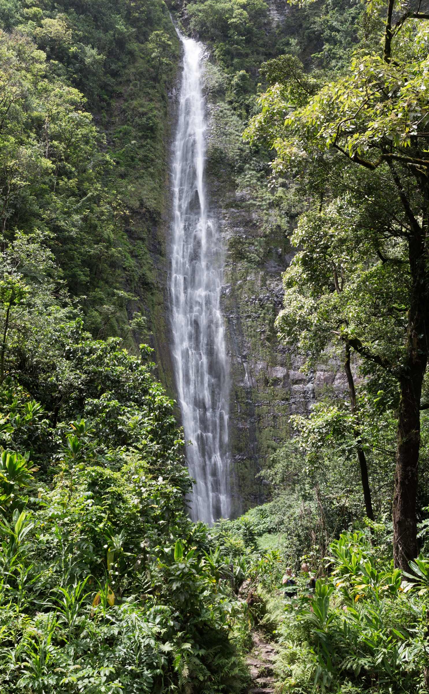
Kawaikoi is the plateau’s only substantial streamside walk and the best sample of the wet native forest that supports the plateau’s endemic birds. It closes the trail set with a habitat that Berry Flat, the ridges and the swamp do not cover.
Equipment
Trail shoes with grip, spare socks or wading shoes, water, rain shell.
Hazards and notes
Stream crossings can rise very quickly after upland rain — turn back rather than commit to a crossing you would not reverse. Mohihi Road is a 4WD-only track and can be impassable after wet spells; when the road is closed, add ~ 4 km of road walking each way from Kōkeʻe HQ. Do not drink from the stream — leptospirosis is present in Kauaʻi’s watersheds.
GPX / route file
| Source | URL | Format / access | Reuse status |
|---|---|---|---|
| DLNR — Kawaikoi Stream Trail | dlnr.hawaii.gov | Official route page | Public agency; no GPX published |
| Nā Ala Hele | hawaiitrails.ehawaii.gov | Official trails portal | Public agency; interactive map |
Further reading
Notes and caveats
- Distances and elevation figures are rounded from a mix of DLNR trail pages, Nā Ala Hele mapping, and secondary sources. DLNR’s own pages give trail lengths as one-way distances only; some third-party sources conflate one-way and round-trip, which explains the range in published totals.
- Kōkeʻe and Waimea Canyon State Parks share the Halemanu-access trail cluster. The Canyon Trail and Cliff Trail are treated in the Waimea Canyon article because their view corridor is the canyon; the Awaʻawapuhi, Nualolo and Alakaʻi trails are treated here because their view corridor is Nā Pali or the swamp.
- No official GPX or KML has been located for any of these trails. Nā Ala Hele’s interactive map is treated as the canonical route source; individual downloads were not found.
- Kalalau Lookout access and Puʻu o Kila lookout parking have been intermittently reduced by DLNR construction and repaving works during the 2022–2026 window. Verify the Kōkeʻe Road end-of-road status before starting the Pihea walk.
- The Alakaʻi boardwalk is under continuous rolling repair. Sections have been closed for weeks at a time; check DLNR alerts before committing to the Kilohana walk.
Further reading
| Resource | Link |
|---|---|
| DLNR — Kōkeʻe State Park | dlnr.hawaii.gov |
| DLNR — Alakaʻi Wilderness Preserve | dlnr.hawaii.gov |
| DLNR — Kauaʻi trails index | dlnr.hawaii.gov |
| Nā Ala Hele trails portal | hawaiitrails.ehawaii.gov |
| Kōkeʻe & Waimea Canyon SP Master Plan | dlnr.hawaii.gov (PDF) |
| Kōkeʻe & Waimea Canyon trail poster | dlnr.hawaii.gov (PDF) |
| Kōkeʻe Natural History Museum | kokee.org |