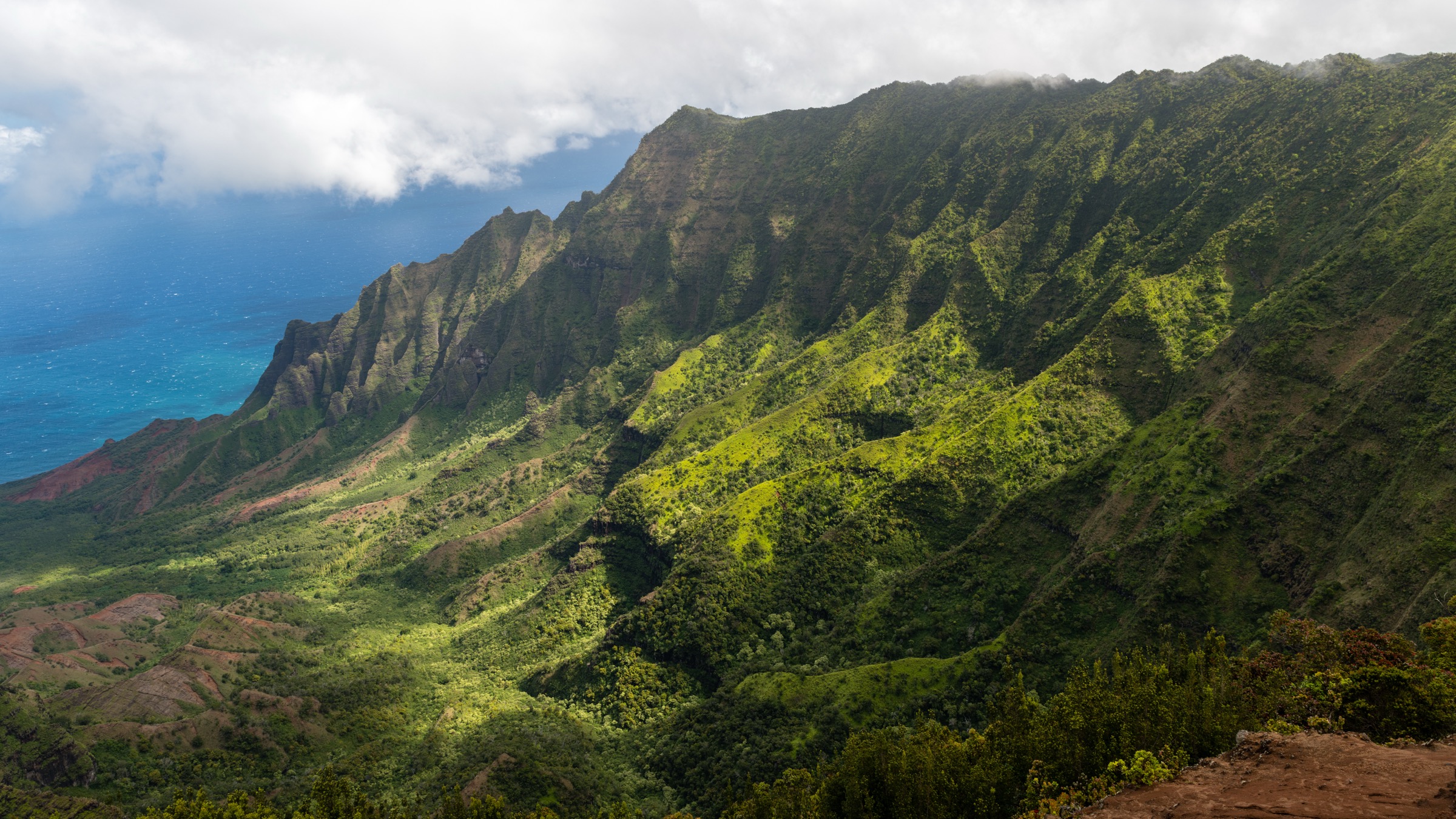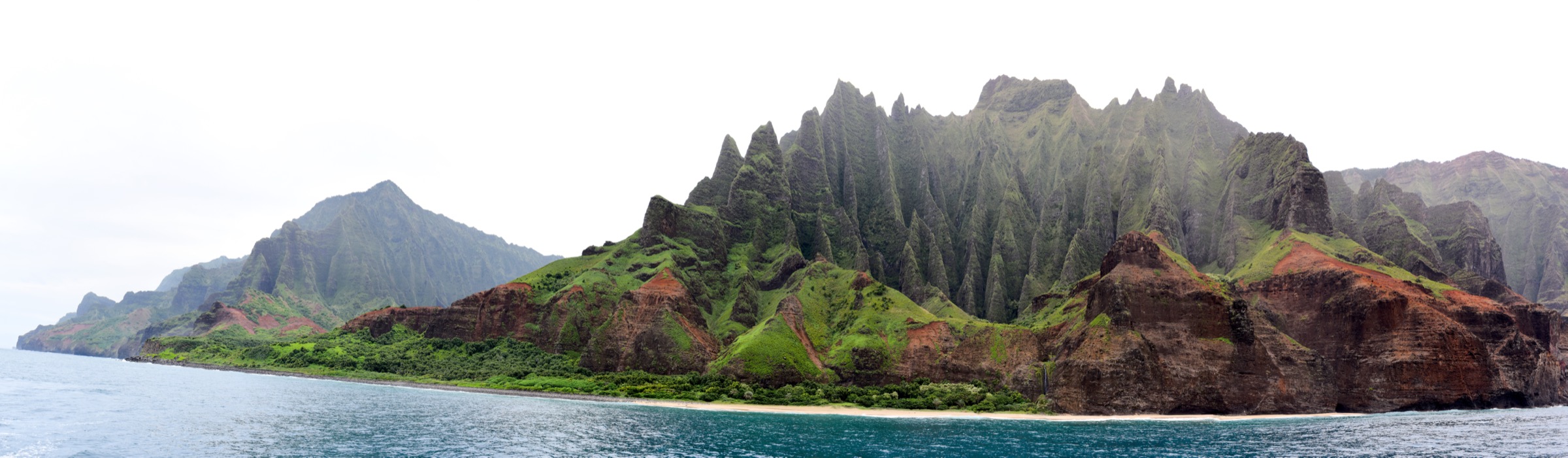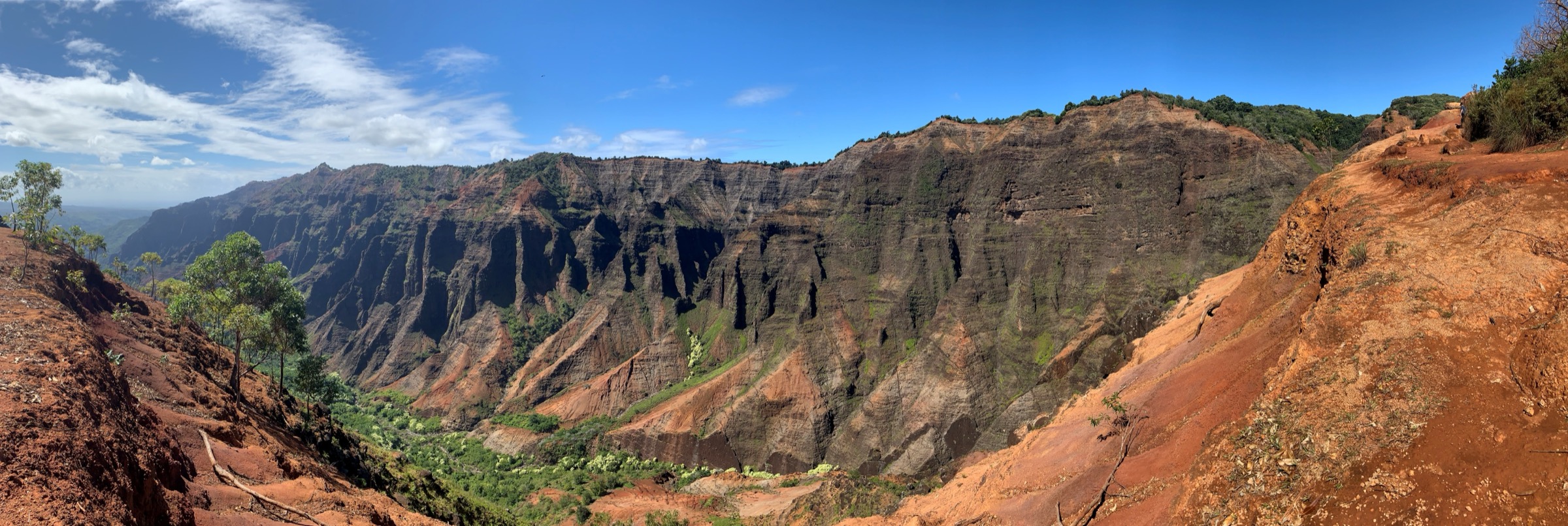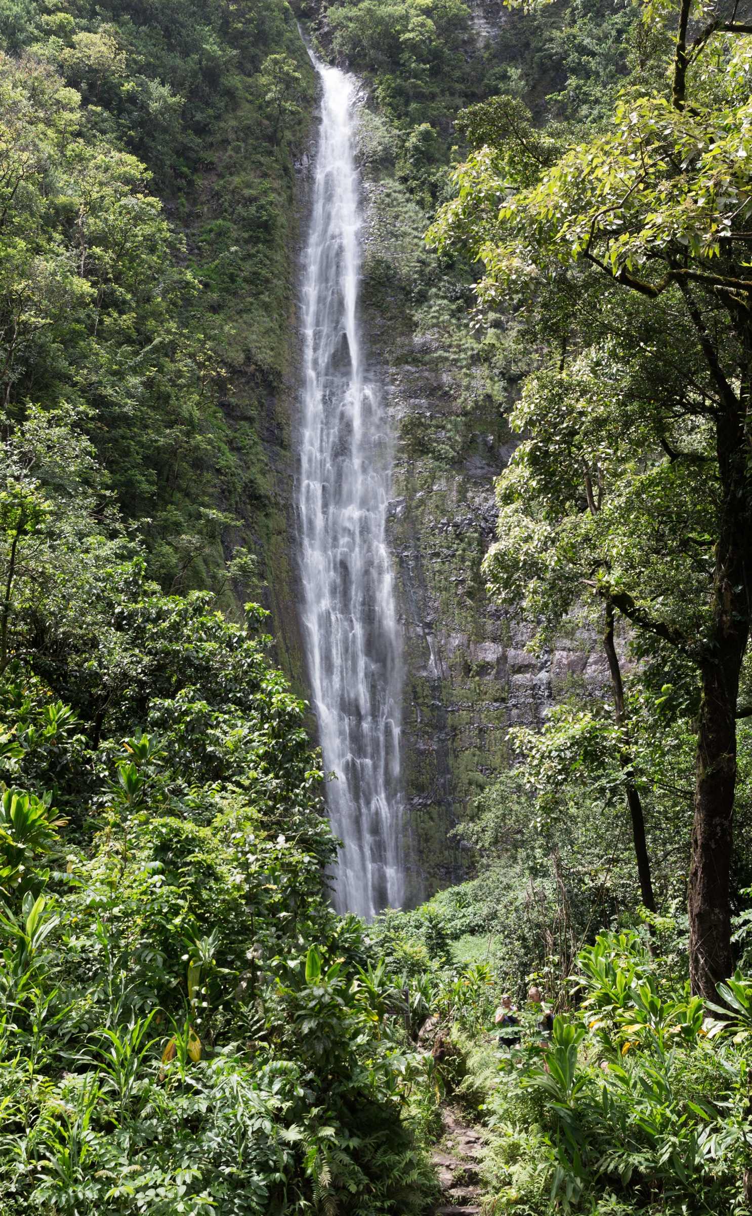
Regional overview
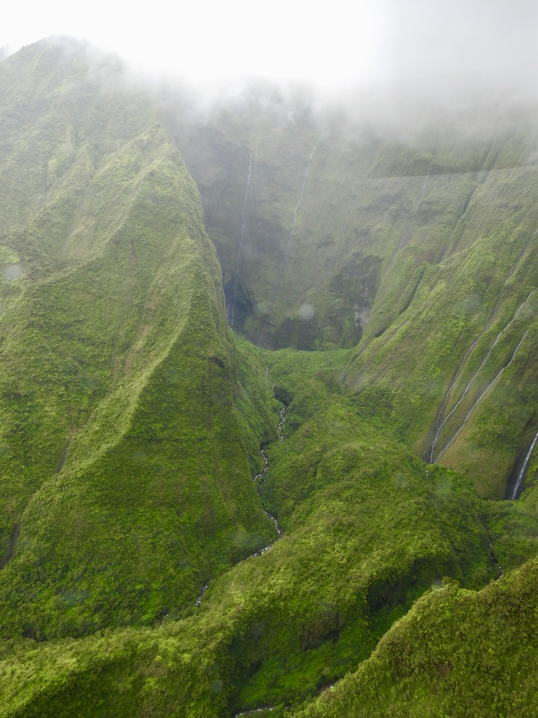
Mount Waiʻaleʻale is the eroded central shield of Kauaʻi — the oldest of the main Hawaiian Islands, with a shield volcano that ceased major activity roughly five million years ago. Its summit stands at 1,569 m (5,148 ft) and is one of the wettest places on Earth: the Waiʻaleʻale rain gauge, in operation since 1912, records a long-term average of roughly 11,500 mm/yr (about 460 in), and set a documented single-year record of 17,300 mm in 1982. The Alakaʻi Plateau bog immediately west of the summit is the direct consequence — a saturated montane wetland that feeds all seven of Kauaʻi’s principal rivers. The summit itself is inaccessible for legal day-hiking: the classic “Blue Hole” approach up the Wailua Nui headwaters crosses private land administered by grove and reservoir owners and is subject to fatal flash flooding in the caldera bowl. The region’s essential legal day-hikes therefore sit on the eastern flanks — the Nounou Forest Reserve above Kapaʻa and Wailua, and the Kuilau / Moalepe / Powerline ridge system reaching from Keahua Arboretum up the Waiʻaleʻale foothills.
Trade winds strike Waiʻaleʻale from the east-north-east. The eastern foothills therefore catch orographic rain year-round (roughly 2,000–4,000 mm/yr in the Nounou–Kuilau belt) while the coastal strip at Wailua and Kapaʻa remains drier (roughly 1,200 mm/yr). Winter (November–March) brings both regular trade-wind rain and periodic Kona-storm downpours, and every trail on this list carries muddy and slick red-clay footing as its universal condition. Summer (May–September) is drier, firmer and clearer at altitude, though summit views of the Waiʻaleʻale headwall itself are rare — cloud shrouds the crest most days.
Land tenure across the region is state-managed. The DLNR Division of Forestry and Wildlife (DOFAW) administers the Nounou Forest Reserve (Sleeping Giant) above Wailua Homesteads and Kapaʻa, and the Līhuʻe-Kōloa Forest Reserve upslope of Keahua Arboretum. Trails are signed under the Nā Ala Hele state trail programme. Access is generally free, without permit requirement — with two important operational caveats: the Keahua Arboretum access ford across the Keahua Stream is passable only when water levels are low (do not drive or wade across in rising water), and Nā Ala Hele periodically closes individual trails for hunting, landslide repair, or bog restoration. The Nounou Mountain range is culturally significant — its silhouette gives it the “Sleeping Giant” name that appears in Hawaiian tradition (the giant Puni, tricked into swallowing stones), and the range sits inside the historical Wailua Nui Hoʻano (“Great Sacred Wailua”), the royal seat of ancient Kauaʻi that stretched from the Wailua Bay river mouth up to the Waiʻaleʻale headwall — Waiʻaleʻale itself was regarded as the realm of the god Kāne.
Access essentials: Kūhiō Highway (HI-56) runs the entire east coast of Kauaʻi and connects to every trailhead below via short spur roads. Most trailheads have small gravel parking lots; those on public reserve land are free and open dawn-to-dusk. The Keahua Arboretum access road (Kuamoʻo Road, HI-580) climbs from Wailua past ʻOpaekaʻa Falls to the arboretum and the upper trailheads for Kuilau and Powerline; the last mile is unpaved and can wash out after storms.
Hazards region-wide: red-clay mud that persists days after rain, slick roots and rocks on ridge switchbacks, no reliable potable water on any trail (all stream water requires treatment; leptospirosis is endemic in Hawaiʻi), rapid cloud and fog on higher ridges, and periodic flash flooding of the Keahua Stream ford. Off-trail scrambling into the Waiʻaleʻale headwall bowl (the “Blue Hole”) is a documented fatality hazard, crosses private land, and is outside the scope of the routes below.
Selection rationale
Five routes are chosen to give balanced coverage of the eastern Waiʻaleʻale foothills without duplicating trailheads or overlapping the Nāpali, Kōkeʻe and Waimea Canyon articles on the west side of Kauaʻi. Kuilau Ridge Trail is the signature short ridge day of the region — a well-graded family-friendly ridge with the definitive Waiʻaleʻale-facing panorama from a legal, permit-free trail. Kuilau to Moalepe through-hike extends the same ridge into the Kealia foothills for a full-length ridge crossing with big open Makaleha views. Nounou Mountain East Trail is the classic Sleeping Giant approach from the Kapaʻa side — the region’s most-hiked summit and the definitive east-shore ocean panorama. Nounou Mountain West Trail is the shorter alternative approach from the Wailua Homesteads side, joining the East Trail near the summit for a natural traverse option. Powerline Trail — from Keahua Arboretum over the interior spine to the Hanalei side — is the long strenuous option for the fit hiker: the closest legal approach to the northern Waiʻaleʻale amphitheatre, on the CCC-era maintenance track originally cut for the trans-island powerline. Together they span two family-grade ridge days, one Sleeping Giant classic, one traverse variant, and one all-day interior crossing.
Summary table
| # | Hike | Country | Route type | Distance | Gain | Max elevation | Difficulty |
|---|---|---|---|---|---|---|---|
| 1 | Kuilau Ridge Trail | USA | Out-and-back | ~5.8 km (~3.6 mi) | ~200 m | ~500 m | Easy–Moderate |
| 2 | Kuilau–Moalepe through-hike | USA | Point-to-point | ~10.5 km (~6.5 mi) | ~330 m | ~530 m | Moderate |
| 3 | Nounou Mountain East Trail | USA | Out-and-back | ~5.6 km (~3.5 mi) | ~300 m | 378 m | Moderate |
| 4 | Nounou Mountain West Trail | USA | Out-and-back | ~4.8 km (~3.0 mi) | ~245 m | 378 m | Easy–Moderate |
| 5 | Powerline Trail (interior crossing) | USA | Point-to-point | ~21 km (~13 mi) | ~700 m | ~650 m | Strenuous |
1. Kuilau Ridge Trail
Snapshot
Itinerary
From Kūhiō Highway (HI-56) at Wailua, turn inland on Kuamoʻo Road (HI-580) and climb past ʻOpaekaʻa Falls Overlook and the University of Hawaiʻi Wailua Experimental Farm to the Keahua Arboretum. The Nā Ala Hele Kuilau Trail trailhead is on the north (right) side of the road immediately before the Keahua Stream ford — park on the wide shoulder. From the trailhead the trail climbs on an old jeep-track grade through introduced kukui and eucalyptus, then swings onto the ridge crest proper. Successive open sections reveal the Makaleha Mountains to the north-east and — on clear mornings — the Waiʻaleʻale headwall directly west. The tread stays wide and well-graded throughout, threading small side gulches on wooden footbridges. The turn-around is the ridge picnic shelter at about 2.9 km, on the broad ridge top at ~500 m: a small open-sided pavilion with the region’s finest panoramic view — Waiʻaleʻale west, Makaleha north, Anahola Mountains north-east, and the Wailua River valley south to the coast. Return by the same tread. Strong parties can continue on the connecting Moalepe Trail — see Hike 2 for the through-hike option.
Why it is essential
Kuilau is the definitive Kauaʻi ridge introduction. It is short, family-friendly, permit-free, and it delivers the single most useful Waiʻaleʻale-facing panorama on the island from a legal trail — the summit headwall visible directly to the west across the Wailua headwaters, with the Makaleha wall to the north. It samples exactly what makes the eastern Waiʻaleʻale foothills distinctive: elevated but not exposed, green and wet, and reachable in a half-day without a permit.
Equipment
- Trail runners or light boots with grip on wet clay
- Weatherproof shell
- Sun protection for the exposed ridge sections
- 1.5 L water — no reliable source on the trail
- Trekking poles helpful on the descent after rain
- Insect repellent for the forested lower sections
Hazards and notes
- Red-clay mud persists days after rain; the ridge shelter is often the last section to dry
- Shared with mountain bikers on the outbound jeep-track section
- Keahua Stream ford at the arboretum can be impassable in high water — do not cross a rising stream
- No potable water on the trail
- Cell coverage patchy on the ridge, adequate at the trailhead
- Trailhead sits inside the Līhuʻe-Kōloa Forest Reserve — hunting units surround the trail; wear bright colours during hunting season
GPX / KML links
| Source | URL | Format | Notes |
|---|---|---|---|
| Nā Ala Hele — Hawaii Trails | hawaiitrails.ehawaii.gov | State portal | Trail search and status |
| DLNR DOFAW — Kauaʻi trails | dlnr.hawaii.gov | Official reserve page | Reserve rules |
Sources
2. Kuilau to Moalepe through-hike
Snapshot
Itinerary
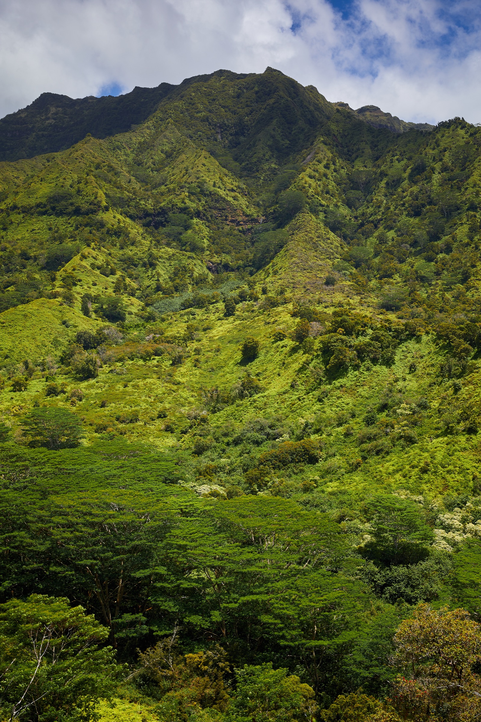
From the Kuilau Trail trailhead below the Keahua Arboretum ford, follow the ridge as described for Hike 1 to the picnic shelter at ~500 m at 2.9 km. Continue north-east along the ridge crest as the Kuilau Trail proper heads through native ʻōhiʻa and uluhe fern for another ~1 km before reaching the signed Kuilau–Moalepe junction at ~530 m on the crest. This is the high point of the traverse; the Makaleha Mountains open dramatically to the north on the final ridge push. Turn right (east) onto the Moalepe Trail and begin the long, well-graded descent along a broad, open jeep-track ridge with expansive views over the Kealia foothills and the Anahola coast. The trail descends steadily through open pasture and reforested slopes to the lower Moalepe trailhead at the intersection of Olohena Road and Waipouli Road in Wailua Homesteads at ~140 m. A shuttle vehicle at this end is required for the point-to-point option; without a shuttle, the round-trip is 21 km and doubles the day. The Moalepe descent alone (from the crest junction) is markedly drier than the Kuilau ascent and dries faster after rain.
Why it is essential
The through-hike is the definitive full-length eastern Waiʻaleʻale ridge day. It combines the Waiʻaleʻale-facing viewpoint of the Kuilau ridge with the wide, open Makaleha and Kealia panoramas of the Moalepe descent — two Kauaʻi ridge experiences on one traverse. It is one of very few point-to-point ridge crossings on Kauaʻi that stays entirely on Nā Ala Hele-signed public tread and requires no permit. On a clear day it delivers both the direct Waiʻaleʻale headwall view and the sweep of the Makaleha wall from the same walk.
Equipment
- Trail runners or light boots with grip on wet clay
- Weatherproof shell
- Sun protection for the ridge and Moalepe descent
- 2 L water — no reliable source on the trail
- Trekking poles helpful throughout
- Map, compass and downloaded Nā Ala Hele map
- Insect repellent for the lower sections
- Shuttle vehicle or pre-arranged pickup at the Moalepe trailhead
Hazards and notes
- Muddy footing on the Kuilau side days after rain; the Moalepe side dries faster
- Shared with mountain bikers and horse-riders on the Moalepe jeep-track section
- Keahua Stream ford access limits some approaches — verify road conditions
- No potable water on the trail
- Cell coverage patchy at the junction, adequate at both trailheads
- Trailhead sits inside the Līhuʻe-Kōloa Forest Reserve — hunting units surround the trail; wear bright colours during hunting season
GPX / KML links
| Source | URL | Format | Notes |
|---|---|---|---|
| Nā Ala Hele — Hawaii Trails | hawaiitrails.ehawaii.gov | State portal | Kuilau + Moalepe listings |
| DLNR DOFAW — Kauaʻi trails | dlnr.hawaii.gov | Official reserve page | Reserve rules |
Sources
3. Nounou Mountain East Trail
Snapshot
Itinerary
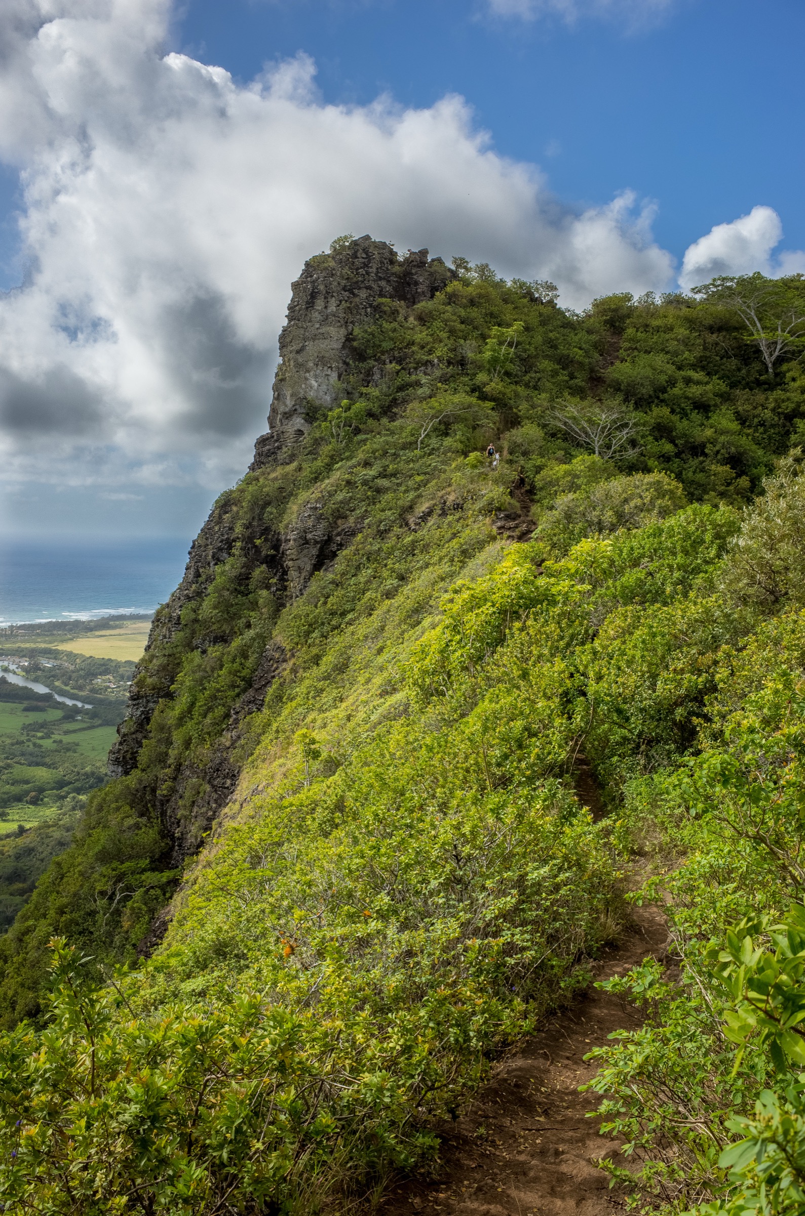
From Kūhiō Highway (HI-56) in Wailua, turn inland on Haleilio Road and climb ~2.4 km through the Wailua Houselots to the signed Nounou Mountain East Trail trailhead on the left, with a small paved parking lot. The trail begins on switchbacks through introduced Cook and Norfolk pines, gaining altitude quickly on a well-graded tread. Views open east over Kapaʻa and the Kealia coast within the first kilometre. At about 2 km the trail rounds the “chest” of the Sleeping Giant and joins the connecting spur from the West Trail (Hike 4) at a signed junction. Continue east another ~0.5 km on the final ridge push to the summit picnic shelter and Chin Lookout at 378 m — a small open-sided shelter on the giant’s chest, with a panoramic view sweeping from Anahola Mountains in the north to the Wailua River mouth in the south, and — on clear mornings — the Waiʻaleʻale summit inland to the west. Do NOT continue on the exposed and dangerous unofficial spur to the giant’s “head” beyond the shelter; the drop-off is fatal and outside the official trail. Return by the same tread, or descend the West Trail for the traverse variant.
Why it is essential
Nounou East is the definitive Kauaʻi ocean panorama. Twenty minutes of switchback and one final ridge push lift you to a 378 m summit that dominates the Wailua–Kapaʻa coast, with the whole east shore of Kauaʻi laid out below and — on clear days — the Waiʻaleʻale headwall directly inland. It is the region’s most-hiked summit for good reason: the effort-to-view ratio is unmatched, the trail is legal and permit-free, and it is culturally the “Sleeping Giant” of Kauaʻi’s east-shore identity.
Equipment
- Trail runners with sticky rubber for the switchbacks and root sections
- Sun protection — patchy shade in the pine plantation, exposed above
- 2 L water — no source on the trail
- Weatherproof shell — brief showers frequent even on sunny days
- Insect repellent for the lower switchbacks
- Trekking poles helpful on the descent
Hazards and notes
- Do NOT continue past the summit shelter onto the exposed unofficial ridge to the giant’s “head” — the drop-off has caused fatalities
- Red-clay mud and slick roots after rain
- Sun exposure heavy on the upper switchbacks — start early
- Small trailhead parking lot fills by mid-morning in high season
- Trail is inside the Nounou Forest Reserve — hunting occasionally in season on the surrounding slopes
- Cell coverage adequate at the trailhead and summit, patchy on the switchbacks
GPX / KML links
| Source | URL | Format | Notes |
|---|---|---|---|
| Nā Ala Hele — Hawaii Trails | hawaiitrails.ehawaii.gov | State portal | Nounou East listing |
| DLNR DOFAW — Nounou Forest Reserve | dlnr.hawaii.gov | Official reserve page | Reserve rules |
Sources
4. Nounou Mountain West Trail
Snapshot
Itinerary
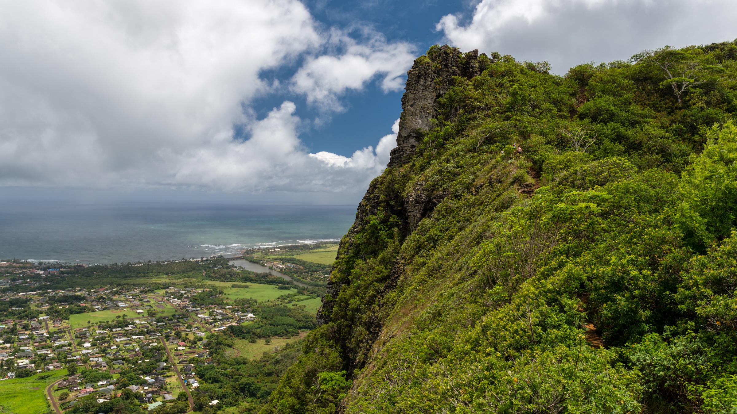
From Kūhiō Highway (HI-56) at Wailua, turn inland on Kuamoʻo Road (HI-580), pass ʻOpaekaʻa Falls, and turn right onto Kamalu Road (HI-581). Follow Kamalu Road ~1.5 km and turn right onto Lokelani Road; the small Nounou Mountain West Trail trailhead sits at the end of the paved lane, with limited street parking. The trail climbs steadily through dense Norfolk pines on a well-shaded and gently graded tread, gaining altitude more evenly than the East approach. At about 1.6 km a signed junction with the Kuamoʻo–Nounou connector spur joins from the south; stay left (east) on the West Trail proper. After another ~0.5 km the trail meets the East Trail at the summit junction, and a final ~0.3 km east push reaches the summit picnic shelter and Chin Lookout at 378 m. Do NOT continue on the unofficial exposed ridge to the giant’s “head” beyond the shelter. Return by the same tread, or descend the East Trail (Hike 3) to Haleilio Road for a traverse variant requiring a shuttle. The West approach is significantly shadier and cooler than the East, making it the preferred summer option.
Why it is essential
The West Trail is the natural summer approach to the Sleeping Giant summit and the essential half of the region’s most-hiked traverse. It reaches the same 378 m viewpoint as the East Trail but with less exposure, less mud, and a gentler grade. Pairing the East ascent with the West descent (or vice versa) is the definitive Nounou traverse — one summit, two Kauaʻi east-shore ridge experiences, and a shuttle-length day of ~10 km when combined.
Equipment
- Trail runners or light boots
- Sun protection for the upper ridge
- 1.5 L water
- Weatherproof shell
- Insect repellent for the Norfolk pine shade
- Trekking poles helpful on the descent after rain
Hazards and notes
- Do NOT continue past the summit shelter onto the exposed unofficial ridge to the giant’s “head” — fatal drop-off
- Roots and clay mud after rain
- Small trailhead parking lot fills quickly on weekends; carpool if possible
- Trail is inside the Nounou Forest Reserve — respect posted boundaries
- Cell coverage adequate at the trailhead and summit, patchy in the pine belt
GPX / KML links
| Source | URL | Format | Notes |
|---|---|---|---|
| Nā Ala Hele — Hawaii Trails | hawaiitrails.ehawaii.gov | State portal | Nounou West listing |
| DLNR DOFAW — Nounou Forest Reserve | dlnr.hawaii.gov | Official reserve page | Reserve rules |
Sources
5. Powerline Trail (interior crossing)
Snapshot
Itinerary
The Powerline Trail follows the maintenance track cut for the trans-island powerline that carries electricity between the northern and eastern coasts of Kauaʻi. From the south (Kapaʻa) end, drive Kuamoʻo Road (HI-580) past the Keahua Arboretum ford — passable only in low water; do not attempt in rising conditions — to the road end at ~245 m, where a rough dirt lot marks the south trailhead. The trail begins as a wide, muddy jeep-track climbing steadily through introduced eucalyptus and native ʻōhiʻa. Within 3 km the track rises above the tree line onto open, exposed ridge terrain, with progressive views south to Kīpū Kai, west into the Waiʻaleʻale headwaters (including — on rare clear mornings — the summit crown itself), and north across the interior spine towards Hanalei. The trail undulates along the crest for the next ~12 km, reaching a maximum elevation of ~650 m before descending steadily to the north end at Pooku Road above Hanalei. The descent is long, hot on sunny days, and exposed. The complete traverse is ~21 km one-way; there is no water source at any point, and no reliable escape route from the interior crest. This is the closest legal approach to the northern flank of the Waiʻaleʻale amphitheatre, and it is the only Nā Ala Hele-signed trail on Kauaʻi that fully crosses the interior spine.
Why it is essential
Powerline is the interior spine crossing that anchors the region’s long-day catalogue. It gives the closest legal view of the northern Waiʻaleʻale amphitheatre and Alakaʻi headwall, sweeping across the interior for the full width of Kauaʻi. It is the region’s principal fitness benchmark day and the one route that shows just how large and untracked the island’s interior really is. On a rare clear day, it is one of the most consequential ridge walks in Hawaiʻi.
Equipment
- Sturdy hiking boots with grip on wet clay
- Weatherproof shell
- Warm insulating layer, hat and gloves for the exposed crest
- Sun protection — most of the trail is above the shade line
- 4 L water — no source anywhere on the trail; treat any water encountered
- High-energy food for a 7–10 hour day
- Trekking poles
- Map, compass, downloaded Nā Ala Hele map and GPS
- Headtorch — the day can run long
- Shuttle vehicle or pre-arranged pickup at Pooku Road
Hazards and notes
- Keahua Stream ford access — do NOT cross a rising stream on the way to the south trailhead; the ford floods rapidly
- No water sources at any point; carry all water
- Exposed to sudden rain, cloud and wind on the interior crest — turn back or shelter in unsettled weather
- Trail can be impassable in mud for several weeks after Kona storms
- No reliable cell coverage on the interior crest
- Do NOT descend off-trail into the Waiʻaleʻale amphitheatre — cliffs and flash-flood terrain
- Passable to mountain bikes; foot traffic still has priority on the narrower crest sections
GPX / KML links
| Source | URL | Format | Notes |
|---|---|---|---|
| Nā Ala Hele — Hawaii Trails | hawaiitrails.ehawaii.gov | State portal | Powerline listing |
| DLNR DOFAW — Kauaʻi trails | dlnr.hawaii.gov | Official reserve page | Reserve rules |
Sources
Missing data / follow-up work
- Kuilau Ridge Trail image — no licence-compatible Wikimedia Commons photo of the Kuilau ridge shelter or Waiʻaleʻale-facing panorama at ≥2400 px was available at time of writing. The Moalepe Trail Makaleha panorama used in Hike 2 comes from the same trail system and can be treated as representative.
- Powerline Trail image — no Commons image of the interior crest at ≥2400 px was available; consult DLNR DOFAW pages and open trail reports for representative photography.
- Nā Ala Hele current closure list 2026 — hunting, landslide repair and bog restoration close individual trails intermittently; verify at hawaiitrails.ehawaii.gov before travel.
- Keahua Arboretum ford conditions 2026 — the ford floods rapidly and closes the upper access; verify road conditions with DLNR or Kauaʻi County Public Works before travel.
- Kauai Bus route 40 timetable 2026 — confirm current stops and frequency at the Kauai County transit portal before relying on public transport.
- Trail closures after storms — Kona storms in winter close all these trails intermittently; check DLNR/DOFAW closure notices before travel November–March.
Further reading
| Source | URL |
|---|---|
| DLNR — Division of Forestry and Wildlife | dlnr.hawaii.gov |
| Nā Ala Hele — Hawaii Trails portal | hawaiitrails.ehawaii.gov |
| DLNR DOFAW — Kauaʻi trails | dlnr.hawaii.gov |
| DLNR DOFAW — Nounou Forest Reserve | dlnr.hawaii.gov |
| DLNR State Parks — Kauaʻi | dlnr.hawaii.gov/dsp |
| Kauai County — Kauai Bus | kauai.gov/Transportation |
| USGS — Waiʻaleʻale rain gauge history | usgs.gov |
| Pacific Tsunami Warning Center | tsunami.gov |