Regional overview
Kīlauea’s hiking character is lower than Mauna Loa or Maunakea but more dynamically volcanic: crater rims, steam vents, solidified lava lakes, fresh-looking lava fields, petroglyph landscapes, desert ash and rainforest pockets. The exact-five selection balances the signature crater-floor loop, an easy caldera-rim balcony, a recent lava-flow / cinder-cone route, a major cultural petroglyph site, and the Kaʻū Desert footprints landscape.
Kīlauea is an active volcanic landscape. A major Kīlauea summit construction project is underway through summer 2026, with temporary parking, trail and access changes. Check current conditions, air-quality and eruption updates and closure notices immediately before travel.
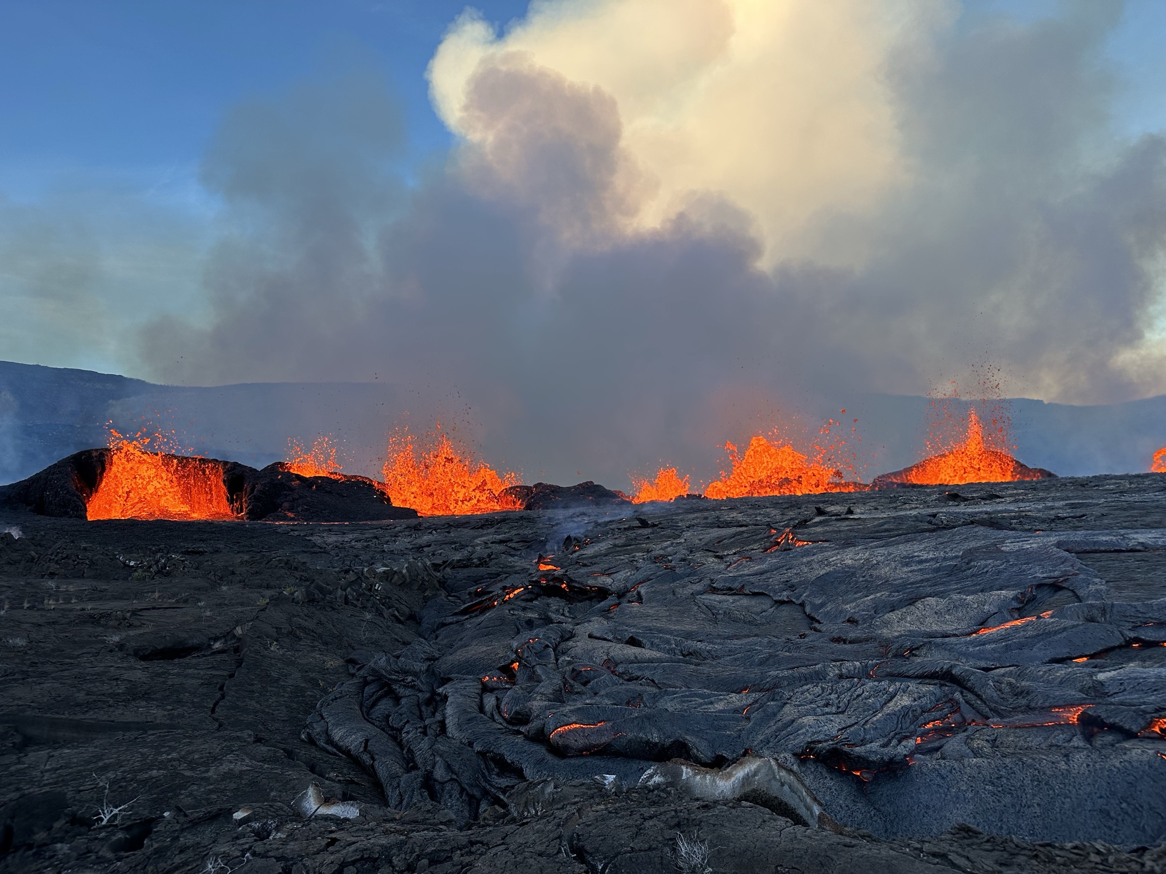
The cover image above shows an active summit eruption inside Halemaʻumaʻu in September 2023 — the dynamic centrepiece of the caldera that all five hikes look out across.
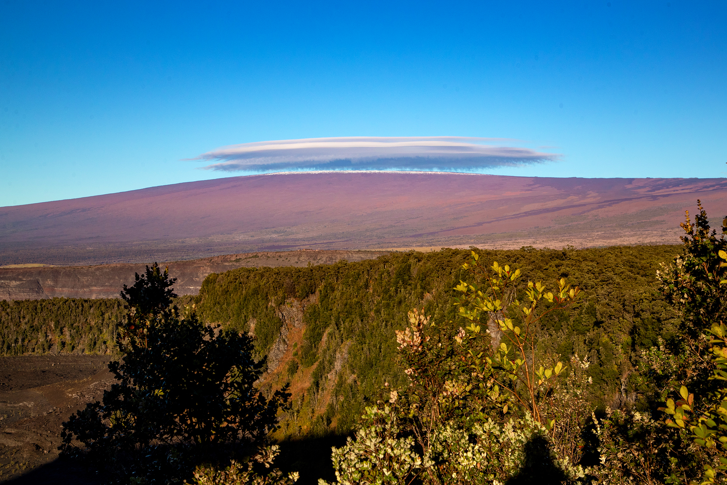
For the rest of Hawaiʻi Island, see Mauna Loa (the much larger neighbouring shield, sharing the southern park boundary) and Maunakea (the high summit of the island). Maui’s Haleakalā is the closest comparable volcanic-summit day-hike landscape elsewhere in Hawaiʻi.
Selection rationale
The five hikes are picked to give a complete Kīlauea sampler in the smallest possible count: one crater-floor traverse (Kīlauea Iki), one easy summit-balcony walk (Crater Rim / Steaming Bluffs), one recent-flow viewpoint hike (Maunaulu / Puʻuhuluhulu), one cultural-landscape hike (Puʻuloa Petroglyphs) and one desert / human-history hike (Kaʻū Desert Footprints toward Maunaiki).
Summary table
| # | Hike | Country | Route type | Distance | Gain | Difficulty |
|---|---|---|---|---|---|---|
| 1 | Kīlauea Iki Loop | USA | Loop | 5.3 km | ~232 m | Moderate |
| 2 | Crater Rim Trail — Steaming Bluffs to Kīlauea Overlook | USA | Out-and-back / section | 6.6 km | ~129 m | Easy–moderate |
| 3 | Maunaulu / Puʻuhuluhulu Cinder Cone | USA | Out-and-back / short loop | 4.2 km | ~97 m | Moderate |
| 4 | Puʻuloa Petroglyphs Trail | USA | Out-and-back with boardwalk loop | 2.1 km | ~27 m | Easy, exposed |
| 5 | Kaʻū Desert Footprints / Maunaiki day section | USA | Out-and-back | 6.4 km | ~188 m | Easy–moderate |
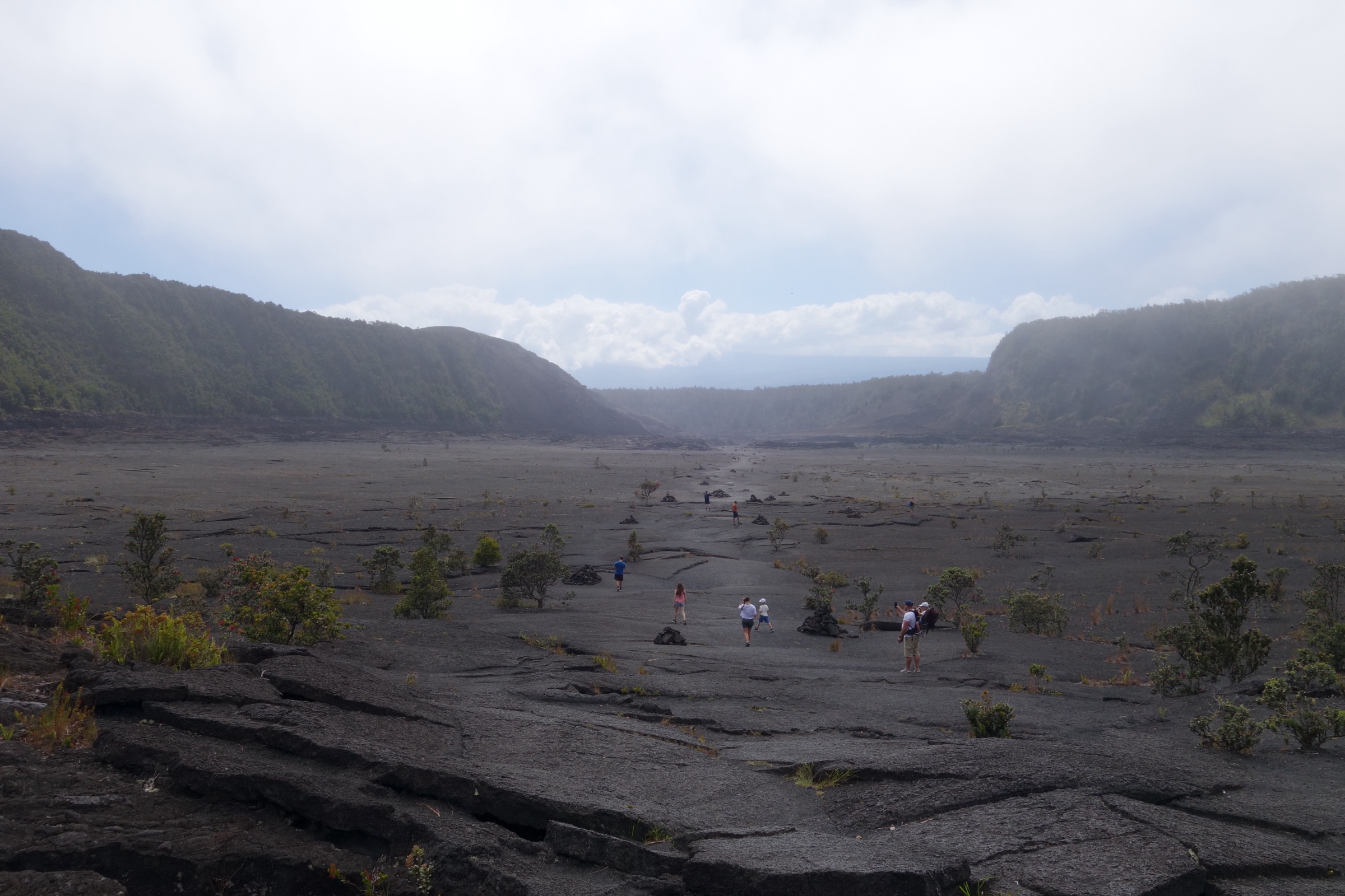
1. Kīlauea Iki Loop
Snapshot
Itinerary
Descend from the rainforest rim into Kīlauea Iki, cross the solidified 1959 lava lake, pass near the vent below Puʻupuaʻi, and climb back to the crater rim. Longer variants run from Kīlauea Visitor Center and Devastation Trailhead.
Why it is essential
Kīlauea Iki is the signature Kīlauea day hike: a compact journey from rainforest to crater floor across a once-molten lava lake.
Equipment
Water, food, rain gear, sun protection, sturdy shoes, and enough time for the climb out. A head torch is prudent if starting late.
Hazards and notes
Lava fields have deep cracks, uneven / unstable terrain and razor-sharp lava. Parking at Kīlauea Iki Overlook is limited; alternate starts are recommended when the lot is full.
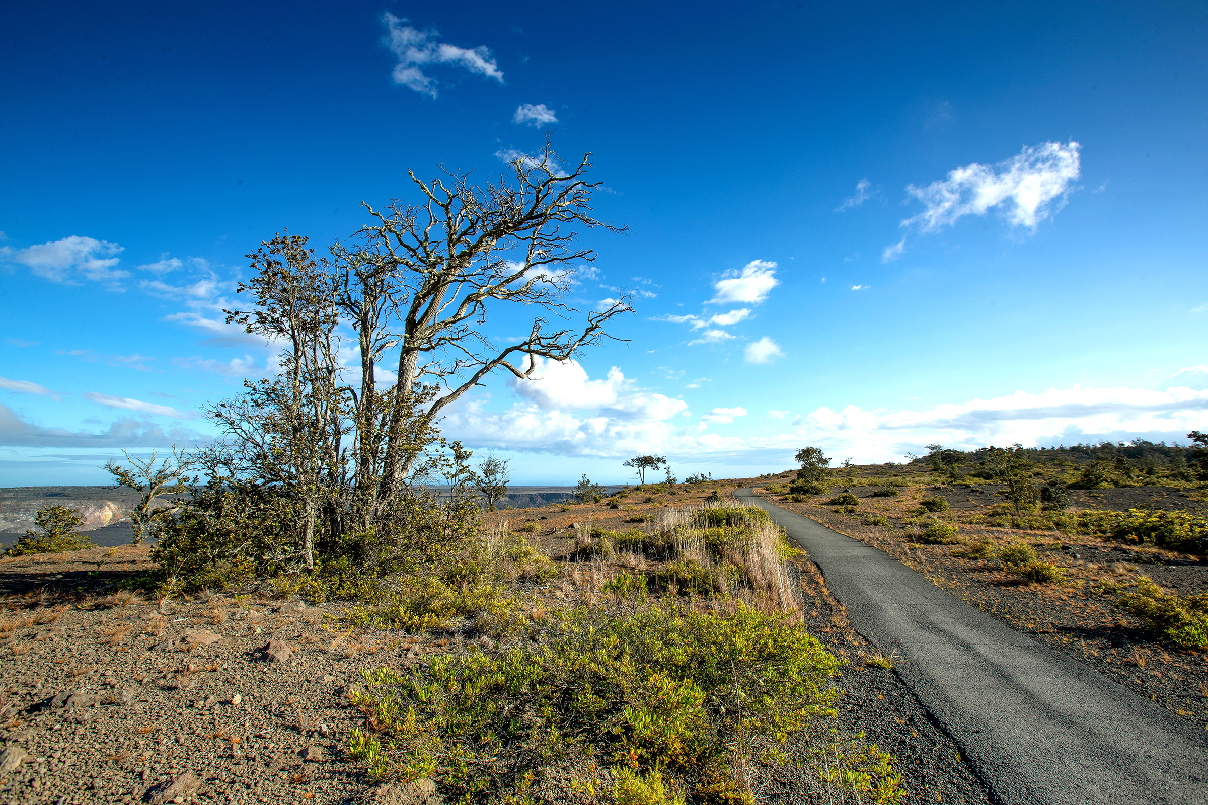
2. Crater Rim Trail — Steaming Bluffs to Kīlauea Overlook
Snapshot
Itinerary
Walk the caldera rim between the steam-vent / Steaming Bluffs area and Kīlauea Overlook, using the officially open Crater Rim Trail sections. The route gives broad caldera views, steam features and close contact with the summit landscape without descending into a crater.
Why it is essential
This is Kīlauea’s best easy rim-balcony walk: accessible, scenic and geologically immediate.
Equipment
Water, rain layer, sun protection and shoes suitable for paved / dirt trail sections.
Hazards and notes
Stay behind barriers. Volcanic gases, unstable crater edges, construction closures and crowded parking are the main issues. Kīlauea summit construction may affect access through summer 2026.
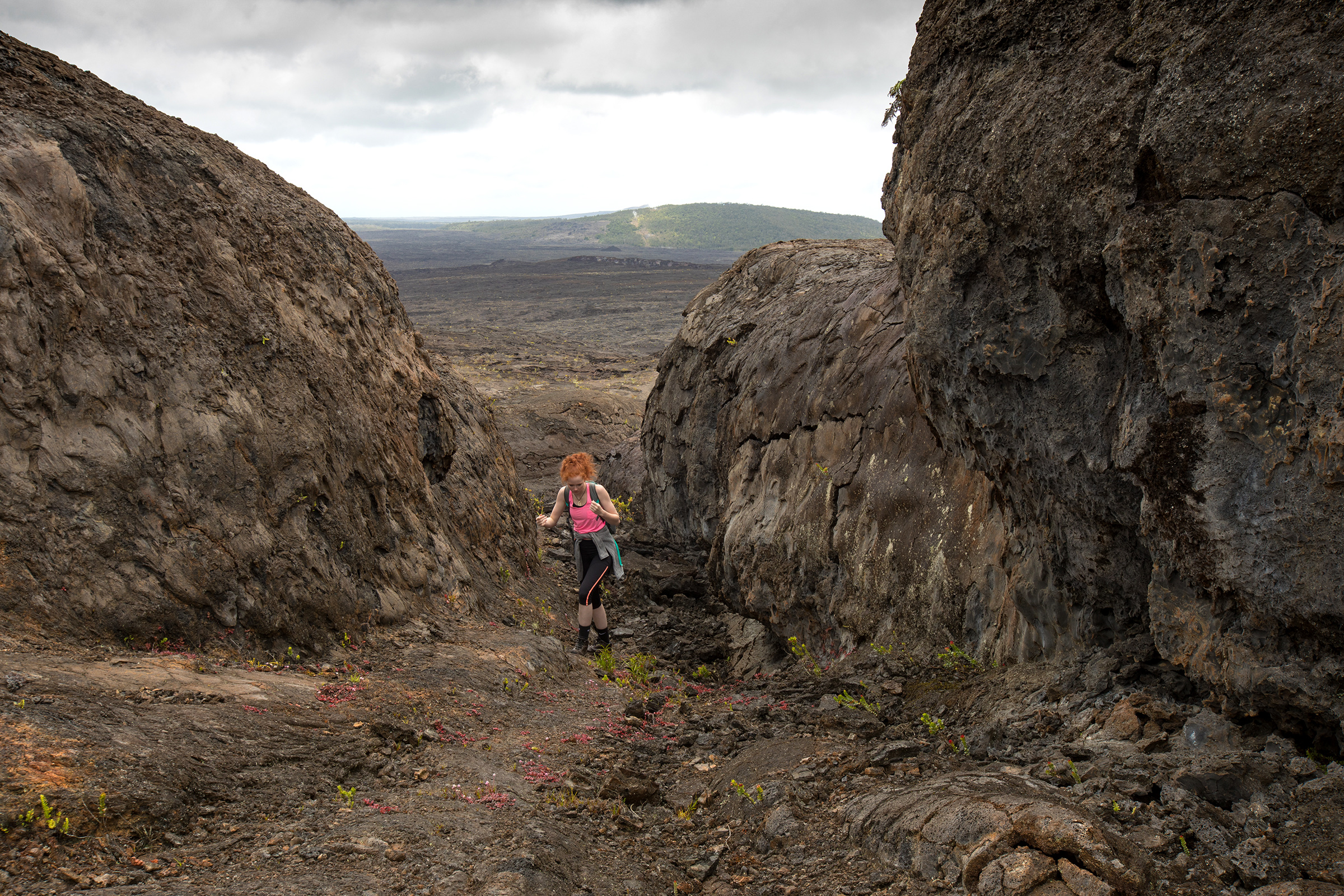
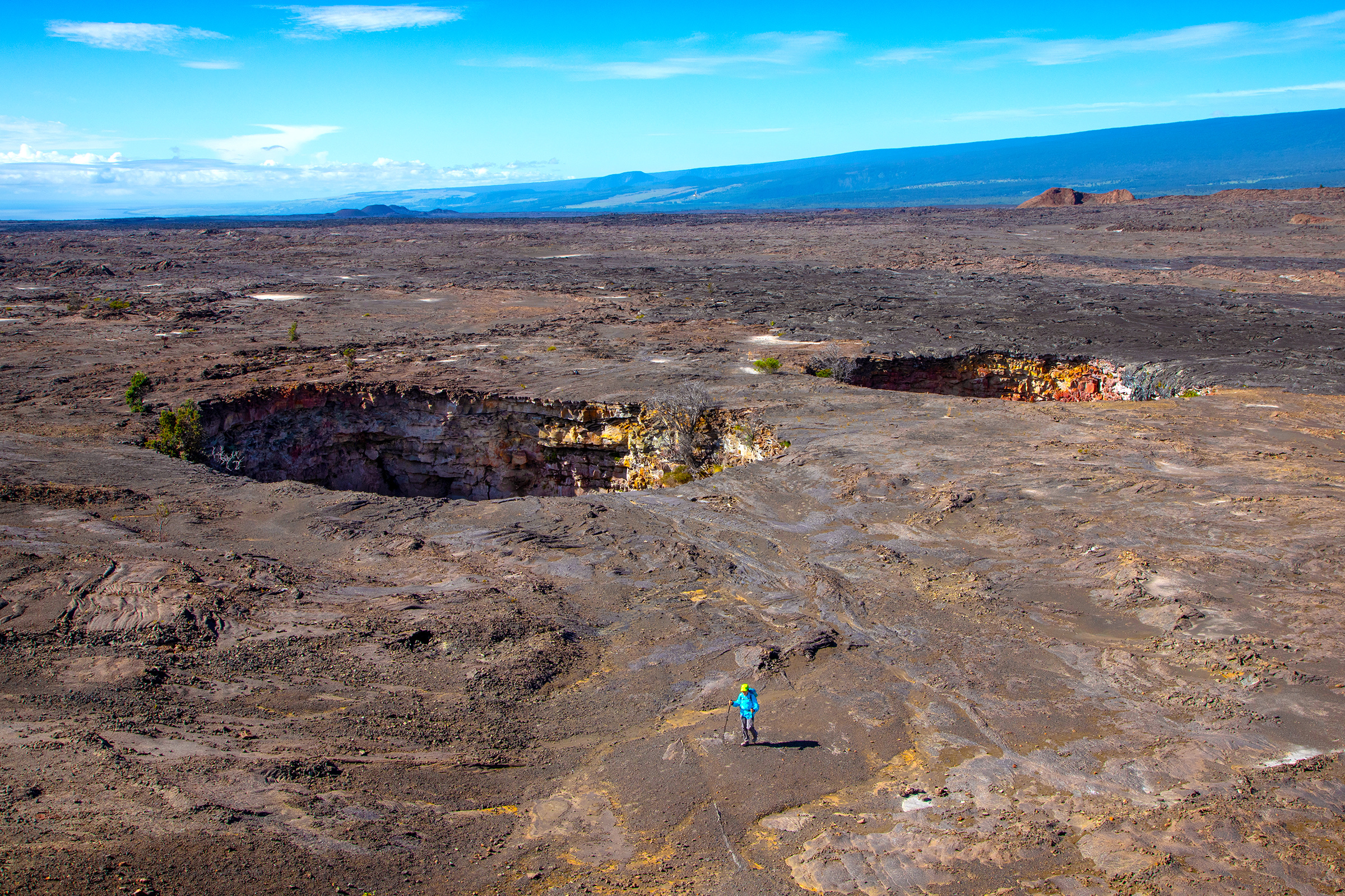
3. Maunaulu / Puʻuhuluhulu Cinder Cone
Snapshot
Itinerary
From the Maunaulu parking area, cross lava-flow terrain associated with the 1969–1974 Maunaulu eruption and climb Puʻuhuluhulu for views over the flow field and surrounding volcanic landscape.
Why it is essential
This is the most accessible short walk for understanding Kīlauea’s relatively recent lava-flow landscapes, fissure features and cinder-cone viewpoints.
Equipment
Water, sun hat, rain shell, sturdy closed shoes and a conservative heat plan. The lava surface is uneven and exposed.
Hazards and notes
Sharp lava, heat, wind, limited shade and changing volcanic conditions are the main hazards. Stay on the marked route to protect fragile new vegetation and avoid unstable lava.
4. Puʻuloa Petroglyphs Trail
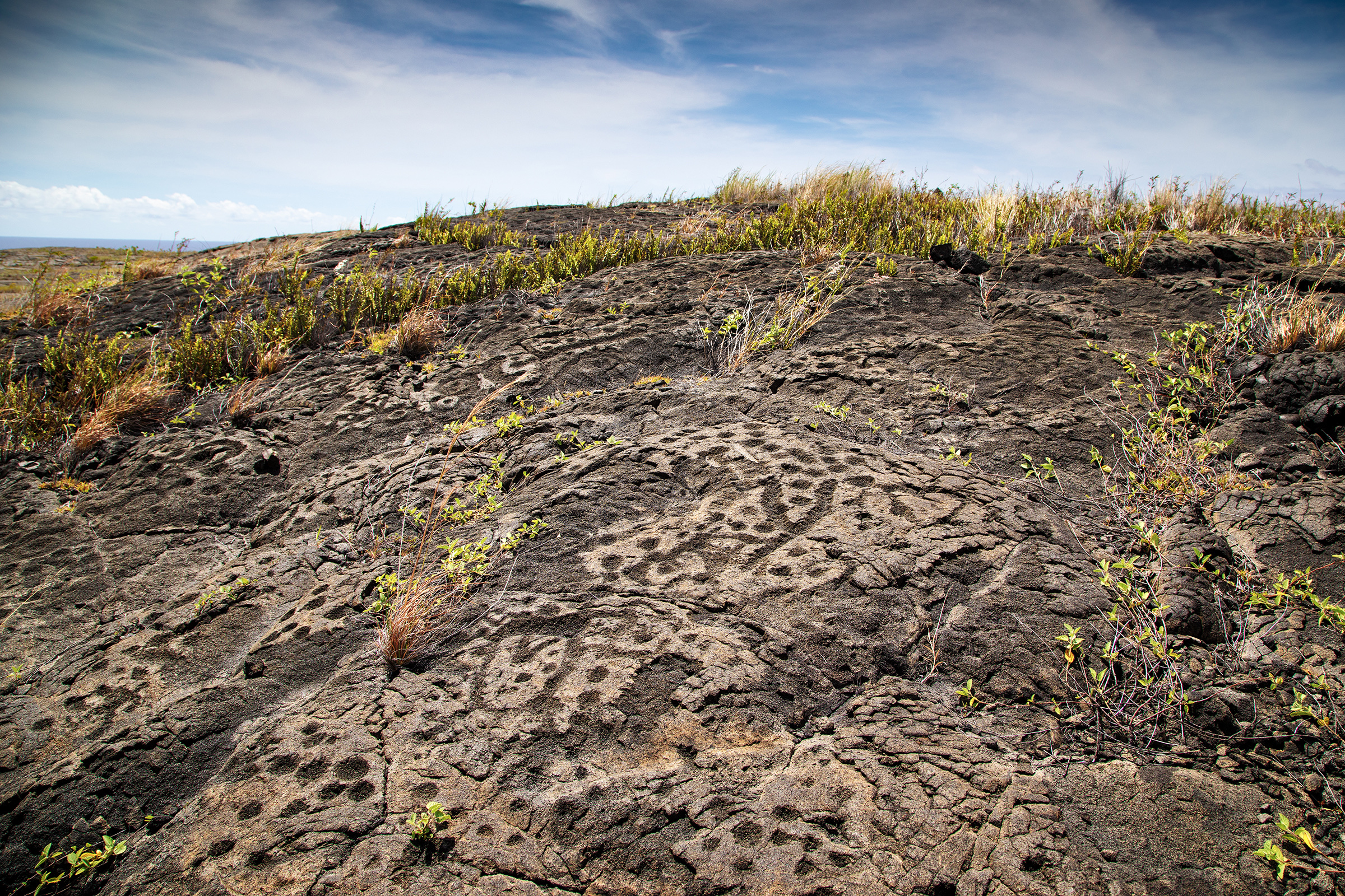
Snapshot
Itinerary
From the Chain of Craters Road parking area, cross exposed lava to the Puʻuloa Petroglyphs boardwalk. Complete the protected viewing loop and return by the same lava-field trail.
Why it is essential
Puʻuloa is one of Hawaiʻi’s largest and most important petroglyph fields, making this the essential cultural-history hike in the Kīlauea district.
Equipment
Water, hat, sunscreen and sturdy shoes. There is little shade and the lava surface is uneven.
Hazards and notes
Do not touch petroglyphs or leave the boardwalk at the cultural site. Heat, wind and rough lava footing are the main physical hazards.
5. Kaʻū Desert Footprints / Maunaiki day section
Snapshot
Itinerary
From the Kaʻū Desert Trailhead, walk into the open desert toward the protected 1790 footprints area, with an optional day-hike continuation toward Maunaiki if time, weather and current guidance allow. Return the same way.
Why it is essential
This route combines stark Kīlauea desert scenery with one of the park’s most important human-history sites: footprints preserved in ash from the 1790 eruption.
Equipment
Water, sun protection, wind / rain layer, sturdy shoes and navigation. The desert can be disorienting in fog, rain or blowing ash.
Hazards and notes
The route is exposed, with little shade. Stay on marked routes and respect the protected footprint area. Do not attempt longer Kaʻū Desert routes without checking current conditions and daylight.