Regional overview
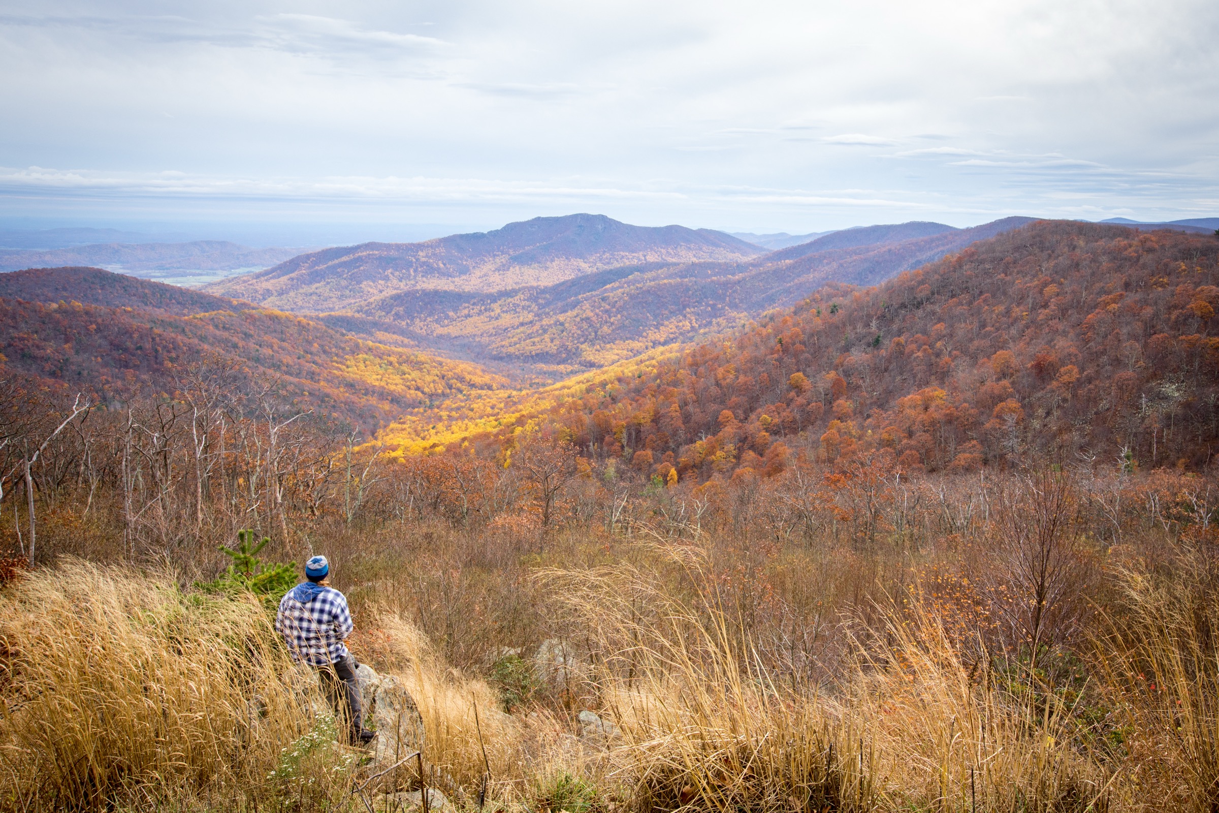
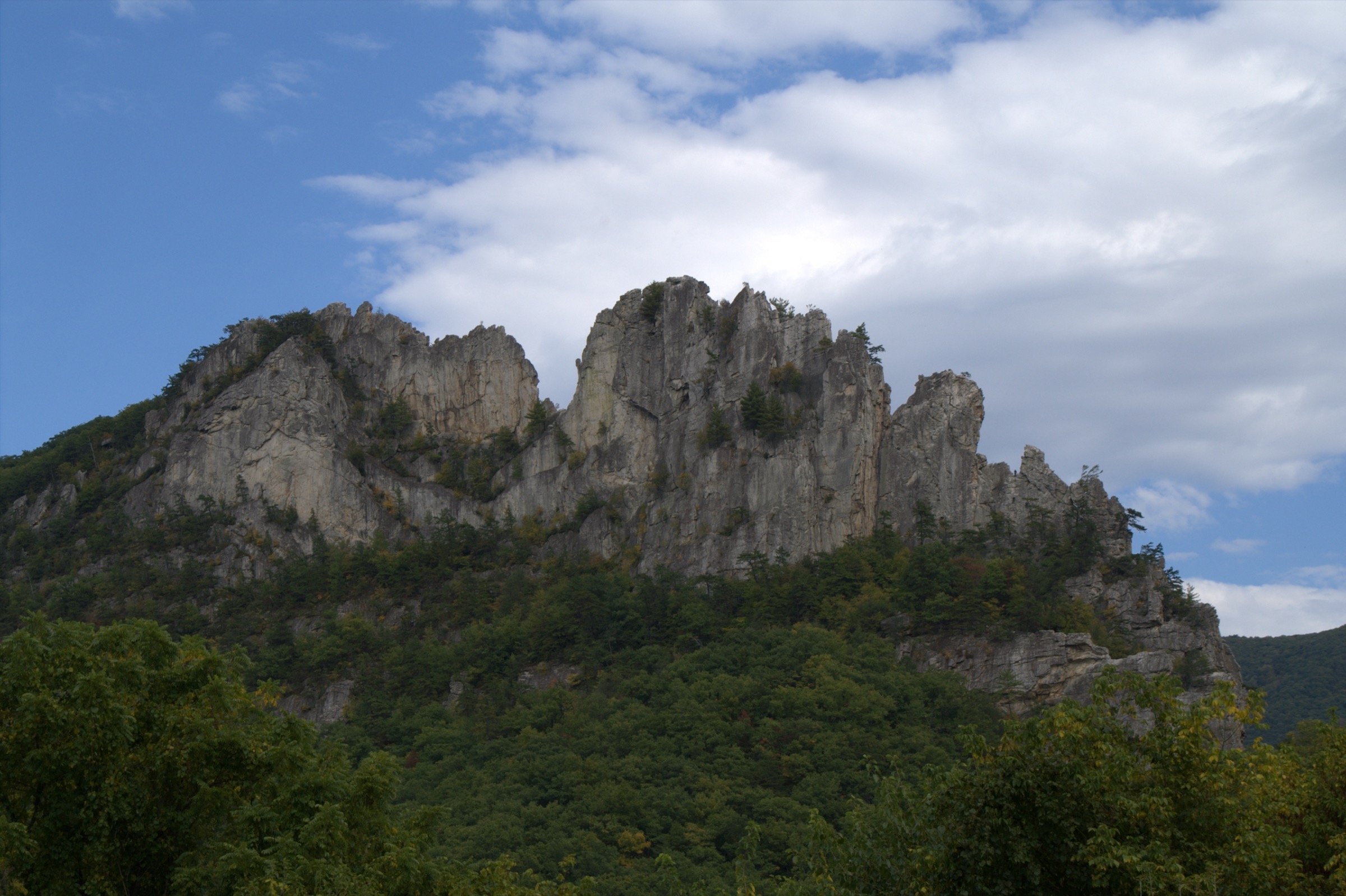
The Maryland and West Virginia Appalachians form a compact but varied Mid-Atlantic hiking region on the two sides of the Potomac watershed. From east to west the terrain moves through three distinct landscapes: the Potomac and Shenandoah river corridor at Harpers Ferry, where three states meet in a dramatic river-cut gap; the South Mountain ridge in Maryland, carrying the Appalachian Trail north from Harpers Ferry; and the higher Allegheny Front in West Virginia, where the Monongahela National Forest and the state parks of the Tucker County plateau hold the region’s most exposed and physically demanding terrain, including the North Fork Mountain / Seneca Rocks quartzite fin, the Dolly Sods Wilderness and the amber-water canyon around Blackwater Falls.
Elevations are lower than in the western United States — the region tops out below 1,500 m — but the walks are not necessarily easier. Ridges are rocky and often steep, humidity is high in summer, the plateau is exposed to fast-moving weather in every season, and winter ice on rock steps, canyon rim boardwalks and cliff-edge overlooks routinely turns short routes into serious ones. Access is concentrated in four hubs: Harpers Ferry, WV for the Potomac confluence and its managed shuttle to the historic lower town; the Weverton trailhead on the Maryland side of the Potomac for the closest Appalachian Trail overlook; US-33 / US-55 at Seneca Rocks for the Monongahela high country; and WV-32 through Davis for the Blackwater Falls and Dolly Sods plateau. Almost all day-hike access is by private vehicle; only Harpers Ferry has an officially managed visitor-centre shuttle, and current NPS practice is to park at the visitor centre and shuttle in rather than driving to the lower town.
The reliable snow-free walking season on the higher Dolly Sods and Blackwater plateau is roughly late April to early November; the Potomac and South Mountain routes are effectively year-round with winter-ice caveats. Summer brings heat, heavy humidity, thunderstorms with lightning on exposed ridges, ticks (with active Lyme and anaplasmosis transmission across the region), and crowded weekend parking at Harpers Ferry, Weverton and Seneca Rocks. Winter and shoulder seasons add ice on rock steps and boardwalks, high water at Dolly Sods stream crossings and limited services in the Tucker County plateau. The region is also black-bear country — encounters are far more common on the West Virginia side than on the Maryland side, and standard practice is to make noise, keep food secured and back away from any bear seen at close range.
Selection rationale
The five walks below were chosen to represent the region’s essential day-hike types rather than five near-identical ridge viewpoints. Maryland Heights is the historic river-confluence overlook and the definitive Harpers Ferry hike. Weverton Cliffs is a short but steep classic on the Appalachian Trail’s Maryland segment. Seneca Rocks is the region’s most recognisable rock landmark and gives the best short-day view in the Monongahela. Rohrbaugh Plains in Dolly Sods samples the exposed high-plateau wilderness that defines the West Virginia highlands. The Blackwater Falls / Elakala Falls / Lindy Point trail cluster closes the selection with the region’s most concentrated waterfall and canyon-rim walking. Spruce Knob (WV state high point) was considered but sits better as a summit-focused entry paired with a North Fork Mountain shortlist. Full Appalachian Trail through-hikes were excluded because they are multi-day shuttles rather than day-hikes.
Summary table
| # | Hike | Country | Route type | Distance | Gain | Max elevation | Difficulty |
|---|---|---|---|---|---|---|---|
| 1 | Maryland Heights (Overlook or Stone Fort loop) | USA | Out-and-back or loop | ~7.2–10.5 km | ~302–545 m | Unresolved | Moderately strenuous |
| 2 | Weverton Cliffs via Appalachian Trail | USA | Out-and-back | ~3.2 km | Unresolved | Unresolved | Moderate–strenuous |
| 3 | Seneca Rocks Hiking Trail | USA | Out-and-back | ~4.2 km | >213 m | Unresolved | Moderate–strenuous |
| 4 | Rohrbaugh Plains Trail (Dolly Sods) | USA | Out-and-back | ~11.6 km | Unresolved | Unresolved | Moderate |
| 5 | Blackwater Falls / Elakala / Lindy Point cluster | USA | Trail cluster | ~3.7 km listed | Unresolved | ~914 m at Lindy Point | Easy–moderate |
1. Maryland Heights (Overlook or Stone Fort loop)
Snapshot
Itinerary
The route starts in Lower Town Harpers Ferry near the Master Armorer’s House and follows Shenandoah Street to the Appalachian Trail at the end of the street. It passes under the railroad trestle to The Point — where the Potomac and Shenandoah meet at the West Virginia, Maryland and Virginia state corners — crosses the Potomac River on the pedestrian footbridge, descends the spiral staircase to the C&O Canal towpath and follows the towpath upstream for about 0.5 km. A footbridge over the dry canal bed reaches Harpers Ferry Road and the Maryland Heights trailhead. The green-blazed Maryland Heights Trail climbs the ridge, and the red-blazed Overlook Cliff Trail spurs to the main viewpoint over Harpers Ferry, the two rivers and their confluence. The blue-blazed Stone Fort Trail can be added as a longer historic loop through Civil War fortifications on the summit ridge before the return.
Why it is essential
Maryland Heights is the definitive Harpers Ferry hike — the walk that combines steep Appalachian ridge climbing, Civil War fortification history, a river-crossing approach and the best-known high view over the Potomac–Shenandoah confluence. It is the region’s most direct pairing of hiking and American history in a single day.
Equipment
- Trail shoes or light hiking boots
- Trekking poles for the descent
- Rain and wind shell; light warm layer outside summer
- 1.5–2 L water — no drinking water on the trail
- Sun protection
- Insect repellent with DEET or picaridin — tick country
- Offline map or NPS PDF loaded on phone
- Headtorch for delays
- Microspikes when ice is present on the overlook rocks
Hazards and notes
- Trail is open daylight hours only; closed sunset to sunrise.
- No drinking water and no restroom on the trail.
- Sustained steep climb — the Stone Fort loop adds significant length and gain.
- Cliff edges at the overlook require care, particularly when wet or icy.
- Lower Town parking is very limited; the NPS visitor-centre shuttle is the recommended access.
- Ticks and Lyme risk from spring through autumn.
- Confirm current NPS pet regulations before travel.
GPX / route file
Sources
2. Weverton Cliffs via Appalachian Trail
Snapshot
Itinerary
The route leaves the small Weverton Cliffs parking area and joins the Appalachian Trail northbound, climbing steeply on switchbacks through forested South Mountain terrain. A short spur breaks east to the rock viewpoint at Weverton Cliffs, which sits directly above the Potomac River gap with a broad view down-river to Harpers Ferry and up-river along the AT ridge. Return is on the same route.
Why it is essential
Weverton Cliffs is the compact Maryland Appalachian Trail classic — a direct ridge climb and a broad Potomac River overlook in a short outing that pairs cleanly with a Harpers Ferry day. It is the shortest walk in the selection and the natural warm-up for the longer Mid-Atlantic days.
Equipment
- Trail shoes or light hiking boots
- Trekking poles helpful on the descent
- 1–1.5 L water
- Rain and wind shell
- Sun protection
- Insect repellent — tick country
- Simple offline map
- Microspikes after snow or freeze-thaw icing
Hazards and notes
- Grade is steep and can be slippery after rain, snow, ice, or leaf fall.
- Overlook rocks are exposed; keep well back from the edge, especially with children or dogs.
- Small parking area fills quickly on summer weekends; arrive early or plan a Harpers Ferry shuttle day instead.
- ATC route page confirms distance and direction but does not publish elevation gain, loss or maximum elevation.
GPX / route file
| Source | URL | Format | Notes |
|---|---|---|---|
| Appalachian Trail Conservancy — Weverton Cliffs | appalachiantrail.org | Web page | Official trail-organisation description; no GPX exposed |
Sources
3. Seneca Rocks Hiking Trail
Snapshot
Itinerary
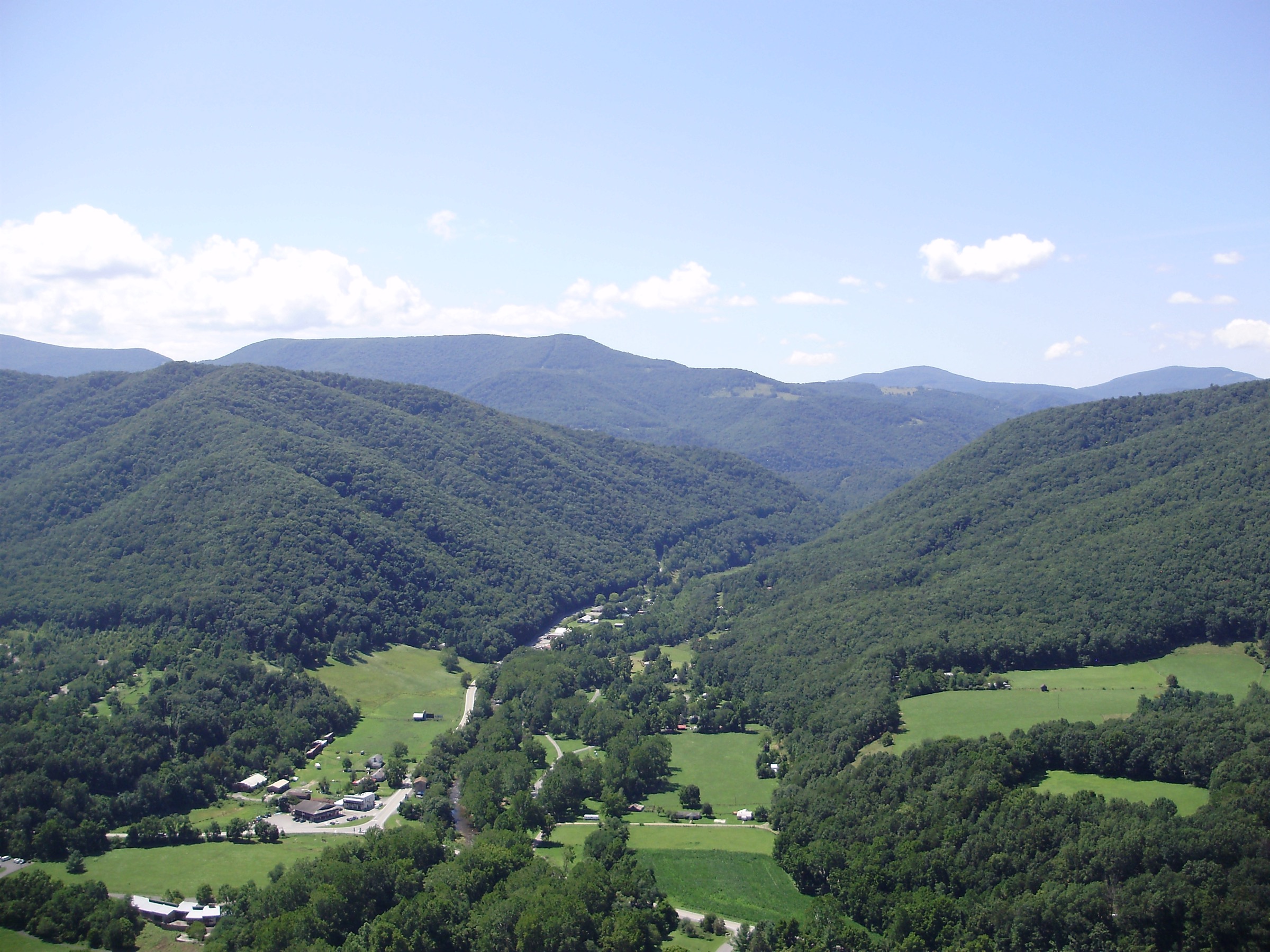
The trail leaves the Seneca Rocks Discovery Center, crosses Seneca Creek to a picnic area, and climbs toward the base of the rocks on a well-maintained switchback trail. The route uses stone steps and a series of switchbacks to reach an observation platform near the top of Seneca Rocks, with wide views over the North Fork valley, the Monongahela high country and the surrounding Allegheny ridges. Beyond the platform the terrain becomes technical climbing ground — the USFS specifically warn hikers not to continue past the platform without ropes and climbing skills. Return is on the same route.
Why it is essential
Seneca Rocks is one of West Virginia’s best-known Appalachian landmarks — a 274-metre quartzite fin rising directly above the North Fork River — and its maintained hiking trail is the only way for non-climbers to reach a high viewpoint on this otherwise technical formation. It is the region’s most iconic short-day objective.
Equipment
- Sturdy trail shoes or light hiking boots — steps and rock throughout
- Trekking poles helpful on the descent
- 2 L water — no potable water at the site; USFS specifically flag this
- Sun protection
- Rain and wind shell
- Insect repellent — tick country
- Simple offline map
Hazards and notes
- Site is open year-round during daylight hours only.
- No potable water at the site — carry from the start.
- USFS warn strongly against going beyond the observation platform without climbing gear and skill; several fatal falls have occurred at Seneca Rocks over the years.
- Keep children close near the platform and on the upper switchbacks.
- Steps and switchbacks make the short route more strenuous than the distance suggests.
GPX / route file
| Source | URL | Format | Notes |
|---|---|---|---|
| USFS Monongahela — Seneca Rocks | fs.usda.gov | Web page | Official route description; no GPX exposed |
Sources
4. Rohrbaugh Plains Trail (Dolly Sods)
Snapshot
Itinerary
From the Rohrbaugh trailhead on Forest Road 75 the route enters Dolly Sods Wilderness and follows the Rohrbaugh Plains Trail across high-elevation forest, heath, bog and short-grass meadow characteristic of the Allegheny Front. Old railroad grades, weather-stunted red spruce, sphagnum bogs, boulder fields and open plateau views make Dolly Sods one of the most physically distinctive walking landscapes east of the Mississippi. The wilderness is unsigned by design — expect to navigate by map, compass and terrain rather than trail signs. Return is on the same trail from either the segment end or a conservative turnaround if weather, water or navigation conditions deteriorate.
Why it is essential
Dolly Sods is the region’s most distinctive high-country wilderness landscape — a plateau that looks and behaves more like sub-arctic Canada than the surrounding Appalachians — and the Rohrbaugh Plains Trail provides the single best day-hike sample of open upland views, boggy ground, old railroad-grade terrain and the exposed weather character of the Allegheny Front.
Equipment
- Sturdy waterproof boots — wet and muddy sections are the norm, not the exception
- Rain and wind shell plus a warm layer, hat and gloves outside midsummer
- Trekking poles for stream crossings and bog edges
- 2.5–3 L water and treatment
- Paper map, compass and offline GPS with route loaded — Dolly Sods is intentionally unsigned
- Insect repellent — tick country
- Bear-aware food handling
- Headtorch
- First-aid kit
Hazards and notes
- Weather changes fast on the plateau — cold rain, wind and even summer snow are all possible.
- Wet sections and stream crossings; fords can become unsafe during high water.
- Old roads and rail grades make navigation confusing; do not rely on continuous tread.
- The area was used for World War II military training; suspected ordnance should not be touched, moved or disturbed — leave the area and notify the Forest Service.
- Groups over 10 are prohibited in the wilderness.
- Camping and open campfires are prohibited within 91 m (300 ft) of Forest Roads 19 and 75, except in Red Creek Campground.
- Mountain bikes and other mechanical transport are not allowed on wilderness trails.
- Black-bear country — food storage, noise and standard bear-aware practice apply.
GPX / route file
| Source | URL | Format | Notes |
|---|---|---|---|
| USFS Monongahela — Dolly Sods Wilderness | fs.usda.gov | Web page | Official area and trail description; no GPX exposed |
Sources
5. Blackwater Falls / Elakala Falls / Lindy Point cluster
Snapshot
Itinerary
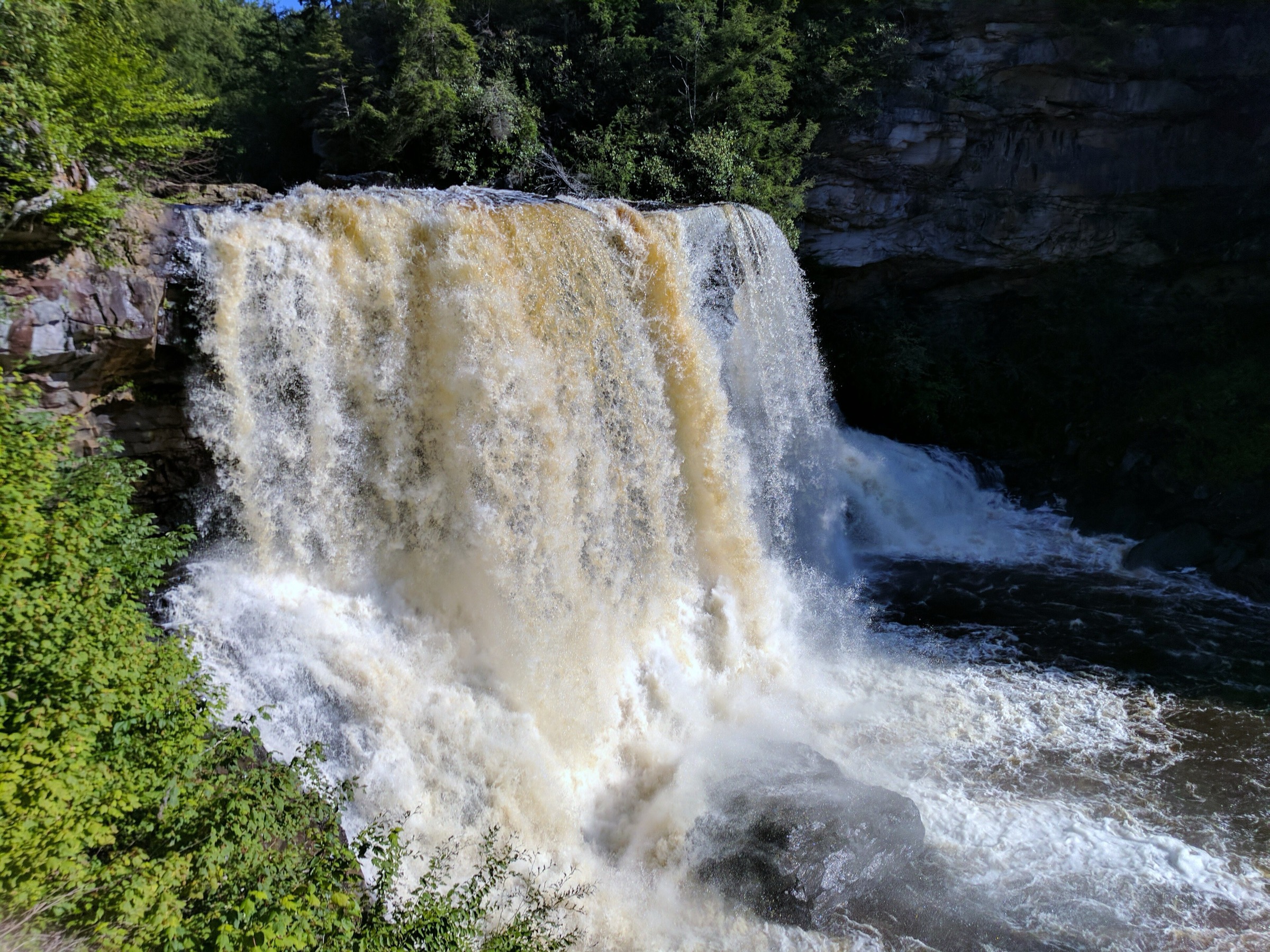
This entry combines three short Blackwater Falls State Park walks rather than a single named circuit. Blackwater Falls itself — the park’s 17 m amber-water plunge — is reached from the Trading Post area either by the Boardwalk Trail (more than 200 steps to the observation deck) or by the paved Gentle Trail for an easier overlook. Elakala Falls is a short walk from the Blackwater Lodge area — the Elakala Trail crosses a bridge above the falls and continues along the canyon rim toward the main park road. Lindy Point sits at the small Lindy Point parking area about 1.6 km below the sled-run turnoff and gives a west-facing overlook over the deep canyon at roughly 914 m. The three walks can be linked by short drives between trailheads or by park-road walking only where signed and safe.
Why it is essential
Blackwater Falls State Park is the region’s most concentrated waterfall and canyon-rim hiking area. The 17 m Blackwater Falls, the tannin-brown cascade at Elakala and the sweeping western overlook at Lindy Point together represent the amber-water streams, red-spruce and eastern-hemlock atmosphere and deep canyon terrain of the Allegheny Mountains in Tucker County. It is the only entry in the selection built around waterfalls.
Equipment
- Grippy walking shoes or hiking shoes
- 1.5 L water
- Rain and wind shell; warm layer for exposed overlooks in shoulder seasons
- Sun protection
- Insect repellent — tick country
- Simple offline map or park PDF
- Microspikes in winter — boardwalks, stairs and boardwalks glaze quickly
Hazards and notes
- Blackwater Falls Boardwalk Trail includes 200+ steps to the lower observation deck.
- Waterfall rocks, boardwalks, stairs and canyon-rim surfaces are slippery — several fatal falls have occurred over the years at Blackwater Canyon overlooks.
- Stay on designated trails and behind railings; do not scramble to the base of the falls.
- Lindy Point has a small parking area and may require a longer approach when winter snow affects road access.
- Because this is a cluster of separate short walks, the exact combined distance, gain and route file need manual mapping before wider republication.
GPX / route file
| Source | URL | Format | Notes |
|---|---|---|---|
| WV State Parks — Blackwater Falls trails | wvstateparks.com | Web page | Official trail descriptions; no GPX exposed |
| WV State Parks — Blackwater Falls park map | wvstateparks.com | Official PDF | Use for manual route reconstruction |
Sources
- WV State Parks — Blackwater Falls State Park trails
- WV State Parks — Blackwater Falls State Park map (PDF)
Routes excluded as out of scope
The following sit inside or adjacent to the Maryland and West Virginia Appalachians but fall outside a day-hike entry or are better treated in a neighbouring catalogue.
- Spruce Knob (WV state high point, 1,482 m). The highest point in West Virginia and a definitive Monongahela summit day, but sits better as the anchor of a dedicated Spruce Knob / North Fork Mountain shortlist rather than the Mid-Atlantic sampler above.
- North Fork Mountain Trail ridge traverse. One of the finest long ridge walks in the eastern United States, but a multi-day route rather than a day-hike.
- Appalachian Trail through-hikes. Full-length Maryland and West Virginia AT sections are shuttle backpacks, not day-hikes; only the Weverton Cliffs day is treated here.
- Catoctin Mountain (Cunningham Falls / Chimney Rock). Fine Maryland Blue Ridge walks, but belong to a Catoctin-focused shortlist rather than the Potomac-and-Monongahela sampler above.
- Green Ridge State Forest (western Maryland). Extensive and worthwhile, but a distinct catalogue better paired with the Allegheny Front on the Maryland side.
Further reading
| Source | URL |
|---|---|
| NPS Harpers Ferry National Historical Park | nps.gov |
| NPS Harpers Ferry — Maryland Heights Trail | nps.gov |
| Appalachian Trail Conservancy — Weverton Cliffs | appalachiantrail.org |
| USFS Monongahela National Forest | fs.usda.gov |
| USFS Monongahela — Seneca Rocks | fs.usda.gov |
| USFS Monongahela — Dolly Sods Wilderness | fs.usda.gov |
| WV State Parks — Blackwater Falls State Park | wvstateparks.com |
| Storm — White Mountains, New Hampshire | /guidebooks/usa-appalachian-mountains-eastern-highlands-northern-appalachians-white-mountains-essential-day-hikes |
| Storm — Green Mountains, Vermont | /guidebooks/usa-appalachian-mountains-eastern-highlands-northern-appalachians-green-mountains-essential-day-hikes |
| Storm — Catskill High Peaks, New York | /guidebooks/usa-appalachian-mountains-eastern-highlands-catskills-shawangunks-catskill-high-peaks-essential-day-hikes |
| Storm — Shawangunk Ridge, Hudson Valley | /guidebooks/usa-appalachian-mountains-eastern-highlands-catskills-shawangunks-shawangunk-ridge-essential-day-hikes |
| Wikipedia — Harpers Ferry National Historical Park | en.wikipedia.org |
| Wikipedia — Seneca Rocks | en.wikipedia.org |
| Wikipedia — Dolly Sods Wilderness | en.wikipedia.org |
| Wikipedia — Blackwater Falls State Park | en.wikipedia.org |
Missing data / follow-up work
- No official downloadable GPX/KML file was located for any of the five entries in this pass.
- Weverton Cliffs official elevation gain, elevation loss and maximum elevation remain unresolved in the checked ATC source.
- Seneca Rocks maximum elevation for the hiking route (as opposed to the summit fin) remains unresolved in the checked USFS source.
- Rohrbaugh Plains Trail elevation gain, elevation loss and route maximum remain unresolved.
- Blackwater Falls trail cluster total distance, elevation gain and continuous walking line require manual mapping before wider republication.
- Dog rules for Maryland Heights, Weverton Cliffs, Seneca Rocks and Blackwater Falls should be confirmed with the managing agency close to travel.
- Public transport options outside the Harpers Ferry visitor-centre shuttle and MARC weekday service were not fully verified.
- Tick-borne disease (Lyme, anaplasmosis) risk is a live regional issue; confirm current CDC / West Virginia and Maryland public-health guidance close to travel.