Regional overview
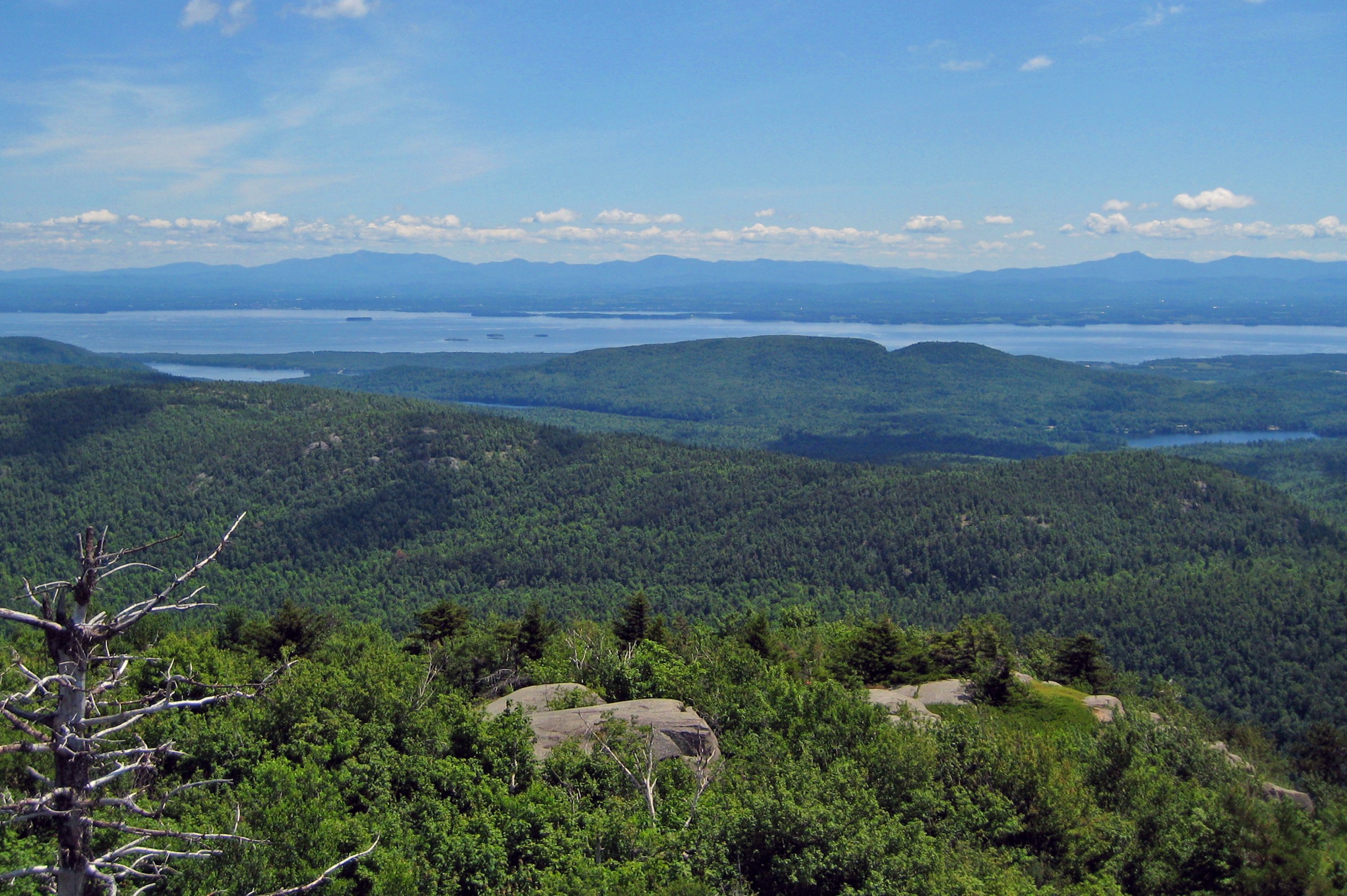
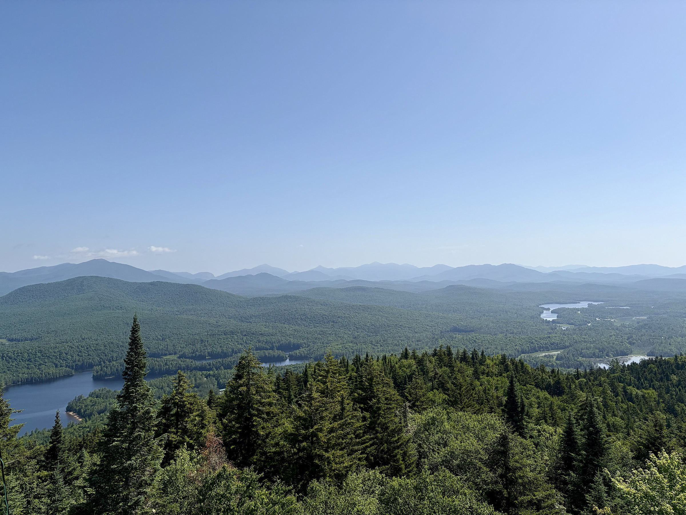
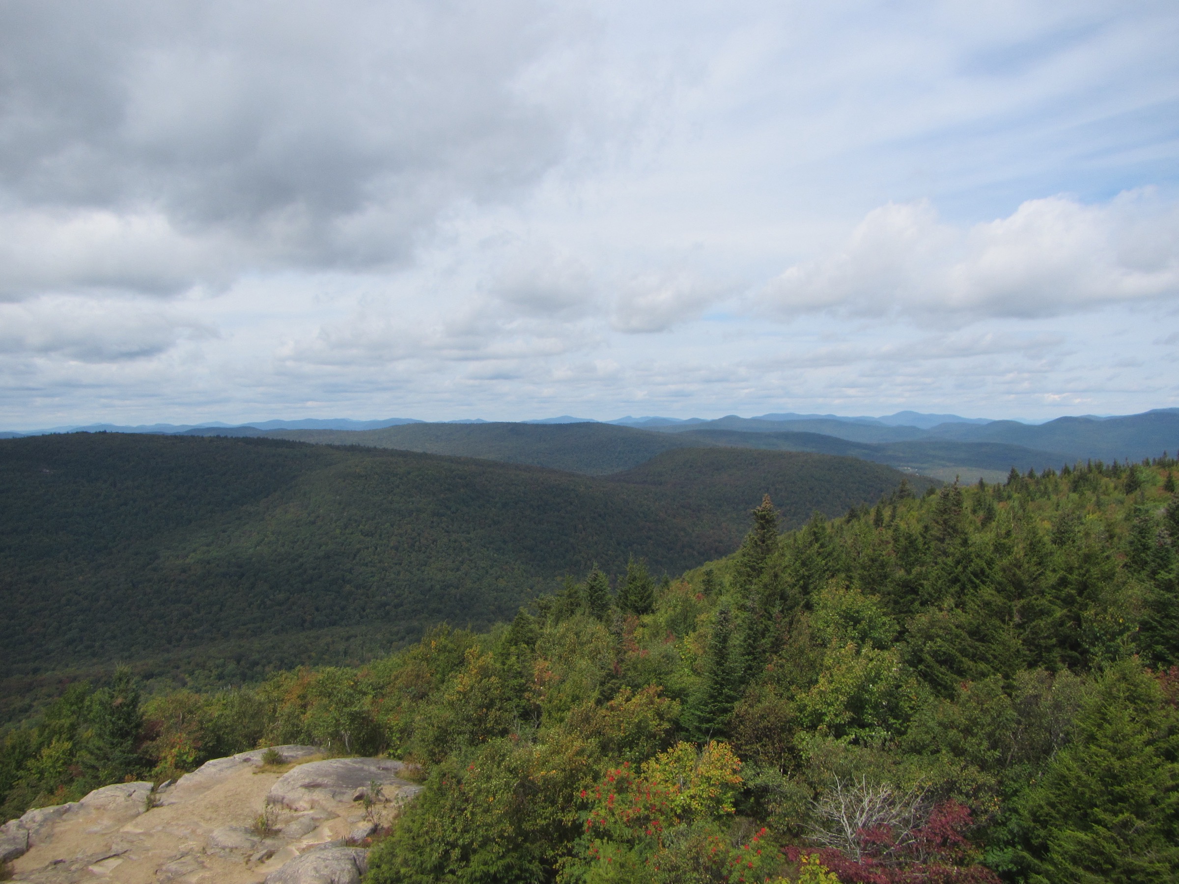
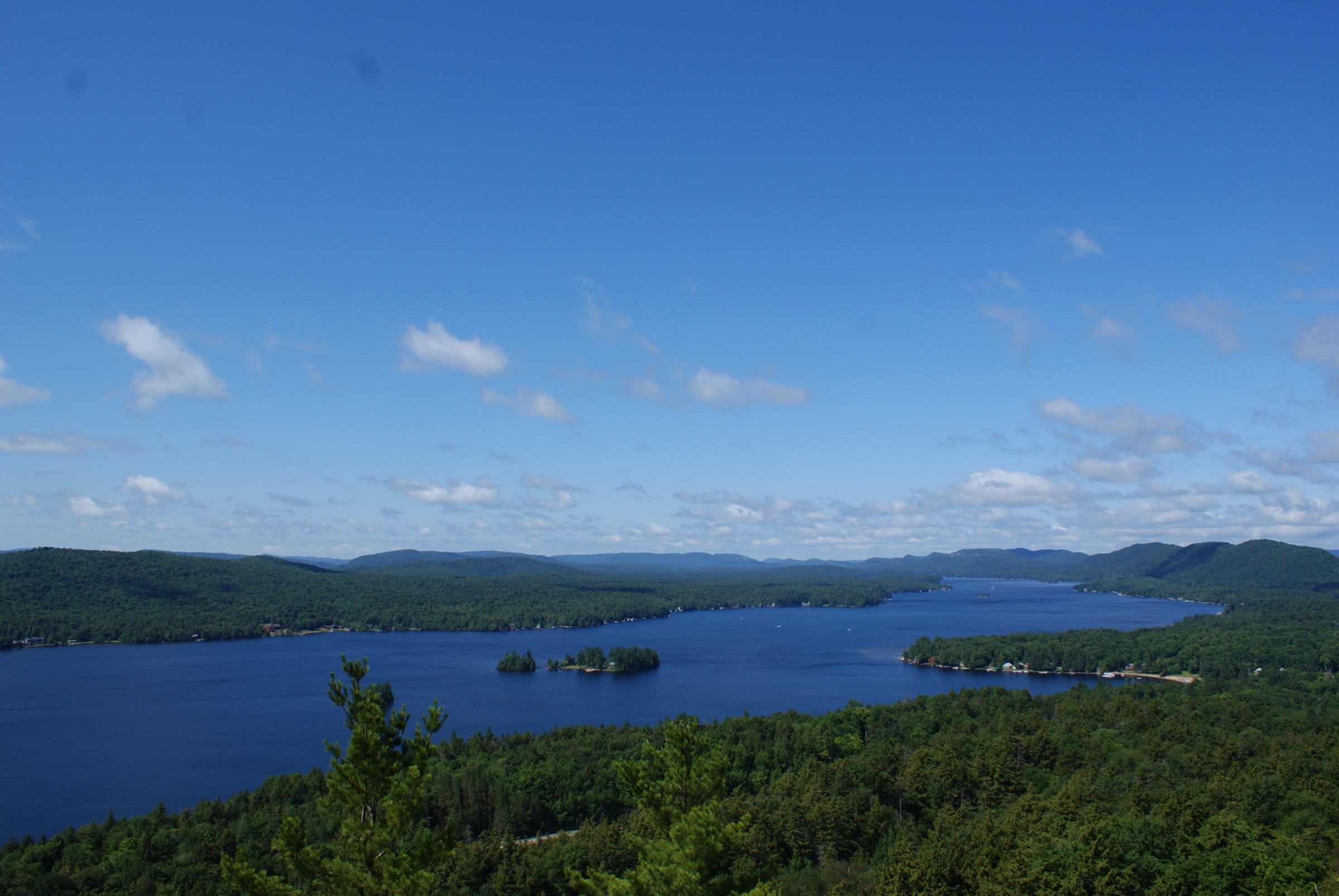
The eastern flank of Adirondack Park runs as a narrow, geologically dramatic corridor from Ticonderoga at the outlet of Lake George north past Crown Point, Port Henry, Westport, Essex, Willsboro and Keeseville toward Plattsburgh. Unlike the High Peaks 40 km inland to the west, this is a landscape of low-to-mid-elevation cliff peaks, anorthosite and gneiss escarpments, and short but sharp climbs that jump straight from the Lake Champlain shoreline (about 30 m elevation) to summits between 260 m and 810 m. The scale is small; the views are outsized. From the fire tower on Poke-O-Moonshine or the open ledges of Coon Mountain, hikers look east across the whole Champlain trough to the Green Mountains of Vermont, and west into the roll of Adirondack foothills that hides the High Peaks beyond.
The region’s hiking is organised around three overlapping land-management traditions. New York State Forest Preserve land, managed by the Department of Environmental Conservation (DEC), covers the largest tracts: Poke-O-Moonshine, Split Rock Mountain Wild Forest, and the eastern shore of Lake George Wild Forest with Black Mountain and its historic fire tower. The Champlain Area Trails (CATS) network and the Adirondack Land Trust have added a dense web of preserved-farmland and cliff-top paths near Westport, Essex and Willsboro, including the well-loved Coon Mountain Preserve. The Lake Champlain Land Trust holds Split Rock Wildway lands that connect the DEC forest to the lakeshore. Between them, these organisations have made the Champlain-side Adirondacks one of the most accessible, well-signed and licence-friendly hiking regions in the northeastern United States.
Terrain is predominantly forested with hardwood-hemlock cover, opening onto bare anorthosite ledges and cliff bands at the summits. Weather is Great Lakes-influenced but with a distinct rain shadow east of the High Peaks; the Champlain corridor sees less precipitation than the interior and warms earlier in spring. That makes April to early May and October key windows for these lower peaks, when the High Peaks are still snowbound. Summer brings hot, humid days with thunderstorm risk on exposed summits, and tick pressure (deer tick and blacklegged tick, with Lyme risk) is high from late April to October. Winter conditions on exposed ledges — Black Mountain in particular — can be genuinely serious, with wind chill and verglas on the anorthosite slabs.
Historical layers run through every trailhead. Ticonderoga’s Mount Defiance is where British artillery under General Burgoyne outflanked the American garrison of Fort Ticonderoga in July 1777, forcing the fort’s abandonment. Samuel de Champlain himself crossed the lake that bears his name in 1609. The LaChute River drops out of Lake George at Ticonderoga to feed Champlain, and the whole corridor was the primary military highway of the northeast into the mid-19th century. Ranger fire towers on Poke-O-Moonshine and Black Mountain add a second, early-20th-century layer of forest-protection history now maintained by DEC and volunteer groups such as Friends of Poke-O-Moonshine.
Selection rationale
The five hikes below were chosen to represent the full character of the Champlain-side Adirondacks rather than to cluster around a single trailhead. Poke-O-Moonshine is the iconic cliff-and-fire-tower peak of the northern half of the corridor and a Fire Tower Challenge summit. Coon Mountain is the short, accessible CATS / Adirondack Land Trust preserve that best represents the private-conservation network around Westport and Essex. Black Mountain is the highest and most serious summit on the east side of Lake George, offering a full-day fire-tower loop in Lake George Wild Forest. Split Rock Mountain — North Rim Loop covers the lake-cliff ecology of the DEC Split Rock Wild Forest and Lake Champlain Land Trust holdings between Essex and Westport. Mount Defiance rounds out the selection with a short, historically loaded walk directly above Fort Ticonderoga. Together they span the region from Fort Ticonderoga north to Chesterfield and represent DEC, CATS / ALT and Lake Champlain Land Trust management in roughly equal measure.
Summary table
| # | Hike | Country | Route type | Distance | Gain | Max elevation | Difficulty |
|---|---|---|---|---|---|---|---|
| 1 | Poke-O-Moonshine (Ranger Trail) | USA | Out-and-back | ~5.6 km | ~390 m | 664 m | Moderate–strenuous |
| 2 | Coon Mountain, Westport | USA | Out-and-back | ~2.2–3.0 km | ~150 m | 309 m | Easy–moderate |
| 3 | Black Mountain (Pike Brook loop) | USA | Loop | ~10.8 km | ~410 m | 806 m | Strenuous |
| 4 | Split Rock Mountain — North Rim Loop | USA | Loop | ~10.0 km | ~336 m | 315 m | Moderate |
| 5 | Mount Defiance, Ticonderoga | USA | Out-and-back | ~3.4 km | ~157 m | 260 m | Easy |
1. Poke-O-Moonshine Mountain (Ranger Trail)
Snapshot
Itinerary
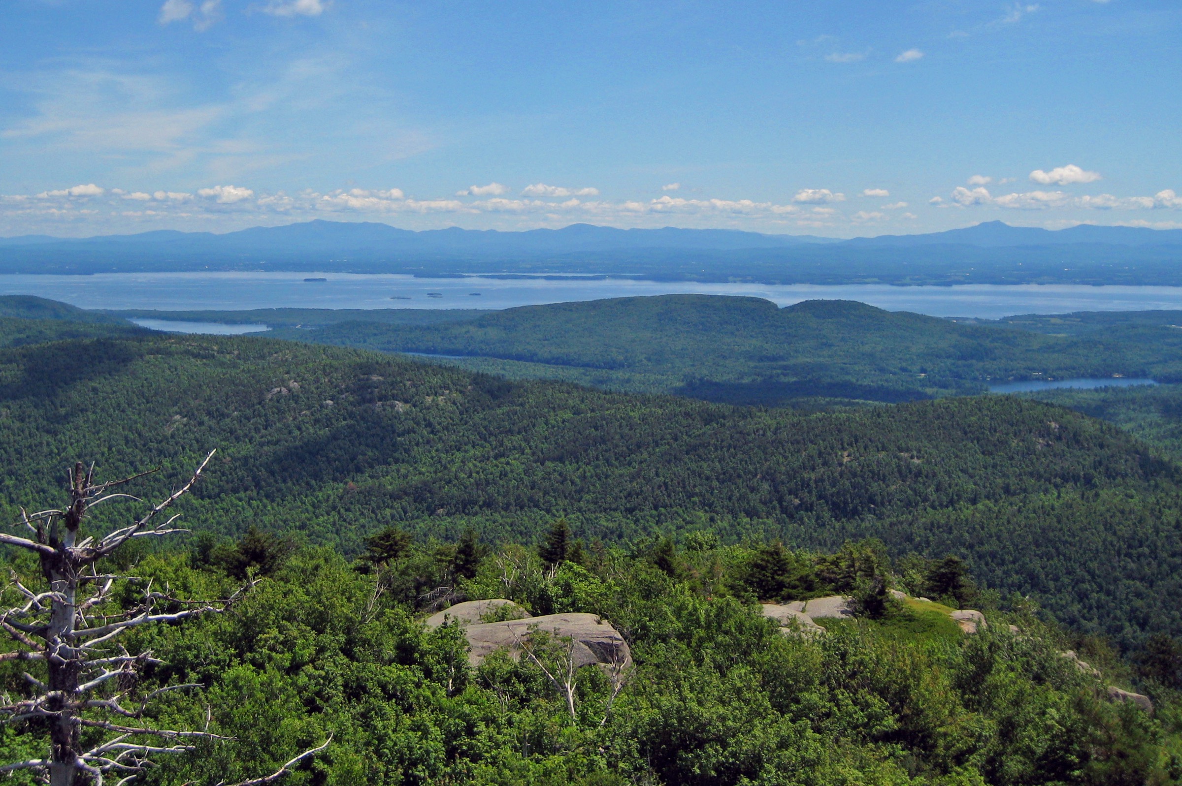
The Ranger Trail leaves the day-use parking area on the west side of US Route 9 and climbs steadily through mixed hardwood forest, following an obvious foot-trodden route rebuilt with stone steps by Friends of Poke-O-Moonshine and DEC. After about 400 m the grade steepens and the trail begins the sustained middle section, weaving between mossy boulders and past the base of low anorthosite outcrops. A signed spur near the halfway mark leads a short distance to the ruins of the former observer’s cabin foundations. Above this the trail eases into a broad col before the final rocky push to the summit, where partial views open west across the Adirondack foothills. The 1917 steel fire tower, restored in 1996 and listed on the National Register of Historic Places, stands on the summit crown. From the cab the panorama extends east across Lake Champlain to Vermont’s Green Mountains, north toward Whiteface, and south along the Champlain escarpment. Return by the same route; the descent is steep and can be slippery when wet.
Why it is essential
Poke-O-Moonshine is the emblematic cliff-and-fire-tower peak of the northern Champlain-side Adirondacks. It combines a short but demanding climb, a fully restored historic fire tower, a working summit-steward programme, and one of the most complete panoramas of Lake Champlain available anywhere in the park. It is a recognised summit of the Adirondack Fire Tower Challenge.
Equipment
- Sturdy boots for rocky steps and small scrambles
- Microspikes from November until snow-melt on shaded upper sections
- Sun protection and water for the exposed summit
- Tick protection through the warm months
- Weatherproof layer for wind on the tower cab
Hazards and notes
- The trail is short but steep; wet rock on the middle section causes most incidents
- The fire tower cab is accessible only when a summit steward is on duty
- Cliffs on the summit’s east and south sides are unfenced and drop several hundred metres to the base of the crag popular with rock climbers
- Dogs allowed on leash
- The US-9 parking area fills on summer weekends and during autumn foliage
GPX / KML links
| Source | URL | Format | Notes |
|---|---|---|---|
| NY DEC — Poke-O-Moonshine Mountain | dec.ny.gov | Official page | No official GPX; description authoritative |
| Protect the Adirondacks — Poke-O-Moonshine trail sheet | protectadks.org | PDF map | Cartographic reference |
| AllTrails — Poke-O-Moonshine Ranger Trail | alltrails.com | Third-party track | Do not redistribute GPX without licence confirmation |
Sources
- NY DEC — Poke-O-Moonshine Mountain
- Friends of Poke-O-Moonshine
- Adirondack Land Trust — Poke-O-Moonshine
2. Coon Mountain, Westport
Snapshot
Itinerary
From the small gravel parking area on Halds Road the Coon Mountain Trail heads west into a maturing hardwood forest and quickly reaches the trail register. The route follows an old logging track, rising gently at first before stepping up through a stone staircase built by CATS volunteers. Above the staircase the path swings around the shoulder of the ridge, passing dark hemlock stands and rocky outcrops characteristic of the preserve’s craggy interior. A junction near the top of the climb offers a short summit spur that emerges onto open anorthosite ledges. From here views extend east across the lakeside farmland of Westport, over the whole width of Lake Champlain to Vermont, and north along the Adirondack coast toward Split Rock and Willsboro. Return by the same route, or drop off the back of the ridge on the Hidden Valley Trail to loop through a shaded basin before rejoining the ascent path near the trailhead.
Why it is essential
Coon Mountain is the standard-bearer of the Champlain Area Trails / Adirondack Land Trust preserve system. It is short enough for families and shoulder-season use, the views from the ledge are disproportionately large for the effort, and it represents the private-conservation model that supplements DEC land throughout the Champlain corridor. It is one of the most-hiked introductory summits between Ticonderoga and Plattsburgh.
Equipment
- Trail runners or light boots (sturdier footwear helpful on the wet staircase)
- Tick protection through the warm months
- Water — no potable source on the mountain
- Blaze orange in autumn (hunting permitted in season on the preserve)
Hazards and notes
- The summit ledges are unfenced and slope toward a cliff — supervise children and dogs
- Dogs must be leashed under Adirondack Land Trust and CATS preserve rules
- Day-use only; no camping or fires
- Parking is limited to roughly a dozen cars and fills on summer weekends and during autumn foliage
GPX / KML links
| Source | URL | Format | Notes |
|---|---|---|---|
| Adirondack Land Trust — Coon Mountain | adirondacklandtrust.org | Preserve page and PDF map | Cartographic reference |
| Champlain Area Trails — Coon Mountain Preserve | champlainareatrails.com | Trail description | Reference |
| AllTrails — Coon Mountain Summit Trail | alltrails.com | Third-party track | Do not redistribute GPX without licence confirmation |
Sources
- Champlain Area Trails — Coon Mountain Preserve
- Adirondack Land Trust — Coon Mountain
- Lakes to Locks Passage — Coon Mountain Trails
3. Black Mountain — Pike Brook Loop
Snapshot
Itinerary
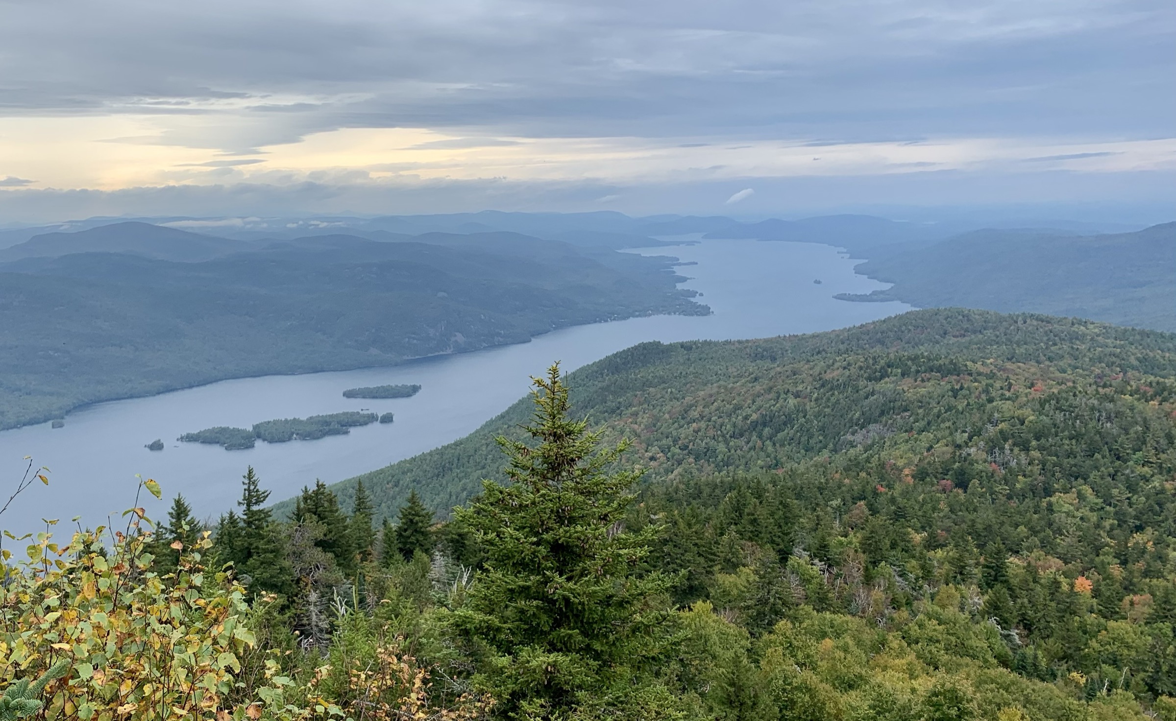
The Pike Brook Road trailhead lies about 1.6 km east of NY-22. The route begins on a rolling old woods road heading west-southwest, drops briefly to a small brook and rises to a junction with the Lapland Pond trail. The main trail bears right and climbs steadily through hardwood forest, then hemlock stands, on a wide old fire-warden’s route. About 3.5 km in, the grade eases at a col below the summit cone before the trail turns sharply up rock steps to the exposed summit dome. The summit carries a fire observer’s cabin, the 35-foot steel 1918 fire tower (closed to the public, now a solar and wind-powered communications and search-and-rescue installation), and open anorthosite ledges giving the finest overlook of Lake George anywhere on the eastern shore — the whole 51 km length of the lake, the Tongue Mountain Range and the High Peaks distant to the north-west. For the full loop, continue south-southwest from the summit on the marked trail to Lapland Pond, then follow the Lapland Pond trail east through a wetland basin (moose have been reported here) and back to the junction near the trailhead.
Why it is essential
Black Mountain is the highest peak on the east side of Lake George, one of the classic Adirondack fire-tower summits, and the finest overlook of the lake anywhere in the region. The Pike Brook loop is the standard full-day version, taking in Lapland Pond and the quieter eastern flank of the massif.
Equipment
- Sturdy boots for rock steps and long descent
- Extra warm layer for the exposed summit
- Trekking poles for the descent
- Microspikes and traction from November through April; snowshoes for deep-snow winters
- Ample water — no reliable summit source
- Tick protection
Hazards and notes
- Weather changes on the summit ledges can be sudden and severe; lightning risk is real in summer thunderstorms
- The fire tower cab is closed to the public
- Cliffs on the west side above Lake George are unfenced
- Route-finding on the Lapland Pond leg can be indistinct in autumn leaf-fall
- Dogs on leash in the day-use area; verify current DEC voice-control guidance for Wild Forest
GPX / KML links
| Source | URL | Format | Notes |
|---|---|---|---|
| NY DEC — Lake George Wild Forest | dec.ny.gov | Official page and PDF map | Reference cartography |
| Protect the Adirondacks — Hike Black Mountain | protectadks.org | Trail description | Reference |
| AllTrails — Black Mountain Loop | alltrails.com | Third-party track | Do not redistribute GPX without licence confirmation |
Sources
- NY DEC — Lake George Wild Forest
- Protect the Adirondacks — Hike Black Mountain
- New York Almanack — The Black Mountain Fire Tower on Lake George
4. Split Rock Mountain — North Rim Loop
Snapshot
Itinerary
From the North Trailhead on Lake Shore Road the route enters Split Rock Mountain Wild Forest on a maintained trail rising gently through mixed hardwoods. Junction signage is comprehensive and follows the CATS / DEC standard: yellow, red and blue disks mark the connector, Robin’s Run and North Rim trails respectively. The recommended loop climbs Robin’s Run to the ridgeline, traverses west across the plateau, then joins the North Rim Trail — the highlight of the route — which follows the cliff edge for around 1.5 km along the north-facing escarpment above Lake Champlain. Numerous open ledges give unobstructed views east across the lake to Vermont’s Snake and Camel’s Hump, north to Willsboro Bay, and back toward the anorthosite cliffs of the eastern Adirondack rim. The loop closes with a return through second-growth hardwood and old field, passing Lake Champlain Land Trust boundary markers where DEC land meets private conservation holdings. Longer variants add the Split Rock summit proper and the Snake Den Harbor lakeshore.
Why it is essential
Split Rock Mountain is the most complete example of Champlain lake-cliff ecology within the Adirondack Forest Preserve, and the North Rim Loop is the only day-hike in the corridor that follows a true clifftop for over a kilometre directly above the lake. It links DEC Wild Forest land, Lake Champlain Land Trust holdings and the Split Rock Wildway conservation corridor, and represents the collaborative model of Champlain-side land protection.
Equipment
- Sturdy boots for rocky cliff-edge sections
- Extra water — no reliable spring on the ridge
- Tick protection (high-density tick habitat in second-growth and field edges)
- Blaze orange October to early December (hunting permitted in season)
Hazards and notes
- The North Rim cliff edge is unfenced and drops sheer to talus and lake below; keep well back in wind, or with dogs and children
- Dogs on leash
- Route-finding around Robin’s Run junctions requires attention in leaf-fall
- Ice can persist in shaded cliff-base sections into May
GPX / KML links
| Source | URL | Format | Notes |
|---|---|---|---|
| NY DEC — Split Rock Mountain Wild Forest map | extapps.dec.ny.gov | PDF map | Reference cartography |
| NY DEC — Split Rock Mountain Wild Forest | dec.ny.gov | Official page | Descriptions |
| Lake Champlain Land Trust — Split Rock Mountain Wild Forest | lclt.org | HTML and trail map | Reference |
| AllTrails — Split Rock Mountain North Loop | alltrails.com | Third-party track | Do not redistribute GPX without licence confirmation |
Sources
- NY DEC — Split Rock Mountain Wild Forest
- Lake Champlain Land Trust — Split Rock Mountain
- Protect the Adirondacks — Hike Split Rock Mountain (North Trails)
5. Mount Defiance, Ticonderoga
Snapshot
Itinerary
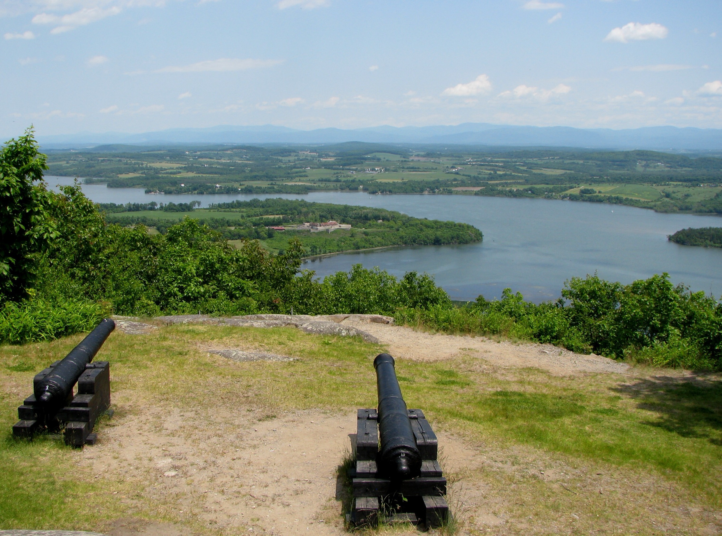
The old carriage road climbs the west face of Mount Defiance in gentle grades and switchbacks, gaining just over 150 m in roughly 1.6 km. The surface is asphalt-and-gravel where cars are permitted in season, and the walking is easy throughout. Toll gates and signage are managed under a Town of Ticonderoga and Fort Ticonderoga historic partnership. Interpretive panels explain the 1777 British siege that made the summit famous: British forces under Brigadier William Phillips, ordered by General Burgoyne, cut a road up the mountain and hauled cannons to the top in 24 hours, forcing General Arthur St Clair to abandon Fort Ticonderoga on 5 July 1777 — one of the pivotal moments of the Saratoga campaign. At the summit are period cannons pointed toward Fort Ticonderoga, a picnic pavilion, and open views over the fort, Lake Champlain’s narrows, Mount Independence in Vermont, and the mouth of the LaChute River draining Lake George.
Why it is essential
Mount Defiance is the region’s most historically significant single hike, giving direct visual command of Fort Ticonderoga and the Champlain narrows in the same way that decided the July 1777 siege. It is short enough to combine with a visit to the fort itself and provides essential context for the whole Champlain-corridor military history that shaped the region’s later settlement.
Equipment
- Trail runners or light shoes (road surface throughout)
- Sun protection at the exposed summit
- Water — no summit source
- Warm layer in shoulder seasons for the wind on the summit terrace
Hazards and notes
- The summit road is open to vehicles for a small fee in season (typically May to October); walkers share the road with cars
- When the gate is closed the road is walkable; check current Town of Ticonderoga notices
- The summit overlook is fenced but includes drop-offs to the north and east; supervise children
- Dogs on leash
- The site is on private land managed under a public-access agreement; observe posted rules
GPX / KML links
| Source | URL | Format | Notes |
|---|---|---|---|
| Town of Ticonderoga — Mount Defiance | townofticonderoga.gov | Municipal page with sketch map | Reference |
| AllTrails — Mount Defiance | alltrails.com | Third-party track | Do not redistribute GPX without licence confirmation |
| OpenStreetMap — Mount Defiance summit road | openstreetmap.org | OSM data | Reusable with attribution (ODbL) |
Sources
Missing data / follow-up work
- Coon Mountain photo — no licence-compatible image located in this pass. Follow-up: Flickr Creative Commons search; consider requesting a licensed photo from CATS or the Adirondack Land Trust.
- Split Rock Mountain photo — no licence-compatible image located. Follow-up: Flickr search and licence request to Lake Champlain Land Trust or DEC. Route distance is quoted variably (4.5 mi vs 6.2 mi); confirm against the DEC PDF map.
- Poke-O-Moonshine summit steward season — confirm annually with Friends of Poke-O-Moonshine; hours vary year to year.
- Black Mountain distance — full loop is cited between 7.5 mi and 7.7 mi across sources; treat DEC map as authoritative.
- Mount Defiance auto-road — confirm current opening dates and toll each season with the Town of Ticonderoga.
- Public transport — no direct trailhead bus service exists for any of the five hikes. Amtrak Adirondack stations at Ticonderoga, Port Henry, Westport and Port Kent are the nearest rail links; taxi or private transfer required from station to trailhead.
- Winter conditions — Black Mountain and Poke-O-Moonshine both require winter traction and can be genuinely serious in ice; confirm current conditions via DEC weekly trail reports before winter attempts.
Further reading
| Source | URL |
|---|---|
| NY DEC — Poke-O-Moonshine Mountain | dec.ny.gov |
| NY DEC — Lake George Wild Forest | dec.ny.gov |
| NY DEC — Split Rock Mountain Wild Forest | dec.ny.gov |
| NY DEC — Fire Towers | dec.ny.gov |
| Friends of Poke-O-Moonshine | pokeomoonshine.org |
| Champlain Area Trails | champlainareatrails.com |
| Adirondack Land Trust | adirondacklandtrust.org |
| Lake Champlain Land Trust | lclt.org |
| Protect the Adirondacks | protectadks.org |
| Adirondack Explorer | adirondackexplorer.org |
| Town of Ticonderoga — Mount Defiance | townofticonderoga.gov |
| Lake Champlain Region | lakechamplainregion.com |