Regional overview
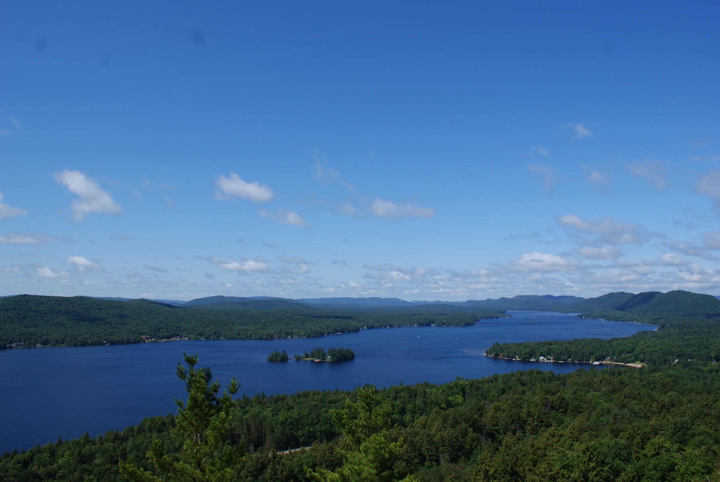
The Western Adirondacks form the low-relief, forest-and-water western third of Adirondack Park in northern New York State. Unlike the High Peaks Wilderness to the east, this sub-region is characterised by rolling wooded ridges, restored fire-tower summits between roughly 700 m and 1,150 m, extensive glacial lake chains, boreal wetlands, and some of the most remote back-country in the north-east United States. The main hiking centres are Old Forge and Inlet along the Fulton Chain of Lakes on NY Route 28, Blue Mountain Lake and Indian Lake in the central corridor, and Wanakena / Cranberry Lake in the far north-west. Around them the New York State Department of Environmental Conservation (DEC) manages the Fulton Chain Wild Forest, Ha-de-ron-dah Wilderness, Pigeon Lake Wilderness, Independence River Wild Forest, Cranberry Lake Wild Forest, and the enormous Five Ponds Wilderness, together with the Moose River Plains and Blue Ridge units.
Terrain is generally forested, with hardwood and spruce–fir cover to summit level and only isolated open rock. Views are almost entirely obtained by climbing one of the restored steel fire towers of the western and central park — Bald (Rondaxe), Blue, Wakely, Stillwater, Vanderwhacker, Kane, Pillsbury, Goodnow and others — or by reaching a rare bare cap such as Rocky Mountain above Fourth Lake or Cat Mountain above the Oswegatchie. Distances and elevation gains are modest, but the character is genuinely wild: bogs, blowdown, black-fly and mosquito seasons in late May and June, and long approach walks along old logging roads and railroad grades.
The practical hiking season runs from mid-May, once mud dries and snow leaves the fire-tower stairs, through late October, with the towers themselves generally accessible whenever the summit trails are open. Winter travel is common on snowshoes and skis on the flatter routes, but several summit tracks — Wakely and Stillwater in particular — sit behind seasonal road closures. Access is almost entirely by private vehicle: there is no scheduled public transport into any of the trailheads listed below. Standard Adirondack cautions apply — variable weather, no cell signal on most summits, ticks in lower forest, bears active around back-country campsites, and long emergency response times from the more remote units.
Fire-tower cabs are managed jointly by DEC and volunteer “Friends of…” groups. Trail-registers sit at every trailhead and should be signed. Dogs are permitted on-leash on all DEC trails covered here; no permits are required for day-hiking, though a free registration is expected at trailhead boxes.
Selection rationale
The five walks below were chosen to represent the geographic and topographic breadth of the Western Adirondacks rather than cluster in one honeypot. Bald (Rondaxe) is the region’s iconic short summit and its most-climbed fire tower. Rocky Mountain gives a family-classic viewpoint over the Fulton Chain in under an hour. Blue Mountain is the tallest and best-known central-Adirondack fire-tower peak. Wakely Mountain is the tallest fire tower in New York State and a longer, quieter classic. Cat Mountain represents the remote lake-and-pond wilderness character of the Cranberry Lake / Five Ponds country in the far west. Together they cover a spread from ~3 km to ~18 km, from ~120 m to ~500 m of ascent, and from tourist-busy to genuinely lonely — while all remain feasible as a day-hike for a fit walker. Panther Mountain (Piseco), Goodnow (Newcomb) and Vanderwhacker were considered but sit at or across the boundary with the Southern Adirondacks and central corridor and are handled elsewhere in the catalogue.
Summary table
| # | Hike | Country | Route type | Distance | Gain | Max elevation | Difficulty |
|---|---|---|---|---|---|---|---|
| 1 | Bald Mountain (Rondaxe Fire Tower) | USA | Out-and-back | ~3.2 km | ~135 m | 716 m | Easy |
| 2 | Rocky Mountain (Inlet) | USA | Out-and-back | ~1.6 km | ~135 m | 678 m | Easy but steep |
| 3 | Blue Mountain Fire Tower | USA | Out-and-back | ~6.4–6.8 km | ~475 m | 1,143 m | Moderate |
| 4 | Wakely Mountain Fire Tower | USA | Out-and-back | ~9.3–9.5 km | ~500 m | 1,141 m | Moderate |
| 5 | Cat Mountain via Dead Creek Flow | USA | Out-and-back | ~17–18 km | ~330 m | 688 m | Moderate (length) |
1. Bald Mountain (Rondaxe Fire Tower)
Snapshot
Itinerary
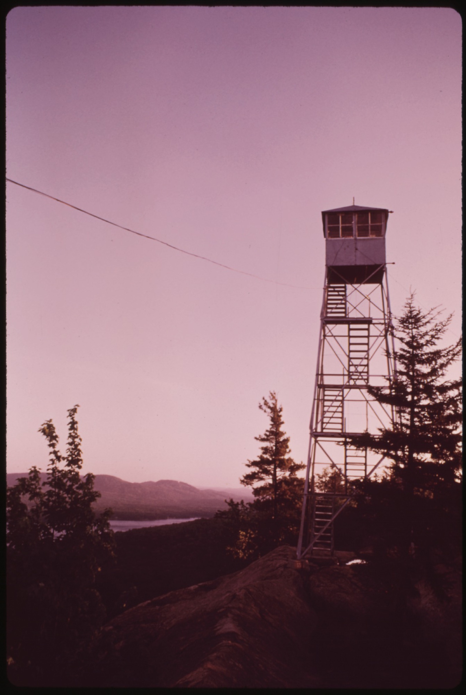
From the Bald Mountain (Rondaxe Road) parking area the red-marked DEC trail sets off eastwards, climbing gently through mixed hardwood forest for roughly 0.4 km. The path then steepens briefly, gains the crest of a narrow ridge, and follows open glacial slabs and short pine benches along the ridgeline for the remaining half-mile. Small blueberry-covered ledges give successive views over Fulton Chain lakes to the south. The trail ends at the restored steel Aermotor LS-40 fire tower on the wooded summit. The cab, restored by the Friends of Bald Mountain and reopened in 2005, gives a full 360-degree panorama over First through Fourth Lakes, the Ha-de-ron-dah Wilderness to the west and the low central Adirondack peaks to the east. Return by the same route.
Why it is essential
Bald Mountain / Rondaxe is the single most-visited fire tower in the Adirondack Park — Protect the Adirondacks and the Adirondack Explorer cite roughly 15,000 ascents per year — and the ridge view over the Fulton Chain is the visual signature of the western park. It is also one leg of the informal “Fulton Chain Trifecta” with Rocky and Black Bear.
Equipment
- Hiking shoes with grip on the sloped rock ridge
- Weatherproof layer
- Water and sun protection
- Microspikes on the open rock from November to April when verglas forms
Hazards and notes
- The open ridge slabs are slippery when wet or icy
- The last ledge before the tower has a modest drop-off
- The fire-tower cab is unheated and gets crowded on peak summer weekends
- Dogs allowed on leash
- Parking overflow on Rondaxe Road is significant on summer weekends
- Ticks in lower forest; no bear canister required for day use
GPX / KML links
| Source | URL | Format | Notes |
|---|---|---|---|
| NYS DEC — Fulton Chain Wild Forest | dec.ny.gov | Official page | No official GPX; trail description authoritative |
| AllTrails — Bald Mountain (Rondaxe Fire Tower) | alltrails.com | Third-party track | Do not redistribute AllTrails GPX without licence confirmation |
| OpenStreetMap — path network at Bald Mountain | openstreetmap.org | OSM data | Reusable with attribution to OpenStreetMap contributors (ODbL) |
Sources
- NYS DEC — Fulton Chain Wild Forest
- Protect the Adirondacks — Hike Bald (Rondaxe) Mountain
- Adirondack Almanack — Featured Hike: Rondaxe Fire Tower
- National Historic Lookout Register — Rondaxe (Bald) Mountain Fire Tower
2. Rocky Mountain (Inlet)
Snapshot
Itinerary
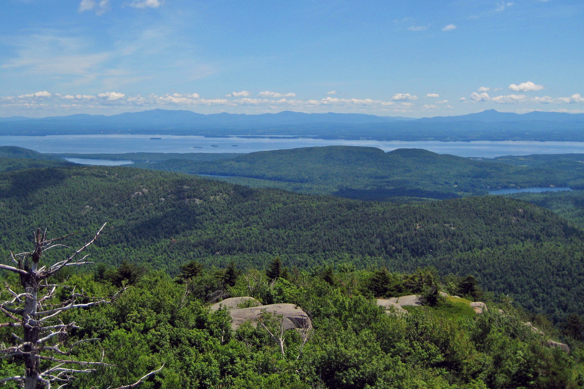
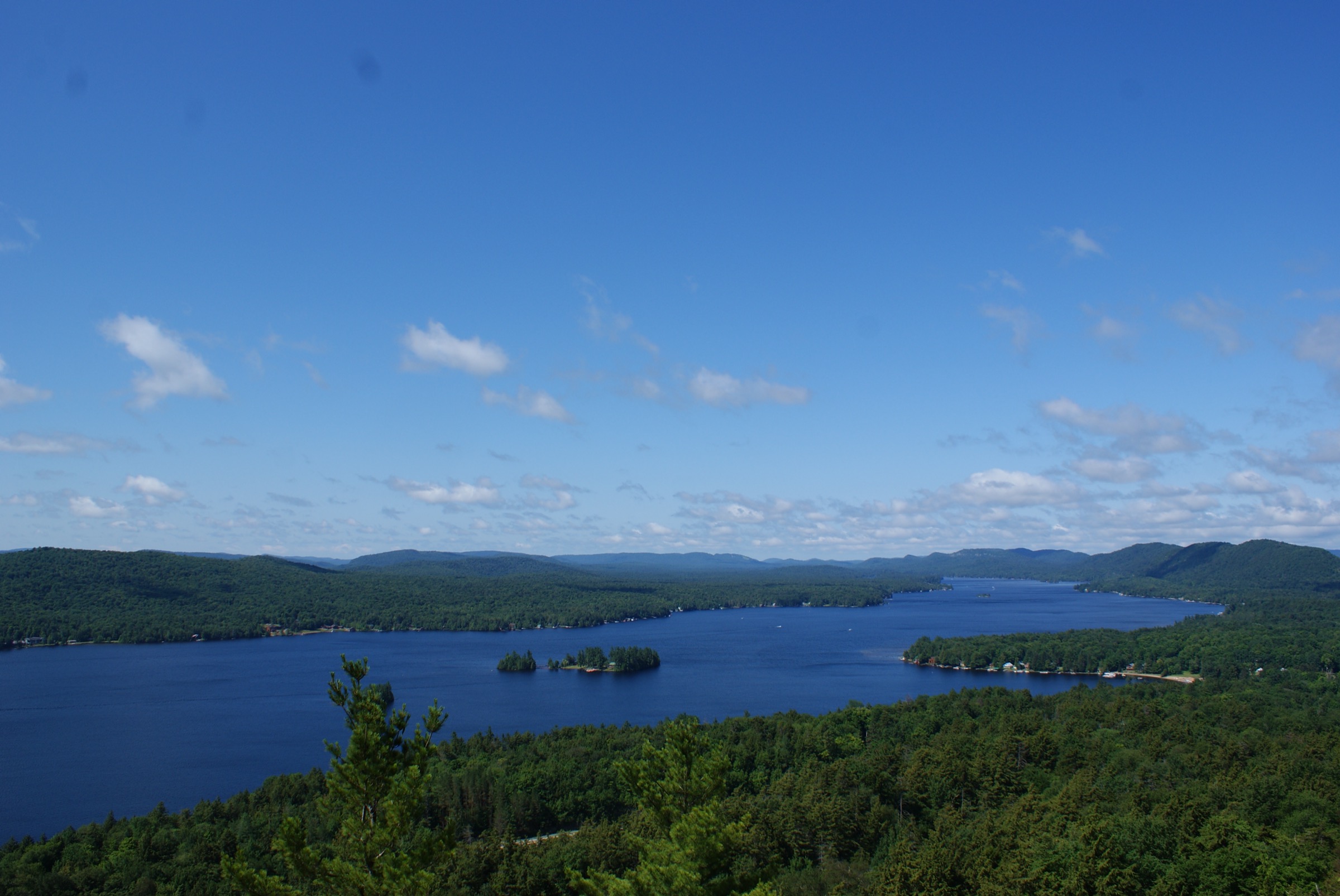
The DEC-marked yellow-disc trail leaves the shared Rocky / Black Bear parking area and climbs steadily and steeply through mixed forest for about 0.8 km. There are no junctions and no significant flat sections; the grade is uniform and the tread mostly bedrock and root. The trail tops out abruptly on a broad open granitic summit dome with unobstructed views south and west over Fourth Lake, the hamlet of Eagle Bay and the surrounding ridges of the Fulton Chain. The summit is a natural viewpoint rather than a fire-tower peak. Return by the same route.
Why it is essential
Rocky Mountain is the shortest full-view summit on the Fulton Chain — under an hour car-to-car — and its bare cap gives one of the very few open, natural (non-tower) viewpoints in the western park. It is the standard family and warm-up hike for Inlet and pairs naturally with Black Bear Mountain from the same trailhead for a longer day.
Equipment
- Hiking shoes with grip; the sloped rock is the crux
- Water and sun protection
- Weatherproof layer
- Microspikes strongly recommended from late October to April
Hazards and notes
- Steep, polished bedrock is treacherous when wet
- No shelter on the summit
- Parking fills quickly on summer weekends; the state lot is patrolled
- Dogs on leash; no permits
GPX / KML links
| Source | URL | Format | Notes |
|---|---|---|---|
| NYS DEC — Fulton Chain Wild Forest | dec.ny.gov | Official page | No GPX published |
| Old Forge Tourism Hiking Guide (PDF) | oldforgeny.com | PDF map | Reference only |
| AllTrails — Rocky Mountain Summit | alltrails.com | Third-party track | Do not redistribute AllTrails GPX without licence confirmation |
Sources
3. Blue Mountain Fire Tower
Snapshot
Itinerary
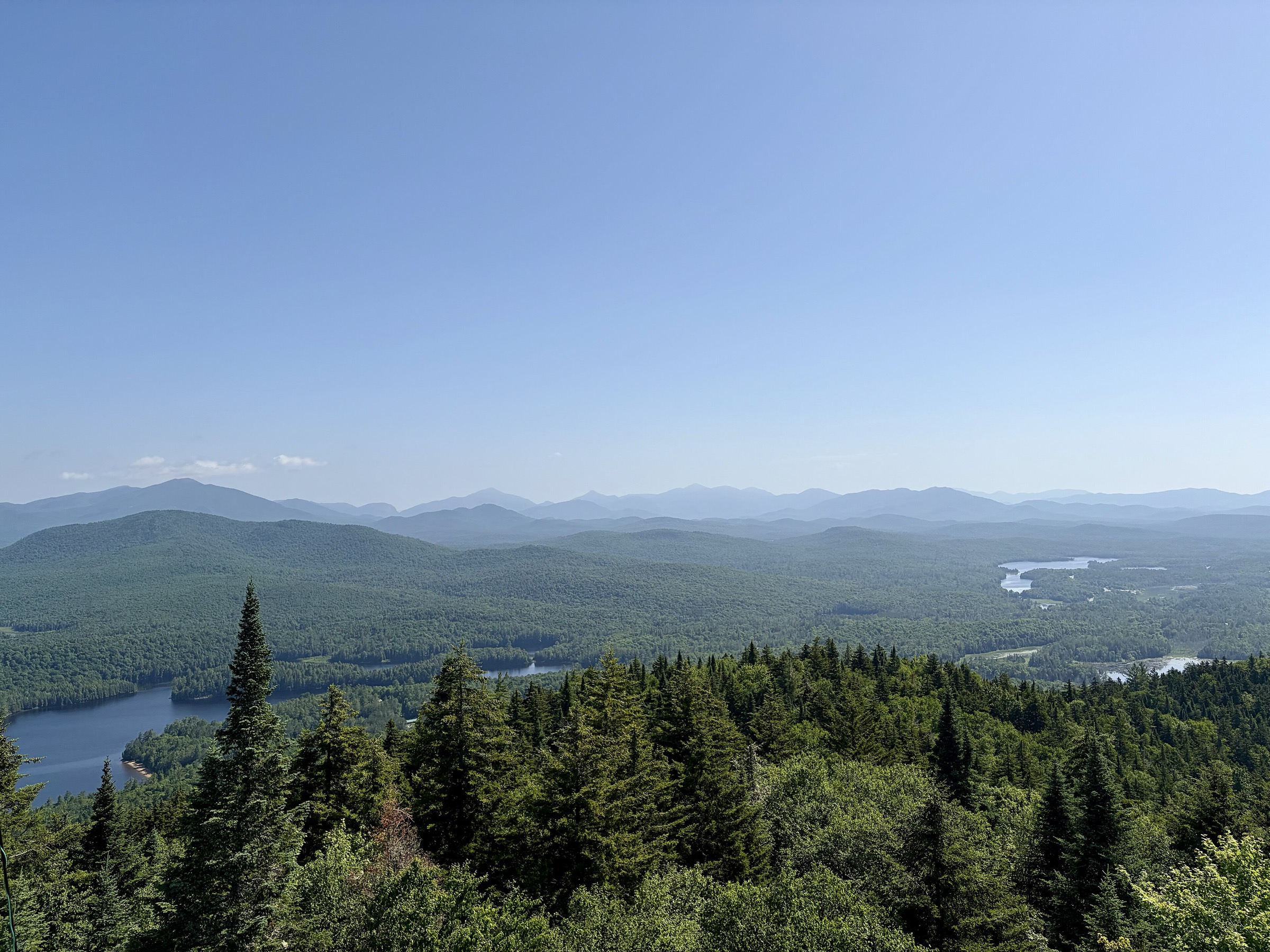
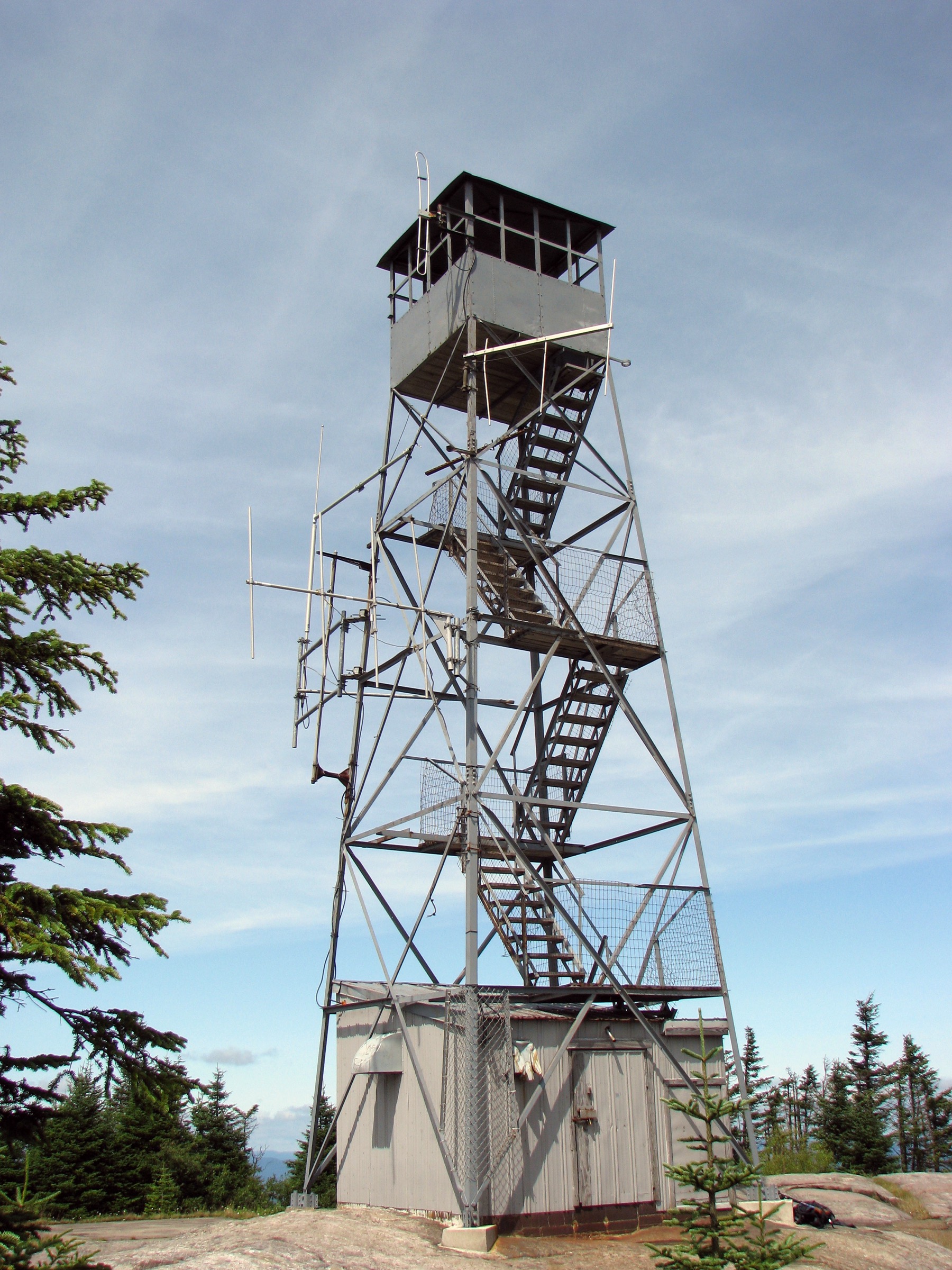
The DEC-marked red trail leaves the Route 30 trailhead on an old grassed access road, climbing very gradually through spruce-fir forest for the first 1.5 km with a stream crossing. Beyond a small brook the grade increases sharply and the tread becomes wide steep bedrock — exposed and slippery when damp — for the next kilometre. Occasional glimpses west open through the fir cover. The trail eases briefly, then makes a final push through denser conifers to the wooded summit, where the historic Aermotor LS-40 steel fire tower (erected 1917, restored after 2019) rises above the trees. The cab gives a 360-degree panorama of Blue Mountain Lake, Eagle Lake, Utowana Lake, Raquette Lake, the Essex Chain, Vanderwhacker and the distant High Peaks. Return by the same route.
Why it is essential
Blue Mountain is the anchor peak of the central and western Adirondack fire-tower network. The tower is on the National Register of Historic Places, the summit sits just below the 4,000-ft High Peaks threshold, and its central position gives one of the broadest viewsheds in the park. The Adirondack Experience museum at the trailhead adds cultural context. With Bald and Wakely it is the western park’s most frequently listed “must-do” fire tower.
Equipment
- Sturdy boots — essential for the wet slabs
- Trekking poles for the descent
- Weatherproof and warm layers
- 2 L water, food
- Headtorch for long days
- Sun protection
- Microspikes into early June if a cold spring lingers
Hazards and notes
- The upper trail’s wide, steep bedrock is the main hazard — genuinely slippery when wet, and often wet from seepage
- Most falls occur on the descent; take extra care
- The tower stairs and cab may be periodically closed for maintenance — check DEC updates
- Black flies mid-May through late June
- Ticks in lower forest
- Dogs on leash; no permits
- No reliable water on the ascent
GPX / KML links
| Source | URL | Format | Notes |
|---|---|---|---|
| NYS DEC — Blue Mountain hiking map | dec.ny.gov | PDF map | Reference cartography; no GPX |
| NYS DEC — Blue Mountain Wild Forest | dec.ny.gov | Official page | Trail descriptions |
| AllTrails — Blue Mountain Fire Tower | alltrails.com | Third-party track | Do not redistribute AllTrails GPX without licence confirmation |
Sources
- NYS DEC — Blue Mountain Wild Forest
- NYS DEC — Blue Mountain hiking map (PDF)
- Protect the Adirondacks — Hike Blue Mountain
- Adirondack Explorer — Views from on High
4. Wakely Mountain Fire Tower
Snapshot
Itinerary
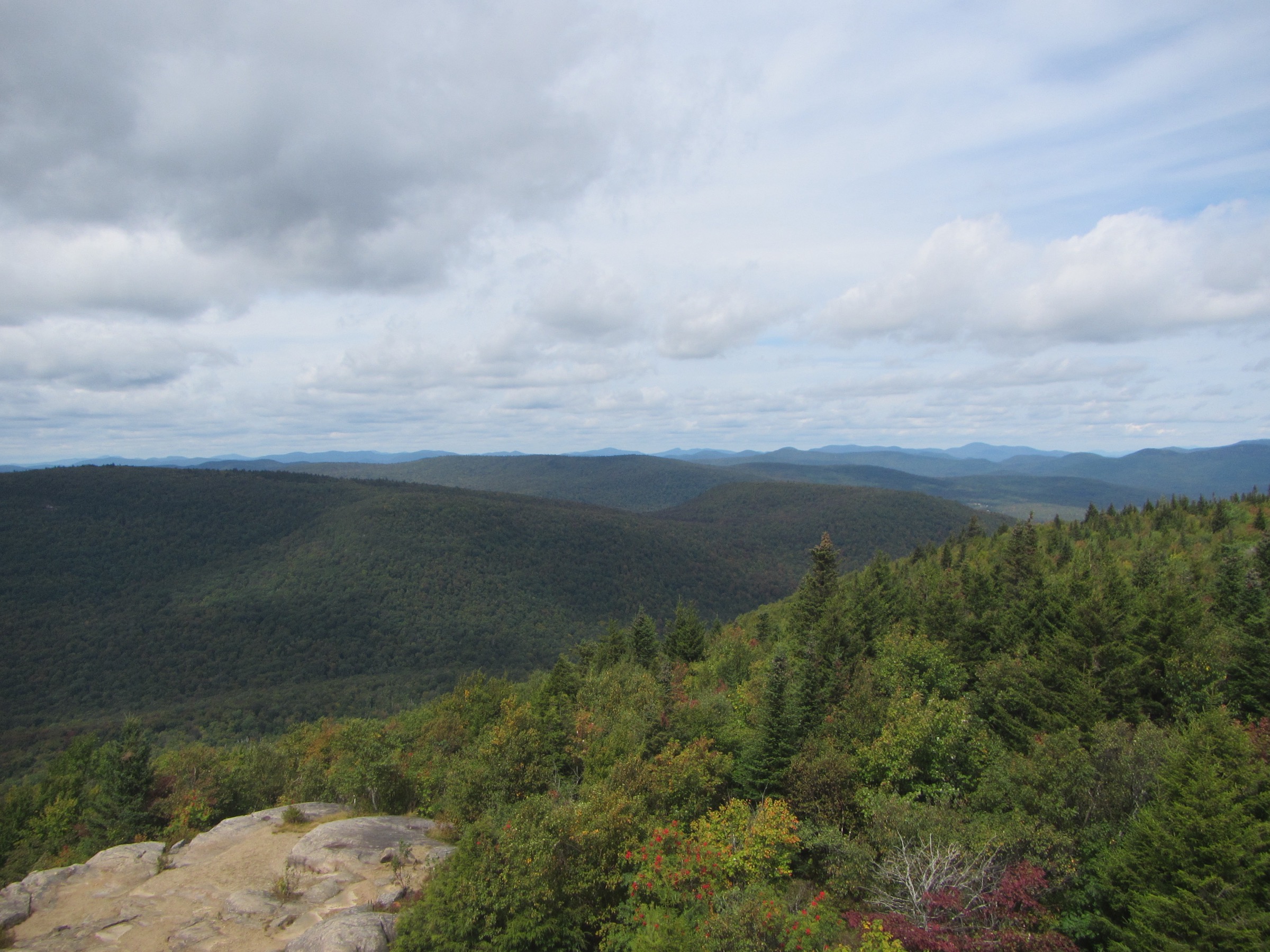
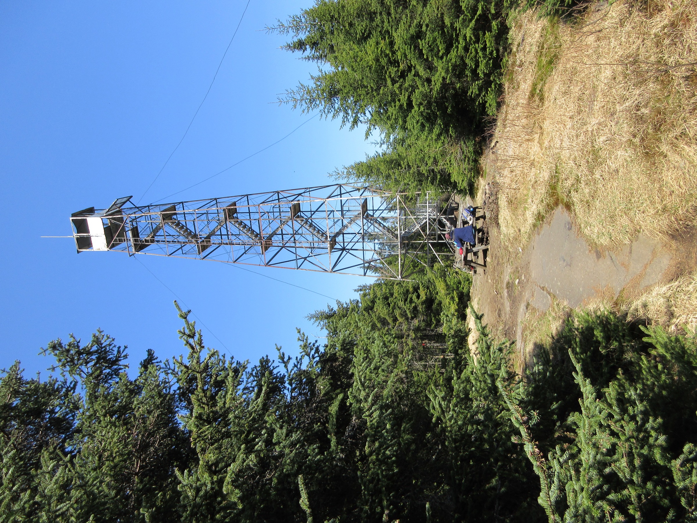
From the small DEC trailhead and register at the end of Cedar River Road, the red-marked trail follows an old logging road on almost level ground through mixed forest, crossing several small streams. This first section runs for approximately 3.2 km with only about 150 m of gradual gain. At a signed junction the route bears right and begins the steep upper section — a persistent, unrelenting climb through spruce-fir forest gaining roughly 350 m in 1.5 km. The summit is wooded, but the 21 m (69.5 ft cab-floor) steel Aermotor tower — one of the tallest still standing in the state, first erected 1916 and restored by the Friends of Wakely Fire Tower — rises well above the canopy and gives a 360-degree view over the Blue Ridge and West Canada Lake wildernesses, Cedar River Flow, the High Peaks and the entire central lake belt. Return by the same route.
Why it is essential
Wakely holds the tallest fire tower in New York State and one of the widest wilderness panoramas in the Adirondacks. Unlike Blue Mountain it sees a fraction of the traffic, giving a genuine sense of the western and central park’s back-country scale. It is a fixture of the Adirondack Fire Tower Challenge and one of the region’s classic longer day-hikes.
Equipment
- Sturdy boots
- Trekking poles
- Weatherproof and warm layers
- Headtorch for long summer days
- Ample water — limited on the upper section
- Food, insect repellent (biting flies persist into July)
- Microspikes in April and October
- Tick protection through summer
Hazards and notes
- The upper climb is relentlessly steep and can be very wet after rain
- The summit is wooded — views require the tower stairs, which are exposed to wind
- Cedar River Road (unpaved for the final miles) is closed in winter; the seasonal closure typically runs mid-December to late April, and the alternative snowshoe / ski approach from the plowed lot adds roughly 6 km each way
- Register at the trailhead
- Dogs on leash; no permits
- Bear-aware food handling recommended for any breaks
GPX / KML links
| Source | URL | Format | Notes |
|---|---|---|---|
| NYS DEC — Wakely Mountain hiking map | dec.ny.gov | PDF map | Reference cartography; no GPX |
| NYS DEC — Moose River Plains Complex | dec.ny.gov | Official page | Trail descriptions |
| AllTrails — Wakely Mountain Trail | alltrails.com | Third-party track | Do not redistribute AllTrails GPX without licence confirmation |
Sources
- NYS DEC — Wakely Mountain hiking map (PDF)
- NYS DEC — Moose River Plains Complex
- Protect the Adirondacks — Wakely Mountain
- Adirondack Explorer — Wakely Mountain
5. Cat Mountain via Dead Creek Flow
Snapshot
Itinerary
From the Dead Creek trailhead on South Shore Road, the DEC-marked route follows a broad old railroad grade south through spruce and mixed forest, running along and above Dead Creek Flow (a bay of Cranberry Lake). The terrain is essentially level with occasional wet sections and stream crossings for approximately 4.5 km, passing the junction to Janack’s Landing lean-to (a 0.4 km spur). The route then bears south and later west onto the Cowhorn Junction / Cat Mountain trail system, skirting Glasby Pond and climbing very gradually into the Five Ponds Wilderness. At the marked Cat Mountain junction the trail turns south for a short but steep final push — around 150 m of ascent in less than a kilometre — to the partially open summit. The bare ledges give an unusually panoramic view for the western park, over Cranberry Lake, the Five Ponds basin, High Falls Ridge and the rolling forested horizon towards Tupper Lake. Return by the same route, or extend into a multi-day loop via High Falls.
Why it is essential
Cat Mountain represents the true wilderness character of the far Western Adirondacks — a long walk through the largest contiguous roadless area in the north-eastern United States to a rare open summit above Cranberry Lake. It is one of only a handful of proper viewpoints in Five Ponds and one of the few day-hikeable summits in the whole Cranberry Lake / Wanakena country. Adirondack Explorer, Tupper Lake tourism and the Cranberry Lake 50 network all treat it as the essential summit of this quadrant.
Equipment
- Sturdy boots — wet ground guaranteed
- Gaiters recommended
- Trekking poles
- Headtorch (the day easily overruns)
- Map / GPS — junctions are the main navigation issue
- Ample water and treatment (streams available, must be filtered)
- Insect repellent (heavy black-fly and mosquito pressure into July, deerfly through August)
- Tick protection
- Bear canister strongly recommended if used as a light overnight; not required for a day-hike
Hazards and notes
- The trail is essentially flat for two-thirds of its length, so route-finding at the several signed junctions is the key skill; take a printed DEC map and a GPS
- Sections cross beaver-flooded ground and can be knee-deep after wet spells
- Cell coverage is nil across the entire route
- Emergency response is slow this deep into Five Ponds
- Register at the trailhead
- Dogs on leash
- Standard black-bear precautions on food
GPX / KML links
| Source | URL | Format | Notes |
|---|---|---|---|
| NYS DEC — Five Ponds and Pepperbox Wildernesses | dec.ny.gov | Official page | Descriptions and PDF map |
| Cranberry Lake 50 — High Falls Loop | cranberrylake50.org | Web map | Network overview |
| AllTrails — Cat Mountain Trail | alltrails.com | Third-party track | Do not redistribute AllTrails GPX without licence confirmation |
Sources
- NYS DEC — Five Ponds and Pepperbox Wildernesses
- Adirondack Explorer — Cat Mountain
- Tupper Lake Tourism — Cat Mountain
- Cranberry Lake 50 — High Falls Loop
Missing data / follow-up work
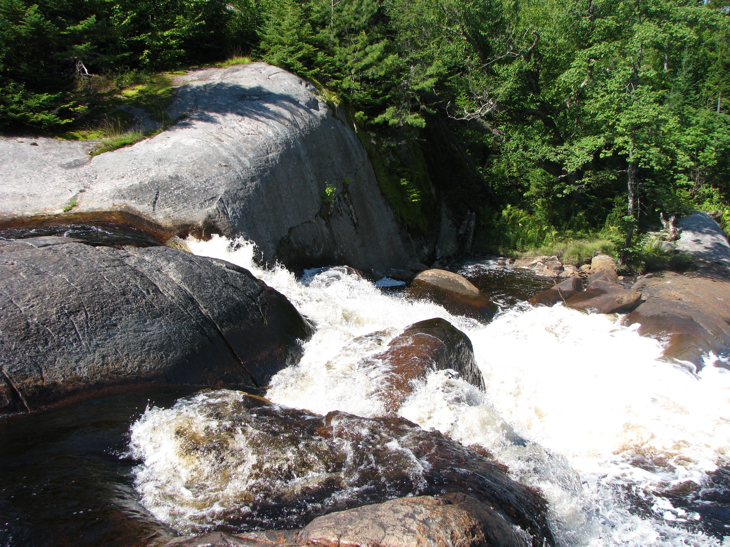
- Cat Mountain summit photo — no openly licensed image of the summit or the Cranberry Lake view was located in this pass. The Oswegatchie High Falls image is a regional stand-in from the connected trail network; a summit-specific CC image should replace it if one becomes available.
- No official GPX — DEC publishes PDF maps for these routes but no GPX. AllTrails, Komoot, Hiking Project and Trailforks tracks are user-generated and restrictively licensed; use for cross-check only.
- Distance discrepancies — Bald, Blue and Wakely all show small (2–8%) discrepancies between DEC published mileage and GPS-recorded AllTrails/Komoot tracks; these reflect GPS drift on ridges.
- Seasonal access — Cedar River Road (Wakely) closure dates vary year to year; confirm with DEC or the Indian Lake DEC office before an off-season attempt.
- Fire-tower cab status — Blue and Bald cabs can be closed for maintenance without long notice; check the DEC Fire Towers page and any Friends group updates before departure.
- Boat approach to Cat Mountain from Janack’s Landing shortens the day dramatically but requires confirmation of current small-boat launch options at Wanakena.
Further reading
| Source | URL |
|---|---|
| NYS DEC — Fire Towers overview | dec.ny.gov |
| NYS DEC — Fulton Chain Wild Forest | dec.ny.gov |
| NYS DEC — Blue Mountain Wild Forest | dec.ny.gov |
| NYS DEC — Moose River Plains Complex | dec.ny.gov |
| NYS DEC — Five Ponds and Pepperbox Wildernesses | dec.ny.gov |
| NYS DEC — Adirondack backcountry information | dec.ny.gov |
| Protect the Adirondacks | protectadks.org |
| Adirondack Explorer | adirondackexplorer.org |
| Adirondack Almanack | adirondackalmanack.com |
| Adirondack.net — Fulton Chain Trifecta | adirondack.net |
| Old Forge Tourism Hiking Guide (PDF) | oldforgeny.com |
| Cranberry Lake 50 | cranberrylake50.org |