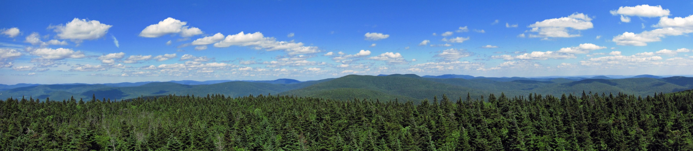
Regional overview
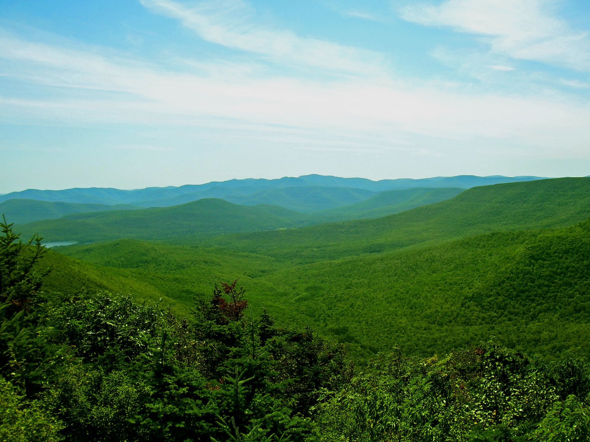
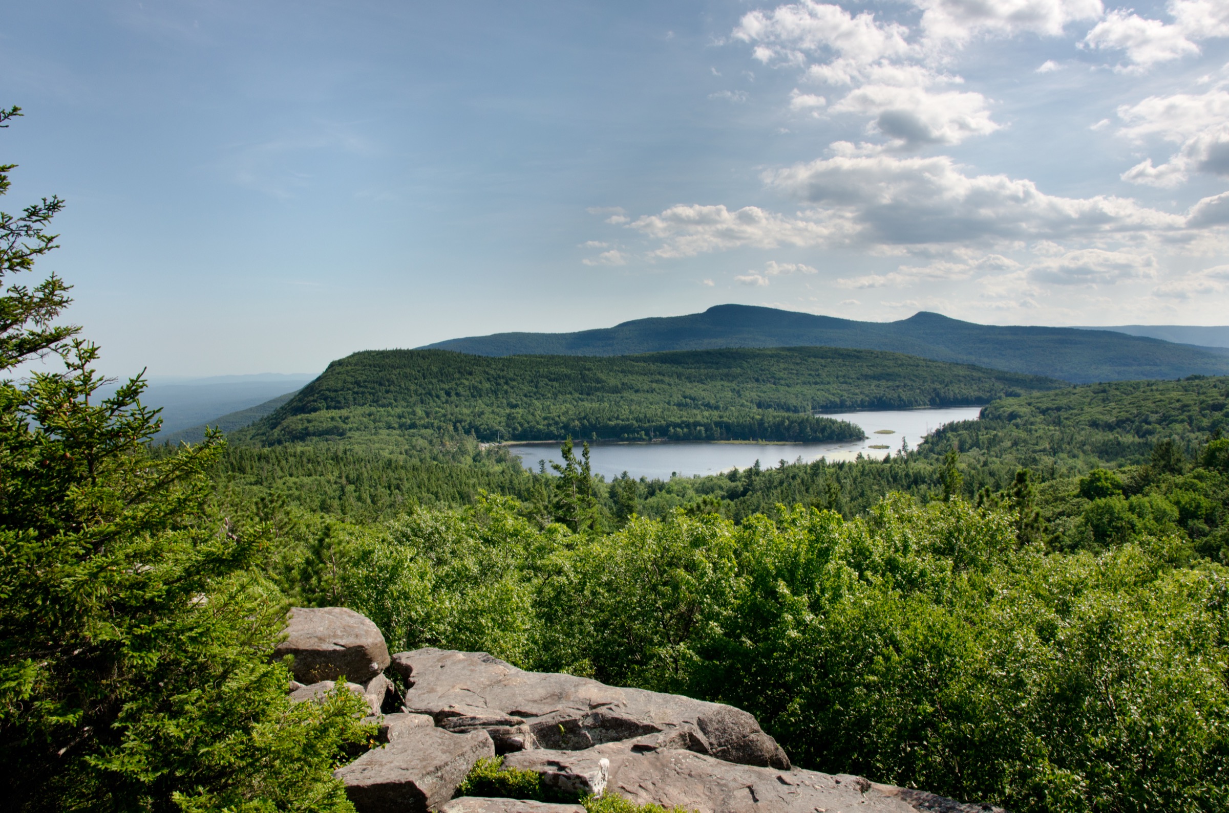
The Catskill High Peaks are the thirty-five summits historically listed as over 3,500 ft (1,067 m) that form the interior of the Catskill Park in south-eastern New York — a 700,000-acre patchwork of state Forest Preserve and private inholdings constitutionally protected as “forever wild” under Article XIV of the New York State Constitution. The range sits west of the Hudson Valley across Ulster, Greene, Delaware and Sullivan counties, and reaches its high point on Slide Mountain at 1,274 m (4,180 ft). Unlike the Adirondack High Peaks, none of the Catskill summits break the treeline: even Slide’s crown is a low spruce–fir carpet cut only by open ledge outcrops. The character of the range is defined instead by long forested ridges, sudden cliff bands at the Devonian–conglomerate horizon, and a scatter of open bedrock ledges that offer disproportionate views for their modest elevation.
The main hiking centres are Phoenicia and Shandaken along NY-28 in the central Catskills, Woodland Valley south of Phoenicia for the Slide–Cornell–Wittenberg trailhead, the Slide Mountain and Giant Ledge trailheads on NY-47 (Oliverea Road / Winnisook Road) at the head of the Esopus valley, Peekamoose Road / Sundown out of West Shokan on the Peekamoose–Table approach, and Beaverkill Road in the western Catskills for Balsam Lake Mountain. The Catskill Park lies wholly within New York State — no fees, no reservations, no permit is required for day hiking anywhere in the Forest Preserve. The New York State Department of Environmental Conservation (DEC) manages the land and maintains the trails through its Region 3 and Region 4 forestry crews, with volunteer support from the Catskill Mountain Club (CMC), the New York–New Jersey Trail Conference (NY-NJ Trail Conference) and the Catskill 3500 Club.
The practical hiking season runs from mid-May, once the mud clears the north-facing trails, through mid-October when the fall foliage peaks. Mud season in April and early May is genuinely serious — DEC formally requests hikers stay off the higher trails until late May in most years to prevent trail widening. Snow and ice can persist on the north side of Slide and Cornell into June, and the higher peaks are effectively in winter conditions from early November through April. Snowshoes are strongly recommended when snow depth exceeds ~20 cm, and microspikes are near-mandatory on the steeper ledge sections most of the winter.
Access rules are simple by American mountain standards. All hikers must sign in and out at the trailhead registers — free, no permit, but a legally important record for search and rescue. Bear canisters are not required in the Catskills (unlike the Eastern High Peaks Wilderness in the Adirondacks), though bear-aware food storage is still recommended: black bears are common throughout the range and habituated animals have been reported at popular camping areas. Hunt seasons run through the autumn on Forest Preserve land — big-game rifle season for deer runs mid-November through mid-December in the Southern Zone — and hikers should wear high-visibility colours in that window. Cell coverage is essentially absent on all Catskill summits and along most of the trail network.
Hazards are real for a modest-elevation range. The Catskills’ bluestone and sandstone ledges become dangerously slick when wet or icy, and the region’s characteristic short cliff bands — sometimes only two or three metres high but running for a hundred — reward careful footwork on descent. Thunderstorms build quickly on hot summer afternoons; lightning risk is real on Slide’s summit and on the open Giant Ledge outlooks. Trails are famously rooty, and the Catskill “escarpment tread” — bare rock washed clean by centuries of use — is a signature underfoot texture but a hazard when wet. Public transport is negligible: Trailways coach service reaches Phoenicia and Kingston, but no scheduled service reaches any of the trailheads listed below.
Selection rationale
The five walks below span the defining experiences of the Catskill High Peaks. Slide Mountain via the Phoenicia-East Branch Trail is the classic ascent of the range’s high point on its most-walked trail. The Wittenberg–Cornell–Slide traverse from Woodland Valley is the range’s iconic ridge day — a long single-day linkup of three of the highest summits, taking in the Ashokan Reservoir view from Wittenberg. Panther Mountain via Giant Ledge from NY-47 is the ledge walk that best repays modest effort with a full Catskill panorama. The Peekamoose–Table ridge from Peekamoose Road delivers a quiet, high-mileage day on two of the range’s less-visited 3,500-footers. The Balsam Lake Mountain fire-tower loop from Beaverkill Road is the western Catskills’ signature short summit — the oldest fire-tower site in New York State, restored and staffed by volunteers in season. Bushwhack peaks (Balsam Cap, Doubletop, Rocky, Lone) and shorter classics such as Overlook Mountain and Kaaterskill High Peak are noted in the follow-up section.
Summary table
| # | Hike | Country | Route type | Distance | Gain | Max elevation | Difficulty |
|---|---|---|---|---|---|---|---|
| 1 | Slide Mountain via the Phoenicia-East Branch Trail | USA | Out-and-back | ~9.7 km (~6.0 mi) | ~530 m | 1,274 m | Moderate–strenuous |
| 2 | Wittenberg–Cornell–Slide traverse | USA | Point-to-point | ~15.5 km (~9.6 mi) | ~1,040 m | 1,274 m | Very strenuous |
| 3 | Panther Mountain via Giant Ledge | USA | Out-and-back | ~10.9 km (~6.8 mi) | ~550 m | 1,133 m | Moderate–strenuous |
| 4 | Peekamoose–Table ridge | USA | Out-and-back | ~15.4 km (~9.6 mi) | ~880 m | 1,155 m | Strenuous |
| 5 | Balsam Lake Mountain fire-tower loop | USA | Loop | ~9.7 km (~6.0 mi) | ~440 m | 1,101 m | Moderate |
1. Slide Mountain via the Phoenicia-East Branch Trail
Snapshot
Itinerary
The Phoenicia-East Branch Trail (yellow disks) leaves the Slide Mountain parking area on NY-47 and drops briefly to cross the West Branch of the Neversink on a footbridge. Beyond the crossing the trail joins an old fire-tower access road and climbs steadily south-east through mixed hemlock and northern hardwood forest. At roughly 1.4 km a signed junction with the Wittenberg–Slide Trail (blue disks) marks the point where most parties turn left onto the direct summit route: the yellow trail continues south toward the Denning trailhead and the interior wilderness. The blue trail climbs through a sequence of stone-step pitches built by DEC and volunteer crews, gaining altitude quickly.
At about 3.0 km the trail passes a small dependable spring on the left — the last reliable water on the ascent — and enters the balsam fir belt that caps the highest Catskill summits. A short scramble up a wet ledge band gains the summit ridge; the trail then contours gently south-east through dense spruce–fir for the final 500 m to the true summit. A bronze plaque set into the summit rock commemorates John Burroughs, the nineteenth-century Catskills naturalist who made Slide the subject of one of his best-known essays. The open ledge just south of the summit gives the view — Table and Peekamoose to the south, the Wittenberg–Cornell ridge east, and the Devil’s Path summits north across the Esopus valley. Return by the same route.
Why it is essential
Slide Mountain is the highest peak in the Catskills and the emblematic summit of the range. The Phoenicia-East Branch approach is the shortest and most-walked route to the top, and the John Burroughs plaque at the summit anchors Slide as the range’s literary and historical high point. The forest cover changes visibly with altitude, from hemlock and hardwood at the trailhead through a spruce–fir cap on the summit — a compressed vertical zonation that repays observation.
Equipment
- Sturdy hiking boots with grip on wet ledge
- Weatherproof shell
- Warm layer for the summit even in mid-summer
- 2 L water; treat the spring water
- Sun protection for the open summit ledge
- Trekking poles for the descent
- Map, compass and downloaded DEC Slide Mountain Wilderness map
- Microspikes November to April; snowshoes when snow exceeds ~20 cm
Hazards and notes
- Wet ledge steps on the upper climb become dangerously slick after rain
- Ice and hard-packed snow linger on the summit ridge into May in most years
- No cell coverage on the summit or on any part of the ascent
- Hunt season (mid-November to mid-December Southern Zone big-game) — wear high-visibility colours
- Bear canisters are not required in the Catskills, but do not leave food unattended at the summit
- No fees, no reservations, no permits — sign the trailhead register
- Parking at the Slide Mountain trailhead fills by 09:00 on peak weekends; do not park illegally on NY-47
GPX / KML links
| Source | URL | Format | Notes |
|---|---|---|---|
| NY State DEC — Slide Mountain Wilderness | dec.ny.gov | Official page | No official GPX published; wilderness map PDF available |
| Waymarked Trails — Catskill trails | hiking.waymarkedtrails.org | OSM route relations | Wittenberg–Slide and Phoenicia-East Branch mapped in OSM |
| AllTrails — Slide Mountain Trail | alltrails.com | Third-party track | Do not redistribute AllTrails GPX without licence confirmation |
Sources
- NY State DEC — Slide Mountain Wilderness
- Catskill 3500 Club — Slide Mountain
- Catskill Mountain Club — Trails and hikes
2. Wittenberg–Cornell–Slide traverse
Snapshot
Itinerary
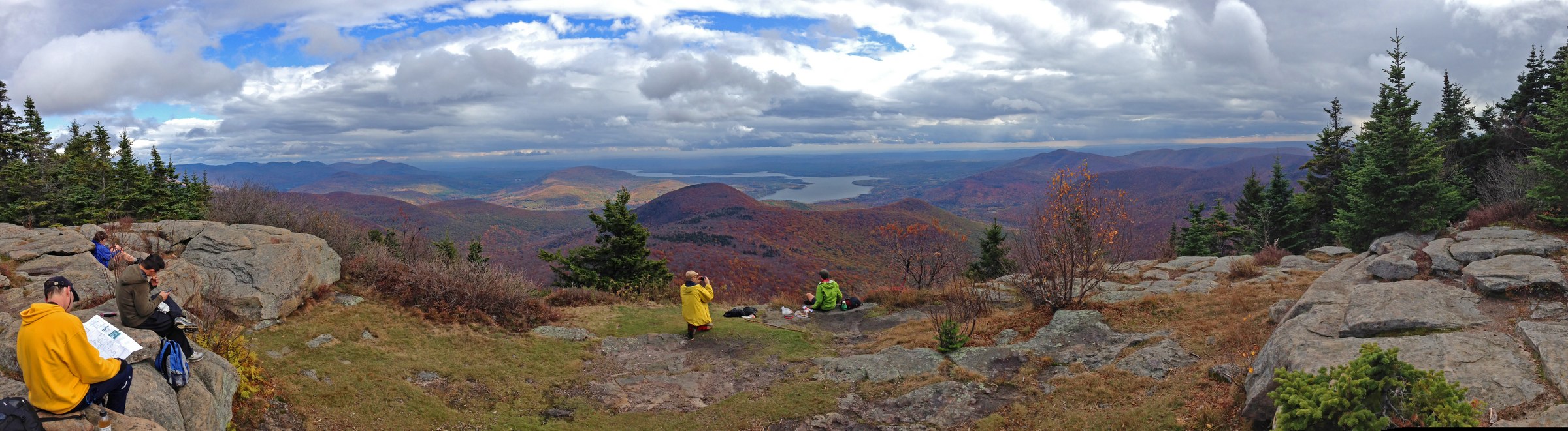
From the Woodland Valley State Campground, the Wittenberg–Slide Trail (red disks) crosses Woodland Creek on a footbridge and climbs steadily east through mixed hardwoods on stone-step tread. The first 4 km gain roughly 550 m at a sustained but even grade; the pitch steepens on a rocky pull through hemlock at Terrace Mountain col. At about 6.4 km the trail reaches the summit ledge of Wittenberg Mountain (1,132 m / 3,714 ft) — a broad open bedrock outcrop with the archetypal Catskill view south-east across the Ashokan Reservoir to the Shawangunk Ridge on the horizon. A short descent from Wittenberg’s summit leads across a narrow forested col to Cornell Mountain (1,168 m / 3,834 ft) at about 7.8 km; the two peaks are so close that many parties walk through Cornell without registering the second summit.
The col between Cornell and Slide holds the crux of the day — a short down-climb known as the Cornell Crack, a narrow chimney of vertical rock two to three metres high that must be reversed with hands and feet. It is straightforward in dry conditions but genuinely committing when wet or icy. From the col, the trail climbs steeply to Slide’s summit ridge and joins the yellow Phoenicia-East Branch Trail near the John Burroughs plaque and summit ledge. Continue west and then south-west on the yellow trail to descend to the Slide Mountain trailhead on NY-47 — the descent is the shortest of the day and the busiest.
Why it is essential
The Wittenberg–Cornell–Slide traverse is the archetypal Catskill ridge day — three of the range’s highest summits linked in a single point-to-point line, taking in Wittenberg’s iconic Ashokan view, Cornell’s quiet wooded top, and Slide’s John Burroughs summit. The route is also the standard test-piece for parties working through the Catskill 3500 Club list, and the Cornell Crack is one of the range’s few genuine scrambling moves on a marked trail. For parties without shuttle logistics, an out-and-back to Wittenberg from Woodland Valley captures the signature reservoir view in a shorter, still-substantial day.
Equipment
- Sturdy hiking boots with strong grip
- Weatherproof shell
- Warm layer for the summit ridges
- 3 L water minimum; treat any stream water
- Sun protection
- Trekking poles for descents; stow before the Cornell Crack
- Map, compass and downloaded DEC map
- Headtorch for a late finish — 10-hour days are common
- Microspikes November to May; the Cornell Crack is a serious hazard in ice
Hazards and notes
- The Cornell Crack is the day’s crux — reversing it wet or icy has caused most of the route’s serious incidents
- Once past the Cornell col, the shortest exit is over Slide; committing terrain
- No reliable water between Woodland Valley and the Slide summit spring
- Wet ledge on the Wittenberg summit rock is dangerously slick after rain
- Hunt season (mid-November to mid-December) — wear high-visibility colours
- Bear canisters are not required in the Catskills; use bear-aware food storage
- No cell coverage on any of the three summits
- Shuttle logistics: pre-position a car at the NY-47 Slide Mountain trailhead before starting from Woodland Valley
GPX / KML links
| Source | URL | Format | Notes |
|---|---|---|---|
| NY State DEC — Slide Mountain Wilderness | dec.ny.gov | Official page | No official GPX published |
| Waymarked Trails — Wittenberg–Slide route | hiking.waymarkedtrails.org | OSM route relations | Wittenberg–Slide Trail mapped in OSM |
| AllTrails — Slide, Cornell and Wittenberg Trail | alltrails.com | Third-party track | Do not redistribute AllTrails GPX without licence confirmation |
Sources
- NY State DEC — Slide Mountain Wilderness
- Catskill 3500 Club — Wittenberg, Cornell, Slide
- Catskill Mountain Club
3. Panther Mountain via Giant Ledge
Snapshot
Itinerary
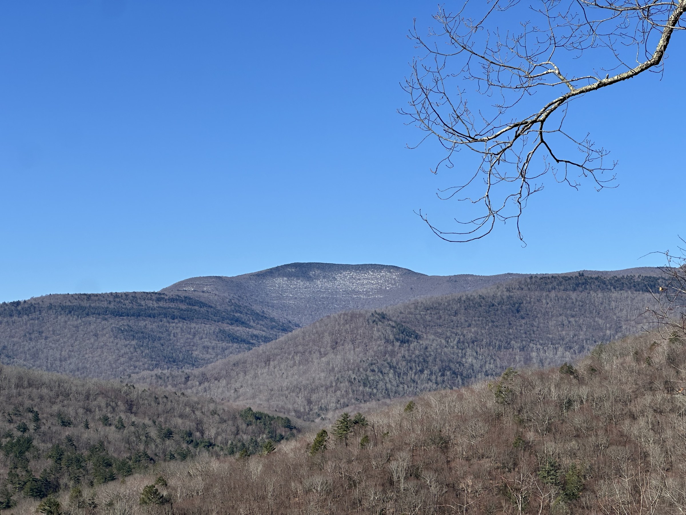
From the NY-47 trailhead the Phoenicia-East Branch Trail (yellow disks) climbs briefly north to a shoulder col, where the blue-blazed Giant Ledge–Panther–Fox Hollow Trail turns north onto the ridge crest. The first 1.5 km climb steadily through mixed hardwoods to the south end of Giant Ledge — a series of open bedrock outlooks running for roughly 500 m along the ridge with wide east-facing views across the Esopus valley to Wittenberg, Cornell and the Devil’s Path skyline beyond. The Giant Ledge overlooks are the standard turnaround for parties on the shorter version of this outing and one of the Catskills’ most-photographed viewpoints. A small campsite sits back from the edge on the north end of the ledge; treat the small nearby spring water.
Beyond Giant Ledge the blue trail drops briefly into the Panther col and then begins the sustained climb of Panther Mountain’s south ridge, passing several intermediate ledge openings with steadily deepening views west toward Balsam and Big Indian. The summit itself is wooded — Panther has no true panorama at the top — but the herd path north of the summit sign leads a short distance to an open ledge with the north-east view over Woodland Valley toward Wittenberg and Cornell. Return by the same route.
Why it is essential
The Giant Ledge–Panther walk is the Catskills’ single most-walked ridge, and for good reason: it delivers the range’s most complete outlook panorama on the outbound side of Giant Ledge, adds a genuine High Peak in Panther Mountain, and takes place in the Slide Mountain Wilderness alongside the range’s three highest summits. The Catskill Mountain Club and the NY-NJ Trail Conference have both invested substantially in the trail’s stone-step reconstruction, and the graded tread is now among the best-built in the range. Parties can shorten to Giant Ledge only for a half-day.
Equipment
- Sturdy hiking boots or trail shoes with grip
- Weatherproof shell
- Warm layer for the exposed ledges
- 2 L water minimum
- Sun protection on the open ledges
- Trekking poles helpful on the ledge scrambles
- Map, compass and downloaded DEC map
- Microspikes November to April for the ledge sections
Hazards and notes
- Giant Ledge is a genuine cliff-top — sheer drops of 20 m or more sit directly beside the trail; do not approach the edge in wind
- Ledge rock is dangerously slick when wet or icy
- Thunderstorm risk on the exposed ledges is real on hot summer afternoons
- No cell coverage on Giant Ledge or Panther summit
- Bear canisters are not required in the Catskills; bear-aware food storage recommended
- Hunt season (mid-November to mid-December) — wear high-visibility colours
- Parking at the Giant Ledge trailhead fills by 08:30 on peak weekends; do not park illegally on NY-47
GPX / KML links
| Source | URL | Format | Notes |
|---|---|---|---|
| NY State DEC — Slide Mountain Wilderness | dec.ny.gov | Official page | No official GPX published |
| Waymarked Trails — Giant Ledge–Panther–Fox Hollow | hiking.waymarkedtrails.org | OSM route relations | Blue trail mapped in OSM |
| AllTrails — Giant Ledge and Panther Mountain Trail | alltrails.com | Third-party track | Do not redistribute AllTrails GPX without licence confirmation |
Sources
- NY State DEC — Slide Mountain Wilderness
- Catskill Mountain Club — Giant Ledge
- NY-NJ Trail Conference — Catskills
4. Peekamoose–Table ridge
Snapshot
Itinerary
The Peekamoose–Table Trail (blue disks) leaves the small parking pull-off on Peekamoose Road and climbs immediately on rocky tread through hemlock and northern hardwoods. The first 3 km are a sustained pull, gaining nearly 400 m to reach the shoulder known as Reconnoiter Rock — a small overlook to the south into the Rondout valley. Beyond the outlook the trail eases through a broad wooded shoulder and then climbs again on rougher tread to reach the Peekamoose summit at about 6.8 km. Peekamoose’s summit is forested with only a small open ledge just below the top — the “Peekamoose signpost” spot — offering a partial view south-west toward the Bear Pen–Vly ridge and the western Catskills.
From Peekamoose the blue trail continues north-east, dropping about 90 m into a col of dense balsam fir and then climbing the final 100 m to the summit of Table Mountain at roughly 8.3 km. Table’s summit is even flatter than its name suggests — a nearly level bedrock plateau in dense spruce–fir with a small herd path leading to a short outlook toward Slide and Cornell. Return by the same route. Strong parties can extend north-east from Table to Lone and Rocky (bushwhack territory on herd paths) for the classic four-peak Catskill 3500 traverse; the standard day is out-and-back to Table.
Why it is essential
The Peekamoose–Table ridge is one of the Catskills’ quieter High Peaks days — the long approach from Peekamoose Road filters out casual traffic, and the two summits themselves see a fraction of the visitors that Slide and Panther attract. The route is also the standard way to link Peekamoose and Table for the Catskill 3500 Club list. The forest transition is one of the range’s most complete: hemlock at the trailhead through northern hardwoods to balsam fir on the summit ridge, with the col between the two peaks holding some of the finest close-grown fir stands in the Catskills.
Equipment
- Sturdy hiking boots
- Weatherproof shell
- Warm layer for the summit ridges
- 3 L water; treat any stream water
- Sun protection
- Trekking poles
- Map, compass and downloaded DEC map
- Headtorch for a late finish
- Microspikes November to May; snowshoes when snow exceeds ~20 cm
Hazards and notes
- Long day with modest outlook views — do not underestimate the return leg
- Trail is rocky and rooty throughout; ankle care is important
- No reliable water on the ridge above the initial climb
- Hunt season (mid-November to mid-December) — wear high-visibility colours
- Bear canisters are not required in the Catskills; bear-aware food storage recommended
- Cell coverage is absent on both summits
- Parking on Peekamoose Road is a small pull-off — arrive early on peak weekends
GPX / KML links
| Source | URL | Format | Notes |
|---|---|---|---|
| NY State DEC — Slide Mountain Wilderness | dec.ny.gov | Official page | No official GPX published |
| NY State DEC — Sundown Wild Forest | dec.ny.gov | Official page | Trailhead lies at the boundary of the two units |
| AllTrails — Peekamoose and Table Mountains | alltrails.com | Third-party track | Do not redistribute AllTrails GPX without licence confirmation |
Sources
- NY State DEC — Slide Mountain Wilderness
- NY State DEC — Sundown Wild Forest
- Catskill 3500 Club — Peekamoose and Table
5. Balsam Lake Mountain fire-tower loop
Snapshot
Itinerary
From the small trailhead at the end of Beaverkill Road, the red-blazed Dry Brook Ridge Trail heads north-east on an old, well-graded fire-tower access road that climbs steadily through mixed hardwoods. At about 1.1 km a signed junction breaks right onto the blue-blazed Balsam Lake Mountain Trail — the direct climb to the summit — while the red trail continues along the shoulder for the descent return. Take the blue trail: the grade steepens through hemlock and northern hardwood, then eases as it enters the balsam fir belt near the summit. The trail passes the volunteer observer’s cabin and a small lean-to just below the summit and arrives at the base of the Balsam Lake Mountain fire tower at roughly 3.5 km.
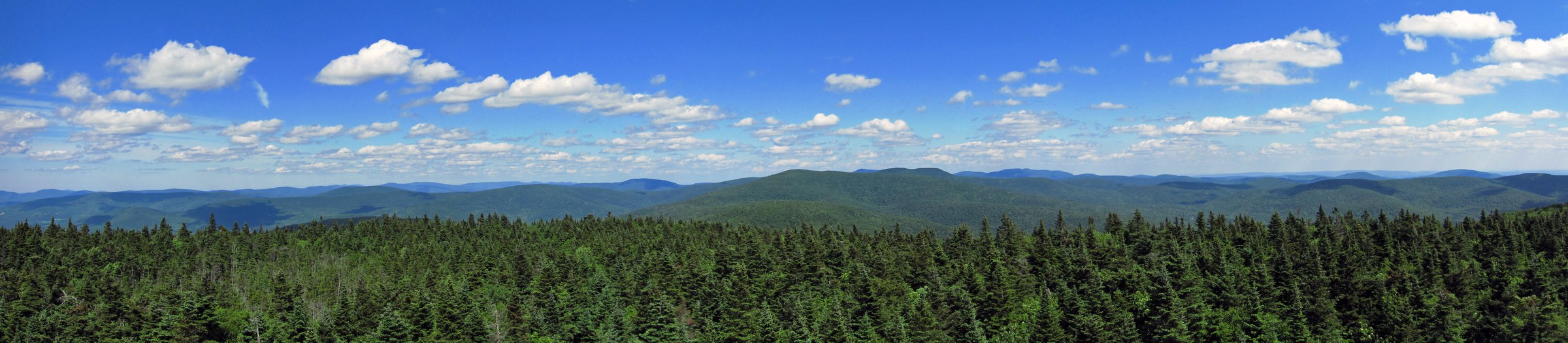
The tower itself is a 47-foot Aermotor steel structure erected in 1919, the successor to New York State’s first summit fire tower placed on this mountain in 1887. The tower was decommissioned in 1988, restored by the Catskill Fire Tower Project, the Catskill Center and DEC, and reopened in 2000. From the observer’s cab the view is genuinely panoramic — 360 degrees across the western Catskills, with Doubletop and Graham to the east, Big Indian and Slide beyond, the Beaver Kill headwaters west, and Bear Pen and Vly to the north-west. On staffed days (typically weekends late May to mid-October) volunteer stewards run interpretive programmes at the summit.
To complete the loop, descend from the fire tower on the blue trail to its junction with the yellow-blazed Mill Brook Ridge / summit connector, then follow the red Dry Brook Ridge Trail back down the north shoulder of the mountain to close the loop at the Beaverkill Road trailhead. For a shorter day, return by the outbound blue trail (out-and-back).
Why it is essential
Balsam Lake Mountain is the westernmost 3,500-foot summit in the Catskills and the range’s oldest fire-tower site — the 1887 tower here was the first ever placed on a New York State summit. The current restored 1919 tower is one of only five surviving fire towers in the Catskill Park (with Overlook, Hunter, Tremper and Red Hill) and is central to the Catskill 3500 Club’s Fire Tower Challenge. The summit view from the tower is the most complete in the western Catskills, and the route is modest enough for a first-time Catskill 3500 hiker while still delivering a genuine High Peak summit.
Equipment
- Standard hiking boots or trail shoes
- Weatherproof shell
- Warm layer for the tower — wind at 47 ft above the summit is strong even in summer
- 2 L water
- Sun protection
- Trekking poles helpful on the descent
- Map, compass and downloaded DEC Balsam Lake Mountain Wild Forest map
- Microspikes November to April on the shaded upper trail
Hazards and notes
- The fire tower is metal and dangerous in thunderstorms — do not climb the tower if lightning is possible
- Tower access may be restricted in high wind or when the observer’s cab is locked
- Rock steps on the blue trail are slick when wet or icy
- No cell coverage on the summit
- Bear canisters are not required in the Catskills; bear-aware food storage recommended
- Hunt season (mid-November to mid-December) — wear high-visibility colours
- Beaverkill Road parking is a small dirt lot; not plowed in winter
- Verify the fire-tower staffing schedule on the DEC Fire Towers page before travel if the observer visit matters to the day
GPX / KML links
| Source | URL | Format | Notes |
|---|---|---|---|
| NY State DEC — Balsam Lake Mountain Wild Forest | dec.ny.gov | Official page | Trailhead access and wild forest map |
| NY State DEC — Fire Towers | dec.ny.gov | Official page | Fire-tower staffing schedule and history |
| AllTrails — Balsam Lake Mountain Fire Tower Loop | alltrails.com | Third-party track | Do not redistribute AllTrails GPX without licence confirmation |
Sources
- NY State DEC — Balsam Lake Mountain Wild Forest
- NY State DEC — Fire Towers
- Catskill Mountain Club — Fire Tower Challenge
Missing data / follow-up work
- Slide Mountain figure — no verified Wikimedia Commons image of the Slide summit ledge or Burroughs plaque could be positively matched to a downloaded article asset; the Slide hike is written without an inline figure. If a licence-verified summit or plaque image can be sourced, a figure should be added.
- Peekamoose–Table figure — no verified Wikimedia Commons image of the Peekamoose or Table summits or the ridge could be positively matched to a downloaded article asset; the hike is written without an inline figure.
- Wittenberg summit image variants — several 2025 uploads to Wikimedia Commons (Category: Views from Wittenberg Mountain) show the reservoir view but are not currently matched to the specific 8208 × 2261 file shipped in the article; if the shipped file is confirmed to a different Commons title, the credit should be updated.
- Catskill 3500 Club section-hike planning — parties working the 3500 list often combine Peekamoose–Table with Lone and Rocky on herd paths; those two are bushwhack peaks without marked trails and are outside the “essential day-hike” scope of this entry.
- Fire-tower staffing 2026 — the volunteer-staffed weekend schedule at Balsam Lake Mountain, Overlook, Hunter, Tremper and Red Hill is confirmed year to year on the DEC Fire Towers page; verify before travel.
- Bushwhack peaks (Balsam Cap, Doubletop, Friday, Fir, Big Indian summits without marked trails) — the Catskill 3500 list includes several trailless summits requiring compass-and-map navigation; these are not included in the essential-day-hike selection above but are important for parties working the full list.
- Overlook Mountain and Kaaterskill High Peak — two more short, popular Catskill summits (Overlook has a fire tower; Kaaterskill High Peak is the fourth highest in the range). Overlook belongs stylistically with the Escarpment Trail region and is covered there; Kaaterskill High Peak’s marked routes are covered in the Devil’s Path essential-day-hikes entry.
- Woodland Valley Campground — the Wittenberg–Cornell–Slide trailhead is inside a NY State fee campground; the trailhead itself is free to access but daily parking rates may change and should be verified before travel.
Further reading
| Source | URL |
|---|---|
| NY State DEC — Catskill Park | dec.ny.gov |
| NY State DEC — Slide Mountain Wilderness | dec.ny.gov |
| NY State DEC — Sundown Wild Forest | dec.ny.gov |
| NY State DEC — Balsam Lake Mountain Wild Forest | dec.ny.gov |
| NY State DEC — Fire Towers | dec.ny.gov |
| Catskill 3500 Club | catskill-3500-club.org |
| Catskill Mountain Club | catskillmountainclub.org |
| NY-NJ Trail Conference — Catskill Park | nynjtc.org |
| Catskill Center | catskillcenter.org |
| Catskills Visitor Center — Balsam Lake Mountain Fire Tower | catskillsvisitorcenter.org |
| Wikipedia — Slide Mountain (Ulster County) | en.wikipedia.org |
| Wikipedia — Balsam Lake Mountain Fire Observation Station | en.wikipedia.org |