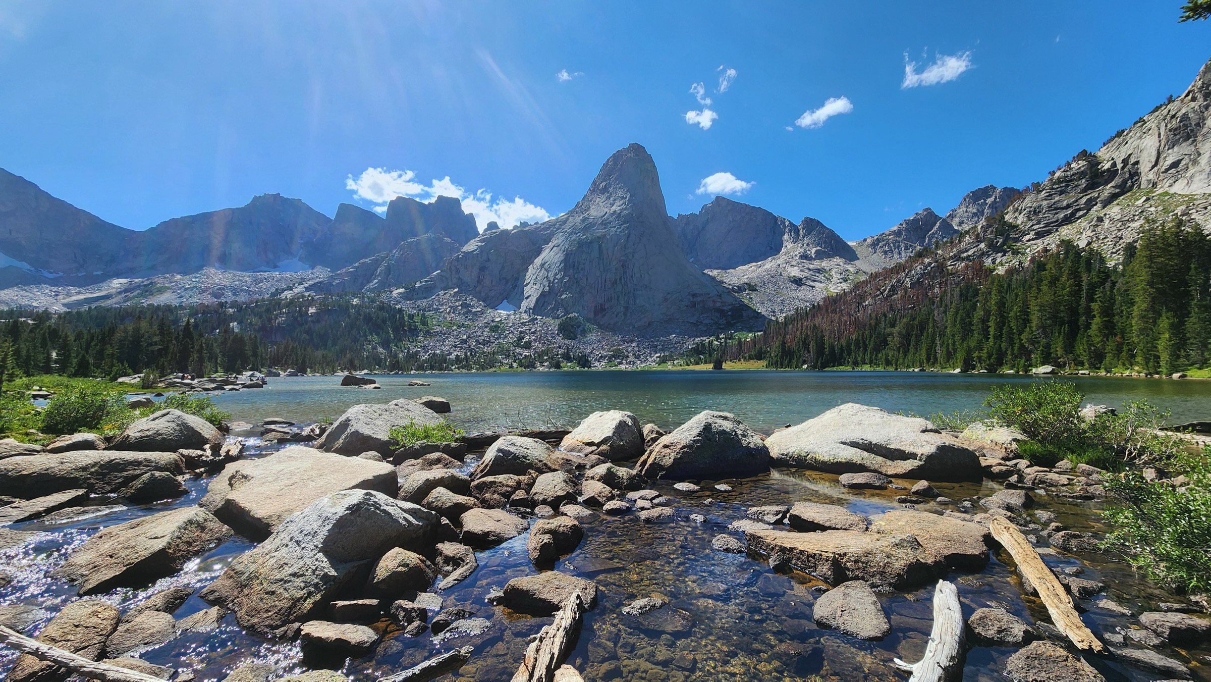
Regional overview
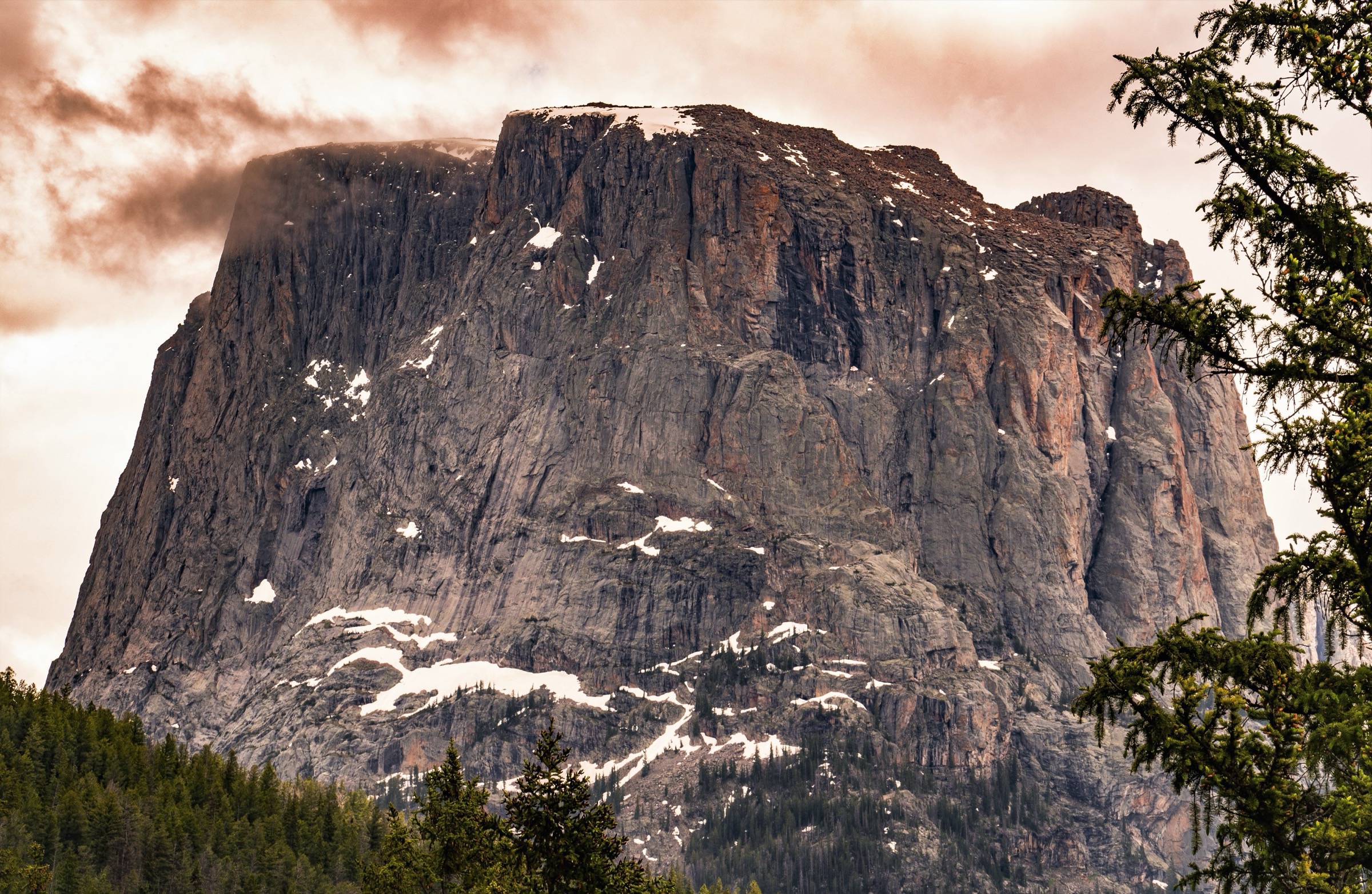
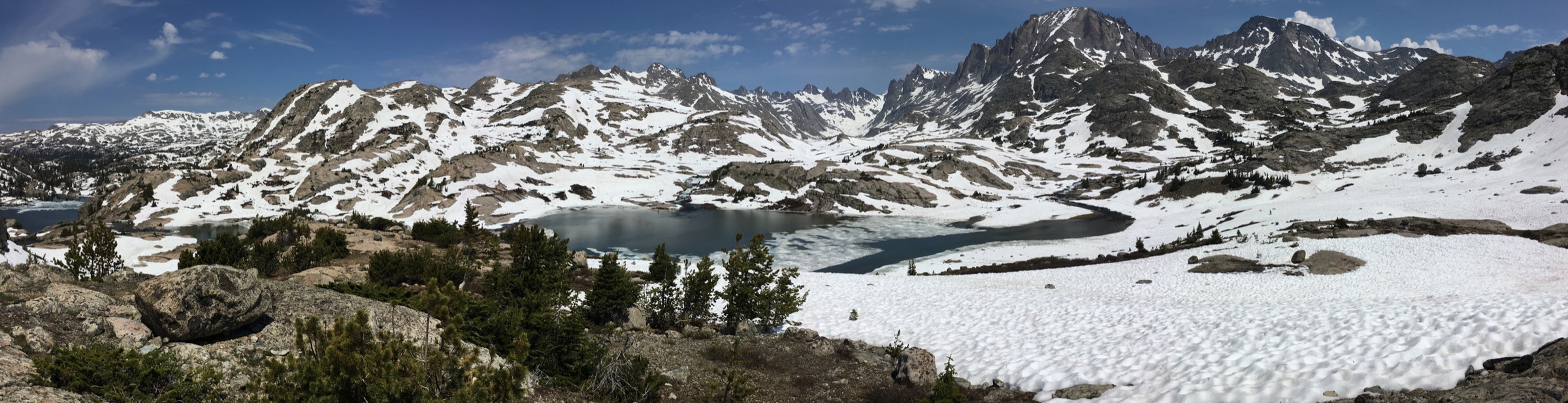
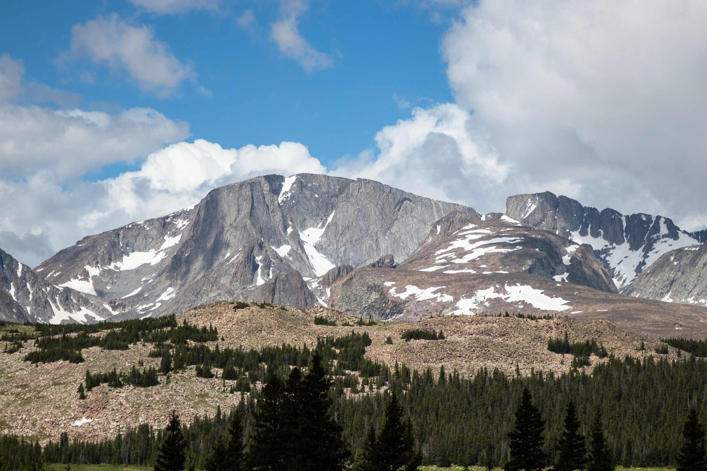
The southern Wind River Range is granite, lake and pass country strung between the Big Sandy Opening on the west and Sinks Canyon on the east. It is one of the great alpine districts of the American Rockies — a wall of Precambrian granite along the Continental Divide rising to more than 4,200 m / 13,800 ft and threaded with hundreds of glacial lakes. Two federal wildernesses cover almost all of the country used by hikers on this side of the range: the Bridger Wilderness on the west slope inside Bridger-Teton National Forest, and the Popo Agie Wilderness on the east slope inside Shoshone National Forest. The Bridger-Teton describes the Bridger Wilderness as an 80-mile Continental Divide wilderness with more than 600 miles of trail, high alpine lakes, glaciers, and fast-changing high-elevation weather.
The area’s hiking has a split character. From the west, long, high, remote wilderness approaches climb from the Big Sandy Trailhead at Big Sandy Opening — the classic start for Big Sandy Lake, Jackass Pass and the Cirque of the Towers, and for the deeper Temple Lake and Deep Lake basins beneath Temple Peak. The Forest Service describes the Big Sandy Campground and Trailhead as sitting at the north end of Big Sandy Opening, about 60 miles south-east of Pinedale, with no potable water at the trailhead, pack-out trash expectations, required food storage, and a usual open window of June/July to early September depending on snow and road conditions. From the east, shorter mountain-fringed canyon and lake routes climb from Sinks Canyon State Park and the Worthen Meadow area near Lander into the Popo Agie high country.
Best hiking season is short. The high basins are typically snow-bound into late June or early July; mid-July to mid-September is the practical window, with afternoon thunderstorms and cold nights the norm. Wildfire smoke can affect visibility and access from mid-summer into September. All the west-side approaches share the same private-vehicle access via US-191, WY-353, county roads and Big Sandy Opening Road; there is no public transport to Big Sandy.
The Cirque of the Towers itself sits inside a designated camping closure around Lonesome Lake: day travel is permitted, but overnight camping within the closure zone is not. Bear-safe food storage is required across the wilderness, and the classic itinerary here — Big Sandy Lake to Jackass Pass to a Cirque view and back — is a long, exposed day above 3,000 m that should be treated as a fit-walker summer objective, not a casual walk.
Selection rationale
The five walks below cover the two principal access sides of the southern Winds and their four defining hike types. Big Sandy Lake is the gateway approach and the shortest west-side day-hike. Jackass Pass to the Cirque of the Towers overlook is the signature non-technical view into the range’s most famous granite amphitheatre. The Temple Lake / Deep Lake basin circuit takes fit parties deeper into the high-lake country beneath Temple Peak — long enough for a day-hike catalogue but included as a fit-walker summer objective. Popo Agie Falls samples the Lander-side canyon country in a short walk from Sinks Canyon. The Stough Creek Lakes loop closes the selection with a full alpine-lake day from the Worthen Meadow area — the natural east-side alternative to the crowded Big Sandy gateway.
Routes excluded as out of scope are discussed at the end of the article.
Summary table
| # | Hike | Country | Route type | Distance | Gain | Max elevation | Difficulty |
|---|---|---|---|---|---|---|---|
| 1 | Big Sandy Lake via Big Sandy Trail | USA | Out-and-back | 17.7 km | 268 m | ~2,970 m | Moderate |
| 2 | Jackass Pass / Cirque of the Towers overlook | USA | Out-and-back | 24.8 km | 688 m | ~3,300 m | Hard |
| 3 | Temple Lake / Deep Lake basin circuit | USA | Loop | 28.2 km | 624 m | ~3,200 m | Hard |
| 4 | Popo Agie Falls Trail | USA | Out-and-back | 5.8 km | 228 m | ~2,200 m | Moderate |
| 5 | Stough Creek Lakes loop | USA | Loop | 24.5 km | 756 m | ~3,200 m | Hard |
1. Big Sandy Lake via Big Sandy Trail
Snapshot
Itinerary
From the Big Sandy Trailhead at the north end of Big Sandy Opening, the trail sets off north-east along Big Sandy Creek, alternating shaded lodgepole forest with meadow openings and small glacial lakes. The tread is gentle for the first several kilometres — a rare thing in the Winds — and the creek is the constant companion. The route passes Diamond Lake and V Lake basins on either side, then draws steadily into the wall of granite at the head of the drainage before opening onto the broad shore of Big Sandy Lake at approximately 2,970 m. The lake is the natural stopping point and the practical base for many of the area’s classic high routes — Jackass Pass and the Cirque, Temple and Deep Lake basins, Clear Lake. Return by the same trail.
Why it is essential
Big Sandy Lake is the gateway walk of the southern Winds — the most direct day-hike sample of Big Sandy country and the practical approach to the Cirque of the Towers, Temple Lake, and Deep Lake. For a party without the fitness or the day-length for Jackass Pass, the lake itself is a full-value destination with an uninterrupted southern-Winds granite backdrop.
Equipment
- Sturdy trail shoes or light hiking boots — the tread is largely benign but stones and roots persist through the forest
- Trekking poles helpful over the middle distance
- 2.5–3 L water and treatment — Big Sandy Creek is the water source; no potable water at the trailhead
- Rain shell and warm insulating layer — mountain weather turns fast at 2,700 m and above
- Sun protection and mosquito repellent (July is peak bug season)
- Bear canister or an IGBC-approved bear-safe storage method for any food carried
- Offline map, GPS and headtorch
Hazards and notes
- Remote gravel-road access to the trailhead; road quality varies with weather and there is no cell service for long stretches.
- No potable water at the trailhead — carry in what you need for the drive and treat creek water on trail.
- Afternoon thunderstorms are the norm from July into September; turn back if convection develops.
- Bear country — food-storage requirements apply everywhere in the wilderness.
- Big Sandy Campground and the trailhead are busy in summer; expect a full parking area on peak weekends.
GPX / route file
| Source | URL | Format | Notes |
|---|---|---|---|
| AllTrails — Big Sandy Lake via Big Sandy Trail | alltrails.com | Source map | Distance, gain and time; AllTrails terms apply and direct GPX was not retrieved |
| USFS — Big Sandy Campground (trailhead context) | fs.usda.gov | Web page | Official access, open-season and no-water status |
| USFS — Bridger Wilderness | fs.usda.gov | Web page | Official wilderness management and hazard context |
Sources
2. Jackass Pass / Cirque of the Towers overlook
Snapshot
Itinerary
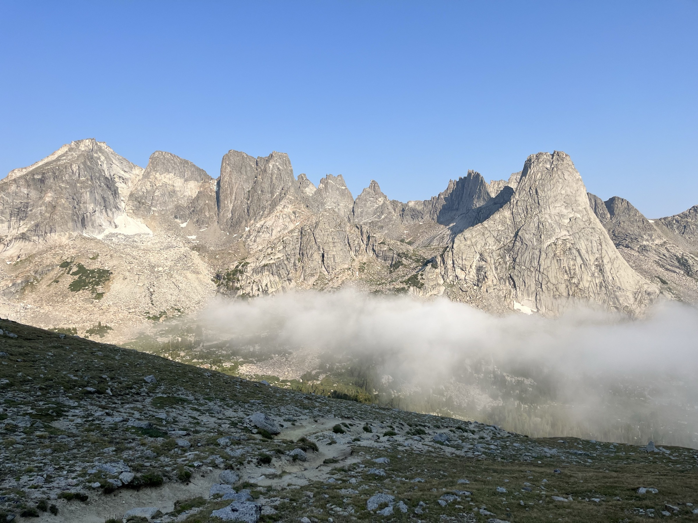
Follow the Big Sandy Trail to Big Sandy Lake as for Hike 1. From the north-east corner of the lake, turn onto the Fremont / Jackass Pass route and climb steadily past North Lake and Arrowhead Lake, threading slabs and short scrambly steps into the upper granite basin. The final climb up Jackass Pass breaks out on the divide at approximately 3,290–3,300 m. From the pass the Cirque of the Towers opens spectacularly across Lonesome Lake — Pingora Peak, Wolf’s Head, Warbonnet, Warrior, and Watchtower in a semicircle of clean granite. Very fit parties can drop a short way down toward Lonesome Lake for a more intimate view, but note that overnight camping is not permitted inside the designated Lonesome Lake closure zone. Return by the same route unless deliberately extending the day.
Why it is essential
Jackass Pass is the signature non-technical day-hike view into the Cirque of the Towers — one of the most famous granite amphitheatres in the Rockies and a defining Wind River view. It is also the most complete single-day sample of the southern Winds: forest, lake chain, slabs, high pass, and cirque, all reached without a permit.
Equipment
- Mountain hiking footwear with a stiff sole for slab and scree; poles useful for the descent
- 3–4 L water and treatment
- Rain and wind shell plus a warm insulating layer for the pass
- Sun protection — the pass climb is fully exposed
- Mosquito repellent for the lake basins
- Bear canister or IGBC-approved food-storage method
- Offline navigation with the Fremont / Big Sandy junctions loaded — signage is minimal
- Headtorch for a long day
Hazards and notes
- Long, exposed day above 3,000 m with steep slabby ground on the pass climb — start early to be off the pass before afternoon storms.
- Route-finding attention around the slabs above Arrowhead Lake — the tread braids across granite in places.
- Storm and lightning exposure on the pass; retreat is the correct response to convection.
- Lonesome Lake camping closure — day travel is permitted, overnight is not.
- Bear country — full food-storage compliance required.
- Snowfields can persist into July on the pass approach; assess before committing.
GPX / route file
| Source | URL | Format | Notes |
|---|---|---|---|
| AllTrails — Big Sandy Lake and Arrowhead Lake via Fremont and Big Sandy Trail | alltrails.com | Source map | Distance and gain to Jackass Pass; AllTrails terms apply |
| USFS — Big Sandy Campground (trailhead context) | fs.usda.gov | Web page | Official access, season, and facilities |
| Wikipedia — Cirque of the Towers | en.wikipedia.org | Web page | Secondary route and closure context |
Sources
3. Temple Lake / Deep Lake basin circuit
Snapshot
Itinerary
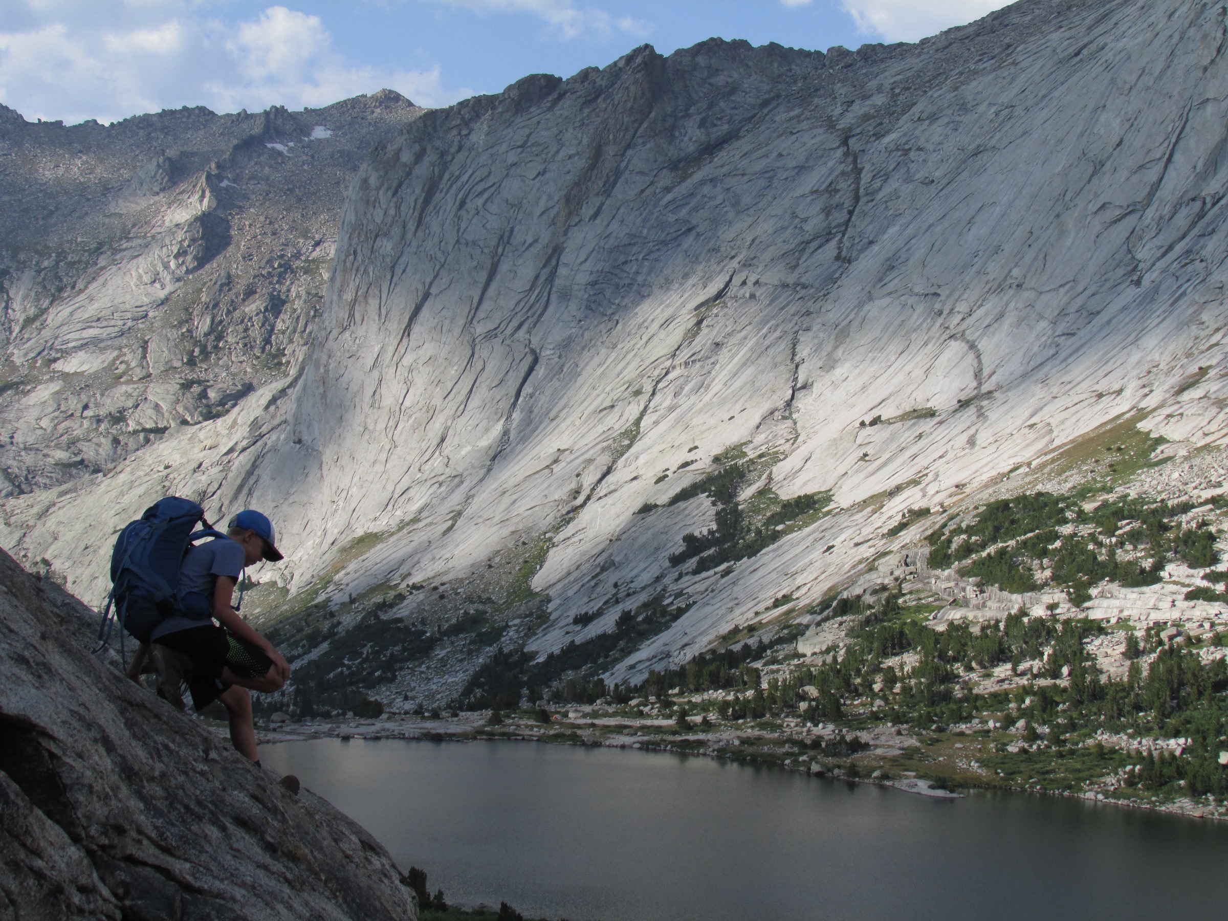
From the Big Sandy Trailhead, follow the Big Sandy Trail toward Big Sandy Lake as for Hikes 1 and 2. Rather than turning north-east for Jackass Pass, take the Temple Lake Trail south-east into the higher granite basins. The loop threads Clear Lake, Deep Lake, and Temple Lake beneath the wall of Temple Peak and the neighbouring granite, then closes back toward Big Sandy Lake and the return trail. Exact junction and loop-direction choices should be finalised on the ground from current maps and trail signs. Even a fit party should treat this as a full mountain day and start early.
Why it is essential
The Temple Lake and Deep Lake basins show a quieter, higher-alpine side of the southern Winds beyond the famous Cirque approach — clear lakes, pale granite, and sustained wilderness walking with none of the Cirque’s crowds and much of the same scenery. It is the natural big-day objective for a party already familiar with Big Sandy country.
Equipment
- Mountain hiking footwear with a stiff sole for slab and scree
- Poles helpful for the descent
- 3–4 L water and treatment
- Rain/wind shell plus a warm insulating layer
- Sun and bug protection
- Bear canister or IGBC-approved food-storage method
- Offline map with the Big Sandy / Temple Lake junctions loaded
- Headtorch — a delayed return is easy on a route of this length
- High-energy food for a long day
Hazards and notes
- Route length exceeds the normal day-hike guideline — assess party fitness before committing.
- Altitude — the entire loop is at or above 2,900 m.
- Storm and lightning exposure in the open basins from July into September.
- Route-finding and junctions — signage is minimal in the higher basins; a GPS track is strongly recommended.
- Wet meadows and stream crossings after high water can slow travel significantly.
- Bear country — full food-storage compliance required.
GPX / route file
| Source | URL | Format | Notes |
|---|---|---|---|
| AllTrails — Big Sandy Trail to Temple Lake Trail | alltrails.com | Source map | Distance, gain, difficulty and route type; AllTrails terms apply |
| USFS — Bridger Wilderness | fs.usda.gov | Web page | Official wilderness management context |
Sources
4. Popo Agie Falls Trail
Snapshot
Itinerary
From the Bruce’s Bridge trail access above Sinks Canyon, the signed Popo Agie Falls Trail climbs gently up-canyon along the Middle Fork of the Popo Agie, through open pine and mixed forest with steady views back over the canyon. The tread is well-worn and family-friendly. A brief steeper section on rocky steps brings you above the falls, where a set of unofficial paths lead to viewpoints of the multi-tier cascade set into the canyon wall. Return by the same trail.
Why it is essential
Popo Agie Falls gives a short, culturally recognisable Lander-side sample of the southern Winds — canyon geology, river sound, waterfall scenery, and quick access to the Sinks Canyon landscape without a full wilderness day. It is the natural half-day companion to a bigger Popo Agie objective, or a stand-alone family or afternoon hike from Lander.
Equipment
- Trail shoes with good grip; the rock steps near the falls can be slick
- 1.5–2 L water
- Sun protection and a light rain layer
- Traction if snow or ice is present
- Leash if hiking with a dog where permitted
- Simple offline map — the trail is short but junctions exist near the falls
Hazards and notes
- Cliff and canyon edges near the falls; unofficial spurs run close to the drop — keep children within reach.
- Slick rock near the falls — approach viewpoints with care, particularly after rain.
- High water in spring can make lower crossings uncomfortable and the falls dangerous to approach closely.
- Rattlesnakes are possible in warm months on lower canyon terrain.
- Fire restrictions may apply in dry periods — check current Sinks Canyon State Park status.
GPX / route file
| Source | URL | Format | Notes |
|---|---|---|---|
| AllTrails — Popo Agie Falls Trail | alltrails.com | Source map | Distance, gain and time; AllTrails terms apply |
| Wyoming State Parks — Sinks Canyon State Park | wyoparks.wyo.gov | Web page | Official park status, access and management |
| Wyoming State Parks — Sinks Canyon maps and brochures | wyoparks.wyo.gov | Web page | Official source-map page; PDF reuse terms unresolved |
Sources
5. Stough Creek Lakes loop
Snapshot
Itinerary
From the Worthen Meadow area on the east side of the range, the trail climbs steadily out of forest and meadow into the Stough Creek lakes basin, linking a chain of tarns beneath the granite of the Popo Agie high country. The exact loop direction and junction sequence should be confirmed against a current map before setting out — the Popo Agie Wilderness signage is minimal and the trail braids in places across meadow and slab. The circuit closes back down toward the Worthen Meadow trailhead through the same forest belt.
Why it is essential
Stough Creek Lakes represents the Lander-side southern Winds beyond Sinks Canyon — a full-value alpine lake day without using the crowded Big Sandy gateway. For parties basing themselves in Lander rather than Pinedale it is the natural alpine-lake objective and a much quieter alternative to the Cirque approach.
Equipment
- Mountain hiking footwear with a stiff sole
- Poles for the loop descent
- 3–4 L water and treatment
- Rain/wind shell and a warm insulating layer
- Sun and mosquito protection
- Bear canister or IGBC-approved food-storage method
- Offline map with the Popo Agie Wilderness junctions loaded
- Headtorch and high-energy food for a long day
Hazards and notes
- Long distance and altitude — treat as a full mountain day and start early.
- Storm and lightning exposure in the open lake basins.
- Navigation and junction errors — signage is minimal; a GPS track is strongly recommended.
- Wet meadows and stream crossings can slow travel significantly after high water.
- Remote access — cell service is intermittent to non-existent.
- Wildfire smoke or closures are possible from mid-summer into September; check current status.
GPX / route file
| Source | URL | Format | Notes |
|---|---|---|---|
| AllTrails — Stough Creek Lakes Loop | alltrails.com | Source map | Distance, gain, time and difficulty; AllTrails terms apply |
| Wyoming State Parks — Sinks Canyon State Park (regional access context) | wyoparks.wyo.gov | Web page | Nearby access and status context; not route geometry |
Sources
Routes excluded as out of scope
The following sit in the southern Winds but fall outside a day-hike entry, are typically done as backpacks, or require dedicated technical planning.
- Cirque of the Towers overnight base camping. Overnight travel around Lonesome Lake sits inside a designated camping closure zone; the classic multi-day Cirque itinerary is treated separately from a day-hike catalogue.
- Wind River High Route / Continental Divide traverses. Long multi-day off-trail or partially cross-country routes across the range; entirely outside a day-hike catalogue.
- Titcomb Basin. The classic Titcomb Lakes / Island Lake objective is an Elkhart Park (northern Winds) route rather than a Big Sandy day-hike, and is much too long for a single-day trip.
- Wind River Peak. The range’s highest walk-up peak from Big Sandy country — a serious summit day requiring off-trail travel and altitude fitness, better treated separately.
- East Fork Valley approaches from the Reservation. Trails on the Wind River Indian Reservation east of the divide require Shoshone and Arapaho tribal permits and are outside the scope of this guide.
- Technical rock objectives — Pingora, Wolf’s Head and the Cirque routes are classic granite climbs, not day-hikes.
Further reading
Missing data / follow-up work
- AllTrails reuse terms for the source maps referenced above are unresolved; the geometry is useful for planning but direct republication should be treated cautiously until terms are confirmed.
- No official USFS GPX or KML was located for any of the five routes in this pass; downloadable route files should be added on a subsequent pass.
- Maximum-elevation values for Big Sandy Lake, Jackass Pass, the Temple Lake / Deep Lake circuit and the Stough Creek Lakes loop are not officially published by the Forest Service; the values given are map-derived approximations and should be replaced with GIS-measured values.
- The Temple Lake / Deep Lake basin circuit exceeds the normal day-hike distance guideline and is included as a fit-walker summer objective; a shorter Temple Lake out-and-back could be added on a subsequent pass.
- AllTrails did not return an estimated time for the Temple Lake / Deep Lake circuit; the 8–11 h figure given is an editorial estimate for fit parties.
- Current fire restrictions, wilderness closures and access-road status for Big Sandy, Sinks Canyon and Worthen Meadow should be rechecked immediately before travel — smoke and closures are common from mid-summer into September.
- No route-specific licence-compatible images were located for Big Sandy Lake, Temple Lake, Deep Lake, Popo Agie Falls or the Stough Creek Lakes; the cover image is a Lonesome Lake / Cirque of the Towers landscape by DuckWrangler97 (CC BY-SA 4.0).