Regional overview
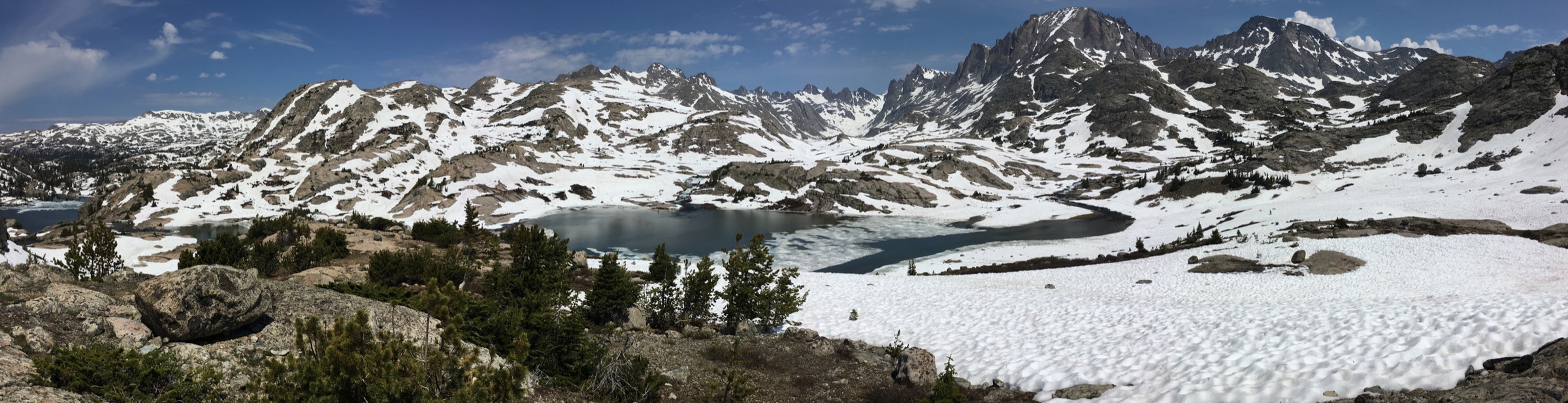
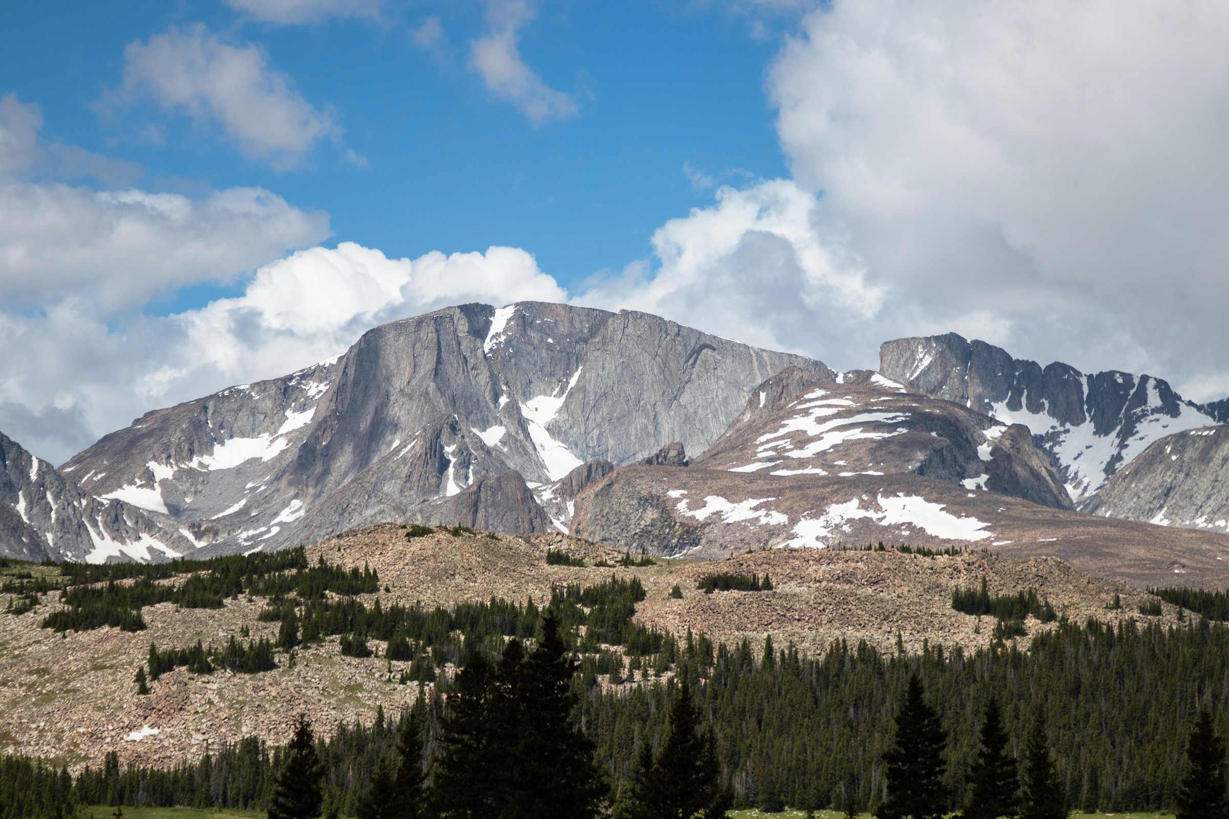
The northern Wind River Range is the most remote, wildlife-heavy end of the Winds: Squaretop and the Green River Lakes on the west side, the Dubois / Trail Lake / Fitzpatrick Wilderness approaches on the east side, and long high-country connectors that quickly become backpacking terrain. The walking character is less polished than the Tetons or the Colorado Front Range: trailheads are often far from services, roads can be rough, route distances are large, and the transition from sagebrush foothills to forest, alpine lakes and wind-scoured tundra can be abrupt.
This is Greater Yellowstone bear country. The northern Winds also carry real high-altitude risks: snow into summer, mosquitoes, fast thunderstorms, remote trailheads, limited cell coverage, difficult rescue logistics, downed timber, creek crossings and vague or off-trail terrain on some higher objectives. The five hikes below favour routes with verified day-hike statistics and deliberately avoid Gannett Peak, Dinwoody and Glacier Trail objectives, which are normally multi-day, glaciated or mountaineering routes.
See also: Titcomb Basin · Cirque of the Towers / southern Wind River Range.
Selection rationale
The selection balances the region’s signature elements: the iconic Green River Lakes and Squaretop view, a long west-side Bridger Wilderness alpine connector on Doubletop Mountain Trail, the Dubois-side Lake Louise classic, the strenuous Ross Lake approach and the culturally and ecologically important Whiskey Mountain. Brooks Lake / Jade Lakes were considered but excluded — they sit more naturally with the Brooks Lake / Washakie / Togwotee side than with the Wind River Range proper. Raft Lake was considered but excluded because the practical route requires Wind River Reservation access permits and off-trail navigation.
Summary table
| # | Hike | Country | Route type | Distance | Gain | Max elevation | Difficulty |
|---|---|---|---|---|---|---|---|
| 1 | Green River Lakes Loop | USA | Loop | 10.1 km | 151 m | 2,479 m | Moderate |
| 2 | Doubletop Mountain Trail day section | USA | Out-and-back | 28.6 km | 1,158 m | 3,267 m | Hard |
| 3 | Lake Louise Trail | USA | Out-and-back | 7.7 km | 293 m | 2,571 m | Moderate |
| 4 | Ross Lake Trail | USA | Out-and-back | 21.7 km | 1,175 m | 3,153 m | Hard |
| 5 | Whiskey Mountain Trail | USA | Out-and-back | 15.0 km | 1,082 m | 3,395 m | Hard |
1. Green River Lakes Loop
Snapshot
Itinerary
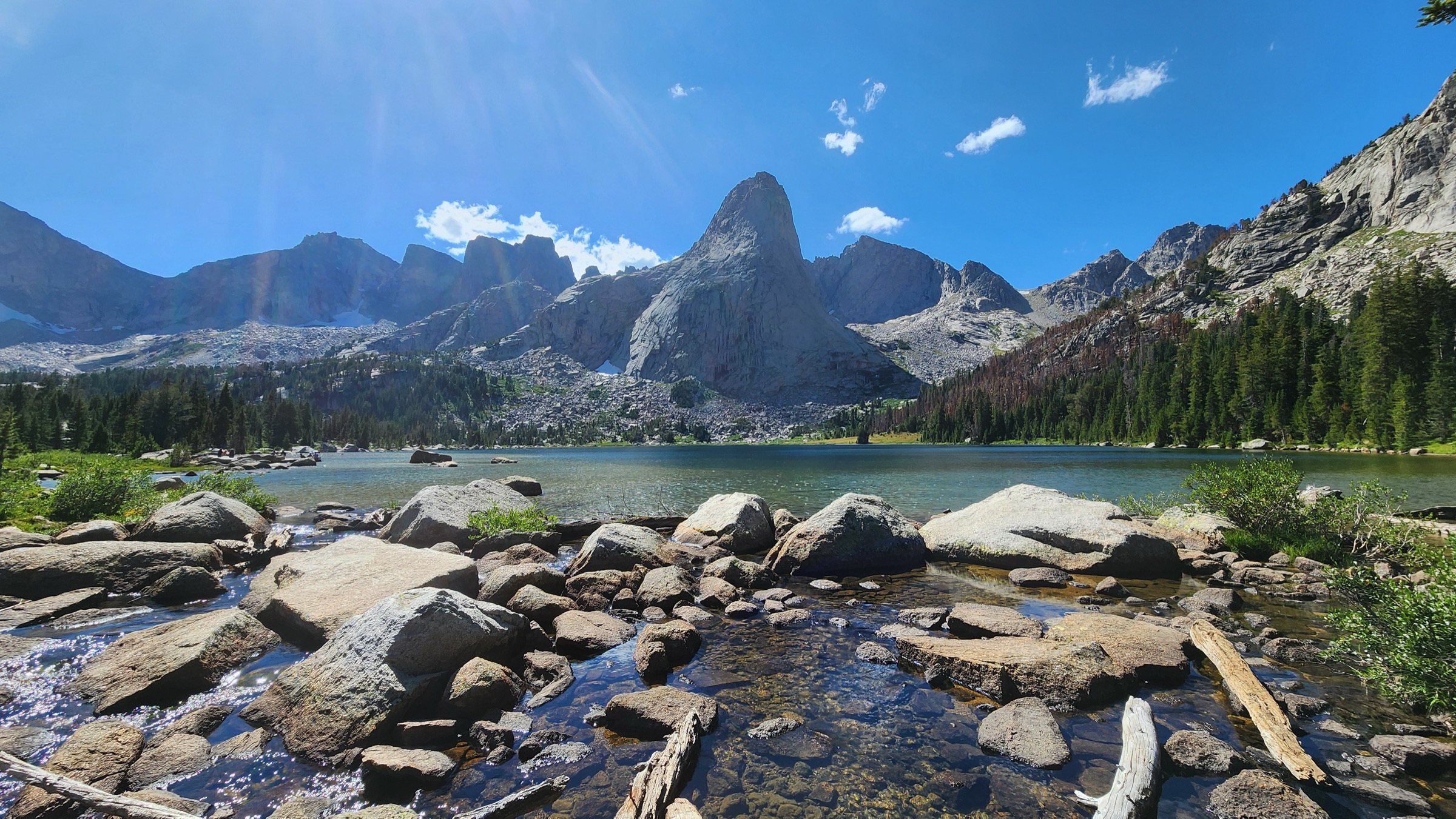
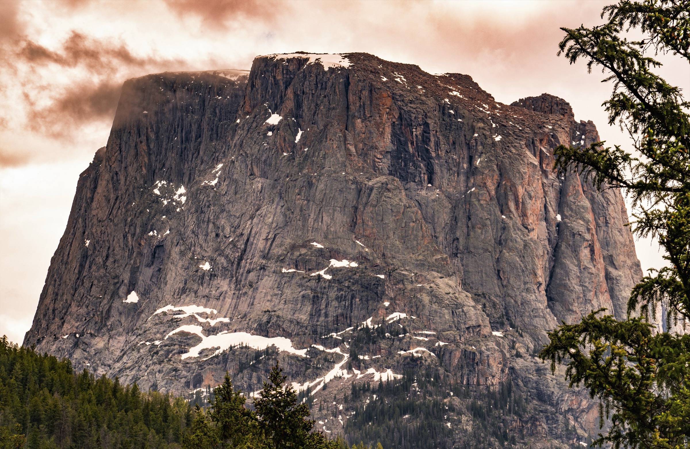
From Green River Lakes, follow the signed lake-area trail system around the lower and upper lake margins, with views toward Squaretop Mountain, Flat Top Mountain, White Rock, Lost Eagle Peak, the Green River and the northwestern Wind River skyline. The route gives the most accessible walking sample of the upper Green River headwaters without committing to the long Highline Trail or Squaretop summit.
Why it is essential
Green River Lakes and Squaretop are among the most recognisable images of the Wind River Range. This is the compact day-hike version: a lake-and-river loop that still carries the full northern-Winds sense of scale.
Equipment
- Hiking shoes
- Rain and wind layers
- Warm layer
- Water and treatment
- Sun protection
- Insect repellent
- Bear spray
- Offline map
Hazards and notes
- Remote road access; expect washboarding and slow travel.
- Downed trees, flooding or wet trail near the lakes.
- Mosquitoes; fast thunderstorms.
- Grizzly and black bear country — carry and know how to use bear spray.
GPX / route file
| Source | URL | Format | Notes |
|---|---|---|---|
| AllTrails — Green River Lakes Loop | alltrails.com | Source map / proprietary trail database | Direct GPX not retrieved; do not reuse proprietary geometry directly |
| OpenStreetMap search | openstreetmap.org | Source map | Reusable only under ODbL terms with attribution/share-alike |
Sources
- AllTrails — Green River Lakes Loop
- Bridger-Teton National Forest — hiking
- Squaretop Mountain — reference page
2. Doubletop Mountain Trail day section
Snapshot
Itinerary
The available route record describes Doubletop Mountain Trail as a backcountry connector between the Summit Lake / Highline Trail area and the New Fork Canyon side. The catalogue day-hike version uses the AllTrails out-and-back record as the bounded route, with the expectation that hikers turn around before committing to a multi-day traverse. Because the trail is a connector rather than a simple destination path, the exact practical trailhead and turnaround should be checked against current maps before the walk.
Why it is essential
This route represents the northern Winds beyond the lakefront classics: longer, quieter, higher and more wilderness-like. It is included as the demanding west-side alpine day for very fit walkers.
Equipment
- Full mountain day kit
- Headlamp
- Water and treatment
- Bear spray
- Offline map and GPS
- Layered clothing with rain shell
- Emergency insulation
- First-aid kit
Hazards and notes
- Long distance, remote trail, uncertain trailhead variant.
- Fatigue, storms, lingering snow patches, route-finding.
- Grizzly and black bear country.
- Confirm the current road status and practical trailhead against the Bridger-Teton map portal before travel.
GPX / route file
| Source | URL | Format | Notes |
|---|---|---|---|
| AllTrails — Doubletop Mountain Trail | alltrails.com | Source map / proprietary trail database | Direct GPX not retrieved; trailhead narrative unresolved |
| OpenStreetMap search | openstreetmap.org | Source map | Reusable only under ODbL terms with attribution/share-alike |
Sources
- AllTrails — Doubletop Mountain Trail
- Bridger-Teton National Forest — hiking
- List of trails in Sublette County, Wyoming
3. Lake Louise Trail
Snapshot
Itinerary
From the Trail Lake side, the route leaves sagebrush and dry lower slopes, climbs through aspen and conifer forest, crosses rougher rocky terrain and reaches Lake Louise in the Fitzpatrick Wilderness. Return by the same path.
Why it is essential
Lake Louise is the most accessible Dubois-side lake hike in this selection: short enough for a half day, but still a genuine entry into the eastern northern Winds.
Equipment
- Hiking shoes or light boots
- Bear spray
- Water and treatment
- Layers and rain shell
- Insect repellent
- Offline map
Hazards and notes
- Rocky, exposed ledge section with loose rock and steep spots.
- Grizzly habitat — carry and know how to use bear spray.
- Storm exposure above treeline; mosquitoes near the lake.
GPX / route file
| Source | URL | Format | Notes |
|---|---|---|---|
| AllTrails — Lake Louise Trail | alltrails.com | Source map / proprietary trail database | Direct GPX not retrieved; do not reuse proprietary geometry directly |
| OpenStreetMap search | openstreetmap.org | Source map | Reusable only under ODbL terms with attribution/share-alike |
Sources
4. Ross Lake Trail
Snapshot
Itinerary
From the Trail Lake / Whiskey Basin side, the trail climbs toward Ross Lake through eastern Wind River forest and open high-country terrain. The route is a substantial day hike with lake scenery and broad views before returning the same way.
Why it is essential
Ross Lake is the strenuous Dubois-side lake objective in this set, giving a fuller day in Fitzpatrick Wilderness terrain than Lake Louise without becoming a glacier or Gannett Peak approach.
Equipment
- Sturdy boots
- Trekking poles
- Bear spray
- Water and treatment
- Headlamp
- Layers and rain shell
- Offline map and GPS
- Emergency kit
Hazards and notes
- Sustained elevation gain and rough access road.
- Remote terrain with limited cell coverage.
- Weather, wildlife, fatigue.
- Grizzly habitat — carry and know how to use bear spray.
GPX / route file
| Source | URL | Format | Notes |
|---|---|---|---|
| AllTrails — Ross Lake Trail | alltrails.com | Source map / proprietary trail database | Direct GPX not retrieved; do not reuse proprietary geometry directly |
| OpenStreetMap search | openstreetmap.org | Source map | Reusable only under ODbL terms with attribution/share-alike |
Sources
5. Whiskey Mountain Trail
Snapshot
Itinerary
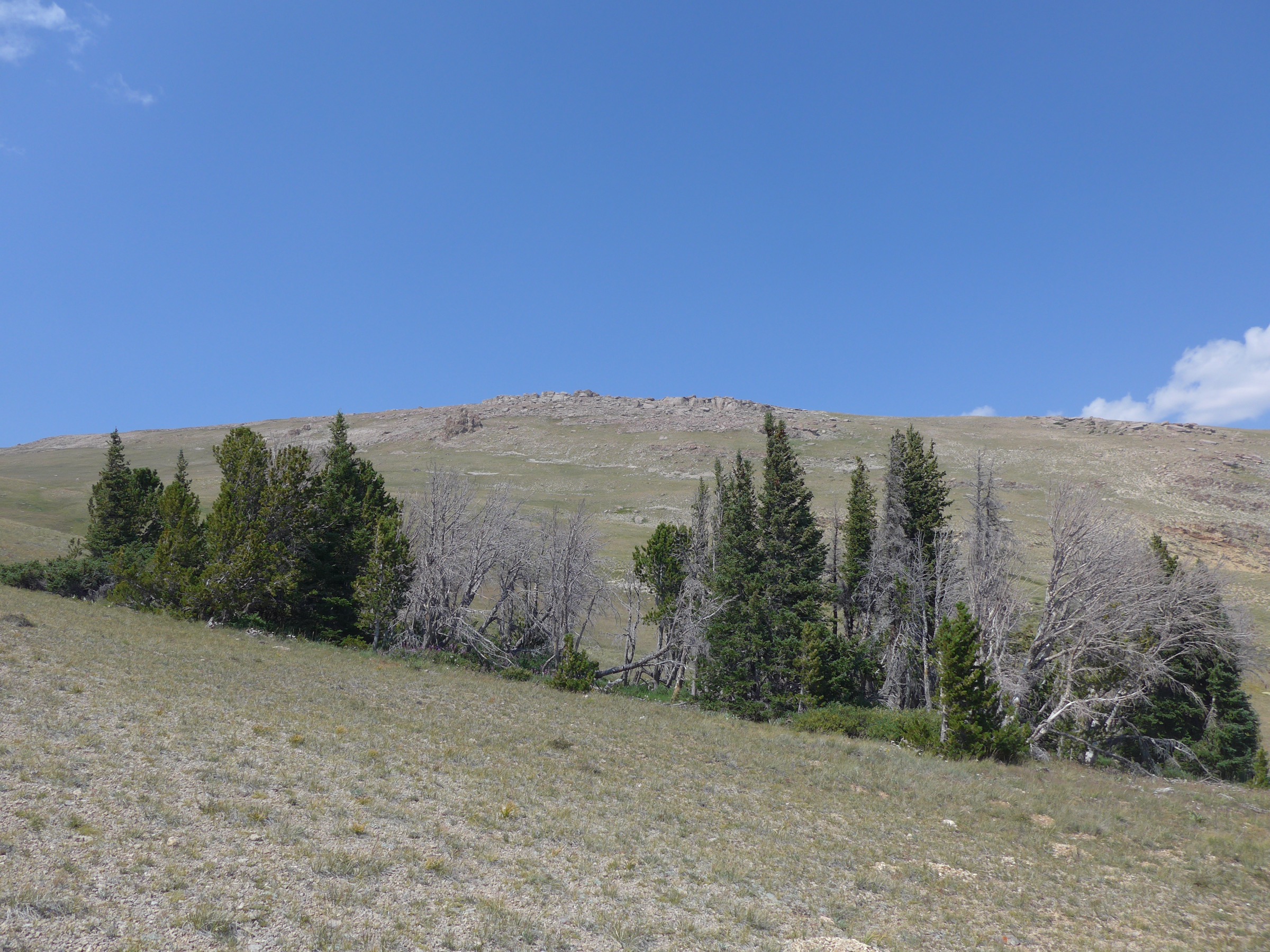
The trail climbs from the Whiskey Mountain / Trail Lake side through dry lower terrain, forest and open high slopes. AllTrails notes that the route is maintained to the Ross Lake split, with a less-defined summit continuation marked by cairns or posts in places. The summit area gives broad views over the Dubois side of the northern Winds and surrounding basins.
Why it is essential
Whiskey Mountain is both a viewpoint and a cultural-wildlife landmark. Public references identify it as a northern Wind River peak near Dubois and associate the area with one of the largest wintering concentrations of Rocky Mountain bighorn sheep in the lower 48.
Equipment
- Sturdy boots
- Trekking poles
- Bear spray
- Wind and warm layers
- Rain shell
- Offline map and GPS
- Water and treatment
- Sun protection
Hazards and notes
- Steep gain and a less-defined summit section above treeline.
- High winds, lightning exposure and remote rescue logistics.
- Grizzly habitat — carry and know how to use bear spray.
- Check for any Whiskey Basin bighorn-sheep sensitivity or seasonal closures before the walk.
GPX / route file
| Source | URL | Format | Notes |
|---|---|---|---|
| AllTrails — Whiskey Mountain Trail | alltrails.com | Source map / proprietary trail database | Direct GPX not retrieved; do not reuse proprietary geometry directly |
| OpenStreetMap search | openstreetmap.org | Source map | Reusable only under ODbL terms with attribution/share-alike |
Sources
- AllTrails — Whiskey Mountain Trail
- Whiskey Mountain — reference page
- Shoshone National Forest — recreation
Routes excluded as out of scope
- Gannett Peak, Dinwoody Glacier and Glacier Trail objectives — normally multi-day, glaciated or mountaineering routes rather than day hikes.
- Brooks Lake / Jade Lakes — sit more naturally with the Brooks Lake / Washakie / Togwotee side than with the Wind River Range proper.
- Raft Lake — the practical route requires Wind River Reservation access permits and off-trail navigation, outside this catalogue’s public-access day-hike scope.
Further reading
- Bridger-Teton National Forest — hiking
- Shoshone National Forest — recreation
- Wind River Range — reference page
- Sister catalogue: USA — Cirque of the Towers and Southern Winds, Wyoming: essential day-hikes
Missing data / follow-up work
- Official downloadable GPX or KML files were not retrieved for any of the five routes; route-file status rests on AllTrails records plus OpenStreetMap source-map searches.
- Doubletop Mountain Trail practical trailhead / turnaround needs a current Bridger-Teton map cross-check before publication.
- Whiskey Mountain Trail parking variant is unresolved; a first-hand parking / trailhead narrative should be added.
- Licence-compatible route-specific images for Doubletop, Lake Louise and Ross Lake are not yet available at the site’s 2000 px floor; open-licence replacements should be sought.
- Current-year Shoshone / Bridger-Teton bear-safety, food-storage, road-status and any Whiskey Basin bighorn-sheep closure rules should be re-checked before the walking season.