Regional overview
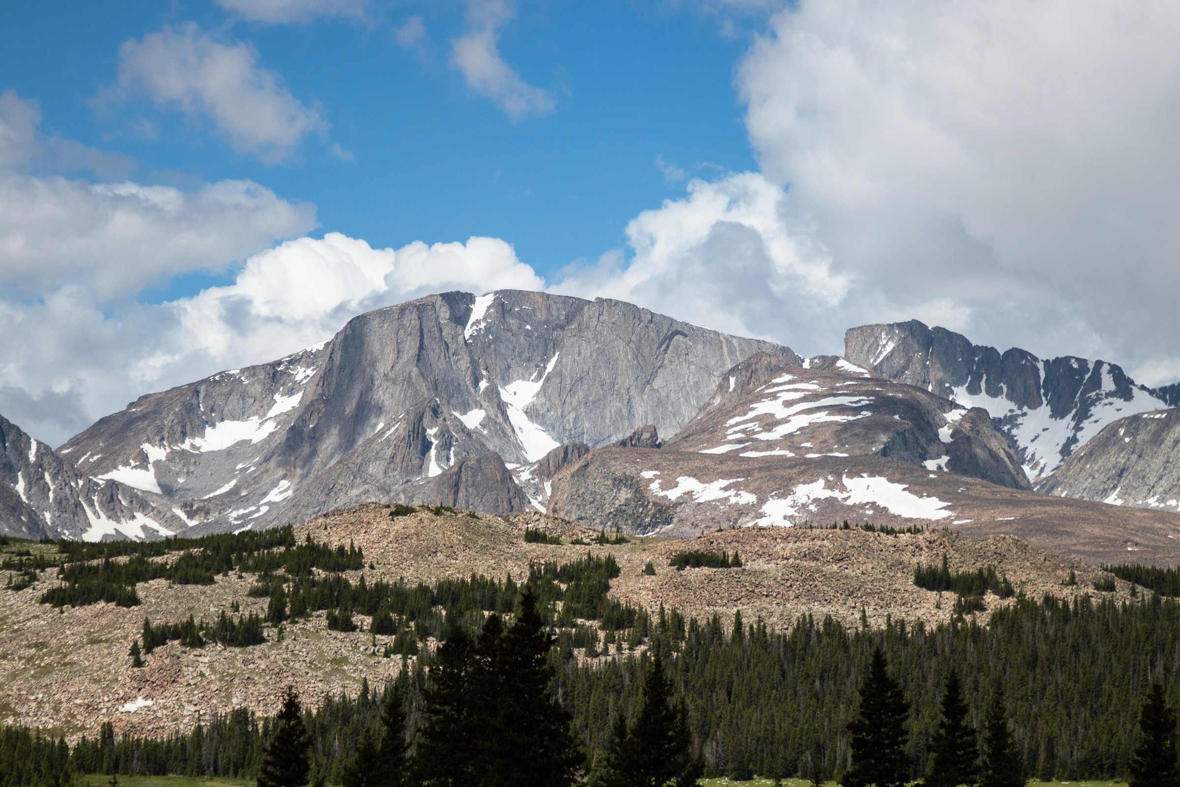
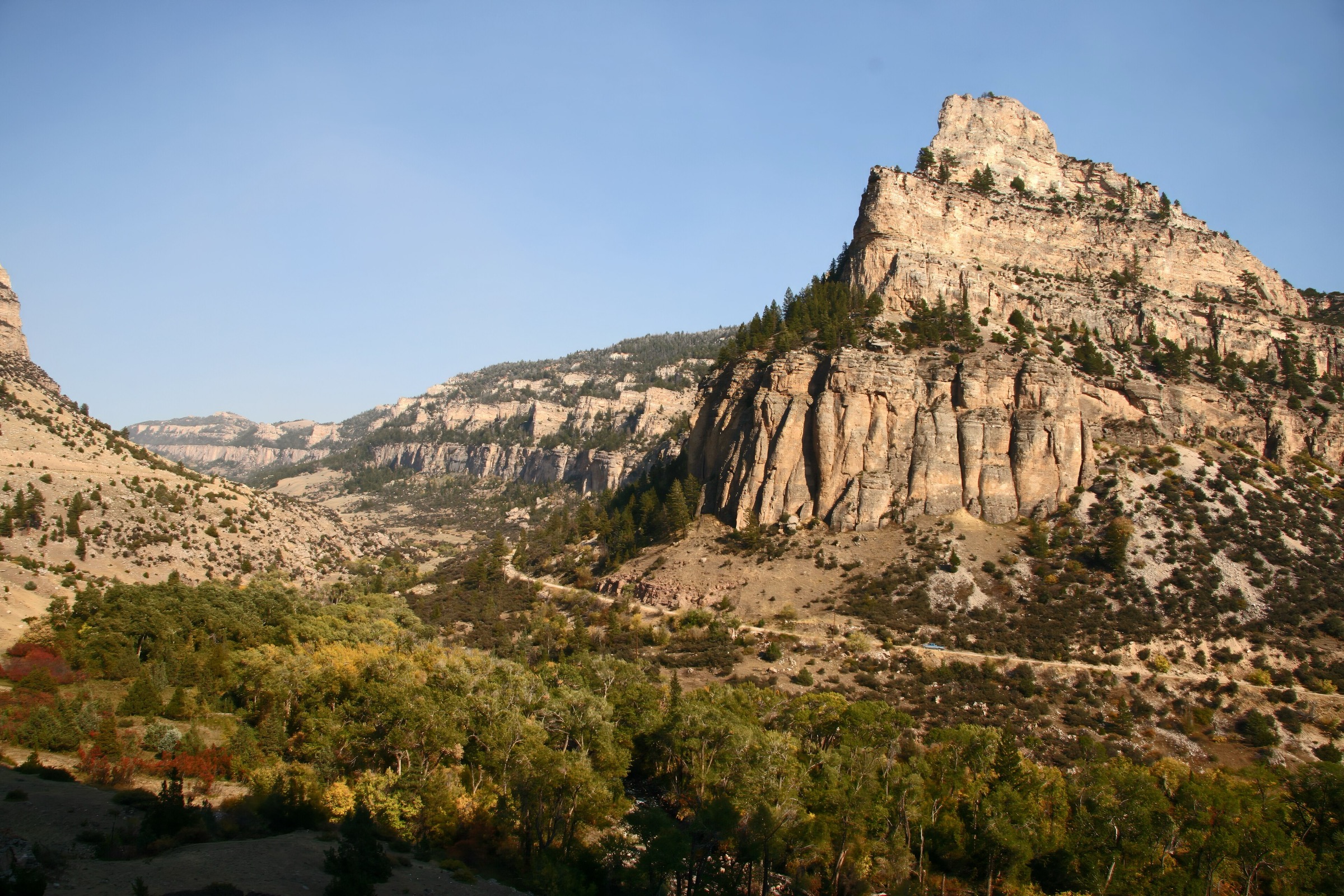
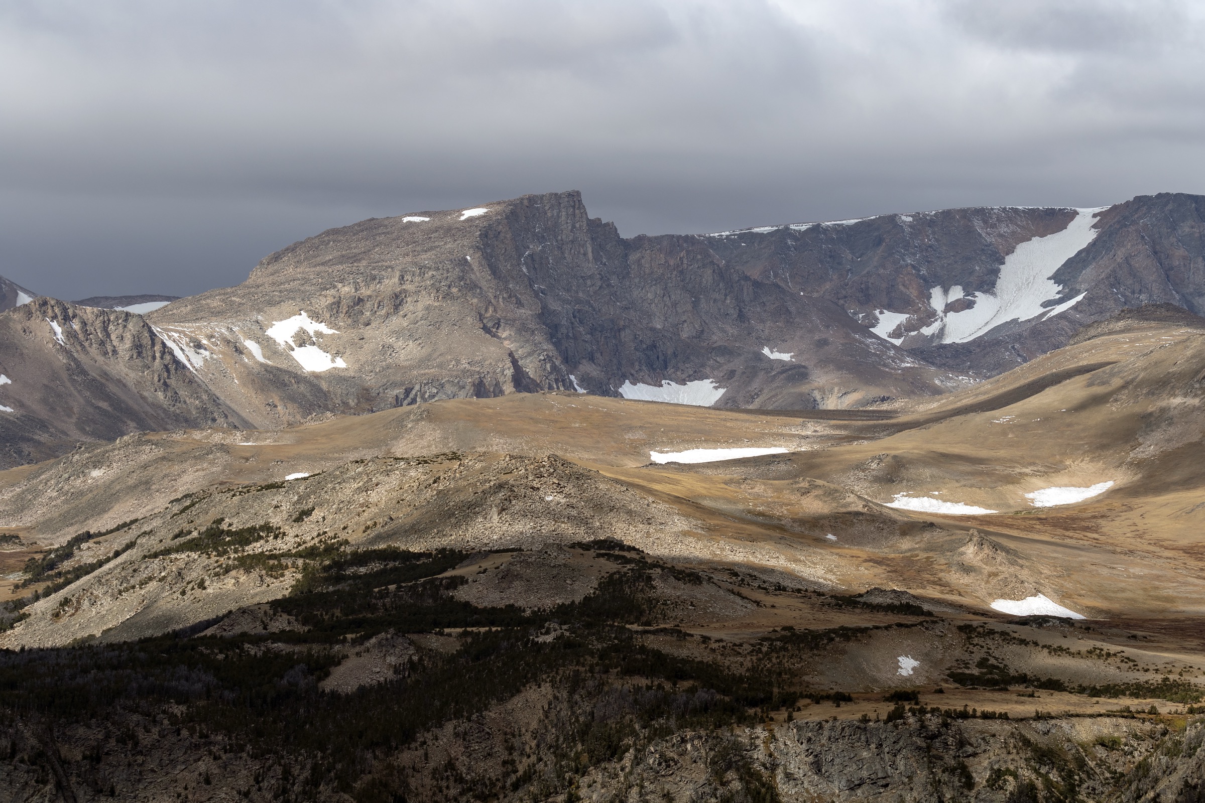
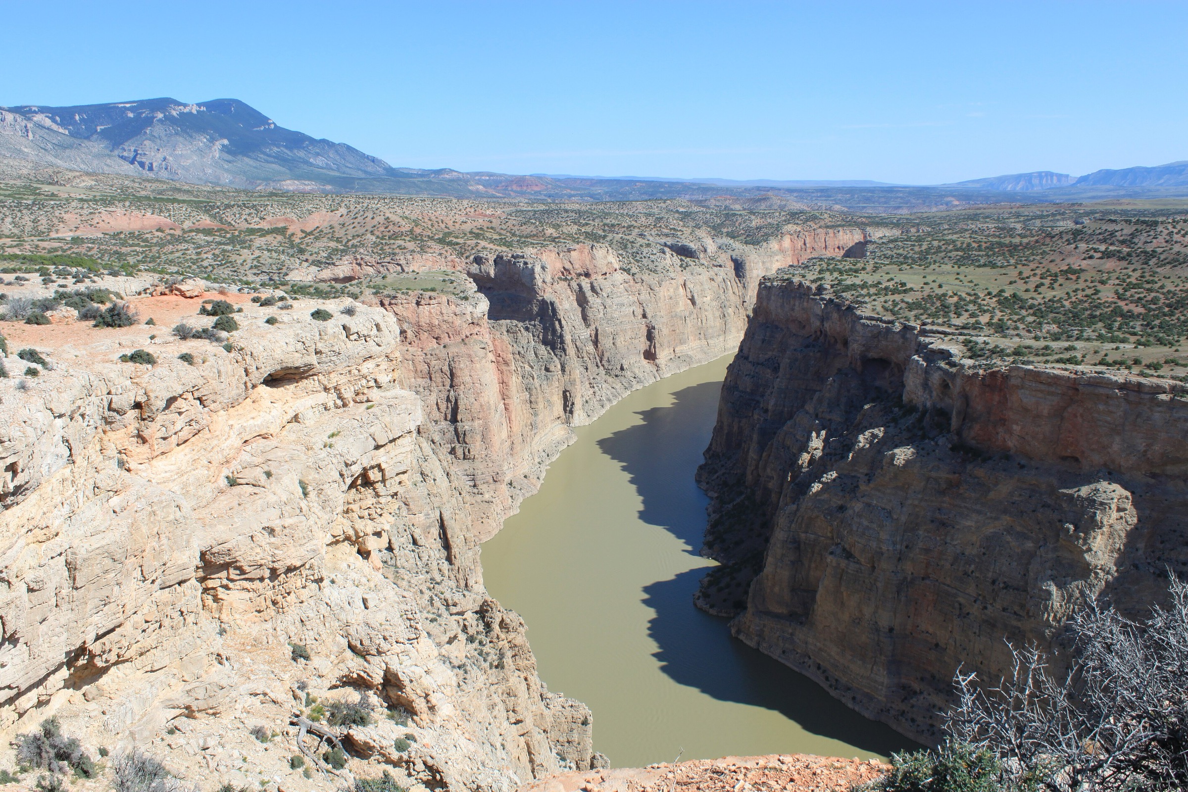
The northern Bighorn Mountains rise from the sagebrush and grasslands of the Bighorn Basin and the Powder River country, capped by the sub-alpine plateau along US-14 and US-14A between Burgess Junction, Dayton and Lovell. The zone treated here runs from the Wyoming–Montana state line south to the Cloud Peak Wilderness boundary and covers the high country crossed by the two northern trans-range highways, the eastern escarpment above Dayton and Sheridan, and the deep limestone gorges of the western flank around Bighorn Canyon National Recreation Area. Elevations range from roughly 1,100 m at the mouth of Bighorn Canyon to 2,943 m (9,655 ft) on Bald Mountain and 3,088 m (10,133 ft) on Black Mountain.
The main hiking centres are Burgess Junction — the sub-alpine plateau on US-14 near the Burgess Ranger Station — and Sibley Lake, Prune Creek and North Tongue campgrounds, all along US-14 between Dayton and Burgess. On the north-west edge, the Medicine Wheel / Medicine Mountain National Historic Landmark on FSR 12 off US-14A is the single most culturally significant site in the range and one of the most important pre-contact stone constructions in North America. On the south-western descent from US-14A, Porcupine Falls and Bucking Mule Falls sit in the deep-cut limestone of Big Horn Canyon and Devil Canyon. Terrain is a mixture of sub-alpine plateau, limestone escarpment, glaciated tarns on the higher ground, and deep canyons on the western descent. Snow lingers on Bald Mountain and along US-14A into late June, and the highways commonly open only in mid-to-late May depending on the year.
Cultural, legal and safety context matters more here than in most of the range. The Medicine Wheel National Historic Landmark is a sacred site actively used by Northern Plains tribes for ceremony; visitor conduct is governed by a Historic Preservation Plan (HPP) developed in cooperation with tribal representatives. The site is closed to the public during ceremonies. Do not touch, disturb, or remove any of the stones. Do not tie prayer cloths or offerings unless invited to do so. Photography of ceremonies is not permitted; general landscape photography is allowed when the site is open. On the western canyons — Porcupine, Bucking Mule, Devil Canyon — access roads (FSR 13, FSR 14) are unpaved, seasonal, and can be rough after rain. Wildlife includes black bear, moose, elk, mule deer and pronghorn; rattlesnakes are common on the western canyon rims below approximately 1,800 m. Cell coverage is limited across the plateau and absent in the canyons.
See also: Southern Bighorns · Cloud Peak Wilderness.
Selection rationale
The five hikes cover the cultural centre-piece of the range, two waterfall descents on the western escarpment, a signature east-side canyon walk, and a short, high sub-alpine summit. Medicine Wheel is the required cultural anchor. Porcupine Falls and Bucking Mule Falls are the two canonical western waterfall walks off US-14A, each with a distinct character — Porcupine is a steep short plunge to a plunge pool, Bucking Mule an overlook onto a 200-foot drop into Devil Canyon. Tongue River Canyon from the Dayton trailhead is the standard eastern gorge walk into the Cloud Peak Wilderness edge. Steamboat Point is the short high summit that gives the plateau’s clearest single-summit view. Route notes were cross-checked against USFS Bighorn National Forest recreation pages, the Medicine Wheel HPP, and the Wyoming Trails site.
Summary table
| # | Hike | Country | Route type | Distance | Gain | Max elevation | Difficulty |
|---|---|---|---|---|---|---|---|
| 1 | Medicine Wheel National Historic Landmark | USA | Out-and-back (walk-in only) | ~4.8 km | ~90 m | ~2,940 m | Easy |
| 2 | Porcupine Falls | USA | Out-and-back | ~1.3 km | ~120 m | ~2,300 m | Easy but steep |
| 3 | Bucking Mule Falls (Devil Canyon rim) | USA | Out-and-back | ~5.5 km | ~180 m | ~2,340 m | Easy to moderate |
| 4 | Tongue River Canyon from Dayton | USA | Out-and-back | ~9–13 km | ~250–400 m | ~1,700 m | Moderate |
| 5 | Steamboat Point | USA | Out-and-back | ~2.4 km | ~180 m | ~2,610 m | Easy but steep |
1. Medicine Wheel National Historic Landmark
Snapshot
Itinerary
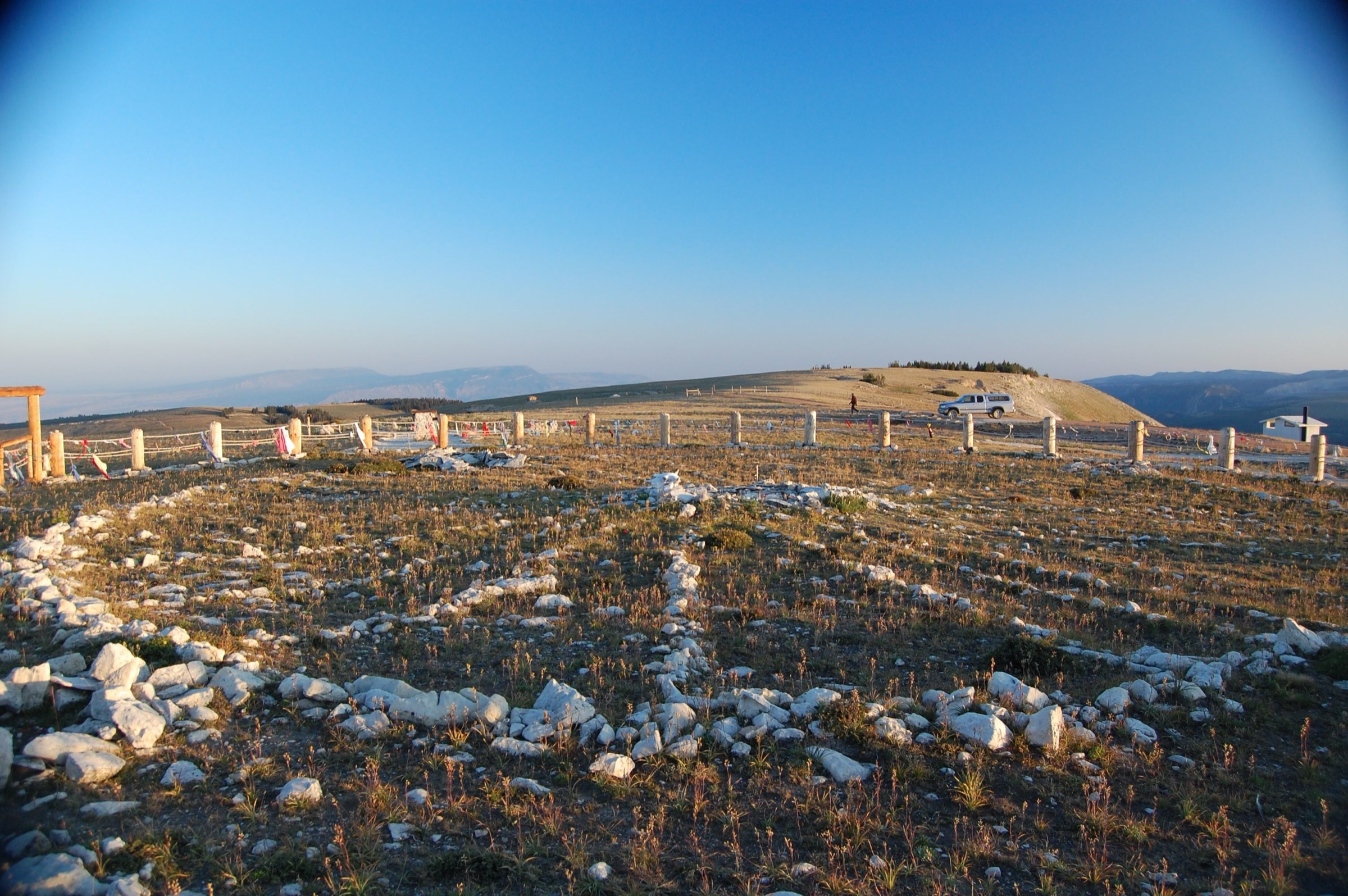
The site is accessed from a designated parking area on FSR 12, a short spur off US-14A on the north-west flank of Medicine Mountain. From the parking area, a gated gravel administrative track — the same one used by USFS interpretive staff — leads roughly 2.4 km south-east across open alpine tundra to the wheel itself. No private vehicle traffic is permitted beyond the gate; visitors walk the full distance. The wheel sits on the summit plateau of Medicine Mountain at approximately 2,940 m, a low ring of stones approximately 24 m across with 28 radiating spokes and a central cairn. Interpretive materials at the parking area and site are prepared in cooperation with tribal representatives. Return is on the same track back to the parking area.
Why it is essential
The Bighorn Medicine Wheel is the most significant single cultural site in the range — a Northern Plains stone construction of pre-contact origin, actively used for ceremony today, and one of the largest and best-preserved medicine wheels in North America. It is a National Historic Landmark and part of the Medicine Wheel / Medicine Mountain Historic Preservation Plan agreed between the USFS, the Advisory Council on Historic Preservation, the Wyoming SHPO, and Northern Plains tribal partners.
Equipment
- Trail shoes; the track is graded gravel
- Rain jacket, warm layer, and wind layer — the summit plateau is fully exposed
- Sun protection and water
- Optional binoculars for landscape and wildlife
- Nothing to leave at the site; do not bring flowers, tobacco or other offerings unless a tribal cultural monitor invites you to do so
Hazards and notes
- The site is closed to public access during ceremonies. Do not enter closed periods. Watch for USFS closure signage on FSR 12 and at the gate.
- Do not touch, move, remove or add stones. Do not tie prayer cloths or offerings on the site’s protective barrier fence.
- Photography of ceremonies and of tribal participants is not permitted; general landscape photography is allowed when the site is open.
- No dogs, no drones. Group behaviour must remain quiet and respectful.
- The plateau is fully exposed to weather; storms build fast and cold linger into late June.
- US-14A is closed in winter and typically opens in mid-May.
GPX / route file
| Source | URL | Format | Notes |
|---|---|---|---|
| USFS Bighorn — Medicine Wheel NHL | fs.usda.gov | Web page | Official managing authority |
| National Park Service — Medicine Wheel NHL | npgallery.nps.gov | Web page | Landmark record |
| CalTopo — Medicine Mountain | caltopo.com | Web map | Route geometry |
Sources
- USFS Bighorn — Medicine Wheel National Historic Landmark
- National Park Service — Medicine Wheel NHL record
- Advisory Council on Historic Preservation — Medicine Wheel HPP
2. Porcupine Falls
Snapshot
Itinerary
The trail leaves a small parking area on FSR 146, itself reached by FSR 13 off US-14A on the western descent from Medicine Mountain. From the trailhead, a graded track drops in steep switchbacks and short flights of steps down the north bank of Porcupine Creek to a viewing area at the base of Porcupine Falls, a single plunge of approximately 60 m (200 ft) into a rock-walled amphitheatre. The full descent is only about 650 m one-way, but the loss of elevation is sustained and gained again immediately on the return. Return is on the same line.
Why it is essential
Porcupine Falls is the single most-photographed waterfall in the Bighorn National Forest and the canonical short-descent waterfall walk on the western escarpment. The falls itself sits in a small, sharp limestone bowl, unusual in a range dominated by open sub-alpine plateau, and the walk delivers the falls with minimal committing distance. It is a natural pair with Bucking Mule Falls on the same day trip.
Equipment
- Trail shoes or boots — the descent is uneven and can be greasy after rain
- Rain jacket and warm layer
- Water and snacks
- Sun protection at the trailhead; the bowl at the base of the falls is shaded
- Optional walking poles for the return climb
Hazards and notes
- The descent is sustained and steep — the return will feel harder than the distance suggests.
- Steps and switchbacks can be wet and slick, particularly after rain or in early season melt.
- Access roads (FSR 13, FSR 146) are unpaved and become rough after rain. Check road status before travel.
- No swimming or wading in the plunge pool; the base is a small, cold amphitheatre with limited standing room.
- Bear and moose activity along Porcupine Creek.
GPX / route file
| Source | URL | Format | Notes |
|---|---|---|---|
| USFS Bighorn — Porcupine Falls | fs.usda.gov | Web page | Official managing authority |
| CalTopo — Porcupine Creek | caltopo.com | Web map | Route geometry |
| AllTrails — Porcupine Falls | alltrails.com | Web page | Distance and elevation cross-check |
Sources
3. Bucking Mule Falls and the Devil Canyon rim
Snapshot
Itinerary
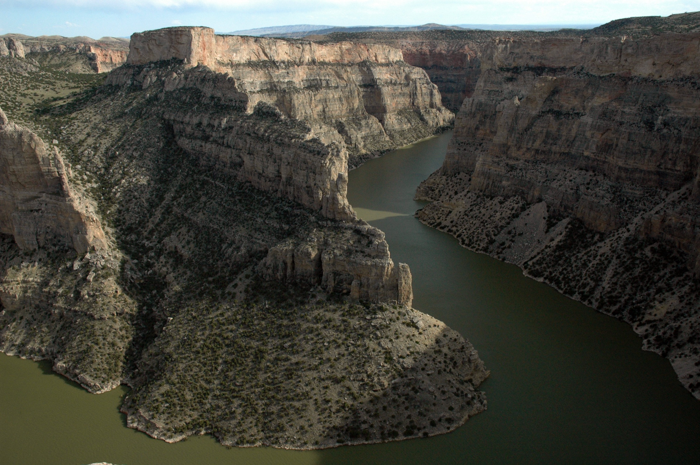
The trail leaves the Bucking Mule Falls Trailhead on FSR 14 above the Devil Canyon rim and follows Trail #100 north across open sagebrush-meadow and mixed forest. The route is broadly flat for the first 2 km before a short steepening as it approaches the canyon rim. The overlook, protected by a rail, gives a full view onto Bucking Mule Falls — a single free drop of approximately 60 m (200 ft) into the head of Devil Canyon — and a broad view down-canyon toward the Devil Canyon Overlook of Bighorn Canyon NRA. Return is on the same line. A longer through-trail continues north toward the Devil Canyon system for backcountry hikers, but the overlook is the standard day-hike turn-around.
Why it is essential
Bucking Mule Falls is the second essential western waterfall and, unlike Porcupine, is a rim-side overlook onto a free 60-metre drop into a limestone canyon. It sits at the head of Devil Canyon and connects the plateau country of the northern Bighorns to the deeper canyon system of Bighorn Canyon National Recreation Area on the west. It is the natural half-day pair with Porcupine Falls on any US-14A trip.
Equipment
- Trail runners or light boots
- Rain jacket and warm layer
- Water (1.5–2 L; no reliable water on the route)
- Sun protection — most of the route is exposed
- No dogs off-lead near the overlook
Hazards and notes
- The rim overlook is exposed; keep clear of the edge and stay within the railing.
- FSR 14 is unpaved, seasonal, and rough in patches; passable to 2WD in dry conditions but check status.
- Rattlesnakes are documented on the lower rim below approximately 1,800 m.
- Storms build fast on the plateau in the afternoon; no natural shelter on the route.
- The through-trail beyond the overlook enters wilderness-quality country and requires navigation and self-sufficiency; do not extend without preparation.
GPX / route file
| Source | URL | Format | Notes |
|---|---|---|---|
| USFS Bighorn — Bucking Mule Falls Trail | fs.usda.gov | Web page | Official managing authority |
| NPS — Bighorn Canyon NRA | nps.gov | Web page | Adjacent NRA management |
| CalTopo — Devil Canyon rim | caltopo.com | Web map | Route geometry |
Sources
4. Tongue River Canyon from Dayton
Snapshot
Itinerary
The trail leaves the Tongue River Canyon Trailhead west of Dayton at approximately 1,300 m and heads west up the north bank of the Tongue River into the gorge. Vertical limestone walls close in quickly; the river is loud through the lower canyon and the trail is at times cut into the cliff base. The route passes several small caves — some of them named on USFS maps — and follows the river bank on a broadly rising grade. Walkers can turn around at any point; common turn-arounds are the first significant creek confluence at approximately 4.5 km one-way, or the upper gorge where the trail joins the wider Bighorn National Forest trail system at approximately 6.5 km. Return is on the same line to the trailhead.
Why it is essential
Tongue River Canyon is the signature east-side gorge of the northern Bighorns and one of the most dramatic limestone canyons in Wyoming outside the Bighorn Canyon system. The walk delivers vertical rock, a big loud river, cave overhangs, and — near the trailhead — the mouth of the canyon looking east across the Sheridan plain. It is the standard low-elevation half-day walk on the east side and the natural counterpart to Steamboat Point above.
Equipment
- Sturdy trail shoes or light boots — the tread is rocky and can be wet
- Rain jacket and warm layer
- Water (2 L; treat river water only)
- Sun protection at the mouth; the upper gorge is shaded
- Bear spray — bears are documented in the canyon
- Head-torch if planning to enter caves; caves have loose rock and low ceilings and are not maintained
Hazards and notes
- Rockfall risk from the limestone walls; do not linger under overhanging sections after freeze-thaw or heavy rain.
- The river is fast and cold. Do not attempt to cross above the trailhead in high water.
- Rattlesnakes are common on the sunny south-facing lower canyon slopes.
- Caves are unmaintained; entry is at own risk and lighting is essential.
- No dogs off-lead. Bear and moose activity in the upper gorge.
GPX / route file
| Source | URL | Format | Notes |
|---|---|---|---|
| USFS Bighorn — Tongue River Canyon | fs.usda.gov | Web page | Official managing authority |
| Sheridan Travel and Tourism — Tongue River Canyon | sheridanwyoming.org | Web page | Access notes |
| CalTopo — Tongue River Canyon | caltopo.com | Web map | Route geometry |
| AllTrails — Tongue River Canyon Trail | alltrails.com | Web page | Distance and elevation cross-check |
Sources
5. Steamboat Point
Snapshot
Itinerary
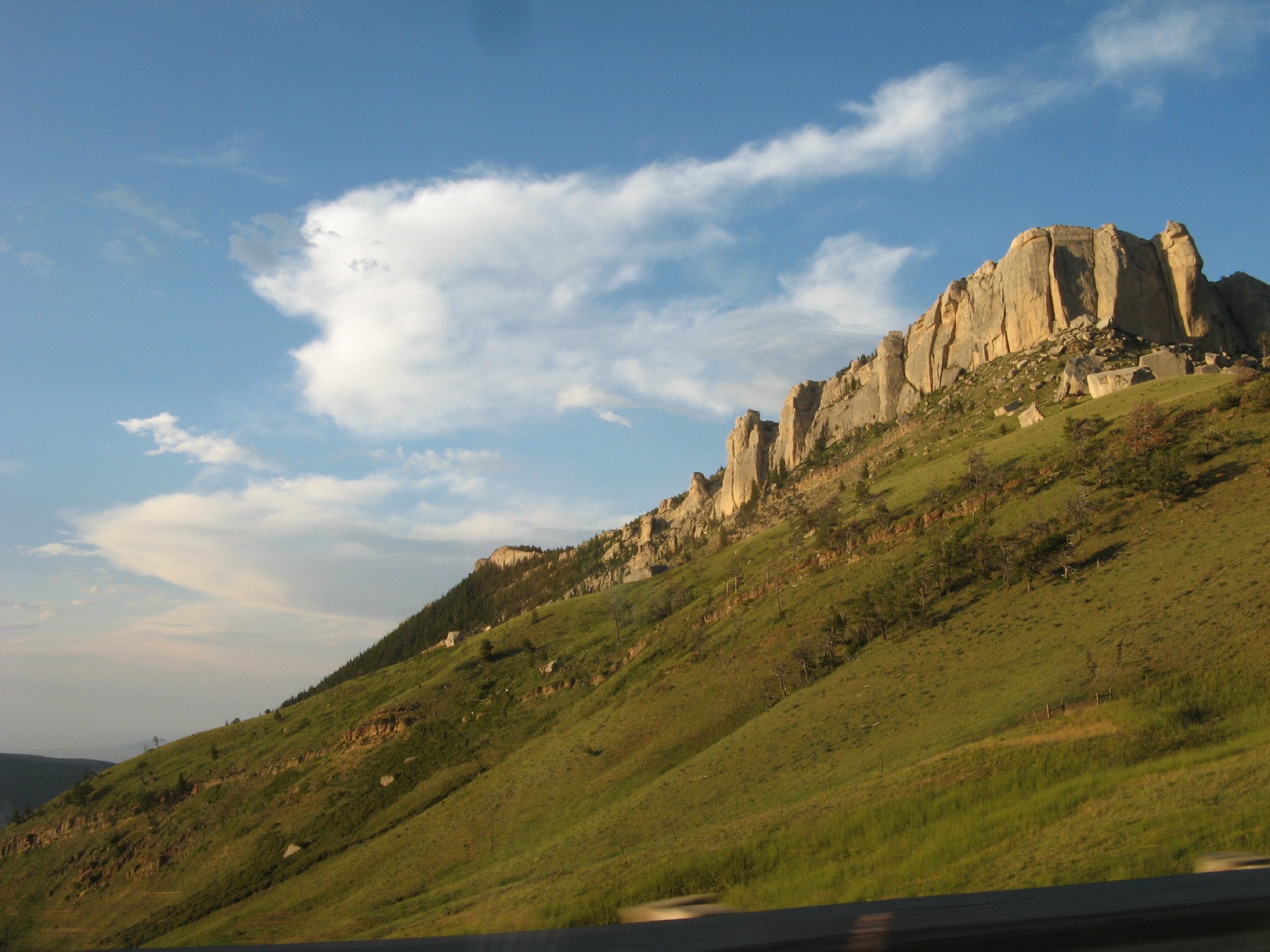
The path starts from a small unmarked pullout on the north side of US-14 directly below Steamboat Point, the prominent limestone prow that rises above the highway approximately 15 km east of Burgess Junction. The trail is short but steep, climbing directly up the south-east ridge through open sub-alpine meadow, scattered spruce, and short rocky steps to the summit at approximately 2,610 m. From the top the view runs south across the Cloud Peak plateau, east across the Powder River country to the Sheridan plain, and north along the escarpment. Return is on the same line back down to the highway pullout.
Why it is essential
Steamboat Point is the shortest signature summit walk on the eastern flank of the Bighorns and the walk that most cleanly delivers the range’s north-south scale in one panorama. It is visible from US-14 as the prow that gives the sub-region its landmark identity, and the summit itself sits above the escarpment with unobstructed views in every direction. It is the natural short-summit counterpart to the Tongue River Canyon walk below.
Equipment
- Sturdy trail shoes; the tread is rough and steep
- Rain jacket and warm layer
- Water (1 L)
- Sun protection at the summit
- Optional walking poles for the descent
Hazards and notes
- The trail is unsigned and informal; do not rely on trailhead markers.
- Steep grade; slippery when wet.
- The summit is fully exposed; storms build quickly and there is no shelter.
- Highway parking is a small pullout; do not park on the highway itself.
- No dogs off-lead near cliff edges at the summit.
GPX / route file
| Source | URL | Format | Notes |
|---|---|---|---|
| USFS Bighorn — Recreation index | fs.usda.gov | Web page | Official managing authority |
| CalTopo — Steamboat Point | caltopo.com | Web map | Route geometry |
| AllTrails — Steamboat Point | alltrails.com | Web page | Distance and elevation cross-check |
Sources
Region-level sources
| Source | URL |
|---|---|
| USFS Bighorn National Forest | fs.usda.gov |
| USFS Bighorn — Medicine Wheel NHL | fs.usda.gov |
| USFS Bighorn — Porcupine Falls | fs.usda.gov |
| USFS Bighorn — Bucking Mule Falls | fs.usda.gov |
| USFS Bighorn — Tongue River Canyon | fs.usda.gov |
| USFS Bighorn — Recreation index | fs.usda.gov |
| NPS — Bighorn Canyon NRA | nps.gov |
| National Park Service — Medicine Wheel NHL record | npgallery.nps.gov |
| Sheridan Travel and Tourism | sheridanwyoming.org |
| Wikipedia — Bighorn Medicine Wheel | en.wikipedia.org |
| Wikipedia — Steamboat Point (Wyoming) | en.wikipedia.org |
Further reading
- Cloud Peak Wilderness — essential day-hikes — the alpine core of the Bighorns with Mistymoon, Lost Twin Lakes, and Cloud Peak Glacier
- Southern Bighorns — essential day-hikes — the US-16 corridor with Ten Sleep Canyon, Meadowlark Lake, and Saban Lookout
Missing data / follow-up work
- The Medicine Wheel is a sacred site actively used for ceremony. Public access can be closed at short notice and photography restrictions apply during ceremonies. Confirm current status with the Bighorn National Forest Medicine Wheel Ranger District before travel.
- No licence-compatible images of Porcupine Falls or Tongue River Canyon were located in this pass. The Bucking Mule Falls figure is a rim-context photograph of Devil Canyon rather than of the falls itself.
- The USFS does not publish downloadable GPX or KML for Bighorn trails. Route geometry must be exported from OpenStreetMap or CalTopo.
- Tongue River Canyon distance depends on turn-around choice; treat the 9–13 km range as indicative only.
- Access roads FSR 13 and FSR 14 (western canyon walks) are seasonal and become rough after rain. Verify condition with the Bighorn National Forest before travel.
- Steamboat Point is not signed and does not appear on official USFS trail maps as a maintained route; it is a well-known informal walk. Use topographic map and GPS.