Regional overview
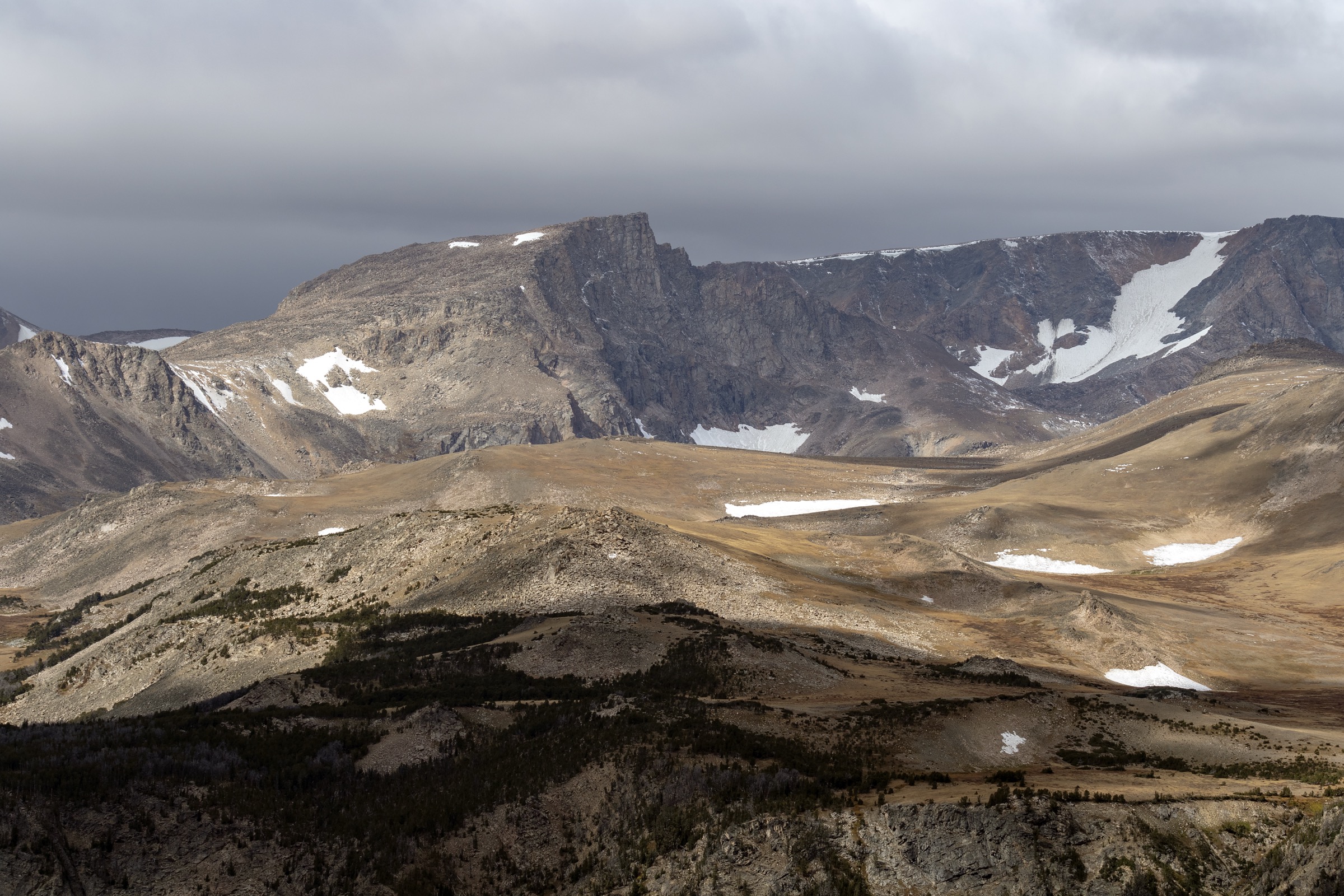
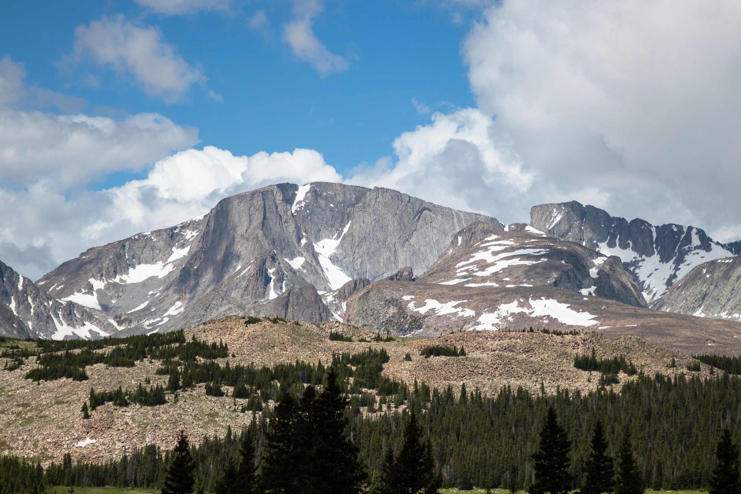
Cloud Peak Wilderness protects roughly 189,000 acres (766 km²) of alpine granite along the crest of the Bighorn Mountains in north-central Wyoming, designated by the Wyoming Wilderness Act of 1984 and managed by the Bighorn National Forest. Cloud Peak itself, at 4,013 m (13,166 ft), is the highest point in the Bighorns and the centrepiece of a compact alpine core of glaciated cirques, granite walls, and clear tarns strung along the West Tensleep, Paint Rock, Clear Creek and Rock Creek drainages. The wilderness holds the range’s only remaining named glacier — Cloud Peak Glacier — on the north face of the summit.
Access is from both flanks of the range. The main west-side trailhead is West Tensleep, at the end of Forest Service Road 27 off US-16, which serves the classic Mistymoon and Lost Twin Lakes routes at approximately 2,774 m (9,101 ft). The main east-side trailheads are Circle Park (off US-16 west of Buffalo, ~2,650 m) for Sherd Lake and Poacher Lake, and Hunter Trailhead further north for Elk Lake and the Ant Hill approach. Battle Park and Coffeen Park sit high on the west and east respectively but see less traffic. All of these routes cross the wilderness boundary within one mile of the trailhead in most cases; walkers looking for front-country lakes and shorter forest walks should consult the sister catalogues for the Northern Bighorns and Southern Bighorns.
The reliable snow-free walking season is mid-July to mid-September. Access roads are commonly closed by snow into late June, and passes above 3,000 m can hold snow into July in cool years. Afternoon thunderstorms are the dominant summer hazard; standard practice is to be off exposed ridges and lakeshores by early afternoon. Both black bears and, in recent years, occasional grizzly bears have been documented in the West Tensleep drainage — carry spray and use bear-aware food handling on any long day.
Wilderness regulation is strict. All visitors must complete a free, self-issued wilderness registration at the trailhead (USFS Special Order BNF-2021-01). Group size is limited to 10 people, and larger groups must split and travel at least 0.5 mi apart. Campfires are prohibited above 9,200 ft (2,804 m) — which covers essentially every lake in this catalogue — so stoves only. Bikes, drones and any mechanised or motorised travel are prohibited under the federal Wilderness Act. Dogs must be under voice control at all times. Pack and saddle stock are restricted from within 100 ft of lakes and streams except when loading or unloading.
Selection rationale
The five walks sample both flanks of the range and cover an easy short introduction, two moderate lake destinations, a full alpine day, and a distinctive east-side approach. Sherd Lake from Circle Park is the short east-side wilderness introduction, crossing the boundary within a mile and reaching a forested tarn without significant elevation gain. Lost Twin Lakes from West Tensleep is the classic cirque destination — a moderate west-side day into a hanging glacial basin beneath granite walls. Mistymoon Lake, also from West Tensleep, is the flagship alpine route: a long day through the Lake Helen chain to an open cirque below Cloud Peak’s south flank. Lake Solitude is the natural extension of the Mistymoon route, adding the Fortress Lake basin and reaching one of the most remote lake shores in the range accessible in a single day. Elk Lake from Hunter Trailhead closes the selection as the east-side alpine destination that stays outside the Mistymoon corridor. Reference material was verified against USFS Bighorn National Forest trail pages, the Cloud Peak Wilderness regulations bulletin, and CalTopo mapping.
Summary table
| # | Hike | Country | Route type | Distance | Gain | Max elevation | Difficulty |
|---|---|---|---|---|---|---|---|
| 1 | Sherd Lake from Circle Park | USA | Out-and-back | ~5.6 km | ~175 m | ~2,830 m | Easy |
| 2 | Lost Twin Lakes from West Tensleep | USA | Out-and-back | ~17.9 km | ~630 m | ~3,200 m | Moderate |
| 3 | Mistymoon Lake from West Tensleep | USA | Out-and-back | ~22.5 km | ~490 m | ~3,120 m | Strenuous |
| 4 | Lake Solitude via Mistymoon | USA | Out-and-back | ~26 km | ~700 m | ~3,180 m | Very strenuous |
| 5 | Elk Lake from Hunter Trailhead | USA | Out-and-back | ~10–13 km | ~500–700 m | ~3,000 m | Moderate |
1. Sherd Lake from Circle Park
Snapshot
Itinerary
The trail leaves Circle Park Trailhead at approximately 2,650 m and heads south-west through coniferous forest and open meadow, crossing the Cloud Peak Wilderness boundary at approximately 1.3 km. The wilderness sign marks the point at which registration must be completed and mechanised travel becomes prohibited. From the boundary the trail continues on a gentle grade to Sherd Lake at 2.8 km, a forested tarn under the low sub-alpine ridge that separates the Sherd and South Fork Ponds drainages. Return is on the same line to the trailhead. Walkers with time to spare can extend the walk into a full loop via Trail #095 through South Fork Ponds and back to Circle Park — approximately 12.5 km with an additional 200 m of gain.
Why it is essential
Sherd Lake is the easiest way into the Cloud Peak Wilderness on foot. It is the short east-side introduction that a visitor without the fitness or time for the long west-side classics can complete in an afternoon, and the walk that most cleanly demonstrates the sub-alpine transition between Bighorn National Forest general country and designated wilderness. It is also the standard family-friendly route in the wilderness catalogue.
Equipment
- Trail runners or light boots
- Rain jacket and warm layer — afternoon storms build fast
- Water (1.5 L)
- Bear spray — black bears active, grizzly presence documented
- Sun and wind protection at the lake
- Wilderness registration (free, self-issued at trailhead)
Hazards and notes
- Afternoon thunderstorms build quickly through July and August; plan the walk for morning.
- Bears are active; carry spray and use bear-aware food handling.
- Wilderness registration is mandatory; group size limited to 10.
- Campfires prohibited above 9,200 ft (2,804 m) — Sherd Lake is above this line, so stoves only.
- FSR 20 (Circle Park access) opens after spring melt and closes with early snow.
GPX / route file
| Source | URL | Format | Notes |
|---|---|---|---|
| USFS Bighorn — Sherd Lake Loop Trail #046 | fs.usda.gov | Web page | Official managing authority |
| USFS Bighorn — Circle Park Trailhead | fs.usda.gov | Web page | Trailhead access |
| CalTopo — Cloud Peak Wilderness layer | caltopo.com | Web map | Route geometry |
| AllTrails — Sherd Lake Loop | alltrails.com | Web page | Distance cross-check only |
Sources
- USFS Bighorn National Forest — Sherd Lake Loop Trail #046
- USFS Bighorn — Cloud Peak Wilderness
- USFS Special Order BNF-2021-01 — Cloud Peak Wilderness regulations
2. Lost Twin Lakes from West Tensleep
Snapshot
Itinerary
The trail leaves West Tensleep Trailhead at approximately 2,774 m and heads south-east up the Middle Tensleep Creek drainage on Trail #065. The wilderness boundary is crossed within the first kilometre. The first half of the route climbs gently through lodgepole and meadow, passing Mirror Lake in an open basin before the grade steepens on switchbacks through spruce-fir toward the head of the drainage. The upper approach opens into a hanging glacial cirque holding the twin tarns beneath the vertical granite walls of the Bighorn crest — one of the sharpest cirque settings in the wilderness. The lakes sit at approximately 3,200 m under Darton Peak and are the standard turn-around. Return is on the same line back to West Tensleep.
Why it is essential
Lost Twin Lakes is the classic west-side cirque destination — a route that a fit walker can complete in a long day and that delivers the alpine granite character of the wilderness without the full commitment of the Mistymoon or Solitude routes. It is the walk that most cleanly frames the range’s glaciated cirque geology and the standard first alpine lake destination on a West Tensleep trip.
Equipment
- Sturdy boots
- Trekking poles for the descent
- Rain jacket, warm layer, and hat
- Water (2.5–3 L; creek water is treatable)
- Sun and wind protection at the cirque
- Bear spray
- Navigation backup
- Wilderness registration; stove only above 9,200 ft
Hazards and notes
- Afternoon thunderstorms are the dominant summer risk; start early.
- Snow lingers in the cirque into July in cool years; check conditions locally.
- Talus and scree on the final approach.
- Bears are active in the West Tensleep drainage.
- No campfires above 9,200 ft; stoves only.
- FSR 27 is unpaved but 2WD passable in dry conditions.
GPX / route file
| Source | URL | Format | Notes |
|---|---|---|---|
| USFS Bighorn — West Tensleep Trailhead | fs.usda.gov | Web page | Official managing authority |
| CalTopo — Cloud Peak Wilderness layer | caltopo.com | Web map | Route geometry |
| AllTrails — Lost Twin Lakes Trail | alltrails.com | Web page | Distance and elevation cross-check |
Sources
- USFS Bighorn National Forest — West Tensleep Trailhead
- USFS Bighorn — Cloud Peak Wilderness
- CalTopo — Cloud Peak Wilderness
3. Mistymoon Lake from West Tensleep
Snapshot
Itinerary
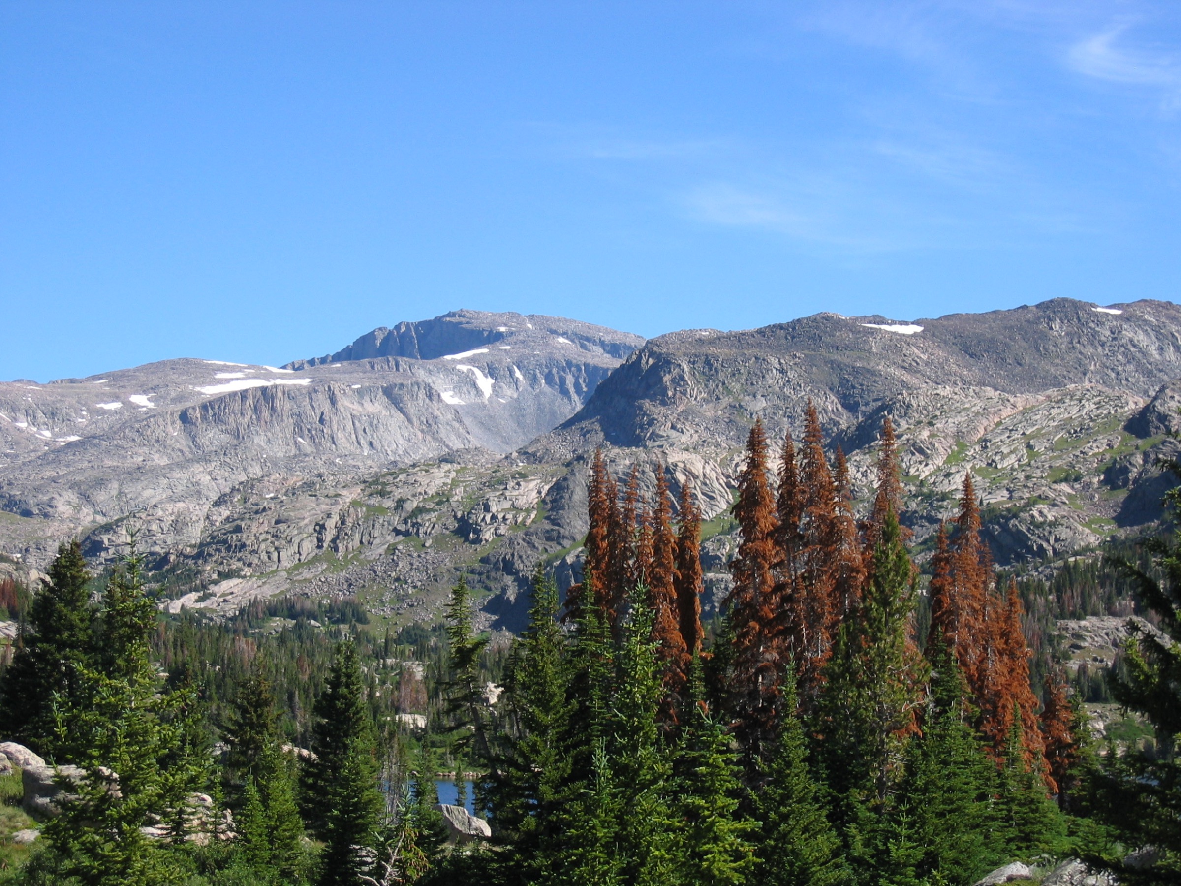
The trail leaves West Tensleep Trailhead and follows Trail #063 north-east up the West Tensleep Creek corridor through mixed spruce-fir. The route passes West Tensleep Falls at approximately 1.3 km and continues past the small Middle Tensleep Lake, then climbs to the string of Lake Helen and Lake Marion at approximately 3,000 m. The setting opens onto the alpine plateau under Bomber Mountain — named for the crew and airframe of a B-17 that crashed on the mountain in 1943 and whose wreckage remains on the ridge above. From Lake Marion the trail continues north-east across sub-alpine tundra to Mistymoon Lake at approximately 3,120 m, an open cirque tarn under Cloud Peak’s south flank. Return is on the same line back to West Tensleep. The Lake Solitude extension (Hike 4) branches north-west from the Mistymoon area onto Florence Pass.
Why it is essential
Mistymoon Lake is the flagship day-hike of Cloud Peak Wilderness — the west-side classic that most cleanly delivers Cloud Peak, Bomber Mountain, and the string of alpine lakes on a single day. It is the walk that a fit visitor can complete without the full weight of the Solitude extension, and the one route in the catalogue that puts every element of the wilderness landscape (glaciated cirque, alpine tarn, historical wreckage) into one line-of-sight approach.
Equipment
- Sturdy boots
- Trekking poles
- Rain jacket, warm layer, hat and gloves for the alpine section
- Water (3 L; treat creek water above the crossings)
- Sun and wind protection
- Bear spray
- Headtorch (long day)
- Navigation backup
- Wilderness registration; stove only above 9,200 ft
Hazards and notes
- Exposed above treeline for the last 5–6 km; storms are a serious risk after early afternoon.
- Snow lingers on Florence Pass and around Mistymoon into July.
- Bombing wreckage on Bomber Mountain: do not remove or disturb material — it is protected as a historical site.
- Bears are active; carry spray and store food.
- No campfires above 9,200 ft.
- Long day at altitude; acclimatise if possible.
GPX / route file
| Source | URL | Format | Notes |
|---|---|---|---|
| USFS Bighorn — West Tensleep Trailhead | fs.usda.gov | Web page | Official managing authority |
| CalTopo — Cloud Peak Wilderness layer | caltopo.com | Web map | Route geometry |
| AllTrails — Mistymoon Lake Trail | alltrails.com | Web page | Distance and elevation cross-check |
Sources
- USFS Bighorn National Forest — West Tensleep Trailhead
- USFS Bighorn — Cloud Peak Wilderness
- Wikipedia — Bomber Mountain
- Wikimedia Commons — Big Horn Mountains (Ttharp23)
4. Lake Solitude via Mistymoon
Snapshot
Itinerary
The route follows the Mistymoon Trail #063 approach in full — West Tensleep Trailhead through West Tensleep Falls, Middle Tensleep Lake, Lake Helen, Lake Marion, and onto the plateau below Bomber Mountain, reaching Mistymoon Lake at approximately 3,120 m and 11 km from the trailhead. From Mistymoon the route turns north-west onto Trail #038 across Florence Pass at approximately 3,180 m, then drops onto the north side of the divide into the Florence Lake basin. Lake Solitude sits in an open cirque approximately 2 km beyond the pass at 3,100 m under the north face of Cloud Peak, with a view onto Cloud Peak Glacier — the range’s only remaining named glacier. Return is on the same line back over Florence Pass and down to West Tensleep. Many walkers do this as a two-day trip with a bivouac at Mistymoon or Lake Solitude to break the elevation.
Why it is essential
Lake Solitude is the deepest lake shore that a strong day-hiker can reach in Cloud Peak Wilderness and the only route in the catalogue with a direct view of Cloud Peak Glacier. It is the walk that most cleanly delivers the north-side aspect of the range — the shaded, still-icy face of Cloud Peak — and the natural extension of the Mistymoon approach for anyone with the fitness and daylight to add the pass crossing.
Equipment
- Sturdy boots
- Trekking poles
- Full alpine layers, hat, gloves — Florence Pass carries wind and cold well into summer
- Water (4 L or treatment for creek and lake water)
- Sun and wind protection
- Bear spray
- Headtorch and spare batteries — dawn start likely
- Navigation backup and paper map
- Emergency shelter (bivvy bag)
- Microspikes early in the season for snow on Florence Pass
- Wilderness registration; stove only above 9,200 ft
Hazards and notes
- Florence Pass holds snow into July in cool years — verify current condition before departure.
- Cold-water rescue risk at the lake; keep to the shore.
- Long exposed section above treeline; storms after early afternoon are dangerous.
- Bombing wreckage on Bomber Mountain — protected historical site.
- Bear activity; food storage strict.
- Two-day itinerary is the common alternative — plan and register accordingly.
GPX / route file
| Source | URL | Format | Notes |
|---|---|---|---|
| USFS Bighorn — West Tensleep Trailhead | fs.usda.gov | Web page | Official managing authority |
| CalTopo — Cloud Peak Wilderness layer | caltopo.com | Web map | Route geometry |
| AllTrails — Solitude Lake via Mistymoon | alltrails.com | Web page | Distance and elevation cross-check |
Sources
- USFS Bighorn National Forest — West Tensleep Trailhead
- USFS Bighorn — Cloud Peak Wilderness
- Wikipedia — Cloud Peak (Wyoming)
5. Elk Lake from Hunter Trailhead
Snapshot
Itinerary
The trail leaves Hunter Trailhead and climbs steeply on Trail #024 up the flanks of Ant Hill, a broad forested shoulder that separates the Hunter Creek and Elk Lake drainages. The route gains most of its elevation in the first 3–4 km through mixed spruce-fir before easing into the upper basin holding Elk Lake at approximately 3,000 m. The lake sits in a shallow open basin under the sub-alpine ridge, with the Cloud Peak Wilderness boundary crossed early on the ascent. Moose are commonly reported around the lake basin. Return is on the same line back over the Ant Hill shoulder to Hunter. The upper route continues to Long Lake but is not treated as a day-hike here.
Why it is essential
Elk Lake is the east-side alpine destination that a walker not committed to the West Tensleep classics can reach on a single day, and the route that most cleanly balances the western catalogue with a distinct east-side approach. The Ant Hill climb is a signature grade in the eastern Bighorns and the Elk Lake basin sits in a quieter part of the wilderness than the Mistymoon corridor.
Equipment
- Sturdy boots — steep, rugged tread
- Trekking poles
- Rain jacket and warm layer
- Water (2.5–3 L)
- Sun and wind protection
- Bear spray
- Wilderness registration; stove only above 9,200 ft
Hazards and notes
- Distance and gain figures vary widely between sources; verify against USFS map before departure.
- Steep, sustained climb of Ant Hill — challenging in wet conditions.
- Afternoon storms — start early.
- Bears and moose active in the basin.
- Hunter Trailhead access is via a forest road that can be rough; check condition.
- Wilderness rules apply from the boundary onwards.
GPX / route file
| Source | URL | Format | Notes |
|---|---|---|---|
| USFS Bighorn — Cloud Peak Wilderness | fs.usda.gov | Web page | Official managing authority |
| CalTopo — Cloud Peak Wilderness layer | caltopo.com | Web map | Route geometry |
| Trailforks — Cloud Peak Wilderness | trailforks.com | Web map | Trail geometry |
Sources
- USFS Bighorn — Cloud Peak Wilderness
- CalTopo — Cloud Peak Wilderness
- Trailforks — Cloud Peak Wilderness
Region-level sources
| Source | URL |
|---|---|
| USFS Bighorn National Forest | fs.usda.gov |
| USFS Bighorn — Cloud Peak Wilderness | fs.usda.gov |
| USFS Bighorn — Special Order BNF-2021-01 | fs.usda.gov |
| USFS Bighorn — West Tensleep Trailhead | fs.usda.gov |
| USFS Bighorn — Circle Park Trailhead | fs.usda.gov |
| USFS Bighorn — Sherd Lake Loop Trail #046 | fs.usda.gov |
| USFS Bighorn — Battle Park Trailhead | fs.usda.gov |
| CalTopo — Cloud Peak Wilderness | caltopo.com |
| Trailforks — Cloud Peak Wilderness | trailforks.com |
| Wikipedia — Cloud Peak Wilderness | en.wikipedia.org |
| Wikipedia — Cloud Peak | en.wikipedia.org |
| Wikipedia — Bomber Mountain | en.wikipedia.org |
Further reading
- Northern Bighorns — essential day-hikes — the US-14 corridor with Medicine Wheel, Steamboat Point, and the Devil Canyon rim
- Southern Bighorns — essential day-hikes — the US-16 corridor with Ten Sleep Canyon, Meadowlark Lake, and Saban Lookout
Missing data / follow-up work
- Elk Lake statistics (distance, gain, maximum elevation) vary widely between sources; no primary USFS figure is published. Verify against the USFS Bighorn National Forest topographic map before travel.
- The USFS does not publish downloadable GPX or KML files for Bighorn National Forest trails. Route geometry can be exported from OpenStreetMap or CalTopo.
- No licence-compatible photographs of Lost Twin Lakes, Sherd Lake, Lake Solitude, or Elk Lake were located in this pass; only the Mistymoon corridor (Lake Helen view) has a verified public-domain image on Wikimedia Commons.
- Grizzly bear presence in the West Tensleep drainage is documented but incidental; check with the Bighorn National Forest before treating the wilderness as bear-country in the sense of Yellowstone or the Wind River Range.
- The West Tensleep drainage is inside a “pack-out human waste” regulation zone as of the 2024 season; verify current requirements before departure.
- Access roads (FSR 20 to Circle Park, FSR 27 to West Tensleep, Hunter access) commonly open late June and close with early snow; confirm current status with the Bighorn National Forest before planning.