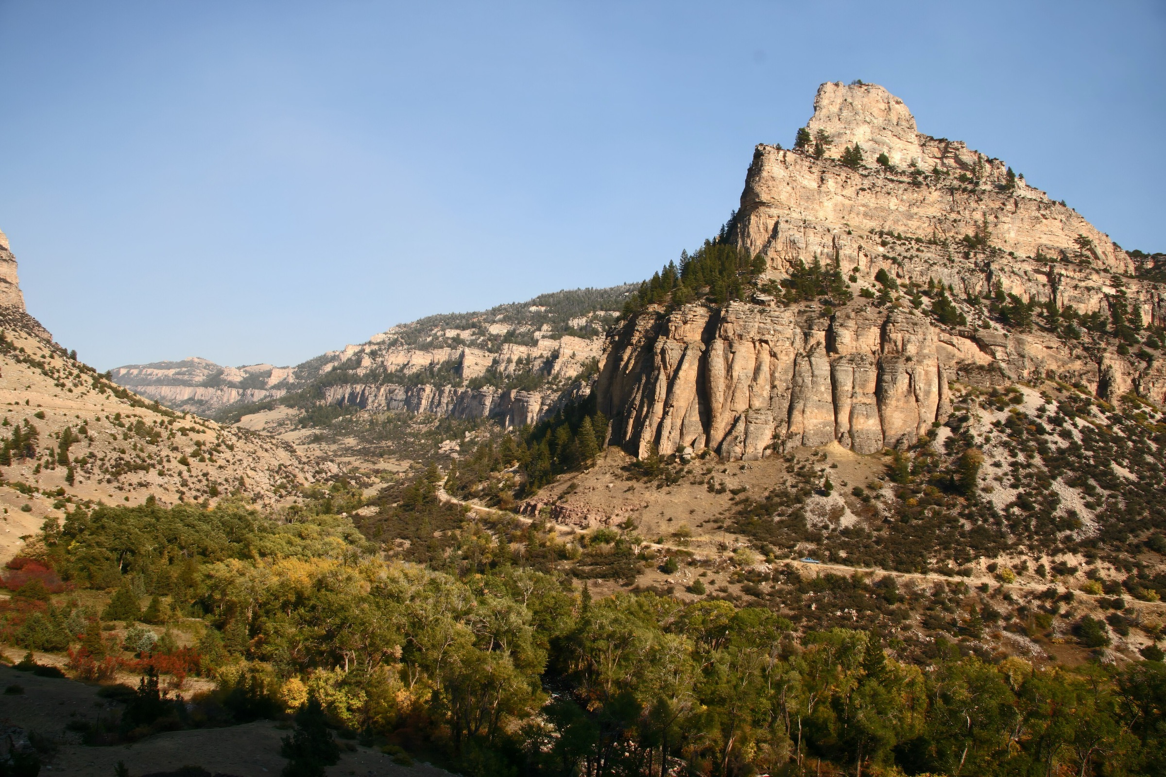
Regional overview
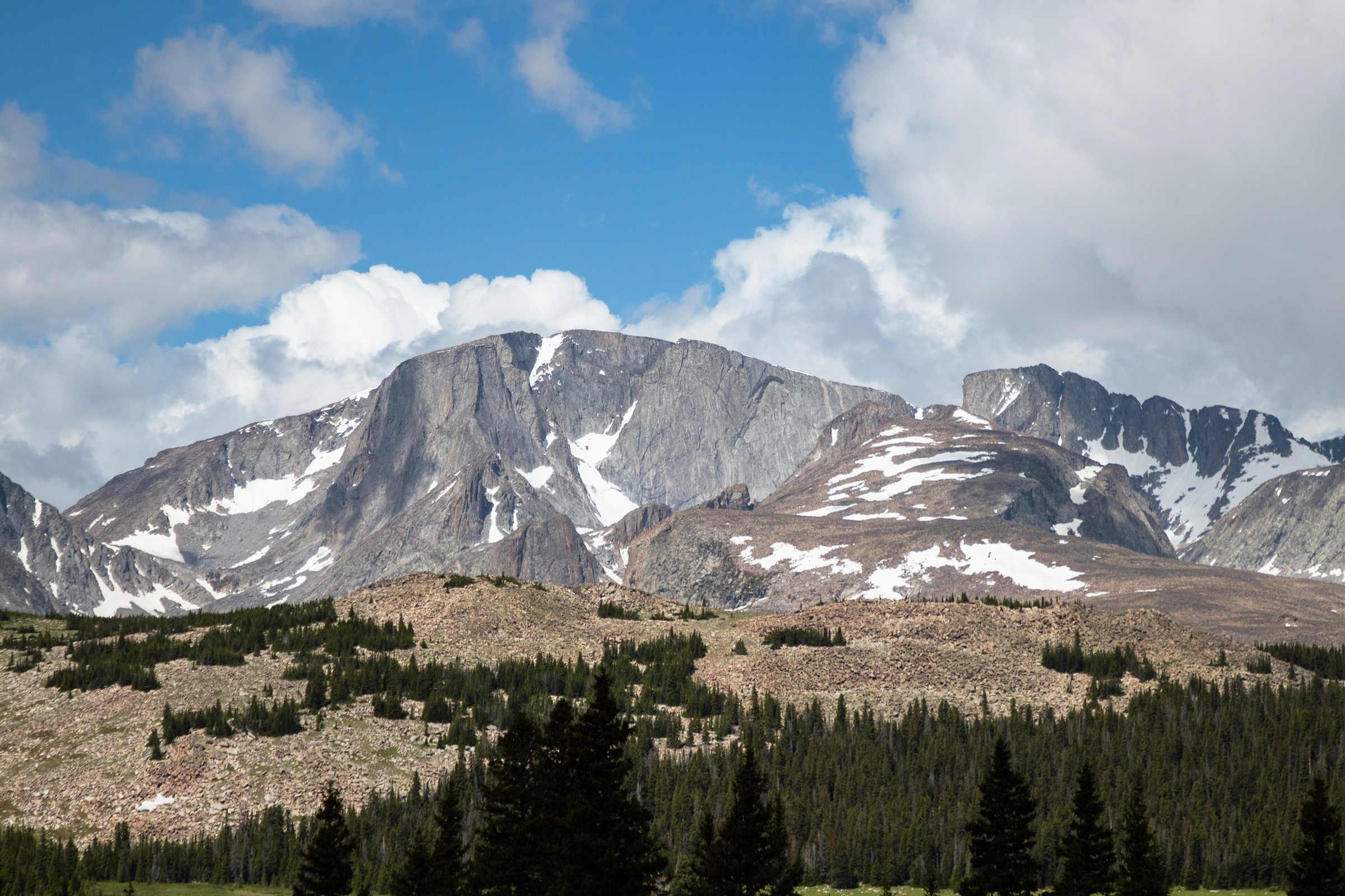
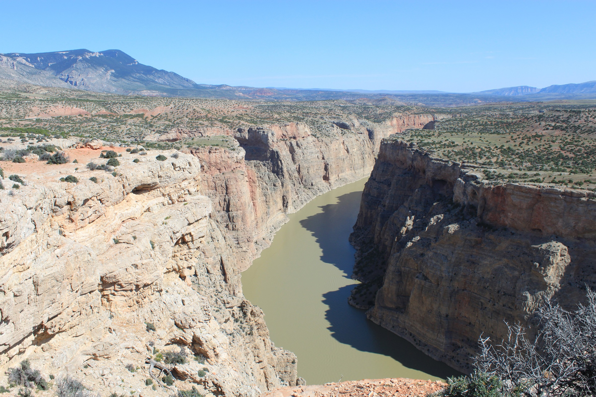
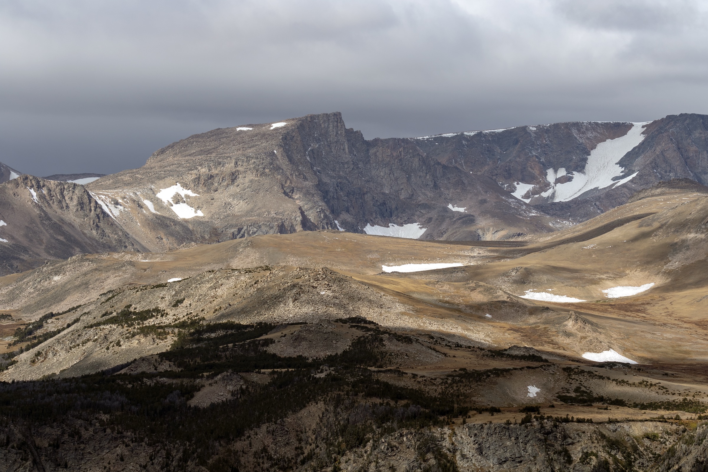
The southern Bighorn Mountains run from the Cloud Peak Wilderness boundary south to the sagebrush plains of the Powder River Basin and the Bighorn Basin, crossed by the US-16 highway between Buffalo, Powder River Pass, and the town of Ten Sleep. The zone treated here covers the plateau country on either side of Powder River Pass, the deep limestone gorge of Ten Sleep Canyon, the Meadowlark Lake basin at approximately 2,500 m, and the eastern-front foothills above Buffalo where the range meets the plain. Elevations range from roughly 1,400 m at the mouth of Ten Sleep Canyon to 2,935 m (9,630 ft) on Powder River Pass and the higher plateau near Loaf Mountain.
The main hiking centres are Meadowlark Lake, the Ten Sleep Canyon corridor along US-16, and the Powder River Pass sub-alpine plateau. West Tensleep Trailhead itself is the primary access for the Cloud Peak Wilderness west side and is covered in the Cloud Peak Wilderness article; this catalogue focuses instead on the front-country and non-wilderness walks accessible from US-16 and the Buffalo foothills. Terrain is a mixture of vertical limestone gorge, sub-alpine lake basin, open coniferous plateau, and eastern foothill sage-and-oak country. Snow lingers on the plateau into late June, and US-16 across Powder River Pass typically opens by mid-May.
Two access constraints matter here. First, Bud Love Wildlife Habitat Management Area, on the eastern foothill front north-west of Buffalo, is closed to all human presence from 1 January through 14 May each year to protect wintering elk. Any Firebox Park approach through Bud Love must respect that closure. Second, the Crazy Woman Canyon Road (FSR 33) has been subject to multi-year bridge and washout closures on the lower canyon; confirm current status with the Bighorn National Forest before planning that access. The West Tensleep drainage sits inside a “pack-out human waste” regulation zone; carry appropriate containment if travelling there. Wildlife includes black bear (with occasional grizzly incursions in the West Tensleep area), moose, elk, mule deer, and pronghorn on the lower slopes; rattlesnakes are common in Ten Sleep Canyon and the eastern foothills below 1,800 m.
See also: Northern Bighorns · Cloud Peak Wilderness.
Selection rationale
The five hikes cover the canonical Ten Sleep Canyon waterfall walk, a family-friendly shoreline lake circuit, the signature short summit-lookout of the sub-region, an eastern-front foothill walk with strict seasonal access, and a canyon-floor gorge walk on the south-eastern flank. West Tensleep Falls sits inside the Cloud Peak Wilderness pack-out zone but is included here as a Ten Sleep Canyon corridor walk rather than as a wilderness route. Meadowlark Lake is the accessible sub-alpine centrepiece of the US-16 corridor. James T. Saban Lookout is the standard short summit and fire-lookout viewpoint. Firebox Park via Bud Love is the eastern-front approach with the closure caveat. Crazy Woman Creek is the south-eastern gorge walk. Reference material was checked against USFS Bighorn National Forest recreation pages, Wyoming Game and Fish Department WHMA regulations, and CalTopo mapping.
Summary table
| # | Hike | Country | Route type | Distance | Gain | Max elevation | Difficulty |
|---|---|---|---|---|---|---|---|
| 1 | West Tensleep Falls (Ten Sleep Canyon corridor) | USA | Out-and-back | ~2.6 km | ~40 m | ~2,790 m | Easy |
| 2 | Meadowlark Lake shoreline | USA | Loop | ~6.4 km | ~90 m | ~2,540 m | Easy |
| 3 | James T. Saban Lookout | USA | Out-and-back | ~9 km | ~370 m | ~2,890 m | Moderate |
| 4 | Firebox Park via Bud Love WHMA | USA | Point-to-point / out-and-back | ~14–18 km | ~800–1,000 m | ~2,850 m | Strenuous |
| 5 | Crazy Woman Creek from FSR 33 | USA | Out-and-back | ~6–9 km | ~150–250 m | ~2,100 m | Easy to moderate |
1. West Tensleep Falls (Ten Sleep Canyon corridor)
Snapshot
Itinerary
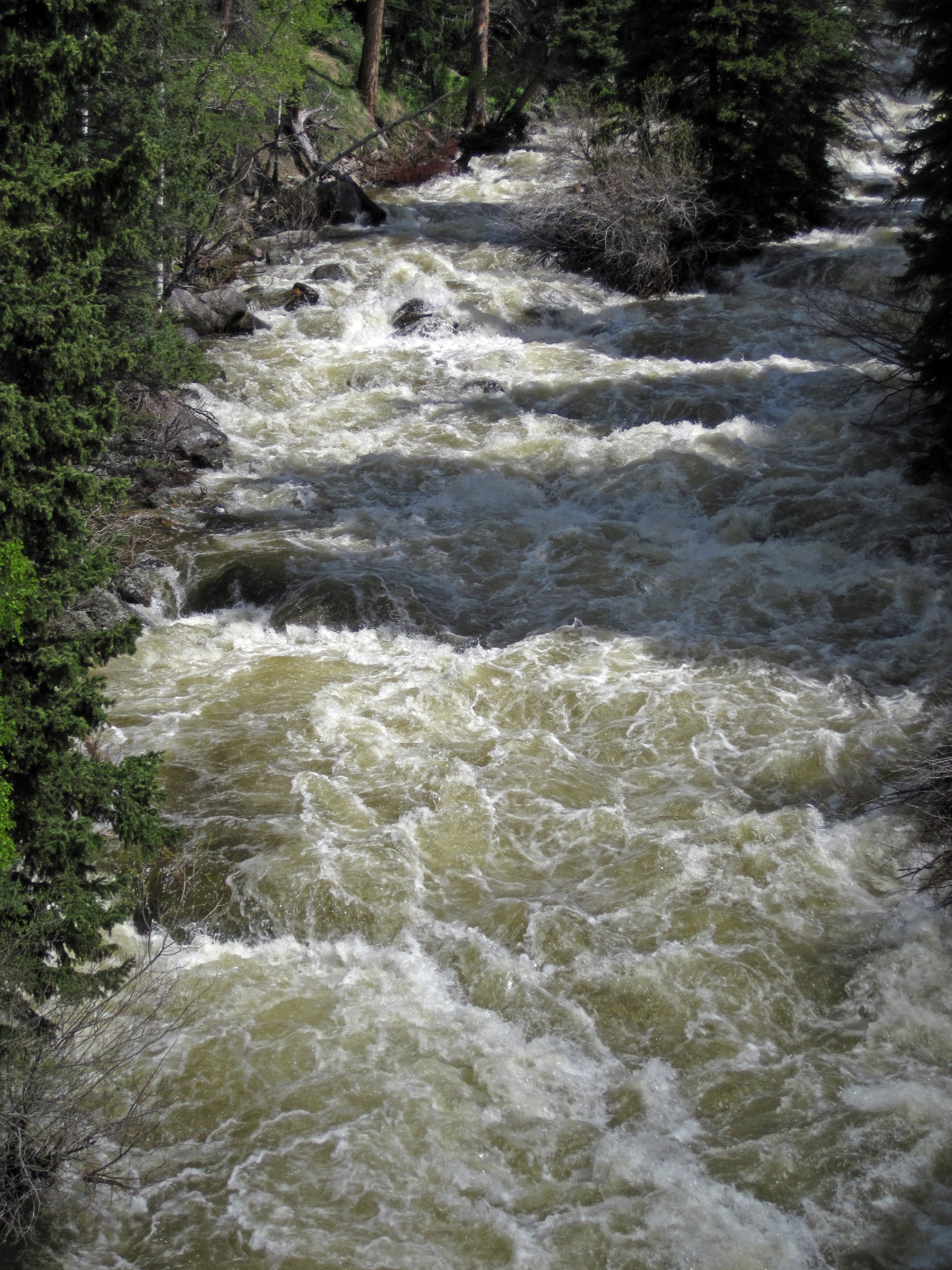
The trail leaves West Tensleep Trailhead at approximately 2,774 m on the Mistymoon Trail #063 and follows West Tensleep Creek south-east on a gentle grade. The Cloud Peak Wilderness boundary is crossed within the first 500 m; wilderness registration is required from that point. At approximately 1.3 km the trail passes West Tensleep Falls, a cascading drop on the creek in a corridor of spruce and boulder-strewn bank. Most walkers turn around at the falls. Return is on the same line to the trailhead. Note that the trail continues to Middle Tensleep Lake, Lake Helen and Mistymoon Lake — treated separately in the Cloud Peak Wilderness catalogue.
Why it is essential
West Tensleep Falls is the shortest signature waterfall in the southern Bighorns and the walk that most cleanly delivers the Ten Sleep Canyon corridor from the top down. It is the natural short introduction to the drainage that feeds Ten Sleep Canyon below, and pairs with either Meadowlark Lake for a half-day or a Mistymoon push (Cloud Peak Wilderness) for a full day.
Equipment
- Trail shoes or light boots
- Rain jacket and warm layer
- Water (1 L)
- Bear spray — bears documented in the drainage
- Human waste pack-out kit (WAG bag) — required inside the Cloud Peak Wilderness pack-out zone
- Wilderness registration (free, self-issued at the trailhead)
Hazards and notes
- The trailhead is inside the Cloud Peak Wilderness pack-out human waste regulation zone as of the 2024 season; carry containment and pack out solid waste.
- Group size limited to 10 from the wilderness boundary onward.
- Campfires prohibited above 9,200 ft (2,804 m); the falls are close to this threshold — stoves only.
- Afternoon storms build fast in July and August; start early.
- FSR 27 is unpaved but 2WD passable in dry conditions; check status before travel.
GPX / route file
| Source | URL | Format | Notes |
|---|---|---|---|
| USFS Bighorn — West Tensleep Trailhead | fs.usda.gov | Web page | Official managing authority |
| CalTopo — Ten Sleep Canyon / West Tensleep | caltopo.com | Web map | Route geometry |
| AllTrails — West Tensleep Falls | alltrails.com | Web page | Distance and elevation cross-check |
Sources
2. Meadowlark Lake shoreline
Snapshot
Itinerary
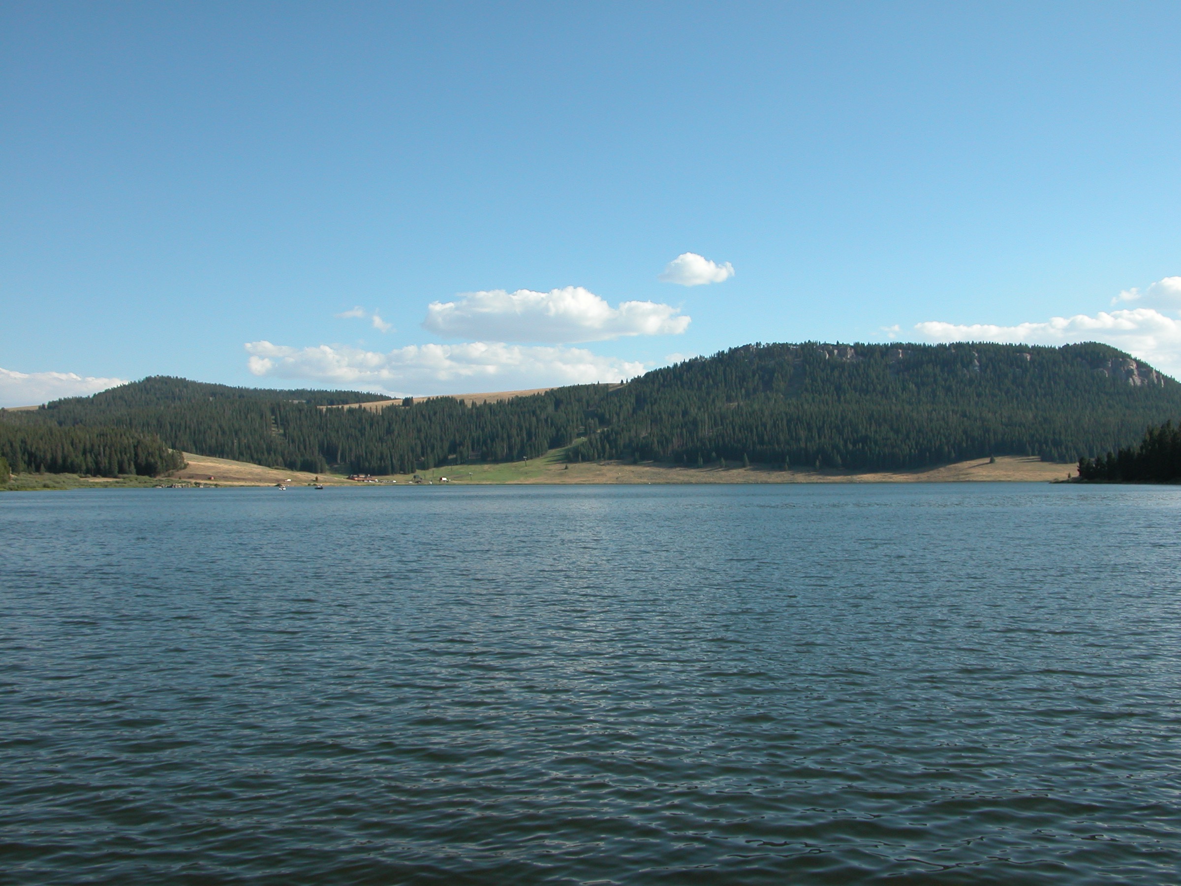
The loop leaves the Meadowlark Lake day-use area at the eastern end of the lake, follows the north shore westward along a graded track through spruce and mixed meadow, and rounds the western end of the lake before returning along the south shoreline. Meadowlark Lake sits in a shallow sub-alpine basin at approximately 2,500 m, dammed on its eastern end for irrigation but otherwise a natural sub-alpine setting. The full shoreline circuit is approximately 6.4 km. Short cuts and out-and-back options are possible from either end. Return closes the loop at the day-use area.
Why it is essential
Meadowlark Lake is the accessible sub-alpine centrepiece of the US-16 corridor and the natural family-friendly walk of the southern range. It is the only major sub-alpine lake on the paved US-16 corridor and the standard morning walk for visitors staying at the surrounding campgrounds — Deer Park, Sitting Bull, or Bull Creek. It closes the range’s mid-elevation lake theme cleanly without requiring the wilderness commitment of West Tensleep.
Equipment
- Trail shoes
- Rain jacket and warm layer — the basin is exposed to plateau weather
- Water (1.5 L)
- Sun protection
- Optional binoculars for waterfowl and moose observation
Hazards and notes
- Storms build quickly on the plateau in the afternoon; there is no natural shelter along the shoreline.
- Moose are commonly reported in the willows on the western end; keep clear.
- Motorised watercraft with low horsepower limits are permitted on the lake; walkers should keep to the shoreline path.
- No dogs off-lead near the day-use area.
- Access is on paved highway and is open year-round, but the trail itself may be snow-covered into June.
GPX / route file
| Source | URL | Format | Notes |
|---|---|---|---|
| USFS Bighorn — Meadowlark Lake | fs.usda.gov | Web page | Official managing authority |
| CalTopo — Meadowlark Lake | caltopo.com | Web map | Route geometry |
| AllTrails — Meadowlark Lake Trail | alltrails.com | Web page | Distance and elevation cross-check |
Sources
3. James T. Saban Lookout
Snapshot
Itinerary
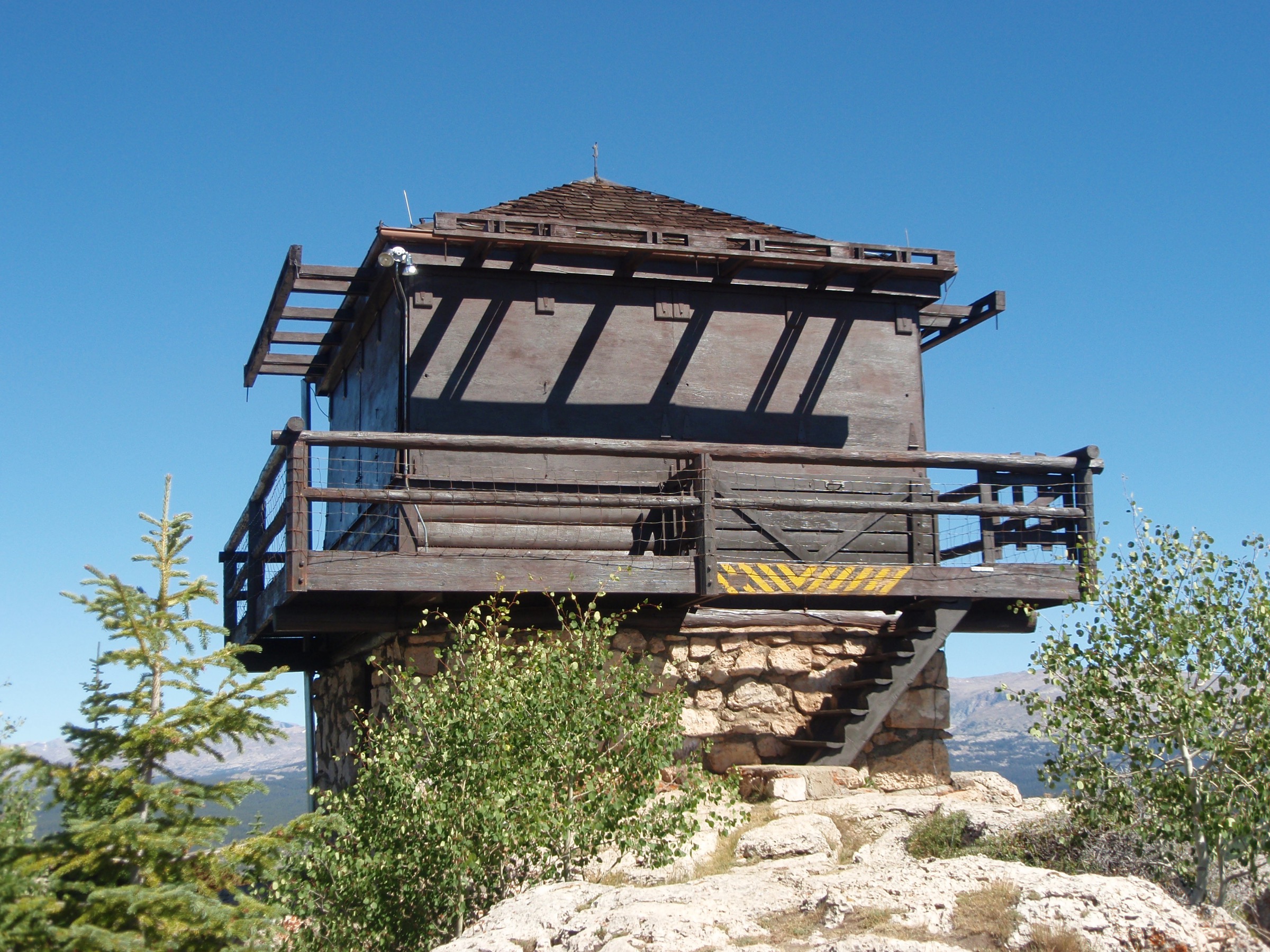
The route leaves the trailhead off FSR 429 at approximately 2,520 m and climbs on the old lookout access road grade — now a hiking trail — through mixed spruce-fir forest and open meadow up the flank of Hunt Mountain. The climb is sustained but on a graded surface; the last section approaches the summit at approximately 2,890 m along the exposed north ridge. The James T. Saban Fire Lookout, built by the Civilian Conservation Corps in 1935 and named for a district ranger, stands on the summit as a preserved cupola-style lookout building — one of the few remaining fire lookouts in the Bighorns. The panorama runs north across the Cloud Peak plateau, west across the Bighorn Basin to the Absaroka Range, and south to the Wind River Range on clear days. Return is on the same line back to FSR 429.
Why it is essential
James T. Saban Lookout is the signature short summit-lookout of the southern Bighorns and the most visited historic fire lookout in the range. It combines a moderate day-hike grade with a preserved CCC-era building at the top and an unobstructed panorama of the southern range and the basins on either side. It is the standard alternative to a wilderness push for anyone who wants a summit day on US-16 without committing to Cloud Peak Wilderness registration.
Equipment
- Sturdy trail shoes or light boots
- Trekking poles for the descent
- Rain jacket, warm layer, and hat — the summit is exposed
- Water (2 L)
- Sun protection
- Bear spray
Hazards and notes
- The summit ridge is exposed; storms are dangerous after early afternoon.
- The lookout building is a preserved historic structure. Do not climb on the roof or damage the woodwork. Interior access depends on USFS staffing.
- The access road (FSR 429) is unpaved and can be rough; check condition.
- Bear and moose activity along the lower forested section.
- No shelter above treeline; turn back if storms build.
GPX / route file
| Source | URL | Format | Notes |
|---|---|---|---|
| USFS Bighorn — Recreation index | fs.usda.gov | Web page | Official managing authority |
| CalTopo — Hunt Mountain | caltopo.com | Web map | Route geometry |
| AllTrails — James T. Saban Lookout | alltrails.com | Web page | Distance and elevation cross-check |
Sources
4. Firebox Park via Bud Love WHMA
Snapshot
Itinerary
The route leaves the Bud Love Wildlife Habitat Management Area parking area on Rock Creek Road, north-west of Buffalo, and follows the WHMA access track west and north through open sage-and-oak foothill country. The WHMA covers approximately 5,400 acres of critical wintering habitat for elk and mule deer; walkers must confirm the seasonal closure and stay on the designated route. Beyond the WHMA boundary the route enters the Bighorn National Forest and continues to climb through mixed forest to Firebox Park, an open sub-alpine meadow at approximately 2,850 m near the range’s eastern crest. Total one-way distance is approximately 7–9 km depending on the exact turn-around and route choice; the full return is a strenuous day at altitude. Return is on the same line back through the WHMA to the parking area.
Why it is essential
Firebox Park via Bud Love is the standard eastern-front foothill approach into the higher southern Bighorns from Buffalo and one of the very few routes in the range that begins in open sage-and-oak country and finishes in sub-alpine meadow. It is the walk that most cleanly demonstrates the range’s east-flank altitudinal transition — foothill winter range, mid-elevation forest, sub-alpine crest — and the destination itself is a quiet meadow away from the US-16 corridor traffic.
Equipment
- Sturdy boots
- Trekking poles
- Rain jacket, warm layer, hat and gloves
- Water (3–4 L; treat creek water only)
- Sun protection
- Bear spray — bears are documented in the upper forest
- Headtorch (long day)
- Navigation backup and paper map
- Tick protection during May–July
Hazards and notes
- Bud Love WHMA is closed to all human presence from 1 January through 14 May each year (Wyoming Game and Fish regulation). No exceptions. Do not attempt the route before 15 May.
- Rattlesnakes are common on the lower sage slopes; watch foot placement.
- Ticks are active in spring and early summer.
- Long day at altitude; acclimatise if possible.
- No reliable water on the lower foothill section; carry sufficient supply.
- No dogs off-lead inside the WHMA; check WGFD rules for current dog regulations.
- Storms build quickly on the crest in the afternoon.
GPX / route file
| Source | URL | Format | Notes |
|---|---|---|---|
| WGFD — Bud Love WHMA | wgfd.wyo.gov | Web page | Access and closure rules |
| USFS Bighorn — Recreation index | fs.usda.gov | Web page | Onward forest access |
| CalTopo — Rock Creek / Firebox Park | caltopo.com | Web map | Route geometry |
Sources
5. Crazy Woman Creek from FSR 33
Snapshot
Itinerary
Crazy Woman Canyon is reached from FSR 33, a scenic forest road that leaves US-16 south-west of Buffalo and drops into the canyon between vertical limestone and granite walls. The walk itself follows the canyon floor along Crazy Woman Creek, either upstream from the current access point or on connecting side-trails into the higher forest. The route is characterised by a loud creek through boulder-choked pools, high canyon walls, and lodgepole forest above the water. Turn-around is at the walker’s discretion — commonly at the first significant bend, or where the creek splits into upper tributaries. Return is on the same line to the vehicle. Note that the lower FSR 33 canyon-floor road has experienced multi-year closures for bridge and washout repairs since 2022; current access and legal turn-around points depend on the state of the road.
Why it is essential
Crazy Woman Creek and its canyon are the canonical south-eastern gorge of the Bighorns and one of the most visually distinctive drives-plus-walks in the range. It is the natural south-side counterpart to Tongue River Canyon in the north — a limestone slot with a loud creek and high walls, walkable from the road. It is the standard short walk for visitors approaching the range from Kaycee or the southern Powder River country.
Equipment
- Sturdy trail shoes; the canyon floor is rocky and can be wet
- Rain jacket and warm layer
- Water (1.5 L)
- Bear spray
- Sun protection at the mouth; the canyon is largely shaded
Hazards and notes
- FSR 33 has had multi-year closures for bridge repair; confirm current status with the Bighorn National Forest before travel.
- The canyon floor is subject to rockfall from the limestone walls, particularly after freeze-thaw or heavy rain.
- Creek water is fast and cold; do not attempt crossings in high water.
- Rattlesnakes are documented on the sunny south-facing lower canyon slopes.
- No dogs off-lead near cliff bases; loose rock is common.
- Cell coverage is absent in the canyon.
GPX / route file
| Source | URL | Format | Notes |
|---|---|---|---|
| USFS Bighorn — Crazy Woman Canyon | fs.usda.gov | Web page | Official managing authority and current closures |
| USFS Bighorn — Alerts and notices | fs.usda.gov | Web page | Road status |
| CalTopo — Crazy Woman Canyon | caltopo.com | Web map | Route geometry |
Sources
Region-level sources
| Source | URL |
|---|---|
| USFS Bighorn National Forest | fs.usda.gov |
| USFS Bighorn — Recreation index | fs.usda.gov |
| USFS Bighorn — Cloud Peak Wilderness | fs.usda.gov |
| USFS Bighorn — West Tensleep Trailhead | fs.usda.gov |
| USFS Bighorn — Meadowlark Lake Recreation Area | fs.usda.gov |
| USFS Bighorn — Crazy Woman Canyon | fs.usda.gov |
| USFS Bighorn — Alerts and notices | fs.usda.gov |
| WGFD — Bud Love WHMA | wgfd.wyo.gov |
| Wyoming State Historic Preservation Office | wyoshpo.wyo.gov |
| CalTopo — Bighorn Mountains | caltopo.com |
| Wikipedia — Bighorn National Forest | en.wikipedia.org |
| Wikipedia — Ten Sleep Canyon | en.wikipedia.org |
Further reading
- Cloud Peak Wilderness — essential day-hikes — the alpine core of the Bighorns with Mistymoon, Lost Twin Lakes, and Cloud Peak Glacier
- Northern Bighorns — essential day-hikes — the US-14 corridor with Medicine Wheel, Steamboat Point, and the Devil Canyon rim
Missing data / follow-up work
- Firebox Park route statistics (distance, gain, connecting trail numbers) rely on secondary guidebook sources; no primary USFS mapped route to the meadow is published. Verify against the Bighorn National Forest topographic map before travel and check Bud Love WHMA regulations for the current season.
- Crazy Woman Canyon Road (FSR 33) has been subject to multi-year bridge and washout closures. Confirm current road and trail status with the Bighorn National Forest before travel; the access point and legal turn-around change with road status.
- No licence-compatible photograph of West Tensleep Falls itself was located in this pass; the Ten Sleep Creek figure provides drainage context.
- No licence-compatible photograph of the Firebox Park area or of Crazy Woman Canyon was located in this pass. The Powder River Pass panorama on Wikimedia Commons is available as a regional cover alternative.
- West Tensleep is inside the Cloud Peak Wilderness pack-out human waste regulation zone as of the 2024 season; verify current requirements before departure.
- The USFS does not publish downloadable GPX or KML files for Bighorn National Forest trails. Route geometry must be exported from OpenStreetMap or CalTopo.
- The James T. Saban Fire Lookout is a preserved historic structure; interior access depends on USFS staffing and volunteer schedules and is not guaranteed.