Regional overview
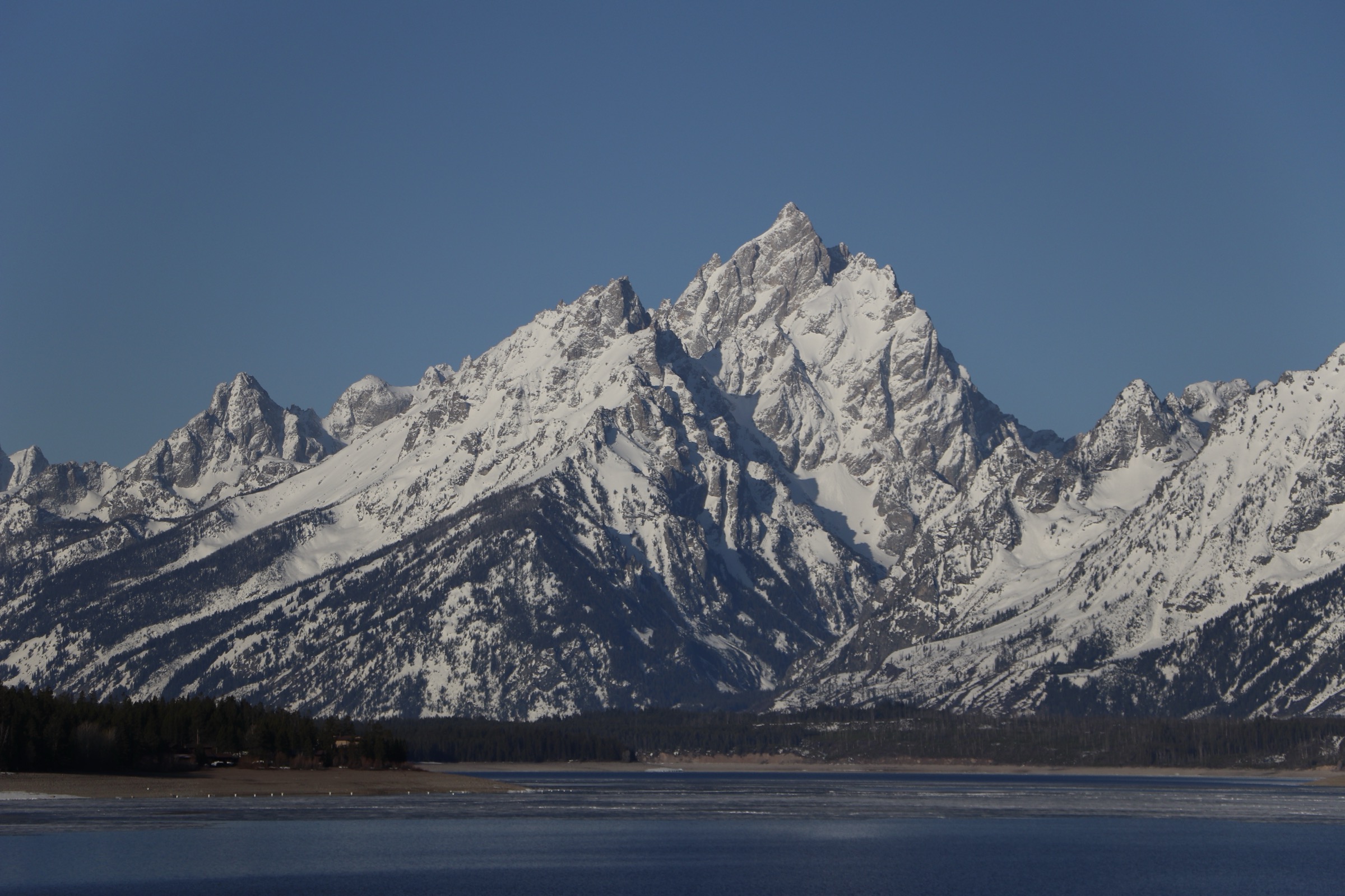
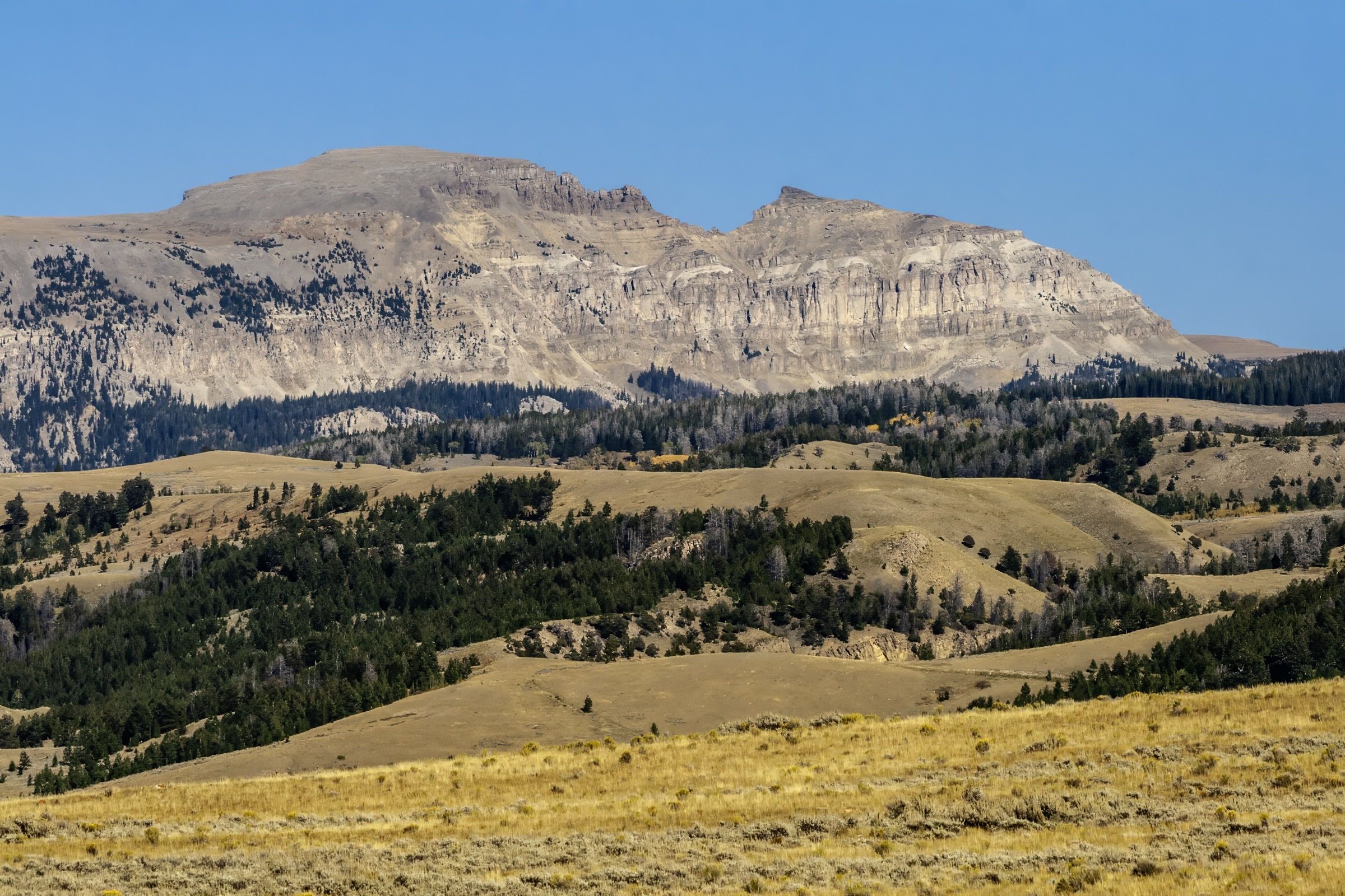
The Gros Ventre Mountains rise directly east and south-east of Jackson Hole, forming the quieter, more rounded sedimentary counterpoint to the jagged Teton crest. Where the Tetons expose sharp Precambrian gneiss and granite in a compact fault-block, the Gros Ventres are built of long, dip-slope ridges of Paleozoic and Mesozoic sedimentary rock — limestone, sandstone and shale — that give the range its characteristic tilted, forested profile and its many long summit ridges. The high point is Doubletop Peak (3,684 m / 12,088 ft), well east of Jackson, while the range’s visual signature from town is the long, level skyline of Sheep Mountain, universally known as the Sleeping Indian.
Almost all the day-hike terrain sits within the Bridger-Teton National Forest — one of the largest national forests in the lower 48 at roughly 3.4 million acres — with the interior of the range protected as the Gros Ventre Wilderness (~287,000 acres, designated 1984). Access is concentrated in three corridors. From Jackson, the Cache Creek trailhead on the east edge of town gives immediate access to a well-used network of forest-slope loops linking Cache Creek and Game Creek, and the road up Cache Creek connects to the higher Goodwin Lake / Jackson Peak approach. From the Gros Ventre Road on the north-west side of the range — the road that climbs east from Kelly past the historic Gros Ventre Slide of 1925 — trailheads reach Grizzly Lake and the middle Gros Ventre drainages. From the south, Granite Creek Road off US-189/191 opens the Little Granite / Granite Highline corridor into the Gros Ventre Wilderness.
The reliable snow-free walking season on the summits and high basins is late June to mid-October; town-edge loops from Cache Creek and the Gros Ventre Road approaches open earlier and close later. Afternoon thunderstorms and lightning are the dominant summer risk on the long open summit ridges of Jackson Peak and Sheep Mountain, and several trailheads require a high-clearance vehicle for the last miles of Forest Service road. The entire range is grizzly-bear country: the Bridger-Teton’s Food Storage Order (currently in force through 15 January 2029) requires approved food and refuse storage in specified bear-country areas across the Jackson, Blackrock, Pinedale, Greys River and Big Piney ranger districts, and standard practice is to carry spray, hike in groups, make noise and follow the storage requirements. Confirm current road status, alerts and fire information with the Bridger-Teton National Forest before travel.
Selection rationale
The five walks below cover the main day-hike faces of the Gros Ventres. Jackson Peak via Goodwin Lake is the best-known high summit above Jackson — the range’s classic lake-plus-summit long day. Cache Creek to Game Creek is the town-edge endurance loop, close to Jackson but with real mountain character. Sheep Mountain is the range’s iconic Sleeping Indian skyline, a demanding but non-technical summit day with the range’s most recognisable views. Grizzly Lake adds a moderate lake approach from the Gros Ventre Road side, balancing the harder summits with a more accessible backcountry feel. Little Granite Creek closes the selection with a deeper Gros Ventre Wilderness route on the south side of the range. Doubletop Peak was considered but is a very long, often multi-day objective from the east side of the range. Multi-day traverses of the Gros Ventre Highline were excluded because they are shuttle backpacks, not day-hikes.
Summary table
| # | Hike | Country | Route type | Distance | Gain | Max elevation | Difficulty |
|---|---|---|---|---|---|---|---|
| 1 | Jackson Peak via Goodwin Lake | USA | Out-and-back | ~16.1 km | ~801 m | ~3,272 m | Hard |
| 2 | Cache Creek to Game Creek Loop | USA | Loop | ~23.7 km | ~682 m | ~2,336 m | Hard |
| 3 | Sheep Mountain (Sleeping Indian) | USA | Out-and-back | ~16.6 km | ~1,285 m | ~3,420 m | Hard |
| 4 | Grizzly Lake Trail | USA | Out-and-back | ~13.2 km | ~403 m | ~2,322 m | Moderate |
| 5 | Little Granite Creek Trail | USA | Out-and-back | ~17.9 km | ~737 m | ~2,653 m | Hard |
1. Jackson Peak via Goodwin Lake
Snapshot
Itinerary
From the Goodwin Lake trail access above Jackson the route climbs through mixed conifer forest on a well-used trail, gaining steadily to Goodwin Lake, a small alpine tarn beneath the Jackson Peak massif. From the lake the trail turns east and climbs onto the summit ridge on open slopes and scree, breaking above treeline for the final push to the summit of Jackson Peak. The summit gives broad panoramas across Jackson Hole, west to the Teton crest, north to Yellowstone and east across the higher Gros Ventre country and, on clear days, the distant Wind River Range. Descent reverses the route.
Why it is essential
Jackson Peak is the most complete classic Gros Ventre day-hike from Jackson: lake basin, forest approach, summit ridge and major cross-range views in one demanding route. It is the walk that most cleanly delivers the range’s mixed sedimentary–alpine character within a long single day out of town.
Equipment
- Sturdy mountain hiking boots and trekking poles for the sustained descent
- Rain and wind shell plus a warm layer — the summit ridge is fully exposed
- Sun hat, high-SPF sunscreen and sunglasses
- 2.5–3 L water and treatment for creek/lake refills
- Bear spray, accessible on the pack
- Insect repellent — the forest and lake basin are heavily bugged in July
- Offline map and GPS with route loaded
- Microspikes early in the season for lingering snow on the summit ridge
Hazards and notes
- Long day at altitude — plan a dawn start and be off the summit before typical afternoon storm build-up.
- Lightning risk on the exposed summit ridge from July through September.
- The Goodwin Lake road spur is often rough enough to require a high-clearance vehicle; the practical trailhead can move down-road in poor conditions and add walking to the day.
- Grizzly-bear presence is documented in the Cache Creek and Goodwin Lake drainages — carry spray and follow the Bridger-Teton food-storage order.
- Trailhead parking fills on summer weekends; plan an early start.
GPX / route file
| Source | URL | Format | Notes |
|---|---|---|---|
| USFS Bridger-Teton National Forest | fs.usda.gov | Web page | Official managing authority; no GPX exposed |
| AllTrails — Jackson Peak Trail | alltrails.com | Web page | Distance and elevation cross-check only — proprietary geometry, do not reuse |
Sources
- USFS Bridger-Teton National Forest
- USFS Bridger-Teton — Food Storage Order
- AllTrails — Jackson Peak Trail
2. Cache Creek to Game Creek Loop
Snapshot
Itinerary
From the Cache Creek Trailhead the route follows the broad Cache Creek drainage east through mixed forest and open sage slopes on a wide multi-use trail popular with runners, mountain-bikers and horse parties. After several kilometres the loop turns south, climbs over a low forested divide, and descends into the Game Creek drainage on the south side. The Game Creek side returns westward through more open, sun-facing slopes and drops back to the trailhead area on a network of paths at the east edge of Jackson. The high point sits on the divide between the two drainages, with views across the southern Gros Ventre foothills and back toward the Tetons. The route is shared with cyclists and horses — expect fast-moving bike traffic on the Cache Creek side.
Why it is essential
Cache Creek to Game Creek is the quintessential Jackson-side Gros Ventre endurance loop: close enough to town for a same-day start and finish, long enough to feel like a full mountain day, and representative of the range’s rolling forest, meadow and wildlife habitat. It is also the only loop in the selection, and the natural choice for parties who want a big day out of Jackson without the summit exposure of Jackson Peak or Sheep Mountain.
Equipment
- Trail shoes or light hiking boots
- Trekking poles (optional)
- 2.5–3 L water and treatment — limited reliable water in the Game Creek half
- Rain and wind shell
- Sun hat and high-SPF sunscreen — long open sections on the south side
- Bear spray, accessible on the pack
- Offline map and GPS with route loaded — junctions are frequent
- Insect repellent in early summer
Hazards and notes
- Long mileage on a shared multi-use trail — expect cyclists and horses, particularly on the Cache Creek side; keep dogs on lead where posted.
- Limited cell coverage on the divide and in the upper Game Creek drainage.
- Sun exposure on the south-facing Game Creek side; carry more water than a similar-distance forest walk would suggest.
- Grizzly-bear presence is documented; carry spray and follow the Bridger-Teton food-storage order.
- Early- and late-season snow and mud can be substantial on the divide and in the upper Cache Creek drainage.
GPX / route file
| Source | URL | Format | Notes |
|---|---|---|---|
| USFS Bridger-Teton National Forest | fs.usda.gov | Web page | Official managing authority; no GPX exposed |
| AllTrails — Cache Creek to Game Creek Loop | alltrails.com | Web page | Distance and elevation cross-check only — proprietary geometry, do not reuse |
Sources
- USFS Bridger-Teton National Forest
- USFS Bridger-Teton — Food Storage Order
- AllTrails — Cache Creek to Game Creek Loop
3. Sheep Mountain (Sleeping Indian)
Snapshot
Itinerary
From the Sheep Mountain trailhead on the Gros Ventre side, the route climbs steadily through intermittent forest and open slopes onto the long summit ridge that Jackson-area residents call the Sleeping Indian — a name reflecting the mountain’s reclining profile viewed from the valley. The ascent is exposed for most of its length, with sustained climbing on open aspen, sagebrush and grass slopes before a rockier final section onto the summit ridge. From the top the panorama takes in the full Teton crest to the west, Jackson Hole and the National Elk Refuge directly below, and the higher Gros Ventre country to the east. Return is on the same route.
Why it is essential
Sheep Mountain is the visual emblem of the Gros Ventres from Jackson Hole — the Sleeping Indian skyline is one of the most photographed profiles in western Wyoming — and its summit is a demanding but non-technical objective. It is also the highest summit in the selection and the route that most directly puts a party face-to-face with the Teton crest across the valley.
Equipment
- Sturdy mountain hiking boots
- Trekking poles for the sustained descent
- 3 L water — no reliable water above the trailhead
- Rain and wind shell plus a warm layer for the summit
- Sun hat, high-SPF sunscreen and sunglasses — long, fully exposed climb
- Bear spray, accessible on the pack
- Offline map and GPS with route loaded
- High-clearance 4WD vehicle for the final approach road; verify passability before setting out
Hazards and notes
- Very large elevation gain from most practical starting points — this is one of the biggest single-day summit efforts in the region.
- Lightning is the defining hazard on the exposed upper slopes and summit ridge; be off the ridge before typical afternoon storm build-up.
- Heat on the open lower slopes in midsummer; start early.
- Sheep Mountain access road is rough and often requires high-clearance 4WD; the practical trailhead can move down-road and add substantial distance and gain to the day.
- Grizzly-bear presence documented across the Gros Ventre; carry spray and follow the Bridger-Teton food-storage order.
GPX / route file
| Source | URL | Format | Notes |
|---|---|---|---|
| USFS Bridger-Teton National Forest | fs.usda.gov | Web page | Official managing authority; no GPX exposed |
| AllTrails — Sheep Mountain | alltrails.com | Web page | Distance and elevation cross-check only — proprietary geometry, do not reuse |
Sources
- USFS Bridger-Teton National Forest
- USFS Bridger-Teton — Food Storage Order
- AllTrails — Sheep Mountain
4. Grizzly Lake Trail
Snapshot
Itinerary
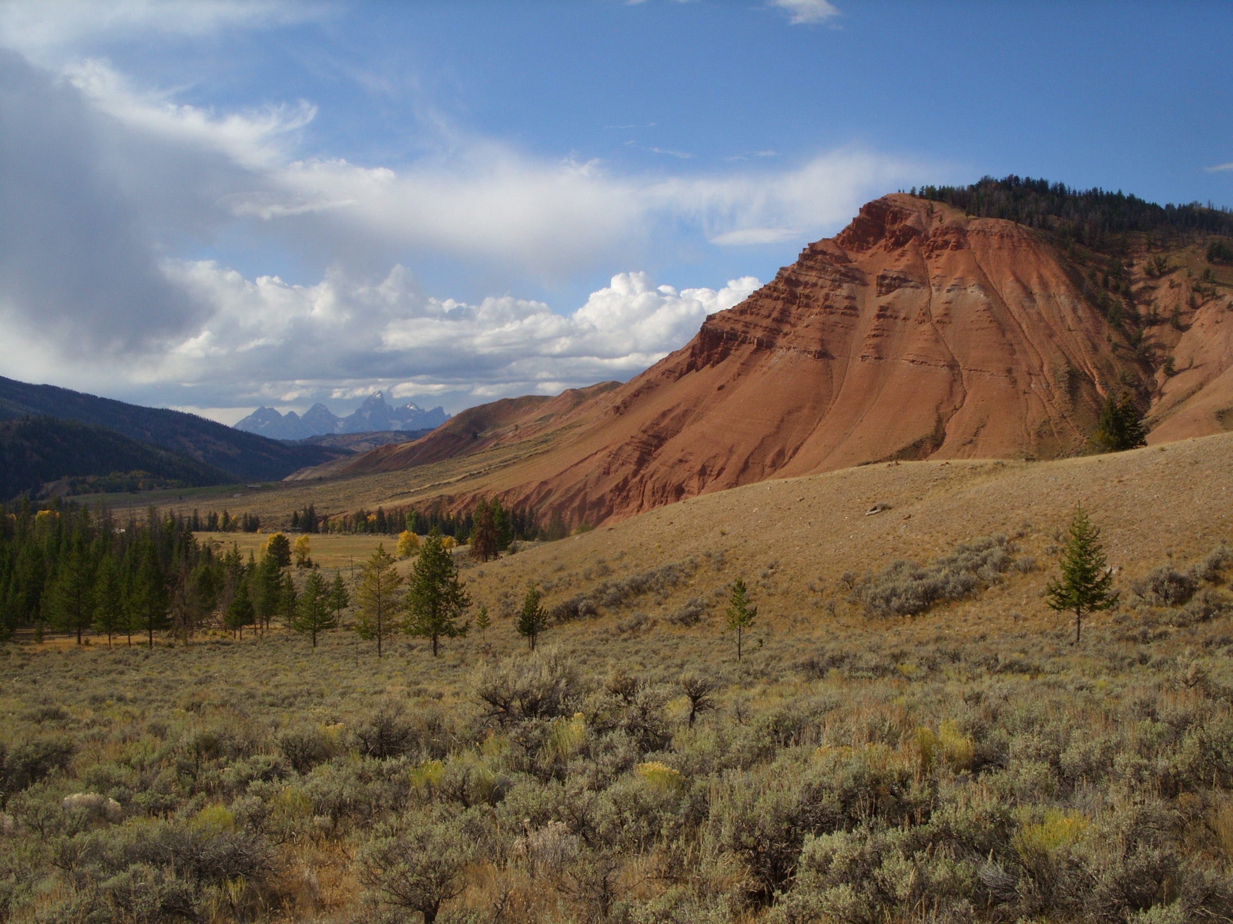
From the Gros Ventre Road side near the Red Hills the trail crosses open sage and meadow terrain and then follows a creekside corridor into forest on the approach to Grizzly Lake. The tread becomes faint across the meadow sections — carry a mapped route and pay attention to cairns and posts — before consolidating on the forested final approach. The lake itself sits in a broad, forest-ringed basin below the higher southern Gros Ventre country. Return is on the same route.
Why it is essential
Grizzly Lake is the accessible, moderate lake day of the selection — a route that puts a party in the Gros Ventre Wilderness feel without the summit exposure or 4WD approach of Jackson Peak or Sheep Mountain. It is the natural pairing for a slower second day out of Jackson Hole or for parties who want a Gros Ventre lake without a full summit commitment.
Equipment
- Hiking shoes or light boots
- 2 L water and treatment for creek refills
- Rain and wind shell
- Bear spray, accessible on the pack
- Offline map and GPS with route loaded — meadow route-finding
- Insect repellent — mosquitoes are heavy in July
- Sun protection on the open meadow sections
Hazards and notes
- Faint tread in the meadow crossings — this route needs more navigation attention than its stats suggest.
- Wet, marshy ground in early season; expect wet feet.
- Grizzly-bear presence is well documented — the trail is aptly named. Carry spray and follow the Bridger-Teton food-storage order.
- Gros Ventre Road is remote gravel with variable surface; check road status before travel.
- Afternoon thunderstorms on the higher slopes above the lake; retreat to lower forest if lightning develops.
GPX / route file
| Source | URL | Format | Notes |
|---|---|---|---|
| USFS Bridger-Teton National Forest | fs.usda.gov | Web page | Official managing authority; no GPX exposed |
| AllTrails — Grizzly Lake Trail | alltrails.com | Web page | Distance and elevation cross-check only — proprietary geometry, do not reuse |
Sources
- USFS Bridger-Teton National Forest
- USFS Bridger-Teton — Food Storage Order
- AllTrails — Grizzly Lake Trail
5. Little Granite Creek Trail
Snapshot
Itinerary
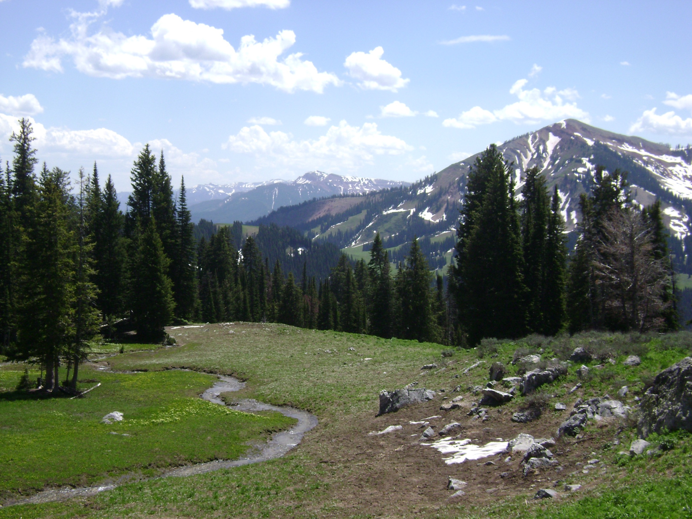
From the Little Granite Creek trailhead the route enters the Gros Ventre Wilderness and follows the Little Granite drainage into open basins fringed by conifer forest and river meadow. The trail climbs gradually onto a highline shoulder that gives views back across the southern Gros Ventres and toward the range’s interior. The turnaround is treated here as a practical day-hike distance rather than the full length of the Granite Highline through-route, which is a multi-day wilderness traverse. Return is on the same route.
Why it is essential
Little Granite Creek represents the quieter, deeper Gros Ventre Wilderness character that the busier Jackson-front hikes do not: spacious basins, wildlife habitat and a remote high-country feel without crossing into a multi-day route. It is the closest thing in the selection to a true wilderness day.
Equipment
- Sturdy hiking boots
- Trekking poles for stream crossings and the sustained climb
- Map and compass or GPS with route loaded — remote and lightly signed
- 2.5–3 L water and treatment
- Bear spray, accessible on the pack
- Rain and wind shell plus a warm layer
- Sun and insect protection
- First-aid kit — the wilderness setting means longer response times
Hazards and notes
- Remote wilderness travel — expect limited cell service and long response times in an emergency.
- Route-finding attention needed on faint sections; do not rely on continuous signage.
- Stream crossings can be high in early season; assess before committing.
- Grizzly-bear presence documented across the Gros Ventre Wilderness — carry spray, hike in groups and follow the Bridger-Teton food-storage order.
- Wildfire and smoke can close or degrade access on short notice; check Bridger-Teton alerts before travel.
- Granite Creek Road status is variable; verify with the Bridger-Teton before setting out.
GPX / route file
| Source | URL | Format | Notes |
|---|---|---|---|
| USFS Bridger-Teton National Forest | fs.usda.gov | Web page | Official managing authority; no GPX exposed |
| AllTrails — Little Granite Creek Trail | alltrails.com | Web page | Distance and elevation cross-check only — proprietary geometry, do not reuse |
Sources
- USFS Bridger-Teton National Forest
- USFS Bridger-Teton — Food Storage Order
- AllTrails — Little Granite Creek Trail
Routes excluded as out of scope
The following sit inside or adjacent to the Gros Ventre Mountains but fall outside a day-hike entry or are better treated in a neighbouring catalogue.
- Doubletop Peak (~3,684 m). The range’s high point and one of the finest summits in western Wyoming, but a long approach from the east side of the range that most parties treat as an overnight rather than a day-hike.
- Full Gros Ventre Highline traverse. The range’s signature wilderness through-trail, but a multi-day shuttle backpack — the Little Granite day above only samples the corridor.
- Gros Ventre Slide interpretive walk. A short interpretive path at the 1925 Gros Ventre landslide site off Gros Ventre Road; a worthwhile side stop with a scenic drive but too short to carry the “essential day-hike” bracket on its own.
- Teton Range summits (Grand Teton and Death Canyon corridor). Iconic day and multi-day objectives across the valley from the Gros Ventres, but part of the Teton Range / Grand Teton–Jedediah Smith catalogue.
- Wind River Range routes. Frequently paired with a Jackson trip but belong to their own catalogue farther east and south-east.
Further reading
| Source | URL |
|---|---|
| USFS Bridger-Teton National Forest | fs.usda.gov |
| USFS Bridger-Teton — Food Storage Order | fs.usda.gov |
| Storm — Teton Range: Grand Teton and Jedediah Smith | /guidebooks/usa-greater-yellowstone-central-rockies-teton-range-grand-teton-jedediah-smith-essential-day-hikes |
| Storm — Absaroka Range, Montana and Wyoming | /guidebooks/usa-greater-yellowstone-central-rockies-absaroka-range-essential-day-hikes |
| Storm — Gallatin Range, Montana and Wyoming | /guidebooks/usa-greater-yellowstone-central-rockies-greater-yellowstone-mountains-gallatin-range-essential-day-hikes |
| Storm — Beartooth Mountains, Montana and Wyoming | /guidebooks/usa-greater-yellowstone-central-rockies-greater-yellowstone-mountains-beartooth-mountains-essential-day-hikes |
| AllTrails — Jackson Peak Trail | alltrails.com |
| AllTrails — Cache Creek to Game Creek Loop | alltrails.com |
| AllTrails — Sheep Mountain | alltrails.com |
| AllTrails — Grizzly Lake Trail | alltrails.com |
| AllTrails — Little Granite Creek Trail | alltrails.com |
| Wikipedia — Gros Ventre Range | en.wikipedia.org |
| Wikipedia — Gros Ventre Wilderness | en.wikipedia.org |
| Wikipedia — Gros Ventre landslide (1925) | en.wikipedia.org |
| Wikipedia — Sheep Mountain (Teton County, Wyoming) | en.wikipedia.org |
Missing data / follow-up work
- No official USFS GPX/KML files are published for the Gros Ventre trails covered here; route geometry can be exported from OpenStreetMap or CalTopo for planning.
- Route statistics for all five walks are from secondary sources (principally AllTrails); verify against Bridger-Teton topographic mapping before travel.
- Access-road conditions for Goodwin Lake / Jackson Peak and Sheep Mountain are variable and often require high-clearance 4WD; confirm current road status with the Bridger-Teton National Forest — Jackson Ranger District before setting out.
- The Bridger-Teton food-storage order is currently in force through 15 January 2029 across the Blackrock, Jackson, Pinedale, Greys River and Big Piney ranger districts; check for renewals or amendments before travel.
- Grizzly-bear presence across the Gros Ventre is well documented — the Bridger-Teton should be consulted for current bear-management updates before any trip.
- Beyond the cover image and a small number of range-context photographs, no licence-compatible route-specific images of the Cache Creek loop, Grizzly Lake or Little Granite Creek were located in this pass; further Wikimedia Commons searches may turn up usable images over time.