Regional overview
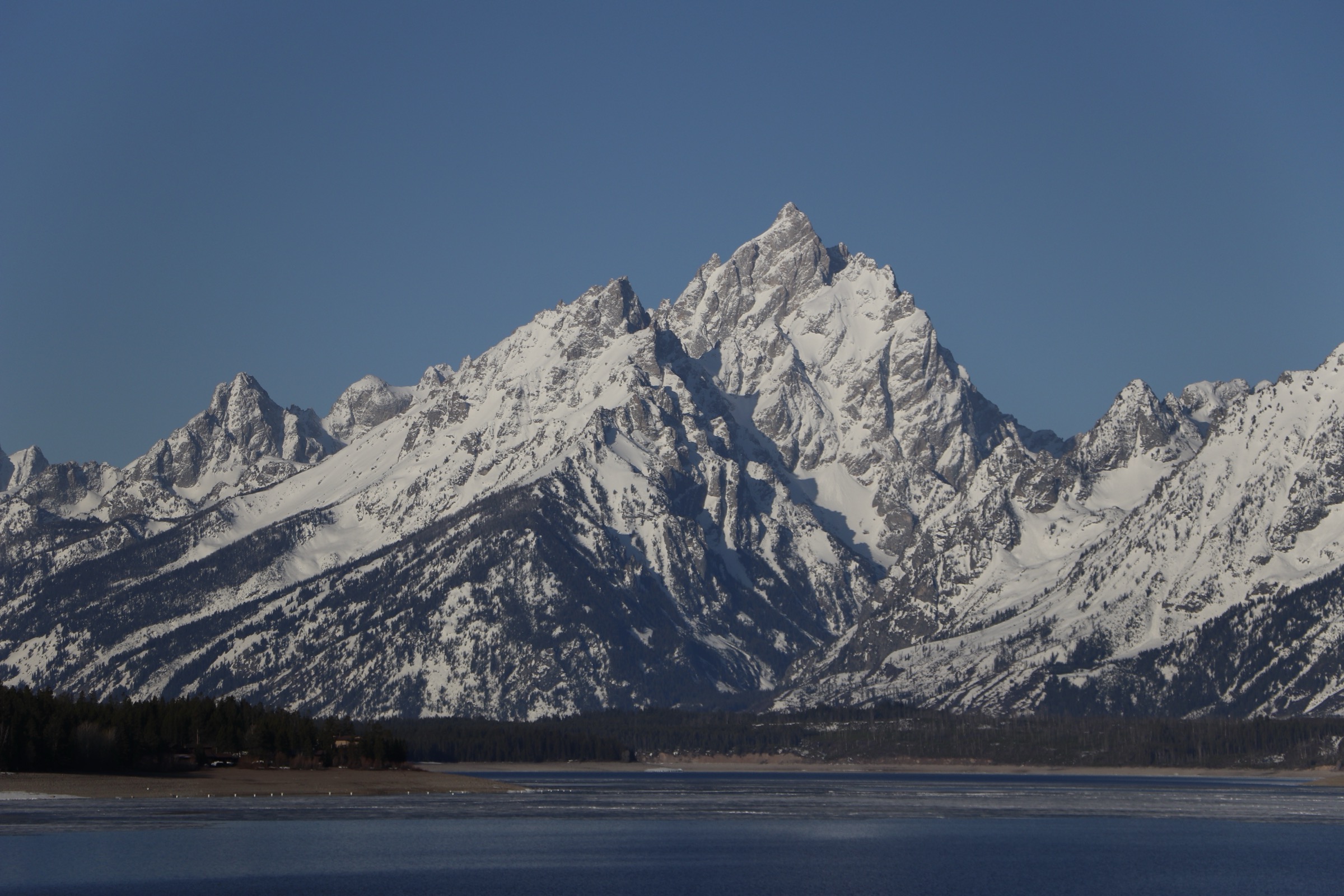
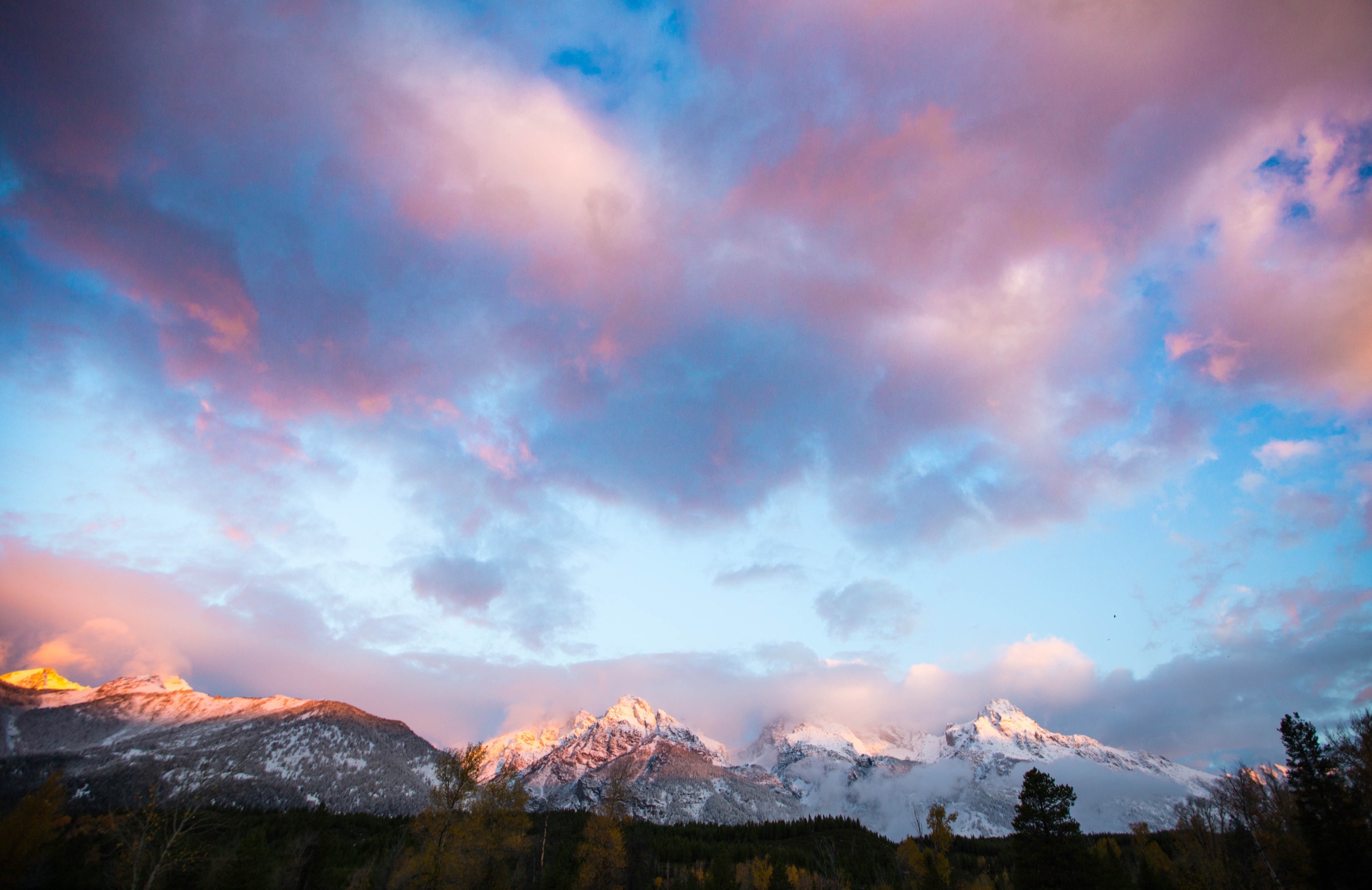
Grand Teton National Park is the abrupt east face of the Teton Range: glacial lakes at the valley edge, steep moraines, U-shaped canyons carved by Pleistocene ice, alpine basins, granite walls and high passes that hold snow well into summer. The essential day-hikes here are generally well-built and heavily used, but the higher routes can become serious snow-and-weather outings even when the valley below is dry.
Current-condition context checked on 2026-07-13: the NPS backcountry trail conditions page was last updated 2026-07-12. NPS lists bears as active, wildland fire danger as high, Taggart Lake Trailhead and Trail partially open due to 2026 construction, and Death Canyon Road and Trailhead closed to all use. High trails still hold snow — Paintbrush Divide was listed as 100 % snow with ice axe and crampons strongly advised as of 2026-07-06. Confirm current conditions on the NPS backcountry-conditions page before travel.
See also: Teton Range · Teton Pass and southern Tetons.
Selection rationale
The five hikes below cover the park’s signature non-technical day-hike landscapes: the classic low lake loop (Taggart–Bradley), the iconic canyon walk from Jenny Lake (Forks of Cascade Canyon), a steep alpine-lake ascent (Surprise and Amphitheater Lakes), the premier high-pass traverse (Paintbrush–Cascade Loop), and the climbers’ walking approach into the range’s granite core (Garnet Canyon).
Delta Lake is deliberately excluded — it is an unofficial, unmaintained route in normal park guidance. The multi-day Teton Crest Trail and the technical summit routes on the Grand, Middle and South Teton are outside the day-hike scope of this entry.
Summary
| # | Hike | Trailhead | Route type | Distance | Gain | Max elevation | Difficulty |
|---|---|---|---|---|---|---|---|
| 1 | Taggart Lake – Bradley Lake Loop | Taggart Lake Trailhead | Loop | 9.0 km | 262 m | c. 2,189 m | Moderate |
| 2 | Forks of Cascade Canyon (via shuttle boat) | Jenny Lake / west shore | Out-and-back | 15.1 km | 450 m | c. 2,392 m | Moderate–strenuous |
| 3 | Surprise and Amphitheater Lakes | Lupine Meadows | Out-and-back | 15.8 km | 940 m | c. 2,969 m | Strenuous |
| 4 | Paintbrush Canyon – Cascade Canyon Loop | String / Leigh Lakes | Loop | 32.0 km | 1,365 m | 3,261 m | Very strenuous |
| 5 | Garnet Canyon | Lupine Meadows | Out-and-back | 13.2 km | 740 m | c. 2,731 m | Strenuous |
1. Taggart Lake – Bradley Lake Loop
Snapshot
Itinerary
From Taggart Lake Trailhead the standard NPS loop climbs an aspen-covered moraine, reaches the Bradley Lake split, visits Bradley Lake, continues to Taggart Lake, and returns to the trailhead — with Teton Range views over both lakes. In 2026, NPS lists the north side of Taggart Trail as closed for trail reconstruction; the trailhead remains partially open.
Why it is essential
This is the compact, lower-elevation Teton lake classic: easy to understand, highly scenic and representative of the valley-edge lake-and-moraine terrain below the range’s east face.
Equipment
- Hiking shoes for compacted trail and rocky sections
- 1.5–2 L water — no reliable treatment-free source on the loop
- Sun protection
- Bear spray and knowledge of its use (NPS lists bears as active)
- Offline navigation
- Traction (microspikes) if snow lingers or in shoulder-season conditions
Hazards and notes
- Narrow sections and dense underbrush in places, with rocks and repeated small gains/losses.
- Bear activity — NPS lists bears as active; store food, carry spray and follow standard bear safety.
- Construction on the north side of Taggart Trail in 2026 — check current NPS routing.
- Popular trailhead: NPS notes it often fills in summer — park fully off the road if using shoulder parking.
- Afternoon thunderstorms in monsoon season.
2. Forks of Cascade Canyon (via shuttle boat)
Snapshot
Itinerary
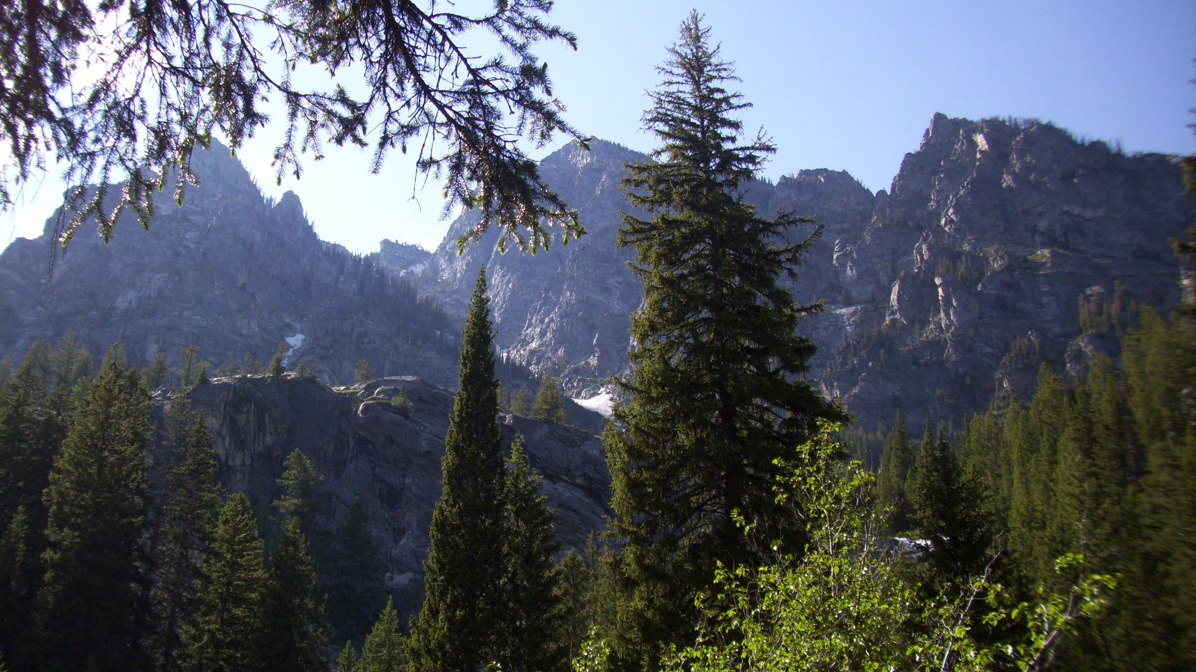
From Jenny Lake’s west shore the route passes Hidden Falls and Inspiration Point, then follows Cascade Creek deep into the glacially carved canyon between Teewinot and Mount St John to the forks, with views back toward the Grand Teton, Mount Owen and Teewinot. Return is by the same route to the shuttle dock — or add the Jenny Lake Loop back to South Jenny Lake if the boat has stopped for the day.
Why it is essential
Cascade Canyon is the park’s definitive canyon day-hike: high scenic value, reliable wildlife habitat and deep access into the central Teton backcountry without crossing a high pass.
Equipment
- Hiking shoes with good traction — stone steps near Inspiration Point can be slick
- 2–2.5 L water and food for a long day
- Bear spray — moose and bears are both frequent on Cascade Creek
- Sun and rain layers
- Offline map / GPS
- Cash or card for the Jenny Lake shuttle-boat ticket
Hazards and notes
- Stone steps and exposed steps near Inspiration Point — take care in wet or crowded conditions.
- Wildlife: moose and bears are both common in the canyon.
- Rock slides are possible on canyon walls; heed any posted warnings.
- Jenny Lake parking fills early — NPS recommends arriving before 9 a.m. in mid-summer.
- Shuttle-boat hours are seasonal — confirm before committing to the 9.4 mi variant.
3. Surprise and Amphitheater Lakes
Snapshot
Itinerary
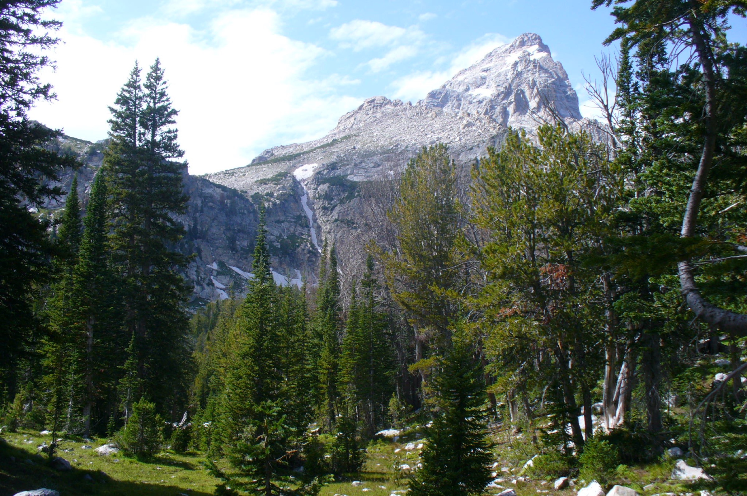
From Lupine Meadows the trail switchbacks for about 5 mi to Surprise Lake, then continues another quarter mile to Amphitheater Lake below Disappointment Peak. Views open west across the central Teton peaks near the top. Return is by the same route.
Why it is essential
This is the central park’s classic strenuous alpine-lake hike, reaching two high glacial basins directly below the granite core of the range without any technical ground.
Equipment
- Hiking shoes or boots for sustained ascent and possible snow tread
- 2.5–3 L water
- Warm and rain layers — weather changes fast above the valley
- Sun protection at altitude
- Bear spray
- Offline navigation
- Traction or snow gear when snow remains in the basins
Hazards and notes
- Steep switchbacks with narrow sections and roots/rock.
- Altitude — the summit lakes sit near 3,000 m; pace accordingly.
- Snow and ice persist in the lake basins into July in some years.
- Thunderstorms — plan to be off the upper slopes by early afternoon in monsoon conditions.
- Parking at Lupine Meadows can fill early.
4. Paintbrush Canyon – Cascade Canyon Loop
Snapshot
Itinerary
The loop climbs Paintbrush Canyon to Paintbrush Divide at c. 3,261 m, descends past Lake Solitude, and exits down Cascade Canyon, linking two major glacial canyons and one of the park’s highest maintained-trail passes. Most parties travel it counter-clockwise (up Paintbrush, down Cascade) to keep the steepest scree descent on the Cascade side.
Why it is essential
This is the definitive Teton high-pass day-traverse for very fit hikers: canyon scenery, an alpine lake, big peak views on both sides of the pass and a full mountain circuit inside a single day.
Equipment
- Full mountain day-kit — early start, headlamp, food for 12+ h
- 3+ L water plus a water filter (Lake Solitude and canyon creeks)
- Warm and rain layers for exposed pass conditions
- Sun protection and offline navigation
- Bear spray
- Ice axe and crampons are required or strongly advised when Paintbrush Divide is snow-covered (as of 2026-07-06 NPS listed 100 % snow on the divide)
Hazards and notes
- Long distance and sustained ascent — misjudge the pace and you finish in the dark.
- Steep switchbacks, bridge crossings, a scree field on the divide.
- Snow and ice on the divide until mid-July in most seasons; assess honestly before committing to the pass.
- High-pass weather — thunderstorm exposure is severe on the divide.
- Route timing — most parties start before dawn.
5. Garnet Canyon
Snapshot
Itinerary
From Lupine Meadows the trail climbs to the Three-Mile Junction, turns left into Garnet Canyon, crosses boulder-field terrain and enters a canyon enclosed by Nez Perce, South Teton, Middle Teton, Grand Teton and Disappointment Peak. Turn-around is typically the Meadows or the Cleft Falls area — the canyon continues as a climbers’ route above.
Why it is essential
Garnet Canyon is the historic walking approach into the heart of the central Teton climbing landscape and a strong non-summit day-hike for fit walkers comfortable with bouldery terrain.
Equipment
- Hiking boots or sturdy shoes for boulder-hopping
- 2–2.5 L water
- Sun protection and warm/rain layers
- Bear spray
- Offline navigation — route-finding is required in the boulder field
- No helmet is normally required on the maintained day-hike section, but a helmet is standard for climbers continuing above
Hazards and notes
- Sustained elevation gain and steep switchbacks to Three-Mile Junction.
- Boulder fields requiring hopping and route-finding — expect slower travel than the mileage suggests.
- Narrow trail surfaces where the canyon path traverses steep sidewalls.
- Snow earlier in the season in the upper canyon; conditions were snow-free at the Meadows as of 2026-07-03.
- Afternoon thunderstorm exposure on the upper approach.
Further reading
| Source | URL |
|---|---|
| NPS Grand Teton — Taggart Lake / Bradley Lake Loop | nps.gov |
| NPS Grand Teton — Forks of Cascade Canyon | nps.gov |
| NPS Grand Teton — Surprise and Amphitheater Lakes | nps.gov |
| NPS Grand Teton — Paintbrush – Cascade Loop | nps.gov |
| NPS Grand Teton — Garnet Canyon | nps.gov |
| NPS Grand Teton — Alerts and current conditions | nps.gov |
| NPS Grand Teton — Backcountry and trail conditions | nps.gov |
| NPS Grand Teton — Road construction 2026 | nps.gov |
| Jenny Lake Boating (shuttle-boat operator) | jennylakeboating.com |
| Wikipedia — Teton Range | en.wikipedia.org |
| Wikimedia Commons — Category: Grand Teton National Park | commons.wikimedia.org |
| OpenStreetMap (ODbL 1.0) | openstreetmap.org |