Regional overview
The Gaoligong Mountains form the wild western wall of Yunnan: the Nujiang/Salween gorge to the east, forested biodiversity reserves on the range, Lisu/Nu/Tibetan villages in the north, and volcanic-geothermal Tengchong to the south. Compared with Jiuzhaigou or Siguniangshan, this region has far less standardised English-language route data. The best verified day-walk evidence in this pass is clustered around Bingzhongluo and the Nujiang gorge; the Tengchong volcanic/geothermal walks are essential but have weaker public GPX/statistics.
Walking character varies sharply: hard village-and-viewpoint climbs above the Nujiang, short ridge or sacred-mountain viewpoints, village loops, crater rim walks, and geothermal boardwalks. Protected-area sensitivity is high in Gaoligongshan; stay on locally opened trails, avoid reserve-core shortcuts, and confirm local access before entering forest routes.
Best seasons are generally the drier months from October to April/May. Summer monsoon rain can bring landslides, leeches, swollen streams, road closures, and poor visibility. The Gaoligong sits in the middle of the Hengduan walking belt between the Cangshan ridge above Dali to the south-east and the Min Mountains around Jiuzhaigou and Huanglong far to the north, with the granite Qionglai front at Siguniangshan as an adjacent eastern sub-range.
Selection rationale
These five hikes balance the northern Nujiang gorge and southern Tengchong sectors: one long iconic gorge viewpoint, two shorter Bingzhongluo-area walks, and two Tengchong volcanic/geothermal walks. The first three have AllTrails source-map statistics; the Tengchong entries are retained as essential regional walks but are marked candidate-level because exact route files and statistics remain unresolved.
Summary table
| # | Hike | Country | Route type | Distance | Gain | Max elevation | Difficulty | Route-file status | Photo status |
|---|---|---|---|---|---|---|---|---|---|
| 1 | First Bend of the Nujiang viewpoints | China | Point-to-point | 23.8 km | 899 m | 1,764 m | Hard | AllTrails source-map found | Commons image verified |
| 2 | Wuli Village Loop | China | Loop | 4.8 km | 388 m | 1,822 m | Hard for short distance | AllTrails source-map found | Commons regional image verified |
| 3 | Mount Gongdangshenshan viewpoint | China | Out-and-back | 3.2 km | 203 m | 2,532 m | Moderate | AllTrails source-map found | Commons regional image verified |
| 4 | Tengchong Volcano Cluster crater walk | China | Loop / out-and-back | Approx. 3-6 km | Unresolved | Unresolved | Moderate | OSM / source pages only | Commons image verified |
| 5 | Tengchong Rehai geothermal boardwalk | China | Loop / out-and-back | Approx. 2-4 km | Unresolved | Unresolved | Easy-moderate | OSM / source pages only | Commons image verified |
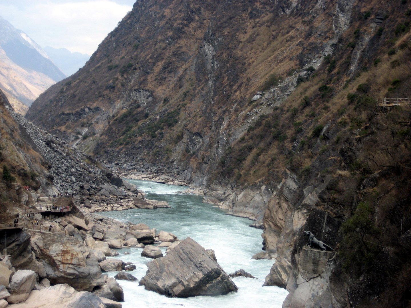
1. First Bend of the Nujiang viewpoints

Snapshot
Itinerary
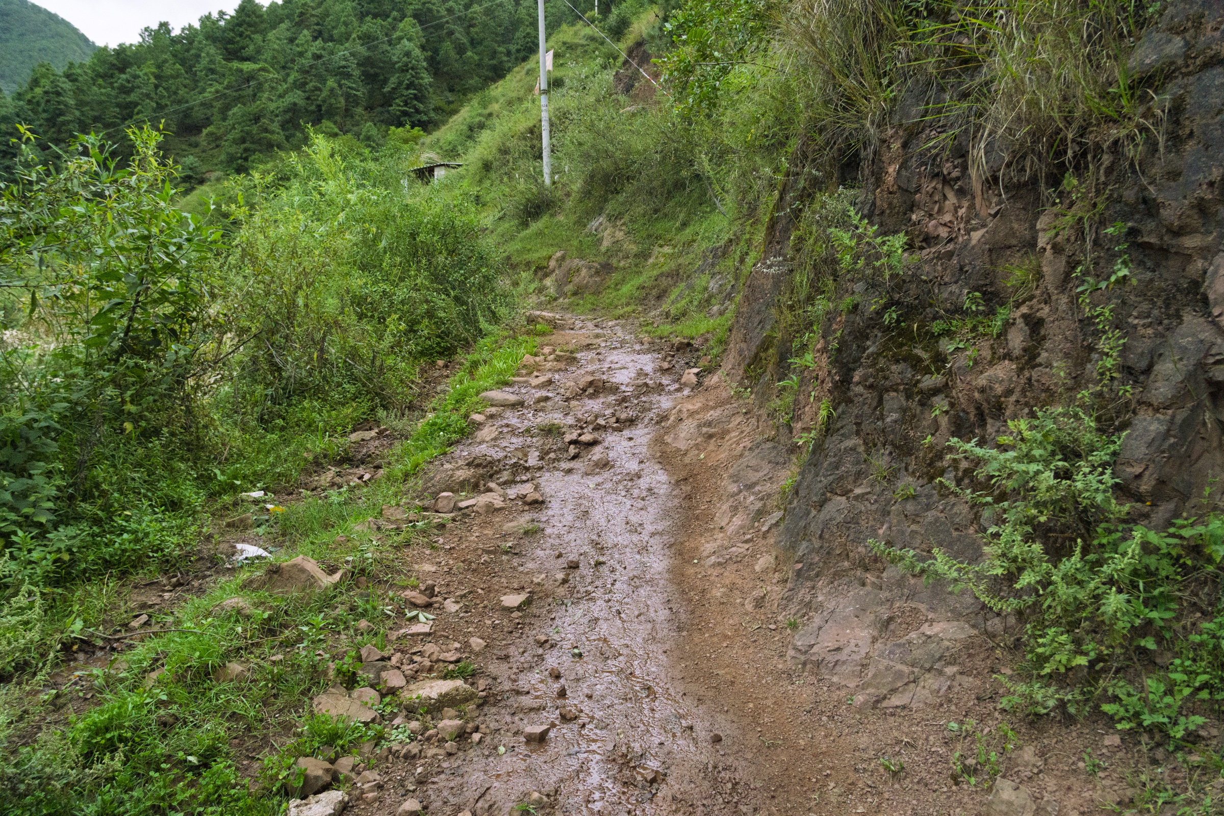
The route climbs and traverses above the Nujiang’s famous U-shaped bend near Bingzhongluo, using village paths, road/path segments, terraces, and viewpoints. The key experience is the river forced into a sharp turn below the Gaoligong cliffs, with village and terraced-field foregrounds.
Why it is essential
This is the defining Nujiang landscape — the gorge, the river bend, and the human geography of the deep valley in one long day walk.
Equipment
Boots or grippy trail shoes, rain shell, sun protection, water, food, trekking poles, offline map/GPS, and headtorch. Carry extra water in the dry season.
Hazards and notes
Long distance, heat at lower elevations, landslide-prone roads/trails, dogs in villages, and point-to-point logistics. Avoid after heavy rain.
GPX / KML links
| Source | URL | Format / access | Reuse status |
|---|---|---|---|
| AllTrails: First Bend of the Nujiang | alltrails.com | Route page / app map | AllTrails terms apply; source-map and statistics used; file reuse not confirmed |
| OpenStreetMap search: First Bend of the Nujiang | openstreetmap.org | OSM map/search | OSM data is ODbL; geometry cross-check only |
Further reading
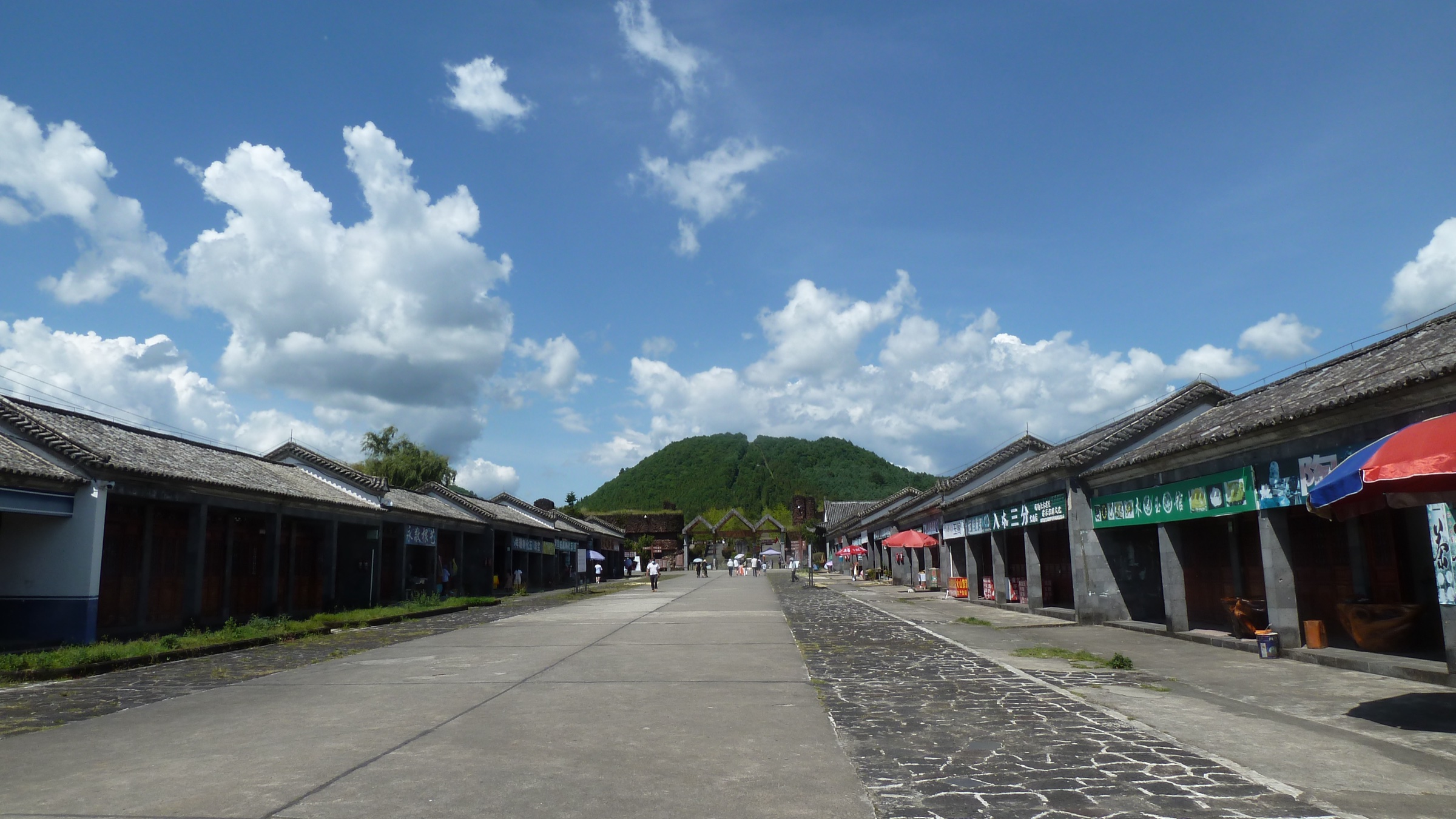
2. Wuli Village Loop
Snapshot
Itinerary
Walk a compact loop around Wuli’s village-and-river landscape, gaining steeply enough to open views over the Nujiang gorge before returning to the settlement. The route is short but not flat.
Why it is essential
Wuli gives a village-scale version of the Nujiang experience: traditional settlement, river gorge, and steep cultivated slopes in a half-day walk.
Equipment
Trail shoes, water, sun/rain protection, and poles if steep or muddy.
Hazards and notes
Steep paths, mud after rain, village dogs, and uncertain waymarking. Ask locally before crossing private agricultural areas.
GPX / KML links
| Source | URL | Format / access | Reuse status |
|---|---|---|---|
| AllTrails: Wuli Village Loop | alltrails.com | Route page / app map | AllTrails terms apply; source-map and statistics used; file reuse not confirmed |
| OpenStreetMap search: Wuli Village Nujiang | openstreetmap.org | OSM map/search | OSM data is ODbL; geometry cross-check only |
Further reading
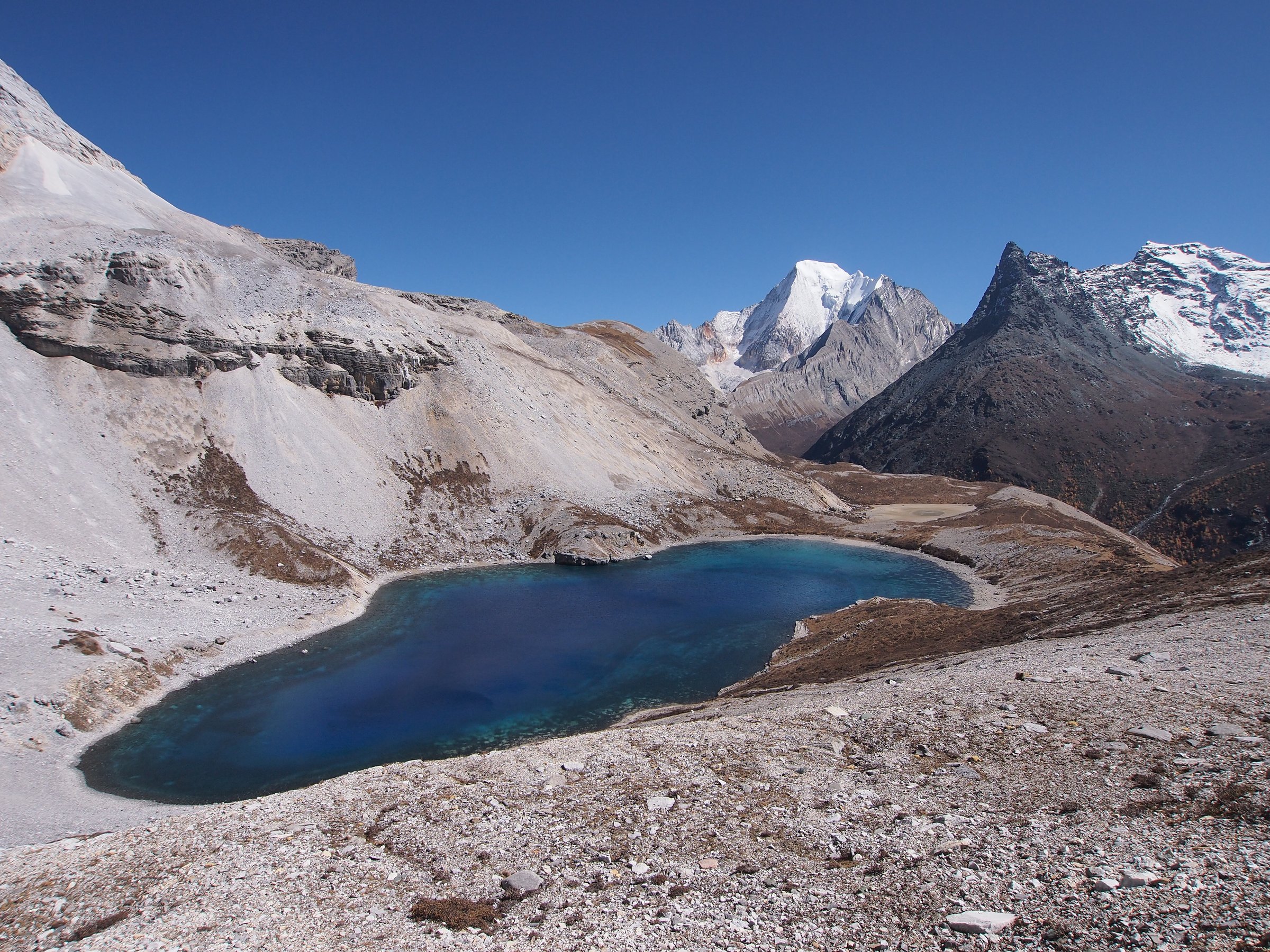
3. Mount Gongdangshenshan viewpoint
Snapshot
Itinerary
Follow the out-and-back trail to a high viewpoint on or near Gongdangshenshan above Bingzhongluo. The route is short enough to pair with local travel but climbs to a noticeably higher outlook over the Nujiang landscape.
Why it is essential
This is the compact high-viewpoint option for the northern Gaoligong/Nujiang sector, useful when the First Bend route is too long.
Equipment
Trail shoes, warm/wind layer, rain shell, water, and offline map.
Hazards and notes
Short but high compared with the valley floor; weather can obscure the view. Route marking and access details need local confirmation.
GPX / KML links
| Source | URL | Format / access | Reuse status |
|---|---|---|---|
| AllTrails: Mount Gongdangshenshan | alltrails.com | Route page / app map | AllTrails terms apply; source-map and statistics used; file reuse not confirmed |
| OpenStreetMap search: Gongdangshenshan Bingzhongluo | openstreetmap.org | OSM map/search | OSM data is ODbL; geometry cross-check only |
Further reading
4. Tengchong Volcano Cluster crater walk
Snapshot
Itinerary
Walk the opened crater and cone paths in the Tengchong Volcano Scenic Area, commonly focused on the large/small empty-mountain crater viewpoints and the volcanic landscape around the geological museum. Use only signed scenic-area paths.
Why it is essential
Tengchong is the volcanic counterpart to the Nujiang gorge. The crater walk represents the region’s Quaternary volcanic landscape better than any road viewpoint.
Equipment
Walking shoes, sun/rain protection, water, and a warm layer in windy weather.
Hazards and notes
Precise pedestrian distance and gain were not verified in this pass. Some parts of the broader geopark have protection zoning; do not enter closed areas or unofficial craters.
GPX / KML links
| Source | URL | Format / access | Reuse status |
|---|---|---|---|
| OpenStreetMap search: Tengchong Volcano Cluster | openstreetmap.org | OSM map/search | OSM data is ODbL; geometry cross-check only |
| Wikipedia: Tengchong volcanic field | en.wikipedia.org | Context page | CC BY-SA 4.0; context only, no GPX |
| Chinese Wikipedia: Tengchong Volcanic Geothermal National Geological Park | zh.wikipedia.org | Context page | CC BY-SA 4.0; context only, no GPX |
Further reading
- Wikipedia — Tengchong volcanic field
- Chinese Wikipedia — Tengchong Volcanic Geothermal National Geological Park
5. Tengchong Rehai geothermal boardwalk
Snapshot
Itinerary
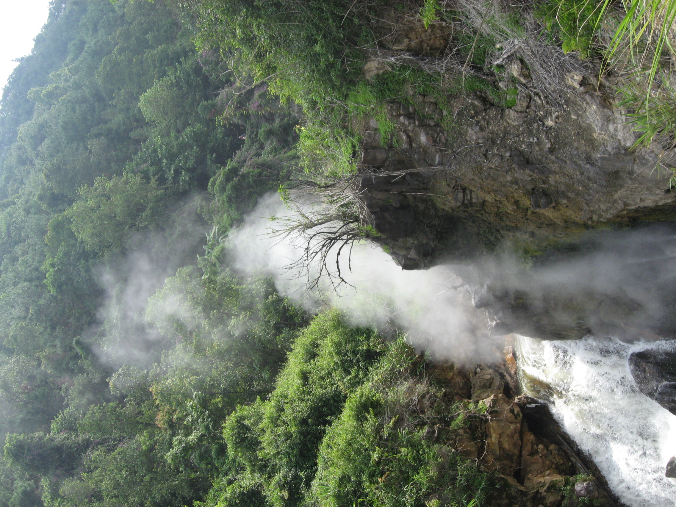
Follow the opened Rehai boardwalk and path system past geothermal vents, hot pools, steaming ground, and the famous large boiling-pool area. Keep to barriers and signed paths; this is a geothermal safety walk, not a free-form hike.
Why it is essential
Rehai completes the Tengchong volcanic story — the active geothermal landscape that gives the southern Gaoligong region a very different mountain-walk character from the Nujiang gorge.
Equipment
Comfortable walking shoes, water, rain/sun protection, and caution around steam and hot-water zones.
Hazards and notes
Geothermal burns, steam, slippery wet paths, and crowding. Exact public boardwalk length was not verified in this pass.
GPX / KML links
| Source | URL | Format / access | Reuse status |
|---|---|---|---|
| OpenStreetMap search: Rehai Tengchong | openstreetmap.org | OSM map/search | OSM data is ODbL; geometry cross-check only |
| Chinese Wikipedia: Tengchong Rehai Tourist Area | zh.wikipedia.org | Context page | CC BY-SA 4.0; context only, no GPX |
Further reading
Missing data / follow-up
- No official GPX/KML downloads were found for any of the five routes.
- Tengchong Volcano Cluster and Rehai need official scenic-area maps or field-measured GPX before guidebook publication.
- Baihualing/Gaoligong forest trails were not selected because no legal opened day-hike route with adequate statistics was verified in this pass.
Further reading
| Source | URL |
|---|---|
| AllTrails — First Bend of the Nujiang | alltrails.com |
| AllTrails — Wuli Village Loop | alltrails.com |
| AllTrails — Mount Gongdangshenshan | alltrails.com |
| UNESCO — Three Parallel Rivers of Yunnan Protected Areas | whc.unesco.org |
| Wikipedia — Tengchong volcanic field | en.wikipedia.org |
| Chinese Wikipedia — Tengchong Volcanic Geothermal National Geological Park | zh.wikipedia.org |
| Chinese Wikipedia — Tengchong Rehai Tourist Area | zh.wikipedia.org |