Regional overview
Cangshan (苍山, “Azure Mountains”) is the long north–south wall that rises directly above Dali Old Town and the western shore of Erhai Lake, in the eastern Hengduan Mountains of Yunnan. The range stretches roughly 50 km between Eryuan in the north and Xiaguan in the south, with nineteen named peaks and eighteen streams draining east into the basin. The high point at Malong Peak reaches 4,122 m, well above the Dali plateau at about 2,000 m. The Cangshan-Erhai National Nature Reserve protects the range as a single geographic unit, and the southern half is also inscribed in the Dali-Cangshan UNESCO Global Geopark for its Cangshan-group metamorphic geology and surface-water heritage.
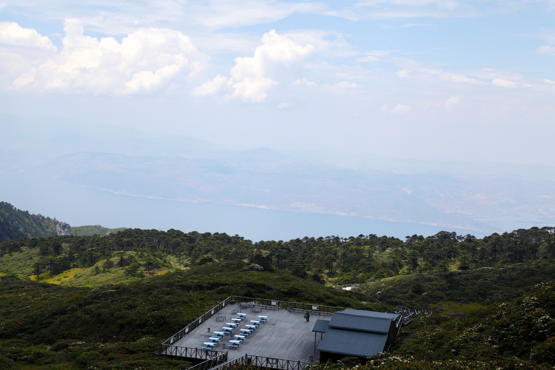
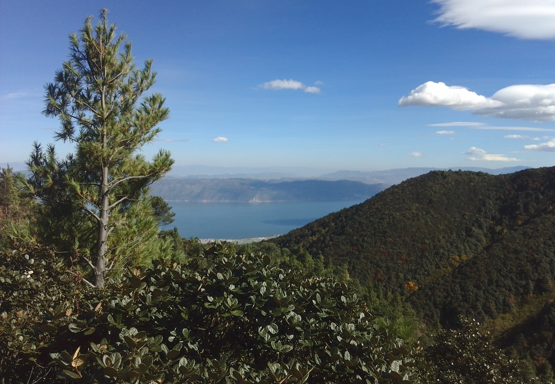
The classic walking experience here is not a remote wilderness traverse but a balcony route between mountain temples and cableway stations: forested slopes, stream-cut gorges, Tang and Song-era temple sites, high meadows, waterfalls, and summit ridges, with constant views east over Erhai and the Dali basin. Two cableways — the Cangshan and the Zhonghe — climb to bench stations on the middle of the range, and the Jade Belt Cloud Road (玉带云游路) contours along the mountain at roughly 2,600 m, linking the upper stations and several temple paths into a single high traverse.
Access is unusually fluid. Walking inside the reserve depends on which scenic-area gates, paths and cableways are open at any given moment, and closures change month by month. AllTrails route notes checked in this pass report that, as of November 2025, the trail from the Three Pagodas approach to Cangshan was closed for repairs until further notice, with cable-car access still possible; the same source reported in April 2026 that the hiking trail to Zhonghe Temple was closed for obstructions until further notice, with chairlift access still possible. Treat every Cangshan hiking plan as provisional until on-the-ground scenic-area staff confirm the route is open.
Best walking seasons are spring (March to May) and autumn (September to November). Summer monsoon weather brings slippery stone, cloud, leeches and stream hazards; winter is cold and windy above the cableway stations, with occasional snow on the upper ridges. Carry layers for the temperature drop between Dali at 2,000 m and the Jade Belt corridor at 2,600 m or higher. Cangshan sits at the southern end of the Hengduan walking arc that continues north through the Gaoligong massif on the Nujiang and culminates in the Min Mountains around Jiuzhaigou and Huanglong.
Selection rationale
The five hikes below cover the Cangshan-Dali walking spectrum: the iconic Jade Belt Cloud Road balcony at mid-mountain, the demanding Ximatan / Cangshan high route from the upper cable-car station toward the 3,800 m ridge, the Zhonghe Temple heritage path on the lower flank above Dali Old Town, a lower-elevation gorge and stream walk in the Cangshan Grand Canyon, and the cultural foothill walk at the Three Pagodas of Chongsheng Temple. Route statistics are strongest for the AllTrails-sourced entries; the Qingbi Stream / Cangshan Grand Canyon walk remains candidate-level because exact public statistics were not verified. The set deliberately spans the full vertical range, from a 2,000 m temple plaza to 3,888 m on the high cableway corridor.
Summary table
| # | Hike | Country | Route type | Distance | Gain | Max elevation | Difficulty |
|---|---|---|---|---|---|---|---|
| 1 | Cangshan Jade Belt Cloud Road traverse | China | Point-to-point | 15.8 km | 1,348 m | 2,762 m | Hard |
| 2 | Ximatan / Cangshan high route via cable car | China | Out-and-back | 15.4 km | 1,847 m | 3,888 m | Very hard |
| 3 | Zhonghe Temple and Jade Cloud Path | China | Out-and-back | 8.2 km | 608 m | 2,603 m | Hard |
| 4 | Qingbi Stream / Cangshan Grand Canyon | China | Out-and-back | ~3–8 km (unresolved) | Unresolved | Unresolved | Moderate |
| 5 | Three Pagodas of Chongsheng Temple foothill walk | China | Out-and-back | 4.0 km | 157 m | 2,162 m | Easy–moderate |
1. Cangshan Jade Belt Cloud Road traverse
Snapshot
Itinerary
The Jade Belt Cloud Road is the classic Cangshan balcony walk. It contours along the mid-mountain bench at roughly 2,600 m, with the mountain wall rising west and the Dali basin and Erhai falling away east. The standard line starts at one upper cableway station, follows the Jade Belt corridor past temples, stream crossings, viewpoints and signed side spurs to the second station, and descends by cableway. The natural route is roughly 15 km on the high path, with 1,348 m of gain if the lower legs are walked on foot rather than ridden, and a maximum elevation of about 2,762 m where the path climbs across a side ridge.
Cableway-assisted variants are the norm. Walking up from the lower gates adds substantial climb without changing the headline view, and is often the section closed for repairs.
Why it is essential
This is the signature Cangshan day walk: a long, mostly level balcony line with the mountain wall on one side and the Dali-Erhai panorama on the other, threaded through a string of temple sites and stream crossings that give the route its cultural character. It is the route most directly responsible for Cangshan’s reputation as a walking objective.
Equipment
Trail shoes or light boots, rain shell, warm layer for the upper section, 2 L water, snacks, sun protection, and an offline map. A headtorch in case of a late descent or a missed last cableway.
Hazards and notes
As of November 2025, AllTrails reported the trail from the Three Pagodas approach to Cangshan closed for repairs until further notice; cableway access was still possible. Check current signage at the lower gates before starting, do not bypass closure notices, and confirm last-cableway times on arrival.
GPX / route file
| Source | URL | Format | Notes |
|---|---|---|---|
| AllTrails — Cangshan and the Jade Cloud Road | alltrails.com | Source map / app route | AllTrails terms apply; direct GPX not retrieved; source-map reference only |
| OpenStreetMap search — Cangshan Jade Belt Cloud Road | openstreetmap.org | Map / search | OSM data is ODbL; geometry cross-check only |
Further reading
2. Ximatan / Cangshan high route via cable car
Snapshot
Itinerary
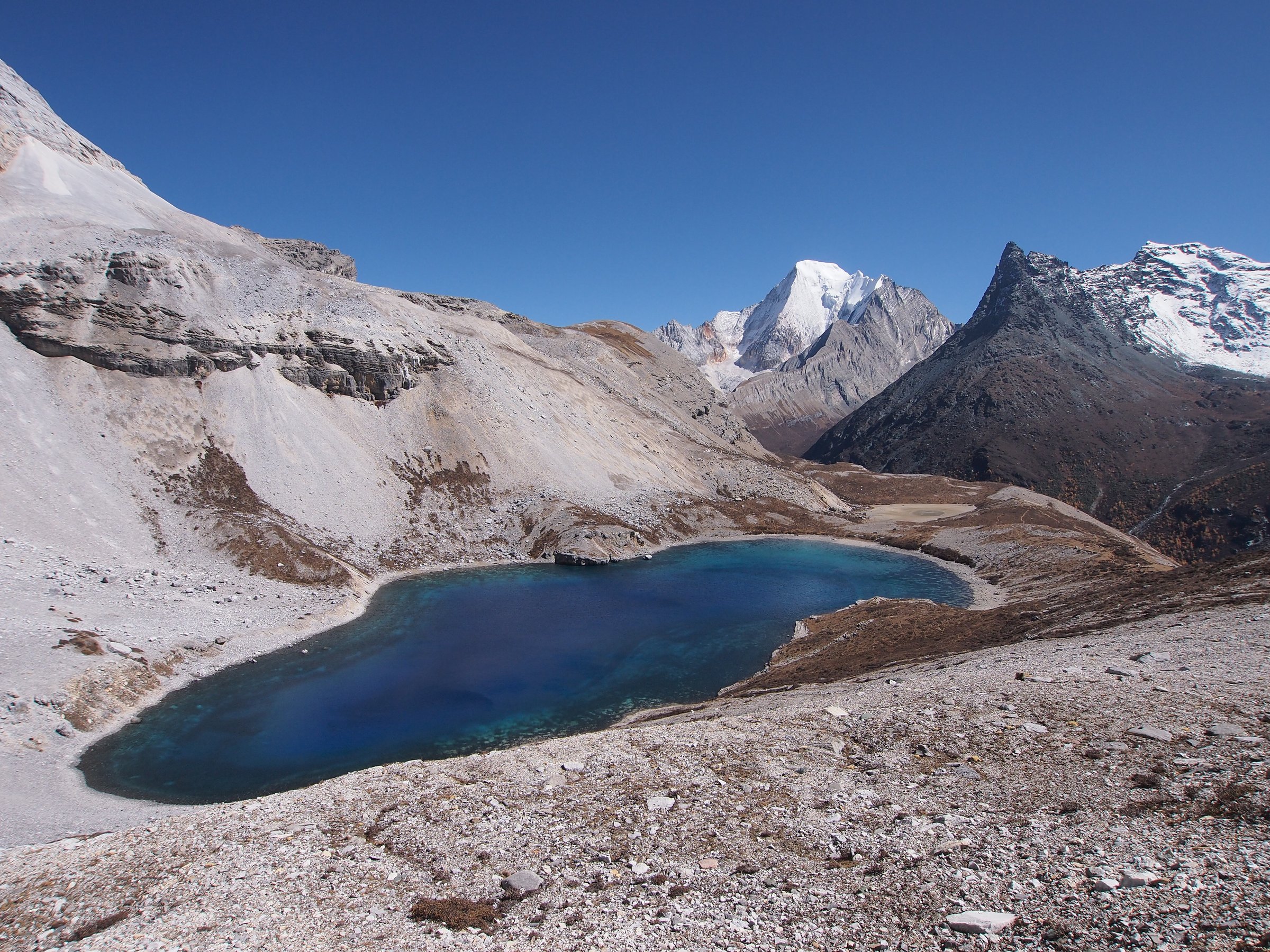
This is the high-altitude Cangshan option. From the Cangshan cableway upper station the path climbs north along the ridge corridor above the Jade Belt bench toward the Ximatan area and the high Cangshan viewpoints, rising to about 3,888 m. The terrain is open meadow, rhododendron and exposed rock above the tree line, with continuous views east over Erhai and west toward the Pinchuan range. The day is long: 15.4 km out-and-back with 1,847 m of cumulative gain even from the upper cable-car start, and a sustained nine to ten hours on the trail before the return cableway.
Why it is essential
This is the only walk in the catalogue that reaches the true high ground of Cangshan — the ridge-and-meadow world above the temples, the cableway stations and the Jade Belt balcony. It shows the alpine character that the lower routes can only hint at.
Equipment
Boots with traction, waterproof shell, warm insulation including hat and gloves outside midsummer, 2.5 L water, food for a long day, an offline map and GPS, a headtorch, and an emergency insulating layer. Sun protection is essential — the upper traverse has no shade.
Hazards and notes
Altitude near 3,900 m, strong wind and exposure to cloud, whiteout or storms are the headline hazards. Cable-car closure can leave walkers stranded above the upper station; confirm operating hours and a hard turnaround time before starting. AllTrails’ November 2025 access warning about Cangshan trail repairs also affects low-route approaches to this route.
GPX / route file
| Source | URL | Format | Notes |
|---|---|---|---|
| AllTrails — Cangshan Mountain via Cable Car | alltrails.com | Source map / app route | AllTrails terms apply; direct GPX not retrieved; source-map reference only |
| OpenStreetMap search — Ximatan Cangshan | openstreetmap.org | Map / search | OSM data is ODbL; geometry cross-check only |
Further reading
3. Zhonghe Temple and Jade Cloud Path
Snapshot
Itinerary
The path climbs from the Cangshan Gate area above Dali Old Town through pine and broadleaf forest toward Zhonghe Temple (中和寺) on the lower flank, then continues to a short signed section of the Jade Cloud Path before turning back. The route connects Dali’s Buddhist temple heritage with the forested mountain slopes and frames the Erhai panorama from a height that the foothill walks below cannot reach. AllTrails records 8.2 km out-and-back with 608 m of gain and a maximum elevation of 2,603 m.
If the hiking trail is closed, the parallel Zhonghe chairlift remains an option for sightseeing access only; do not walk closed sections.
Why it is essential
Zhonghe Temple is one of the classic cultural anchors of Cangshan walking — a temple objective rather than a pure viewpoint route. When open it offers the shortest day with a meaningful temple destination on the mountain.
Equipment
Trail shoes, 1.5 L water, rain shell, warm layer for the upper benches, sun protection.
Hazards and notes
AllTrails reported in April 2026 that the hiking trail to Zhonghe Temple was closed for obstructions until further notice, with chairlift access still possible. Confirm current status at the lower station before committing to the walk; do not bypass closure notices.
GPX / route file
| Source | URL | Format | Notes |
|---|---|---|---|
| AllTrails — Zhonghe Temple / Jade Cloud Path | alltrails.com | Source map / app route | AllTrails terms apply; access closure noted at source; direct GPX not retrieved |
| OpenStreetMap search — Zhonghe Temple Cangshan | openstreetmap.org | Map / search | OSM data is ODbL; geometry cross-check only |
Further reading
4. Qingbi Stream / Cangshan Grand Canyon
Snapshot
Itinerary
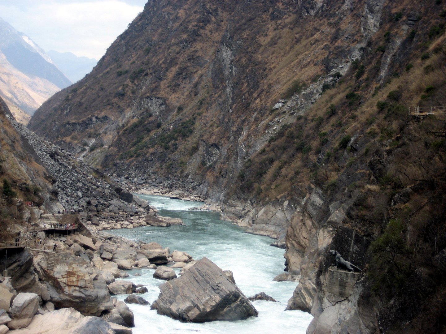
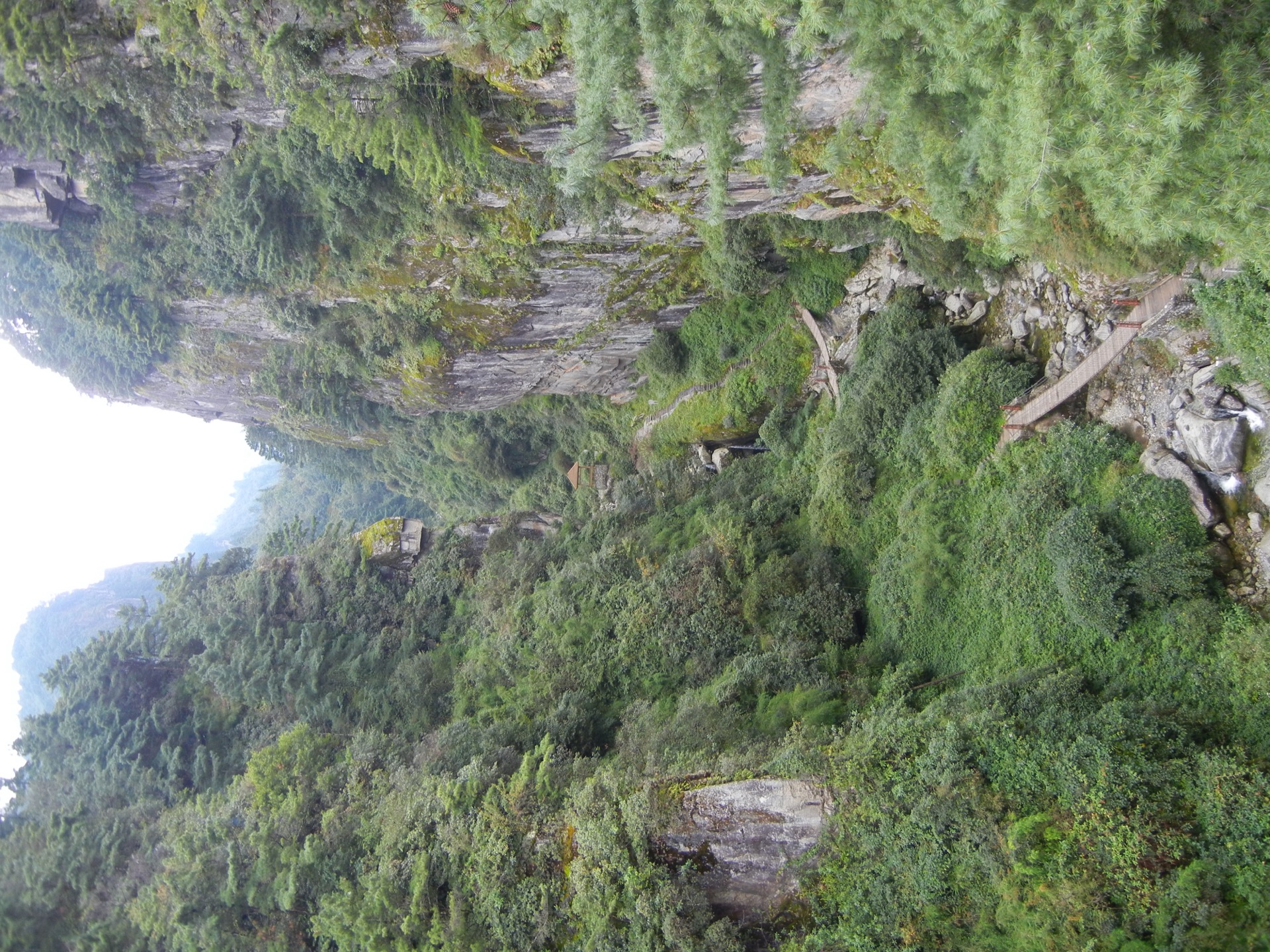
The Cangshan Grand Canyon is one of the eighteen streams that cut the eastern face of the range, gathering below the Jade Belt corridor in a stream-and-cliff gorge. The walk follows the opened scenic path along the stream from the Gantong / Qingbi access, threading through forest, stone steps and small waterfall viewpoints to a turnaround at a higher pool or stream junction. This is the lower-elevation, water-focused entry in the Cangshan set, intended as the counterpoint to the high cableway and balcony routes — but the exact public path length and high point change with stream conditions and scenic-area gating.
Why it is essential
Cangshan is cut by many streams and ravines; a gorge walk gives a different mountain texture from the balcony road and high cableway routes, and is the only entry in this catalogue that stays close to running water for most of the day.
Equipment
Grippy hiking shoes that handle wet stone, rain shell, 1.5 L water, food, and trekking poles for the stream crossings.
Hazards and notes
Do not enter after heavy rain or during the monsoon: stream flow, rockfall and slippery stone are the main concerns, and the gorge can become a trap. This route needs a field-mapped GPX or an official scenic-area map before it can be promoted out of candidate-only status.
GPX / route file
| Source | URL | Format | Notes |
|---|---|---|---|
| OpenStreetMap search — Qingbi Stream Cangshan | openstreetmap.org | Map / search | OSM data is ODbL; geometry cross-check only |
| OpenStreetMap search — Cangshan Grand Canyon | openstreetmap.org | Map / search | OSM data is ODbL; geometry cross-check only |
Further reading
5. Three Pagodas of Chongsheng Temple foothill walk
Snapshot
Itinerary
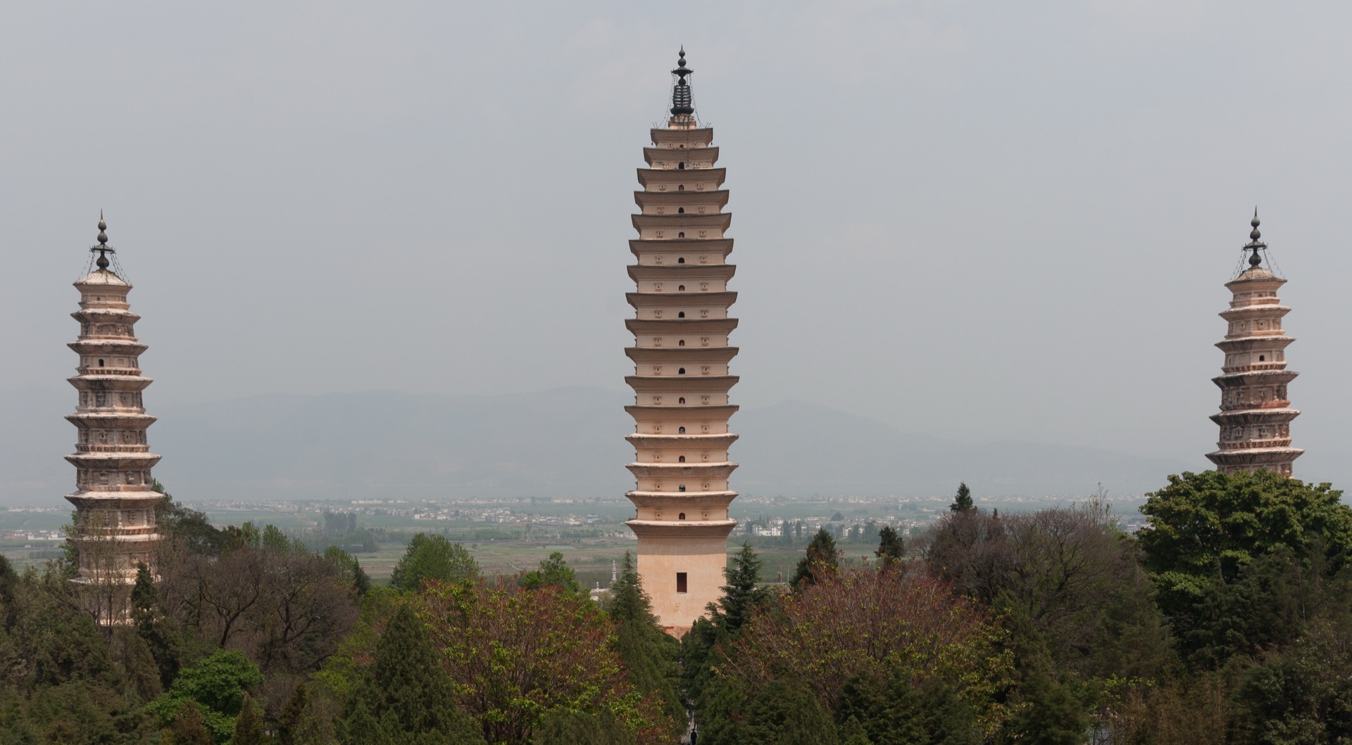
The walk threads through the Chongsheng Temple (崇圣寺) and Three Pagodas grounds at the foot of Cangshan, north of Dali Old Town. From the scenic entrance the path passes the main Qianxun Pagoda — a 69 m brick stupa dating from the 9th-century Nanzhao kingdom — and the two smaller flanking pagodas, then continues uphill through reconstructed temple courtyards to the Reflection Pond and the upper viewpoints under the mountain wall. The return is by the same line through the temple grounds.
This is a short cultural walk, not a high mountain route, but it anchors the Cangshan skyline in Dali’s most recognisable historic foreground.
Why it is essential
The Three Pagodas are the iconic cultural view of Cangshan. Including this walk keeps the Cangshan-Dali set from becoming only cableways and high trails, and gives a short, accessible day that pairs with a longer Jade Belt or Zhonghe outing.
Equipment
Comfortable walking shoes, sun protection, 1 L water, and a light rain layer in wet weather.
Hazards and notes
Crowds, steps and sun exposure are the main issues. The 4.0 km distance is shorter than the catalogue’s usual five-kilometre target but the route is included for cultural importance and as the natural Dali foreground to the higher walks.
GPX / route file
| Source | URL | Format | Notes |
|---|---|---|---|
| AllTrails — Three Pagodas of Chongsheng Temple | alltrails.com | Source map / app route | AllTrails terms apply; direct GPX not retrieved; source-map reference only |
| OpenStreetMap search — Three Pagodas Dali | openstreetmap.org | Map / search | OSM data is ODbL; geometry cross-check only |
Further reading
Further reading
| Source | URL |
|---|---|
| UNESCO — Dali-Cangshan UNESCO Global Geopark | unesco.org |
| Wikipedia — Cangshan | en.wikipedia.org |
| Wikipedia — Three Pagodas | en.wikipedia.org |
| AllTrails — Cangshan and the Jade Cloud Road | alltrails.com |
| AllTrails — Cangshan Mountain via Cable Car | alltrails.com |
| AllTrails — Zhonghe Temple / Jade Cloud Path | alltrails.com |
| AllTrails — Three Pagodas of Chongsheng Temple | alltrails.com |
| China Travel Note — Cangshan Jade Belt Cloud Tour Road | china-travelnote.com |
| Wikimedia Commons — Category: Cangshan | commons.wikimedia.org |