Regional overview
The Meili Snow Mountain / Deqin region is the northern Yunnan face of the Hengduan Mountains: high sacred peaks, deep Lancang/Mekong valleys, glacier-fed side valleys, Tibetan villages, pilgrimage paths, and the famous Kawagebo massif. The main hiking bases are Feilai Temple, Xidang, Ninong, Mingyong, and Yubeng, with Yubeng serving as the base for the best-known day walks.
The walking character is high-altitude and access-dependent. Several routes start around 3,000 m and reach 3,800-4,000 m; weather, snow, road works, scenic-area rules, and Yubeng access arrangements can change the practical route. Current local confirmation is essential before relying on Xidang, Ninong, or scenic-area shuttles.
Best seasons are generally spring and autumn, with summer rain increasing landslide and muddy-trail risk and winter/early spring bringing ice and avalanche risk. In February 2025 Chinese state media reported temporary closure of the Yubeng scenic area after snow/ice hazards; use local official channels before departure.
Selection rationale
These five routes cover the Meili essentials available to day hikers: the classic pilgrimage approach into Yubeng, the glacier-lake walk, the sacred waterfall pilgrimage, the Ninong canyon exit, and the managed Mingyong Glacier walk. Route-file evidence is strongest for the AllTrails and Outdooractive routes; Mingyong has route character verified but precise GPX/statistics remain weaker.
Summary table
| # | Hike | Country | Route type | Distance | Gain | Max elevation | Difficulty |
|---|---|---|---|---|---|---|---|
| 1 | Xidang Hot Springs to Upper Yubeng via Nanzong Pass | China | Point-to-point | 8.9-18 km depending start/source | 1,060-1,100 m | 3,729-3,776 m | Hard |
| 2 | Yubeng to Glacier / Ice Lake | China | Out-and-back | 11.9-14 km | 854-900 m | 3,882 m | Hard |
| 3 | Lower/Upper Yubeng to Sacred Waterfall | China | Out-and-back | 12-14 km | 600-650 m | 3,650-4,000 m unresolved | Hard |
| 4 | Yubeng to Ninong Grand Canyon | China | Point-to-point | 13.5-14.3 km | Net descent; AllTrails records 589 m gain | 3,223 m | Moderate-hard |
| 5 | Mingyong Glacier boardwalk to glacier viewpoint | China | Shuttle-assisted out-and-back | 4-11 km depending shuttle use | Approx. 300 m | Approx. 3,000 m viewpoint | Moderate |
1. Xidang Hot Springs to Upper Yubeng via Nanzong Pass
Snapshot
Itinerary
The classic approach climbs from Xidang Hot Springs through forest and teahouse/rest points to Nanzong Pass, then descends into Upper Yubeng. The route is a pilgrimage approach rather than a casual valley walk: the main effort is the sustained ascent to the pass, followed by a steep descent into the village.
Why it is essential
This is the traditional foot approach to Yubeng and gives the Meili entry its clearest sense of pilgrimage geography: crossing from the Lancang-side access valley into the hidden settlement below Kawagebo.
Equipment
- Boots
- Warm layer
- Waterproof shell
- Sun protection
- Water
- Food
- Trekking poles
- Offline map/GPS
- Headtorch
- Traction if snow or ice is reported
Hazards and notes
- Altitude, snow on the pass, mud, mule/vehicle traffic, and access changes are the main issues.
- Recent traveller reports have described periodic restrictions or construction-related changes to the Xidang approach; confirm with the Deqin Meili Snow Mountain National Park official channel or local guesthouses before starting.
GPX / KML links
| Source | URL | Format / access | Reuse status |
|---|---|---|---|
| Outdooractive: Xidang Hot Springs to Upper Yubeng | outdooractive.com | Route page / map | Outdooractive terms apply; source-map found; reusable route-file status not confirmed |
| OpenStreetMap search: Xidang Yubeng | openstreetmap.org | OSM map/search | OSM data is ODbL; geometry cross-check only |
External links
- Outdooractive — Xidang Hot Springs to Upper Yubeng
- 360 Nomad — Yubeng hiking guide
- Yunnan Net — Meili Snow Mountain overview
- CCTV — Yubeng temporary closure report, 24 February 2025
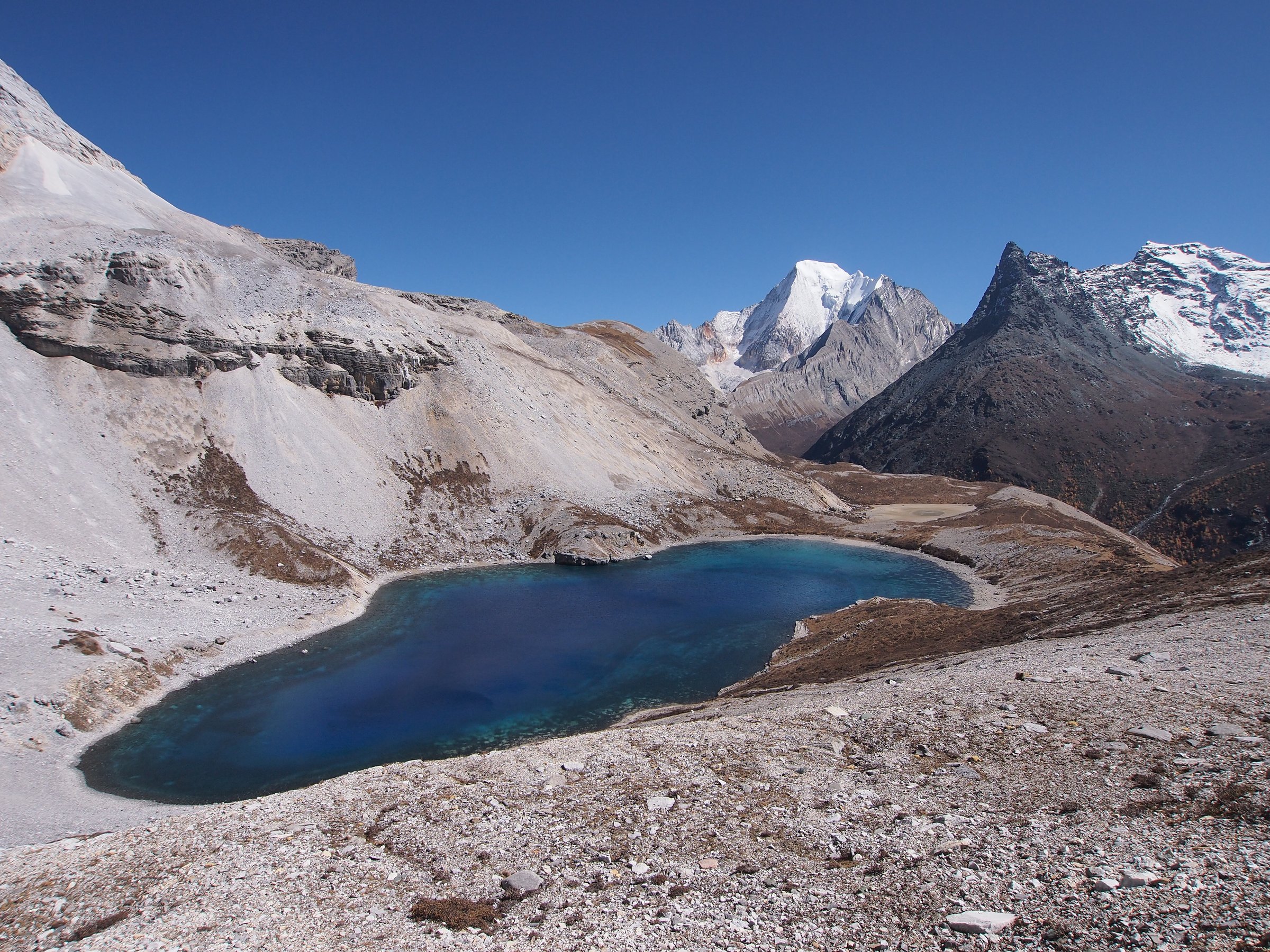
2. Yubeng to Glacier / Ice Lake
Snapshot
Itinerary
From Upper Yubeng, the trail climbs through forest and rhododendron/fir country toward Xiaonong Base Camp and the glacier-fed lake below the Meili peaks. The final approach is rougher and rockier, with views towards glacier and snow mountain terrain. Return by the same path to Upper Yubeng.
Why it is essential
Ice Lake is the classic alpine-lake day hike from Yubeng and gives close views of the glaciated north Yunnan sacred-mountain landscape without entering technical glacier terrain.
Equipment
- Mountain hiking footwear
- Trekking poles
- Warm layer
- Waterproof shell
- Gloves/hat outside midsummer
- Food
- Water
- Offline map
- Traction if ice is reported
Hazards and notes
- Altitude, steep muddy sections, boulder terrain near the lake, lingering snow, and afternoon storms are the key hazards.
- Start early and turn back if weather or altitude symptoms worsen.
GPX / KML links
| Source | URL | Format / access | Reuse status |
|---|---|---|---|
| AllTrails: Yubeng to Glacier Lake | alltrails.com | Route page / app map | AllTrails terms apply; source-map and statistics used; file reuse not confirmed |
| Wikimedia Commons category: Yubeng Ice Lake | commons.wikimedia.org | Media category | Per-file licences vary; photo source only |
External links
- AllTrails — Yubeng to Glacier Lake
- Hiking in China — Meili/Yubeng trek notes
- China Highlights — Meili Snow Mountain route context
3. Lower/Upper Yubeng to Sacred Waterfall
Snapshot
Itinerary
The route leaves the Yubeng village area and follows the valley towards the sacred waterfall below the Meili peaks. The path passes forest, prayer flags, pilgrimage points, and steeper upper sections before reaching the waterfall basin. Return by the same route.
Why it is essential
The Sacred Waterfall is the principal Yubeng pilgrimage day walk and adds the region’s living Tibetan sacred-mountain practice to the catalogue, not just its scenery.
Equipment
- Boots or grippy hiking shoes
- Rain shell
- Warm layer
- Water
- Food
- Sun protection
- Trekking poles
- Microspikes if ice is reported
Hazards and notes
- Respect local pilgrimage practice around the waterfall.
- Snow, ice, avalanche hazard, and slippery paved sections can make the route serious.
- Check current official local conditions before starting.
GPX / KML links
| Source | URL | Format / access | Reuse status |
|---|---|---|---|
| OpenStreetMap search: Yubeng Sacred Waterfall | openstreetmap.org | OSM map/search | OSM data is ODbL; geometry cross-check only |
| TrekChina Meili Snow Mountain Yubeng Trek | trekchina.com | Itinerary/source route description | Site terms apply; statistics used as secondary source; no reusable GPX confirmed |
External links
- Go Western China — Yubeng Sacred Waterfall attraction notes
- TrekChina — Meili Snow Mountain Yubeng Trek route statistics
- Yunnan Net — Meili Snow Mountain overview
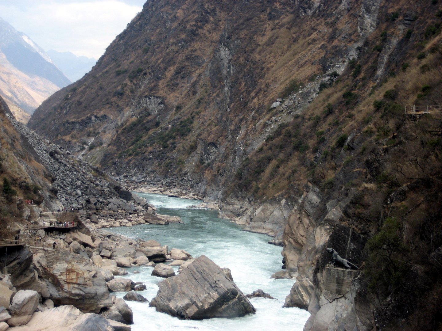
4. Yubeng to Ninong Grand Canyon
Snapshot
Itinerary
The route exits Yubeng through forest and canyon terrain towards Ninong, eventually following cliff-side and valley paths above the Yubeng River / Lancang drainage. It is commonly used as a one-way exit from Yubeng rather than a pure recreational loop.
Why it is essential
The Ninong route completes the standard Yubeng trekking circuit and gives a contrasting canyon descent after the high village, lake, and waterfall walks.
Equipment
- Mountain hiking shoes
- Poles
- Water
- Food
- Sun protection
- Waterproof layer
- Offline map
- Headtorch for delays
Hazards and notes
- Narrow cliff sections, heat, rockfall, landslides, mud, and exposure are the main hazards.
- Avoid in heavy rain or immediately after storms.
- Some accounts advise that inexperienced or vertigo-prone walkers avoid the route.
GPX / KML links
| Source | URL | Format / access | Reuse status |
|---|---|---|---|
| AllTrails: Yubeng to Ninong | alltrails.com | Route page / app map | AllTrails terms apply; source-map and statistics used; file reuse not confirmed |
| Outdooractive: Hiking route from Upper Yubeng to Ninong | outdooractive.com | Route page / map | Outdooractive terms apply; source-map found; reusable route-file status not confirmed |
External links
- AllTrails — Yubeng to Ninong
- Outdooractive — Hiking route from Upper Yubeng to Ninong
- 360 Nomad — Yubeng hiking guide
- Mafengwo — Ninong route warning and timing
5. Mingyong Glacier Boardwalk to Glacier Viewpoint
Snapshot
Itinerary
From the Mingyong visitor system, walkers use or follow the access road to the upper trail start, then continue on paved and wooden boardwalk sections through forest to the glacier-view area. The route does not enter the glacier. Return by the same path.
Why it is essential
Mingyong is the accessible glacier-view day walk of Meili Snow Mountain and balances the harder Yubeng routes with a managed half-day option.
Equipment
- Standard hiking equipment
- Warm layer
- Rain shell
- Water
- Sun protection
- Traction if icy
Hazards and notes
- Do not leave the boardwalk or approach unstable glacier/river margins.
- The glacier is retreating and the safe viewpoint arrangement may change; follow scenic-area signs.
GPX / KML links
| Source | URL | Format / access | Reuse status |
|---|---|---|---|
| OpenStreetMap search: Mingyong Glacier | openstreetmap.org | OSM map/search | OSM data is ODbL; geometry cross-check only |
| China Discovery: Mingyong Glacier classic hiking route | chinadiscovery.com | Route description | Site terms apply; no reusable GPX confirmed |
External links
- China Discovery — Meili Snow Mountain / Mingyong Glacier
- Lonely Planet — Mingyong Glacier access notes
- Go Western China — Mingyong Glacier route character
Missing data / follow-up work
- Confirm current Xidang and Ninong access rules with the Deqin Meili Snow Mountain National Park official WeChat channel before publication.
- Sacred Waterfall maximum elevation differs by source; field GPS or official route data needed.
- Mingyong Glacier distance/elevation gain needs a current official scenic-area map or GPS track.
- Route-file reuse rights for AllTrails and Outdooractive are not confirmed.
- Several photos are regional rather than route-specific; Sacred Waterfall and Ninong need better licence-compatible images.
External links
| Source | URL |
|---|---|
| Yunnan Net — Meili Snow Mountain overview | yunnan.cn |
| CCTV — Yubeng closure report | news.cctv.com |
| AllTrails — Yubeng to Glacier Lake | alltrails.com |
| AllTrails — Yubeng to Ninong | alltrails.com |
| Outdooractive — Xidang Hot Springs to Upper Yubeng | outdooractive.com |
| Outdooractive — Hiking route from Upper Yubeng to Ninong | outdooractive.com |
| China Highlights — Meili Snow Mountain | chinahighlights.com |
| China Discovery — Meili Snow Mountain | chinadiscovery.com |
| Lonely Planet — Mingyong Glacier | lonelyplanet.com |
| Go Western China — Yubeng Sacred Waterfall | gowesternchina.com |
| Go Western China — Mingyong Glacier | gowesternchina.com |
| TrekChina — Meili Snow Mountain Yubeng Trek | trekchina.com |
| 360 Nomad — Yubeng hiking guide | 360nomad.org |
| Hiking in China — Yubeng | hikinginchina.net |
| Mafengwo — Ninong route warning | mafengwo.cn |