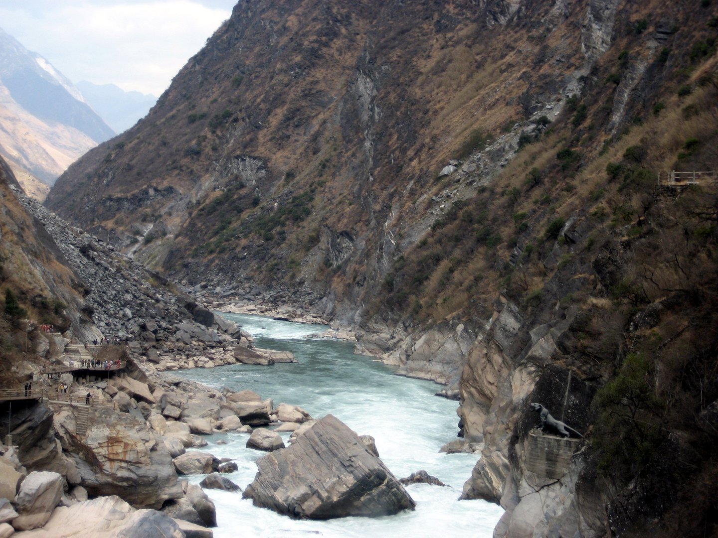
Regional overview
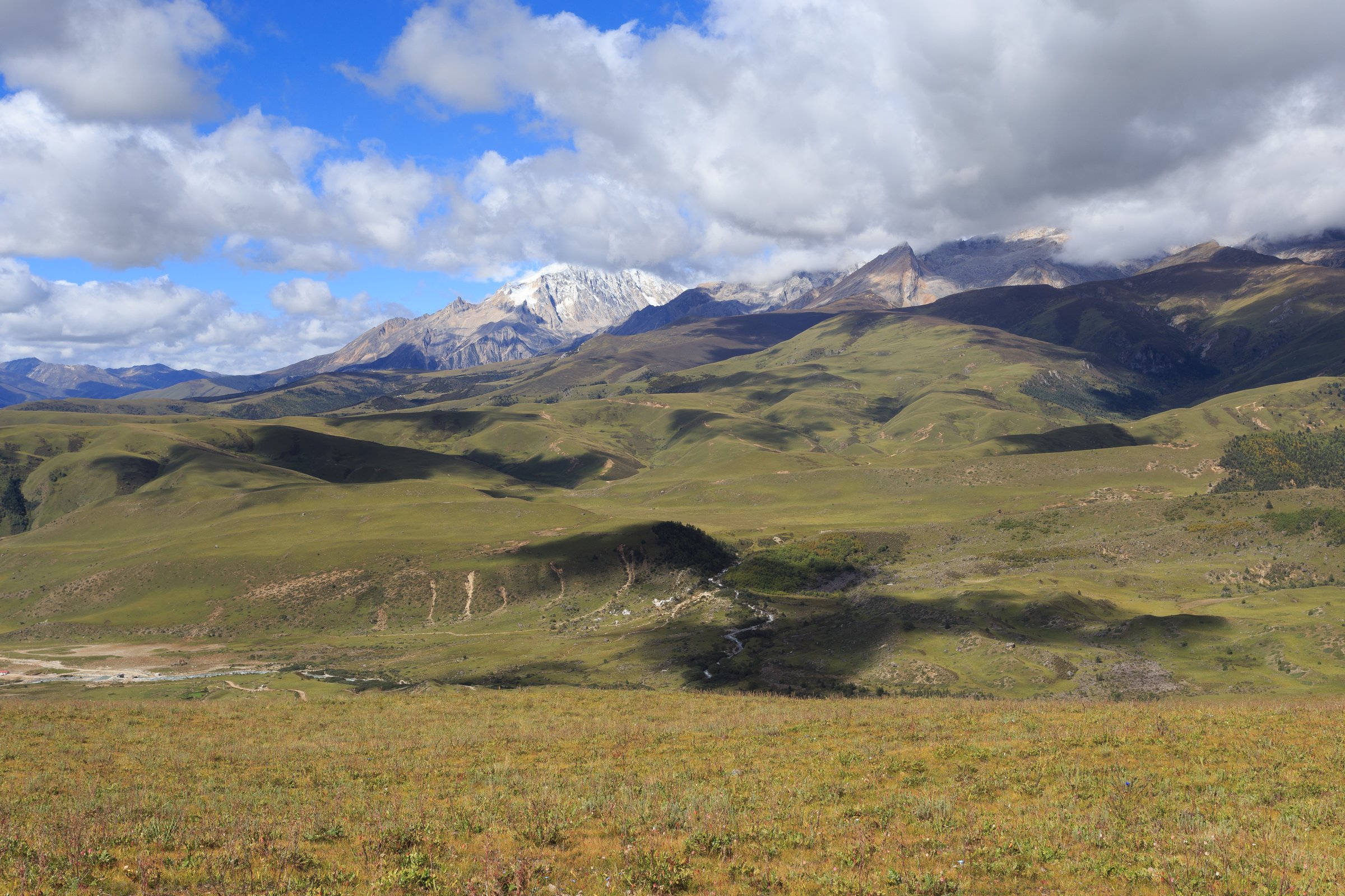
The Litang-Daocheng-Yading sector lies in the Shaluli / western Sichuan Hengduan highlands: broad Tibetan plateau, sacred snow peaks, glacial lakes, high meadows, monastery landscapes, and road passes above 4,000 m. The most developed walking is inside Yading National Nature Reserve; Litang/Genyen and Haizi Mountain routes are wilder, less standardised, and more access-dependent.
Altitude is the central safety issue. Litang is around 4,000 m, Yading walks start near 3,900 m, and the long lake route reaches about 4,560-4,700 m depending source. Scenic-area shuttles and electric carts change the distance actually walked, and off-route hiking may be restricted.
Best seasons are May-October, with September-October especially valued for clear weather and autumn colour. Snow, ice, thunderstorms, shuttle rules, and high-altitude illness can all stop a route.
Selection rationale
The five hikes cover the regulated Yading core and the broader Shaluli context: the famous Milk Lake/Five-Color Lake route, the shorter Pearl Lake/Chonggu walk, the Luorong Pasture valley walk, the Genyen/Lenggu monastery foothills, and the Haizi Mountain lake plateau. The last two require more follow-up because route statistics and legal access are less standardised.
Summary table
| # | Hike | Country | Route type | Distance | Gain | Max elevation | Difficulty | Photo status |
|---|---|---|---|---|---|---|---|---|
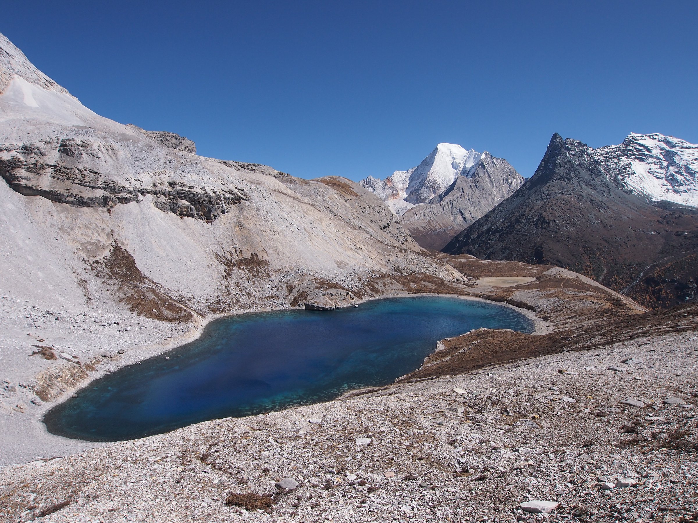
| 1 | Luorong Pasture to Milk Lake and Five-Color Lake | China | Out-and-back | 10.6 km | 598 m | 4,563 m AllTrails; sources cite up to 4,700 m | Hard | Commons image verified |
| 2 | Chonggu Monastery to Pearl Lake / Daocheng Yading Loop | China | Loop / out-and-back | 4.5 km | 280 m | Approx. 4,100 m | Moderate | Commons category verified |
| 3 | Chonggu Monastery to Luorong Pasture valley walk | China | Out-and-back / shuttle-assisted | Approx. 12 km return | Approx. 250 m | Approx. 4,150 m | Moderate-hard due altitude | Commons category verified |
| 4 | Genyen Eye and Lenggu Monastery foothill walk | China | Out-and-back / road-assisted walk | Approx. 5-9 km depending start | Approx. 4,100-4,266 m | Moderate-hard | Commons image verified | |
| 5 | Haizi Mountain / Xingyicuo Lake approach | China | Road-assisted out-and-back | Approx. 3-8 km | Approx. 4,400-4,500 m | Moderate-hard | No licence-compatible image verified |
1. Luorong Pasture to Milk Lake and Five-Color Lake

Snapshot
Itinerary
From Luorong Pasture, the route leaves the broad meadow and follows the engineered path and rougher upper mountain trail towards Gongga Sacred Platform, Serushen Cliff, Milk Lake, and Five-Color Lake. Return by the same route to Luorong for scenic-area transport.
Why it is essential
This is the signature high-altitude lake walk of Daocheng Yading, combining Luorong Pasture, the three sacred peaks, Milk Lake, and Five-Color Lake in one strenuous day.
Equipment
Mountain hiking equipment, warm layer, waterproof/windproof shell, gloves/hat, sun protection, sunglasses, food, water, trekking poles where allowed, and altitude planning.
Hazards and notes
Altitude sickness is the key hazard. Walk slowly and turn around if symptoms worsen. Weather can make the upper route icy or closed. Horses, when available, may cover only part of the route and should not be assumed.
GPX / KML links
| Source | URL | Format / access | Reuse status |
|---|---|---|---|
| AllTrails: Five Color Lake from Luorong Pasture | alltrails.com | Route page / app map | AllTrails terms apply; source-map and statistics used, file reuse not confirmed |
| OpenStreetMap search: Luorong Pasture Five Color Lake | openstreetmap.org | OSM map/search | OSM data is ODbL; geometry cross-check only |
External links
- AllTrails — Five Color Lake from Luorong Pasture
- Sichuan Travel Guide — hiking at Yading
- China Highlights — Daocheng Yading route distances
- WestChinaGo — Yading route details
2. Chonggu Monastery to Pearl Lake / Daocheng Yading Loop
Snapshot
Itinerary
From Chonggu Monastery or the nearby meadow, the path follows boardwalk/stair sections towards Pearl Lake below Mount Chenrezig/Xiannairi. The short route returns to Chonggu and can be combined with the meadow and monastery area.
Why it is essential
Pearl Lake is the accessible short Yading hike and gives strong views of Chenrezig/Xiannairi for visitors who cannot safely complete the high lake route.
Equipment
Standard hiking equipment plus warm layer, waterproof shell, sun protection, water, and slow altitude pacing.
Hazards and notes
The route is technically easy but still above 3,900 m. Boardwalks can be slippery or icy. Crowding and scenic-area time limits may affect the walk.
GPX / KML links
| Source | URL | Format / access | Reuse status |
|---|---|---|---|
| AllTrails: Daocheng Yading Loop | alltrails.com | Route page / app map | AllTrails terms apply; source-map and statistics used, file reuse not confirmed |
| OpenStreetMap search: Chonggu Pearl Lake Yading | openstreetmap.org | OSM map/search | OSM data is ODbL; geometry cross-check only |
External links
- AllTrails — Daocheng Yading Loop
- Sichuan Travel Guide — Yading walking distances
- Great Tibet Tour — Pearl Lake route note
- China Highlights — Daocheng Yading short route
3. Chonggu Monastery to Luorong Pasture Valley Walk
Snapshot
Itinerary
The valley route follows the south branch from the Chonggu area towards Luorong Pasture, staying on the regulated scenic corridor. The walk gives gradual views of streams, meadow, forest edges, and the sacred peaks before reaching the Luorong pasture basin.
Why it is essential
Luorong Pasture is the visual heart of Yading and this route lets walkers experience the valley instead of only using the electric cart.
Equipment
Standard-to-mountain hiking equipment, warm layer, rain shell, sun protection, water, snacks, and altitude pacing.
Hazards and notes
Confirm whether walking the full corridor is currently permitted or whether electric carts are mandatory for sections. Weather and altitude can make the return slower than expected.
GPX / KML links
| Source | URL | Format / access | Reuse status |
|---|---|---|---|
| OpenStreetMap search: Chonggu Luorong Pasture | openstreetmap.org | OSM map/search | OSM data is ODbL; geometry cross-check only |
| The Land of Snows: Yading Sichuan | thelandofsnows.com | Route/access description | Site terms apply; no reusable GPX confirmed |
External links
- The Land of Snows — Yading access and Chonggu-Luorong distance
- China Discovery — Yading Luorong Pasture and Chonggu notes
- TravelChinaGuide — Daocheng Yading attractions
4. Genyen Eye and Lenggu Monastery Foothill Walk
Snapshot
Itinerary
The practical day-hike version uses road access into the Genyen area, then walks short highland sections around Genyen Eye and, if legal and open, towards Lenggu Monastery viewpoints. The route should remain on established local paths/roads and avoid committing to the multi-day Genyen kora.
Why it is essential
Genyen is the major sacred massif of the Litang Shaluli area, and the Genyen Eye / Lenggu Monastery landscape gives this regional entry a Litang-based sacred-mountain route outside regulated Yading.
Equipment
Mountain hiking equipment, warm/windproof layers, waterproof shell, sun protection, water, food, offline map, and emergency layer.
Hazards and notes
Route data is not yet strong enough for independent publication. Roads can be rough, weather changes quickly, and the area is remote. Use local guidance and avoid closed or ecologically sensitive areas.
GPX / KML links
| Source | URL | Format / access | Reuse status |
|---|---|---|---|
| OpenStreetMap search: Genyen Eye Litang | openstreetmap.org | OSM map/search | OSM data is ODbL; geometry cross-check only |
| Sichuan Travel Guide: Eye of Genyen | sichuantravelguide.com | Attraction/access description | Site terms apply; no reusable GPX confirmed |
External links
- Sichuan Travel Guide — Eye of Genyen
- Sichuan Travel Guide — Genyen hiking and trekking
- Go Western China — Lenggu Monastery
- Chengdu HTPA — Old Lenggu altitude/walk context
5. Haizi Mountain / Xingyicuo Lake Approach
Snapshot
Itinerary
The route is a conservative day-walk concept for the Haizi Mountain plateau: use legal road access, then walk to a selected lake viewpoint such as Xingyicuo without committing to off-trail plateau navigation. Return the same way.
Why it is essential
Haizi Mountain represents the glacial-lake plateau between Litang and Daocheng: a bleak, high, boulder-and-lake landscape unlike the forested Yading valleys.
Equipment
Mountain hiking equipment, windproof/waterproof layers, warm hat/gloves, sun protection, water, food, offline map, and emergency layer.
Hazards and notes
This is not yet publication-ready as a precise route. Access roads are rough, weather exposure is high, and altitude is severe. Confirm local legality, road conditions, and exact walking line before use.
GPX / KML links
| Source | URL | Format / access | Reuse status |
|---|---|---|---|
| OpenStreetMap search: Xingyicuo Daocheng | openstreetmap.org | OSM map/search | OSM data is ODbL; geometry cross-check only |
| Sichuan Travel Guide: Haizi Shan | sichuantravelguide.com | Attraction/access description | Site terms apply; no reusable GPX confirmed |
External links
- Sichuan Travel Guide — Haizi Shan
- China Xian Tour — Haizi Mountain Scenic Area and Xingyicuo
- Visit Our China — Haizi Mountain Scenic Area
Missing data / follow-up work
- Genyen Eye / Lenggu Monastery and Haizi Mountain need exact field GPS tracks and current access legality before publication.
- Haizi Mountain / Xingyicuo needs a licence-compatible image.
- Individual Luorong and Chonggu Commons images should be selected and attributed per file if used.
- Route-file reuse rights for AllTrails are not confirmed.
- Yading scenic-area shuttle/electric-cart rules and route closures should be checked immediately before use.
External links
| Source | URL |
|---|---|
| AllTrails — Yading route pages | alltrails.com |
| AllTrails — Five Color Lake from Luorong Pasture | alltrails.com |
| AllTrails — Daocheng Yading Loop | alltrails.com |
| Sichuan Travel Guide — hiking at Yading | sichuantravelguide.com |
| Sichuan Travel Guide — Genyen pages | sichuantravelguide.com |
| Sichuan Travel Guide — Eye of Genyen | sichuantravelguide.com |
| Sichuan Travel Guide — Genyen hiking and trekking | sichuantravelguide.com |
| Sichuan Travel Guide — Haizi Shan | sichuantravelguide.com |
| China Highlights — Daocheng Yading | chinahighlights.com |
| The Land of Snows — Yading guide | thelandofsnows.com |
| WestChinaGo — Yading route details | westchinago.com |
| Great Tibet Tour — Pearl Lake route note | greattibettour.com |
| China Discovery — Yading Luorong Pasture and Chonggu notes | chinadiscovery.com |
| TravelChinaGuide — Daocheng Yading attractions | travelchinaguide.com |
| Go Western China — Lenggu Monastery | gowesternchina.com |
| Chengdu HTPA — Old Lenggu altitude/walk context | cdhtpa.com |
| China Xian Tour — Haizi Mountain Scenic Area and Xingyicuo | chinaxiantour.com |
| Visit Our China — Haizi Mountain Scenic Area | visitourchina.com |