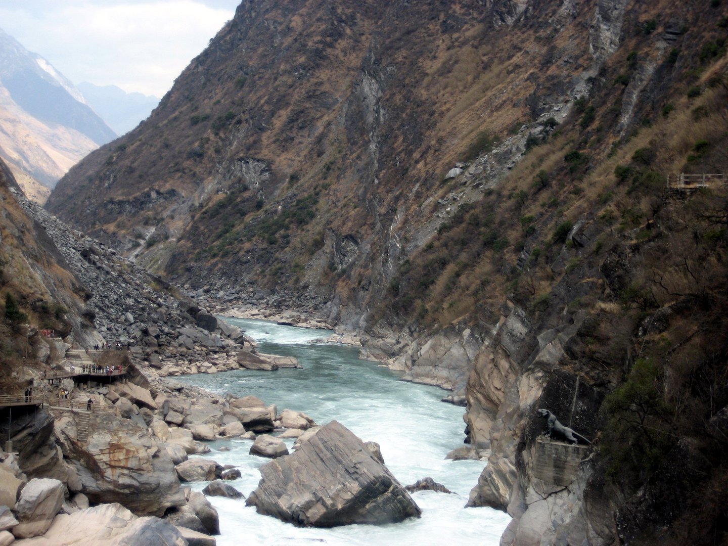
Regional overview
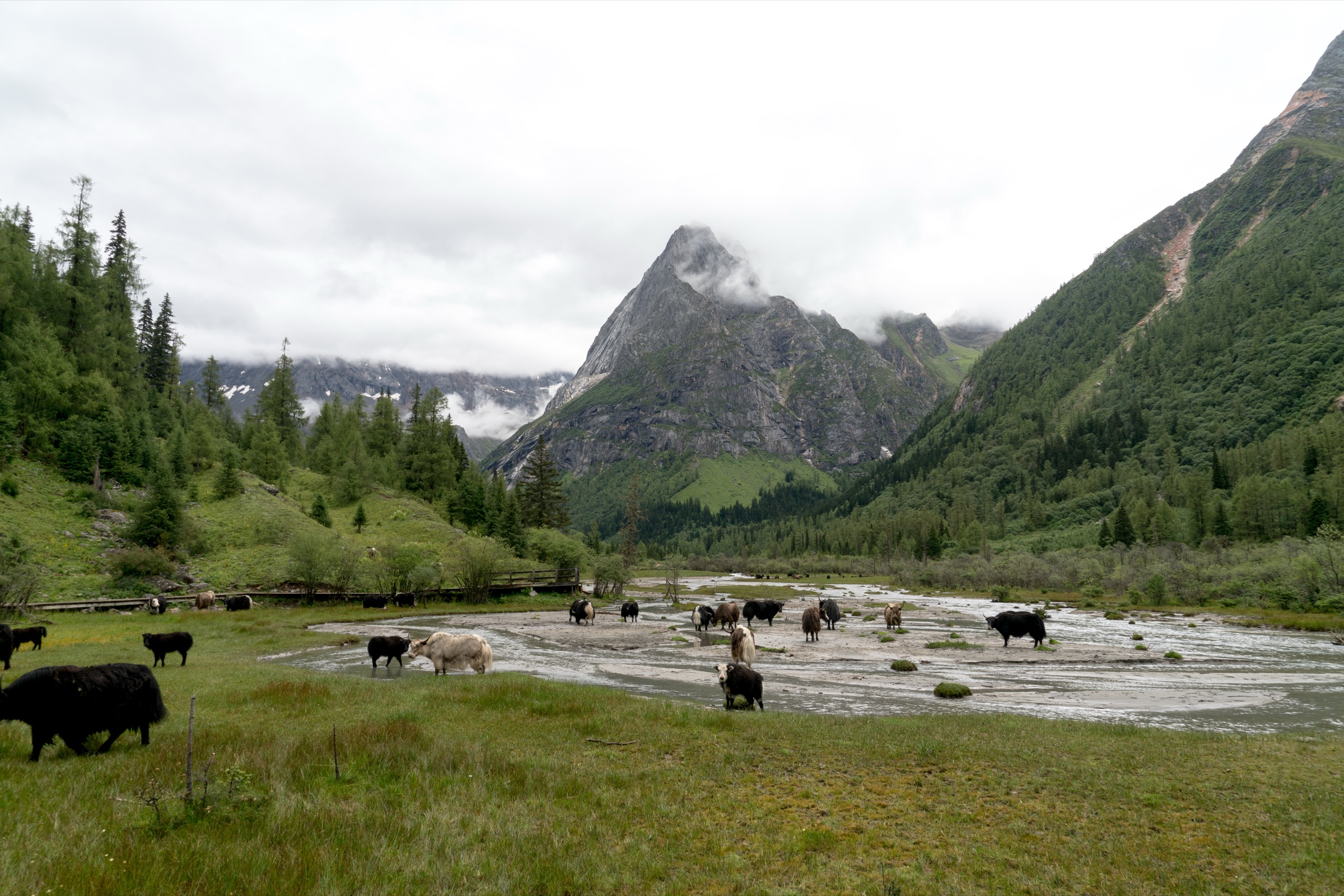
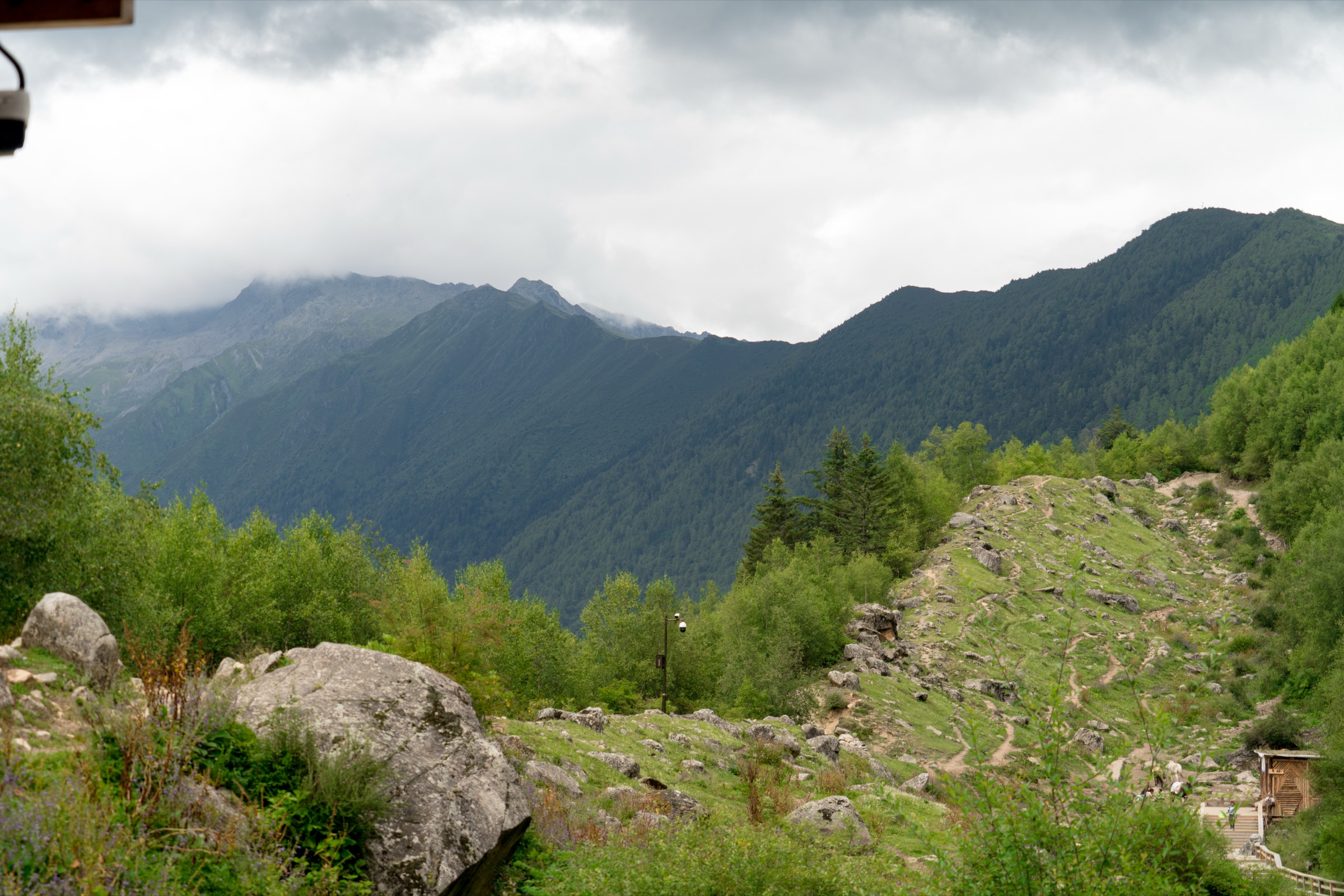
Siguniangshan — the Four Sisters — is the high Qionglai front of the Hengduan Mountains: a north–south range of sharp granite-and-snow peaks above three managed glacial valleys, set on the eastern edge of the Tibetan plateau in western Sichuan. The massif itself runs from Daguniang Feng (5,025 m, the Big Sister) to Yaomei Feng (6,250 m, the Youngest Sister), the highest summit of the Qionglai range. The practical walking is concentrated in the Mount Siguniang National Scenic Area, which packages three roughly parallel valleys — Shuangqiao to the north-west, Changping in the centre, and Haizi to the south — each entered through Siguniangshan Town (Rilong) on the G350. The Qionglai front sits immediately south of the Min Mountains around Jiuzhaigou and Huanglong within the wider Hengduan walking region.
Valley floors and roadheads sit between roughly 2,900 m and 3,300 m; the day-hikes in this catalogue reach between 3,500 m and 4,400 m. The headline access constraint is the scenic-area system itself: each valley has its own gate, ticket and (in Shuangqiao and Changping) an internal sightseeing bus that drops walkers at fixed stops. Haizi Valley is the only one of the three where the day starts on foot from the entrance. A Mount Siguniang official notice dated 22 May 2026 restricts hiking, climbing, skiing, camping and traverses to opened sections of the reserve; this article stays inside the managed scenic line and excludes the peak ascents (DaFeng / ErFeng / SanFeng), which are graded mountaineering objectives that require local guide and permit arrangements.
Practical hiking seasons are May to October. September and October give the clearest skies and the autumn larch and birch colour the area is photographed for; June and July add a short wildflower window in the high meadows but also bring afternoon thunderstorms. Winter and early spring close many of the higher sections to snow and ice, and the boardwalks become slippery or impassable. In every season, ticket prices, shuttle hours, last-bus times and open-area boundaries should be checked through the official scenic-area site before walking.
Selection rationale
The five hikes cover the public hiking character of Siguniangshan without duplication:
- Shuangqiao Valley — the shuttle-and-boardwalk showcase, the easiest way to taste the regional landscape at altitude.
- Changping Valley to Red Stone Array — the moderate boardwalk-and-river day in the central valley.
- Changping Valley to Lianghekou Glacier — the hard end of the same valley, the strongest non-technical view into the glacial interior.
- Haizi Valley to Dajianbao — the open meadow-and-viewpoint acclimatisation day, the only Siguniangshan walk that begins on foot.
- Haizi Valley to Dahaizi and Huahaizi — the long, very hard alpine-lake day under Yaomei Feng, the route that puts a full Hengduan lake basin into a single day.
Peak ascents (DaFeng / ErFeng / SanFeng) and the closed traverses outside the scenic-area boundary are deliberately excluded.
Summary table
| # | Hike | Country | Route type | Distance | Gain | Max elevation | Difficulty |
|---|---|---|---|---|---|---|---|
| 1 | Shuangqiao Valley boardwalks and Hongshanlin | China | Shuttle-assisted linear walk | 8–12 km on foot | 100–400 m | 3,840 m | Easy–moderate |
| 2 | Changping Valley to Dead Tree Beach / Red Stone Array | China | Out-and-back | 14–22 km | 150–350 m | ~3,490 m | Moderate–hard |
| 3 | Changping Valley to Lianghekou Glacier | China | Out-and-back | 18.0 km | 769 m | 3,607 m | Hard |
| 4 | Haizi Valley to Dajianbao acclimatisation | China | Out-and-back | ~15 km | 600–900 m | 3,670–3,830 m | Hard |
| 5 | Haizi Valley to Dahaizi and Huahaizi | China | Out-and-back | 23.7 km | 1,358 m | 4,391 m | Very hard |
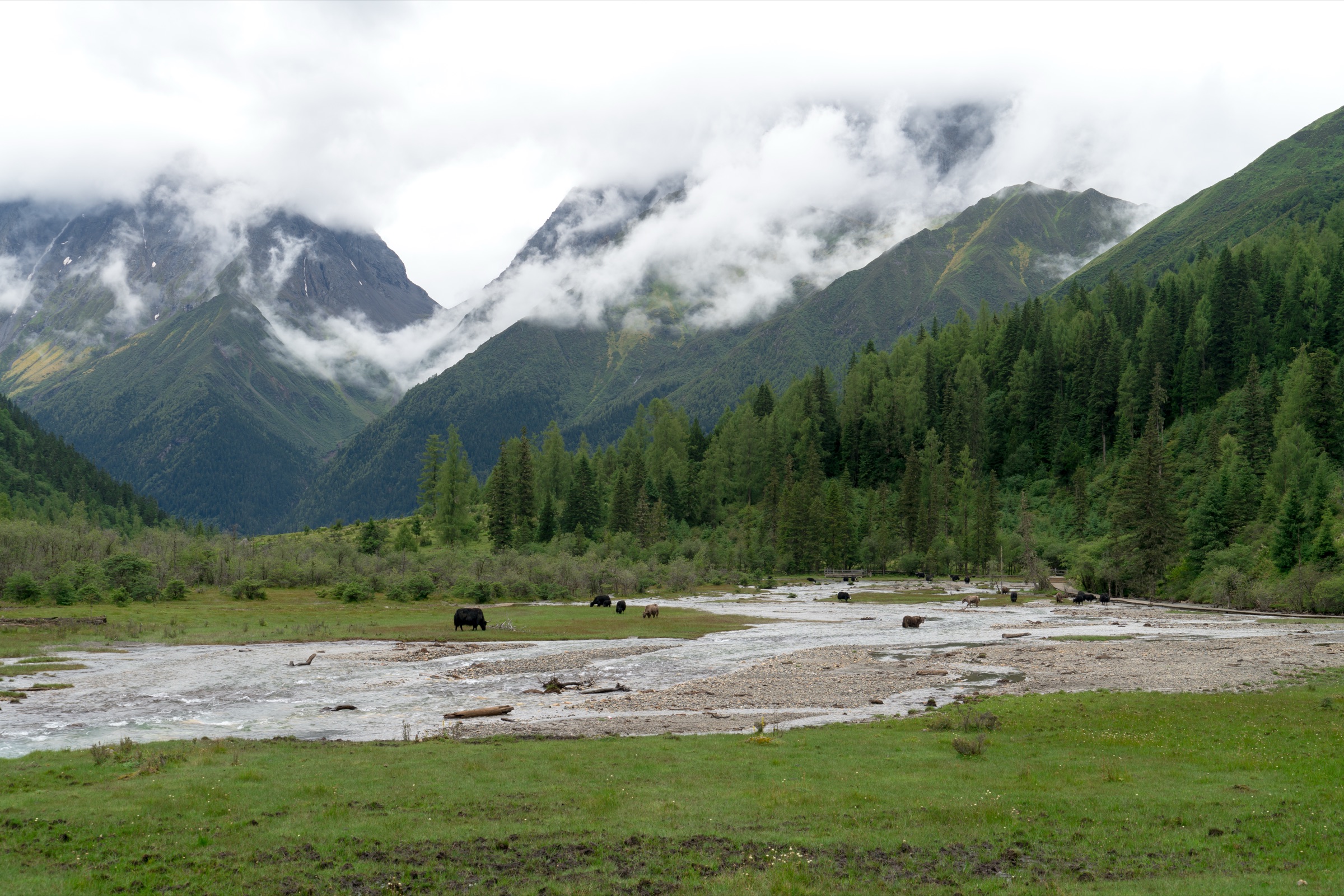
1. Shuangqiao Valley boardwalks and Hongshanlin
Snapshot
Itinerary
From the Shuangqiao gate the sightseeing bus runs up the valley and stops at each of the named scenic points. The essential day-hike version takes the bus to the upper end of the valley around Hongshanlin, then steps off and walks the boardwalk and viewpoint sections under the Budala Peak / Renparang Peak skyline. Re-board the bus to drop down to the central meadow stops — Lianhua Ba, Yinyangtan, Shalang — and walk the river flats and conifer-edge boardwalks before catching the last bus back to the gate. The road itself is too long to walk: the catalogue route uses the bus as a chairlift.
Why it is essential
This is the most accessible way to read the Siguniangshan landscape at altitude. The shuttle delivers walkers to a 3,800 m perspective on glaciated peaks, larch and birch forest, stream flats and managed viewpoints without committing to a 20 km high-altitude day, which makes it the obvious acclimatisation walk before the harder Changping and Haizi routes.
Equipment
- Trail shoes or light boots
- Warm windproof layer; the upper stops are 1,000 m higher than the gate
- Strong sun and UV protection
- 1.5–2 L of water
- Offline map between bus stops; phone reception is patchy
Hazards and notes
- The last bus down is the trip-defining constraint — confirm it at the gate and budget at least 30 minutes of buffer.
- Walking the 34.8 km road as a single-day route is not the intended use and leaves the scenic boardwalk experience for road tarmac.
- Boardwalks freeze in shoulder season; take the engineered tread carefully when wet or icy.
Sources
- Mount Siguniang — official Shuangqiao Valley page
- Mount Siguniang — official scenic-area route page
- AllTrails — Shuangqiao Valley
2. Changping Valley to Dead Tree Beach / Red Stone Array
Snapshot
Itinerary
From the Lamasery the official boardwalk leads up the valley through fir and birch forest, crossing the river on engineered footbridges and skirting open meadows. The standard turn-around is Dead Tree Beach — a flat of bleached, drowned trees in the river — which makes for a comfortable 14 km return. The full version continues past Dead Tree Beach onto the rougher dirt path up to Shaji forest and the Red Stone Array (boulders coated in orange-red cyanobacteria), then returns the same way. The dirt path beyond the boardwalk is shared with horse parties; expect mud, horse traffic, and short, steep step-ups.
Why it is essential
This is the manageable expression of Changping Valley: the long glacial valley, the forest and river, and the front-row view of Pomoshan and Yaomei Feng without committing to the full Muluozi day. The Red Stone Array gives a distinctive geological turn-around that the boardwalk alone does not.
Equipment
- Hiking shoes or boots
- Rain shell and warm layer
- Trekking poles for the dirt section beyond the boardwalk
- 2 L of water; food
- Sun protection — the upper meadows are exposed
Hazards and notes
- Wet boardwalks are slippery; beyond the boardwalk, mud and horse traffic increase.
- Stay inside the opened scenic-area trail; the 22 May 2026 notice restricts entry to undeveloped sections.
- Afternoon thunderstorms in June and July can cut visibility quickly — turn at Dead Tree Beach if cloud is closing in.
Sources
3. Changping Valley to Lianghekou Glacier
Snapshot
Itinerary
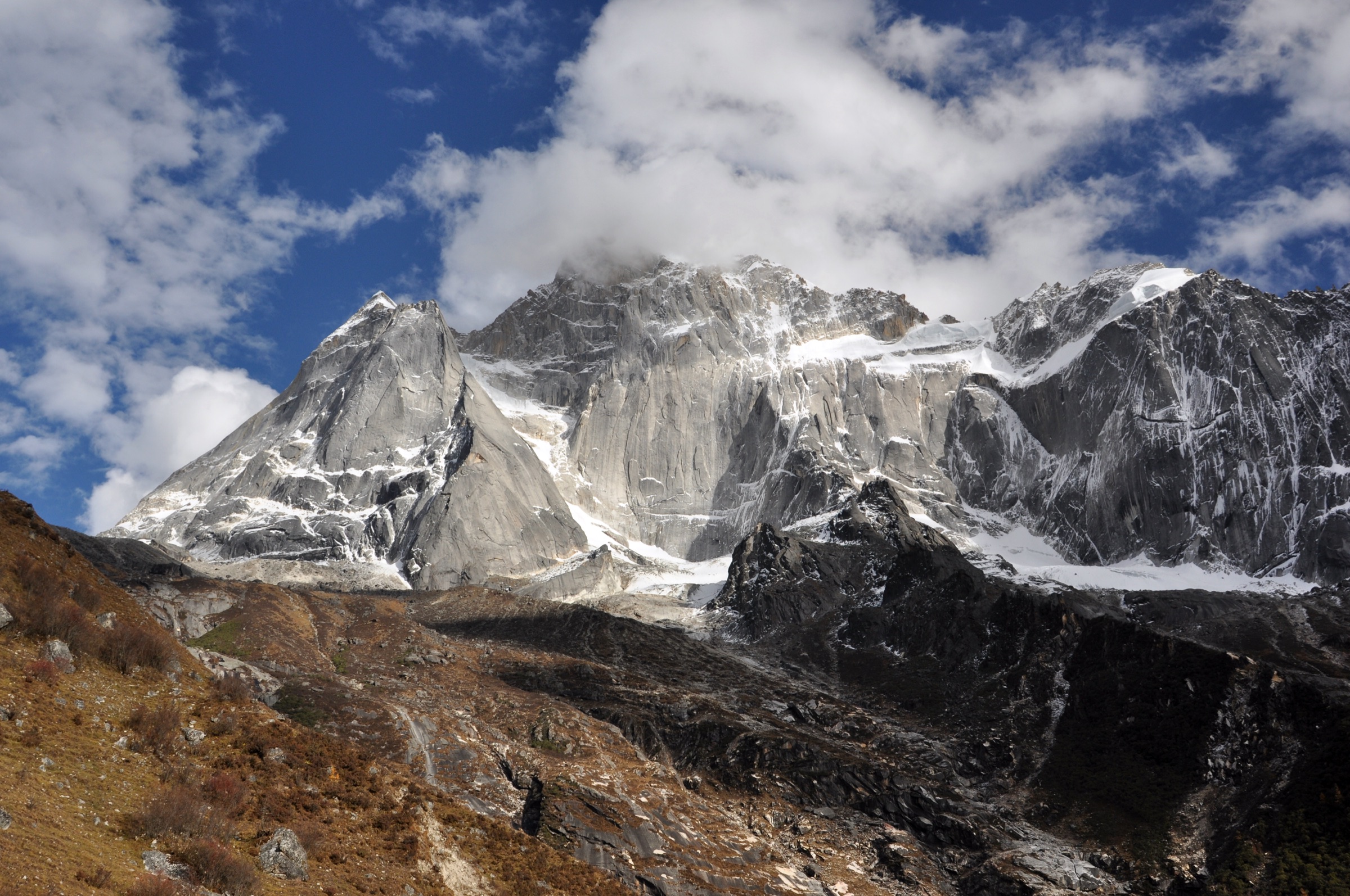
The route shares the Hike 2 boardwalk approach to Dead Tree Beach, then continues up the dirt path through Shaji and the Red Stone Array. Beyond Red Stone Array the path opens onto broader glacial flats — boulder, river braid and short meadow — and climbs gently to the Lianghekou junction, where two valleys meet under the north face of Yaomei Feng. The catalogued turn-around is the Lianghekou glacier viewpoint; the full Lamasery–Muluozi return adds the rough trace further up-valley to Muluozi camp and is the natural fitness-and-time-dependent extension.
Why it is essential
PNT-style boardwalk walks aside, this is the strongest non-technical reading of Changping Valley. The day works through forest, river flats and open glacial scenery to arrive directly under Yaomei Feng — at 6,250 m the highest summit of the Qionglai range and the visual core of the Siguniangshan massif.
Equipment
- Mountain boots
- Waterproof / windproof shell
- Warm insulation, hat and gloves outside midsummer
- 2.5–3 L of water and lunch
- Trekking poles, head torch and offline GPS
Hazards and notes
- The 18 km return at 3,300–3,600 m is a serious altitude day; pace conservatively from the Lamasery.
- The dirt path is heavily used by horse parties and is muddy in shoulder season — closed-toe footwear with grip is essential.
- The Muluozi extension takes the day above 25 km; commit only with an early start and confirmed weather.
- Do not stray onto closed traverses or peak approaches; the 22 May 2026 reserve notice is explicit.
Sources
- AllTrails — Changping Valley · Lianghekou Glacier
- Mount Siguniang — official Changping Valley page
- Mount Siguniang — official scenic-area route page
4. Haizi Valley to Dajianbao acclimatisation
Snapshot
Itinerary
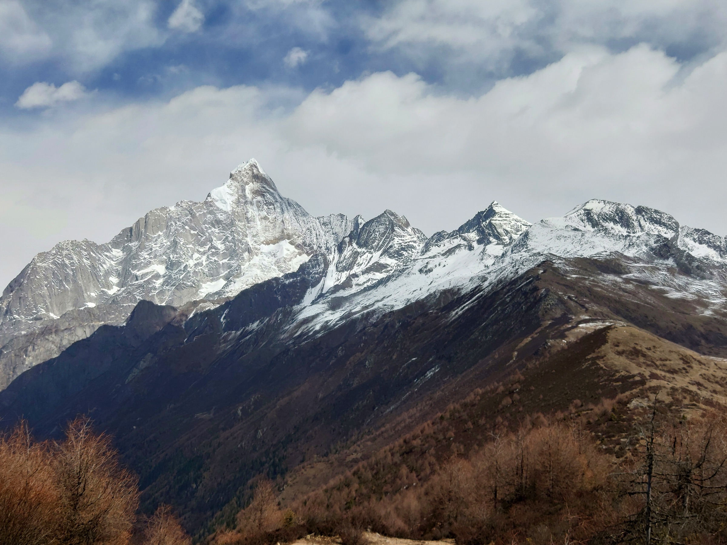
Unlike the other two valleys, Haizi has no internal sightseeing bus: the day begins on foot from the gate. The trail climbs steadily through forest and rhododendron scrub to the open meadow of Guozhuangping, then continues to the Dajianbao ridge — the first big-view stop, looking across the valley head to the four peaks of the massif. The route returns the same way; the temptation to push on to the lakes is reserved for Hike 5.
Why it is essential
Haizi is the open counterpoint to the enclosed Shuangqiao and Changping valleys. This shorter version delivers the classic four-sisters panorama with a feasible same-day return and acts as the acclimatisation day for the much harder lake-basin route.
Equipment
- Mountain boots
- Warm layer and waterproof shell
- Sun and wind protection
- 2 L of water and lunch
- Trekking poles for the descent
Hazards and notes
- Altitude sickness is the dominant hazard; turn at Guozhuangping if symptoms appear and do not push to Dajianbao.
- Weather above 3,500 m changes within minutes — carry insulation even in midsummer.
- Horse parties share the lower meadow; give way and stay on the marked tread.
Sources
5. Haizi Valley to Dahaizi and Huahaizi
Snapshot
Itinerary
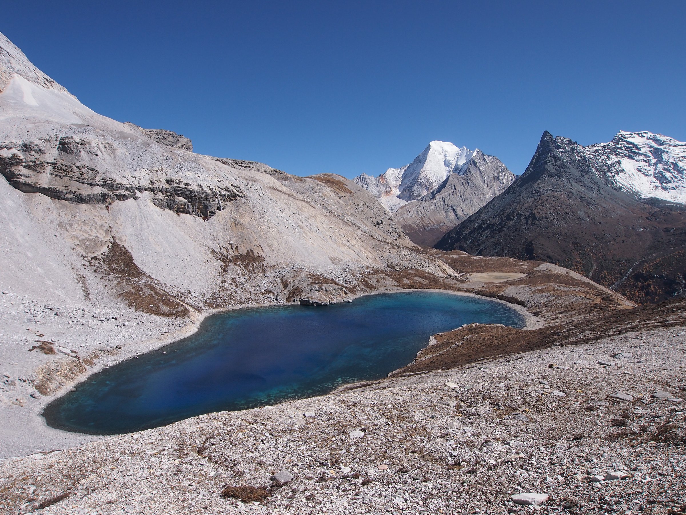
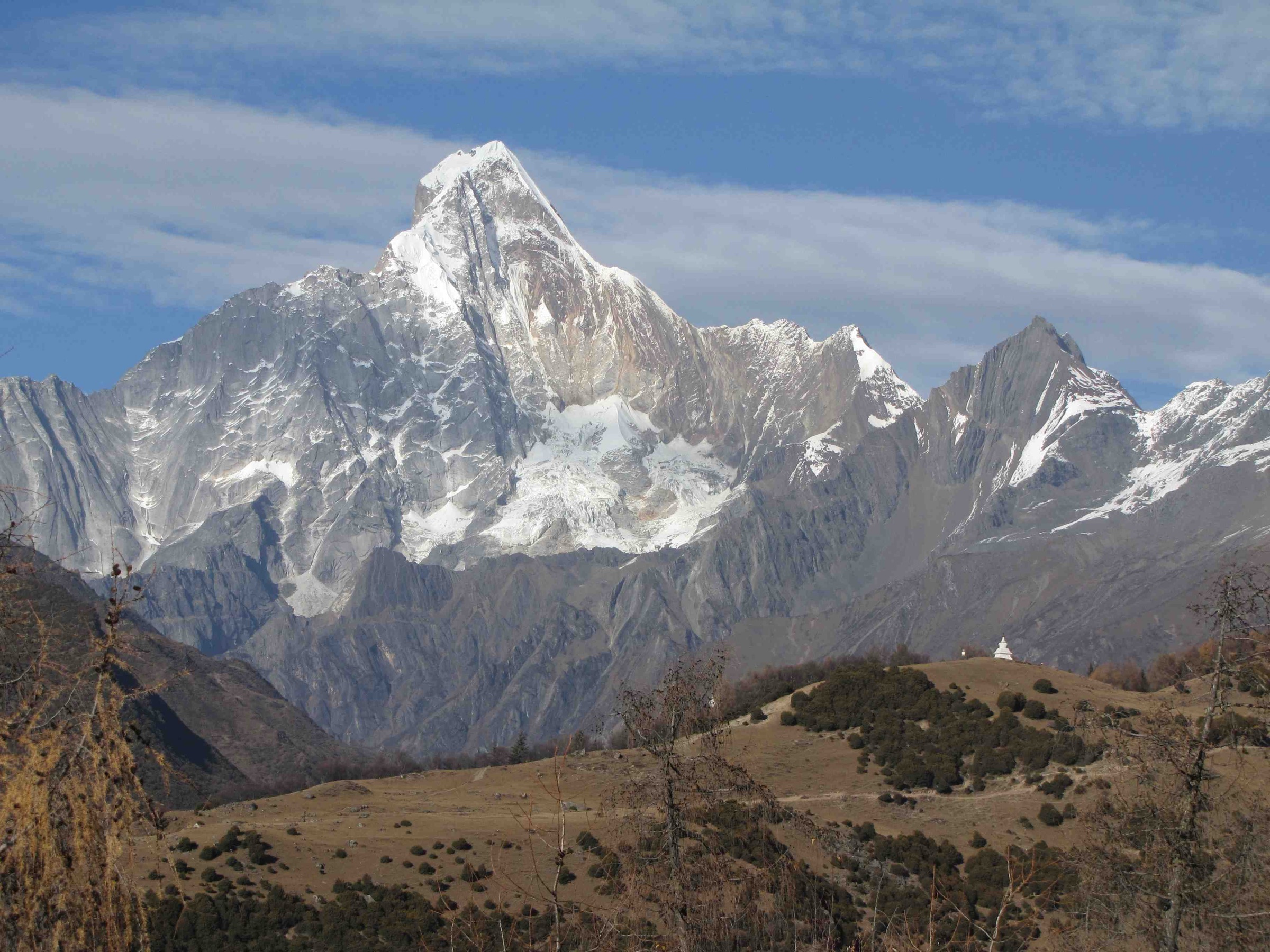
The route climbs the Hike 4 line through Guozhuangping and Dajianbao, then continues above the meadow on a rougher trail through scrub and boulder field to the lake basin: Dahaizi (the larger lake) and Huahaizi (the flower lake shelf above it) sit in a wide cirque directly under Yaomei Feng. The basin is the visual climax of the catalogue — turquoise lakes against ice-streaked granite — and is best reached with the first light of the day so the return drops below 3,800 m before any afternoon weather arrives.
Why it is essential
This is the hard alpine-lake day in Siguniangshan. It is the only walk in the selection that takes the route past 4,000 m and into the full Hengduan lake-and-meadow basin, and it does the thing the peak ascents do — putting the walker directly under Yaomei Feng — without the technical climbing or permit overhead.
Equipment
- Mountain boots
- Waterproof / windproof shell and warm insulation; hat and gloves are not optional above 4,000 m
- 3 L of water; substantial food
- Head torch — the day often starts and finishes in the dark
- Trekking poles
- Offline GPS and a first-aid kit
- Acclimatisation — at minimum, complete Hike 1 and Hike 4 before this route
Hazards and notes
- Altitude (4,391 m at the high point) is the dominant hazard; turn back early if headache, nausea or coordination loss appears.
- Afternoon thunderstorms are common from June through August in the upper basin; aim to be off the lake shelf by 14:00.
- The scenic-area gate closes at a fixed time — confirm it before starting and do not commit to the lakes if the cut-off is tight.
- The May 2026 reserve notice explicitly bans excursions into undeveloped areas — stay on the marked tread and turn at the Huahaizi shelf.
Sources
- AllTrails — Haizi Valley Boardwalk · Mount Siguniang
- Mount Siguniang — official Haizi Valley page
- Mount Siguniang — official scenic-area route page
- Mount Siguniang — May 2026 reserve-access notice
Further reading
| Source | URL |
|---|---|
| Mount Siguniang National Scenic Area — official site | sgns.cn |
| Mount Siguniang — Shuangqiao Valley | sgns.cn |
| Mount Siguniang — Changping Valley | sgns.cn |
| Mount Siguniang — Haizi Valley | sgns.cn |
| Mount Siguniang — official route page | sgns.cn |
| Mount Siguniang — May 2026 reserve-access notice | sgns.cn |
| Wikipedia — Four Girls Mountain | en.wikipedia.org |
| Wikipedia — Qionglai Mountains | en.wikipedia.org |
| Wikimedia Commons — Category: Mount Siguniang | commons.wikimedia.org |
| OpenStreetMap (ODbL 1.0) | openstreetmap.org |