Regional overview
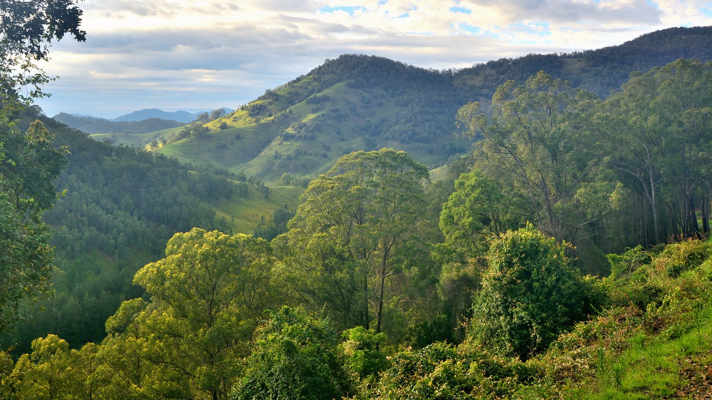
The Central Victorian Highlands sit within the Great Dividing Range between the Yarra Ranges to the west and the Bogong High Plains and Mount Buffalo to the east. The sub-region takes in Cathedral Range State Park near Buxton, the Mount Buller and Mount Stirling massif above Mansfield, the Baw Baw Plateau above Rawson and Noojee, and Lake Mountain above Marysville. Anchor peaks are Mount Buller (1,805 m), Mount Stirling (1,749 m), the Baw Baw Plateau high point at Mount St Phillack (1,566 m), Lake Mountain (1,433 m) and Cathedral Range’s Sugarloaf Peak (923 m).
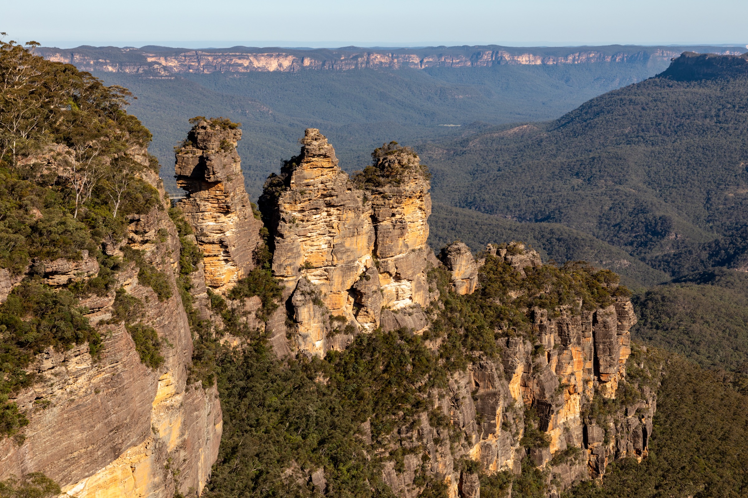
The area’s four principal ranges are geologically distinct. Cathedral Range is a 7 km ridge of upturned Upper Devonian sandstones, mudstones and conglomerates deformed during the Tabberabberan Orogeny, flanked on the east by rhyolitic units of the Cerberean Caldera (~370–350 Ma). Mount Buller and Mount Stirling sit in Ordovician–Silurian metasediments intruded by granitic bodies. The Baw Baw Plateau is a Late Devonian granodiorite pluton, weathered into a dissected peneplain of tors and peaty flats. Lake Mountain lies within the Cerberean Caldera complex and is built on rhyolitic and basaltic ignimbrites rather than a simple basalt cap. Vegetation grades from tall mountain-ash (Eucalyptus regnans) forest in the valleys through alpine ash (E. delegatensis) to snow-gum (E. pauciflora) woodland above ~1,300 m, with sphagnum bogs, snowgrass and alpine heath on the plateau surfaces.
The country is that of the Taungurung, the Gunaikurnai and the Wurundjeri Woi-wurrung. Cathedral Range, Lake Mountain and the Buller–Stirling massif sit on Taungurung country (Cathedral Range is recorded as Nanadhong). The Baw Baw Plateau is shared Gunaikurnai and Wurundjeri country, and Dhudhuroa country extends into the eastern edge of the sub-region. Cultural attribution should be verified with the relevant Registered Aboriginal Parties (Taungurung Land and Waters Council; Gunaikurnai Land and Waters Aboriginal Corporation; Wurundjeri Woi-wurrung Cultural Heritage Aboriginal Corporation) where accuracy matters.
Access is from Melbourne on the Hume Freeway, Maroondah Highway and Melba Highway. Cathedral Range is roughly 2 hours via Yea and Buxton; Lake Mountain is about 2 hours via Marysville; the Baw Baw walks are about 2½ hours via Noojee or Rawson; Mount Buller and Mount Stirling are about 3 hours via Mansfield. Snow lies on the plateaus and resort roads from around the King’s Birthday long weekend to late September, and wheel chains are legally required on many access roads for the declared snow season. Summer brings elevated bushfire risk — Baw Baw, Lake Mountain and the Marysville corridor were all hit hard by the 2009 Black Saturday fires and the ecosystems are still recovering. Cathedral Range weather changes rapidly and Parks Victoria explicitly advises against solo walking on the ridge.
Selection rationale
The five walks were chosen to represent each of the sub-region’s four principal ranges and every rung of the difficulty ladder. Cathedral Range’s Southern Circuit is the signature exposed razorback walk of the Central Highlands and unlike anything else within two hours of Melbourne. Mount Stirling is the best undeveloped high-country summit accessible as a day walk — a snow-gum plateau and hut-heritage classic without the ski infrastructure of Buller. Mount Buller Summit Nature Walk is the anchor short summit walk of the region and the easiest way to reach a genuine >1,800 m panorama. Mount Erica to Mushroom Rocks is the recommended day entry to the Baw Baw Plateau and to the Australian Alps Walking Track. The Lake Mountain summit walk anchors the recovering post-Black Saturday snow-gum ecosystem and is the region’s most accessible sub-alpine walk. Together they give a razorback ridge, a summit loop, a short summit, a plateau day and a recovery-forest walk.
Summary
| # | Hike | Country | Route type | Distance | Gain | Max elevation | Difficulty |
|---|---|---|---|---|---|---|---|
| 1 | Cathedral Range Southern Circuit | Australia | Loop | ~11 km | ~650–900 m | 923 m (Sugarloaf) | AWTGS Grade 5 |
| 2 | Mount Stirling summit loop | Australia | Loop | ~13 km | ~600 m | 1,749 m | AWTGS Grade 4 |
| 3 | Mount Buller Summit Nature Walk | Australia | Loop | 3.4 km | ~90 m | 1,805 m | Easy |
| 4 | Mount Erica to Mushroom Rocks (Baw Baw) | Australia | Out-and-back | ~7–9 km | ~450 m | ~1,240 m | Moderate |
| 5 | Lake Mountain summit walk | Australia | Out-and-back | 4 km | ~100 m | 1,433 m | Easy–moderate |
1. Cathedral Range Southern Circuit
Snapshot
Itinerary
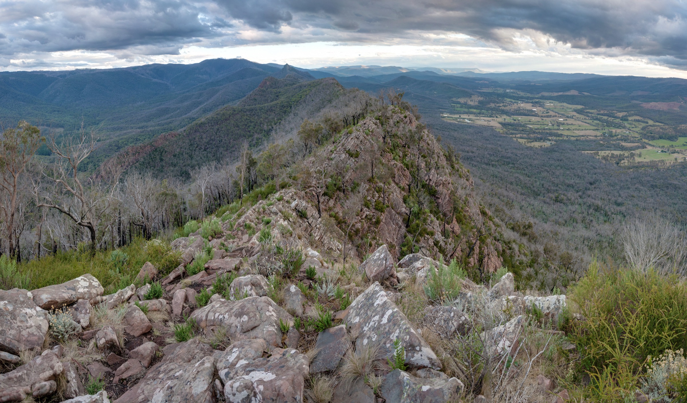
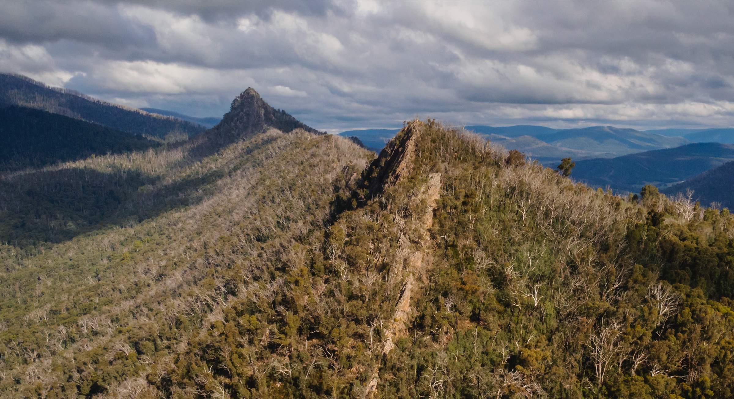
From the Sugarloaf Saddle car park the walk climbs west on the Canyon Track (or the Wells Cave Track, which is harder and requires squeezing through a rock chimney) to Sugarloaf Peak at 923 m. The route then follows the razorback north along an exposed sandstone ridge past the North Jawbone Peak, the South Jawbone and the Farmyard camp. The Farmyard is a flat, sheltered camp on the ridge below the eastern face and marks the turning point of the day. The return line drops on Jawbones Track (or Wells Cave Track for a harder finish) back through open eucalypt forest to Sugarloaf Saddle.
Why it is essential
The Southern Circuit is the signature exposed razorback walk of the Central Victorian Highlands and unlike anything else within two hours of Melbourne. It combines the state’s clearest sandstone-ridge geology with genuine hands-and-feet scrambling, and it is the anchor day of any Cathedral Range visit.
Equipment
- Sturdy boots with good grip
- Weatherproof shell and warm layer
- Water: 2 litres per person; no reliable water on the ridge
- Food for a long day
- Sun protection — extreme UV on the ridge
- Small pack — Wells Cave chimney requires removing a large pack
- Helmet worth considering if walking behind a large party in the scrambles
- Map, compass or GPS; PLB or satellite messenger recommended
Hazards and notes
Loose sandstone, exposed drops on both sides of the razorback, and no water above the trailhead. Parks Victoria explicitly advises against solo walking on the ridge. Wells Cave chimney is a genuine squeeze and unsuitable for those uncomfortable with confined spaces. Snakes are possible in warmer months. Track fully closes on days of Extreme or Catastrophic fire danger.
GPX / route file
| Source | URL | Format | Licence / terms | Reuse |
|---|---|---|---|---|
| Parks Victoria — Cathedral Range State Park | parks.vic.gov.au | Web description and map | Copyright Parks Victoria | Reference only |
| OpenStreetMap — Cathedral Range | osm.org | OSM way data | ODbL | Reusable with attribution |
Sources
- Parks Victoria — Cathedral Range State Park
- Wikipedia — Cathedral Range State Park
- Weekend Geology — Cathedral Range (geological cross-reference)
2. Mount Stirling summit loop
Snapshot
Itinerary
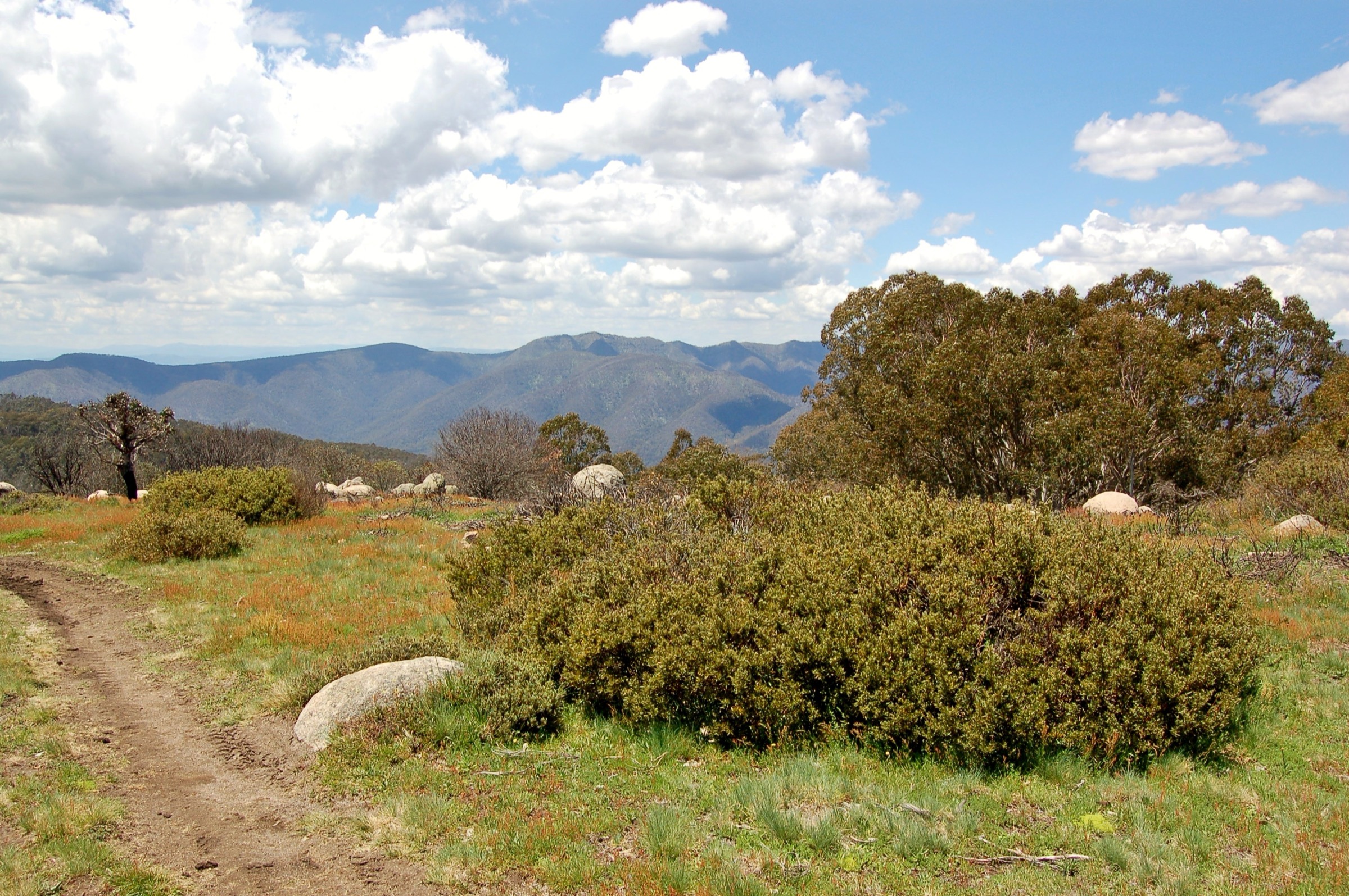
From Telephone Box Junction the loop climbs east on the Stanley Name Spur through mixed alpine ash and snow gum, passing Bluff Spur Hut and Geelong Grammar School (GGS) Hut — two of the cluster of historic ski-touring huts scattered across the Stirling plateau. A short side-trip climbs the exposed summit ridge to the 1,749 m trig, with panoramic views across to Mount Cobbler, The Bluff, the Bogong High Plains and Mount Buller close to the south. The return line follows the Cricket Pitch clearing and the Circuit Road back down to Telephone Box Junction.
Why it is essential
Mount Stirling is the best undeveloped high-country summit accessible as a day walk in the Central Victorian Highlands. There is no ski-lift infrastructure on top, unlike Mount Buller across the saddle, and the plateau’s snow-gum woodland and cluster of historic ski-touring huts are the clearest single walk through the region’s mountain-cattlemen and ski-club heritage.
Equipment
- Sturdy boots
- Weatherproof shell and warm layer
- Hat and gloves outside midsummer
- Water: 2 litres per person; limited reliable water on the plateau
- Food for a long day
- Sun protection — extreme UV on the exposed summit
- Trekking poles useful for the climb and descent
- Map or GPS; the plateau is easy to misread in cloud
Hazards and notes
Snow cover from around June to September; snowshoes or touring skis are required outside the walking season, and the loop becomes a serious cross-country ski day. Weather can shift very quickly on the plateau. Cornice and hard-frozen snow persist into late spring. Dogs are permitted on some Alpine Resort tracks but not in the surrounding Alpine National Park — verify the route in use.
GPX / route file
| Source | URL | Format | Licence / terms | Reuse |
|---|---|---|---|---|
| Mount Stirling Alpine Resort — walking tracks | mtstirling.com.au | Web description | Copyright Mount Stirling ARMB | Reference only |
| OpenStreetMap — Mount Stirling tracks | osm.org | OSM way data | ODbL | Reusable with attribution |
| Australian Alps Walking Track — route relation | waymarkedtrails.org | OSM route | ODbL | Reusable with attribution |
Sources
- Mount Stirling Alpine Resort — walking tracks
- Bushwalking Victoria — Mount Stirling track notes
- Wikipedia — Mount Stirling
3. Mount Buller Summit Nature Walk
Snapshot
Itinerary
From the village the Summit Nature Walk loops around the southern slopes of the Buller cone on interpretive track, then climbs the final steep pinch to the summit trig at 1,805 m. The trig gives the widest 360-degree panorama in the sub-region — Mount Cobbler and The Bluff to the north, the Bogong High Plains and Mount Feathertop to the east, Mount Stirling immediately across the saddle, and the Yea Valley and Great Dividing Range spreading west. The loop descends via the Kandahar or Little Buller Spur tracks back into the village.
Why it is essential
Mount Buller is the highest summit accessible as a very short day walk anywhere in the Central Victorian Highlands. It gives an unmatched 360-degree Central Highlands panorama in about an hour on the ground, and it is a natural acclimatisation option before a longer Stirling or Baw Baw day.
Equipment
- Standard hiking shoes or boots
- Weatherproof shell
- Warm layer
- Water: 1 litre per person
- Sun protection — extreme UV at plateau elevation
Hazards and notes
Wind exposure on the summit. Snow patches into November. Winter chains are legally required on the Mount Buller access road for the declared snow season. The village is a full alpine resort with lifts running in winter — verify the summer walking-track status before travel. Dogs are permitted on some resort tracks but check current restrictions.
GPX / route file
| Source | URL | Format | Licence / terms | Reuse |
|---|---|---|---|---|
| Mount Buller Alpine Resort — Summit Nature Walk | mtbuller.com.au | Web description | Copyright Mount Buller ARMB | Reference only |
| OpenStreetMap — Mount Buller tracks | osm.org | OSM way data | ODbL | Reusable with attribution |
Sources
- Mount Buller Alpine Resort — Summit Nature Walk
- Wikipedia — Mount Buller
4. Mount Erica to Mushroom Rocks (Baw Baw Plateau)
Snapshot
Itinerary
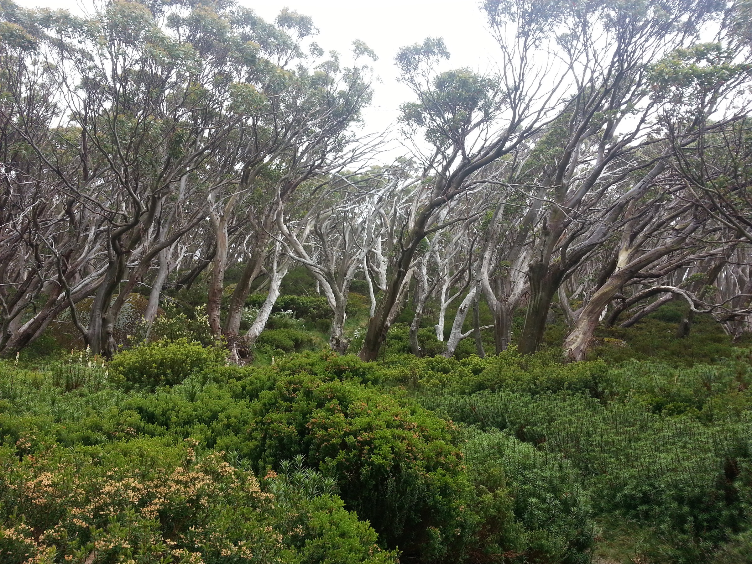
From the Mount Erica car park the track climbs steadily through tall mountain-ash forest onto the Baw Baw Plateau, meeting the Australian Alps Walking Track at the Mushroom Rocks — a cluster of granodiorite tors rising above snow-gum woodland at about 1,240 m. The rocks make a natural turnaround with plateau views back down the Latrobe Valley to the south. A longer variant continues north across the plateau on the AAWT to the Mount Erica summit at 1,512 m before returning by the same route.
Why it is essential
Mount Erica to Mushroom Rocks is the recommended day entry to the Baw Baw Plateau and to the southern Australian Alps Walking Track. It gives a full sample of the plateau’s granodiorite-tor landscape and sphagnum-bog snow-gum woodland in a half day, and is the anchor Baw Baw walk within reach of a Melbourne day trip.
Equipment
- Sturdy boots
- Weatherproof shell and warm layer
- Hat and gloves outside midsummer
- Water: 2 litres per person; the plateau bogs are not a safe drinking source
- Sun protection
- Trekking poles useful on the climb
- Map or GPS; the plateau is easy to misread in cloud
Hazards and notes
Cold, rapid weather change on the plateau even in summer; snow can lie until late spring. Sphagnum bogs off-track are fragile and unsafe underfoot. Standing dead-tree fall risk in wind — the plateau’s snow gums have been damaged by fires in 2009 and later years. Dogs are not permitted in Baw Baw National Park.
GPX / route file
| Source | URL | Format | Licence / terms | Reuse |
|---|---|---|---|---|
| Parks Victoria — Mount Erica to Mushroom Rocks | parks.vic.gov.au | Web description | Copyright Parks Victoria | Reference only |
| Parks Victoria — Baw Baw National Park | parks.vic.gov.au | Web description and map | Copyright Parks Victoria | Reference only |
| OpenStreetMap — Baw Baw Plateau tracks | osm.org | OSM way data | ODbL | Reusable with attribution |
Sources
- Parks Victoria — Mount Erica to Mushroom Rocks
- Parks Victoria — Baw Baw National Park
- Wikipedia — Baw Baw National Park
5. Lake Mountain summit walk
Snapshot
Itinerary
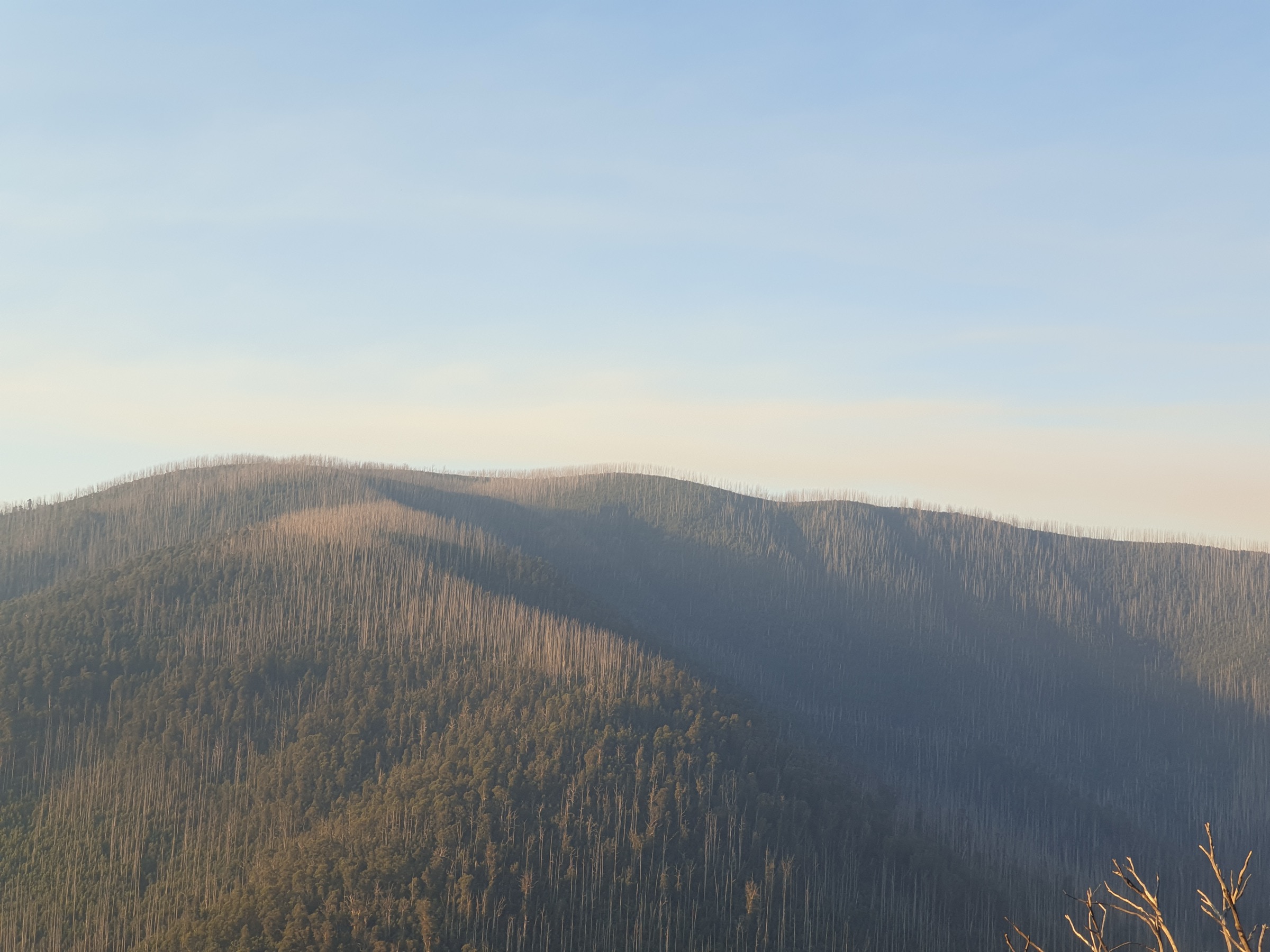
From the Lake Mountain village a groomed sub-alpine trail climbs about 200 m through regenerating snow-gum woodland — heavily burned by the 2009 Black Saturday fires and still recovering — to the summit lookout at 1,433 m. On a clear day the outlook takes in Melbourne to the west, the Yarra Ranges immediately south, and the Baw Baw and Bogong ranges to the east. The Day Loop extends this into a 14 km circuit through the resort’s cross-country ski trail network for those wanting a longer walk.
Why it is essential
Lake Mountain is the closest sub-alpine walking to Melbourne, historically the state’s premier cross-country ski area, and one of the clearest walks through a post-fire snow-gum ecosystem in active recovery. It is the recommended low-effort sub-alpine day of the Central Victorian Highlands and a natural pairing with the drive up from Marysville.
Equipment
- Hiking shoes or boots
- Weatherproof shell
- Warm layer
- Water: 1 litre per person
- Sun protection — extreme UV at sub-alpine elevation
Hazards and notes
Winter chains are legally required at the resort entry gate through the declared snow season. Standing dead-tree fall risk in wind — the 2009 fire killed a very large proportion of the summit-area snow gums and their standing skeletons continue to shed limbs. The Rainforest Gallery boardwalk down at Cement Creek is a natural add-on if driving up through the Yarra Ranges but is currently closed for repairs — verify status before travel.
GPX / route file
| Source | URL | Format | Licence / terms | Reuse |
|---|---|---|---|---|
| Lake Mountain Alpine Resort — walks | lakemountainresort.com.au | Web description | Copyright Lake Mountain ARMB | Reference only |
| Visit Yarra Valley — Lake Mountain Summit Walk | visityarravalley.com.au | Web description | Copyright Visit Yarra Valley | Reference only |
| OpenStreetMap — Lake Mountain tracks | osm.org | OSM way data | ODbL | Reusable with attribution |
Sources
- Lake Mountain Alpine Resort — walks
- Visit Yarra Valley — Lake Mountain Summit Walk
- Wikipedia — Lake Mountain (Victoria)
Region-level sources
| Source | Type | Notes |
|---|---|---|
| Parks Victoria — Cathedral Range State Park | Official park authority | Primary source for the Southern Circuit and Wells Cave routes |
| Parks Victoria — Baw Baw National Park | Official park authority | Primary source for the Baw Baw Plateau walks |
| Mount Buller Alpine Resort — mtbuller.com.au | Resort management board | Summer walk descriptions and closures |
| Mount Stirling Alpine Resort — mtstirling.com.au | Resort management board | Summer walk descriptions and closures |
| Lake Mountain Alpine Resort — lakemountainresort.com.au | Resort management board | Winter and summer walking information |
| Taungurung Land and Waters Council — taungurung.com.au | Registered Aboriginal Party | Cultural attribution for Taungurung country |
| Gunaikurnai Land and Waters Aboriginal Corporation — gunaikurnai.org | Registered Aboriginal Party | Cultural attribution for Baw Baw country |
| Wurundjeri Woi-wurrung Cultural Heritage Aboriginal Corporation — wurundjeri.com.au | Registered Aboriginal Party | Cultural attribution for shared Baw Baw country |
| OpenStreetMap — openstreetmap.org | Community map | Track geometry cross-checking |
| Bureau of Meteorology — bom.gov.au | Federal weather bureau | Frontal timing, snow and lightning risk |
Further reading
Nearby Great Dividing Range guides on Storm
- ACT, Namadgi and the Brindabella Ranges
- Atherton Tablelands / Cairns Highlands
- Barrington Tops
- Blue Mountains
-
Storm — Australia | Mount Buffalo and Bogong High Plains: Essential Day-Hikes
- Storm — Australia | Dandenong Ranges and Yarra Ranges: Essential Day-Hikes
- Storm — Australia | Snowy Mountains and Kosciuszko: Essential Day-Hikes
Missing data / follow-up work
- Parks Victoria does not publish an exact distance for the Cathedral Range Southern Circuit; sources cluster around 10.6–11 km. The Wells Cave variant adds gain and is harder.
- Parks Victoria does not publish an exact distance for Mount Erica to Mushroom Rocks; sources range from ~7 km (trailhiking.com.au) to ~9 km (AllTrails) return.
- Lake Mountain is described in some secondary sources as “basalt-capped”; published geology maps assign it to the rhyolitic Cerberean Caldera complex. This article treats it as caldera-derived volcanics.
- No licence-compatible Mount Buller summit or Mushroom Rocks photograph meeting the shipping resolution was found in this pass; both hikes rely on non-image visual description.
- Traditional-owner attribution for Baw Baw as shared Gunaikurnai and Wurundjeri country should be confirmed with both Registered Aboriginal Parties where accuracy matters.
- No official Parks Victoria GPX file was found for any of the five walks; OpenStreetMap is the most reliable geometry source. The Australian Alps Walking Track is available as an OSM route relation.