Regional overview
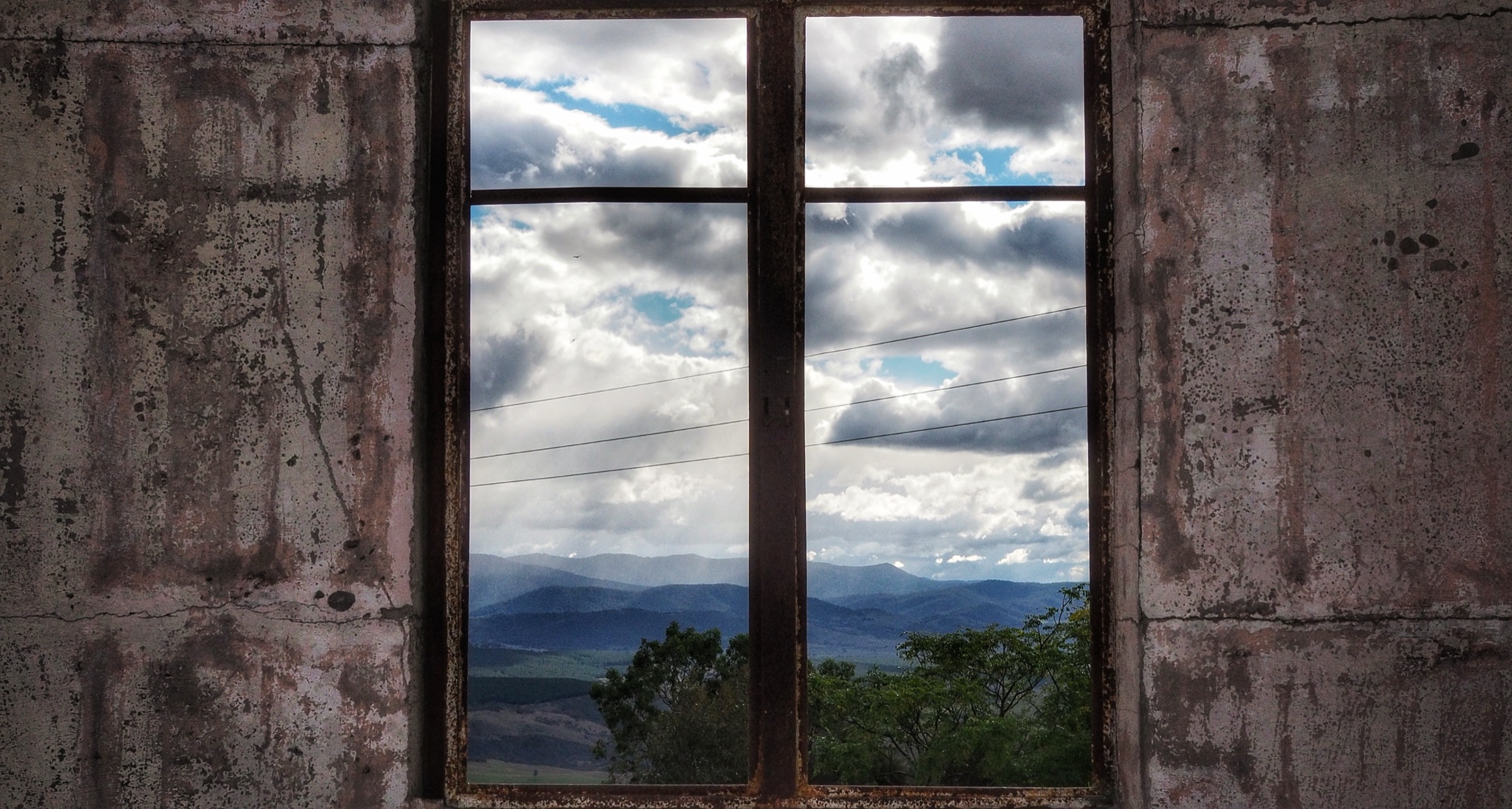
Namadgi National Park covers the southern half of the Australian Capital Territory and forms the northern anchor of the Australian Alps. From the Murrumbidgee corridor near Tharwa the country rises through dry eucalypt forest and river-flat grassland onto a run of granite bluffs, subalpine snow-gum plateaux and dolerite-and-granite tops that culminate in Bimberi Peak at 1,912 m — the ACT’s high point — inside the adjoining Bimberi Nature Reserve. West of the ACT border the Brindabella Range crests through Brindabella National Park in New South Wales, giving Namadgi a continuous protected corridor into Kosciuszko National Park. The park is managed by ACT Parks and Conservation Service, with Brindabella NP managed by NSW National Parks and Wildlife Service (NPWS). The range sits on the Country of the Ngunnawal, Ngambri and Ngarigo peoples, and Yankee Hat holds one of the region’s most important open rock-art sites.
The walking spectrum is compact and unusually varied for a capital city’s back garden. Namadgi’s short-day objectives cluster on Naas Road and Corin Road — Booroomba Rocks and Square Rock at the granite end, Yankee Hat on the grasslands, Mount Tennent as the flagship summit push from the Namadgi Visitor Centre — while the true alpine ridge walking sits on the Brindabella crest at Mount Franklin, Mount Ginini and Mount Gingera, all reached from the mostly gravel Mount Franklin Road on the western fringe of the ACT. Trailheads are between 30 minutes and 1 h 30 min from central Canberra; there is no scheduled public transport to any of the walks in this selection.
The dominant hazards are fire history, weather and access. In January 2020 the Orroral Valley bushfire burned roughly 80 per cent of Namadgi — around 86,000 ha — and several core tracks stayed closed for years while ACT Parks rebuilt bridges, drainage and signage. Most of the walks below are now open, but Booroomba Rocks Road in particular has been closed for extended maintenance windows in 2026 and the Mount Franklin Road tops are snowbound from about May to October. Snakes are active in warm months, summer thunderstorms build fast off the Brindabella crest, and the Bimberi crest above roughly 1,400 m carries hard winter snow. Trailhead intention books at Namadgi Visitor Centre and Corin Forest are standard practice for the longer walks.
Summary table
| # | Hike | Route type | Distance | Estimated time | Difficulty | Verification |
|---|---|---|---|---|---|---|
| 1 | Booroomba Rocks | Out-and-back | 4.5 km return (Trail Hiking Australia); ACT Parks brochure short walk | ~2 h | Grade 4 / steep | Route verified; access subject to road closures |
| 2 | Mount Tennent summit | Out-and-back | 14 km return (ACT Parks); 13.7 km (Trail Hiking Australia) | ~6 h | Grade 4 / hard | Route verified; open through 2026 access windows |
| 3 | Yankee Hat rock art | Out-and-back | 6 km return (Trail Hiking Australia); 6.2 km (Australian Hiker) | 2.5–3 h | Grade 3 / moderate | Route verified; cultural site |
| 4 | Square Rock | Out-and-back | 10.3 km return (Trail Hiking Australia); 9–10.5 km depending on Orroral Lookout side-trip | ~4 h | Grade 3 / moderate | Route verified; ACT Parks brochure |
| 5 | Mount Gingera via Mount Franklin Road | Out-and-back | ~15 km return from Mount Ginini gate (Australian Hiker: 14.9 km) | 5–6 h | Grade 4 / hard, high-country | Route verified; seasonal access via Mount Franklin Road |
Before you go
Access
The five walks span three trailhead corridors. Booroomba Rocks, Yankee Hat and Mount Tennent are reached from Naas Road / Boboyan Road south of Tharwa via the Namadgi Visitor Centre. Square Rock is on Corin Road at the Corin Forest end. Mount Gingera is reached from the Mount Franklin Road gate at the Mount Ginini car park, which is off Brindabella Road west of the ACT border. Booroomba Rocks Road is unsealed and periodically closed for maintenance — the 11 May to 26 June 2026 window is documented in ACT Parks alerts — and Mount Franklin Road is closed by snow through winter. There is no scheduled public transport to any of these trailheads; visitors self-drive from Canberra (30–90 minutes).
Standard kit
- Sturdy walking shoes or light hiking boots for all five walks; the Booroomba, Square Rock and Gingera routes have granite steps or rough tread.
- Full waterproof shell, warm mid-layer, hat and gloves on the Brindabella crest routes (Gingera, and Mount Tennent above the treeline) in any month — the range holds snow from May to October.
- Sun protection and 2–3 litres of water per person on Mount Tennent and Gingera; 1.5–2 litres for the shorter walks. Yankee Hat has no potable water.
- Offline map (ACT Parks Namadgi map or 1:25,000 topographic sheets — Rendezvous Creek for Yankee Hat, Corin Dam for Square Rock, Bimberi for Gingera), compass, headtorch and a small first-aid kit.
- PLB is standard practice on Mount Tennent and Gingera. Signing the trailhead intention book at the Namadgi Visitor Centre and Corin Forest is recommended for the longer walks.
Common hazards
- Fire closures: ACT Parks closes tracks on Total Fire Ban days and during ecological burn programs. The 2026 Thermal Assisted Aerial Control program closes the ACT section of the Australian Alps Walking Track from 15–29 May 2026; the Mount Tennent summit track from the Namadgi Visitor Centre remains open during that window.
- Post-2020 fire recovery: several bridges, boardwalks and signs were still being rebuilt at the time of writing; check ACT Parks alerts before travel.
- Snakes are active from late spring to autumn; eastern brown and red-bellied black snakes are both present in Namadgi.
- Winter snow, ice and wind chill on the Brindabella crest (Mount Franklin Road, Ginini, Gingera) from about May to October.
- Rapid weather change: summer thunderstorms build fast on the west side of the range.
- Cultural landscape: Namadgi is Ngunnawal, Ngambri and Ngarigo Country. At Yankee Hat and other rock-art sites, stay on the boardwalk and do not touch the artwork.
1. Booroomba Rocks
Snapshot
Itinerary
The track leaves the Booroomba Rocks car park at about 1,175 m and climbs steeply north-east through dry eucalypt forest on a formed track with rock steps and root sections. After a sustained climb of roughly 170 m in the first kilometre it reaches the saddle behind the granite tors, where a short spur breaks left onto the north outcrop for the headline view: a sweep across the Naas Valley to Mount Tennent and the Bimberi Range beyond. A second spur to the right leads onto the south outcrop, the main climbing area. The route returns by the same track. When Booroomba Rocks Road is closed, walkers reach the same car park on foot from Honeysuckle Campground via the Australian Alps Walking Track — an additional 8 km return that turns the day into a 12–13 km outing.
Why it is essential
Booroomba Rocks is the archetypal Namadgi granite viewpoint: a short, steep climb to the biggest cliff-top vista in the eastern part of the park, and the walk that ACT Parks itself uses as the flagship half-day objective for visitors from Canberra. The tors are also one of Australia’s best-known granite climbing crags, and the walk-in gives a good non-technical view of the cliff.
Hazards and notes
- Steep granite steps on the descent are slippery when wet or icy.
- Cliff edges beyond the marked viewpoints are unfenced; stay behind the granite lip.
- Booroomba Rocks Road is unsealed and can be closed for extended maintenance windows or after adverse weather — check the ACT Parks alerts page before travel.
- Climbing traffic is active on the south face; do not throw rocks and stay clear of belay areas.
GPX / KML links
| Source | URL | Format | Notes |
|---|---|---|---|
| ACT Parks — Namadgi walking tracks | parks.act.gov.au | Official park page | No GPX published |
| Trail Hiking Australia — Booroomba Rocks | trailhiking.com.au | Third-party route page with stats | GPX behind login |
| AllTrails — Booroomba Rocks | alltrails.com | Third-party route page | Secondary reference |
Further reading
2. Mount Tennent summit
Snapshot
Itinerary
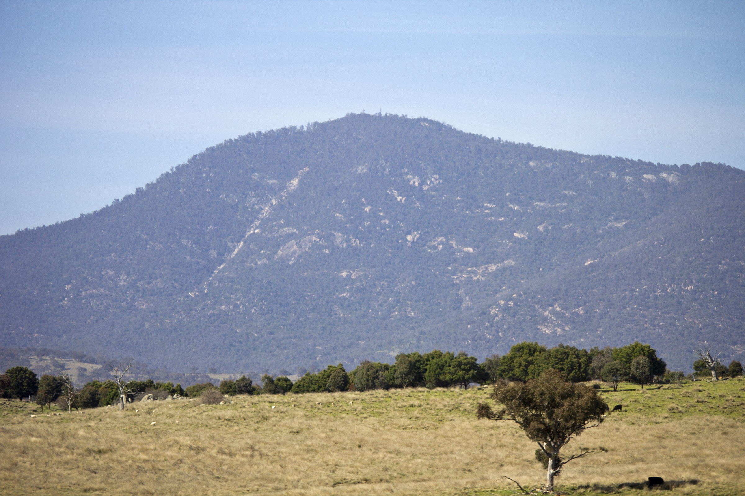
The route leaves the Namadgi Visitor Centre car park at about 603 m and starts on the Woodland Walk before joining the Mount Tennent Track proper. The track climbs steadily through dry sclerophyll forest — the lower slopes were heavily burned by the 2020 Orroral Valley fire — passes the Cypress Pine Lookout junction at about 2.2 km, and continues up a long series of switchbacks and rock steps. Above roughly 1,200 m the forest opens onto the summit ridge, where the track uses part of the Australian Alps Walking Track alignment and reaches the fire tower, communications equipment and trig at 1,371 m. In clear conditions the summit gives a full arc over Canberra to the north, Bimberi and the Brindabella crest to the west and the Naas Valley south. The return uses the same track.
Why it is essential
Mount Tennent is Namadgi’s flagship summit day-walk: the highest summit reached directly from a Canberra-side trailhead, the walk that ACT Parks itself uses as the “big day” from the Visitor Centre, and the natural way to see the extent of the 2020 fire scar on the lower Namadgi ranges. It is also the closest thing in the ACT to a full high-country ascent day.
Hazards and notes
- Long day: allow the full 6 h ACT Parks estimate and carry a headtorch.
- The upper slopes are exposed to wind and cold; carry a shell and warm layer in any month.
- Snow and ice on the summit ridge in winter.
- Sections still show fire damage from 2020 — take care around damaged trees on windy days.
- Sign the intention book at the Namadgi Visitor Centre.
GPX / KML links
| Source | URL | Format | Notes |
|---|---|---|---|
| ACT Parks — Namadgi walking tracks | parks.act.gov.au | Official park page | No GPX published |
| Trail Hiking Australia — Mount Tennent | trailhiking.com.au | Third-party route page with stats | GPX behind login |
| AllTrails — Mount Tennent Trail | alltrails.com | Third-party route page | Secondary reference |
Further reading
- ACT Parks — Namadgi National Park
- Trail Hiking Australia — Mount Tennent
- Australian Hiker — Mount Tennent
3. Yankee Hat rock art
Snapshot
Itinerary
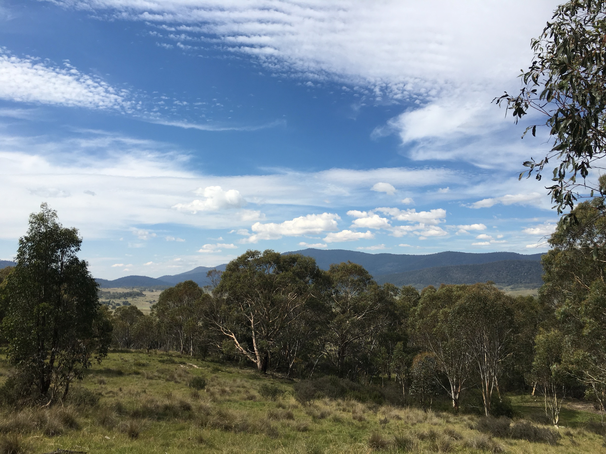
The route leaves the Yankee Hat car park on Old Boboyan Road, crosses Middle Creek on a footbridge and heads north-west across the Gudgenby grassland flats on constructed metal-mesh boardwalk and formed track. Kangaroos and wombats are common on the flats. After about 3 km the route arrives at a granite tor at the base of Yankee Hat mountain, where a naturally formed shelter holds a series of Ngunnawal rock paintings and hand stencils in white clay and red ochre. Return by the same track.
Why it is essential
Yankee Hat is the region’s most accessible open Aboriginal rock-art site and a Ngunnawal cultural landscape of national significance: an easy, near-level walk that connects the Namadgi grasslands with a rare public window onto more than 3,700 years of documented use of the shelter. It is the walk in this selection that ACT Parks and the Ngunnawal community both point to as the essential cultural outing in the park.
Hazards and notes
- Cultural site: stay on the boardwalk, do not touch the artwork and do not use flash photography.
- Middle Creek can rise in heavy rain and after snowmelt.
- Old Boboyan Road is unsealed and periodically closed for maintenance.
- Little shade on the grassland flats; carry water and sun protection.
- Snakes on the grassland from spring to autumn.
- Sign the intention book at the trailhead.
GPX / KML links
| Source | URL | Format | Notes |
|---|---|---|---|
| ACT Parks — Namadgi walking tracks | parks.act.gov.au | Official park page | No GPX published |
| Trail Hiking Australia — Yankee Hat | trailhiking.com.au | Third-party route page with stats | GPX behind login |
| AllTrails — Yankee Hat Walking Track | alltrails.com | Third-party route page | Secondary reference |
Further reading
4. Square Rock
Snapshot
Itinerary
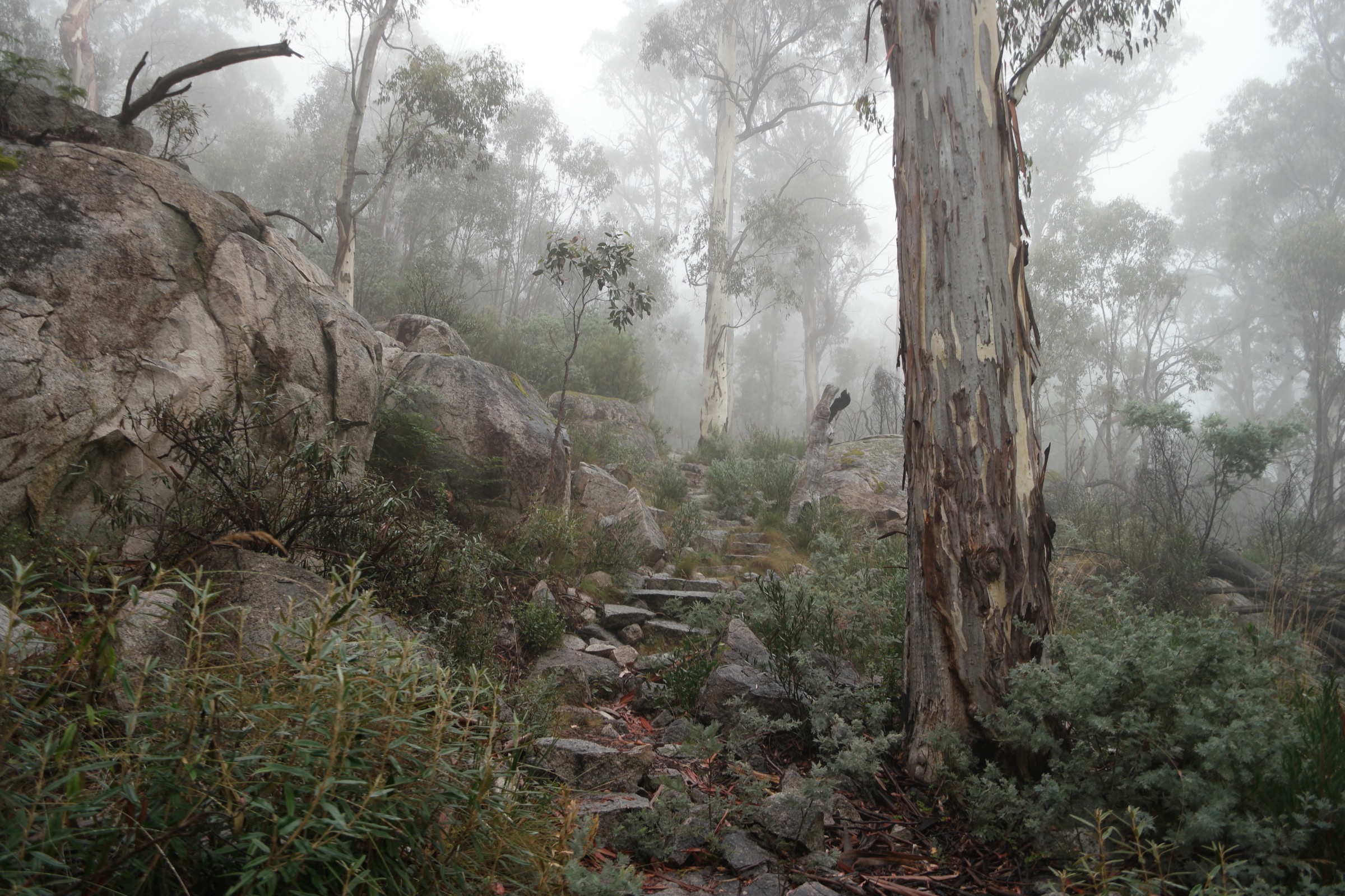
The route leaves the Square Rock car park at about 1,218 m and climbs steadily through mixed eucalypt forest — ash, alpine ash and snow gum — on a formed track. After about 2 km it passes Smokers Flat, then continues onto the ridge and undulates north to the Square Rock outcrop at 1,451 m. A short metal ladder gives access to the top of the granite tor, from where the view runs west across the Cotter valley to the Brindabella crest and Mount Franklin, and north-east back over Corin Reservoir. An optional 500 m side-trip on the return leads to the Orroral Valley Lookout, giving views south into the Orroral valley and the 2020 fire scar. Return by the same track.
Why it is essential
Square Rock is the essential ACT high-country day-walk on the Corin Road side: a rewarding but moderate half-day to a granite tor at the western edge of Namadgi, with an equally strong view of the Brindabella crest as the harder Gingera routes. ACT Parks publishes it as one of the featured Namadgi walks in its official brochure.
Hazards and notes
- The metal ladder at the summit is exposed to wind and can be slippery when wet or frosted.
- Cliff edges beyond the marked lookout are unfenced.
- Cold, exposed ridge on the upper half of the walk; carry a shell and warm layer.
- Snakes on the ridge from spring to autumn.
- Walkers’ register is available at the trailhead — sign in.
GPX / KML links
| Source | URL | Format | Notes |
|---|---|---|---|
| ACT Parks — Square Rock brochure | parks.act.gov.au | Official PDF brochure | ACT Government terms; no GPX published |
| Trail Hiking Australia — Square Rock | trailhiking.com.au | Third-party route page with stats | GPX behind login |
| AllTrails — Square Rock | alltrails.com | Third-party route page | Secondary reference |
Further reading
5. Mount Gingera via Mount Franklin Road
Snapshot
Itinerary
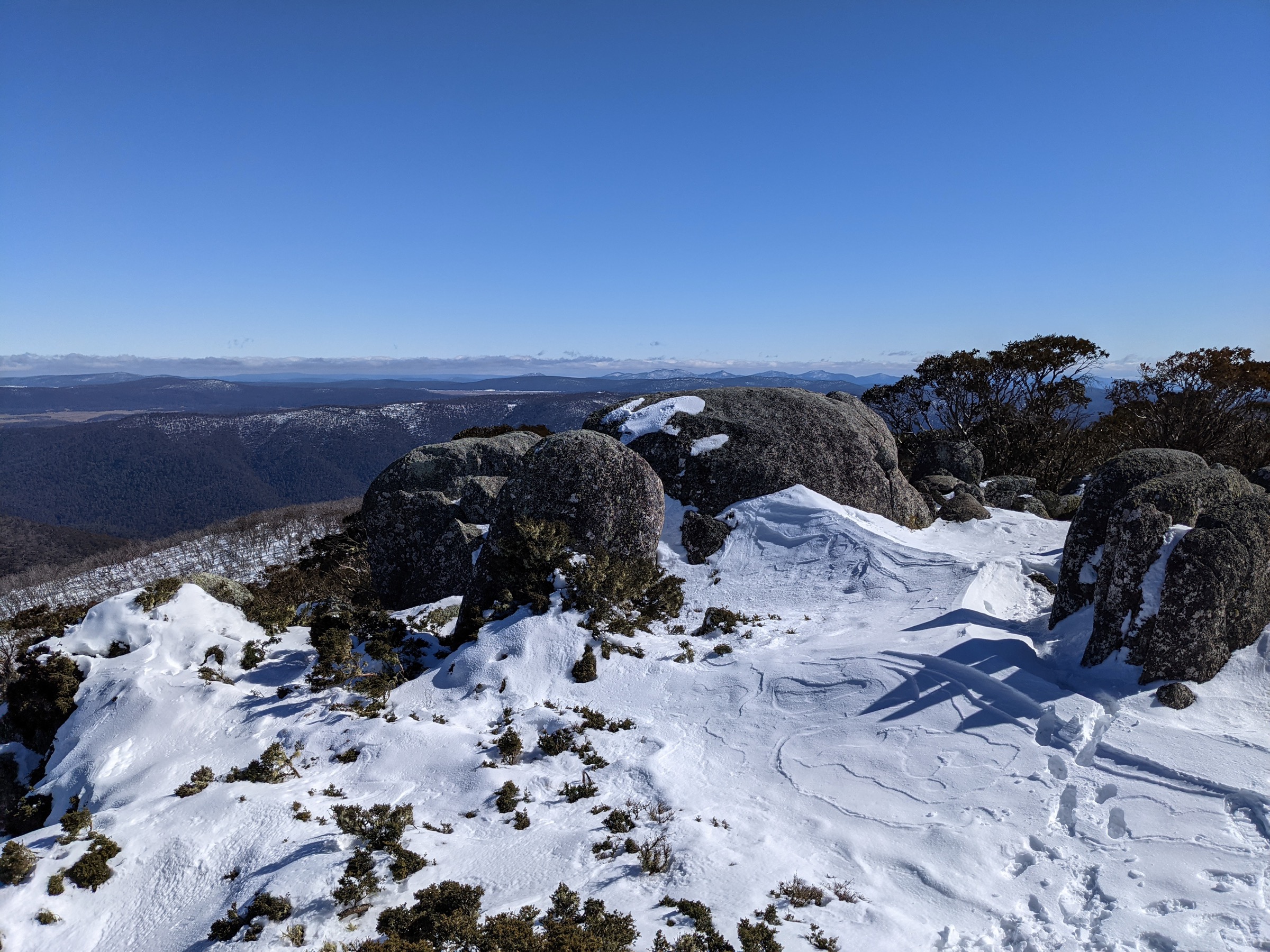
The route leaves the locked gate at the Mount Ginini car park and follows Mount Franklin Road south along the eastern flank of the Brindabella crest, roughly holding the 1,650 m contour through snow-gum woodland with intermittent views west into the Goodradigbee valley. After about 4 km it passes the Stockyard Spur track junction on the left, then reaches Pryors Hut at about 5 km — a small tin working hut built in 1952 for alpine planting programs and still usable as an emergency shelter. From Pryors Hut a marked track continues about 1 km south-west onto the open summit ridge and up to the trig at 1,857 m. In clear conditions the summit gives an uninterrupted arc across the Brindabella crest into Kosciuszko National Park, north-east to the ACT valleys and south to Bimberi Peak. Return by the same route.
Why it is essential
Mount Gingera is the essential ACT alpine day-walk: the highest summit that can realistically be reached as a day trip from Canberra, the natural way to see the Brindabella crest and its snow-gum-and-cushion-plant subalpine zone, and one of only two easily accessible ACT-side day-walks that top out above 1,800 m. It is also the classic historical objective from Pryors Hut and the Mount Franklin ski hut area.
Hazards and notes
- Snow closes Mount Franklin Road from about May to October; even in summer the summit ridge can carry rime and hard snow patches.
- Long day with exposure to wind and cold on the crest; carry a full shell, warm layer, gloves and hat in any month.
- Navigation on the summit ridge above Pryors Hut becomes difficult in fog or snow — carry map, compass and GPS.
- Pryors Hut is an emergency shelter only, not a booked hut.
- PLB recommended.
- Bimberi Peak, the ACT’s high point at 1,912 m, sits about 8 km further south from Gingera and is a full multi-day objective or a very long single day — outside the day-hike bracket here.
GPX / KML links
| Source | URL | Format | Notes |
|---|---|---|---|
| ACT Parks — Namadgi walking tracks | parks.act.gov.au | Official park page | No GPX published |
| Australian Hiker — Mount Gingera | australianhiker.com.au | Third-party route page with stats | Reference only |
| Hiking the World — Mount Gingera from Corin Dam | hikingtheworld.blog | Third-party trip report | Alternative approach from Corin Dam (longer) |
Further reading
Missing data
- ACT Parks does not publish official GPX or KML files for any of the five walks. Route geometry should be redrawn from OpenStreetMap or the ACT Parks embedded maps rather than reused from third-party sources.
- Elevation gain, loss and maximum elevation figures for Mount Gingera are not published by ACT Parks; the values quoted come from third-party trip reports and topographic estimates and should be treated as approximate.
- No open-licence Wikimedia Commons image at or above the 2,000 px source floor was located for Booroomba Rocks in this pass. The figure block is intentionally omitted from that section rather than shipping a below-floor image; Commons holds only smaller images and a 1976 climbing set.
- Public-transport suitability to any of the five trailheads was not verified; all five walks assume self-drive access.
- Booroomba Rocks Road and Old Boboyan Road are subject to periodic maintenance closures in 2026; the current status should be checked on ACT Parks alerts before travel.
Verification status
- Booroomba Rocks — Route verified against ACT Parks and Trail Hiking Australia; no compliant Commons image located, media pending.
- Mount Tennent summit — Route verified against ACT Parks and Trail Hiking Australia; media verified via Wikimedia Commons.
- Yankee Hat rock art — Route verified against Trail Hiking Australia and Australian Hiker; cultural site notes verified via ACT Parks and Australian Hiker; media verified via Wikimedia Commons.
- Square Rock — Route verified against the ACT Parks brochure and Trail Hiking Australia; media verified via Wikimedia Commons.
- Mount Gingera — Route verified against Australian Hiker and Hiking the World trip reports; ACT Parks does not publish a dedicated route page for Gingera; media verified via Wikimedia Commons.
Further reading
| Source | URL |
|---|---|
| ACT Parks — Namadgi National Park | parks.act.gov.au |
| ACT Parks — Namadgi walking tracks | parks.act.gov.au |
| ACT Parks — Alerts | parks.act.gov.au |
| ACT Parks — Square Rock brochure (PDF) | parks.act.gov.au |
| NSW National Parks — Brindabella National Park | nationalparks.nsw.gov.au |
| Trail Hiking Australia — Namadgi National Park | trailhiking.com.au |
| Wikipedia — Namadgi National Park | en.wikipedia.org |
| Wikipedia — Brindabella Ranges | en.wikipedia.org |