Regional overview
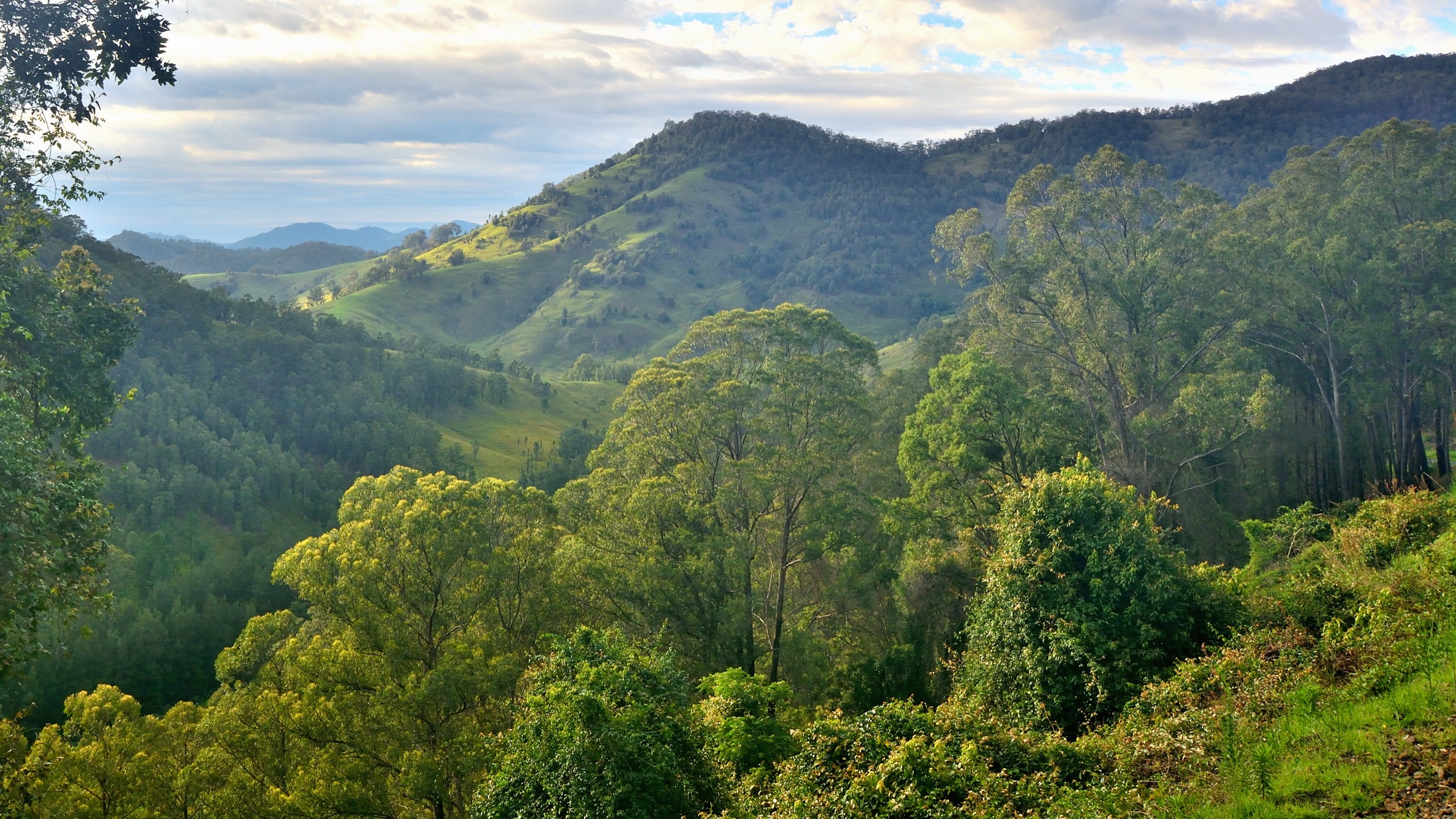
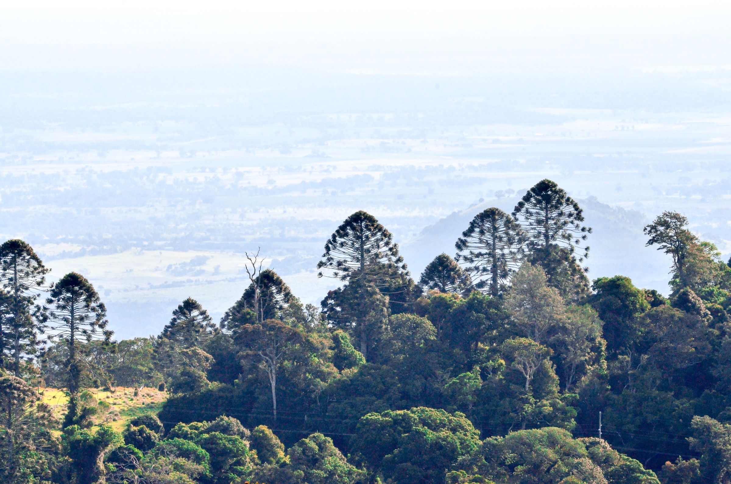
The Bunya Mountains rise as an isolated basalt plateau on the Great Dividing Range between the Darling Downs to the south-west and the South Burnett to the north-east, roughly 250 km north-west of Brisbane. Their highest point, Mount Kiangarow, reaches 1,135 m, and the range preserves the world’s largest remaining stand of ancient bunya pine (Araucaria bidwillii), a Gondwanan conifer that once ranged widely across eastern Australia and is now largely restricted to this compact 19,500 ha national park and a smaller outlier at Mount Lewis in the wet tropics. The plateau also supports a mosaic of subtropical rainforest, wet sclerophyll forest and open grassy “balds” studded with grasstrees (Xanthorrhoea glauca), a combination unusual in south-eastern Queensland and one of the reasons Bunya Mountains was gazetted as Queensland’s second national park in 1908.
The Bunya Mountains are Country for the Wakka Wakka, Jarowair and Barunggam peoples, and for many generations before European settlement they were the site of a triennial gathering during the summer bunya-nut harvest. As many as fifteen distinct cultural groups travelled from across south-eastern Queensland and northern New South Wales to feast on the nutritious cones, trade, arrange marriages, resolve disputes and exchange songs and stories. The bunya festival is remembered today as one of the largest recurring inter-tribal gatherings in pre-colonial Australia; contemporary Traditional Owners are working to revive the tradition, and visitors are asked to treat the pines themselves as living cultural heritage rather than scenery.
Access is by sealed road via the Bunya Mountains Road from either Dalby (south) or Kingaroy (north-east). The main day-use hub is Dandabah, near the southern end of the plateau, with a QPWS information shelter, a campground and the trailheads for the Scenic Circuit and Barker Creek Circuit. A second hub, Burton’s Well, near the northern edge of the plateau at approximately 1,090 m, gives access to Mount Kiangarow and the Westcott to Cherry Plain track through the plateau’s grasslands. The park contains approximately 35 km of walking tracks connecting these two hubs and the intermediate picnic areas at Cherry Plain, Westcott and Paradise, with QPWS grading tracks under the Australian Walking Track Grading System (AWTGS) — most Bunya Mountains walks fall into Grade 3 (some experience recommended) with short Grade 2 links.
Two ongoing management issues shape any visit. First, Phytophthora dieback — a soil-borne water mould — has been implicated in the death of mature bunya pines across the park since about 2011, with damage intensifying through the 2017–2020 drought and again during wet years when spores spread through soil movement. QPWS has installed boot-washing stations at every walking track entrance and periodically closes tracks either to control the spread of the pathogen or because dying trees are a safety risk overhead; the Bunya Bunya walking track has been closed for this reason. Second, parts of the range were burnt during the extended 2019–20 Queensland bushfire season, and short sections of the network are still under regrowth management. Walkers should check the QPWS park-alerts page before travel rather than relying on published maps alone.
Selection rationale
The five walks are chosen to give a representative cross-section of the Bunya Mountains plateau within the constraints of a relatively compact 35 km track network. The Scenic Circuit at Dandabah is the flagship short walk and the essential introduction to the ancient bunya-pine forest and the plateau’s waterfall gullies. The Barker Creek Circuit is the standard longer day-walk from the same trailhead and adds the Big Falls escarpment. Mount Kiangarow from Burton’s Well is the plateau’s summit walk and reaches the range’s high point at 1,135 m. The Westcott to Cherry Plain track (used here as a stand-in for the Westcott Plains Circuit route family) samples the open grassland “balds” and the plateau’s western escarpment lookouts. The Fishers Lookout circuit at Dandabah is included as the shorter waterfall-and-lookout alternative to the Scenic Circuit for parties wanting a second half-day on the southern plateau. The proposed Pine Gorge Lookout Track is treated as a variant of the Scenic Circuit rather than a separate walk because it shares the same trailhead and the same rim-line lookout. Confirm the current status of the Bunya Bunya Track and any other closures with QPWS before travel.
Summary table
| # | Hike | Country | Route type | Distance | Gain | Max elevation | Difficulty |
|---|---|---|---|---|---|---|---|
| 1 | Scenic Circuit (Dandabah) | Australia | Loop | ~4 km | ~120 m | ~1,000 m | Grade 3 (AWTGS) |
| 2 | Barker Creek Circuit | Australia | Loop | ~10 km | ~350 m | ~1,000 m | Grade 3 (AWTGS) |
| 3 | Mount Kiangarow (from Burton’s Well) | Australia | Out-and-back | ~2.8 km | ~130 m | 1,135 m | Grade 3 (AWTGS) |
| 4 | Westcott to Cherry Plain (grassland balds) | Australia | Point-to-point | ~4.8 km one-way | ~150 m | ~1,090 m | Grade 3 (AWTGS) |
| 5 | Fishers Lookout Circuit (Dandabah) | Australia | Loop | ~6.4 km | ~250 m | ~1,000 m | Grade 3 (AWTGS) |
1. Scenic Circuit (Dandabah)
Snapshot
Itinerary
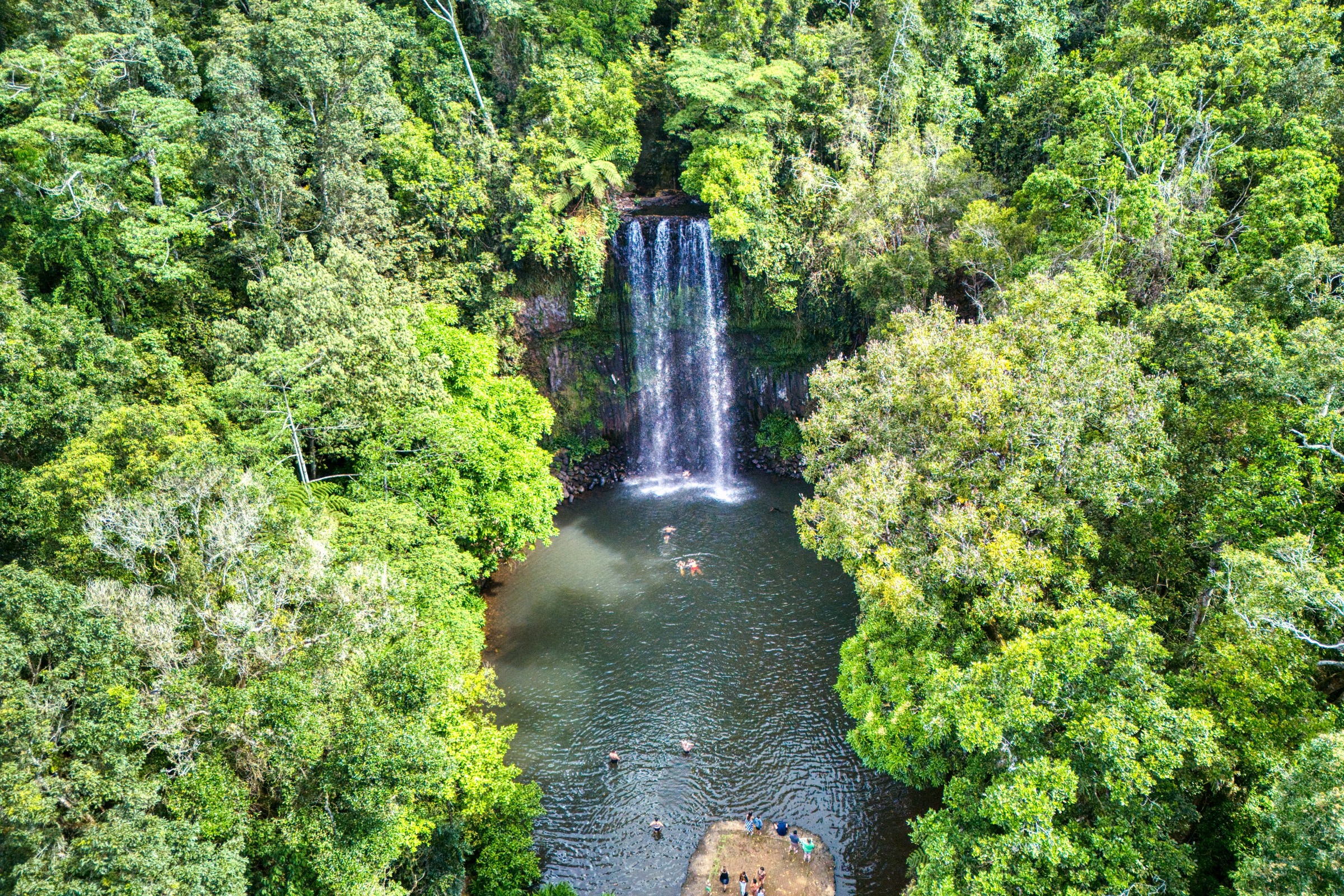
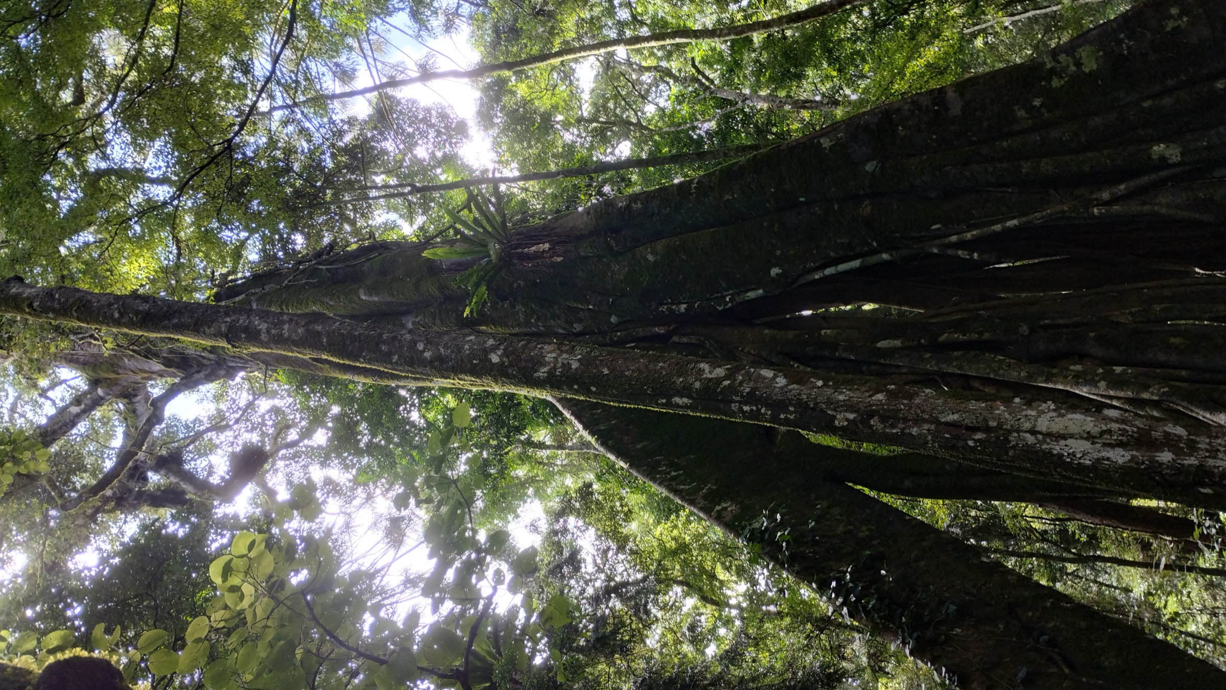
The Scenic Circuit starts from the Dandabah picnic area at the southern end of the plateau, where an obvious signposted junction and boot-washing station mark the entry point. The track drops gently into the head of a deep rainforest gully lined with mature bunya pines, black bean, hoop pine and strangler figs, then crosses a small side creek to the base of Festoon Falls, a ribbon cascade over a mossy basalt lip that runs strongly through winter and after summer storms. From Festoon Falls the loop climbs steadily through a mixed piccabeen palm and rainforest understorey to a second waterfall at Tim Shea Falls, where a viewing platform gives a partial view across the plunge pool.
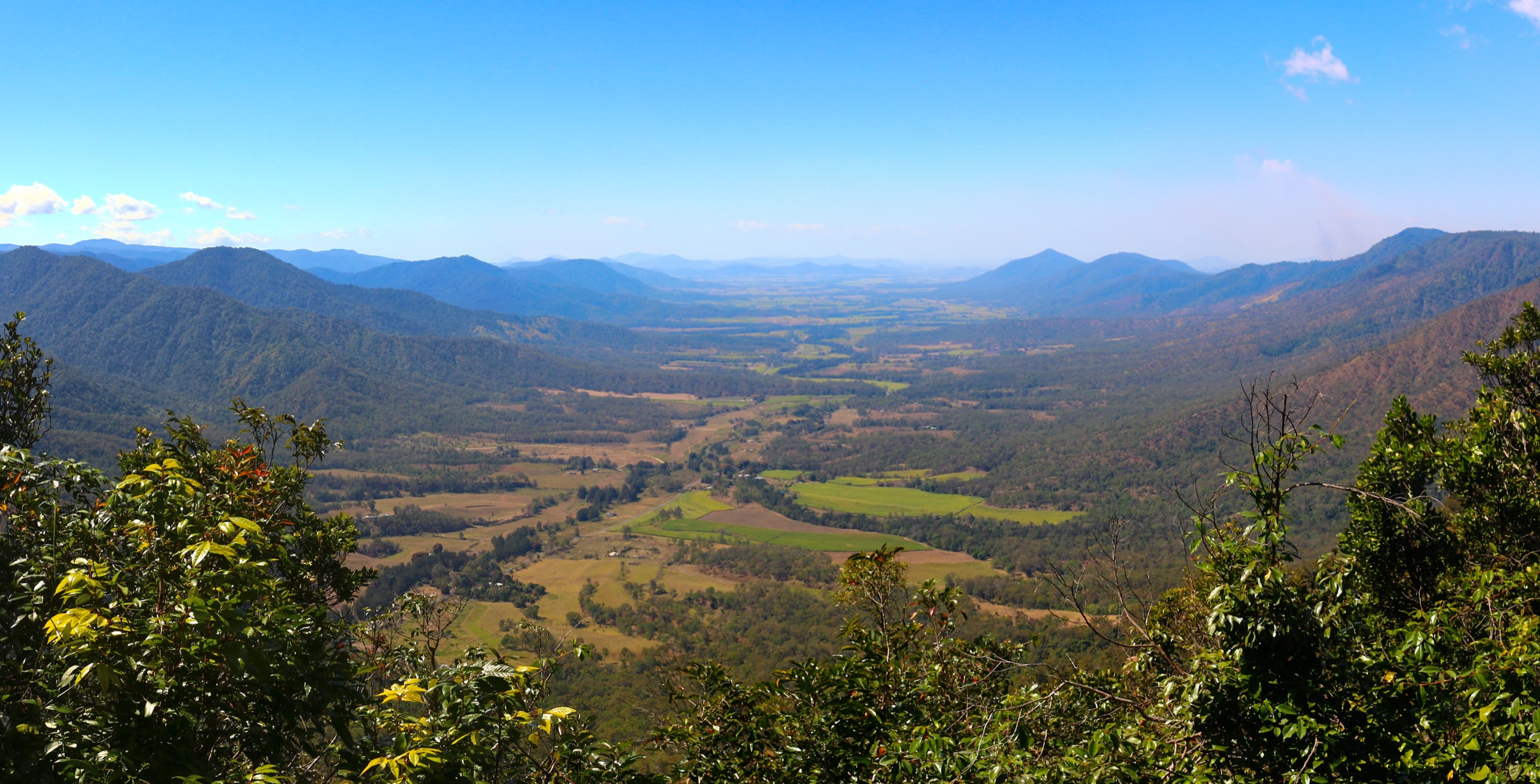
Beyond Tim Shea the track climbs onto the drier eastern rim of the gully system and joins a wider ridge trail that returns towards Dandabah along a line of exposed basalt bluffs. A short signposted spur leaves the main loop at Pine Gorge Lookout — the natural rim highpoint of the walk — with an open view east across the South Burnett plains towards Kingaroy and the distant Tarong power station. A further optional detour along the rim adds roughly 1 km round-trip to the shorter Tim Shea Falls arm. From the lookout junction the loop returns through more open eucalypt–grasstree woodland to the Dandabah trailhead.
Why it is essential
The Scenic Circuit is the essential short introduction to the Bunya Mountains and the only walk that combines the two dominant landscape types of the plateau — old-growth bunya-pine rainforest and open rim-line lookouts — in a single 4 km loop. For visitors on a single day trip from Dalby or Kingaroy it is the standard first walk and, together with the Mount Kiangarow summit at the plateau’s northern end, the pair that best represents the range.
Equipment
- Sturdy walking shoes or light boots
- Broad-brimmed hat and sun protection
- 1.5–2 L of water (no reliable water on route)
- Warm layer for the ridge in cooler months
- Insect repellent (leeches after rain)
- First-aid kit including snake-bite bandage
- Use the QPWS boot-wash station at both ends of the walk
Hazards and notes
- Steps and roots can be slippery in and after rain; falls are the most common injury.
- Snake activity through the warmer months.
- Leeches are common on the rainforest sections after wet weather.
- Falling limbs are a real hazard around dieback-affected bunya pines — do not linger under dead crowns and do not leave the marked track.
- Use the boot-washing stations to reduce Phytophthora spread.
- Cell coverage is patchy on the plateau.
GPX / route file
| Source | URL | Format | Notes |
|---|---|---|---|
| QPWS — Scenic circuit, Bunya Mountains NP | parks.qld.gov.au | Web page | Official route source; no direct GPX download published |
| Trail Hiking Australia — Scenic Circuit Walk | trailhiking.com.au | Web page | Distance, time and grade cross-check |
| AllTrails — Bunya Pine Scenic Circuit | alltrails.com | Web page | Community elevation-gain reference |
Sources
- QPWS — Bunya Mountains National Park
- QPWS — Scenic circuit
- Trail Hiking Australia — Scenic Circuit Walk
- Wikimedia Commons — Photo of a tree on the Scenic Circuit, Bunya Mountains
2. Barker Creek Circuit
Snapshot
Itinerary
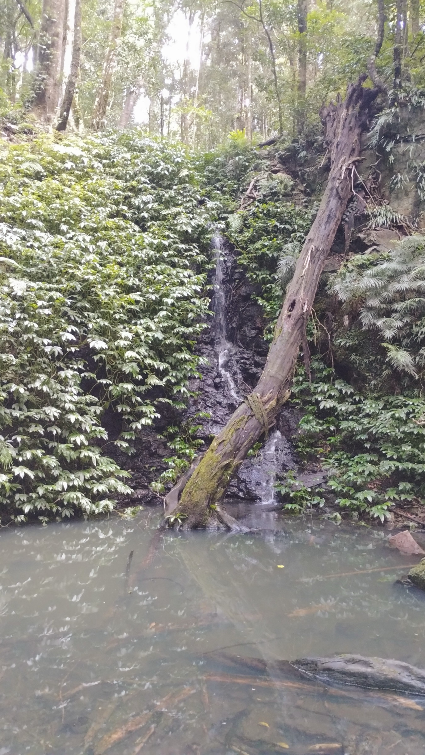
The Barker Creek Circuit is the standard longer day-walk of the southern plateau and can be walked in either direction from Dandabah, or as a shuttle from the Paradise car park. Taken clockwise from Dandabah, the track shares its first kilometre with the Scenic Circuit down into the Festoon Falls gully, then branches north through denser rainforest and follows the head of Barker Creek onto a broad shelf of piccabeen palm and hoop-pine forest. The line descends steadily through the middle section to Paradise Falls, a stepped cascade that also functions as the natural halfway rest.
Below Paradise Falls the track drops to Little Falls and then to Big Falls, the longest single drop in the park (published at approximately 122 m), where a fenced viewing platform gives the standard escarpment perspective — spectacular after heavy rain and often little more than a trickle in a dry autumn. From Big Falls the loop climbs back onto the plateau on the eastern arm of the circuit, rejoining the Scenic Circuit along the rim near Pine Gorge Lookout and returning to Dandabah through the same open eucalypt–grasstree woodland. The full circuit is sustained rather than technical, and the elevation gain accumulates in short climbs rather than a single sustained ascent.
Why it is essential
Barker Creek is the essential longer walk of the Bunya Mountains and the only route that gives sustained time in the deep rainforest gullies away from the Dandabah day-use precinct. The combination of Paradise, Little and Big Falls is the standard “waterfall day” of the park, and the eastern arm along the rim links back through the same lookout system as the Scenic Circuit for continuity.
Equipment
- Sturdy walking shoes or light boots (steps and stream crossings)
- Broad-brimmed hat and sun protection
- 2–3 L of water (no reliable treated water on route)
- Warm and weatherproof layer
- Insect repellent (leeches common)
- Map and compass or GPS
- First-aid kit including snake-bite bandage
- Use the QPWS boot-wash stations
- Headtorch for late-afternoon finishes in winter
Hazards and notes
- Slippery steps and rock slabs after rain — this is where most injuries occur.
- Stream crossings can rise quickly in summer storms; do not attempt in flood.
- Snake activity through the warmer months.
- Falling limbs around dieback-affected bunya pines — stay on the marked track.
- Leeches after rain.
- Cell coverage is patchy; a PLB is sensible for parties walking mid-week off-season.
GPX / route file
| Source | URL | Format | Notes |
|---|---|---|---|
| QPWS — Bunya Mountains journeys | parks.qld.gov.au | Web page | Official route source; no direct GPX download published |
| Trail Hiking Australia — Barker Creek Circuit | trailhiking.com.au | Web page | Distance and time cross-check |
| Aussie Bushwalking — Barker Creek Circuit | aussiebushwalking.com | Web page | Route-description cross-check |
Sources
- QPWS — Bunya Mountains National Park
- Trail Hiking Australia — Barker Creek Circuit
- Aussie Bushwalking — Barker Creek Circuit
- Wikimedia Commons — Tim Shea Falls, Bunya Mountains
3. Mount Kiangarow (from Burton’s Well)
Snapshot
Itinerary
The Mount Kiangarow track begins across the road from the Burton’s Well camping ground at the northern end of the plateau road. The path enters mature high-altitude rainforest immediately, with bunya pines mixed through hoop pine and rose she-oak, and climbs steadily on a well-graded surface. QPWS gives the climb as 132 m over the 1.4 km one-way distance — a sustained but gentle grade rather than any steep pitches. The upper third of the walk breaks out of the closed canopy into an open avenue of grasstrees (Xanthorrhoea glauca), some of them centuries old, which line the last few hundred metres to the crest.
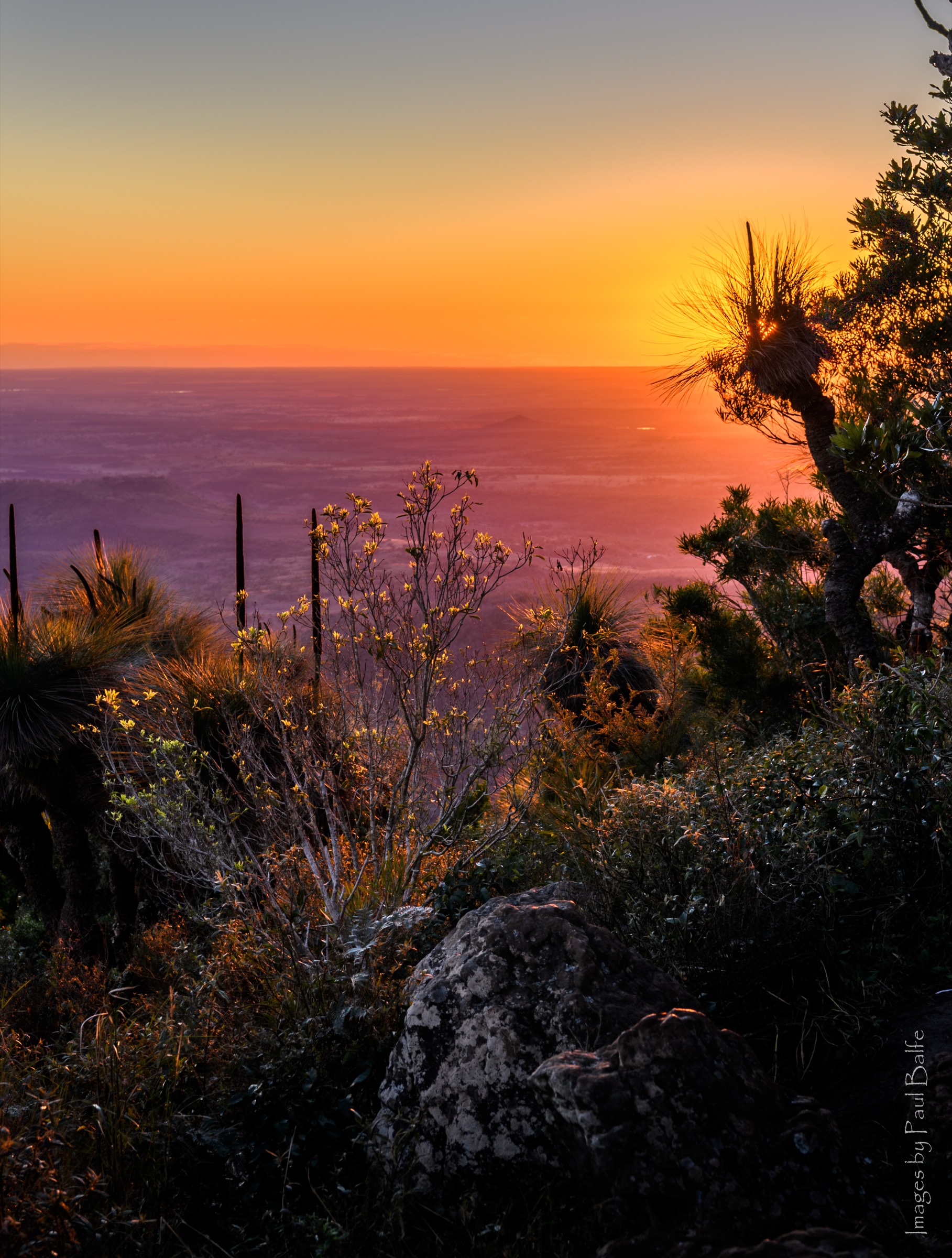
The summit lookout sits at 1,135 m, the highest point in the Bunya Mountains, on a small clearing of basalt bedrock among the grasstrees. Views open west across the Darling Downs and the Great Dividing Range, north and south along the ridgeline, and are particularly striking around sunset. Return is on the same line back through the grasstree avenue and rainforest to the Burton’s Well trailhead.
Why it is essential
Mount Kiangarow is the plateau’s high point and the only Bunya Mountains walk that combines a summit view with the range’s distinctive grasstree “avenue”. At under 3 km return it is short enough to add as an afternoon walk to a day already anchored around Dandabah, and the summit sunset is the classic photograph of the northern plateau.
Equipment
- Walking shoes or light boots
- Sun protection and hat
- 1–1.5 L water
- Warm layer for the summit (exposed and often windy)
- Headtorch if walking for sunset
- First-aid kit
- Use the QPWS boot-wash station at the trailhead
Hazards and notes
- Exposed summit lookout — watch children on the rock slabs.
- Cool and windy at the top even in summer; carry a layer.
- Falling limbs around dieback-affected pines — stay on the marked track.
- Cell coverage is patchy.
- The plateau road from Dandabah to Burton’s Well is narrow and winding; drive slowly, especially at dusk when wallabies are active.
GPX / route file
| Source | URL | Format | Notes |
|---|---|---|---|
| QPWS — Mount Kiangarow walk | parks.qld.gov.au | Web page | Official route source; no direct GPX download published |
| Aussie Bushwalking — Mount Kiangarow | aussiebushwalking.com | Web page | Route-description cross-check |
Sources
- QPWS — Mount Kiangarow walk
- Aussie Bushwalking — Mount Kiangarow
- Wikimedia Commons — Mount Kiangarow Sunset
4. Westcott to Cherry Plain (grassland balds)
Snapshot
Itinerary
The Westcott to Cherry Plain track crosses the central plateau between the two intermediate picnic areas and gives the best walker’s exposure to the Bunya Mountains “balds” — natural grassland openings on the plateau, historically maintained by cultural burning and now managed by QPWS as an ecological feature in their own right. The track leaves the Westcott picnic area on a gently graded line through open eucalypt woodland, weaves between short sections of rainforest and grassland edge, and follows the western escarpment of the plateau north-east towards Cherry Plain.
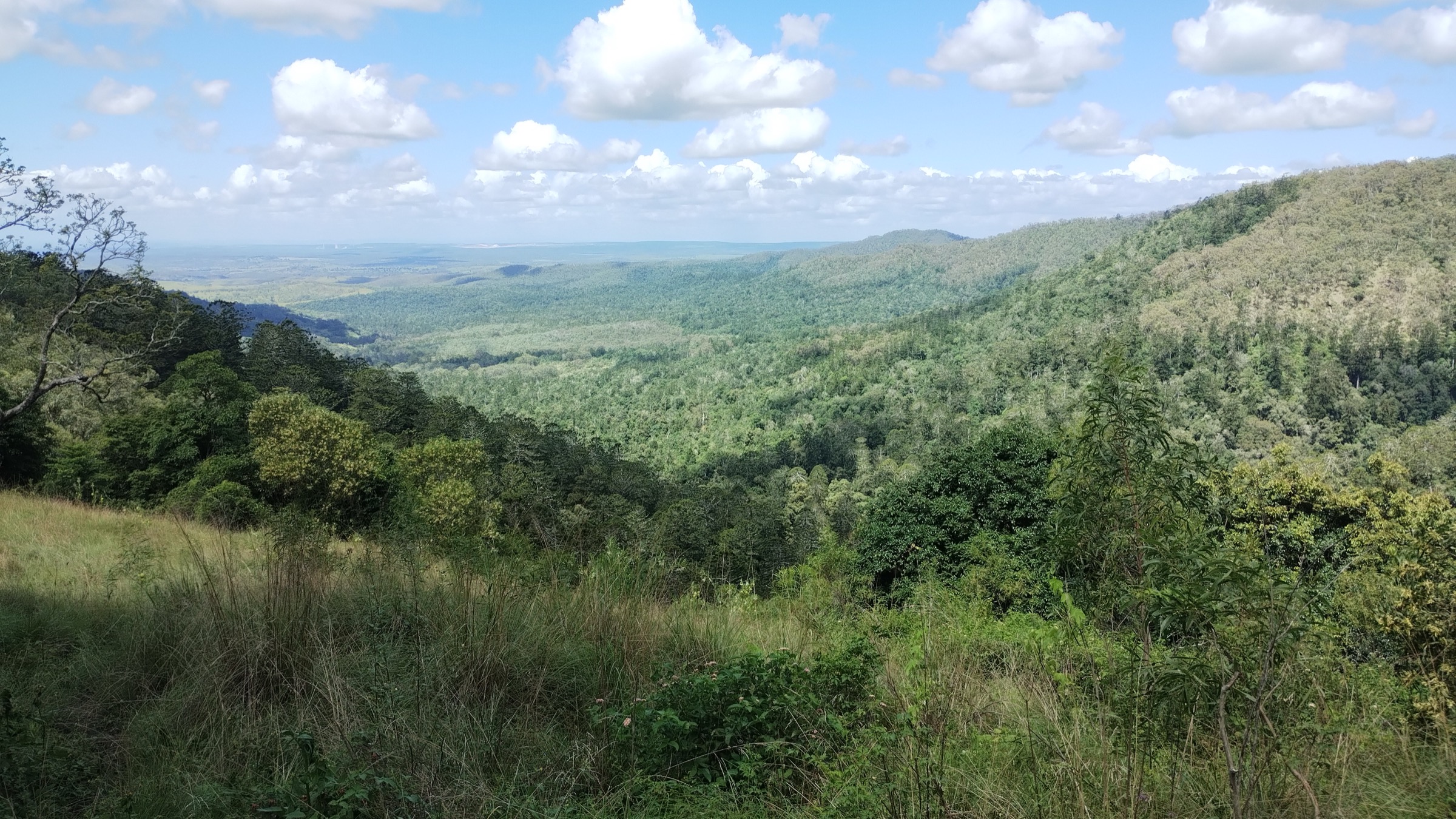
The middle third of the walk crosses a series of open balds studded with grasstrees and, along the western rim, offers panoramas across the Darling Downs and the head of the South Burnett. The line then re-enters wet sclerophyll and rainforest for the last kilometre into the Cherry Plain picnic area. A two-car shuttle between Westcott and Cherry Plain makes the walk a comfortable half-day; parties walking as a return trip should allow 3.5–4 hours for the full 9.6 km.
Why it is essential
The Westcott to Cherry Plain track is the essential grassland walk of the Bunya Mountains and the only route that crosses more than one bald in a single day. It complements the Scenic Circuit (rainforest and waterfalls) and the Mount Kiangarow walk (summit rainforest and grasstrees) with the plateau’s open-country landscape, and gives the best walker’s context for the seasonal burning regimes that keep the balds open.
Equipment
- Walking shoes or light boots
- Broad-brimmed hat and sun protection (grassland sections are open)
- 2 L of water
- Warm layer for the rim
- Insect repellent (grass ticks in warmer months)
- First-aid kit including snake-bite bandage
- Use the QPWS boot-wash stations at both ends
Hazards and notes
- Fully exposed grassland sections — sun and wind can be strong.
- Grass ticks are common in warmer months; check on completion.
- Snake activity through the warmer months, particularly on the balds.
- Cell coverage is patchy on the plateau.
- The point-to-point requires a two-car shuttle; the same route walked as an out-and-back doubles the day.
GPX / route file
| Source | URL | Format | Notes |
|---|---|---|---|
| QPWS — Bunya Mountains journeys | parks.qld.gov.au | Web page | Official route source; no direct GPX download published |
| QPWS — Bunya Mountains national park map (PDF) | parks.des.qld.gov.au | Official park map showing Westcott–Cherry Plain–Burton’s Well segments |
Sources
- QPWS — Bunya Mountains journeys
- QPWS — Bunya Mountains National Park map (PDF)
- Wikimedia Commons — View from Pine Gorge Lookout (Bunya Mountains)
5. Fishers Lookout Circuit (Dandabah)
Snapshot
Itinerary
The Fishers Lookout circuit is the shorter half-day complement to the Barker Creek Circuit and gives a compact “waterfall gully and rim lookout” combination without committing to the full 10 km loop. From the Dandabah trailhead the track descends steeply on stepped rainforest tread through mature bunya-pine and piccabeen palm forest, crossing several small gullies to reach the lower rim shelf. From the lower shelf a signposted spur climbs to Fishers Lookout (also referred to as J.S. Fisher Lookout), a fenced rock platform giving an open view east across the South Burnett and — on clear mornings — as far as the Great Dividing Range escarpment beyond Kingaroy.
The return leg climbs steadily on a more open eucalypt–grasstree line, with an optional extension to a small waterfall known locally as Chute No. 3 that adds roughly a further kilometre. The published circuit distance including the Chute extension is 6.4 km, and the climb back to the plateau is the day’s main effort — a sustained but never technical ascent through rainforest with several short benches for rest.
Why it is essential
Fishers Lookout is the essential half-day walk from Dandabah when the Barker Creek Circuit is too long, and its combination of steep-descent rainforest and open rim lookout gives a middle ground between the 4 km Scenic Circuit and the full 10 km Barker Creek day. It is also the natural sunrise walk from the Dandabah campground.
Equipment
- Sturdy walking shoes or light boots (steps and roots)
- Sun protection
- 1.5–2 L water
- Warm layer
- Insect repellent
- First-aid kit including snake-bite bandage
- Use the QPWS boot-wash station
Hazards and notes
- Steep stepped descent — slippery in and after rain.
- Falling limbs around dieback-affected pines — stay on the marked track.
- Snake activity through the warmer months.
- Leeches after rain.
- Cell coverage is patchy.
- Confirm current status with QPWS before travel; some connecting tracks in the Dandabah network have been closed for dieback or safety.
GPX / route file
| Source | URL | Format | Notes |
|---|---|---|---|
| QPWS — Bunya Mountains journeys | parks.qld.gov.au | Web page | Official route source; no direct GPX download published |
| Aussie Bushwalking — Bunya Mountains index | aussiebushwalking.com | Web page | Route-description cross-check for Fishers Lookout circuit and the Chute No. 3 extension |
Sources
- QPWS — Bunya Mountains journeys
- Aussie Bushwalking — Bunya Mountains index
- Wikimedia Commons — Bunya (Araucaria bidwillii) in habitat, Bunya Mountains NP, Queensland
Region-level sources
| Source | URL |
|---|---|
| QPWS — Bunya Mountains National Park | parks.qld.gov.au |
| QPWS — Bunya Mountains journeys | parks.qld.gov.au |
| QPWS — Scenic circuit | parks.qld.gov.au |
| QPWS — Mount Kiangarow walk | parks.qld.gov.au |
| QPWS — Bunya Mountains national park map (PDF) | parks.des.qld.gov.au |
| QPWS — Phytophthora dieback management | parks.qld.gov.au |
| Trail Hiking Australia — Scenic Circuit Walk | trailhiking.com.au |
| Trail Hiking Australia — Barker Creek Circuit | trailhiking.com.au |
| Aussie Bushwalking — Bunya Mountains index | aussiebushwalking.com |
| Wikipedia — Bunya Mountains National Park | en.wikipedia.org |
| Wikipedia — Bunya Mountains | en.wikipedia.org |
| Wikipedia — Wakka Wakka | en.wikipedia.org |
| Wikipedia — Jarowair | en.wikipedia.org |
Further reading
Nearby Great Dividing Range guides on Storm
- ACT, Namadgi and the Brindabella Ranges
- Atherton Tablelands / Cairns Highlands
- Barrington Tops
- Blue Mountains
- QPWS — Phytophthora dieback management programme
- Ngarrngga — Songlines Case Study: Bunya Nut Festival
- Wikipedia — Bunya Mountains National Park
- Wikipedia — Araucaria bidwillii (bunya pine)
Missing data / follow-up work
- QPWS does not publish direct GPX or KML downloads for any of the walks listed above. All route files are official web-page sources or the QPWS park-map PDF.
- Elevation gain values for all five walks are approximate. QPWS publishes an explicit 132 m climb over 1.4 km for Mount Kiangarow; the Scenic Circuit and Barker Creek Circuit gains are inferred from community mapping (AllTrails, Aussie Bushwalking) and should be regarded as within roughly ±20% until re-checked against a direct GPS trace.
- Trailhead elevations (~1,000 m at Dandabah, ~1,090 m at Burton’s Well, ~1,050 m at Cherry Plain) are approximate, drawn from published summit height and the QPWS park map rather than an on-the-ground GPS reading.
- The Bunya Bunya walking track was closed by QPWS at the time of writing for dieback / safety reasons; confirm the current status of all Dandabah connecting tracks with QPWS before travel.
- Parts of the plateau were affected by the 2019–20 bushfire season and periodic prescribed burns for grassland management; short sections of the western rim may be periodically closed for regrowth work. Check QPWS alerts.
- No licence-compatible image of Big Falls, Paradise Falls or the Westcott / Cherry Plain grasslands specifically was located on Wikimedia Commons in this pass; the Barker Creek and Westcott sections are illustrated with representative images from the same track network (Tim Shea Falls and Pine Gorge Lookout).
- AWTGS Grade 3 has been used for all five walks based on QPWS “Medium / uneven track with steady incline” style descriptions and Trail Hiking Australia grades; a definitive per-track class list from QPWS is a useful follow-up.