Regional overview
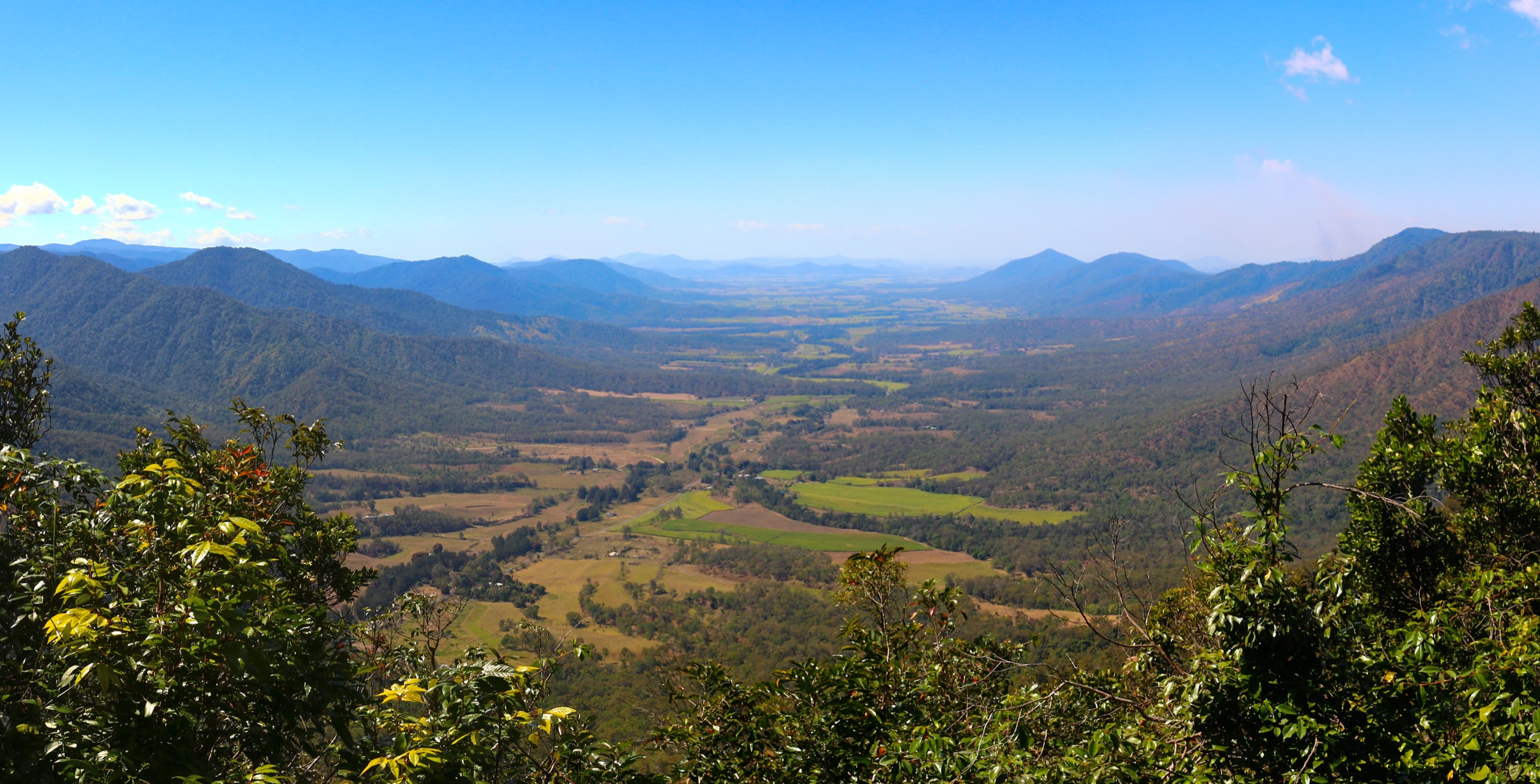
The Clarke Range rises abruptly from the sugar-cane country of the Pioneer Valley 80 km west of Mackay to form a north–south coastal escarpment that tops out at Mount Dalrymple (1,258 m) — the highest point in central Queensland. Because the range intercepts moist south-easterly trade winds, its eastern face carries dense subtropical and tropical rainforest above about 600 m, an ecologically isolated block that Queensland Parks and Wildlife Service (QPWS) manages under the umbrella of Eungella National Park. To the north, the coastal spur at Cape Hillsborough National Park drops the same escarpment into the Coral Sea. Together the two parks and their neighbours (Homevale, Crediton State Forest, Cape Palmerston) form the “Mackay Highlands” — a wet-forest island between the Wet Tropics to the north and the drier ranges further south.
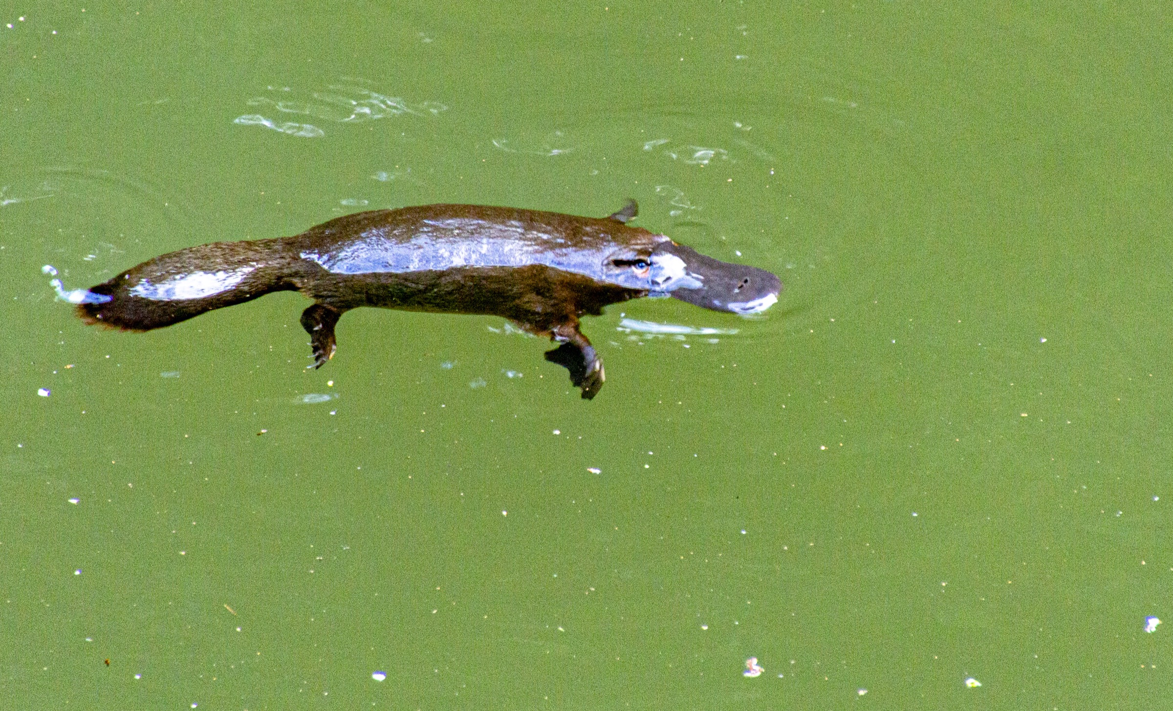
Endemism is the defining scientific story of the region. Eungella is one of Australia’s recognised centres of frog endemism and was the sole home of the northern gastric-brooding frog (Rheobatrachus vitellinus), last recorded in 1985 and now considered extinct. The plateau is the entire world range of the Eungella honeyeater (Bolemoreus hindwoodi), described only in 1983, and Broken River is regarded as one of the world’s most reliable platypus viewing sites, with purpose-built decks above the pools. Traditional Owners of the plateau are the Wirri people, whose determined native title (2019) runs from the Coast Range west toward Nebo and the Suttor headwaters. The coastal edge at Cape Hillsborough is Yuwibara Country, formally acknowledged in park interpretation on the Yuwi Plant Trail.
The reliable walking season runs from May to October: cool nights, clear plateau days, peak platypus visibility and firm tracks. November to April brings the tropical wet, cyclone risk, high humidity, road washouts and heavy leech loads. The Wheel of Fire walking track at Finch Hatton Gorge has been under indefinite QPWS closure since severe erosion undermined the tread; Araluen Cascades remains the reliable gorge walk in the interim. The principal walking bases are Eungella township (Sky Window, Cedar Grove and Palm Grove trailheads), Broken River 5.5 km south (camping, platypus decks, rainforest circuits) and Finch Hatton Gorge on the northern approach. Mackay is the sealed-road gateway, about 84 km east. There is no scheduled public transport above Finch Hatton — the local 310 bus reaches central Mackay only and a hire vehicle or taxi is required from there.
Selection rationale
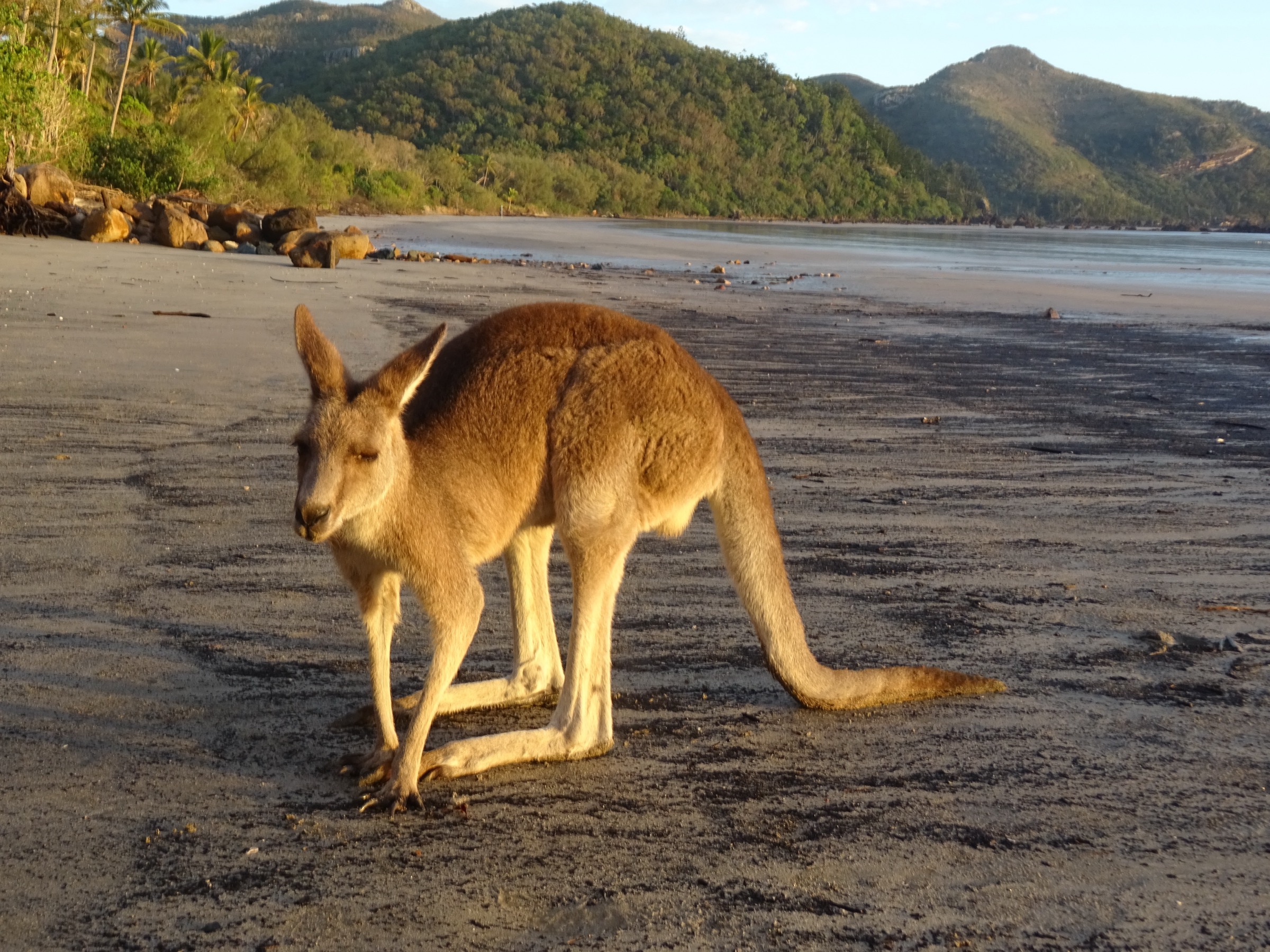
The five walks are chosen to cover the ecological, geological and cultural spectrum of the Mackay Highlands at four different difficulty levels. Broken River, Sky Window / Cedar Grove and Araluen Cascades collectively cover the three signature Eungella experiences — platypus and rainforest wildlife, plateau escarpment and Pioneer Valley views, and gorge waterfall swimming. The Wheel of Fire circuit was the natural fifth candidate but is currently under an indefinite QPWS closure; Araluen is the reliable substitute. Mount Dalrymple is the region’s only true summit day-hike and gives the article a genuine wilderness route, though it is honestly flagged as Grade 5 with navigation required. The Andrews Point circuit at Cape Hillsborough is included because the cape is where the Clarke Range escarpment meets the Coral Sea, and its sunrise kangaroo-on-beach scene is the region’s most internationally recognised image.
Summary table
| # | Hike | Country | Route type | Distance | Gain | Max elevation | Difficulty |
|---|---|---|---|---|---|---|---|
| 1 | Broken River Rainforest Discovery and platypus decks | Australia | Interlinked loops | ~2.4 km | ~40 m | ~730 m | Grade 3 (QPWS) |
| 2 | Sky Window and Cedar Grove Track | Australia | Out-and-back | ~3.5 km | ~120 m | ~780 m | Grade 2 (QPWS) |
| 3 | Araluen Cascades, Finch Hatton Gorge | Australia | Out-and-back | ~2.8 km | ~120 m | ~300 m | Grade 3 (QPWS) |
| 4 | Mount Dalrymple summit via Dalrymple Road | Australia | Out-and-back | ~14–16 km | ~700 m | 1,258 m | Grade 5 (unmaintained) |
| 5 | Andrews Point and Beachcomber Cove, Cape Hillsborough | Australia | Linked out-and-backs | ~5.0 km | ~180 m | ~110 m | Grade 3 (QPWS) |
1. Broken River Rainforest Discovery and platypus decks
Snapshot
Itinerary
The Broken River day-use area sits on the western bank of the river between the bridge and the kiosk. The Rainforest Discovery boardwalk leaves the kiosk and traces a short interpretive loop through complex notophyll vine forest with signage written by Eungella State School students on rainforest ecology and Wirri plant use. Crossing the road bridge on foot connects the loop to the Granite Bend Circuit, a slightly longer river-cliff track that follows the north bank above quiet pools before returning through more open eucalypt and hoop-pine woodland. Both loops feed back to the two purpose-built platypus viewing decks — one above the bridge, one downstream at the campground pool — which are the reliable dawn and dusk sighting points for platypus, freshwater turtles and azure kingfishers.
Why it is essential
The Broken River loops are the single best-value wildlife-watching walk in central Queensland. Sightings of platypus are near-guaranteed at dawn and dusk in the dry season, and the interpretive circuits give a compact primer on Clarke Range rainforest ecology that sets up every other walk in this article.
Equipment
- Trail runners or light walking shoes
- Binoculars for wildlife spotting
- Insect repellent
- Rain shell (rainforest drips year-round)
- Waterproof camera or phone bag
- Head-torch if arriving pre-dawn (deck approaches unlit)
Hazards and notes
- Boardwalk sections become slippery after rain.
- Leech activity heavy through the wet season (November to April).
- Feral pigs occasionally seen at dusk; give space.
- Silence and stillness on the decks improve platypus sightings — group behaviour matters.
- No swimming in Broken River — protected platypus habitat.
GPX / route file
| Source | URL | Format | Notes |
|---|---|---|---|
| QPWS — Walks in the Broken River area | parks.qld.gov.au | Web page | Official route source; short-walks map PDF available |
Sources
- QPWS Eungella National Park — journeys
- Wikimedia Commons — Platypus, Broken River, Queensland
- Wikipedia — Eungella National Park
2. Sky Window and Cedar Grove Track
Snapshot
Itinerary
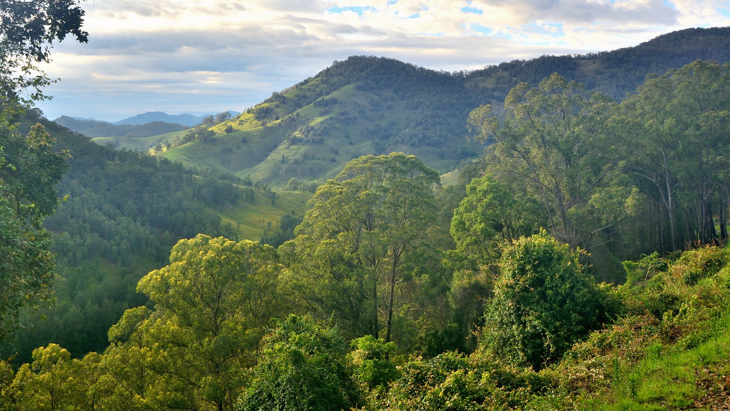
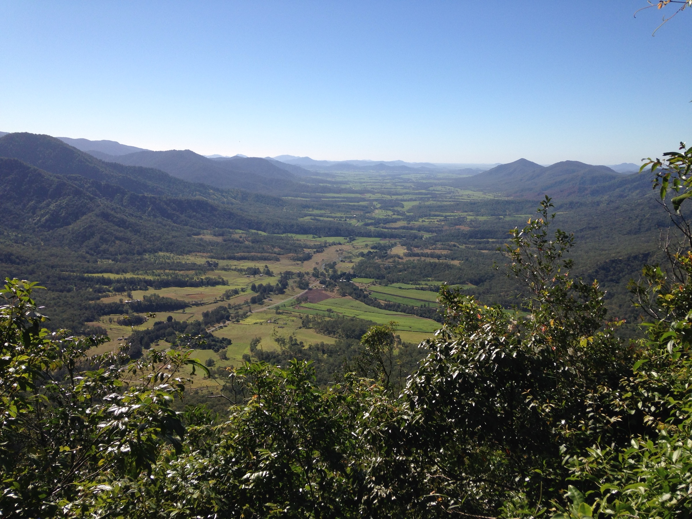
The Sky Window picnic area sits on the escarpment edge at the southern end of Eungella township. A short 250 m loop leaves the picnic area, descends past interpretive signage on the Clarke Range volcanic geology, and reaches a signposted timber platform at the escarpment gap that gives the classic Pioneer Valley view — a green mosaic of cane paddocks stretching east toward the Coral Sea between forested spurs. From Sky Window the Cedar Grove Track continues north along the plateau on a graded rainforest path, threading between piccabeen and Alexandra palm groves and past mature red cedars to the Cedar Grove picnic area at approximately 2.8 km. The through-track passes some of the region’s best mid-canopy habitat for the endemic Eungella honeyeater. Return is on the same line; an optional Palm Walk spur south of Sky Window adds a 500 m detour to Palm Lookout.
Why it is essential
Sky Window and Cedar Grove together are the definitive highland rainforest walk of Eungella. The escarpment lookout gives the region’s headline view down the Pioneer Valley, and the plateau link doubles as a botany-heavy forest transect and the best mid-elevation habitat for the Eungella honeyeater. It is the natural pairing with the Broken River wildlife loops on a two-walk day out of Eungella township.
Equipment
- Trail runners or light boots
- Rain shell (rainforest drips year-round)
- Binoculars for canopy birds
- Insect repellent
- 1–2 L water
- Warm layer in winter mornings
Hazards and notes
- Slick clay after rain; the plateau track can be muddy where roots cross it.
- Leeches active November to April.
- Fallen limbs occasionally block the through-track after storms; check QPWS alerts.
- Escarpment platform is fenced but the rim beyond is unfenced — keep well back with children.
GPX / route file
| Source | URL | Format | Notes |
|---|---|---|---|
| QPWS — Walks in the Clarke Range area | parks.qld.gov.au | Web page | Official route source; short-walks map PDF |
Sources
3. Araluen Cascades, Finch Hatton Gorge
Snapshot
Itinerary
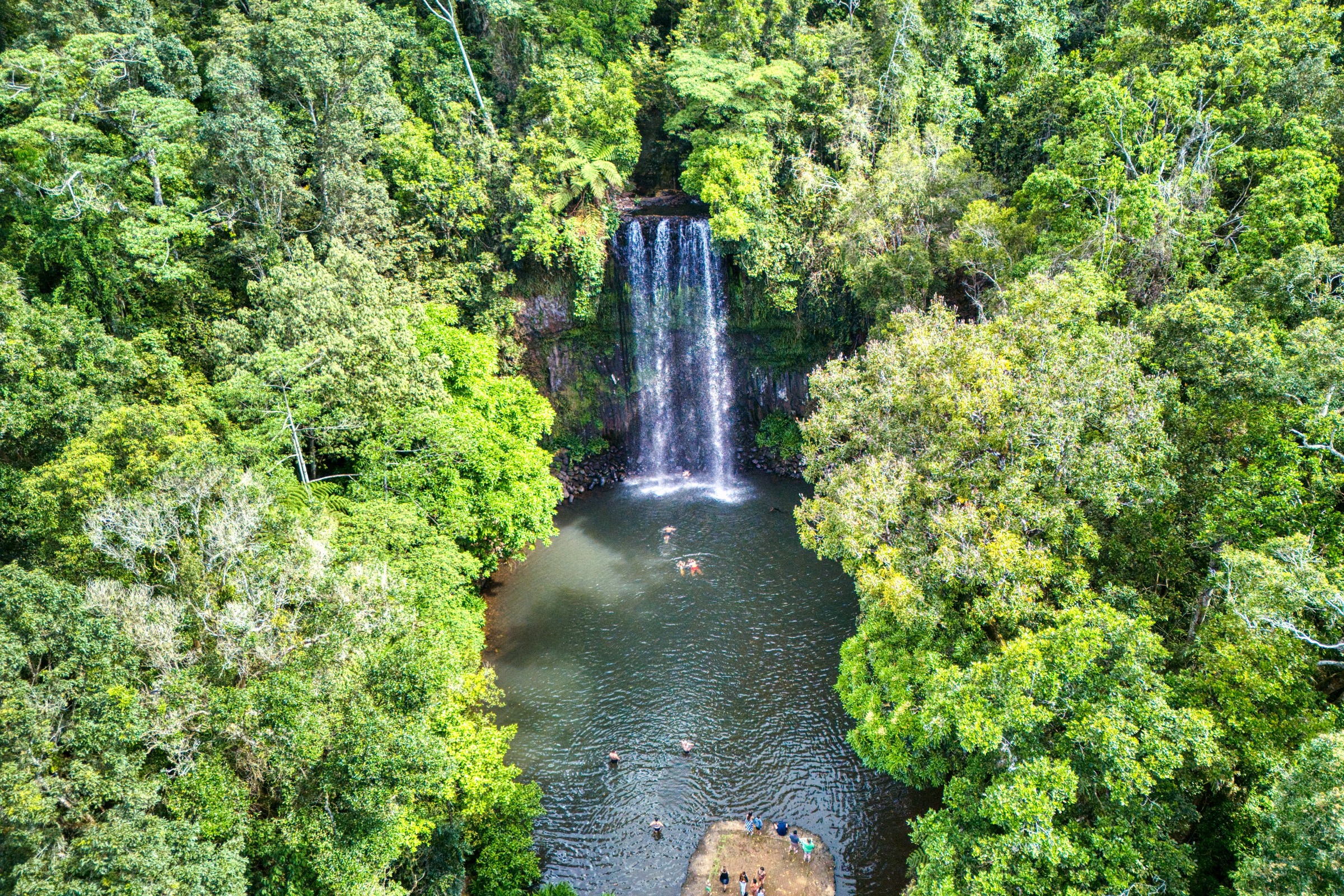
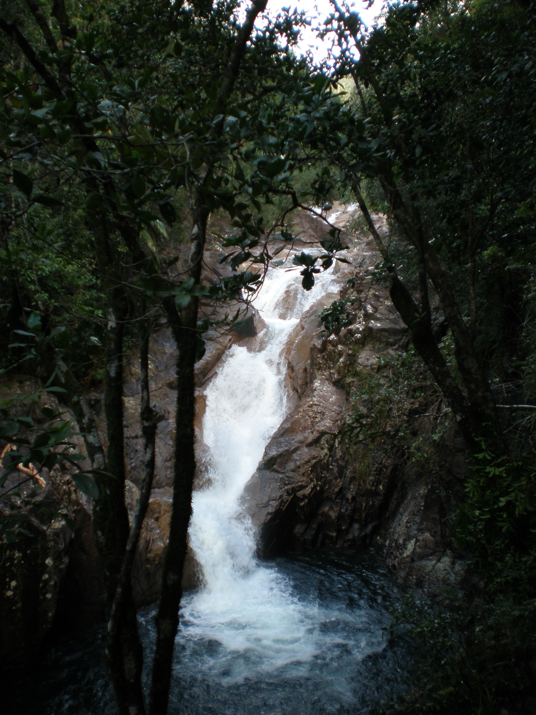
The Finch Hatton Gorge day-use car park sits at the end of Gorge Road with a covered picnic area and a signposted trailhead. The Araluen track leaves the car park through subtropical rainforest with strangler figs, buttressed trees and abundant epiphytes, contouring above Finch Hatton Creek before dropping toward the boulder-strewn creek bed. A signposted junction at approximately 700 m carries the closed Wheel of Fire route left; keep right and continue on the graded path along the creek to a small viewpoint above Araluen Cascades — a fanned rainforest waterfall pouring into a deep clear pool at approximately 300 m elevation. The pool is a permitted swimming site in the dry season but should not be entered after rain when the rocks are slippery and the creek can flood without warning. Return is on the same line.
Why it is essential
Araluen is the most accessible rainforest-waterfall swim in the Mackay Highlands and the only fully open Finch Hatton Gorge walk while the Wheel of Fire track remains under indefinite closure. It is the standard second-day pairing with Broken River and Sky Window and gives the article its “gorge and cascade” character.
Equipment
- Sturdy walking shoes with grip
- Swimwear and quick-dry towel in the dry season
- Dry-bag for camera and valuables
- Insect repellent (leeches heavy in wet season)
- 1.5 L water
- First-aid kit
Hazards and notes
- Submerged rocks are slippery; check pool clarity before entering.
- Flash-flood risk after rain; the road creek crossings can also close access.
- Wheel of Fire walking track (grade 4, 4.2 km return) is currently under indefinite QPWS closure due to eroded tread — do not attempt to link Araluen through to it.
- Leech activity heavy through the wet season.
- No phone signal in the gorge.
GPX / route file
| Source | URL | Format | Notes |
|---|---|---|---|
| QPWS — Walks in the Finch Hatton Gorge area | parks.qld.gov.au | Web page | Official route source; Ma778 Finch Hatton track map PDF |
| QPWS — Park alerts | parks.qld.gov.au | Web page | Current closures including Wheel of Fire |
Sources
4. Mount Dalrymple summit via Dalrymple Road
Photo status: No licence-compatible summit image located in this pass.
Snapshot
Itinerary
The trailhead is unsignposted and marked only by pink flagging tape on the eastern side of Dalrymple Road at the end of the drivable section. From the flagged start the route heads east through montane rainforest on rooty and often muddy tread, fording Cattle Creek and its tributaries several times — these crossings can be dangerous or impassable after rain. Beyond the creek system the route climbs steadily onto the summit plateau, following pink flagging through mossy notophyll vine forest with progressively thinner canopy and colder air. The summit itself is a small clearing near the trig point at 1,258 m, with partial views across the Clarke Range, the Pioneer Valley and — on the clearest days — east to the Coral Sea. Return is on the same flagged route down through the creek system to Dalrymple Road.
Why it is essential
Mount Dalrymple is the one true summit day-hike in the Mackay Highlands and the highest point in central Queensland. It contrasts sharply with the manicured Broken River and Sky Window walks and gives the article a genuine wilderness route with real navigation and creek-crossing consequence.
Equipment
- Sturdy boots (muddy tread throughout)
- Topographic map plus GPS with a pre-loaded route
- 3 L water minimum
- Long sleeves and long pants for stinging tree (Dendrocnide) and cutting grass
- Gaiters (leeches, ticks)
- Personal Locator Beacon (PLB) or satellite messenger
- Warm and waterproof layers for the summit
- First-aid kit including snake-bite bandage
- Headtorch and spare batteries for the long return
Hazards and notes
- Route-finding required — the flagging is intermittent and can be lost after fire, wind or heavy rain.
- Creek crossings become dangerous after rain and can close the route within hours.
- Stinging tree present along the track; do not brush against unfamiliar broad-leaved shrubs.
- Ticks and leeches heavy in the shoulder season.
- No phone signal; rescue is slow.
- Not a route for solo inexperienced walkers.
- Do not confuse this route with the shorter, rougher Finch Hatton approach, which is longer and less maintained.
GPX / route file
| Source | URL | Format | Notes |
|---|---|---|---|
| Aussie Bushwalking — Mt Dalrymple | aussiebushwalking.com | Web page | Community route description; use for reference only |
| Wikiloc / AllTrails — Mount Dalrymple | user-generated | GPX | Community traces of variable quality; verify against topo before use |
Sources
5. Andrews Point and Beachcomber Cove, Cape Hillsborough
Snapshot
Itinerary
Arrive at the Cape Hillsborough day-use area before dawn for the sunrise wildlife show — eastern grey kangaroos and agile wallabies feeding on the tideline are the region’s most photographed scene. From the boat ramp, walk 300 m east along the beach to the signposted Andrews Point trailhead and climb through vine forest to a series of headland lookouts over the Coral Sea and offshore islets. Retrace to the beach, cross to the Beachcomber Cove trailhead at the far end of the day-use bay, and follow a shorter track through eucalypt-to-rainforest transition to a sheltered rocky cove. Finish with the Diversity Boardwalk — a 1.2 km loop through mangroves and past a Yuwibara midden that gives the cultural and ecological context for the whole cape.
Why it is essential
Cape Hillsborough is where the Clarke Range escarpment meets the Coral Sea, and the Andrews Point loop is the region’s signature coastal-fringe walk. It gives the article a genuine coastal-to-highland ecological contrast, plus the internationally recognised kangaroo-on-beach sunrise that no Mackay Highlands guide can honestly leave out.
Equipment
- Head-torch for the pre-dawn approach
- Sturdy trail shoes for rock scrambling on the headland
- Sun protection
- 1.5 L water
- Insect repellent
- Tide chart — some rock-hop sections on Andrews Point are impassable at high tide
- Camera and binoculars
Hazards and notes
- Tidal cutoff on the Andrews Point rock-hopping sections; check the tide before starting.
- Slippery basalt boulders on the headland.
- Marine stingers (box jellyfish and Irukandji) render open-beach swimming inadvisable November to May.
- Do not feed the wildlife — kangaroos and dingoes are habituated but not tame.
- Fully exposed on the beach; heat and glare intense by mid-morning.
GPX / route file
| Source | URL | Format | Notes |
|---|---|---|---|
| QPWS — Cape Hillsborough National Park | parks.qld.gov.au | Web page | Official route source; Cape Hillsborough map PDF |
Sources
- QPWS Cape Hillsborough National Park — journeys
- Wikimedia Commons — Kangaroo on the beach Cape Hillsborough, 2017
- Wikipedia — Cape Hillsborough National Park
Region-level sources
| Source | URL |
|---|---|
| QPWS Eungella National Park | parks.qld.gov.au |
| QPWS Eungella — journeys | parks.qld.gov.au |
| QPWS Cape Hillsborough National Park | parks.qld.gov.au |
| QPWS park alerts | parks.qld.gov.au |
| Mackay Highlands discovery guide (QPWS PDF) | parks.des.qld.gov.au |
| Wikipedia — Eungella National Park | en.wikipedia.org |
| Wikipedia — Cape Hillsborough National Park | en.wikipedia.org |
| Wikipedia — Mount Dalrymple (Queensland) | en.wikipedia.org |
| Wikipedia — Wiri people | en.wikipedia.org |
Further reading
Nearby Great Dividing Range guides on Storm
- ACT, Namadgi and the Brindabella Ranges
- Atherton Tablelands / Cairns Highlands
- Barrington Tops
- Blue Mountains
- QPWS Cape Hillsborough National Park — about
- Wikipedia — Eungella honeyeater
- Wikipedia — Platypus
Missing data / follow-up work
- No licence-compatible photograph of the Mount Dalrymple summit was located in this pass; a future upload from a Wikiloc or Flickr Creative Commons source, or a fresh field photograph, is the natural fix.
- Wheel of Fire walking track at Finch Hatton Gorge remains under indefinite QPWS closure — confirm current status via park alerts before travel.
- QPWS does not publish direct GPX or KML downloads for any of the walks listed above. All route files are official web-page or PDF sources.
- Precise trailhead coordinates for Sky Window, Cedar Grove and Finch Hatton Gorge car parks are shown only on QPWS short-walk PDF maps; extract before publishing a machine-readable route database.
- Cyclone-driven wet-season closures of the Mackay–Eungella Road and the unsealed Finch Hatton Gorge Road can affect access at short notice — confirm current conditions before travel.