Regional overview
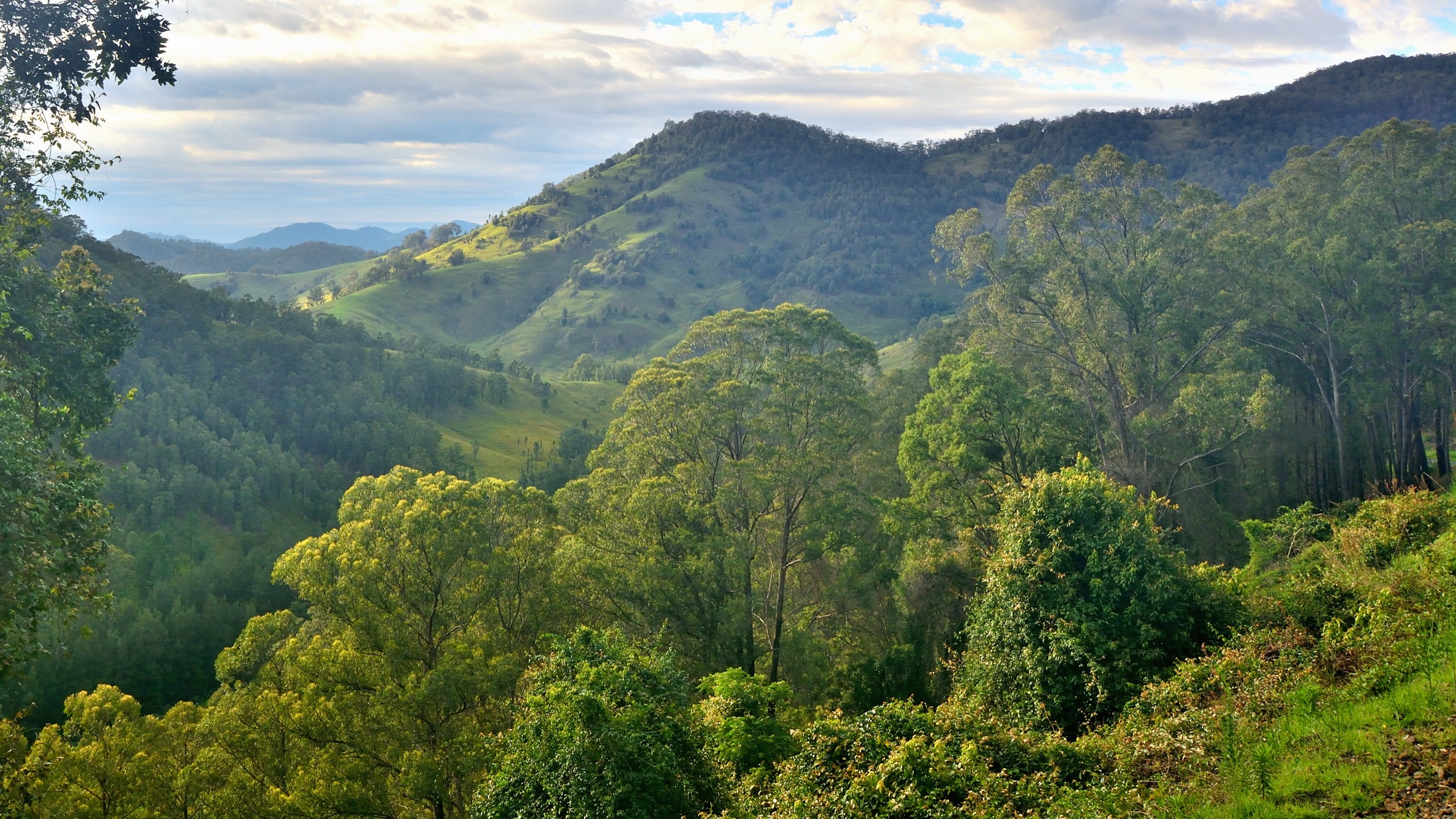
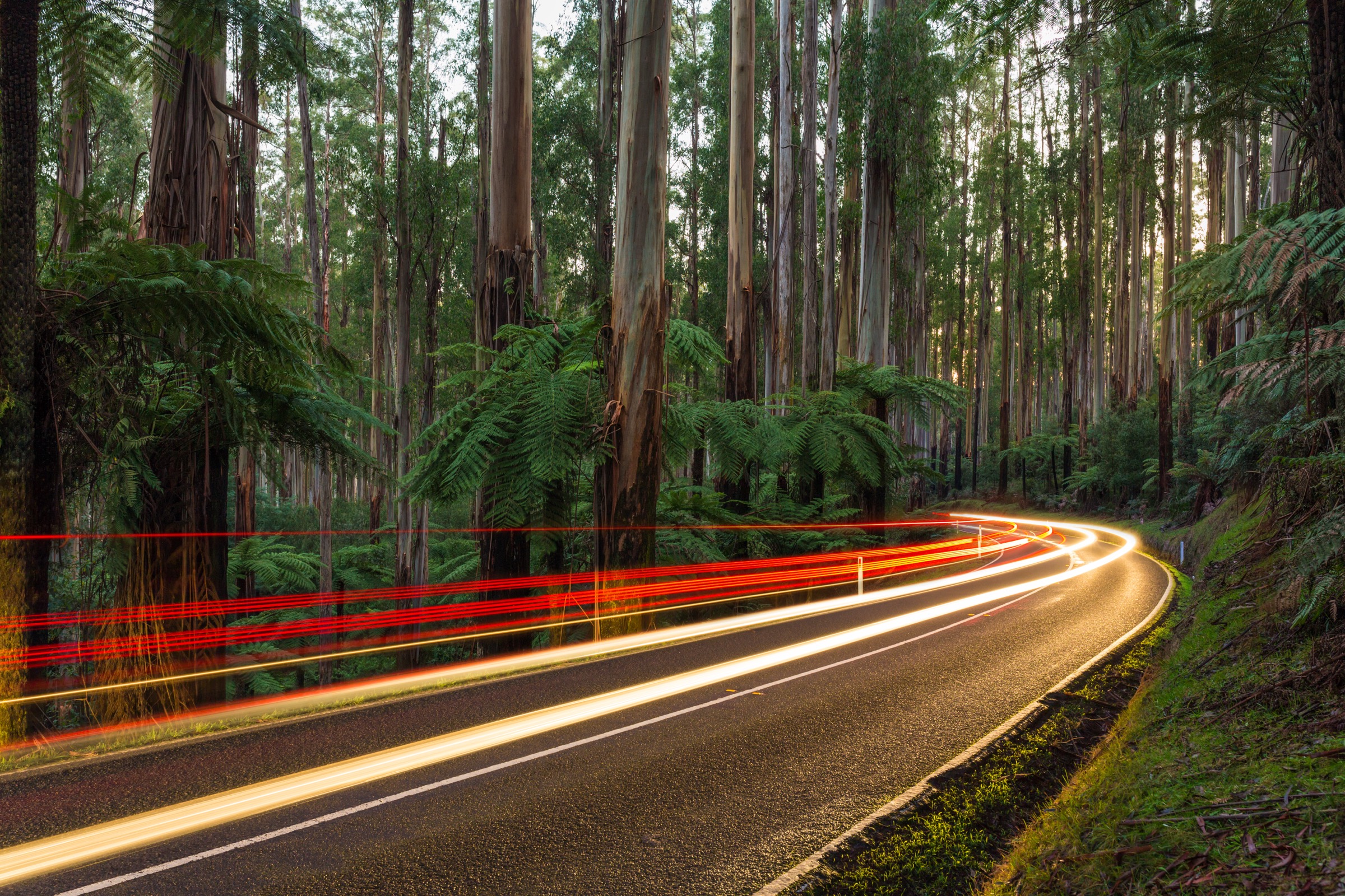
The Dandenong Ranges and Yarra Ranges are the forested mountains immediately east of Melbourne — the closest genuine bushwalking country to a capital-city population of five million. The Dandenongs are the eroded remnant of a Late Devonian volcanic complex (~370–360 Ma) built by cauldron subsidence, with a summit ridge dominated by dacite, rhyodacite and rhyolite of the Mount Dandenong Volcanics Group in thick flows locally over 300 m deep. Mount Dandenong at 633 m is the high point. The Yarra Ranges further east rise onto older Silurian–Devonian marine sediments intruded by younger igneous suites; Mount Donna Buang at 1,250 m is the highest point of the Yarra Ranges sub-region and the only easily accessible summit above 1,000 m within 90 minutes of Melbourne.
Vegetation defines the visitor experience. Southern slopes and gullies hold Australia’s iconic Mountain Ash forest (Eucalyptus regnans) — the world’s tallest flowering plant, routinely 70–90 m in mature stands. The Ada Tree in Yarra State Forest is approximately 76 m tall and 15 m in circumference, one of the largest surviving specimens in Victoria and estimated at more than 300 years old. Cool-temperate rainforest fills the gullies with myrtle-beech (Nothofagus cunninghamii), southern sassafras (Atherosperma moschatum), soft treefern (Dicksonia antarctica) and rough treefern (Cyathea australis). Above roughly 1,100 m on Donna Buang, mountain ash gives way to alpine ash (E. delegatensis) and scattered snow gum, with cool-temperate rainforest gullies persisting along Cement Creek.
The country is that of the Wurundjeri Woi-wurrung people of the Kulin nation. Corhanwarrabul is the Woi-wurrung name for the main Dandenong summit ridge; the name Donna Buang is believed to derive from a Wurundjeri term. Cultural attribution should be verified with the Wurundjeri Woi-wurrung Cultural Heritage Aboriginal Corporation where accuracy matters.
Access is straightforward. Ferntree Gully and the 1000 Steps trailhead are about 45 minutes by car from central Melbourne, or reachable by train on the Belgrave line to Upper Ferntree Gully and a short walk. Sherbrooke Forest and Mount Dandenong are about 60 to 75 minutes. Warburton and Mount Donna Buang are about 90 minutes. The Ada Tree access from Powelltown or Warburton is about two hours. Fire is the primary hazard. All Dandenong Ranges and Yarra Ranges walks close on days of Extreme or Catastrophic fire danger. The 7 February 2009 Black Saturday bushfires devastated the Kinglake, Marysville and Narbethong corridor on the northern fringe of the Yarra Ranges and reshaped the recovering forest that walkers now pass through. Storm damage is now the more frequent immediate hazard — the 1000 Steps closed for track reconstruction after 2021 storms and reopened in September 2022, and the Rainforest Gallery elevated boardwalk on Cement Creek has been closed since around 2023 for structural repairs. Verify current closures at parks.vic.gov.au before travel.
Selection rationale
The five walks were chosen to represent both national parks and the neighbouring Yarra State Forest, and to cover both the Dandenongs’ low-elevation forest character and the Yarra Ranges’ rainforest and Mountain Ash landscape. The 1000 Steps is Melbourne’s most walked bush track and the state’s principal WWII memorial walk. Sherbrooke Falls is the essential lower-elevation Mountain Ash and treefern walk and one of the most reliable Superb Lyrebird sites in Victoria. The Mount Dandenong summit via the Kyeema Track is the anchor summit walk of the Dandenongs and the shortest way to combine summit lookout with interior forest. Mount Donna Buang is the region’s only easily accessible >1,200 m summit and pairs with the Rainforest Gallery boardwalk at Cement Creek. The Ada Tree and Federal Mill circuit in Yarra State Forest is the essential walk to the tallest tree accessible on foot from Melbourne and doubles as a walk through the 1920s–1940s timber-tramway heritage of the Powelltown mills.
Summary
| # | Hike | Country | Route type | Distance | Gain | Max elevation | Difficulty |
|---|---|---|---|---|---|---|---|
| 1 | Kokoda Track Memorial Walk (1000 Steps) circuit | Australia | Loop | ~4 km | ~260 m | ~350 m | Moderate |
| 2 | Sherbrooke Falls circuit | Australia | Out-and-back | 2.4 km | ~60 m | ~280 m | Easy |
| 3 | Mount Dandenong summit via Kyeema Track | Australia | Loop | 2.5–3 km | ~70–100 m | 633 m | Easy–moderate |
| 4 | Mount Donna Buang summit and Rainforest Gallery | Australia | Loop plus boardwalk | 2.8 km + 1 km | ~185 m | 1,250 m | AWTGS Grade 2 |
| 5 | Ada Tree and Federal Mill circuit | Australia | Loop | 5.2 km | ~170 m | ~790 m | AWTGS Grade 3 |
1. Kokoda Track Memorial Walk (1000 Steps) circuit
Snapshot
Itinerary
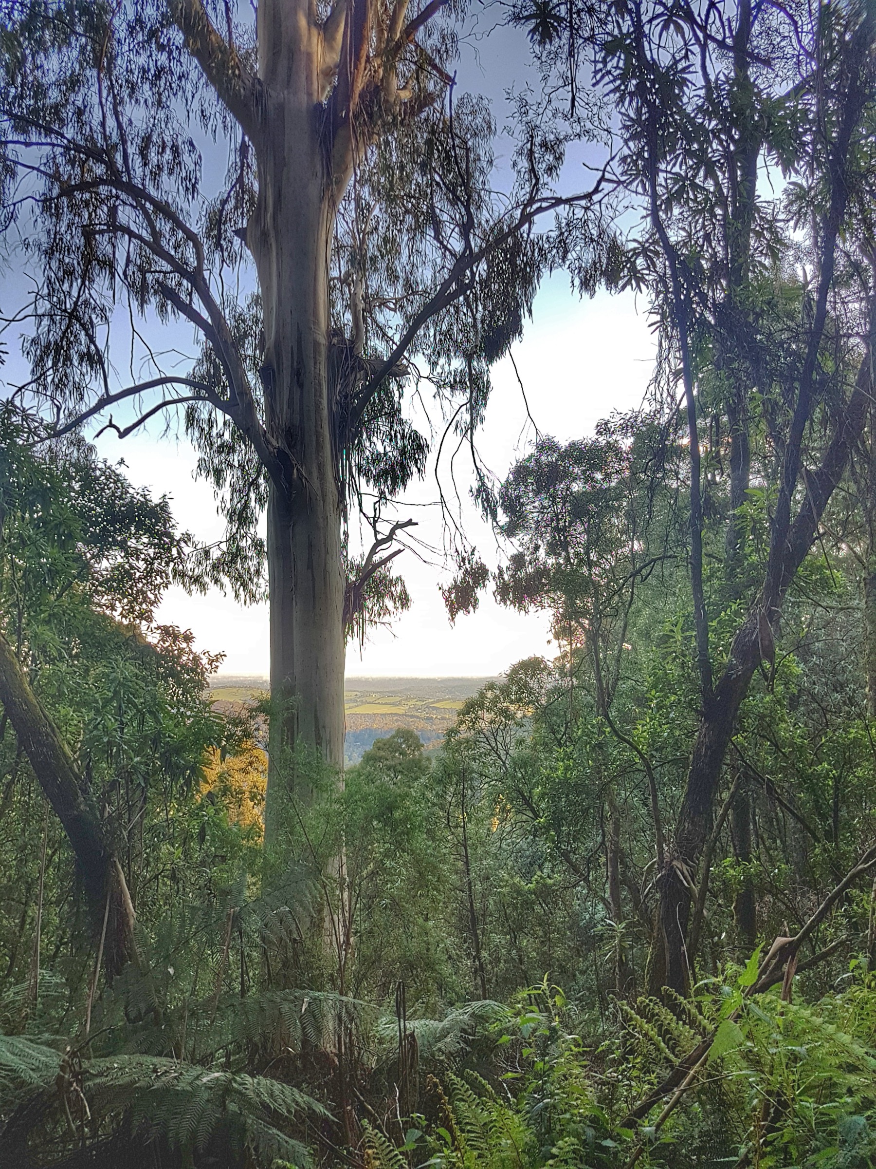
From the Ferntree Gully Picnic Ground the 1000 Steps climbs steeply beside a fern-filled creek through tall Mountain Ash forest. The concrete steps replaced the original tree-fern log path of the early 1900s and were formalised in 1950 as the Kokoda Track Memorial Walk, with fourteen plaques along the ascent commemorating the AIF’s 1942 Kokoda Track campaign in Papua. The steps arrive at One Tree Hill Picnic Ground at about 350 m. The return line descends on the graded Lyrebird Track through the same forest, closing the loop back at the picnic ground.
Why it is essential
The 1000 Steps is Melbourne’s most walked bush track and the anchor introduction to the Dandenong Ranges’ Mountain Ash forest for anyone arriving by public transport. It is also the state’s principal WWII memorial walk and, at ~4 km with a stepped climb and a graded return, a natural training walk for longer alpine days.
Equipment
- Standard hiking shoes or boots (steps become slippery in wet weather)
- Weatherproof shell
- Warm layer for cooler months
- Water: 1 litre per person
- Sun protection
Hazards and notes
The steps become slippery when wet or frosted. Weekend crowds are heavy — arrive before 09:00 for a quieter walk. Dogs are not permitted in the national park. Closed on Extreme and Catastrophic fire-danger days.
GPX / route file
| Source | URL | Format | Licence / terms | Reuse |
|---|---|---|---|---|
| Parks Victoria — Dandenong Ranges NP (Ferntree Gully area) | parks.vic.gov.au | Web description and PDF map | Copyright Parks Victoria | Reference only |
| OpenStreetMap — Kokoda Track Memorial Walk / Lyrebird Track | osm.org | OSM way data | ODbL | Reusable with attribution |
Sources
- Parks Victoria — Dandenong Ranges National Park
- Wikipedia — Kokoda Track Memorial Walk
2. Sherbrooke Falls circuit
Snapshot
Itinerary
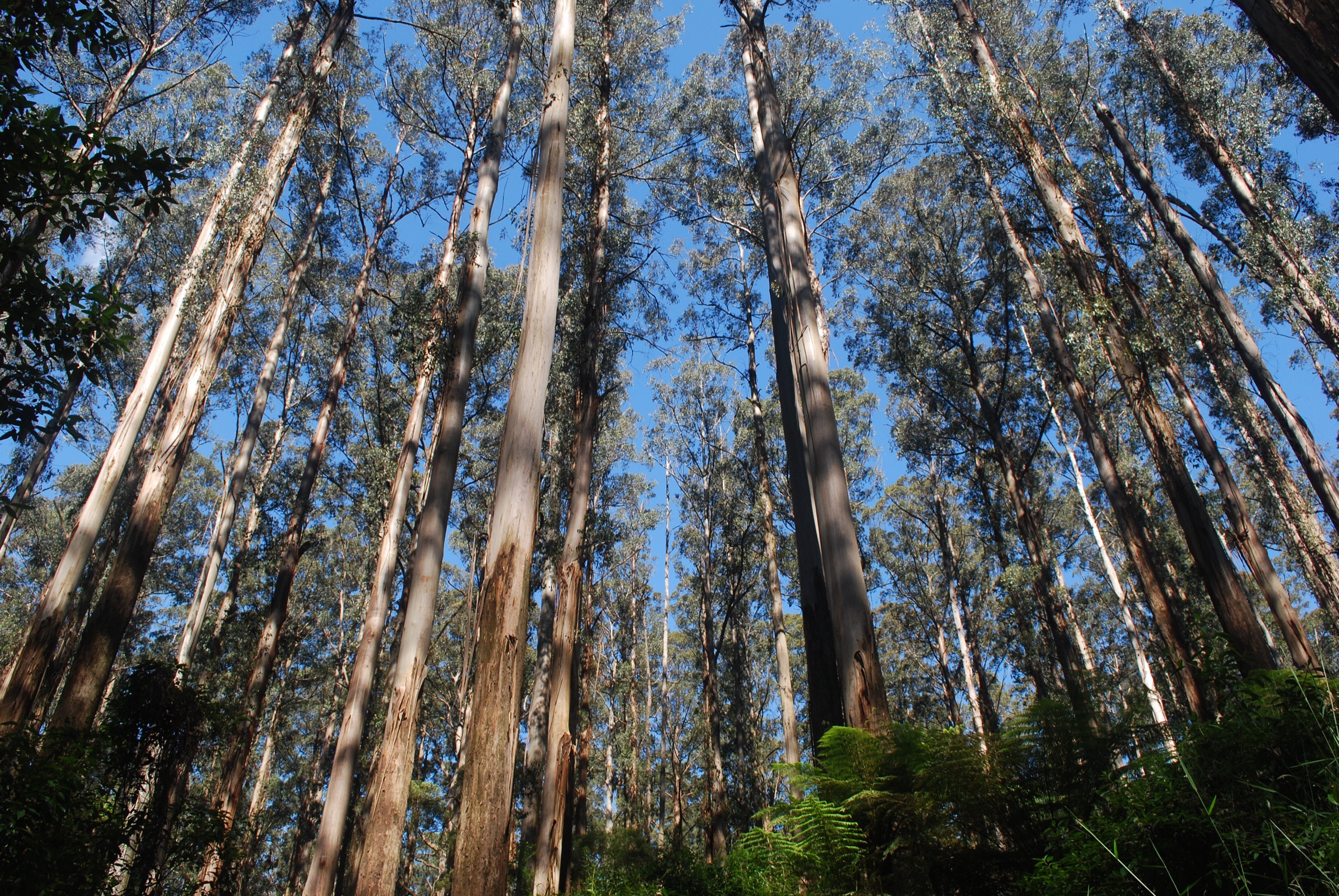
From the Sherbrooke Picnic Ground or the O’Donohue Picnic Ground the track drops gently through tall Mountain Ash and treefern gully on the Sherbrooke Track to a small cascade on Sherbrooke Creek — the eponymous falls. From O’Donohue the 500 m Margaret Lester Forest Walk — an all-abilities boardwalk — can be combined with the falls loop for a longer circuit through the same stand. Lloyd’s Track and Neuman Track extend the walk into a 4–5 km loop through the interior of the Sherbrooke Forest stand.
Why it is essential
Sherbrooke Falls is the essential lower-elevation Mountain Ash walk of the Dandenongs and the best-preserved E. regnans stand in the sub-region. Sherbrooke Forest is one of the most reliable Superb Lyrebird sites in Victoria, and the track is short enough to be walked in a quiet morning window before the crowds.
Equipment
- Standard walking shoes
- Weatherproof shell
- Warm layer for cooler months
- Water: 0.5–1 litre per person
- Insect repellent in warmer months
Hazards and notes
Gravel is slippery after rain. Leeches are common in the wet season. Dogs are not permitted in the national park. Closed on Extreme and Catastrophic fire-danger days.
GPX / route file
| Source | URL | Format | Licence / terms | Reuse |
|---|---|---|---|---|
| Parks Victoria — Dandenong Ranges NP (Sherbrooke area) | parks.vic.gov.au | Web description and PDF map | Copyright Parks Victoria | Reference only |
| OpenStreetMap — Sherbrooke Track / Margaret Lester Forest Walk | osm.org | OSM way data | ODbL | Reusable with attribution |
Sources
- Parks Victoria — Dandenong Ranges National Park
- Visit Victoria — Sherbrooke Falls
3. Mount Dandenong summit via the Kyeema Track
Snapshot
Itinerary
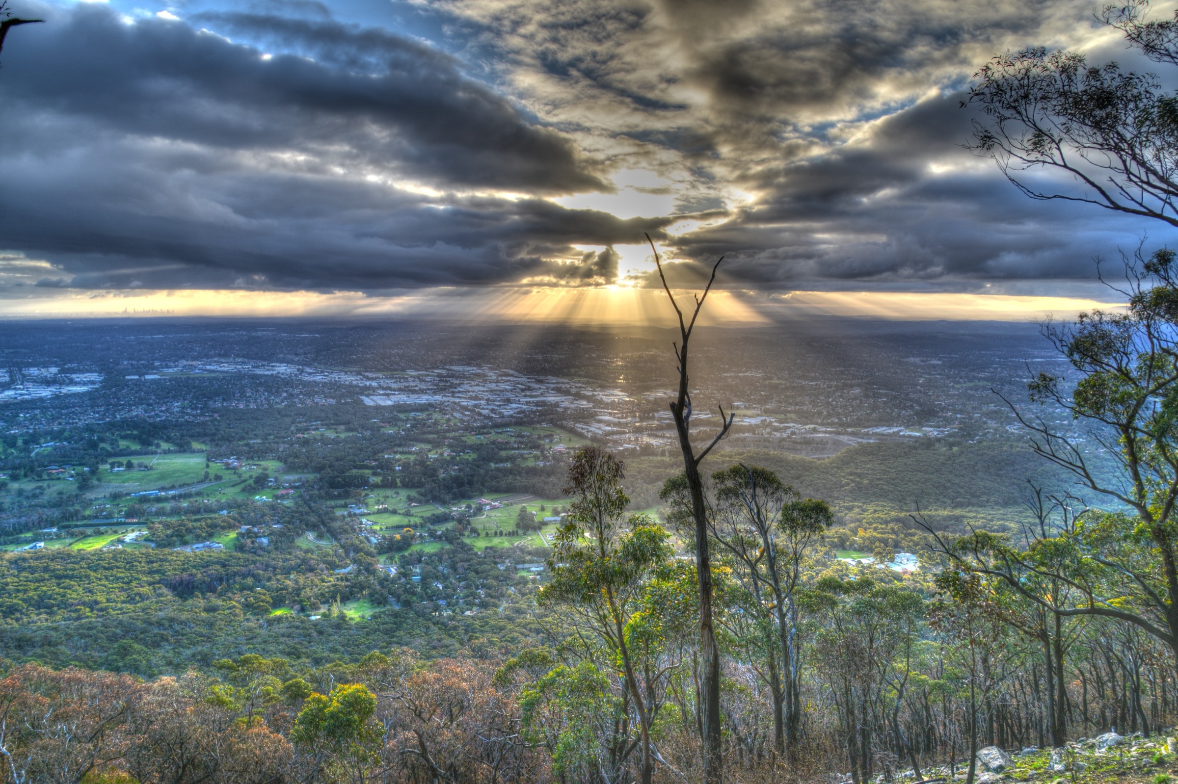
From SkyHigh Mount Dandenong or the Ferny Creek Reserve car park the Kyeema Track drops through fern gully and Mountain Ash below the summit ridge, passing the 1938 Kyeema DC-2 crash memorial — the crash that killed 18 people in fog on the ridge and led to major reforms in Australian air-traffic control. The return line climbs on the Trig Track past Burke’s Lookout to the SkyHigh observatory gardens and the 633 m summit outlook. The Mountain Circuit extends this into a ~15 km day through Sassafras, Olinda and the Dandenong Botanic Garden.
Why it is essential
The Mount Dandenong summit gives the widest panoramic view in the Dandenongs — eastern Melbourne, Port Phillip and the Yarra Valley spread below the observatory ridge. The Kyeema loop is the shortest way to combine that summit outlook with the interior forest and the historically significant crash memorial, and it is walkable in an hour before or after driving the ridge road.
Equipment
- Standard hiking shoes or boots
- Weatherproof shell
- Warm layer
- Water: 1 litre per person
- Sun protection
Hazards and notes
Gravel is slippery after rain. Road crossings near SkyHigh — supervise children. SkyHigh car-park fees apply if driving. Dogs are permitted on some short tracks near the SkyHigh gate but not in the national park interior — verify signage. Closed on Extreme and Catastrophic fire-danger days.
GPX / route file
| Source | URL | Format | Licence / terms | Reuse |
|---|---|---|---|---|
| Parks Victoria — Dandenong Ranges NP (Doongalla area) | parks.vic.gov.au | Web description and PDF map | Copyright Parks Victoria | Reference only |
| OpenStreetMap — Kyeema Track / Trig Track | osm.org | OSM way data | ODbL | Reusable with attribution |
Sources
- Parks Victoria — Dandenong Ranges National Park
- SkyHigh Mount Dandenong — walking tracks
4. Mount Donna Buang summit and Rainforest Gallery
Snapshot
Itinerary
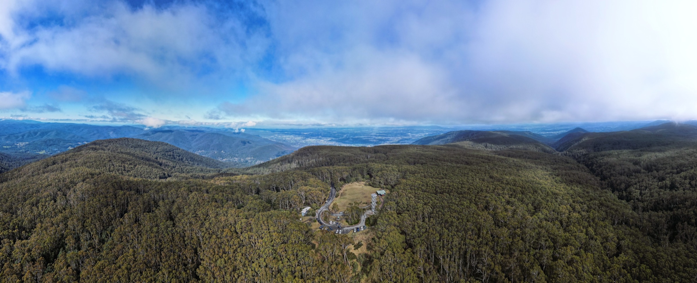
From the 10 Mile turntable on Donna Buang Road a marked track climbs through mixed alpine ash and myrtle-beech to a junction, then continues up through wet forest to the summit clearing. A 21 m steel observation tower gives 360-degree views over the Yarra Valley to the Bogong High Plains and Mount Baw Baw. The descent uses the toboggan-run track back to the car park.
A natural pairing on the drive back is the Rainforest Gallery at Cement Creek, 15 km down Donna Buang Road. In normal operation the site combines a 350 m elevated boardwalk through 65 m Mountain Ash and ancient myrtle-beech with a 40 m canopy skywalk — one of only a small number of purpose-built rainforest canopy walks in Australia. The boardwalk has been closed since around 2023 for structural repairs; verify the current status with Parks Victoria before including it in the walking day.
Why it is essential
Mount Donna Buang is the only easily accessible summit above 1,200 m within 90 minutes of Melbourne, and the shortest walk in the sub-region that reaches a genuine sub-alpine environment. It is also the natural gateway to the Yarra Ranges’ cool-temperate rainforest, and — when open — the Rainforest Gallery canopy skywalk is the only walk in the sub-region that lets a visitor stand at Mountain Ash canopy height.
Equipment
- Sturdy hiking shoes or boots
- Weatherproof shell and warm layer
- Water: 1 litre per person
- Sun protection
- Microspikes may be useful in winter if road access is possible over ice
Hazards and notes
Winter ice on Donna Buang Road and the summit; the road is not always accessible in mid-winter. Leeches are common on the Cement Creek section. The Rainforest Gallery elevated boardwalk is closed for repairs at time of writing — verify status before travel and do not attempt to access the closed boardwalk. Dogs are not permitted in Yarra Ranges National Park. Closed on Extreme and Catastrophic fire-danger days.
GPX / route file
| Source | URL | Format | Licence / terms | Reuse |
|---|---|---|---|---|
| Parks Victoria — Yarra Ranges National Park | parks.vic.gov.au | Web description and PDF map | Copyright Parks Victoria | Reference only |
| Parks Victoria — Mount Donna Buang | parks.vic.gov.au | Web description | Copyright Parks Victoria | Reference only |
| OpenStreetMap — Donna Buang summit tracks | osm.org | OSM way data | ODbL | Reusable with attribution |
Sources
- Parks Victoria — Yarra Ranges National Park
- Parks Victoria — Mount Donna Buang
- Wikipedia — Mount Donna Buang
5. Ada Tree and Federal Mill circuit
Snapshot
Itinerary
From the Ada Tree Picnic Area a short boardwalk descends to the Ada Tree itself — approximately 76 m tall, about 15 m in circumference, and estimated at more than 300 years old, one of the largest surviving Mountain Ash in Victoria. The circuit continues through cool-temperate rainforest along Ada Creek to the Federal Mill site, a scattered set of relics from a 1920s–1940s sawmill including boilers, tram-line grades and mill-race stonework. The return line climbs on a former timber-tramway grade — the levelled cutting still shows sleepers and pins in places — back to the picnic area.
Why it is essential
The Ada Tree is the tallest tree accessible on foot from Melbourne and one of Victoria’s most significant surviving Mountain Ash specimens. The circuit combines that single-tree focus with cool-temperate rainforest and a walkable record of the Powelltown timber-tramway industry — the essential single walk through the Yarra Ranges’ rainforest and forest-industry heritage.
Equipment
- Sturdy hiking shoes or boots
- Weatherproof shell and warm layer
- Water: 1–1.5 litres per person
- Insect repellent — leeches after rain
- Map or GPS; no mobile coverage at the trailhead
Hazards and notes
Leeches are common. Access roads are gravel and can become muddy or impassable in wet weather — check with DEECA / Yarra State Forest for the current road status. No mobile reception at the trailhead. Yarra State Forest is a working forest managed by DEECA, not by Parks Victoria — walking access is provided but conditions can change with adjacent forestry operations. Dogs on leash are permitted in state forest, unlike in the surrounding national parks.
GPX / route file
| Source | URL | Format | Licence / terms | Reuse |
|---|---|---|---|---|
| DEECA — Yarra State Forest | ffm.vic.gov.au | Web description | Copyright State of Victoria | Reference only |
| trailhiking.com.au — Ada Tree Federal Mill circuit | trailhiking.com.au | Web description and GPX | Copyright trailhiking.com.au | Reference only |
| OpenStreetMap — Ada Tree Walk and Federal Mill | osm.org | OSM way data | ODbL | Reusable with attribution |
Sources
- DEECA — Yarra State Forest
- trailhiking.com.au — Ada Tree and Federal Mill circuit
- Wikipedia — Powelltown timber tramway history
Region-level sources
| Source | Type | Notes |
|---|---|---|
| Parks Victoria — Dandenong Ranges National Park | Official park authority | Primary source for Ferntree Gully, Sherbrooke and Mount Dandenong walks |
| Parks Victoria — Yarra Ranges National Park | Official park authority | Primary source for Mount Donna Buang and Cement Creek |
| DEECA — Yarra State Forest | State forest manager | Access status for the Ada Tree and Federal Mill circuit |
| Wurundjeri Woi-wurrung Cultural Heritage Aboriginal Corporation — wurundjeri.com.au | Registered Aboriginal Party | Cultural attribution across the sub-region |
| OpenStreetMap — openstreetmap.org | Community map | Track geometry cross-checking |
| CFA / FFMVic fire-danger ratings — emv.vic.gov.au | State emergency management | Extreme and Catastrophic day closures |
| Bureau of Meteorology — bom.gov.au | Federal weather bureau | Frontal timing, storm and fire-weather risk |
Further reading
Nearby Great Dividing Range guides on Storm
- ACT, Namadgi and the Brindabella Ranges
- Atherton Tablelands / Cairns Highlands
- Barrington Tops
- Blue Mountains
-
Storm — Australia | Central Victorian Highlands: Essential Day-Hikes
- Storm — Australia | Mount Buffalo and Bogong High Plains: Essential Day-Hikes
Missing data / follow-up work
- Parks Victoria does not publish official distances for the 1000 Steps circuit or the Sherbrooke Falls walk; distances here are compiled from consistent secondary sources.
- The Rainforest Gallery boardwalk at Cement Creek is closed for structural repairs at time of writing and has been since around 2023. Verify current status against Parks Victoria before including it in a walking day; do not attempt to bypass closures.
- No licence-compatible photograph of the Ada Tree itself meeting the shipping resolution was found in this pass on Wikimedia Commons; the walk is described without a summit-tree image.
- The Ada Tree and Federal Mill circuit sits in Yarra State Forest, not Yarra Ranges National Park — access rules, road status and closures are managed by DEECA rather than Parks Victoria.
- No official Parks Victoria GPX file was found for any of the five walks; OpenStreetMap is the most reliable geometry source.
- Cultural attribution for Corhanwarrabul and the etymology of Donna Buang should be verified with the Wurundjeri Woi-wurrung Cultural Heritage Aboriginal Corporation where accuracy matters.