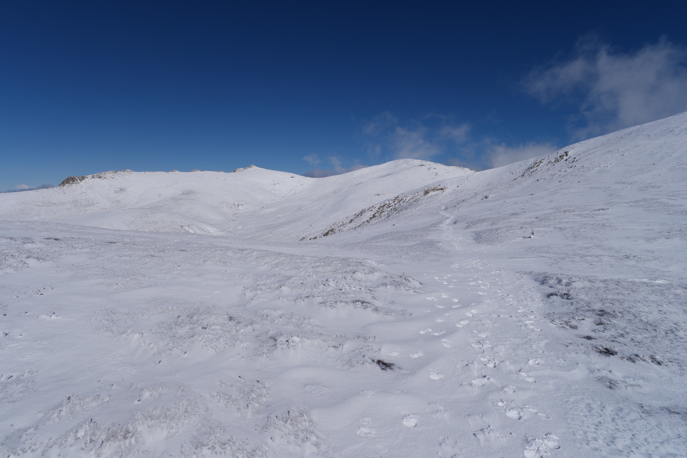
Regional overview
Kosciuszko National Park protects the highest ground in mainland Australia — a compact arc of the Great Dividing Range that rises from the montane forests of the Thredbo and Snowy River valleys to a treeless alpine plateau capped by Mount Kosciuszko at 2,228 m. The Main Range is the park’s high spine: a granite and metasediment ridge shaped by Pleistocene glaciation, cradling the only cirque lakes on the Australian mainland — Blue Lake, Club Lake, Lake Albina and Lake Cootapatamba — and the small tarn known as Hedley Tarn. The country carries deep cultural significance for its Traditional Custodians, the Ngarigo, Wolgalu (Walgalu) and Djilamatang peoples, and remains one of the summer ceremonial grounds tied to the Bogong moth harvest.
Two trailhead systems carry almost all of the region’s essential day-walking. Thredbo Village, on the Alpine Way, gives lift-assisted access to the summit ridge via the Kosciuszko Express Chairlift and drops walkers onto the Kosciuszko Walk boardwalk at about 1,930 m. Charlotte Pass, at the head of Kosciuszko Road above Perisher, is the starting point for the full Main Range circuit — a 22 km alpine loop that visits Blue Lake, Carruthers Peak, Mount Northcote and the summit itself — and for the shorter Blue Lake return. A third node, Perisher Valley, adds the Porcupine walk to the catalogue and gives a rare formed-track view of the Ramshead–Main Range ridgeline from the northeast.
The dominant hazards on every route are weather, exposure and route-finding. Kosciuszko sits on the receiving end of Southern Ocean fronts driven inland across Victoria and the Australian Alps; NPWS records sudden fog, driving rain, snow flurries in any month, lightning strikes on exposed ridges and severe wind chill. Boardwalk and steel-mesh walking platforms above Rawson Pass protect a fragile alpine ecosystem — walkers must stay on the formed surface, and pets are excluded across the park. A NSW national parks vehicle pass is required at Thredbo, Perisher and Charlotte Pass, and snow chains are compulsory on Kosciuszko Road in winter even when there is no visible snow.
Summary table
| # | Hike | Route type | Distance | Estimated time | Difficulty | Verification |
|---|---|---|---|---|---|---|
| 1 | Kosciuszko Walk (Thredbo to Mount Kosciuszko) | Out-and-back, lift-assisted | 13 km return (NPWS) | 4–5 h (NPWS) | Grade 3 | Route verified via NPWS + wildwalks cross-check |
| 2 | Main Range walk from Charlotte Pass | Loop | 22 km loop (NPWS) | 7–9 h (NPWS) | Grade 4 | Route verified via NPWS + Trail Hiking Australia |
| 3 | Blue Lake from Charlotte Pass | Out-and-back | ~9.3 km return per Trail Hiking Australia | ~3 h | Grade 4 (short) | Route verified via NPWS lookout page + Trail Hiking Australia |
| 4 | Dead Horse Gap track (Thredbo) | Point-to-point, lift-assisted | ~10 km (chairlift down to Dead Horse Gap and back to Thredbo) | 4–5 h | Grade 4 | Route verified via NPWS |
| 5 | Porcupine walk (Perisher Valley to Porcupine Rocks) | Out-and-back | 5.7 km return (NPWS) | 1 h 30 – 2 h 30 (NPWS) | Grade 3 | Route verified via NPWS; media pending |
Before you go
Access
Thredbo Village is on the Alpine Way, about 490 km south-west of Sydney and 200 km south of Canberra. The Kosciuszko Express Chairlift lifts walkers to the top of the Thredbo Kosciuszko Walk trailhead in around 15 minutes and operates through the summer walking season; a return ticket is required. Charlotte Pass is at the end of Kosciuszko Road, 8 km beyond Perisher Valley, and closes to public vehicles between the June and October long weekends. Perisher Valley is reached from Jindabyne via Kosciuszko Road; the Porcupine trailhead is at the Perisher reservoir car park a short distance below the ski village. There is no scheduled public bus network to the trailheads outside the ski season. A NSW national parks vehicle pass is required at all entry points; the winter fee is higher.
Standard kit
- Sturdy hiking boots or sturdy trail runners — boardwalk sections above Rawson Pass are steel mesh and can be slippery when wet or frosted.
- Full waterproof shell (jacket and overpants) plus a warm mid-layer, hat and gloves — carry these on every walk on the plateau, not just the summit push.
- Water: 1–1.5 litres for Blue Lake and Porcupine, 2 litres for the Thredbo summit walk and Dead Horse Gap, 2.5–3 litres for the full Main Range circuit.
- Wide-brim sun hat, sunglasses and high-SPF sunscreen — UV on the alpine plateau is intense even in cool weather.
- Offline map (the 1:50,000 Kosciuszko Alpine Area / Perisher Range sheet), compass, headtorch and a small first-aid kit; carry a PLB for the Main Range circuit.
Common hazards
- Weather change: cold fronts move up from the Southern Ocean without warning and can drop temperatures 15 °C in an hour; snow flurries are possible in any month.
- Route-finding on the Main Range depends on cairns, marker posts and boardwalk; fog can obscure the line above Blue Lake in minutes.
- Lightning on the exposed ridges from Rawson Pass to Carruthers Peak — turn back on any forecast of afternoon storms.
- Snowdrifts commonly linger in the Wilkinsons Creek headwaters and on the shaded side of Carruthers Peak into January.
- The alpine ecosystem is fragile and includes the endangered mountain pygmy-possum and endemic anemone buttercup; keep to the formed track and boardwalk at all times.
- Dogs and other domestic animals are not allowed anywhere in the park.
1. Kosciuszko Walk — Thredbo to Mount Kosciuszko
Snapshot
Itinerary
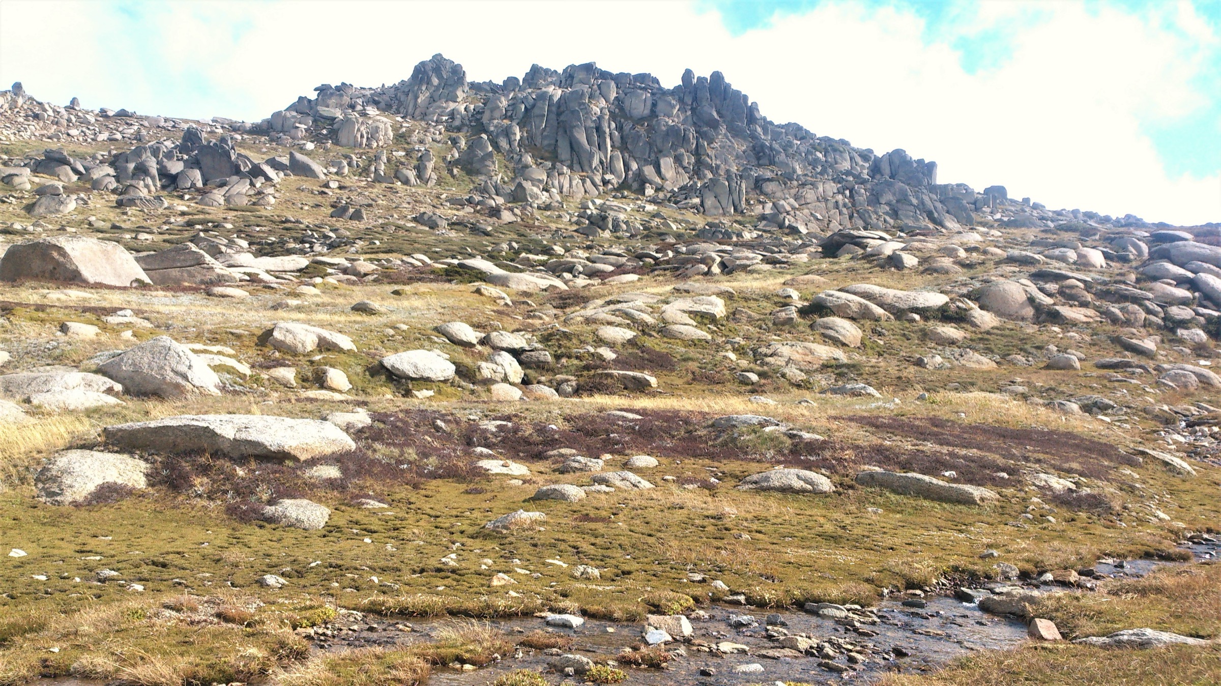
From the top of the Kosciuszko Express Chairlift, the route sets out north-west across the Ramshead Range on a mix of steel-mesh walking platform and formed track, threading granite tors and low alpine heath. It contours below the North Ramshead ridge, drops slightly to a footbridge over the headwaters of the Snowy River and climbs gently past the outlet of Lake Cootapatamba — Australia’s highest lake — into Rawson Pass at about 2,120 m. From the saddle a paved summit road (closed to vehicles) curves clockwise around the north-east flank of the peak to the summit cairn at 2,228 m. Return by the same route to the chairlift.
Why it is essential
This is the shortest and most accessible way to stand on the mainland high point. It is the walk that visitors, guidebooks and NPWS all name first for the region, and — because most of the ascent has been done by the chairlift — it opens the summit to walkers who could not attempt the full Main Range circuit.
Hazards and notes
- Steel-mesh walking platforms are sharp; NPWS asks that walkers do not run on them and that trekking poles carry rubber tips.
- The summit ridge is fully exposed to lightning; turn back on any forecast of afternoon storms.
- Snow can linger under the North Ramshead ridge into January in heavy years.
- The Kosciuszko Express Chairlift has fixed operating hours — allow a comfortable margin for the return.
- Dogs are not permitted anywhere in the park.
GPX / KML links
| Source | URL | Format | Notes |
|---|---|---|---|
| NPWS — Kosciuszko Walk (Thredbo to Mount Kosciuszko) | nationalparks.nsw.gov.au | Official park page | No GPX published on the official page in this pass |
| Wildwalks — Thredbo to Kosciuszko | wildwalks.com | Third-party route page | Secondary reference |
| AllTrails — Mount Kosciuszko Summit walk | alltrails.com | Third-party route page | Secondary reference |
Further reading
2. Main Range walk from Charlotte Pass
Snapshot
Itinerary
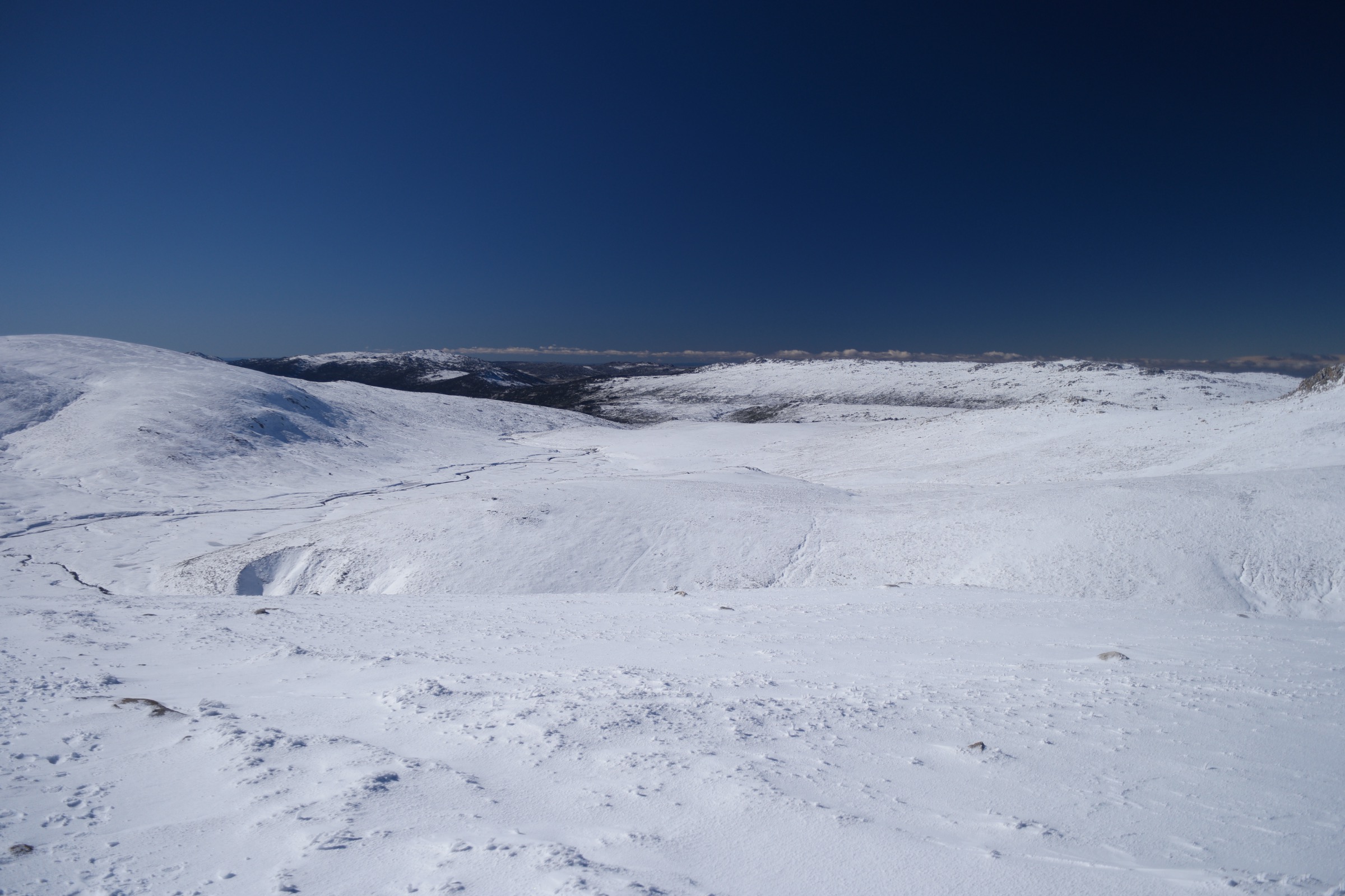
The classic direction is anticlockwise. From the Charlotte Pass day-use area the walk drops to the Snowy River footbridge, climbs west onto the Foreman Range, and traverses across the head of Wilkinsons Creek to the Blue Lake junction. From there it follows the Main Range ridge north-west over Carruthers Peak (2,145 m), across the head of Club Lake and past the Mount Lee spur to a saddle above Lake Albina. The route continues south along the ridge over Mount Northcote and Muellers Peak, drops into Muellers Pass, then climbs onto Etheridge Ridge and joins the paved summit road at Rawson Pass. From Rawson Pass the walk curves clockwise around Kosciuszko itself to the summit cairn at 2,228 m, then returns along the paved Summit Road east to Seamans Hut and along the old vehicle track back to Charlotte Pass. Hedley Tarn and Blue Lake sit just below the ridge on the outward leg and give the walk its cirque-lake character.
Why it is essential
The Main Range circuit is the region’s marquee alpine day-hike. It links four of Australia’s only cirque lakes, the whole spine of the Main Range and the mainland high point in one long day, and it is the walk that NPWS itself uses to describe the character of the park at its highest.
Hazards and notes
- Fully exposed to weather and lightning across the Carruthers–Northcote traverse; do not commit to the circuit on any afternoon-storm forecast.
- Route-finding above Blue Lake depends on cairns and marker posts; carry map, compass, GPS and PLB.
- The circuit is a long day for its distance because most of it is at or above 2,000 m; start early and carry a headtorch.
- Snowdrifts linger in the Wilkinsons Creek headwaters and on the shaded side of Carruthers Peak into January.
- Blue Lake and its inflow are a Ramsar wetland of international significance; formal side-trails to the lake shore, Hedley Tarn and Wilkinsons Creek are closed to allow the area to recover — stay on the Main Range track.
GPX / KML links
| Source | URL | Format | Notes |
|---|---|---|---|
| NPWS — Main Range walk | nationalparks.nsw.gov.au | Official park page | No GPX published on the official page in this pass |
| Wildwalks — Main Range Walk (Charlotte Pass to Kosciuszko) | wildwalks.com | Third-party route page | GPX embedded; check licence before reuse |
| Trail Hiking Australia — Main Range Walk (22.4 km) | trailhiking.com.au | Third-party route page | Secondary reference |
Further reading
3. Blue Lake from Charlotte Pass
Snapshot
Itinerary
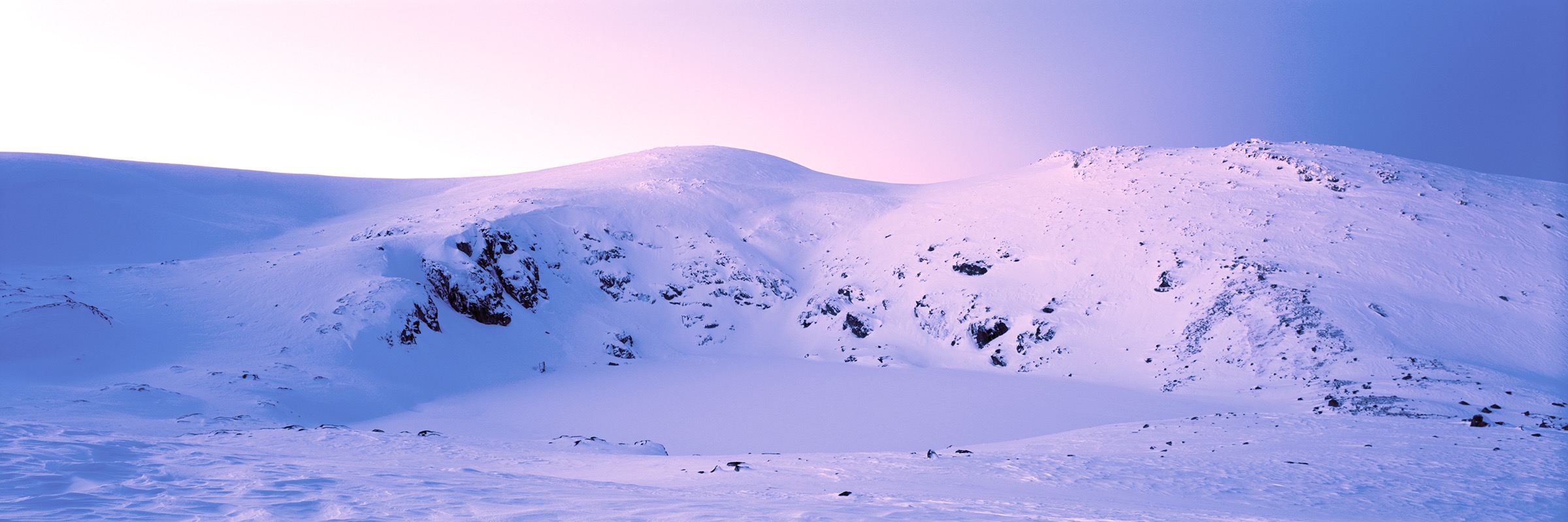
The route shares the first section of the Main Range walk. From the Charlotte Pass day-use area it drops to the Snowy River footbridge, climbs west across the Foreman Range on a mix of formed track and steel-mesh boardwalk, and traverses to the signposted Blue Lake lookout above the eastern shore of the tarn. The formal side-trails to the lake shore, Hedley Tarn and Wilkinsons Creek are closed. Return by the same route to Charlotte Pass.
Why it is essential
Blue Lake is one of only four glacial cirque lakes on the mainland and the most accessible of them. The lookout gives the classic Kosciuszko cirque view — a dolerite-and-granite headwall cupping a Ramsar-listed alpine tarn — as a short return day rather than a full Main Range circuit, and complements the summit-focused walks by showing the range’s glacial history.
Hazards and notes
- Weather change on the Foreman Range can be as abrupt as on the higher summits; carry a shell.
- The Blue Lake area is a Ramsar wetland; the formal shore, tarn and creek side-tracks are closed to allow recovery — do not step off the marked track or lookout platform.
- Boardwalk is slippery when wet or frosted; steel-mesh sections are sharp.
- Snowdrifts linger in the Wilkinsons Creek headwaters into January.
GPX / KML links
| Source | URL | Format | Notes |
|---|---|---|---|
| NPWS — Blue Lake lookout | nationalparks.nsw.gov.au | Official lookout page | No GPX published on the official page in this pass |
| Trail Hiking Australia — Charlotte Pass to Blue Lake (9.3 km) | trailhiking.com.au | Third-party route page | Secondary reference |
| BeyondTracks — Blue Lake from Charlotte Pass | beyondtracks.com | Third-party route page with GPX | Check licence before reuse |
Further reading
4. Dead Horse Gap track from Thredbo
Snapshot
Itinerary
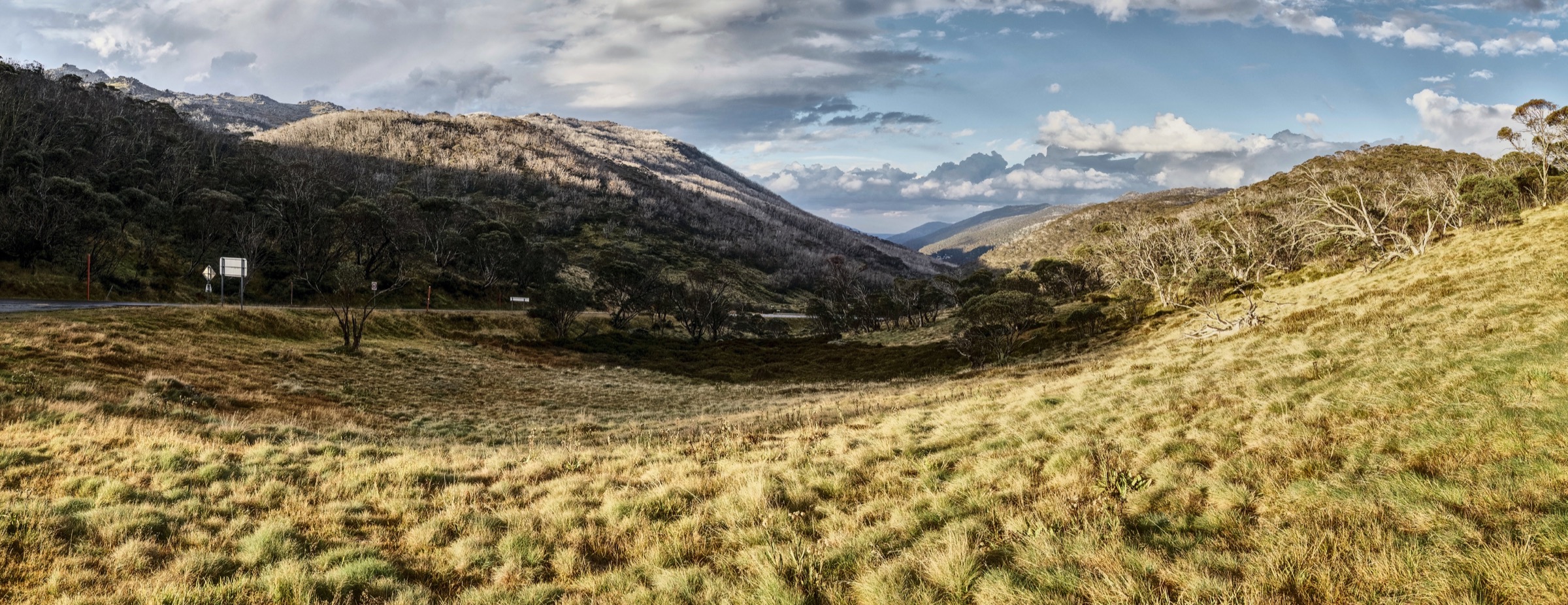
From the top of the Kosciuszko Express Chairlift the route contours south-west along the South Ramshead ridge and drops steeply through snow gum and alpine heath toward the Alpine Way at Dead Horse Gap (about 1,580 m). At the Gap the walk crosses the road and joins the Thredbo Valley Track, which follows the Thredbo River downstream through montane forest and open grazing flats back to Thredbo Village. Part of the corridor is shared with the Australian Alps Walking Track, and the route can also be walked in reverse for an uphill day out of the village.
Why it is essential
The Dead Horse Gap track is the region’s classic alpine descent and the best introduction to the Ramshead–Thredbo Valley transition. It samples the snow-gum ecosystem that the summit walk crosses only in miniature, and — because it starts at the top of the chairlift and finishes at the village — it gives a one-way day rather than an out-and-back.
Hazards and notes
- The descent off South Ramshead is steep and, in wet or frosted conditions, slippery; walking poles are useful.
- The upper ridge is fully exposed to weather and lightning.
- Snow can linger on the north-facing descent into November in heavy years.
- The Alpine Way at Dead Horse Gap is a fast-traffic road; take care crossing.
- Chairlift operating hours cap the workable start window — check the day’s schedule at Thredbo.
GPX / KML links
| Source | URL | Format | Notes |
|---|---|---|---|
| NPWS — Dead Horse Gap walking track | nationalparks.nsw.gov.au | Official park page | No GPX published on the official page in this pass |
| Wildwalks — Dead Horse Gap track | wildwalks.com | Third-party route page | Secondary reference |
| AllTrails — Eagles Nest, Dead Horse Gap and Thredbo River Track | alltrails.com | Third-party route page | Longer variant, ~14 km |
Further reading
5. Porcupine walk from Perisher Valley
Snapshot
Itinerary
From the Perisher Valley reservoir car park the track climbs south-east through open snow gum woodland along Rock Creek, then rises through wet heath and alpine herbfield onto the ridgeline that carries Porcupine Rocks. The outcrop is a cluster of weathered granite tors on the edge of the plateau; the view from the rocks looks south-west across the Thredbo Valley to the Ramshead Range and the Main Range spine, with Mount Kosciuszko visible in clear weather. Return by the same route. Longer loop variants continue via the Porcupine Link and Betts Creek back to Perisher Gap but sit above the day-walk brief for this catalogue.
Why it is essential
The Porcupine walk is the region’s short, ridge-view day-walk from the northern (Perisher) side of the park. It gives the clearest formed-track view of the Main Range and Ramshead ridgelines from an angle that neither Charlotte Pass nor Thredbo can offer, and it is the natural short outing when Kosciuszko Road is open beyond Perisher but the higher trails are still under snow.
Hazards and notes
- Porcupine Rocks itself is unfenced with a sheer south-west drop; NPWS warns against climbing on the outcrop.
- The ridge is fully exposed to UV, wind and afternoon storms; carry a shell.
- Track can close for weather; check NPWS alerts before leaving Perisher.
- Snow lingers on the shaded aspects into November in heavy years.
GPX / KML links
| Source | URL | Format | Notes |
|---|---|---|---|
| NPWS — Porcupine walk | nationalparks.nsw.gov.au | Official park page | No GPX published on the official page in this pass |
| Trail Hiking Australia — Porcupine Walk (5.7 km) | trailhiking.com.au | Third-party route page | Secondary reference |
| Wildwalks — Porcupine Walk | wildwalks.com | Third-party route page | Secondary reference |
Further reading
Missing data
- No Wikimedia Commons image at or above the 2,000 px source floor was located for Porcupine Rocks or the Porcupine walk itself; the figure block is intentionally omitted from that section rather than shipping a below-floor image.
- NPWS does not publish elevation gain, loss or maximum elevation for any of the five walks. Values shown are conservative estimates derived from the 1:50,000 Kosciuszko Alpine Area topographic sheet and Trail Hiking Australia; treat them as approximate.
- No open-licence GPX/KML files were located on official NPWS pages in this pass. Third-party GPX files exist on wildwalks, BeyondTracks and Trail Hiking Australia but their reuse licences vary and should be checked case-by-case before republication.
- Public-transport suitability to Charlotte Pass, Perisher and Thredbo trailheads was not verified for the summer walking season; the only scheduled buses in the district are the winter Snowy Mountains ski shuttles.
Verification status
- Kosciuszko Walk (Thredbo) — Route verified against NPWS and wildwalks; media verified via Wikimedia Commons.
- Main Range walk — Route verified against NPWS and Trail Hiking Australia; media verified via Wikimedia Commons.
- Blue Lake from Charlotte Pass — Route verified against NPWS Blue Lake lookout page and Trail Hiking Australia; media verified via Wikimedia Commons.
- Dead Horse Gap track — Route verified against NPWS; media verified via Wikimedia Commons.
- Porcupine walk — Route verified against NPWS and Trail Hiking Australia; no compliant Commons image located, media pending.
Further reading
Nearby Great Dividing Range guides on Storm
- ACT, Namadgi and the Brindabella Ranges
- Atherton Tablelands / Cairns Highlands
- Barrington Tops
- Blue Mountains
- NPWS — Main Range walk
- NPWS — Kosciuszko Walk: Thredbo to Mount Kosciuszko
- NPWS — Blue Lake lookout
- NPWS — Dead Horse Gap walking track
- NPWS — Porcupine walk
- Trail Hiking Australia — Main Range Walk
- Wildwalks — Kosciuszko NP south catalogue
- Wikipedia — Kosciuszko National Park