Regional overview
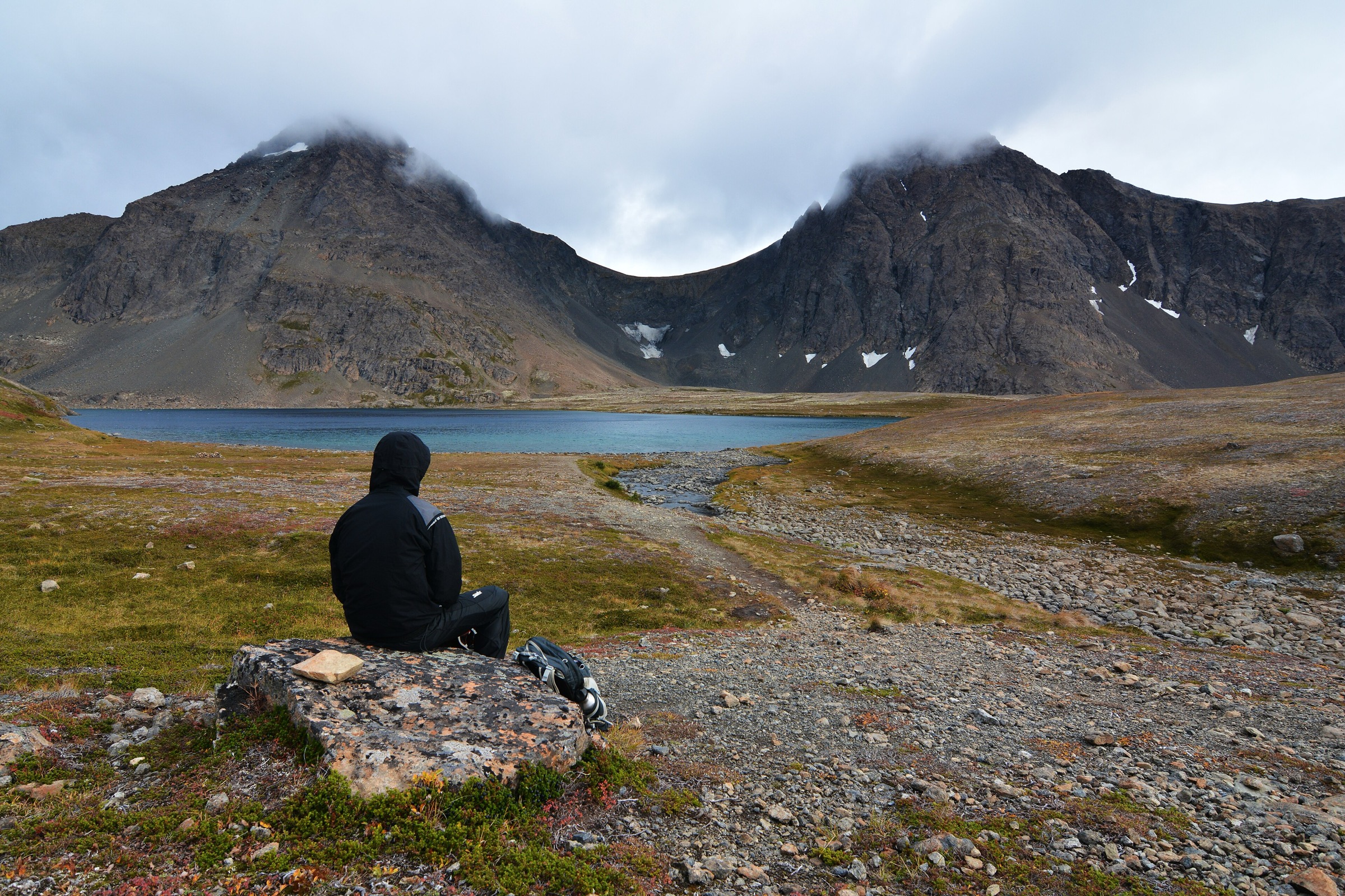
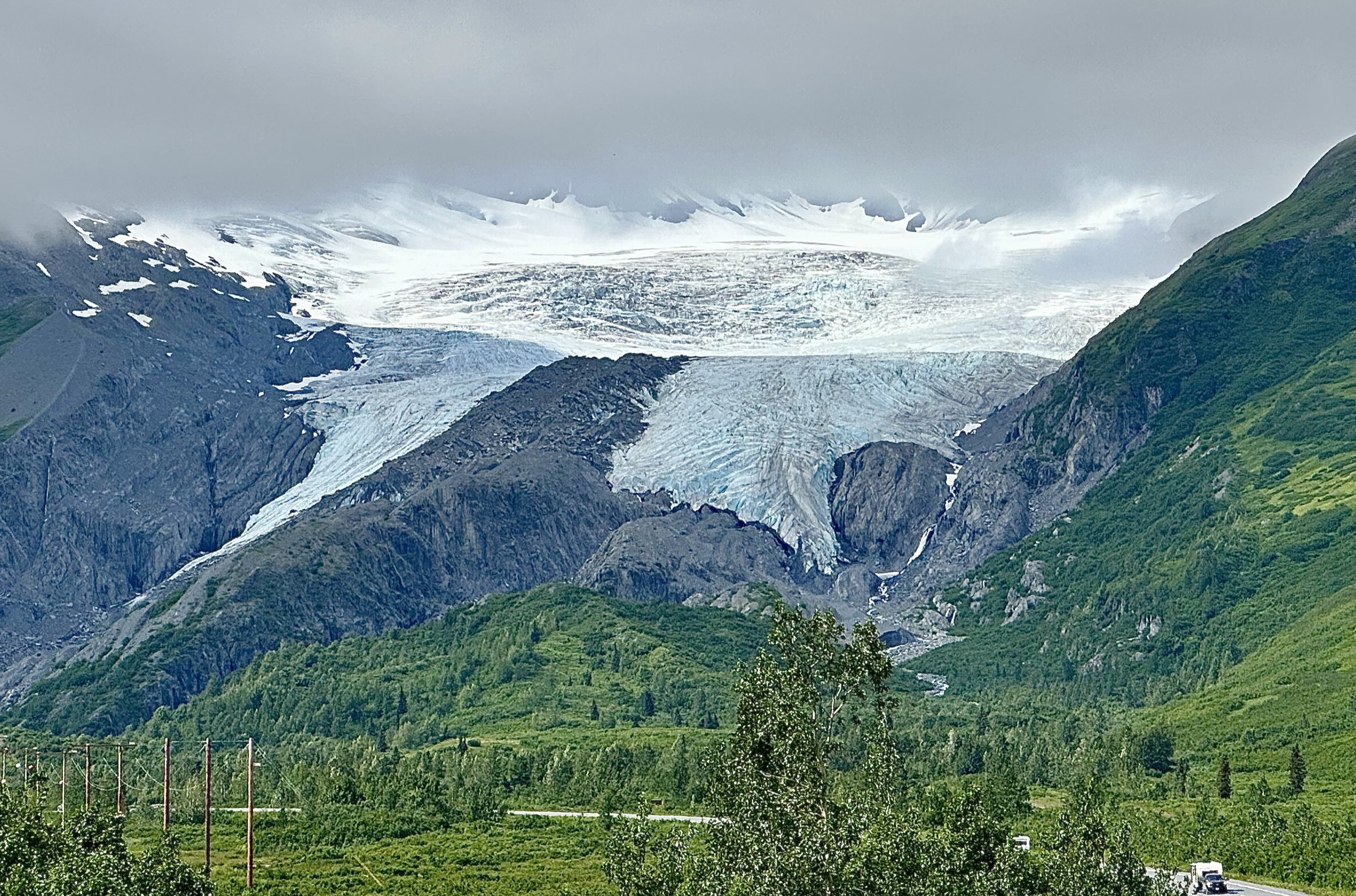
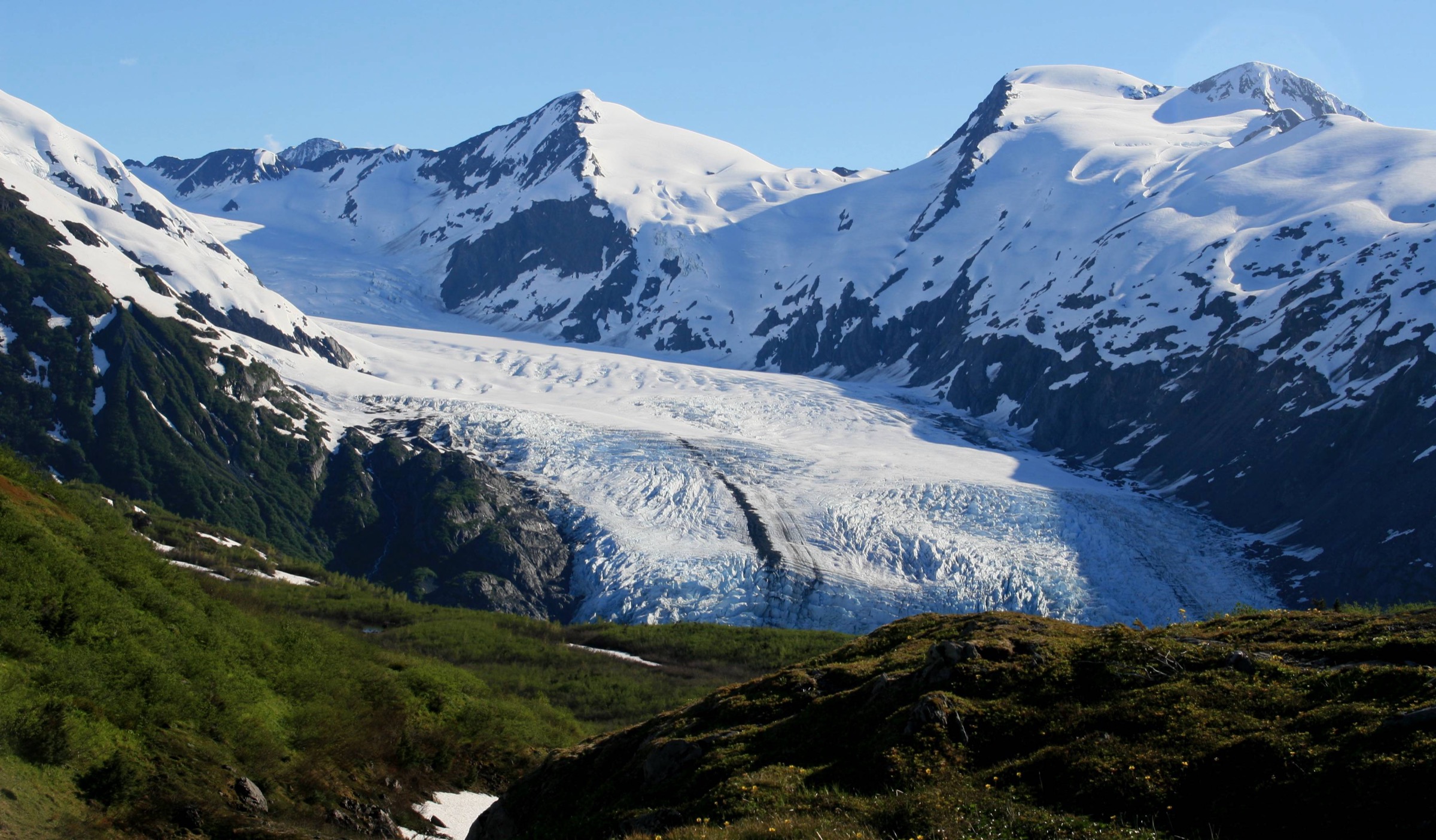
The Prince William Sound sector of the Chugach Mountains wraps around the coastal fjords and glaciated ridges that surround Alaska’s largest tidewater embayment. Almost all of the walkable country sits inside the Chugach National Forest — the second-largest national forest in the United States — with trailheads spread across four small hiking centres: Whittier at the head of Passage Canal, the Portage Valley to its west, Girdwood on Turnagain Arm, and Cordova on the eastern shore of the sound. Valdez and the eastern Chugach around Thompson Pass are covered in the Thompson Pass / Valdez catalogue and are excluded from this selection.
The walking splits by centre. Whittier and the Portage Valley give short, glacier-focused walks — Portage Pass on the historic Iditarod approach, Byron Glacier on the Chugach National Forest maintained trail. Girdwood is the alpine hub: the Winner Creek Gorge boardwalk from the Alyeska tram base and the long Crow Pass route over the range to Eagle River. Cordova, reached only by ferry from Whittier or Valdez, sits above the Copper River Delta with a set of quiet forest-and-ridge trails maintained by the Cordova Ranger District. Every one of these five hikes climbs into or looks onto tidewater ice, hanging glaciers, or the salmon-run corridors that carry the region’s brown-bear activity.
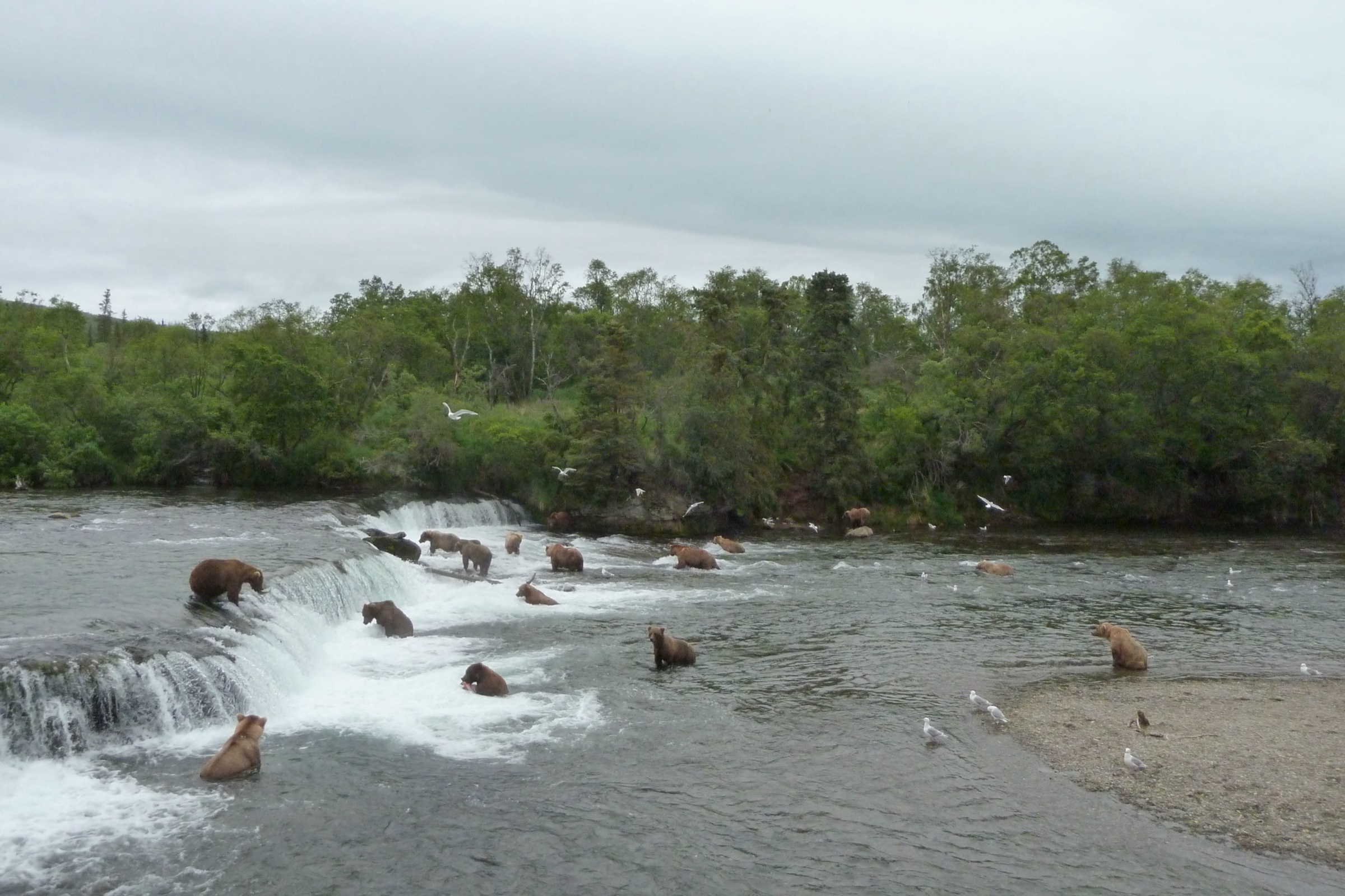
Both brown and black bears are dense across the sector. Portage Valley in particular is described by the Chugach Forest as a major wildlife corridor sustaining a high density of both species, and Cordova’s Copper River drainages have some of the densest brown-bear populations in North America. All food should be carried and stored under Chugach National Forest food-storage rules; bear spray is standard equipment on any of the five walks in this catalogue. The reliable snow-free walking season is mid-May to late September at low elevation, but Crow Pass and the upper Portage Pass often hold snow into July.
Access is unusual in Alaskan terms. Whittier is reached only through the single-lane Anton Anderson Memorial Tunnel, which shares its bore with the Alaska Railroad and operates on a scheduled one-way alternation every 30 minutes — miss the return window and you sleep in Whittier. Cordova has no road connection; it is reached by the Alaska Marine Highway ferry or by air from Anchorage or Juneau. Girdwood and the Portage Valley are on the paved Seward Highway, roughly 45 to 80 km south of Anchorage. Fees apply at most Chugach National Forest trailhead parking areas (typically $5–10 day use).
Selection rationale
The five walks are chosen to sample the four hiking centres of the sector and the full range of the region’s walking character. Portage Pass is included as the flagship glacier-view walk and the only foot approach to Portage Glacier — a segment of the Iditarod National Historic Trail and the defining Whittier hike. Byron Glacier is the short glacier-terminus walk from the Portage Valley and the natural pairing with Portage Pass on a Whittier day. Winner Creek is the Girdwood valley classic — a boardwalk through old-growth spruce and hemlock to the Winner Creek Gorge, with the hand-tram section currently closed pending suspension bridge construction. Crow Pass is the Girdwood high route: a strenuous day-hike segment of the 21-mile Iditarod National Historic Trail crossing that reaches the Raven Glacier viewpoint and Crow Pass itself at 1,184 m. Power Creek closes the selection as the Cordova walk — the classic hanging-glacier and salmon-stream route through the coastal Chugach behind the town. Reference material was verified against USFS Chugach National Forest trail pages, Alaska.org sector summaries, and Alaska Department of Natural Resources brochures.
Summary table
| # | Hike | Country | Route type | Distance | Gain | Max elevation | Difficulty |
|---|---|---|---|---|---|---|---|
| 1 | Portage Pass Trail (Whittier) | USA | Out-and-back | ~6.4 km | ~229 m | ~229 m | Moderate |
| 2 | Byron Glacier Trail (Portage Valley) | USA | Out-and-back | ~2.2–4.5 km | ~30 m | ~155 m | Easy |
| 3 | Winner Creek Trail (Girdwood) | USA | Out-and-back | ~9.6 km | ~60 m | ~300 m | Easy–moderate |
| 4 | Crow Pass Trail — Girdwood side to Crow Pass | USA | Out-and-back | ~13 km | ~610 m | 1,184 m | Strenuous |
| 5 | Power Creek Trail (Cordova) | USA | Out-and-back | ~13.5 km | ~150 m | ~250 m | Moderate |
1. Portage Pass Trail (Whittier)
Snapshot
Itinerary
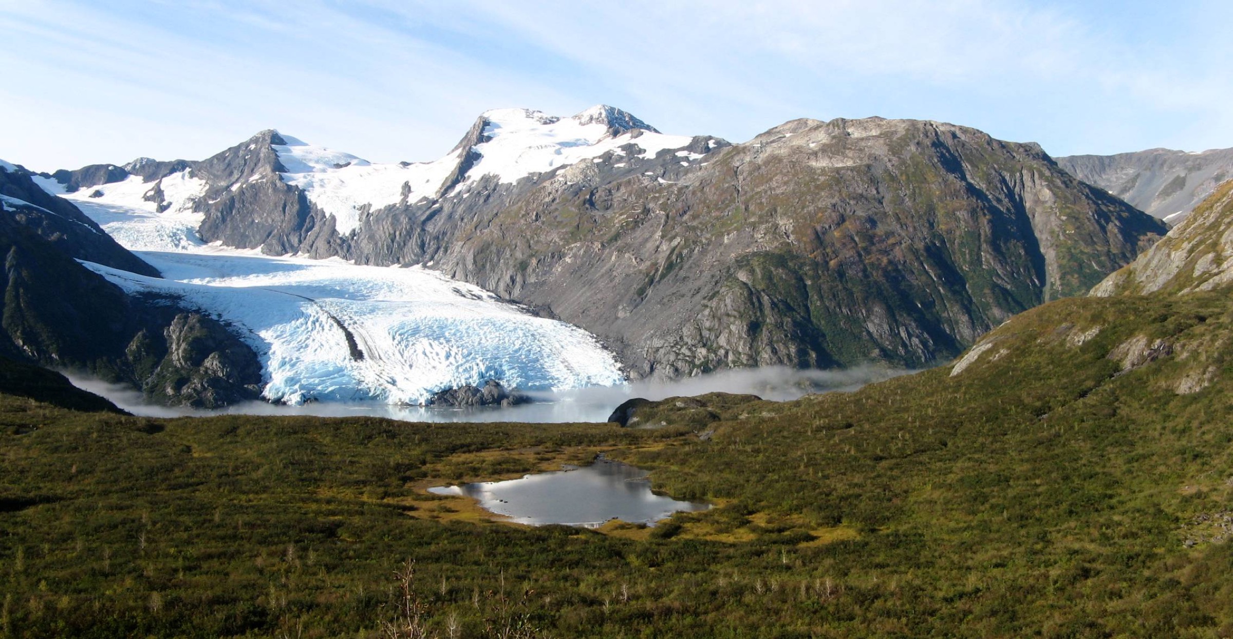
The trailhead sits just east of the Anton Anderson Memorial Tunnel portal on the Whittier side, across the railroad tracks from the tunnel exit road. The trail climbs steeply from sea level up an open, avalanche-cleared slope for the first 800 m, gaining most of the elevation of the route in that stretch. The grade eases onto Portage Pass at approximately 229 m, where the outlook opens west across Portage Lake to the tidewater snout of Portage Glacier and the icefield behind. Most walkers continue down the west side of the pass through low willow to the shore of Portage Lake, adding roughly 500 m of descent and re-climb to the round-trip. The route is a preserved segment of the Iditarod National Historic Trail — the historic pack-and-portage route from Passage Canal to Turnagain Arm used successively by Chugach Alutiiq travellers, Russian fur traders, and the 1890s gold-rush prospectors bound for the Susitna and Iditarod goldfields. Return is on the same line back to the tunnel portal.
Why it is essential
Portage Pass is the only foot approach to Portage Glacier and the defining Whittier hike. It combines a short but sustained climb, a genuine tidewater outlook, and a segment of the Iditarod National Historic Trail into a walk that a visitor can complete between two tunnel-alternation windows. It is also the walk that most cleanly delivers the sector’s coastal-glacier character.
Equipment
- Sturdy walking shoes or light boots (steep, loose gravel on the initial climb)
- Rain jacket and warm layer — Whittier averages more than 200 rain-days a year
- Water (1.5–2 L)
- Bear spray — brown and black bears both active
- Sun and wind protection at the pass
- Trekking poles for the descent
- Microspikes in shoulder seasons if snow persists
Hazards and notes
- The tunnel alternation is the operational constraint — the return window from Whittier is fixed on a 30-minute cycle; missing it means a night in town. Confirm the timetable on the day.
- Snowfields on the north side of the pass persist into June in cool years.
- Brown and black bears both use the corridor; the Portage Valley is a major wildlife corridor.
- Weather turns quickly on the pass; wind funnels through from Passage Canal.
- No potable water on the route.
GPX / route file
| Source | URL | Format | Notes |
|---|---|---|---|
| USFS Chugach — Portage Pass Trail (INHT) | fs.usda.gov | Web page | Official managing authority |
| USFS Chugach — Portage Pass Trail brochure (PDF) | fs.usda.gov | Official trail map | |
| AllTrails — Portage Pass | alltrails.com | Web page | Distance and elevation cross-check only |
Sources
- USFS Chugach National Forest — Portage Pass Trail (INHT)
- Alaska.org — Portage Pass Trail
- Wikimedia Commons — Portage Glacier from Portage Pass
2. Byron Glacier Trail (Portage Valley)
Snapshot
Itinerary
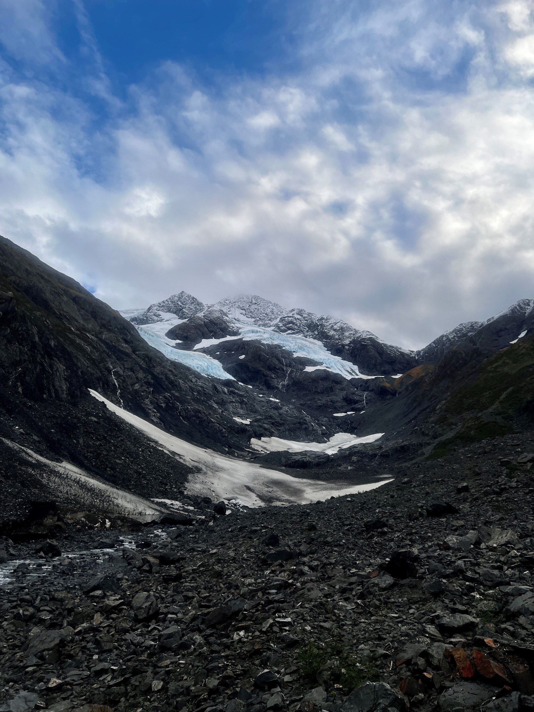
The Byron Glacier trailhead sits at the end of Byron Road in the Portage Valley, roughly 1.5 km past the Begich, Boggs Visitor Center. The trail leaves the parking area on a broad gravel bed, crosses Byron Creek on a footbridge, and follows the valley floor south through low willow and moss to a boulder field below the glacier terminus. The standard viewing area is on the north side of the boulder field at approximately 0.8 miles from the trailhead; a rougher onward route continues over the boulders toward the ice for another kilometre, though the exact turn-around varies with the state of the moraine each year. The setting is short-approach glacier: hanging seracs above the terminus, avalanche debris fans across the boulders, and a permanent snowpatch under the ice face that once carried informal “ice caves” through the summer. Return is on the same line.
Why it is essential
Byron Glacier is the shortest walk in this catalogue and the natural half-day partner to Portage Pass on a Whittier trip. It is the walk that most cleanly delivers the glacier-terminus experience without any real climb, and the only route in the sector that puts a family group under a hanging glacier within an hour of the car park. It is also a candidate stop when weather closes down the higher trails.
Equipment
- Trail shoes or light boots (loose boulder-field near the terminus)
- Rain jacket and warm layer
- Water (1 L)
- Bear spray — Portage Valley is a very active corridor
- Sun protection on clear days
Hazards and notes
- Do not enter ice caves or ice tunnels under the glacier under any circumstances. A collapse in July 2018 killed a hiker; the risk is present through the entire summer and the Chugach Forest and rescue services have repeated warnings since then.
- Falling seracs and rockfall from the glacier face are constant background risks; keep well back of the ice.
- Braided glacial streams cross the boulder field; be prepared to turn back at a raised flow.
- Brown and black bears both use the Portage Valley in high densities.
- Slick moss-covered boulders on the last section.
GPX / route file
| Source | URL | Format | Notes |
|---|---|---|---|
| USFS Chugach — Byron Glacier Trail | fs.usda.gov | Web page | Official managing authority |
| Alaska.org — Byron Glacier Trail | alaska.org | Web page | Sector-level source |
| AllTrails — Byron Glacier Trail | alltrails.com | Web page | Distance and elevation cross-check only |
Sources
- USFS Chugach National Forest — Byron Glacier Trail
- Alaska.org — Byron Glacier Trail
- Alaska’s News Source — 2018 Byron Glacier ice-cave collapse
- Wikimedia Commons — Byron Glacier (USDA Forest Service)
3. Winner Creek Trail (Girdwood)
Snapshot
Itinerary
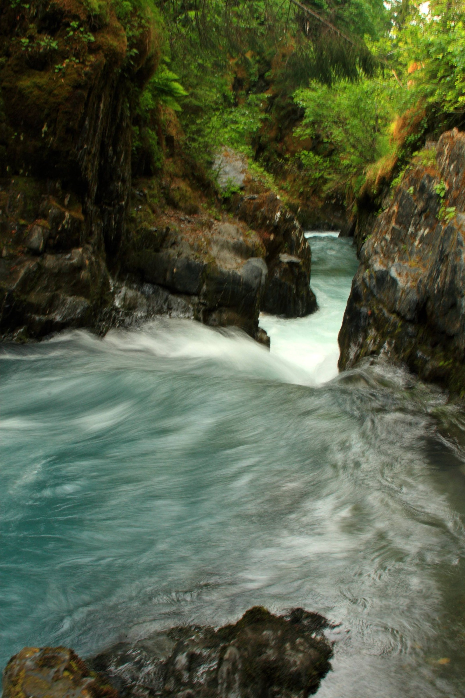
The trail leaves Girdwood behind the base of the Alyeska aerial tram at approximately 75 m and follows a boardwalk-and-graded-gravel corridor east into the Winner Creek valley. The first three kilometres pass through mature Sitka-spruce and mountain-hemlock forest with muskeg openings and long stretches of raised boardwalk over the wettest ground. The trail meets Winner Creek at a small suspension bridge, then continues to the confluence of Winner Creek and Glacier Creek at the Winner Creek Gorge — a granite slot carrying Glacier Creek through a series of standing waves and pour-overs 15–20 m below the trail. The gorge itself is the standard turn-around for the day-hike; the historical route continued across Glacier Creek on a hand tram to reach the Crow Creek Road side, but the tram has been closed indefinitely since a fatal fall in 2019. A replacement suspension bridge was funded by the Anchorage Assembly in November 2025 and is under construction; confirm status before travel. Return is on the same line back to Alyeska.
Why it is essential
Winner Creek is the accessible Girdwood valley walk — the flat, family-friendly counterpart to Crow Pass — and the natural first-day hike on any trip that uses Alyeska as its base. It is also the walk that most cleanly frames the rainforest character of the coastal Chugach: old-growth spruce, muskeg boardwalk, and the granite gorge at the turn-around. The upper Winner Creek Trail beyond the former tram site is a preserved segment of the Iditarod National Historic Trail.
Equipment
- Trail runners or light boots — boardwalk sections are slippery when wet
- Rain jacket — Girdwood is one of the wettest valleys on the sound
- Warm layer
- Water (1.5 L)
- Bear spray — brown and black bears both use the valley
- Insect repellent — mosquitoes are heavy in muskeg openings through August
Hazards and notes
- The Winner Creek hand tram is closed indefinitely; the trail dead-ends at Glacier Creek gorge on the Alyeska side. Confirm suspension-bridge construction status directly with Girdwood.com or the Chugach National Forest before travel.
- Winner Creek Gorge itself is a sheer drop to fast-moving water; keep back from the unfenced sections.
- Boardwalk sections are slippery in rain and after frost.
- Brown and black bears use the Glacier Creek corridor; make noise on blind corners.
GPX / route file
| Source | URL | Format | Notes |
|---|---|---|---|
| USFS Chugach — Winner Creek Gorge (INHT) | fs.usda.gov | Web page | Official managing authority |
| USFS Chugach — Upper Winner Creek (INHT) | fs.usda.gov | Web page | Upper section on the Iditarod National Historic Trail |
| Girdwood.com — Lower Winner Creek Trail | girdwood.com | Web page | Community trail authority |
| AllTrails — Winner Creek Trail | alltrails.com | Web page | Distance and elevation cross-check only |
Sources
- USFS Chugach National Forest — Winner Creek Gorge (INHT)
- USFS Chugach National Forest — Upper Winner Creek (INHT)
- Girdwood.com — Lower Winner Creek Trail
- Anchorage Daily News — Winner Creek suspension bridge, November 2025
- Wikimedia Commons — Winner Creek Gorge
4. Crow Pass Trail — Girdwood side to Crow Pass
Snapshot
Itinerary
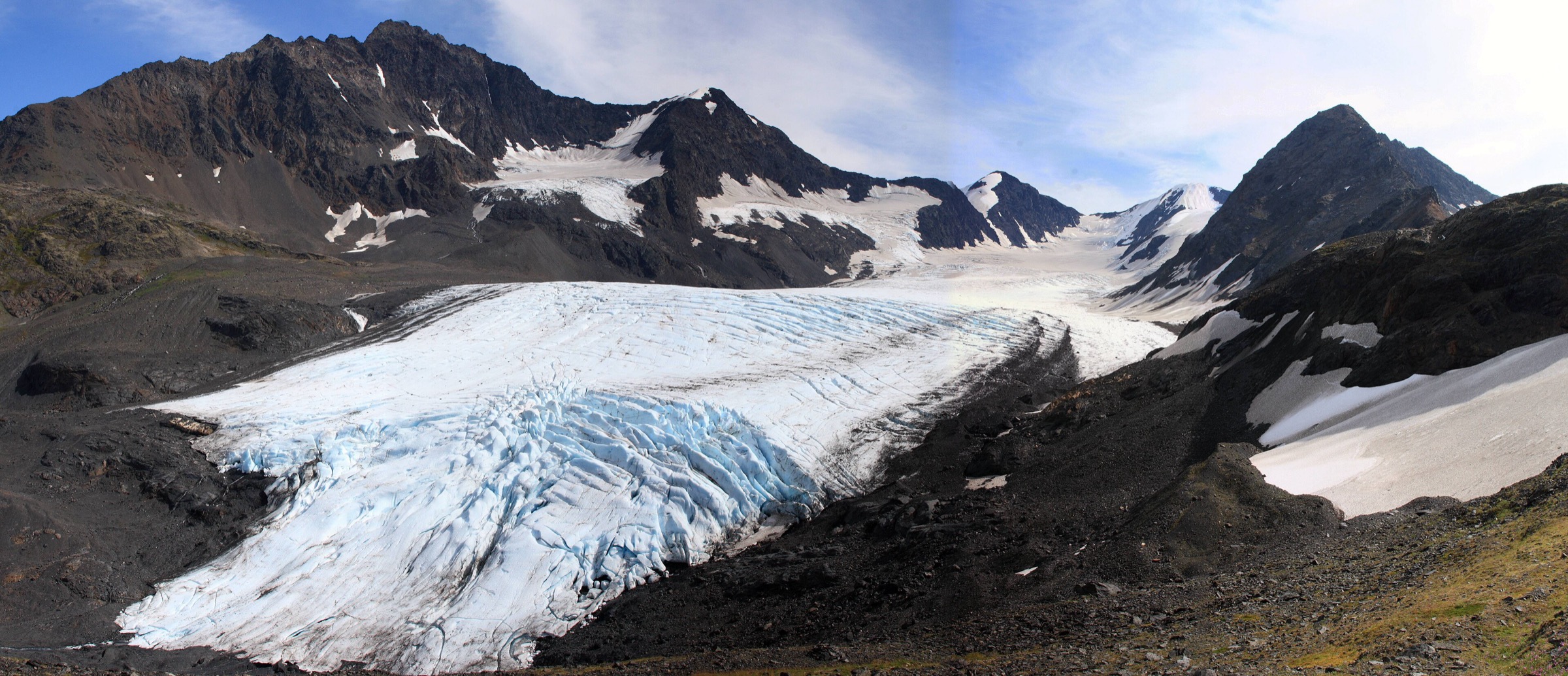
The trailhead at the end of Crow Creek Road sits at approximately 555 m in the head of the Crow Creek valley, above the historic Crow Creek Mine. The trail climbs on switchbacks through low subalpine spruce for the first 1.7 miles, passing the ruins of the Monarch Mine at approximately 800 m — historic mining structures and shaft openings that should not be entered. Above the treeline the trail traverses onto the north side of the valley and climbs a scree-and-tundra slope directly under Raven Glacier, which hangs off Cariboo Peak to the north. The pass at 1,184 m is the highest point on the historic Iditarod route and the standard turn-around for the day-hike. From the pass the outlook opens north into the head of the Raven Creek valley toward the Eagle River side of the Chugach; the through-route continues 21 miles down to the Eagle River Nature Center as a two-to-three day backpack. Return is on the same line back to Crow Creek Road. Crystal Lake, just below the pass on the south side, is a common short extension.
Why it is essential
Crow Pass is the alpine day-hike of the Girdwood sector and the standard training route for Anchorage-based mountaineers. It is the only walk in this catalogue that reaches above 1,100 m and the only one that carries the historic weight of the Iditarod National Historic Trail through its highest point. For a fit walker on a settled day it is the most rewarding single hike in Prince William Sound Chugach country — glacier, pass, ridge, and history in one line.
Equipment
- Sturdy boots — some scree and lingering snow
- Trekking poles for the descent
- Rain jacket, warm layer, and extra insulation
- Water (2.5–3 L; the creek water is safe with treatment)
- Sun and wind protection at the pass
- Bear spray
- Navigation backup and a headtorch
- Microspikes early in the season for the snowfields
Hazards and notes
- The pass often carries snow into July and cornices on the north side into August; check conditions with the Chugach National Forest before travel.
- Historic mining ruins around the Monarch Mine — do not enter shafts or structures.
- Brown and black bears use the Crow Creek and Raven Creek valleys; reports of encounters past Raven Glacier are common in season.
- Weather in the pass changes quickly; visibility can drop to near zero.
- Crow Creek Road is unpaved and rough in the upper section.
GPX / route file
| Source | URL | Format | Notes |
|---|---|---|---|
| USFS Chugach — Crow Pass Trail (INHT) | fs.usda.gov | Web page | Official managing authority |
| USFS Chugach — Crow Pass Trail brochure (PDF) | fs.usda.gov | Official trail map | |
| Alaska DNR — Crow Pass brochure (PDF) | dnr.alaska.gov | State parks brochure for the Eagle River side | |
| Visit Girdwood — Crow Pass | visitgirdwood.com | Web page | Sector-level source |
Sources
- USFS Chugach National Forest — Crow Pass Trail (INHT)
- USFS Chugach — Crow Pass Trail brochure (PDF)
- Alaska DNR — Crow Pass brochure (PDF)
- Visit Girdwood — Crow Pass
- Wikimedia Commons — Raven Glacier near Crow Pass
5. Power Creek Trail (Cordova)
Snapshot
Itinerary
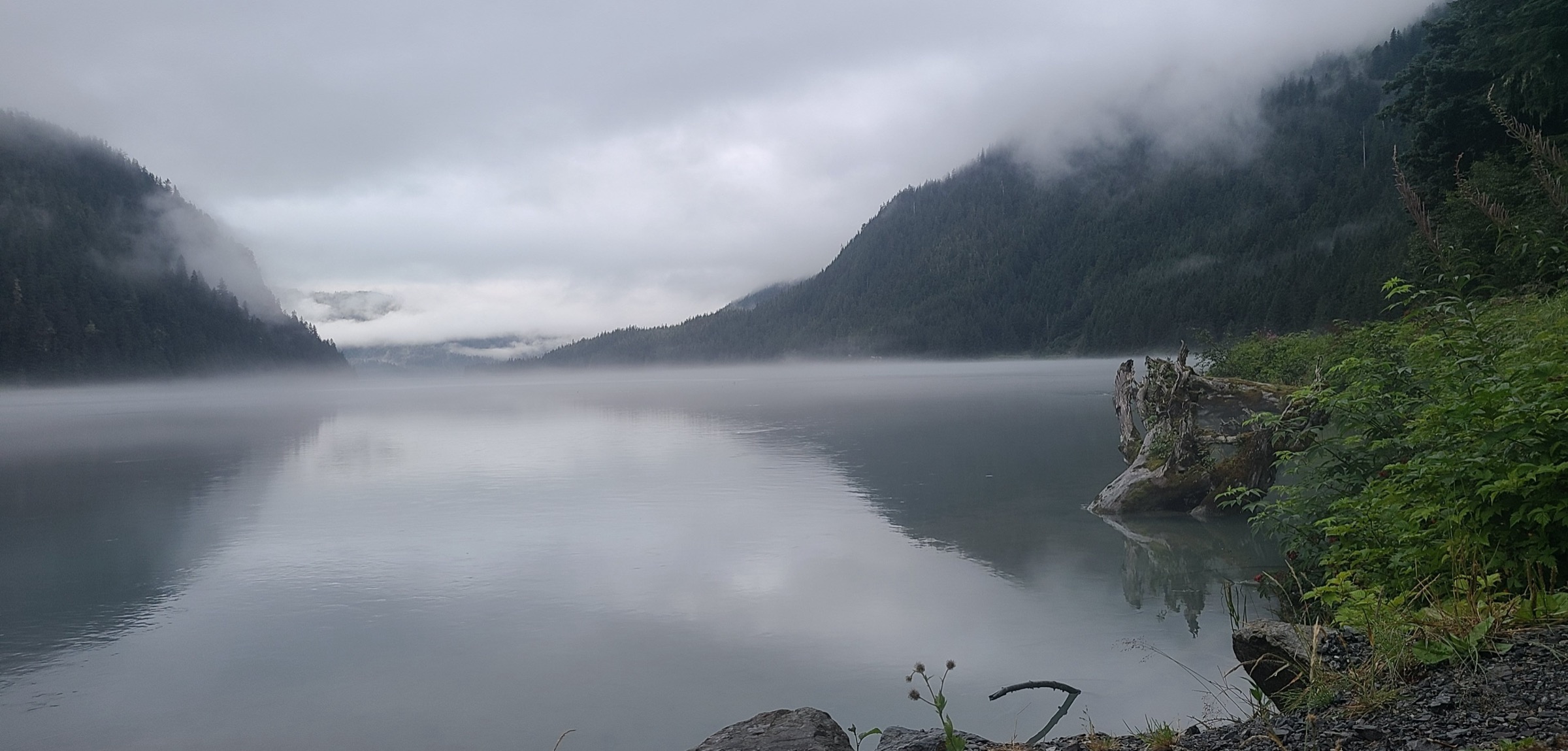
The Power Creek Trailhead sits at the end of Power Creek Road, roughly 11 km north of Cordova through the Eyak Lake and Cordova Electric hydro corridor. The trail climbs gently through mature Sitka-spruce forest along the north side of Power Creek, passing salmon-bearing pools on the lower section and beaver ponds in the middle valley. Hanging glaciers appear on the ridge to the south from about 2 km in, with the upper valley opening into a broad U-shaped trough carved by the retreating Power Creek Glacier. The trail crosses several side streams on planked bridges — spring floods can carry these away — and reaches the Power Creek Cabin at approximately 4.2 miles, a Forest Service reservable cabin with a wood stove and outlook onto the upper basin. The cabin is the standard turn-around for the day-hike; walkers with time and transport can continue up-valley and over the col to Crater Lake for a full 12-mile loop that finishes at a second trailhead. Return is on the same line back to Power Creek Road.
Why it is essential
Power Creek is the Cordova walk — the accessible day-hike that most cleanly delivers the eastern Prince William Sound Chugach character. Hanging glaciers, coastal rainforest, salmon runs and Forest Service cabin infrastructure combine into a single line-of-sight route from town to alpine, and the trail is the one hike in this catalogue that a ferry-in visitor can complete without needing a full expedition setup. Cordova itself is a genuinely quiet trailhead compared to the Portage-Girdwood corridor.
Equipment
- Sturdy boots (roots, mud, some standing water)
- Rain jacket and warm layer — Cordova is one of the wettest towns on the Sound
- Water (2 L; creek water is treatable but not potable straight)
- Bear spray — brown-bear density in the Copper River drainages is very high
- Insect repellent
- Trekking poles helpful for the switchback section
Hazards and notes
- Brown bears are dense throughout the Power Creek and Eyak River drainages; carry spray and make noise on blind bends.
- Stream crossings can wash out; the planked bridges are seasonal.
- The upper basin has hanging glaciers overhead — avoid the direct base of the ice on warm afternoons.
- Wet, mossy roots and boardwalk sections are very slippery in rain.
- Cordova is reached only by ferry or air; plan the trailhead day around the ferry timetable.
GPX / route file
| Source | URL | Format | Notes |
|---|---|---|---|
| USFS Chugach — Power Creek Cabin | fs.usda.gov | Web page | Official managing authority |
| Alaska.org — Power Creek Trail | alaska.org | Web page | Sector-level source |
Sources
- USFS Chugach National Forest — Power Creek Cabin
- Alaska.org — Power Creek Trail
- USFS Chugach — Heney Ridge Trail
- Wikimedia Commons — Power Creek (USDA Forest Service)
Region-level sources
| Source | URL |
|---|---|
| USFS Chugach National Forest | fs.usda.gov |
| USFS Chugach — Portage Pass Trail (INHT) | fs.usda.gov |
| USFS Chugach — Byron Glacier Trail | fs.usda.gov |
| USFS Chugach — Crow Pass Trail (INHT) | fs.usda.gov |
| USFS Chugach — Upper Winner Creek (INHT) | fs.usda.gov |
| USFS Chugach — Winner Creek Gorge (INHT) | fs.usda.gov |
| USFS Chugach — Power Creek Cabin | fs.usda.gov |
| USFS Chugach — Heney Ridge Trail | fs.usda.gov |
| Alaska DNR — Crow Pass brochure (PDF) | dnr.alaska.gov |
| Alaska.org — Portage Pass, Byron Glacier, Winner Creek, Power Creek | alaska.org |
| Girdwood.com — Lower Winner Creek Trail | girdwood.com |
| Visit Girdwood — Crow Pass | visitgirdwood.com |
| Wikipedia — Chugach National Forest | en.wikipedia.org |
| Wikipedia — Iditarod National Historic Trail | en.wikipedia.org |
Further reading
- Anchorage Front Range Chugach — essential day-hikes — the western Chugach immediately east of Anchorage
- Thompson Pass / Valdez Chugach — essential day-hikes — the eastern Chugach around Valdez
- Kenai Mountains — Resurrection Pass and Hope day-hikes — the range across Turnagain Arm to the south
- Kenai Mountains — Kenai Fjords day-hikes — the tidewater fjord country of the Kenai
Missing data / follow-up work
- USFS, Alaska.org, and AllTrails give notably different distance and gain figures for Byron Glacier (0.8 to 1.4 miles one-way) and Portage Pass (2 to 2.4 miles one-way). The figures used here follow the USFS trail pages where available.
- Winner Creek suspension-bridge construction status is fluid — the Anchorage Assembly approved $1.7 million funding in November 2025, but construction had been delayed at time of publication. Confirm with Girdwood.com or the Chugach National Forest before travel.
- Chugach National Forest does not publish direct GPX or KML downloads for these trails. USFS brochure PDFs include the official route maps.
- Cordova ferry timetables shift by season; the trailhead day for Power Creek depends on scheduled Alaska Marine Highway service and available flights.
- Salmon-run timing (July into September) concentrates brown-bear activity on the Winner Creek, Bird Creek, and Power Creek corridors; carry spray and check for area closures with the local ranger district.