Regional overview
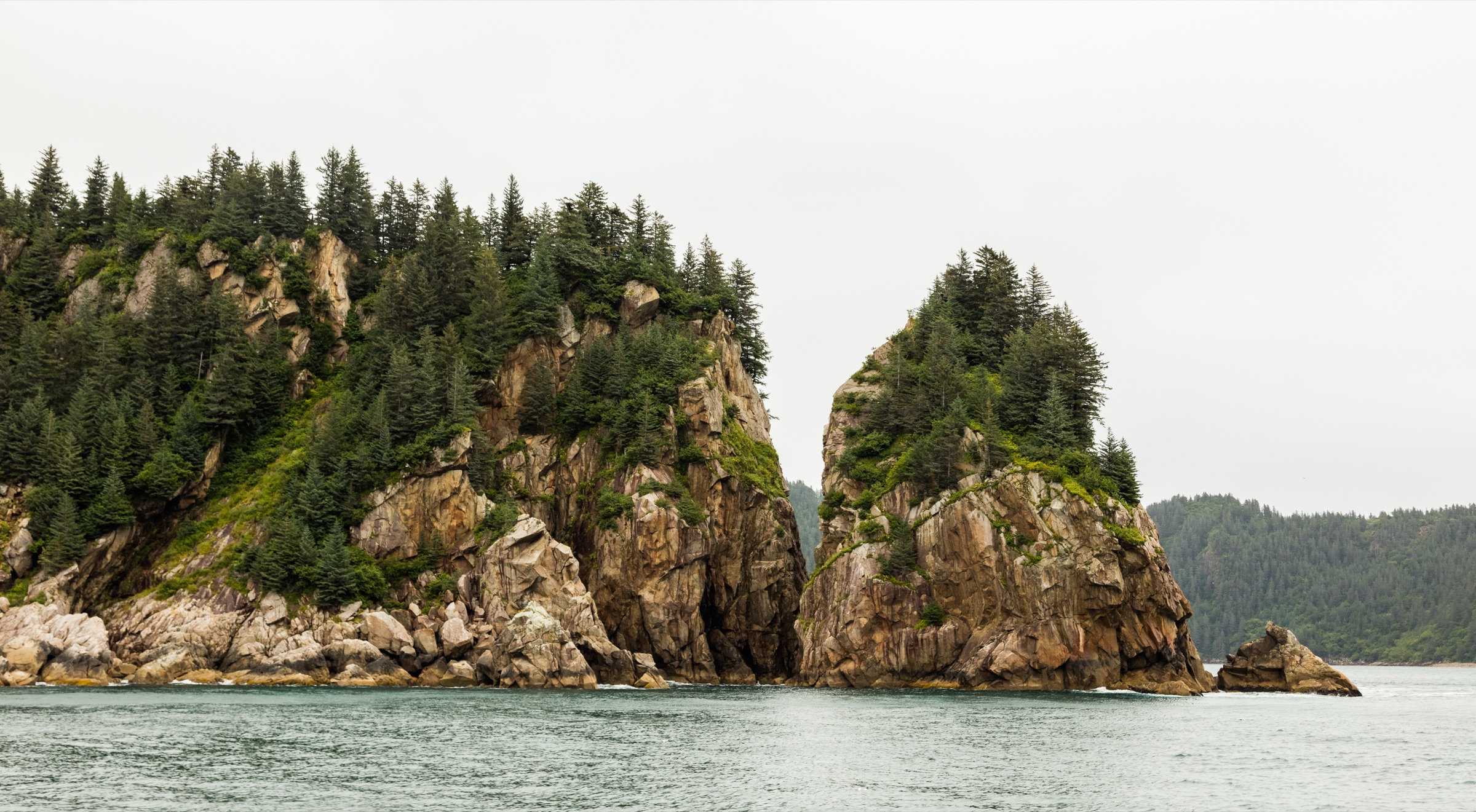
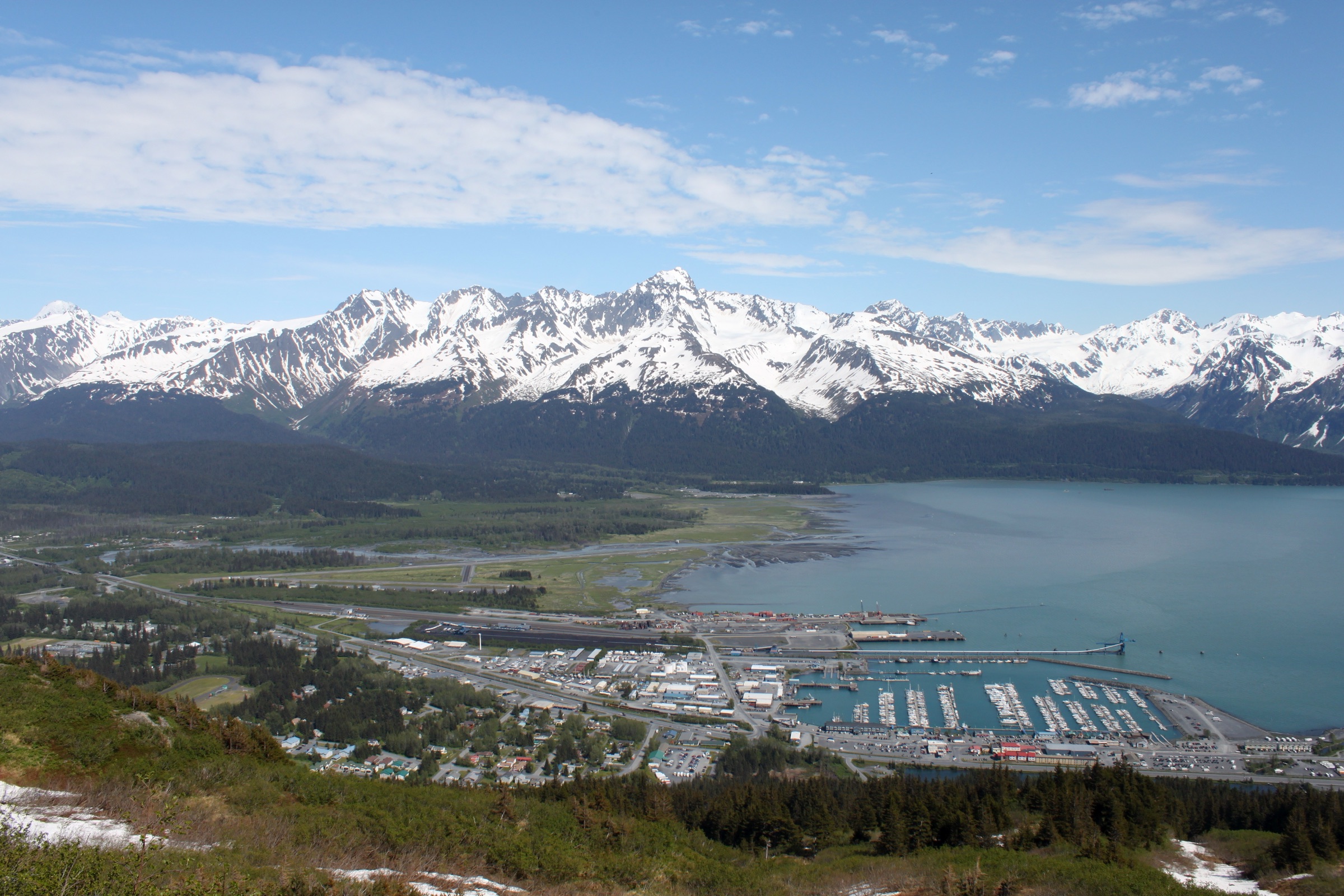
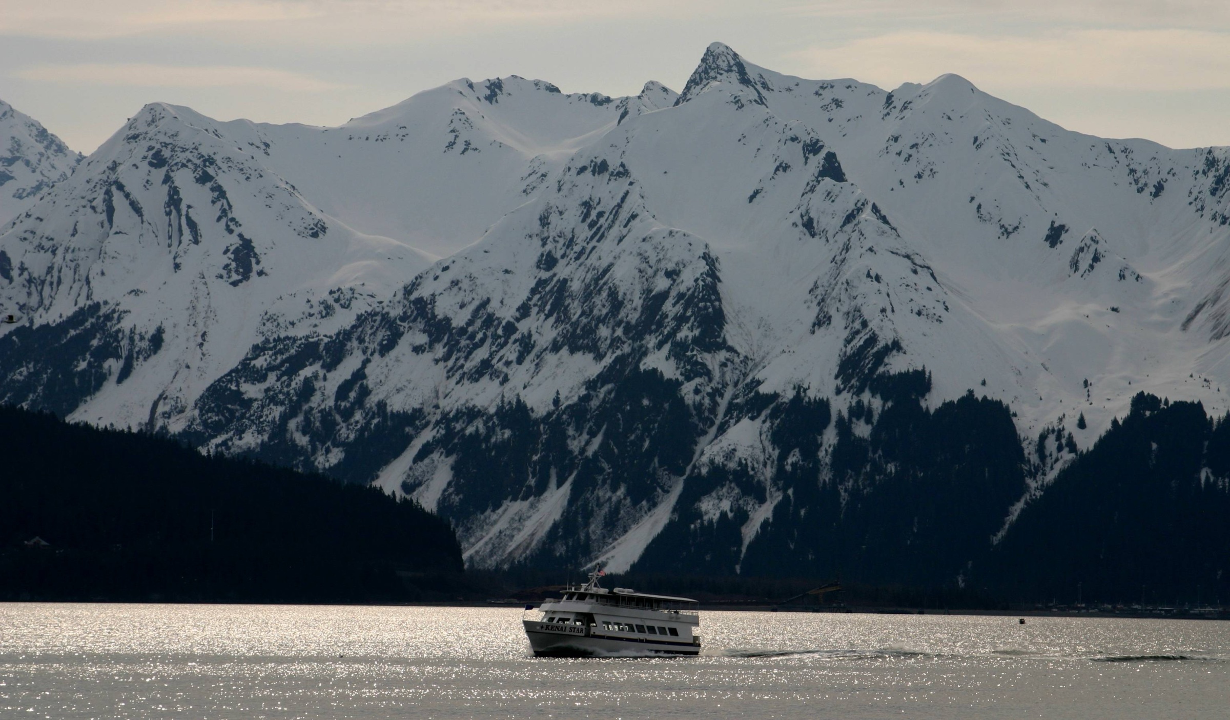
The walking country around Seward and Kenai Fjords National Park combines a glaciated coastal mountain front with the steep town mountains and the Chugach National Forest lake basins immediately above Resurrection Bay. The on-foot catalogue collapses into four threads: the road-accessible Exit Glacier / Harding Icefield corridor inside Kenai Fjords National Park; the Chugach National Forest alpine-lake country (Lost Lake); the Seward town mountains (Mount Marathon); and the Resurrection Bay shoreline running south from Lowell Point through Sitka-spruce and hemlock rainforest to Tonsina Creek and the wider Caines Head State Recreation Area trail system. The walking character is unusually varied for a compact Alaska base — from easy glacier-foreland loops to a major icefield ascent, a steep town-mountain loop, and a rainforest-to-coast walk above Resurrection Bay. Inland from this coastal front, the Resurrection Pass and Hope day-hike catalogue covers the drier interior Kenai Mountains terrain north of Seward.
Weather, snow, tides and bears are not background details here — they decide whether a hike is safe or possible. Snow and avalanche risk on the upper Harding Icefield Trail can persist into late June or early July; Lost Lake can hold soft snow on the high meadows into mid-summer; and the beach pinch points further south on the Caines Head Coastal Trail beyond Tonsina Point are passable only at very low tide — the day-hike turnaround in this catalogue stops at the Tonsina Point / Tonsina Creek beach where that tide constraint does not apply.
Seward sits at the head of Resurrection Bay and is the practical base for every route. Access to Exit Glacier and the Harding Icefield Trail is via the Herman Leirer (Exit Glacier) Road, closed to cars outside the snow-free season. Lost Lake is reached from Chugach National Forest trailheads near Seward. Mount Marathon rises directly above the town. The Tonsina Creek trailhead is at Lowell Point State Recreation Site, at the end of Lowell Point Road on a state-fee parking site. Cell signal is unreliable on the coast or above the lower forest — assume no comms past Tonsina, on the upper icefield approach, or above the bowl on Marathon.
Selection rationale
The five hikes were chosen to cover the area’s essential on-foot spectrum without overlap:
- Harding Icefield Trail — the road-accessible icefield ascent, the headline mountain walk.
- Exit Glacier View and Overlook Loop — the compact glacier-foreland companion for visitors who can’t commit to Harding.
- Lost Lake Trail — the Chugach National Forest alpine-lake objective above Seward.
- Mount Marathon (Skyline / Jeep Trail loop) — the iconic Seward town mountain on the established hiker line, not the race chute.
- Tonsina Creek / Tonsina Point Trail — the rainforest-to-coast walk from Lowell Point to Tonsina Creek and the Resurrection Bay shoreline.
Boat-only fjord landings, ranger-led options, the Mount Marathon race line and the tide-locked Caines Head beach stretch beyond Tonsina Point are deliberately excluded.
Summary table
| # | Hike | Country | Route type | Distance | Gain | Max elevation | Difficulty |
|---|---|---|---|---|---|---|---|
| 1 | Harding Icefield Trail | United States | Out-and-back alpine | 13.2 km | ~1,067 m | ~1,220 m | Hard |
| 2 | Exit Glacier View and Overlook Loop | United States | Loop / short trail system | 3.5 km | ~98 m | ~190 m | Easy–moderate |
| 3 | Lost Lake Trail | United States | Out-and-back to alpine lake | 22.2 km | ~793 m | ~674 m | Hard |
| 4 | Mount Marathon (Skyline / Jeep Trail loop) | United States | Loop | 7.2 km | ~891 m | ~895 m | Hard / very steep |
| 5 | Tonsina Creek / Tonsina Point Trail | United States | Out-and-back | 5.3 km | ~198 m | ~87 m | Moderate |
1. Harding Icefield Trail
Snapshot
Itinerary
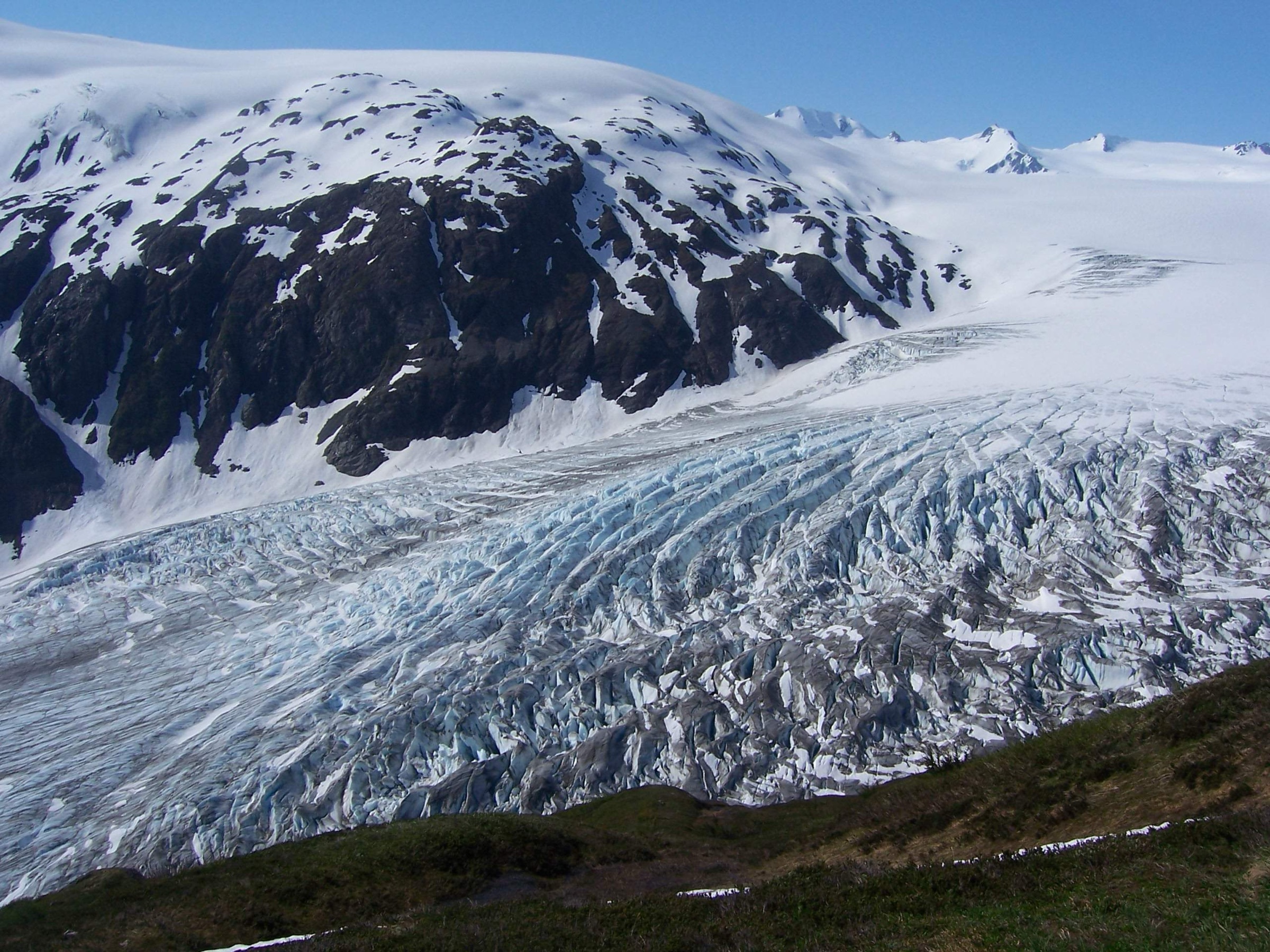
From the Exit Glacier Nature Center the trail leaves the foreland and climbs steadily through cottonwood and alder, breaks out into open alpine meadow at the Marmot Meadows section, and rises across a long flank above the glacier’s south side. Higher up the line traverses bare bedrock and seasonal snowfields to the emergency-shelter cabin and the upper viewpoint, where the trail meets the southern edge of the Harding Icefield. The turnaround is the icefield rim — there is no maintained route beyond it. The descent retraces the climb and is the section in which most injuries occur, on tired legs and wet rock.
Why it is essential
It is the only road-accessible day hike that gives walkers a true scale sense of Kenai Fjords’ icefield landscape — the same ice that feeds Exit Glacier and the seaward tidewater glaciers spreads from horizon to horizon at the upper viewpoint. Nothing else on the catalogue substitutes for it.
Equipment
- Boots with stiff sole and grippy lugs — the upper sections mix bedrock and wet snow
- Waterproof shell and warm mid-layer; weather at the rim can be 15 °C colder than at the trailhead
- Sun protection and sunglasses for the icefield glare
- 2 L of water per person or a filter for the lower creek
- Bear-aware kit (spray, food storage)
- Snow and avalanche gear only if you are trained and conditions require it
Hazards and notes
- Snow and avalanche risk on the upper trail can linger into late June or early July; check the NPS conditions page before committing.
- The climb is long and exposed; turn back at the rim if cloud closes in — there is no shelter on the icefield itself.
- Black bears are common in the meadows; make noise on blind corners.
- Fragile alpine vegetation along the bedrock benches — stay on the tread.
Sources
- NPS — Harding Icefield Trail
- NPS — Harding Icefield Trail trailhead
- AllTrails — Harding Icefield Trail
2. Exit Glacier View and Overlook Loop
Snapshot
Itinerary
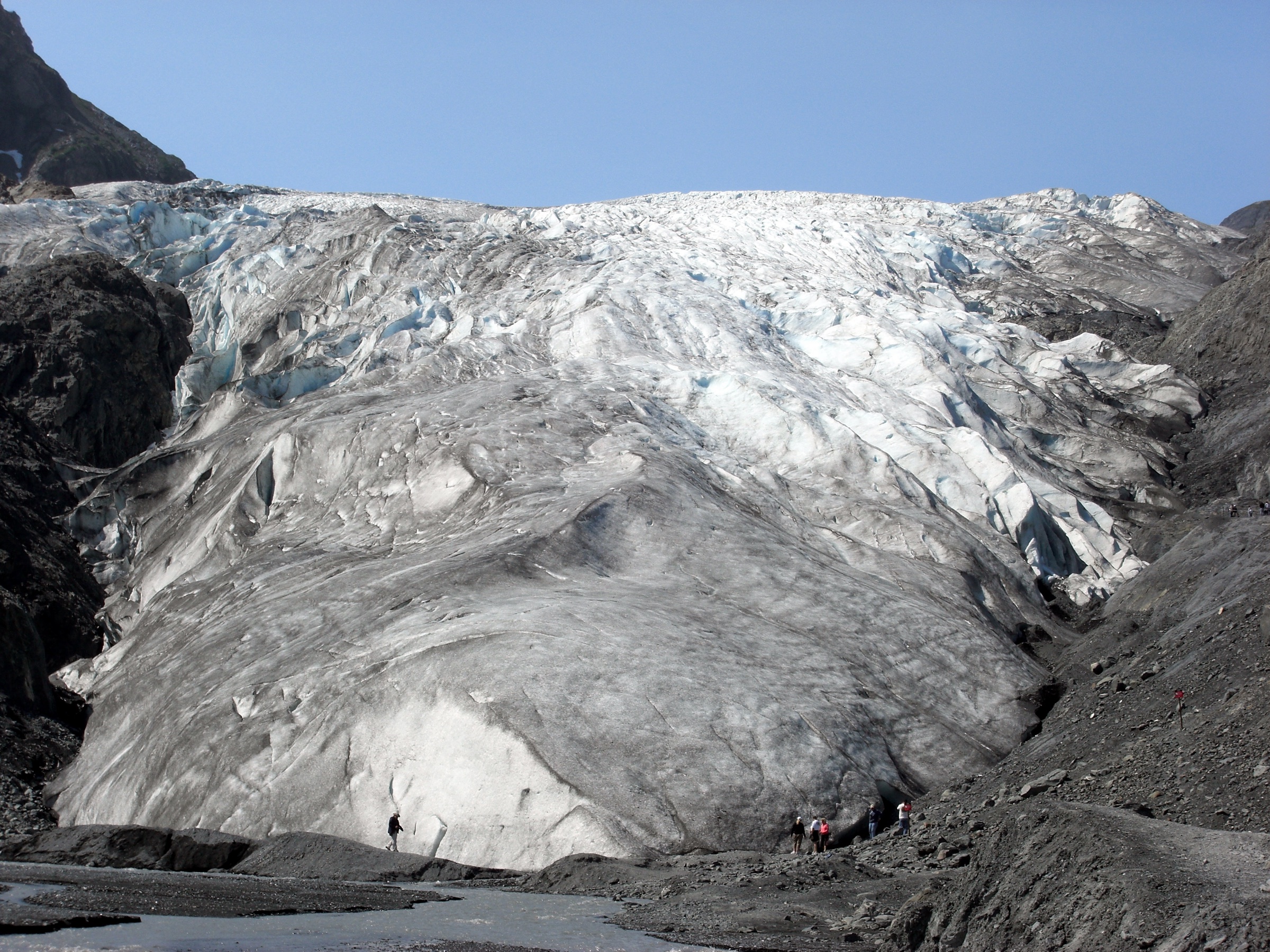
The trail system loops out from the nature centre on a wide, partly accessible lower path through cottonwood and alder, past the glacier-retreat year markers, with side spurs to the Glacier View and the steeper Glacier Overlook. The Overlook adds a short climb of around 90 m for the close-in view across the glacier’s snout, and the loop returns through the outwash plain to the centre.
Why it is essential
It is the compact, low-commitment companion to the Harding Icefield Trail — the only short walk in the catalogue that puts the visitor on the same ice and gives the recession-marker context without a full day on the mountain. Anyone who does not have the time, fitness or weather for Harding still gets the Kenai Fjords glacier experience here.
Equipment
- Walking shoes
- Light rain or warm layer
- Water
- Sun protection — the outwash plain is open
Hazards and notes
- Closed areas and barriers near the glacier face shift each season; respect signage and do not cross into the foreland.
- Uneven gravel and root sections; watch footing on the descent from the overlook.
- Bears and moose use the same lower forest; make noise and keep food contained.
Sources
- NPS — Explore the Exit Glacier area in a couple of hours
- AllTrails — Exit Glacier View and Overlook Loop
3. Lost Lake Trail
Snapshot
Itinerary
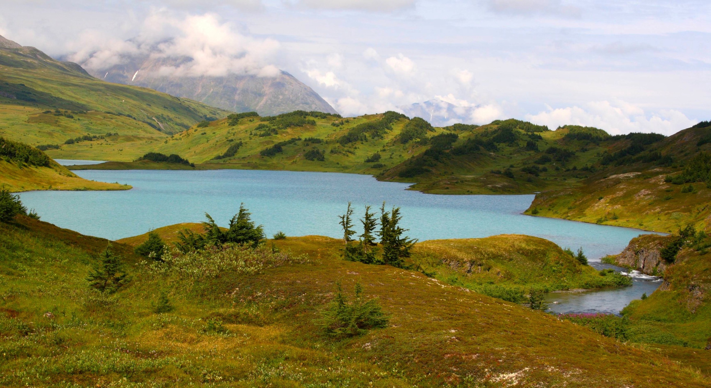
The route climbs out of coastal rainforest into a long sequence of open meadows and ridges, eventually reaching the Lost Lake basin near treeline. The north end of the through-route is sometimes called the Primrose Trail, and the high-meadow lake country is the core attraction. As a day hike from the Seward-side trailhead the lakes themselves make the natural turnaround; return is by the same path.
Why it is essential
Lost Lake is the classic Seward-area alpine-lake day hike and the only route in the catalogue that reaches a sustained high-meadow lake basin. It complements the icefield, town-mountain and coastal routes by giving the catalogue its Chugach National Forest backcountry-lake objective.
Equipment
- Sturdy hiking boots — upper meadows can be wet or snow-streaked into early summer
- Rain shell and warm layer; the high meadows are fully exposed
- 2–3 L of water plus a treatment method for natural sources
- Trekking poles useful on the long descent
- Bear-aware food storage and bear spray
- Bug protection — mosquitoes can be intense in the meadows
- Map, GPS and headtorch for the long day length
Hazards and notes
- Mud and rocky sections through the lower forest.
- Exposed weather in the high meadows; storms can move in quickly.
- Bears and wildlife throughout the corridor.
- Long day length; turn around early enough to clear the meadows before nightfall.
- Confirm the current trailhead approach locally — official USFS trail-stat text was not retrievable in the most recent verification pass.
Sources
4. Mount Marathon (Skyline / Jeep Trail loop)
Snapshot
Itinerary
The hiker route climbs Mount Marathon on the established Skyline trail and returns via the Jeep Trail, looping behind the steeper race line. The Skyline ascent is sustained and very steep, with loose ground in places, before opening into the bowl below the summit ridge. From the bowl there are immediate panoramas over Seward, Resurrection Bay and the surrounding Kenai Mountains. The descent down the Jeep Trail is longer but less exposed than the race chute, and brings the walker back into town along the established hiker line. The race route up the front face is steeper, shorter and not appropriate as a casual walk.
Why it is essential
Mount Marathon is the iconic Seward summit and the namesake of the Fourth of July Mount Marathon Race. The hiker loop is the only entry in the catalogue that climbs directly out of town to immediate panoramic views over Resurrection Bay, and it preserves the route’s racing identity without putting walkers on the race chute itself.
Equipment
- Sturdy footwear with grippy soles — the descent is loose and steep
- Trekking poles strongly recommended
- Gloves are useful on the steep loose ground
- Water, wind and rain layer
- Map and basic navigation backup; route-choice complexity is real on the upper mountain
- Traction devices if the route holds ice
Hazards and notes
- Very steep ascent and descent on loose rock and shale.
- Slippery gullies and short cliff bands; route-choice complexity above the bowl.
- The race line is dangerous as a casual walking route — use the Skyline / Jeep Trail hiker loop instead.
- Weather can change quickly; turn back if visibility drops on the upper mountain.
Sources
- Mount Marathon Race — official site
- AllTrails — Mount Marathon Skyline / Jeep Trail loop
- Alaska.org — Mount Marathon Trail
5. Tonsina Creek / Tonsina Point Trail
Snapshot
Itinerary
From the Lowell Point trailhead the Tonsina Trail climbs gently through Sitka-spruce, hemlock and cottonwood rainforest, crosses two bridged sections over the Tonsina Creek drainage and descends to the gravel-and-cobble beach at Tonsina Point. Alaska.org describes salmon-viewing in season from the bridges and an open Resurrection Bay shoreline at the beach itself. The beach is the natural day-hike turnaround. Continuing south on the Coastal Trail toward North Beach is tide-locked and is treated separately from this entry.
Why it is essential
It is the catalogue’s compact rainforest-to-coast walk, the only entry that ties Sitka-spruce forest, a clear salmon stream and an open Resurrection Bay shoreline into a single short outing. It is also the lowest-commitment route in the area for shoulder seasons when the higher trails are snowbound or saturated.
Equipment
- Hiking shoes
- Rain shell and warm layer
- Water
- Bear awareness and bear-safe food storage
- Insect protection in summer
- Traction devices in winter
Hazards and notes
- Mud and wet boardwalk or bridge surfaces, especially in shoulder seasons.
- Private land borders parts of the first section above Lowell Point; stay on the marked tread.
- Bears use the creek and beach zones, especially during salmon season — make noise and carry spray.
- Low tide is not required for Tonsina Point itself, but the further Coastal Trail south toward North Beach is tide-locked and requires separate tide planning.
Sources
- Alaska State Parks — Caines Head SRA
- Alaska State Parks — Lowell Point SRS
- Alaska State Parks — Caines Head trail-system map (JPG)
- Alaska.org — Tonsina Creek Trail
- AllTrails — Tonsina Creek Trail
Further reading
| Source | URL |
|---|---|
| NPS — Kenai Fjords National Park | nps.gov/kefj |
| NPS — Harding Icefield Trail | nps.gov |
| NPS — Exit Glacier area | nps.gov |
| USFS — Chugach National Forest | fs.usda.gov/chugach |
| Mount Marathon Race | mountmarathon.com |
| Alaska State Parks — Caines Head SRA | dnr.alaska.gov |
| Alaska State Parks — Lowell Point SRS | dnr.alaska.gov |
| Caines Head trail-system map | dnr.alaska.gov |
| Alaska.org — Tonsina Creek Trail | alaska.org |
| Wikipedia — Kenai Fjords National Park | en.wikipedia.org |
| Wikipedia — Harding Icefield | en.wikipedia.org |
| Wikipedia — Mount Marathon (Alaska) | en.wikipedia.org |
| Wikimedia Commons — Kenai Fjords National Park | commons.wikimedia.org |
| OpenStreetMap (ODbL 1.0) | openstreetmap.org |