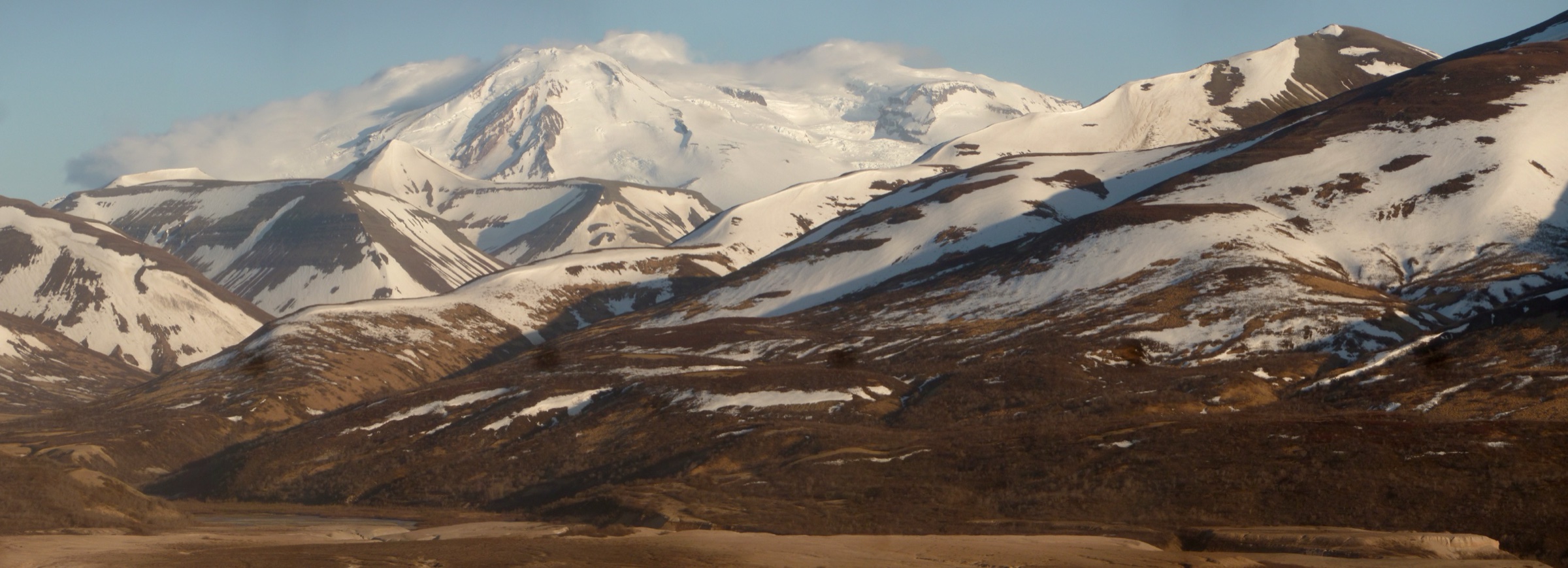
Regional overview
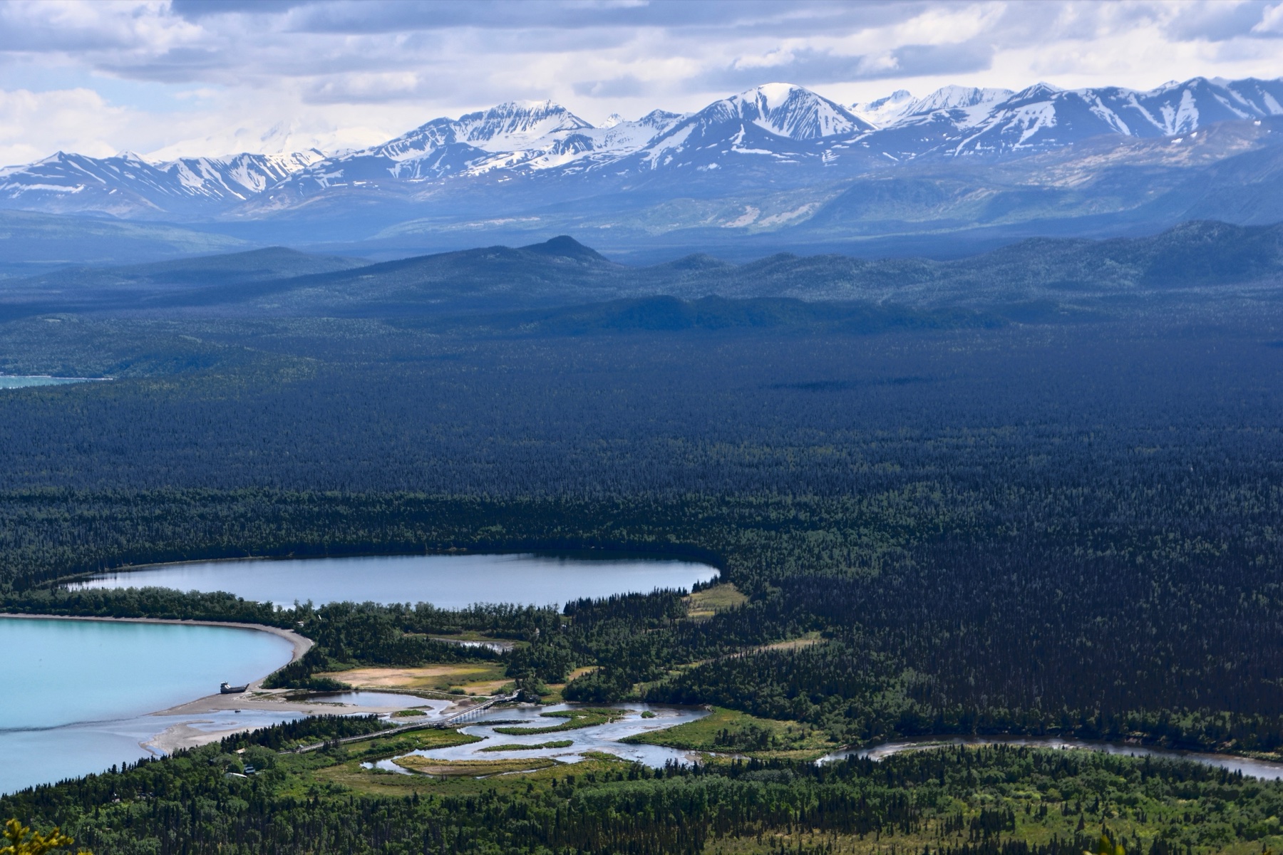
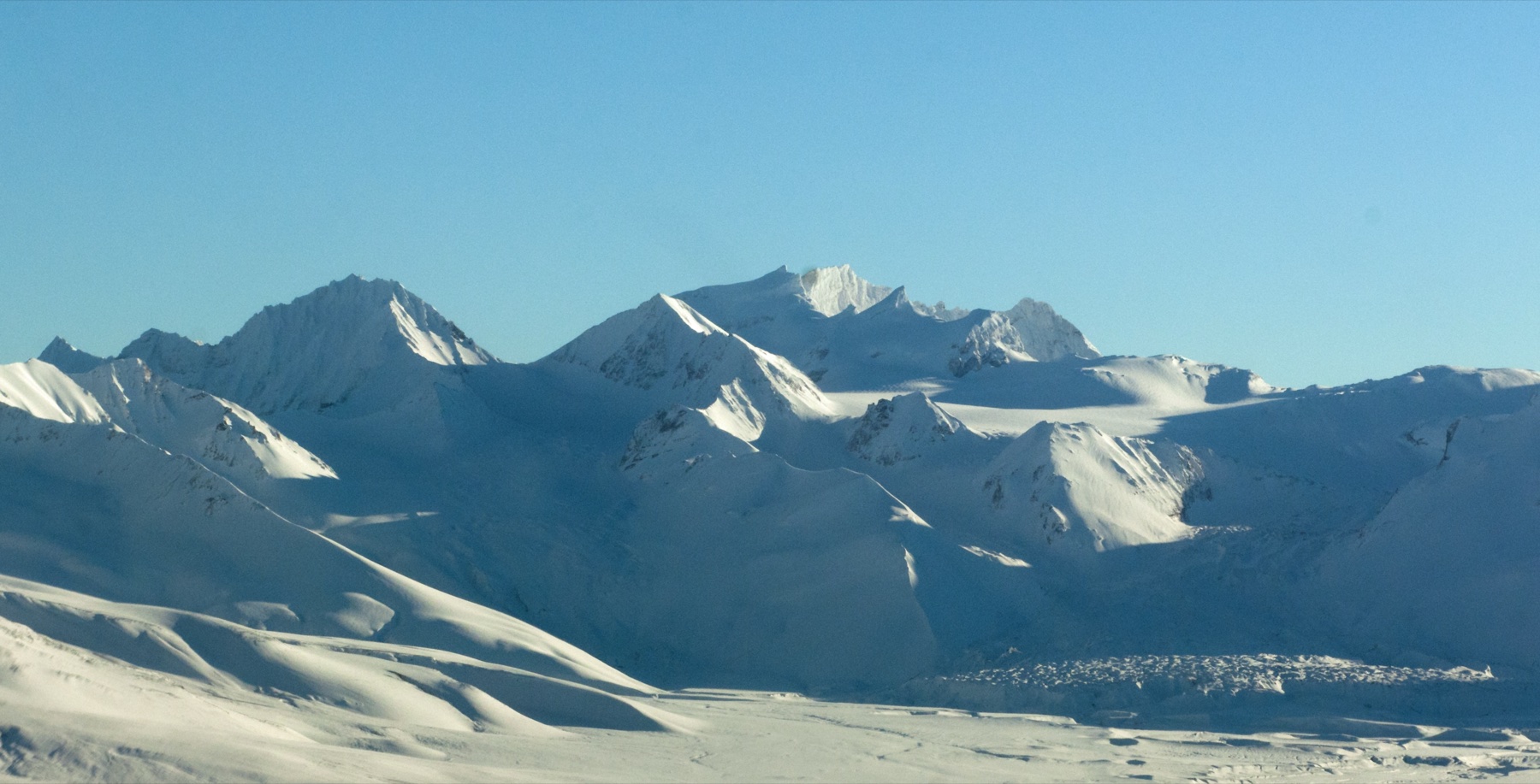
The Alaska Peninsula volcanoes are a remote volcanic arc of ash valleys, calderas, tundra slopes, crater lakes, and bear-rich river corridors. The most practical hiking centre is Katmai National Park and Preserve around Brooks Camp and the Valley of Ten Thousand Smokes; Aniakchak National Monument and Preserve represents the wilder, less-tracked volcanic interior farther south-west.
This is not a normal trail-network region. The National Park Service states that Brooks Camp has very few established hiking trails, while Aniakchak has no formal trails at all. Day hiking often depends on aircraft or boat access, ranger-led transport, private guiding, or a carefully planned backcountry drop-off.
The usual hiking season is June to September, but cold rain, fog, volcanic ash, river crossings, insects, and brown-bear encounters can be part of the summer experience. Rain gear, warm layers, navigation backup, bear-aware conduct, and conservative turnaround decisions are essential. The Katmai and Aniakchak region day-hike catalogue provides a sister entry focused on the same parks, and the Aleutian Islands volcanic ranges day-hike catalogue extends the volcanic arc south-west into the Aleutians.
Selection rationale
The selected hikes balance the few trail-verified options around Brooks Camp with the essential volcanic objectives of the Valley of Ten Thousand Smokes and Aniakchak. Dumpling Mountain is the main established summit-style hike; the Valley floor descent and Ukak Falls route represent Katmai’s 1912 Novarupta landscape; the Valley road day section represents the long volcanic access corridor; and Aniakchak is included as a candidate because a complete catalogue of Alaska Peninsula volcano hikes needs at least one caldera-floor objective, even though the data is not yet publication-grade.
Summary table
| # | Hike | Country | Route type | Distance | Gain | Max elevation | Difficulty |
|---|---|---|---|---|---|---|---|
| 1 | Dumpling Mountain Trail | USA | Out-and-back | 14.5 km | 783 m | 742 m | Hard |
| 2 | Valley of Ten Thousand Smokes floor descent | USA | Bus-assisted out-and-back | 5.4 km hiking | 305 m | Not stated | Moderate |
| 3 | Windy Creek Overlook and Ukak Falls | USA | Out-and-back | 7.1 km | 259 m | 380 m | Moderate |
| 4 | Valley of Ten Thousand Smokes Road to mile-7.5 viewpoint | USA | Out-and-back road walk | 24–26 km | Not verified | Not verified | Hard |
| 5 | Aniakchak Caldera Floor: Surprise Lake to The Gates | USA | Off-trail out-and-back / traverse candidate | Unresolved | Unresolved | Unresolved | Remote / hard |
1. Dumpling Mountain Trail
Snapshot
Itinerary
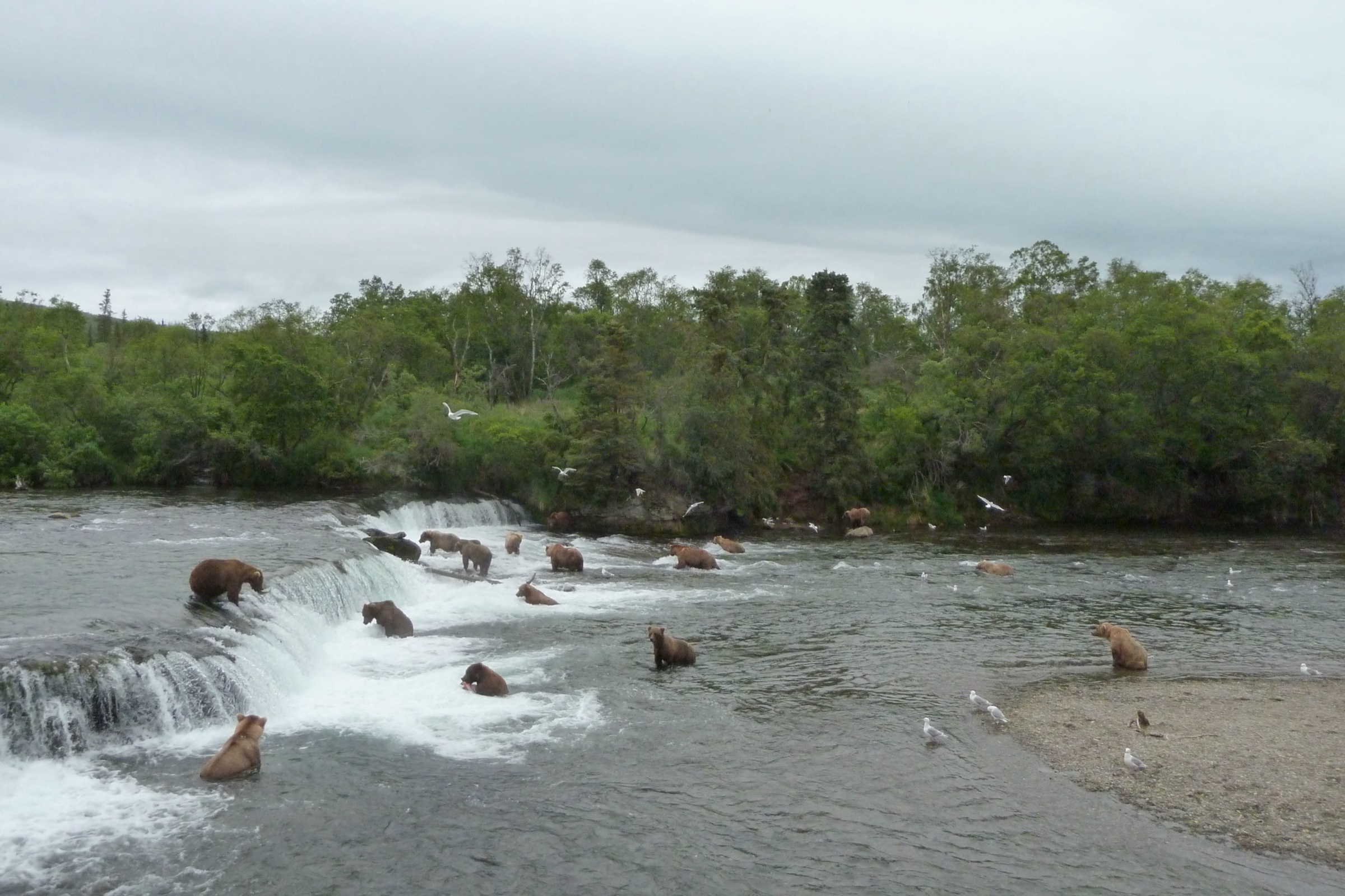
The route starts in the Brooks Camp Campground and climbs from boreal forest toward the Dumpling Mountain overlook. NPS describes an 800 ft / 244 m climb to the first overlook above Brooks Camp, with longer options continuing through subalpine and alpine tundra toward the summit. Views include Naknek Lake, Brooks River, Lake Brooks, and the surrounding Katmai volcanic landscape.
Why it is essential
Dumpling Mountain is the principal established mountain hike from Brooks Camp and gives the clearest trail-accessible high viewpoint over Katmai’s lake, river, and tundra setting.
Equipment
Mountain hiking equipment: boots, rain jacket and rain pants, warm layer, map/GPS, food, water, insect protection, bear-aware food storage, and bear spray where locally recommended.
Hazards and notes
NPS warns that weather can change rapidly and that cold, wet conditions can occur throughout summer. Bears and moose may be encountered around Brooks Camp; food and gear storage regulations must be followed. Fog can make the upper route more navigationally serious.
GPX / KML links
| Source | URL | Format / access | Reuse status |
|---|---|---|---|
| AllTrails — Dumpling Mountain Trail | alltrails.com | Interactive source map | AllTrails terms; GPX reuse not verified; source/check only |
| NPS — Hiking in Brooks Camp | nps.gov | Official route description, not GPX | Route facts usable as official source; no downloadable route file found |
Further reading
2. Valley of Ten Thousand Smokes floor descent
Snapshot
Itinerary
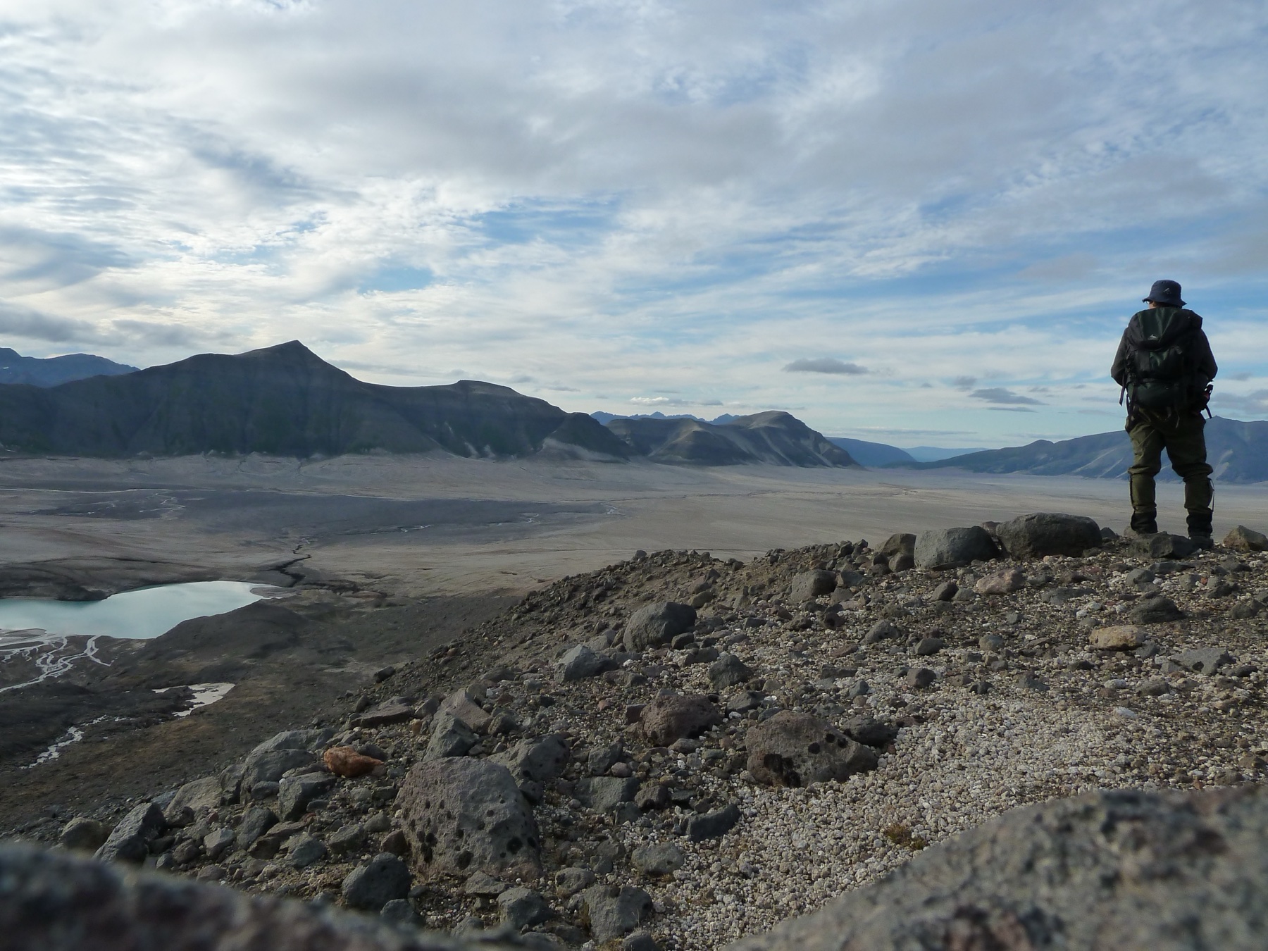
The day begins with the long bus journey from Brooks Camp to the Robert F. Griggs Visitor Center at the Valley of Ten Thousand Smokes. After the lunch stop, the official NPS-described option is a ranger-led descent to the Valley floor, entering the ash-covered landscape formed by the 1912 Novarupta eruption.
Why it is essential
This is the most accessible non-technical way to stand inside the Valley of Ten Thousand Smokes, the defining volcanic landscape of Katmai and one of the world’s classic eruption terrains.
Equipment
Mountain hiking equipment: hiking boots, rain gear, warm clothing, water, food, sun/wind protection, and a daypack. NPS specifically advises water, hiking boots, rain gear, and warm clothing for the tour.
Hazards and notes
Reservations and a fee are required for the tour according to NPS. Same-day flight arrivals and departures need enough time around the 9:00 a.m. tour start and late-afternoon return. Ash slopes, wind, rain, and bus schedule constraints make independent wandering inappropriate.
GPX / KML links
| Source | URL | Format / access | Reuse status |
|---|---|---|---|
| NPS — Ranger-led Programs, Valley of Ten Thousand Smokes Tour | nps.gov | Official route description, not GPX | Route facts usable as official source; no downloadable route file found |
Further reading
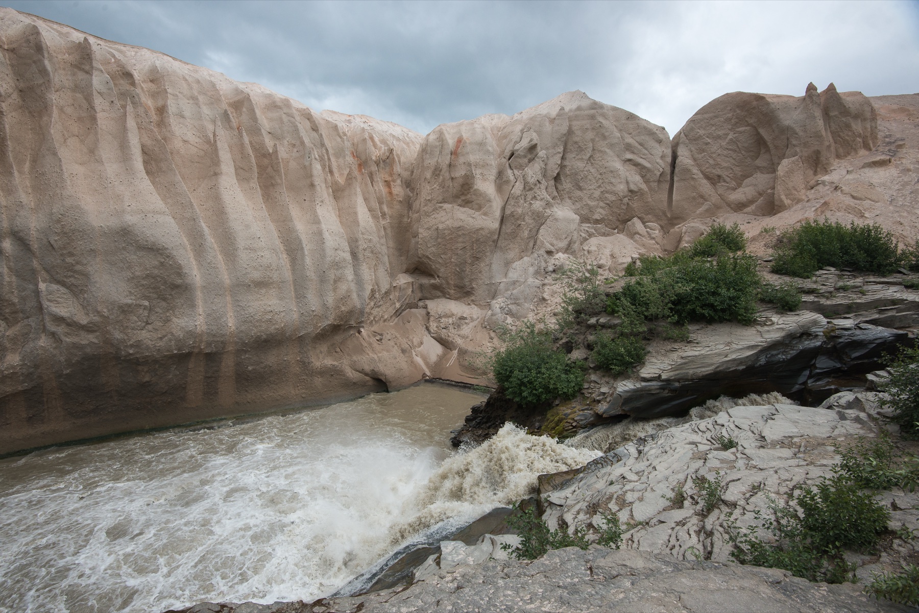
3. Windy Creek Overlook and Ukak Falls
Snapshot
Itinerary
This route uses the Valley of Ten Thousand Smokes road-end area to reach a viewpoint over Windy Creek and Ukak Falls. It gives a shorter volcanic-landscape walk than committing to long backcountry travel and pairs naturally with the bus-accessed Valley tour logistics.
Why it is essential
Ukak Falls is one of the most striking named features in the Valley of Ten Thousand Smokes area, and this route gives the catalogue a waterfall-and-canyon objective within the volcanic terrain.
Equipment
Mountain hiking equipment: boots, rain gear, warm layer, water, food, navigation backup, sun/wind protection, and bear-aware conduct.
Hazards and notes
AllTrails marks dogs as not allowed. The route is exposed to weather, and independent access depends on transport to the Valley. Loose ash or steep sections may make footing more difficult than the distance suggests.
GPX / KML links
| Source | URL | Format / access | Reuse status |
|---|---|---|---|
| AllTrails — Windy Creek Overlook and Ukak Falls | alltrails.com | Interactive source map | AllTrails terms; GPX reuse not verified; source/check only |
| NPS — Ranger-led Programs / Valley tour context | nps.gov | Official access context, not GPX | Access and safety context only |
Further reading
- AllTrails — Windy Creek Overlook and Ukak Falls
- NPS — Ranger-led Programs (Valley of Ten Thousand Smokes Tour)
4. Valley of Ten Thousand Smokes Road to mile-7.5 viewpoint
Snapshot
Itinerary
The NPS-described Valley of Ten Thousand Smokes Road begins 1.1 km from the South Platform along Lake Brooks Road and continues 37 km to the Valley. For a day-hike variant, a fit party could walk the road to the scenic viewpoint around mile 7.5 and return, staying well short of the full road end and the later stream crossings.
Why it is essential
The road is the primary access corridor into the Valley of Ten Thousand Smokes. A day section gives a long, austere walking sample of the volcanic approach landscape for hikers not using the bus tour or committing to a backcountry trip.
Equipment
Mountain hiking equipment plus long-day margin: waterproof layers, warm clothing, food, ample water or treatment, headtorch, navigation backup, insect protection, and bear-aware food handling.
Hazards and notes
This candidate needs exact day-section measurement before publication. NPS notes stream crossings on the full road and dense boreal forest for much of the route. Bears, weather, remoteness, and lack of easy exit make this more serious than a normal road walk.
GPX / KML links
| Source | URL | Format / access | Reuse status |
|---|---|---|---|
| NPS — Hiking in Brooks Camp (VTTS Road) | nps.gov | Official route description, not GPX | Official facts usable; no route file found |
| AllTrails — Valley of Ten Thousand Smokes Road | alltrails.com | Interactive source map for full road | AllTrails terms; GPX reuse not verified; day-section geometry still needs manual derivation |
Further reading
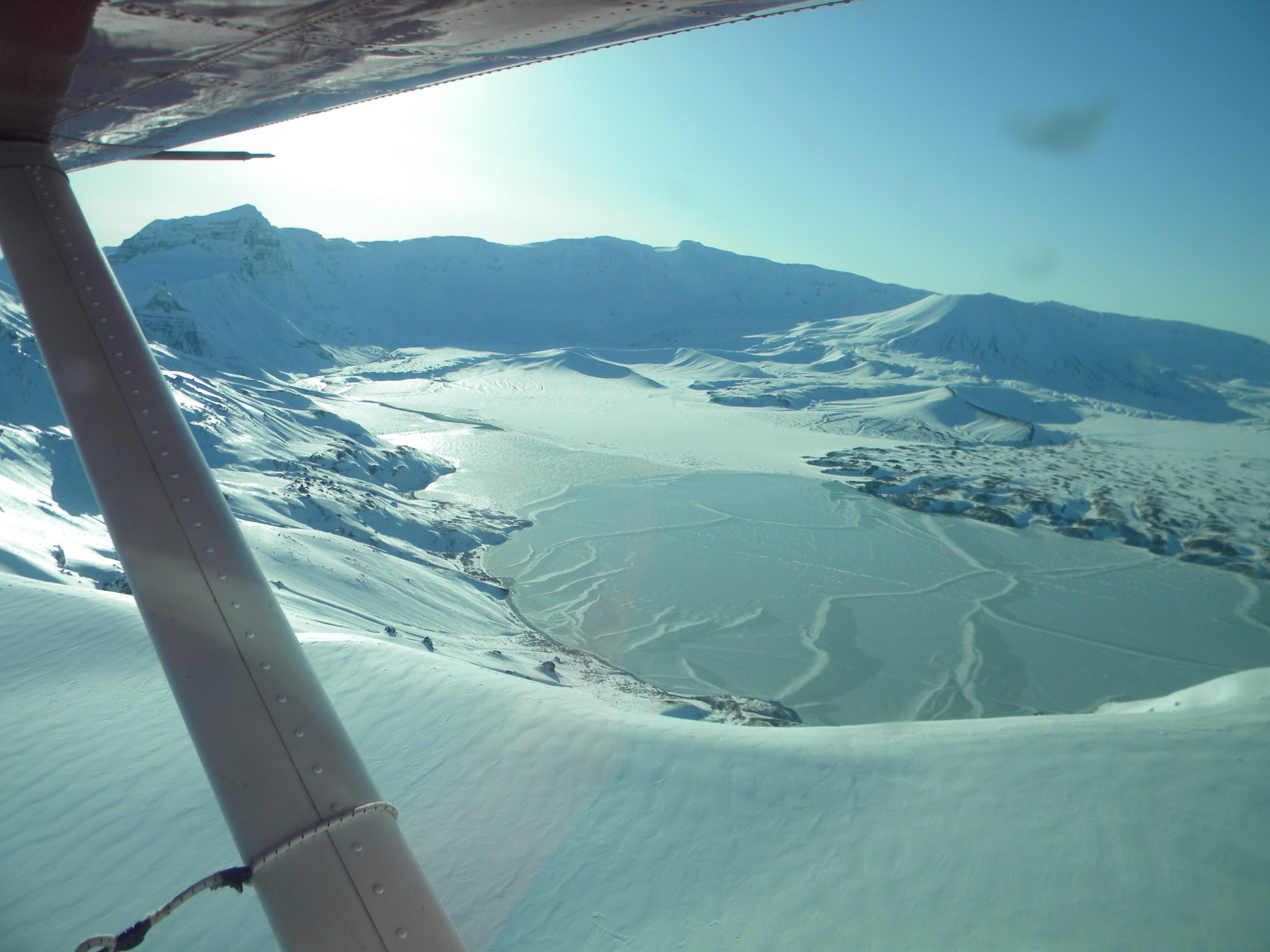
5. Aniakchak Caldera Floor: Surprise Lake to The Gates
Snapshot
Itinerary
The candidate route would use the open ash-and-cinder floor of Aniakchak Caldera, linking the Surprise Lake area with views toward The Gates, where the Aniakchak River exits the caldera wall. The NPS explicitly states that there are no formal trails in Aniakchak, but that hikers can find excellent walking conditions on the ash and cinder fields of the caldera floor.
Why it is essential
Aniakchak is one of the defining volcanic landscapes of the Alaska Peninsula. A caldera-floor day objective is essential to a regional catalogue, but it requires stronger route measurement, access confirmation, and risk review before publication.
Equipment
Remote backcountry equipment: waterproof boots, full rain gear, warm layers, navigation tools with backup, emergency communication device, bear-aware food storage, first-aid kit, water treatment, and a robust flight/weather contingency plan.
Hazards and notes
NPS warns of no formal trails, swift cold rivers, dense vegetation in parts of the monument, and use of animal trails as paths of least resistance. Weather and aircraft logistics can strand parties. This is not a casual trailhead day hike and should remain candidate-only until a specific legal, measured day route is confirmed.
GPX / KML links
| Source | URL | Format / access | Reuse status |
|---|---|---|---|
| NPS — Hiking & Backpacking in Aniakchak | nps.gov | Official terrain / access description, not GPX | No route geometry; use only as official context |
Further reading
Missing data / follow-up work
- Aniakchak needs a precise, legal, measured day-route variant before publication.
- Valley of Ten Thousand Smokes Road day-section gain, loss, and exact turnaround coordinates remain unresolved.
- No official GPX/KML files were found for the selected routes.
- AllTrails links are source maps, not confirmed licence-compatible route files.
- NPS tour dates, fees, and reservations can change; the Valley tour information should be rechecked before publication.
Further reading
| Resource | Link |
|---|---|
| NPS — Hiking in Brooks Camp | nps.gov |
| NPS — Ranger-led Programs (Valley of Ten Thousand Smokes Tour) | nps.gov |
| NPS — Backcountry Hiking and Camping in Katmai | nps.gov |
| NPS — Hiking & Backpacking in Aniakchak | nps.gov |
| AllTrails — Dumpling Mountain Trail | alltrails.com |
| AllTrails — Valley of Ten Thousand Smokes Road | alltrails.com |
| AllTrails — Windy Creek Overlook and Ukak Falls | alltrails.com |