Regional overview
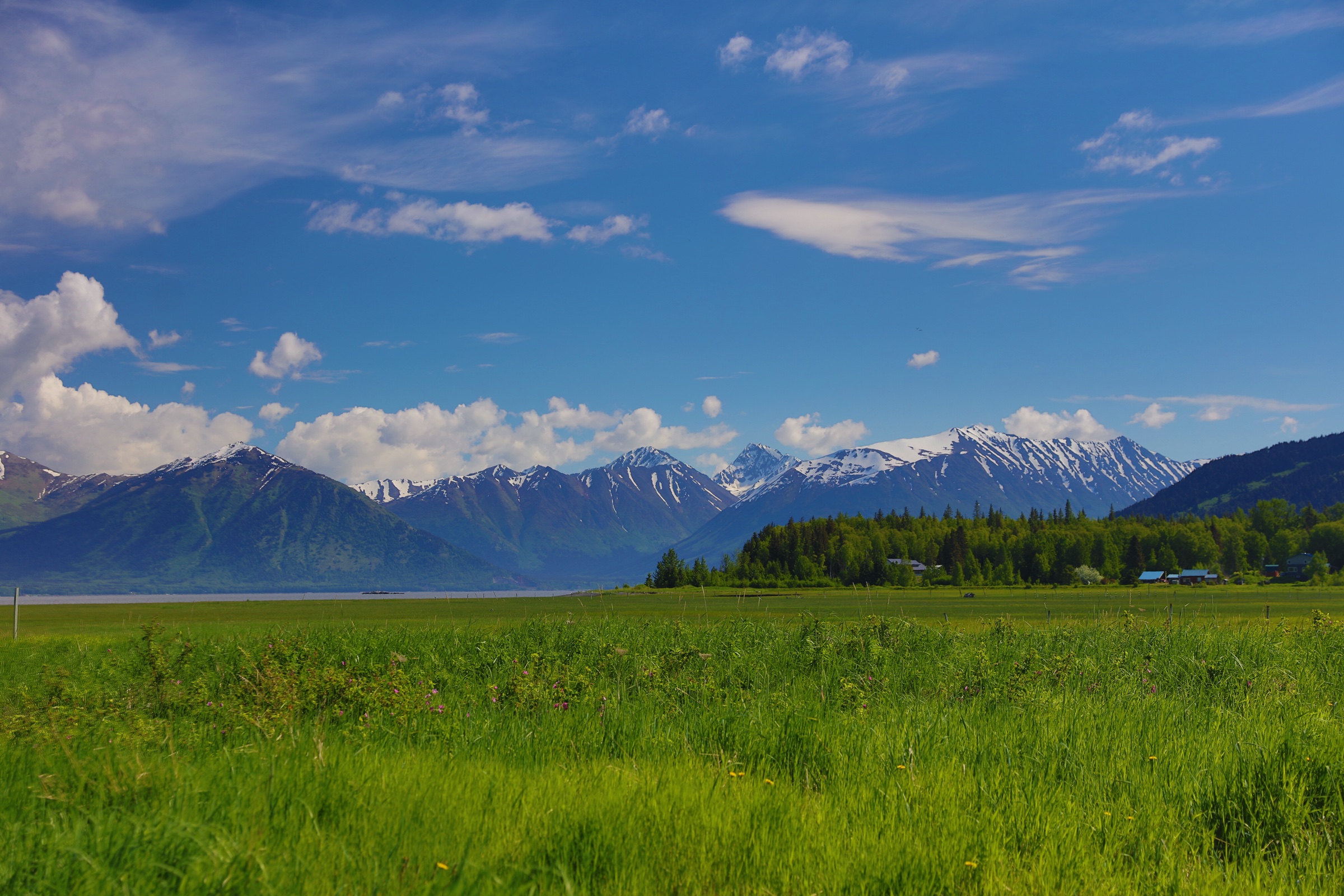
The Resurrection Pass and Hope area sits on the north-western edge of the Kenai Mountains, where Turnagain Arm, Resurrection Creek, Palmer Creek and the forested valleys of Chugach National Forest rise quickly into tundra ridges and small alpine basins. The walking character is Alaskan rather than engineered: short distances can involve steep grades, brush, mud, creek crossings, bear country and rapidly changing coastal weather. Hope itself — a small former gold-rush town at the mouth of Resurrection Creek — is the practical base and the road-access point for almost every trail in the catalogue.
The strongest day-hike set divides into four characters: steep summit viewpoints above Hope, coastal forest walking along Turnagain Arm, alpine lake objectives on rough mining roads, and day sections of the longer Resurrection Pass backcountry corridor. South of here, the Kenai Fjords and Seward day-hike catalogue covers the wetter coastal flank of the same Kenai Mountains range. Public transport to the trailheads was not verified in this pass; private vehicle access from the Seward Highway and Hope Highway is the normal assumption, and several of the upper trailheads sit at the end of unmaintained gravel roads whose status changes year to year.
The usual hiking season runs late May to September for the lower forest routes and June to September for higher routes, with snow or saturated ground possible outside midsummer. Bear-aware travel, rain gear, warm layers, navigation backup and a willingness to turn around are core safety requirements throughout the area.
Selection rationale
These five hikes represent the area’s main day-hiking identities:
- Hope Point — the steep summit panorama above Hope and Turnagain Arm.
- Gull Rock — the long coast-and-forest walk along the south shore of Turnagain Arm.
- Palmer Creek Lakes — a compact alpine lake basin reached from an old mining road.
- Resurrection Pass Trail (north day section) — a day-length sample of the area’s defining backcountry corridor.
- Bear Creek Trail — a wilder mining-road-to-valley objective near Hope.
Several entries remain partially verified because official US Forest Service trail pages were not reachable in this pass, and the AllTrails source maps are interactive views rather than confirmed licence-compatible route files. Verification notes are flagged per hike below.
Summary table
| # | Hike | Sub-region | Route type | Distance | Gain | Max elevation | Difficulty |
|---|---|---|---|---|---|---|---|
| 1 | Hope Point | Chugach NF / Hope | Out-and-back | 13.8 km | 1,056 m | 1,118 m | Hard |
| 2 | Gull Rock | Chugach NF / Turnagain Arm | Out-and-back | 18.7 km | 790 m | 126 m | Hard |
| 3 | Palmer Creek Lakes | Palmer Creek / Hope | Out-and-back | 5.1 km | 302 m | 891 m | Moderate |
| 4 | Resurrection Pass — north day section | Resurrection Creek / Chugach NF | Out-and-back day section | 10–16 km | Day-section unresolved | Day-section unresolved | Moderate to hard |
| 5 | Bear Creek Trail | Bear Creek / Hope | Out-and-back | 12.6 km | 570 m | 698 m | Moderate |
1. Hope Point
Snapshot
Itinerary
From the Hope area the route climbs steadily through wooded slopes toward the open ridge of Hope Point. The lower section is enclosed and brushy; the grade is unrelenting from the trailhead and gives little respite once the climb begins. The trail emerges onto the upper ridge after several hundred metres of vertical gain, where progressively wider views open over Resurrection Creek valley, Cook Inlet, Turnagain Arm and the surrounding Kenai Mountains. The summit ridge near 1,118 m is the natural turnaround, with the option to continue along the open spine in good weather. Descent is by the same route.
Why it is essential
Hope Point is the area’s strongest compact summit hike — steep, direct and visually representative of the transition from coastal forest to open Kenai ridgelines. No other day hike in the Hope catalogue delivers the same amount of vertical gain and panoramic ridge above Turnagain Arm in a single, road-accessible package.
Equipment
- Sturdy mountain hiking boots; trail can be slick after rain.
- Rain shell and warm layer; the upper ridge is exposed to wind and fast weather changes.
- Trekking poles strongly recommended for the steep descent.
- 2–3 litres of water; little reliable on-route water above the lower forest.
- Headtorch for a late finish.
- Bear-aware food storage and bear spray.
- Insect protection in summer.
Hazards and notes
- The route is steep throughout and can be slick after rain.
- Wind and low cloud can affect the upper ridge; turn back if visibility collapses.
- Early-season snow may remain on the upper route into June.
- Travel bear-aware; make noise in brush and avoid surprising wildlife.
- Exact trailhead access and parking should be checked locally before departure.
GPX / KML links
| Source | URL | Format / access | Reuse status |
|---|---|---|---|
| AllTrails — Hope Point | alltrails.com | Interactive source map | Proprietary; cross-check only |
| OpenStreetMap — Hope Point Trail (way 363617236) | openstreetmap.org | OSM XML / GPX export | ODbL; reusable with OSM attribution |
Further reading
2. Gull Rock
Snapshot
Itinerary
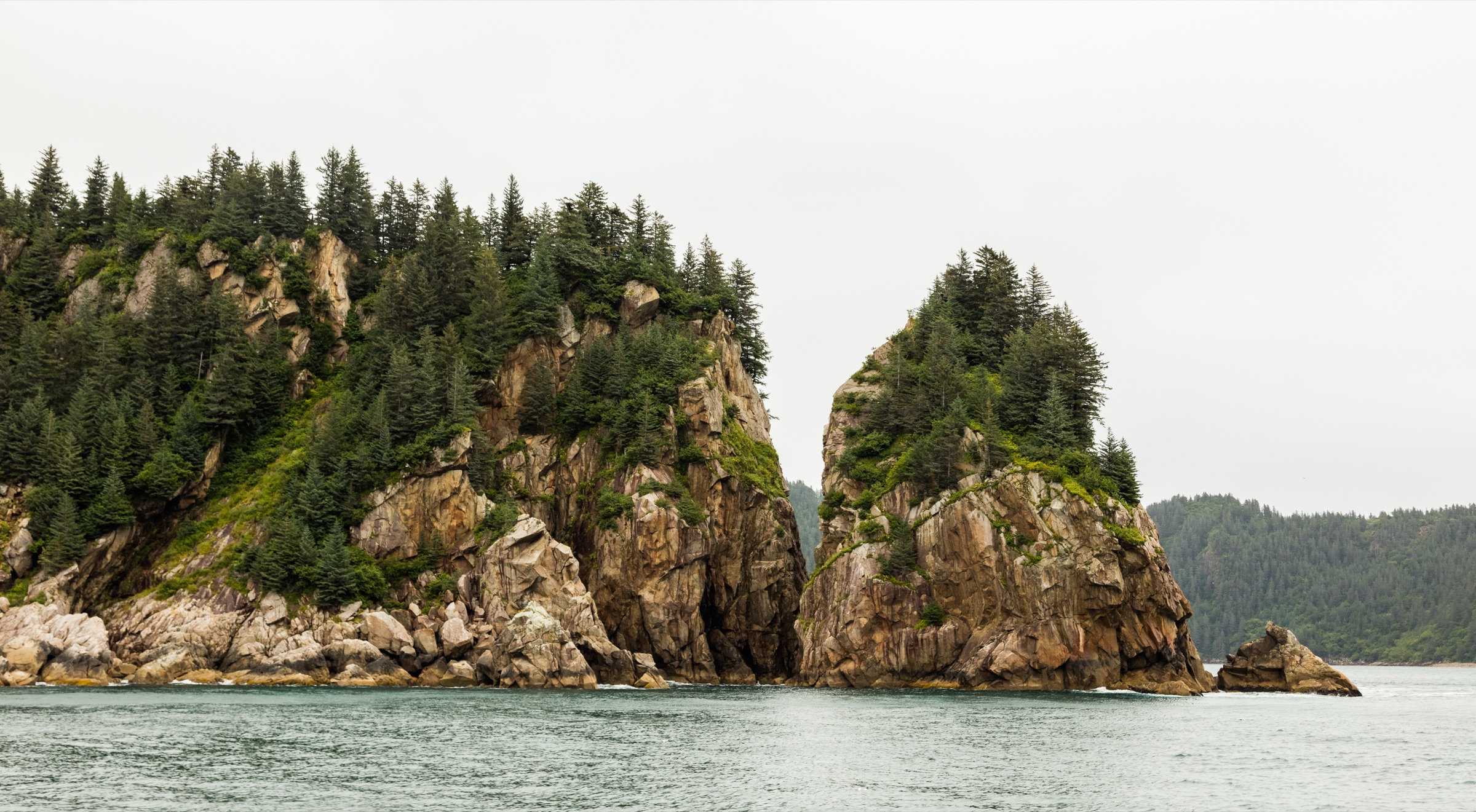
The trail begins from the Porcupine Campground area at the end of the Hope Highway and follows forested terrain along the base of the mountains above Turnagain Arm. The grade is gentle on average, but the route rolls continuously and accumulates significant elevation gain over its full length. The path passes through wet, root-bound and brushy sections, with periodic openings onto the tidewater and views across Turnagain Arm toward the Chugach Mountains on the north shore. The route reaches Gull Rock — a low headland overlooking Chickaloon Bay — at the turnaround. Return is by the same trail.
Why it is essential
Gull Rock is the classic coastal-forest counterpoint to the area’s summit hikes, showing the Kenai Mountains where they meet tidal water and low-elevation rainforest. It is the only route in the catalogue that walks at sea level for its entire length and the only one that fronts directly onto Turnagain Arm.
Equipment
- Waterproof hiking boots or trail shoes — the trail is muddy throughout.
- Rain shell and warm layer.
- Trekking poles useful for mud, roots and slick boardwalk sections.
- Map and GPS backup; the path is long and committing once started.
- 2 litres of water; little reliable on-route water on the lower benches.
- Bear-aware food storage.
- Insect protection — mosquitoes can be intense in early summer.
Hazards and notes
- AllTrails user summaries note muddy and overgrown sections throughout the route.
- Leashed dogs are reported by AllTrails, but current land-manager rules should be checked.
- Expect wet footing, brush and limited bailout options once committed along the coast.
- Tides on Turnagain Arm are extreme and the mudflats are dangerous; stay on the trail above the tideline.
GPX / KML links
| Source | URL | Format / access | Reuse status |
|---|---|---|---|
| AllTrails — Gull Rock | alltrails.com | Interactive source map | Proprietary; cross-check only |
| OpenStreetMap — Gull Rock Trail (way 8981794) | openstreetmap.org | OSM XML / GPX export | ODbL; reusable with OSM attribution |
Further reading
3. Palmer Creek Lakes
Snapshot
Itinerary
From the upper Palmer Creek Road area the trail climbs through initially brushy ground into a compact alpine basin holding the Palmer Creek (Twin) Lakes. The route is short but climbs steadily, becoming more exposed as it leaves the lower vegetation. The lakes themselves sit in a small alpine bowl beneath surrounding ridges and make a natural turnaround. Return is by the same route.
Why it is essential
This is the most concise alpine-lake objective in the Hope catalogue, adding a high-basin destination to the region’s summit, coast and valley routes. The short distance hides the gain figure; the alpine character is genuine despite the modest scale.
Equipment
- Sturdy boots; the upper section can be wet, snowy or scree-strewn well into summer.
- Rain shell and warm layer; the basin is exposed.
- Trekking poles.
- 1.5–2 litres of water.
- Bear-aware food storage.
- A high-clearance vehicle was historically useful for the upper sections of Palmer Creek Road, but current road status takes precedence over historic access notes.
Hazards and notes
- AllTrails reports Palmer Creek Road as indefinitely closed as of June 2026, while noting that the trail itself remains open. Do not treat the road as drivable without checking current Chugach National Forest status.
- Snow can linger around the basin into early summer.
- The lower approach may be brushy or wet.
- Travel bear-aware; Palmer Creek valley is genuine bear habitat.
GPX / KML links
| Source | URL | Format / access | Reuse status |
|---|---|---|---|
| AllTrails — Palmer Creek Lakes | alltrails.com | Interactive source map | Proprietary; cross-check only |
| Wikimedia Commons — Palmer Lakes Trail image (geotagged) | commons.wikimedia.org | Geotagged photo file | Trailhead context only, not a route file |
Further reading
4. Resurrection Pass Trail — north day section
Snapshot
Itinerary
This entry selects the northern Resurrection Pass Trail as a day-hike corridor rather than the full through-route. From the north trailhead at the end of Resurrection Creek Road, the path follows the Resurrection Creek drainage into forest and open backcountry terrain, climbing gradually as it heads south toward the pass. Mining-era infrastructure and small open meadows punctuate the lower section. The day-hike version should use a conservative turnaround — Caribou Creek cabin and the Juneau Lake area are logical objectives, but each commits to a long day — before committing to the multi-day pass crossing. Return is by the same trail.
Why it is essential
Resurrection Pass is the defining historic and recreational corridor of the Hope area. Even a day section gives the catalogue a necessary representative of the Kenai’s longer backcountry-trail character, and the trail’s mining history, Forest Service cabins and corridor scenery are not replicated by any of the four other routes in the selection.
Equipment
- Sturdy boots; rain shell and warm layer.
- Map, GPS and compass; the trail is long and committing once started.
- Headtorch — late finishes are common on this trail.
- 2–3 litres of water plus a treatment method if drawing from natural sources.
- Insect protection.
- Bear-aware food storage.
- Enough margin for a longer-than-planned day, including a backup plan if the turnaround needs to move further than expected.
Hazards and notes
- The full Resurrection Pass Trail is a ~61 km point-to-point backpacking route and should not be presented as a normal day hike.
- This catalogue entry needs a measured day-section variant before publication-grade statistics can be quoted.
- Bugs, mud, brush, bears and seasonal access issues on Resurrection Creek Road should be expected.
- Snow can persist on the higher pass section well into June.
GPX / KML links
| Source | URL | Format / access | Reuse status |
|---|---|---|---|
| AllTrails — Resurrection Pass Trail | alltrails.com | Interactive source map for full route | Proprietary; cross-check only |
| OpenStreetMap — Resurrection Pass Trail (way 8974936) | openstreetmap.org | OSM XML / GPX export; trail split across multiple ways | ODbL; reusable with OSM attribution |
Further reading
5. Bear Creek Trail
Snapshot
Itinerary
The route begins from Bear Creek Road, where motorised access stops at a gate. It follows an old mining road that gradually degrades into a rougher track and then continues toward the upper canyon. AllTrails notes that the trail becomes indistinct after a creek crossing about two-thirds of the way in, so the final portion is more navigational than engineered. The upper canyon makes a natural turnaround for parties who do not want to commit to off-trail terrain. Return is by the same route.
Why it is essential
Bear Creek adds a wilder, less-used Hope-area valley route and preserves the mining-road character that shaped much of the local access network. It is the catalogue’s clearest example of how quickly an “obvious” Alaskan trail can fade into navigation-sensitive ground.
Equipment
- Sturdy boots suitable for mud and creekside travel.
- Rain shell and warm layer.
- Map, GPS and compass; the upper trail is indistinct.
- Trekking poles for stream crossings and rougher ground.
- 2 litres of water; treatment method for natural sources.
- Bear-aware food storage; the valley name is not accidental.
- Insect protection.
Hazards and notes
- AllTrails notes dense brush, muddy sections, creek crossings and a loss of defined trail after roughly two-thirds of the route.
- Treat this as a navigation-sensitive outing rather than a maintained path.
- Verify current land status and gate access before departure.
- Bear-aware travel is essential; make noise, carry bear spray and avoid surprising wildlife.
GPX / KML links
| Source | URL | Format / access | Reuse status |
|---|---|---|---|
| AllTrails — Bear Creek Trail | alltrails.com | Interactive source map | Proprietary; cross-check only |
Further reading
Further reading
| Resource | URL |
|---|---|
| Chugach National Forest — US Forest Service | fs.usda.gov/chugach |
| Wikipedia — Hope, Alaska | en.wikipedia.org |
| Wikipedia — Resurrection Pass | en.wikipedia.org |
| Wikipedia — Turnagain Arm | en.wikipedia.org |
| Wikipedia — Kenai Mountains | en.wikipedia.org |
| AllTrails — Hope Point | alltrails.com |
| AllTrails — Gull Rock | alltrails.com |
| AllTrails — Palmer Creek Lakes | alltrails.com |
| AllTrails — Resurrection Pass Trail | alltrails.com |
| AllTrails — Bear Creek Trail | alltrails.com |