This 9-day Tour du Mont Blanc itinerary follows a high-level route around the Mont Blanc massif, using selected transport links to make the circuit possible within a shorter timeframe. It is suited to fit trekkers who are comfortable with long mountain days, sustained elevation gain, exposed paths, and variant routes. Several stages include high passes or technical sections that should only be attempted in stable weather.
Overview
- Start: Chamonix / Les Houches, France
- Finish: Chamonix, France
- Duration: 9 days
- Route style: High-level TMB route with variants and selected transport shortcuts
- Best suited to: Experienced or well-prepared hikers with good mountain fitness
Main stages
- Les Houches – Refuge Miage / Auberge du Truc / Refuge Plan Glacier option
- Miage / Truc / Plan Glacier – Refuge de la Croix du Bonhomme
- Refuge de la Croix du Bonhomme – Val Veny
- Val Veny – Rifugio Bertone
- Rifugio Bertone – Gîte Alpage de la Peule
- Gîte Alpage de la Peule – Relais d’Arpette
- Relais d’Arpette – Col de Balme / Tré-le-Champ
- Tré-le-Champ – Refuge Lac Blanc
- Refuge Lac Blanc – Chamonix / Les Houches
This itinerary uses several shortcuts, including the Bellevue cable car, the Les Contamines–Notre-Dame-de-la-Gorge shuttle, lifts around Courmayeur where available, and cable car options above Chamonix. Walking times are approximate and do not include stops, meals, weather delays, or photography.
Important route notes
Several variants on this route are only suitable in good weather. The Col du Tricot, Col des Fours, Fenêtre d’Arpette, and other high or exposed sections should be avoided in storms, poor visibility, heavy snow, or unstable conditions. Early-season snow may make parts of the route unsafe, especially in late June and early July.
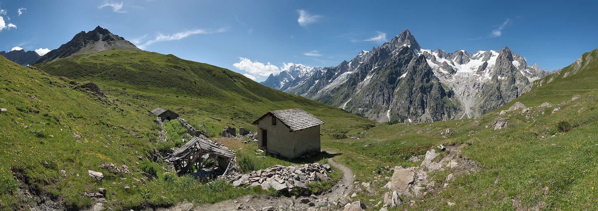
Day 1: Les Houches to Refuge Miage, Auberge du Truc, or Refuge Plan Glacier
- Standard option to Auberge du Truc: 7.68 km, +811 m / -896 m
- Plan Glacier option from valley floor: 13.3 km, +1,856 m / -187 m, 5–6 hrs
- Plan Glacier option using Bellevue cable car: 8 km, +1,090 m / -196 m
The route begins from Les Houches, with the Bellevue cable car often used to avoid the lower forested ascent. From Bellevue, the trail heads towards the Col du Tricot, passing the suspension bridge near the Bionnassay Glacier before climbing to the grassy col.
The standard overnight option is Auberge du Truc or Refuge Miage. A more serious alternative is Refuge Plan Glacier, reached by an exposed, unsignposted balcony path from the Col du Tricot. This approach is not suitable for hikers uncomfortable with exposure, narrow paths, or poor weather. A packed lunch is required for the Plan Glacier option, as there are no reliable food stops on that approach.
Day 2: Miage / Truc / Plan Glacier to Refuge de la Croix du Bonhomme
- Approximate distance: 22.3 km
- Elevation: +1,543 m / -1,795 m
- Time: 7–8 hrs
This is a long stage with a significant descent into the Miage Valley, followed by travel through Les Contamines and Notre-Dame-de-la-Gorge. In peak season, the shuttle between Les Contamines and Notre-Dame-de-la-Gorge can reduce walking time.
From Notre-Dame-de-la-Gorge, the route climbs the old Roman road, passes Refuge Nant Borrant and Refuge de Balme, then continues to the Col du Bonhomme and Col de la Croix du Bonhomme. Snow may remain on this section early in the season.
Suggested lunch stops: Refuge Nant Borrant or Refuge de Balme
Overnight: Refuge de la Croix du Bonhomme, 2,443 m
Day 3: Refuge de la Croix du Bonhomme to Val Veny
- Via Les Chapieux to Rifugio Elisabetta: 18.7 km, +1,032 m / -1,288 m, 5–6 hrs
- Via Col des Fours to Rifugio Elisabetta: 16.6 km, +999 m / -1,260 m, 5–6 hrs
- Additional distance to Cabane Combal: 3.3 km, about 1 hr
In stable weather, the Col des Fours variant provides a higher, more remote alternative to the standard route. This variant bypasses Les Chapieux and descends towards Ville des Glaciers. It should not be attempted in poor weather or low visibility.
The standard route descends to Les Chapieux, where a shuttle may be available to Ville des Glaciers. From there, the trail climbs to the Col de la Seigne, crossing from France into Italy, before descending into Val Veny.
Possible side trip: Beaufort cheese farm at Ville des Glaciers
Overnight: Rifugio Elisabetta or Cabane Combal
Day 4: Val Veny to Rifugio Bertone
- Approximate distance: 20.6 km
- Elevation: +1,350 m / -1,552 m
- Time: 6–7 hrs
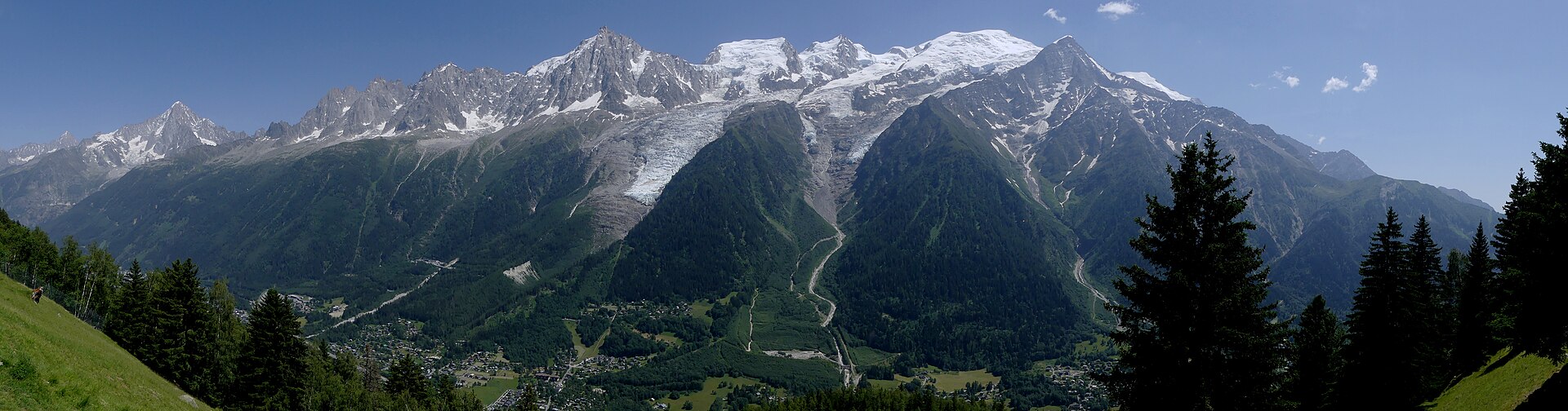
The route climbs from the Val Veny floor and follows the south side of the valley, with views across to Monte Bianco and the glaciated massif. Rifugio Maison Vieille is a useful food stop.
During the lift operating season, the Maison Vieille chairlift and Dolonne cable car can be used to reduce the long descent into Courmayeur. From Courmayeur, the route climbs again to Rifugio Bertone, positioned high above the town.
Suggested lunch stop: Rifugio Maison Vieille or Courmayeur
Overnight: Rifugio Bertone
Day 5: Rifugio Bertone to Gîte Alpage de la Peule
- Approximate distance: 20.9 km
- Elevation: +1,193 m / -1,095 m
- Time: 6–7 hrs
This stage follows the Italian Val Ferret before climbing to the Grand Col Ferret at 2,537 m, the border between Italy and Switzerland. The standard balcony route from Rifugio Bertone is the more practical option when also crossing the Grand Col Ferret on the same day.
A higher variant via Mont de la Saxe and Tête de la Tronche is possible in good conditions but adds difficulty and exposure. It should not be used in poor weather.
Suggested lunch: Hotel Chalet Val Ferret or a packed lunch
Overnight: Gîte Alpage de la Peule, a working dairy farm on the Swiss side of the pass
Day 6: Gîte Alpage de la Peule to Relais d’Arpette
- Approximate distance: 22.7 km
- Elevation: +743 m / -1,187 m
- Time: 5–6 hrs
The route descends through the Swiss Val Ferret, passing Ferret, La Fouly, Praz de Fort, Les Arlaches, and other small settlements. This section is generally less rugged than the Italian and French high passes, with more pasture, forest, and valley walking.
After Champex-Lac, the route continues uphill towards Relais d’Arpette, which is positioned for the Fenêtre d’Arpette variant the following day.
Suggested lunch: Supplies from La Fouly
Overnight: Relais d’Arpette
Day 7: Relais d’Arpette to Col de Balme, Charamillon, or Tré-le-Champ
- To Tré-le-Champ: 22 km, +1,981 m / -2,228 m, 7–8 hrs
- To Charamillon: 18 km, +1,904 m / -1,612 m, 6–7 hrs
- To Refuge Col de Balme: 16 km, +1,904 m / -1,316 m, 6–7 hrs
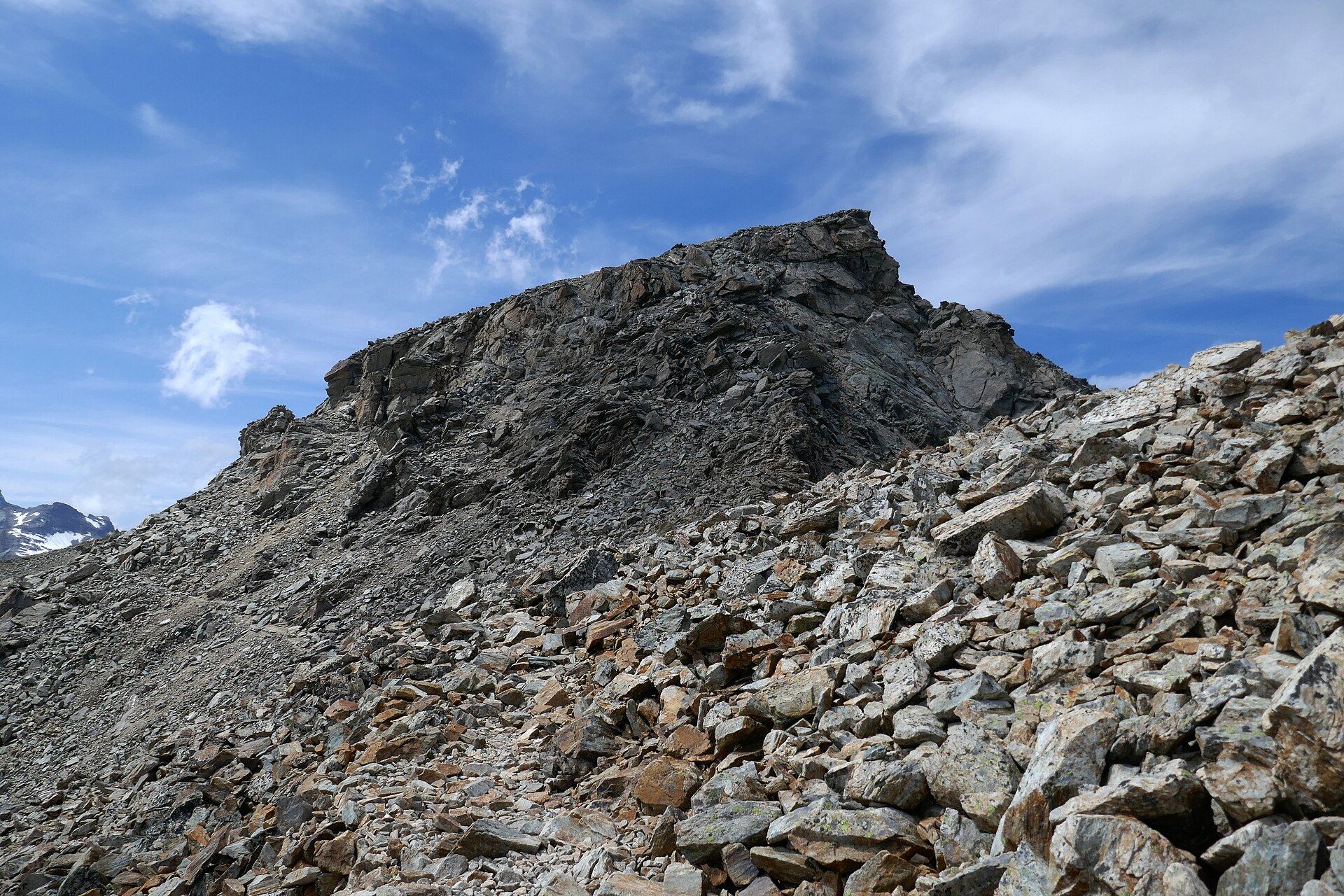
This is one of the hardest days of the itinerary. The Fenêtre d’Arpette variant crosses rough, high mountain terrain and should not be attempted in bad weather, poor visibility, or early-season snow. The trail is less clearly marked than other parts of the TMB, and the upper boulder field requires care.
After crossing the Fenêtre d’Arpette, the route descends near the Trient Glacier, passes Buvette du Glacier, and climbs again towards Refuge Les Grands and the Col de Balme, before descending towards the French side.
Required: Packed lunch and extra water
Alternative: Bovine route in poor weather
Overnight: Refuge Col de Balme, Gîte d’Alpage Les Écuries de Charamillon, or accommodation in Tré-le-Champ
Day 8: Tré-le-Champ to Refuge Lac Blanc
- Approximate distance: 5 km
- Elevation: +982 m / -23 m
- Time: 2–3 hrs
This shorter stage climbs through the Aiguilles Rouges side of the Chamonix Valley. The route includes the well-known TMB ladders, a series of fixed ladders and metal steps on the ascent. Hikers with vertigo may need an alternative route.
At Tête aux Vents, the trail can continue towards La Flégère or detour to Lac Blanc. Staying overnight at Refuge Lac Blanc allows the lake area to be experienced after most day visitors have left.
Overnight: Refuge Lac Blanc
Day 9: Refuge Lac Blanc to Chamonix or Les Houches
- Full route: 19.8 km, +839 m / -2,183 m, 5–6 hrs listed, potentially longer for the full descent
- Short options: La Flégère cable car or Plan Praz gondola
The final stage follows the balcony trail above Chamonix, with views across to Mont Blanc in clear weather. Several exit options are available. The route can be shortened by descending from La Flégère to Les Praz, or by continuing to Plan Praz and taking the gondola to central Chamonix.
For a fuller circuit, the route can continue from Plan Praz to Le Brévent and then descend towards Les Houches. This is a long and demanding finish, especially after eight previous days of trekking.
Possible lunch stops: Brévent café or Refuge Bellachat
Finish: Chamonix or Les Houches, depending on the chosen descent