Regional overview
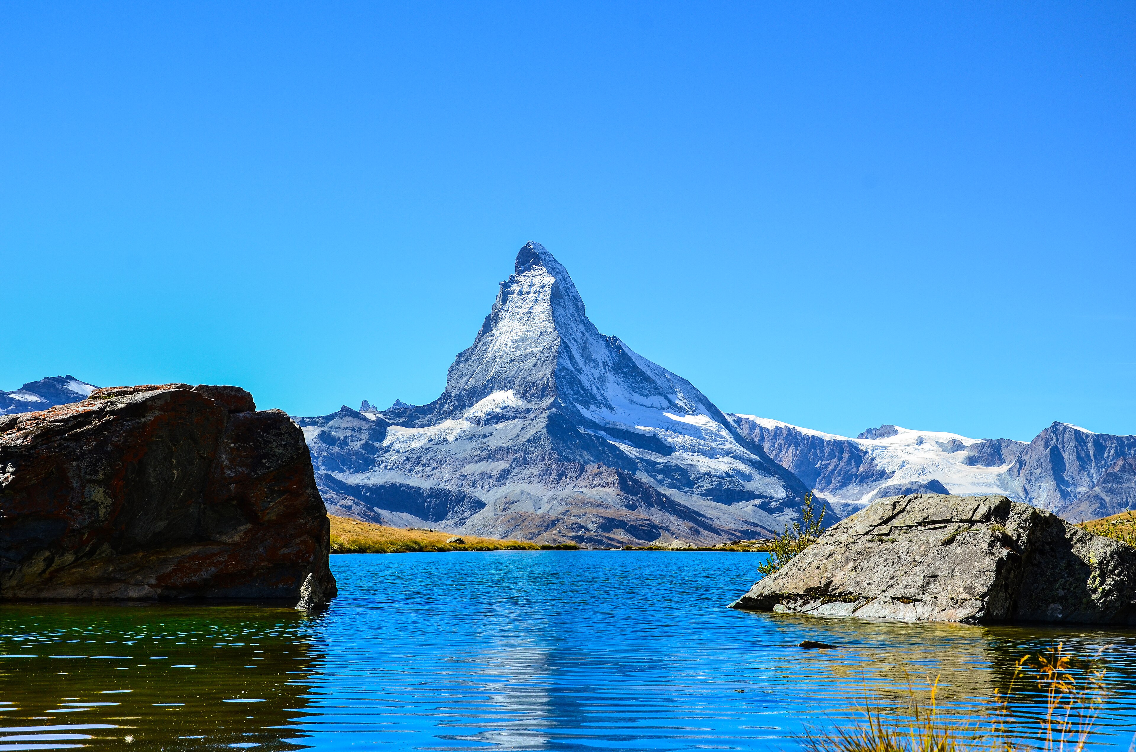
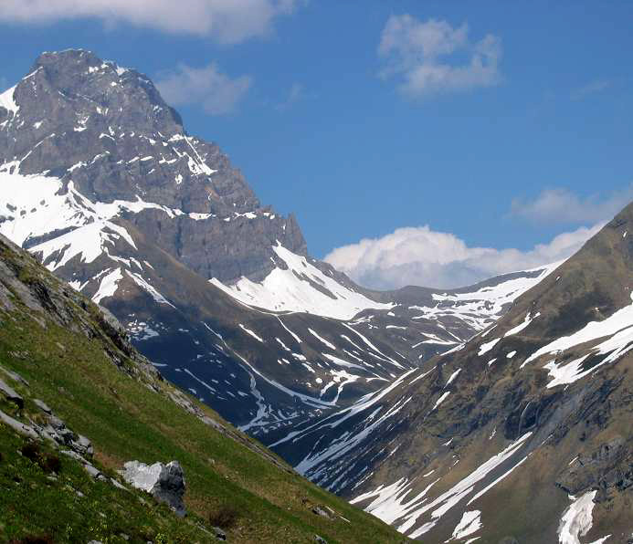
The Central and Eastern Swiss Alps covered here run from the steep pass routes of Uri and Glarus to the high, dry valleys of the Engadin and the glaciated Bernina group. The hiking character changes quickly: Uri offers long historic traverses between deep valleys; Glarus has rugged limestone and lake basins; the Engadin combines larch forests, wildlife valleys, high panoramic balconies and access to glacier viewpoints.
Main hiking centres include Engelberg, Altdorf and Attinghausen for Uri; Murg and the Lake Walen / Glarnerland area for the Glarus Alps; S-chanf, Zernez, Pontresina and St Moritz for the Engadin; and Diavolezza for the Bernina high-alpine routes. Most routes use marked Swiss mountain paths, often with excellent public transport or lift access, but several remain serious because of length, altitude, snow or rapid weather changes.
The usual hiking season is summer to early autumn. Lower and mid-altitude routes may be possible from June, while higher Bernina routes are normally safer later in summer. The Swiss National Park has strict protection rules: hikers must remain on marked paths and rest areas, dogs are not allowed, cycling and drones are prohibited, and the park is closed in winter.
Selection rationale
These five hikes were selected to represent the region’s main walking characters: a classic Uri pass traverse, a Glarus lake-and-forest circuit, the Swiss National Park’s most famous wildlife valley, an Upper Engadin balcony route, and a high Bernina glacier-view summit walk.
Summary table
| # | Hike | Country | Route type | Distance | Gain | Max elevation | Difficulty |
|---|---|---|---|---|---|---|---|
| 1 | Surenenpass Traverse | Switzerland | Public-transport / lift-assisted traverse | 24.1 km | 704 m | 2,292 m | Difficult |
| 2 | Murgseen Rundweg | Switzerland | Loop | 14.5–15 km | 864–950 m | 1,985 m | T2 / moderate, physically demanding |
| 3 | Val Trupchun Circular Hike | Switzerland | Loop | 13.9–14 km | 441 m | 2,051 m | Moderate |
| 4 | Muottas Muragl–Alp Languard Panorama | Switzerland | Lift-assisted point-to-point | 6.8 km | 104 m | 2,454 m | Easy |
| 5 | Diavolezza–Munt Pers | Switzerland | Lift-assisted out-and-back | 3.9 km | 240 m | 3,206 m | Easy to moderate; surefootedness required |
1. Surenenpass Traverse
Snapshot
Itinerary
The route crosses from Engelberg into the Uri Reuss valley by way of the Surenenpass. The full official route starts in Engelberg and finishes at Attinghausen; many walkers use the Fürenalp and Brüsti cableways to reduce the amount of ascent and descent. From Fürenalp the path follows the marked mountain hiking trail via Blackenalp and Unter Schatzboden to the Surenenpass. It then descends into Uri by Langschnee, Angistock, Geissrüggen and Alp Grat towards Brüsti, with final descent to Attinghausen by cableway where operating.
Why it is essential
This is one of the major historic and scenic pass crossings of Central Switzerland. It links Engelberg with the Uri Reuss valley, forms part of the Via Alpina corridor, and gives a strong representative sample of the long mountain traverses that define Uri hiking.
Equipment
- Sturdy boots
- Weatherproof layer
- Warm layer
- Water and food
- Map/GPS
- Navigation backup
- Sun protection
- Trekking poles recommended
- Headtorch recommended for the full route
- Microspikes may be useful if early-season snow remains on the pass
Hazards and notes
- Long route with a very large descent on the full Engelberg–Attinghausen version
- Snow can remain on the pass in early summer
- High open terrain is exposed to rapid weather changes
- Cableway timetables should be checked before departure
- Lift-assisted variants depend on operating schedules
GPX / KML links
| Source | URL | Format | Notes |
|---|---|---|---|
| Lucerne / Engelberg official route page | luzern.com | GPX download offered on page | Terms not fully resolved. Official GPX button present; use as route-reference source |
Sources
2. Murgseen Rundweg
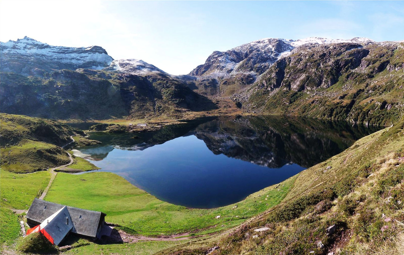
Snapshot
Itinerary
The loop reaches the three Murg lakes above the Murgtal. From the valley access point the route climbs steeply through forest and past Gspon towards Alp Unter Mürtschen. It continues below the Mürtschenstock area to the Murgseefurggel and the upper lake basin, then passes the Murgsee hut and the lower lakes. The descent returns through the protected Swiss stone pine forest reserve, via Alp Guflen and Alp Mornen, back towards the starting area.
Why it is essential
This is the classic Glarus lake circuit for the region: a compact but rugged day linking waterfalls, alpine lakes, peat meadows, rock scenery and a protected stone pine forest. Local tourism presents it as a classic and highly popular hike, while MySwitzerland lists it as route 933, the Murgsee Rundweg.
Equipment
- Sturdy boots
- Weatherproof layer
- Warm layer
- Water and food
- Map/GPS
- Sun protection
- Trekking poles recommended
Hazards and notes
- White-red-white marked mountain hiking route
- Rated T2 by Outdooractive’s Swiss route source
- Steep climb
- Seasonal snow or storm damage can interrupt access
- Murgsee bus / taxi bus requires prior registration
- No regular public transport between Murg and Merlen
GPX / KML links
| Source | URL | Format | Notes |
|---|---|---|---|
| Outdooractive route page | outdooractive.com | GPX / KML / FIT buttons visible | Outdooractive terms not resolved. Route-file controls present; direct download URL unresolved |
| MySwitzerland route 933 | myswitzerland.com | Official route map / source route | Terms not resolved. Suitable for verification; direct reusable GPX not found |
Sources
- MySwitzerland route 933
- Glarnerland tourism route page
- Outdooractive mobile route page
- Wikimedia Commons image source
3. Val Trupchun Circular Hike
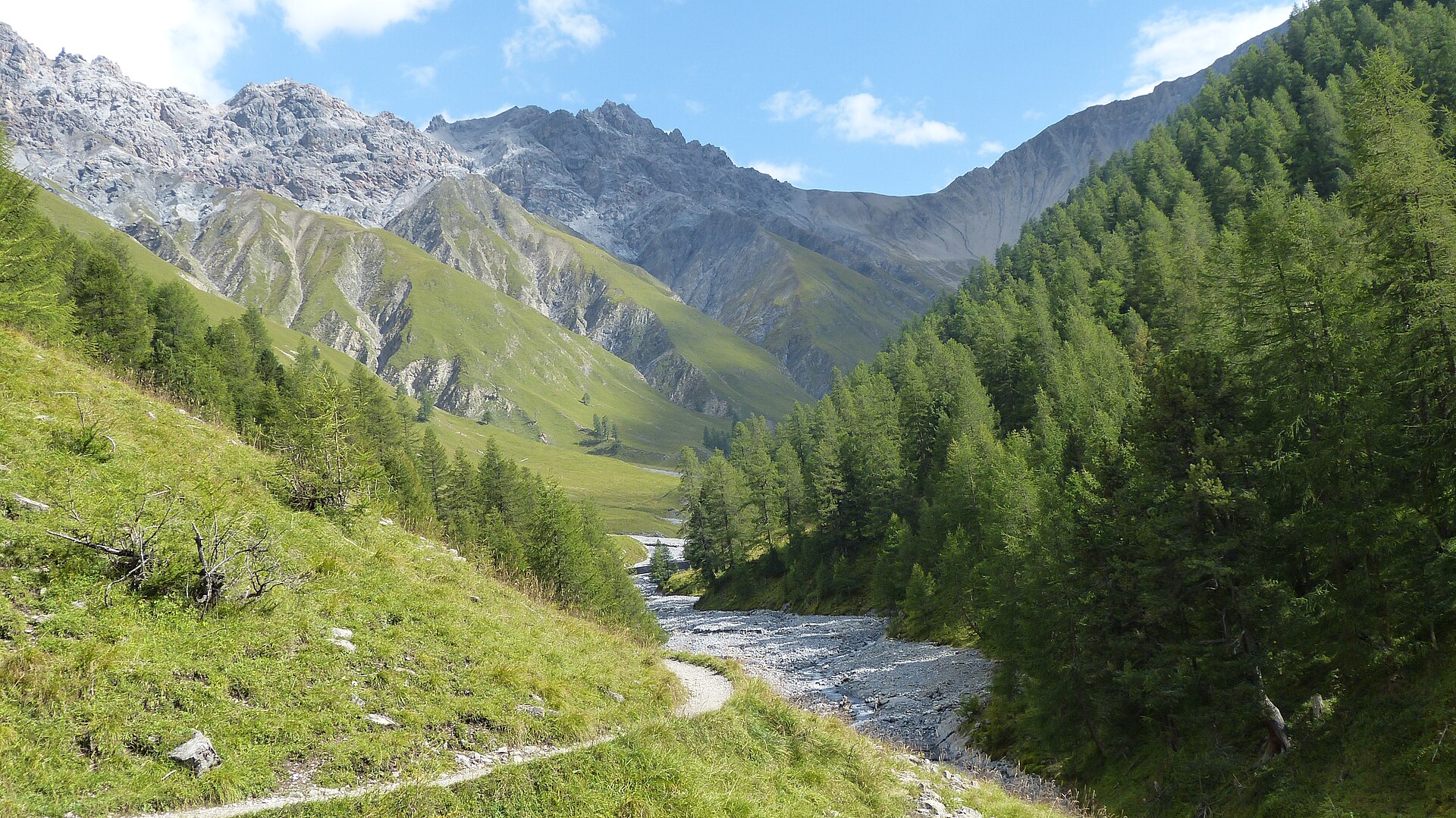
Snapshot
Itinerary
The route starts from the Prasüras access point near S-chanf and enters Val Trupchun, one of the most important wildlife valleys in the Swiss National Park. It first follows forest and riverside terrain towards Punt da Scrins, then enters the national park and continues on the signed valley route beside the Ova da Trupchun. Rest areas and wooden bridges structure the route towards Alp Trupchun. The return uses the permitted trail back via the Varusch area and the access road.
Why it is essential
Val Trupchun is a defining Engadin hike because it combines accessible mountain walking with the strict protection and wildlife character of the Swiss National Park. Engadin’s official route source describes it as the park’s most wildlife-rich valley, and the Swiss National Park lists Alp Trupchun as one of its official walking routes.
Equipment
- Hiking shoes or boots
- Weatherproof layer
- Warm layer
- Water and food
- Map/GPS
- Sun protection
- Binoculars strongly recommended for wildlife observation
Hazards and notes
- Inside the Swiss National Park
- Hikers must stay on marked paths and rest areas
- Dogs are not allowed, even on a lead
- Natural objects must not be removed
- Campfires, cycling, bathing and drones are prohibited
- Park is closed in winter
- Wildlife should be observed quietly and from the permitted route
GPX / KML links
| Source | URL | Format | Notes |
|---|---|---|---|
| Engadin Maps / Engadin Tourismus route page | maps.engadin.ch | GPX / KML / FIT buttons visible | Terms not resolved. Route-file controls present; direct download URL unresolved |
| Swiss National Park walking-route page | nationalpark.ch | Official route listing / map reference | Terms not resolved. Suitable for route verification; no direct GPX found |
Sources
- Engadin Maps route page
- Swiss National Park trails and routes
- Swiss National Park protection regulations
- Wikimedia Commons image source
4. Muottas Muragl–Alp Languard Panorama
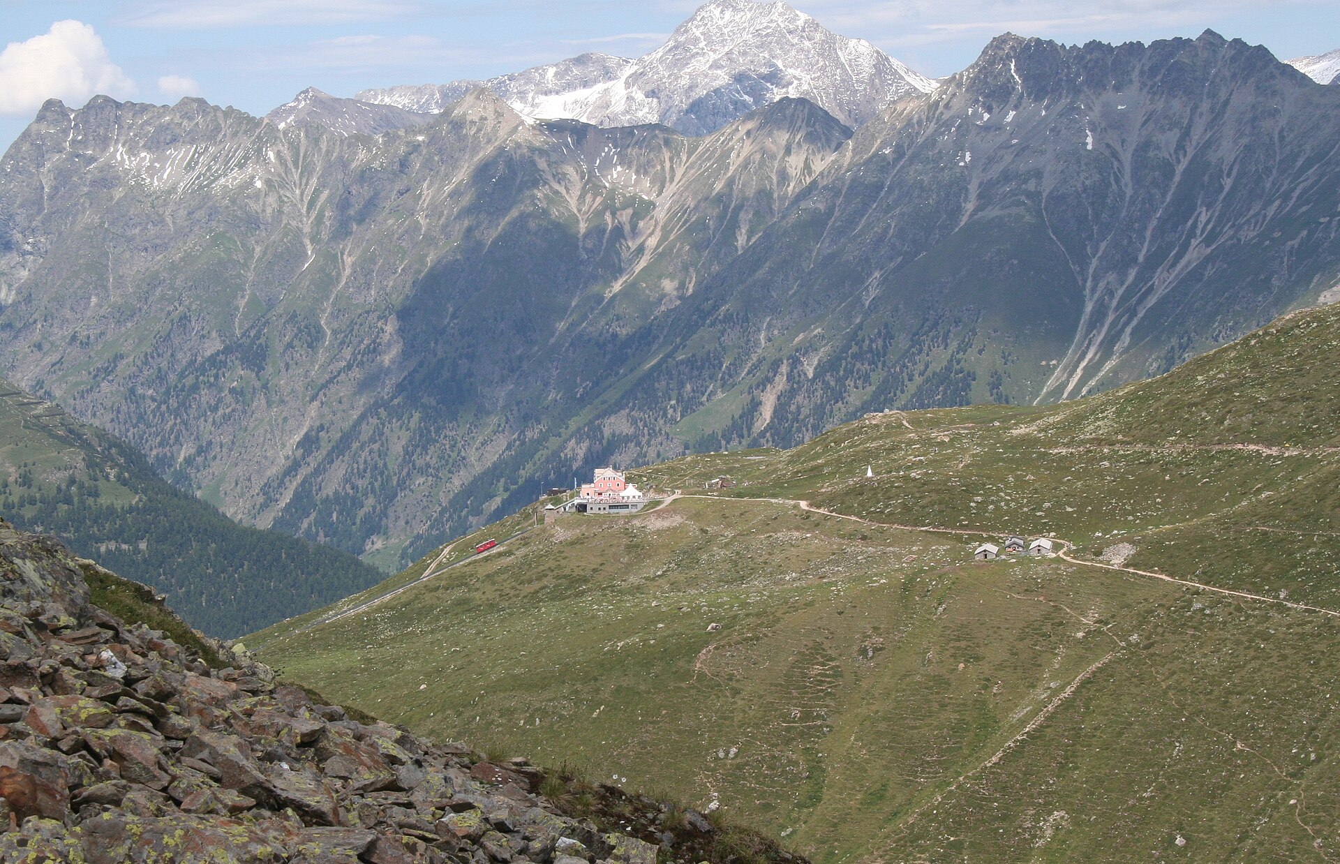
Snapshot
Itinerary
The route starts at Muottas Muragl, reached by funicular from Punt Muragl. It follows a panoramic mountain path across the slopes above the Upper Engadin, with views towards the Engadin lakes and the Bernina massif. The path traverses towards the Schafberg area and continues to Alp Languard, from where a chairlift descends to Pontresina. Engadin’s official route description notes a walking ticket linking the Muottas Muragl ascent with the Alp Languard descent.
Why it is essential
This is one of the most accessible classic panorama walks of the Upper Engadin. It gives a high balcony view of the lakes, Pontresina and the Bernina skyline without requiring a long or technical mountain day. It balances the more strenuous pass and lake routes in this regional selection.
Equipment
- Hiking shoes
- Weatherproof layer
- Warm layer
- Water and food
- Map/GPS
- Sun protection
- Extra warm layer recommended because the route stays above 2,200 m
Hazards and notes
- Short but exposed to high-level weather
- Cloud, wind or lingering snow can make the walk less straightforward
- Lift timetables should be checked before departure
- Walking-ticket availability should be checked before departure
- Snow may remain on shaded slopes outside the normal summer season
GPX / KML links
| Source | URL | Format | Notes |
|---|---|---|---|
| Engadin Maps / Engadin Tourismus route page | maps.engadin.ch | GPX / KML / FIT buttons visible | Terms not resolved. Route-file controls present; direct download URL unresolved |
Sources
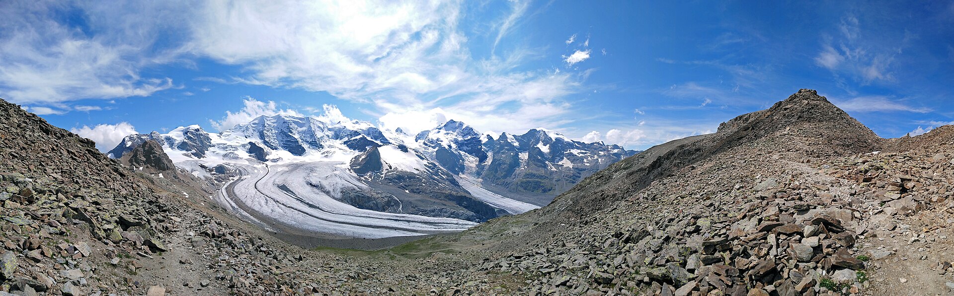
5. Diavolezza–Munt Pers
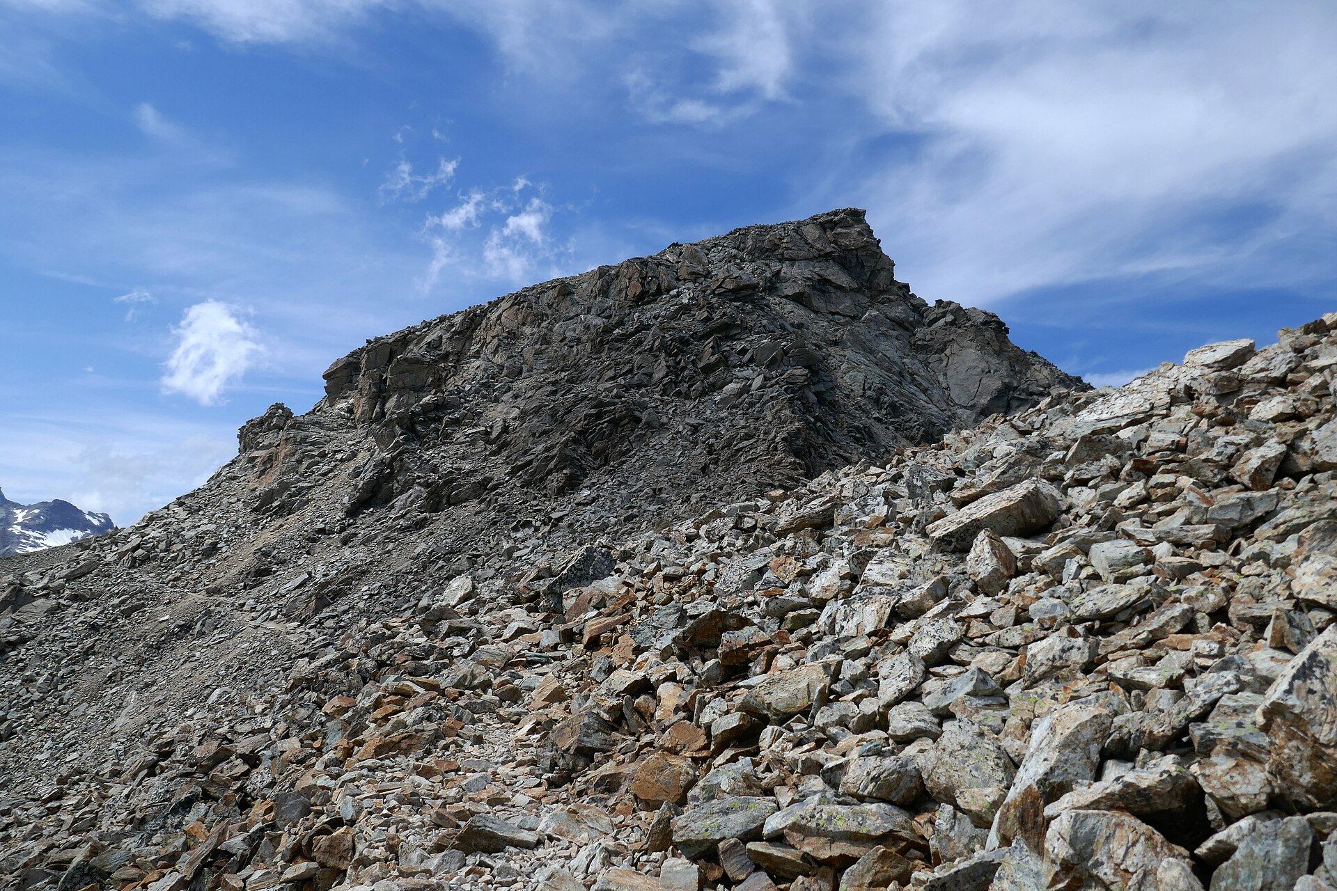
Snapshot
Itinerary
From the Diavolezza mountain station the marked path climbs to Munt Pers and returns by the same route. The path is described as well developed but narrow, with some steep sections requiring surefootedness. The summit gives close views over the Pers and Morteratsch glaciers and towards Piz Palü, Bellavista and Piz Bernina. The route stays on the mountain path and does not require glacier travel in normal dry summer conditions.
Why it is essential
Munt Pers is the compact high-altitude Bernina viewpoint in this selection. It provides a direct view into the glaciated Bernina group, including the Pers and Morteratsch glacier systems and the highest peaks of the massif, while remaining feasible as a short lift-assisted day hike for surefooted walkers in good conditions.
Equipment
- Sturdy boots
- Warm and windproof layers
- Weatherproof shell
- Water and food
- Sun protection
- Map/GPS
- Navigation backup
- Trekking poles may help on the descent
- Headtorch required for sunrise starts
- Microspikes should be considered only if current conditions indicate snow or ice
Hazards and notes
- Short route but reaches more than 3,200 m
- Weather can deteriorate quickly
- Wind chill can be severe even in summer
- Steep and narrow sections require surefootedness
- Snow patches can remain or return outside stable summer conditions
- Diavolezza lift timetable should be checked before departure
- Sunrise ascents require a headlamp or an overnight stay at the mountain station
GPX / KML links
| Source | URL | Format | Notes |
|---|---|---|---|
| Outdooractive / Engadin Tourismus route page | outdooractive.com | GPX / KML / FIT buttons visible | Outdooractive terms not resolved. Route-file controls present; direct download URL unresolved |
| Corvatsch–Diavolezza official route information | corvatsch-diavolezza.ch | Official route description | Terms not resolved. Suitable for route verification; no direct GPX found |
Sources
- Outdooractive route page
- Corvatsch–Diavolezza route page
- Wikimedia Commons image source: Munt Pers
- Wikimedia Commons image source: Vadret Pers and trail
Region-level sources
| Source | Use | URL |
|---|---|---|
| Engelberg tourism, Surenenpass | Surenenpass route | engelberg.ch |
| Lucerne tourism, Surenenpass | Surenenpass route | luzern.com |
| MySwitzerland, Murgseen Rundtour | Murgseen route | myswitzerland.com |
| Glarnerland, Murgseen Rundweg | Murgseen route | glarnerland.ch |
| Outdooractive, Murgsee circular hike | Murgseen route | outdooractive.com |
| Engadin Maps, Val Trupchun | Val Trupchun route | maps.engadin.ch |
| Swiss National Park, trails and routes | National Park context | nationalpark.ch |
| Swiss National Park, protection regulations | National Park rules | nationalpark.ch |
| Engadin Maps, Muottas Muragl panorama | Muottas Muragl route | maps.engadin.ch |
| Outdooractive, Diavolezza–Munt Pers | Munt Pers route | outdooractive.com |
| Corvatsch–Diavolezza, Munt Pers | Munt Pers route | corvatsch-diavolezza.ch |