Regional overview
This region covers three classic Northern Limestone Alps areas on the Germany–Austria border: the Wetterstein around Garmisch-Partenkirchen and the Zugspitze massif, the Karwendel between Bavaria and Tyrol, and the compact limestone walls of the Wilder Kaiser. The hiking character is steep, rocky, scenic, and often hut-based, with deep gorges, high limestone cirques, royal hunting routes, alpine pastures, and exposed-looking but mostly non-technical mountain paths.
Main hiking centres include Garmisch-Partenkirchen, Grainau, Elmau, Mittenwald, Scharnitz, Hinterriss/Eng, Achensee, Ellmau, Going, and Scheffau. Access is generally good by train and regional bus, but some trailheads, especially Eng in the Karwendel and Wochenbrunner Alm in the Wilder Kaiser, depend on seasonal roads, paid parking, or summer hiking buses.
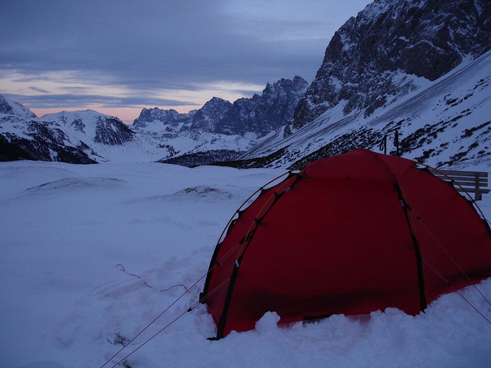
The best general season is late June to October, depending on snow, thunderstorms, gorge openings, road access, and hut schedules. Early-season snow can make upper limestone gullies, scree slopes, and north-facing passes significantly more serious. Höllentalklamm is seasonal and weather-dependent, normally opening in May or June and closing around mid-October, with winter access unsafe because of snow and avalanche exposure.
Selection rationale
These five hikes were selected to give a balanced, representative catalogue entry: one Wetterstein gorge route, one long royal Wetterstein mountain road to Schachen, one Karwendel pasture-and-wall route below the Laliderer Wände, one Achensee/Karwendel summit viewpoint, and one Wilder Kaiser limestone pass route. The selection favours official or semi-official route sources, available route-file links where found, and open-licence Wikimedia media.
Summary table
| # | Hike | Country | Route type | Distance | Gain | Max elevation | Difficulty | Photos |
|---|---|---|---|---|---|---|---|---|
| 1 | Höllentalklamm to Höllentalangerhütte | Germany | Out-and-back / gorge route | 11.4 km | 947 m | 1,401 m | Hard mountain hike | CC BY-SA image found |
| 2 | Königshaus am Schachen via Königsweg | Germany | Out-and-back | 20.7 km | 870 m | 1,867 m | Strenuous mountain hike | CC BY-SA image found |
| 3 | Großer Ahornboden / Engalm to Falkenhütte | Austria | Out-and-back day hike | 13.6–13.8 km approx. | c. 820 m | 1,848 m | Moderate | CC BY image found |
| 4 | Bärenkopf from Maurach / Seespitz via Weißenbachsattel | Austria | Loop | 16.3 km | 1,065 m | 1,991 m | Medium, summit sure-footedness | CC BY-SA image found |
| 5 | Ellmauer Tor from Wochenbrunner Alm | Austria | Out-and-back | 8.1 km | 900 m | 1,980–2,001 m | Medium, scree/roped section | CC BY image found |
1. Höllentalklamm to Höllentalangerhütte
Snapshot
Itinerary
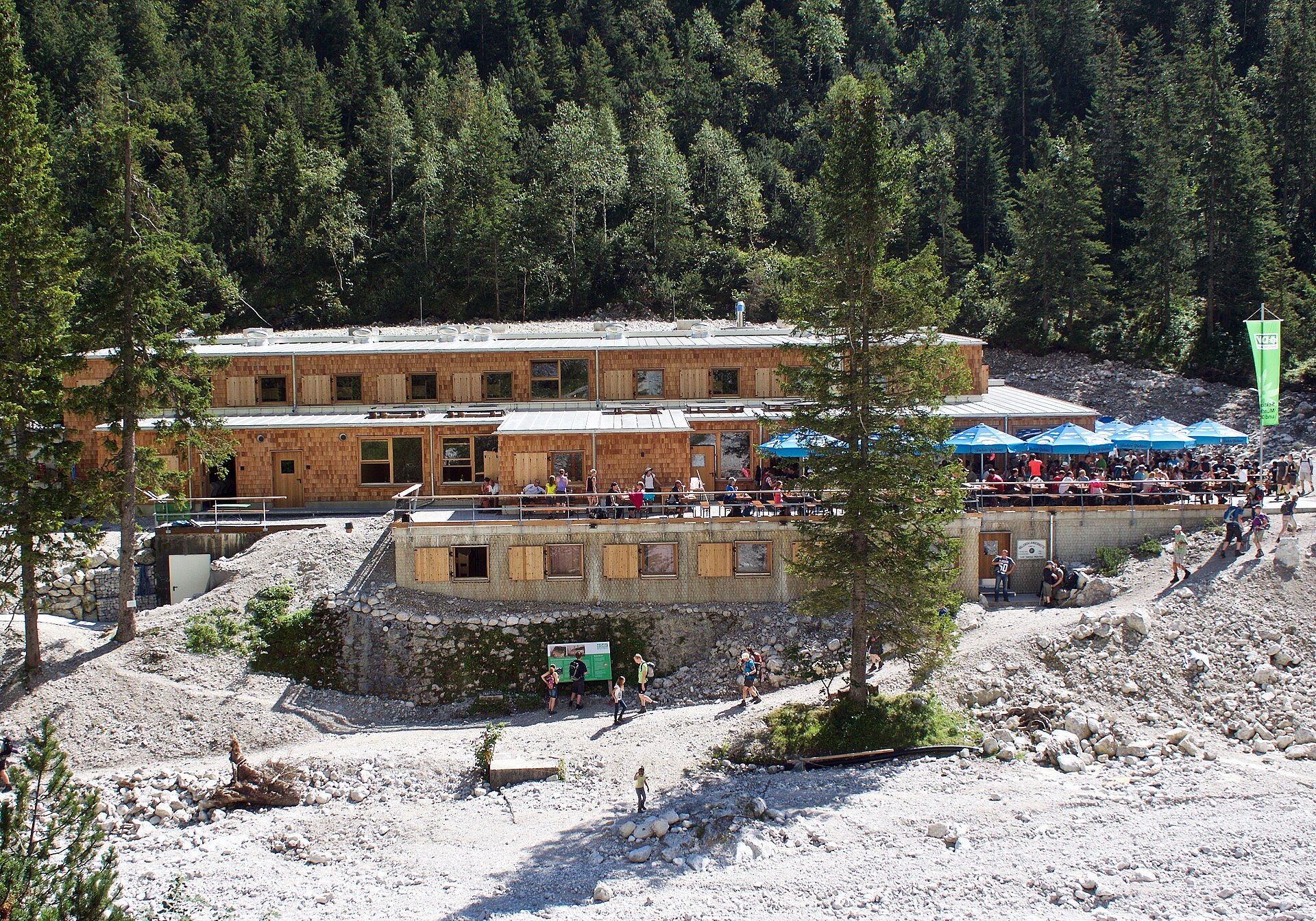
The route starts at Hammersbach and follows the Hammersbach stream into the lower Höllental. The official description uses the Stangensteig approach, crossing above the gorge on the iron bridge before continuing towards the entrance area of Höllentalklamm. From the gorge, the path continues upstream through the narrow valley to Höllentalangerhütte, set below the high Wetterstein walls and the Zugspitze approaches. The return follows the same general line back to Hammersbach.
Why it is essential
Höllentalklamm is one of the defining gorge hikes of the Bavarian Alps and gives direct access to the dramatic north side of the Wetterstein. It is a strong day-hike choice because it combines gorge walking, high limestone scenery, and a classic mountain-hut objective without requiring glacier travel or the full Zugspitze ascent.
Equipment
- Sturdy boots
- Waterproof layer
- Warm layer
- Food and water
- Map or GPS
- Headtorch for poor light or delays
- Sun protection
- Traction may be needed if snow remains above the gorge
Hazards and notes
- The gorge is seasonal and can close because of snow, rockfall risk, storm damage, or maintenance.
- Winter access is unsafe because of avalanche gullies and major snow accumulation.
- The gorge path can be wet, cold, slippery, and busy.
- The Stangensteig variant includes exposed engineered sections and a high bridge.
- Local opening status should be checked before travel or departure.
GPX / KML links
| Source | URL | Format | Notes |
|---|---|---|---|
| Garmisch-Partenkirchen / Outdooractive route download | outdooractive.com | GPX | File found; legal reuse terms unresolved |
| Garmisch-Partenkirchen / Outdooractive route download | outdooractive.com | KML | File found; legal reuse terms unresolved |
Sources
- Official Garmisch-Partenkirchen route page
- Höllentalklamm seasonal-access information
- Wikimedia Commons image page
2. Königshaus am Schachen via Königsweg
Snapshot
Itinerary
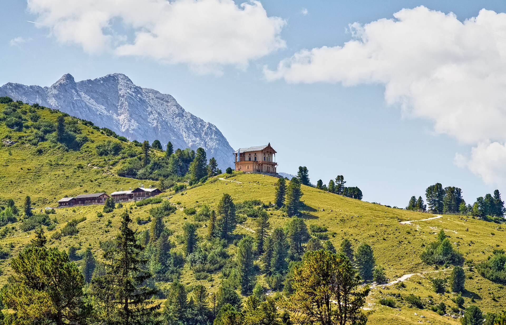
The route starts from the Elmau hiking car park and follows the Königsweg towards Schachen. It passes along the Koitaboch and Elmauer Bach, climbs through forest and alpine pasture terrain to the Wettersteinalm, then continues to the Königshaus am Schachen and the nearby Schachenhaus area. The descent returns on the same route to Elmau.
Why it is essential
Schachen is one of the most distinctive cultural and scenic objectives in the Wetterstein. The route combines a long historic mountain approach, views into the Wetterstein, and King Ludwig II’s Königshaus am Schachen, making it a representative Bavarian royal-mountain hike rather than only a summit walk.
Equipment
- Sturdy boots
- Weatherproof layer
- Warm layer
- Food and water
- Map or GPS
- Sun protection
- Headtorch for the long day
- Trekking poles useful for the descent
Hazards and notes
- This is a long route with a sustained climb and a long return.
- The final section above the Schachensee area is strenuous and steep.
- Early-season snow or poor weather can make the upper part more serious.
- Extra water may be needed in warm weather.
GPX / KML links
| Source | URL | Format | Notes |
|---|---|---|---|
| Garmisch-Partenkirchen / Outdooractive route download | outdooractive.com | GPX | File found; legal reuse terms unresolved |
| Garmisch-Partenkirchen / Outdooractive route download | outdooractive.com | KML | File found; legal reuse terms unresolved |
Sources
- Official Garmisch-Partenkirchen route page
- Alpenvereinaktiv secondary route page
- Schachenhaus ascent information
- Wikimedia Commons image page
3. Großer Ahornboden / Engalm to Falkenhütte
Snapshot
Itinerary
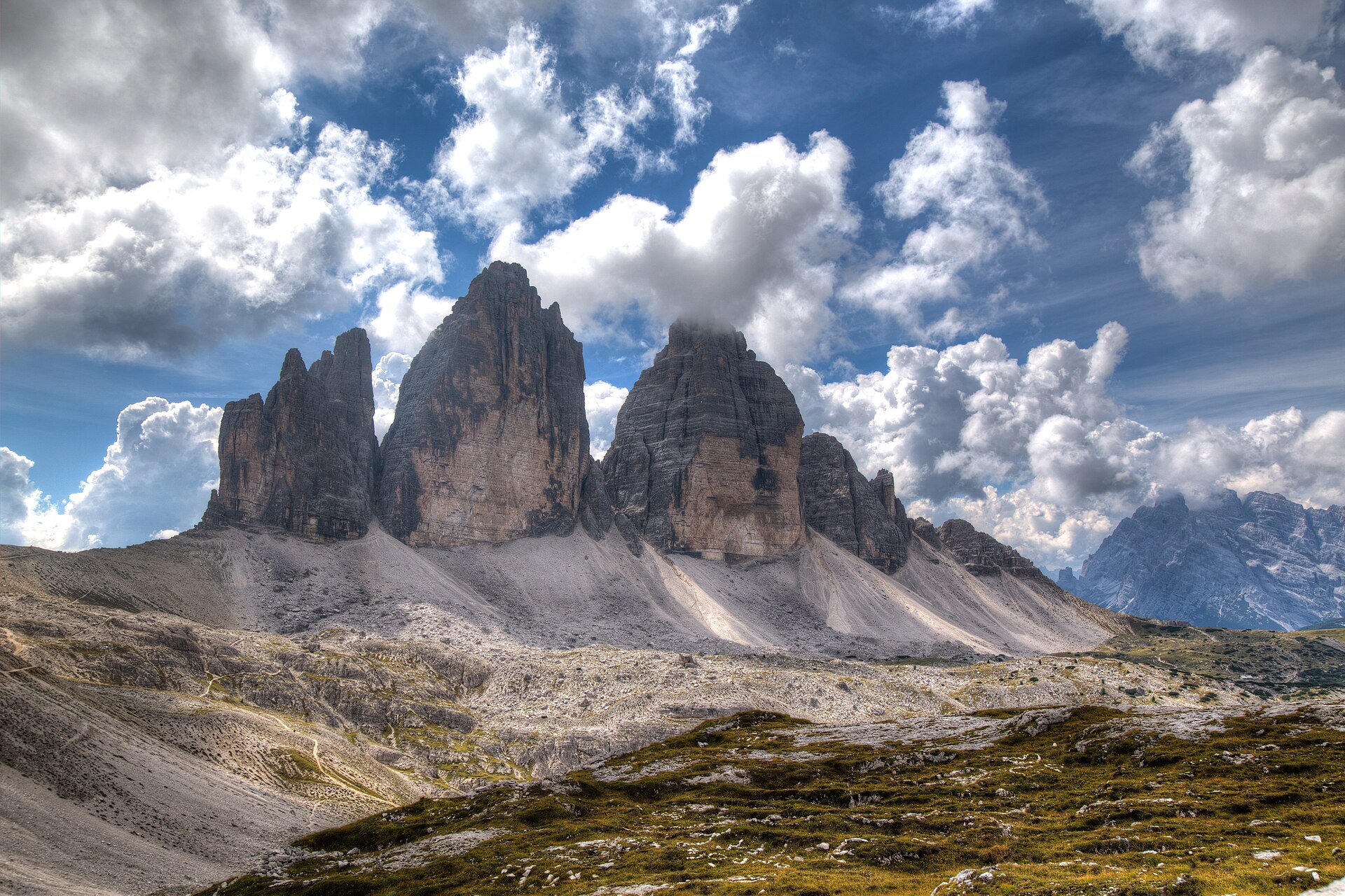
From Engalm at the head of the Riss valley, the route passes through the Eng alpine-pasture settlement and climbs through forest and open pasture to the Hohljoch. It continues below the striking Laliderer Wände, crosses the Spielissjoch area, and reaches Falkenhütte at 1,848 m. The same route can be used for the return to Eng, creating a full day hike through one of the best-known Karwendel landscapes.
Why it is essential
This hike gives direct access to the classic Karwendel scenery of the Großer Ahornboden, Engalm, and the Laliderer Wände. It is less summit-focused than Bärenkopf, but it is one of the most representative hut approaches in the region: maple pastures, limestone walls, and a major Alpine Club hut in one itinerary.
Equipment
- Sturdy boots
- Weatherproof layer
- Warm layer
- Food and water
- Map or GPS
- Sun protection
- Trekking poles optional
- Headtorch recommended if relying on late buses or walking late in the day
Hazards and notes
- The route enters sensitive Karwendel protected landscapes.
- Walkers should not leave the marked path and should observe notices about protected areas and closures.
- Public transport to Eng is seasonal.
- Road, bus, hut, and snow conditions should be checked before using this as a catalogue route.
GPX / KML links
| Source | URL | Format | Notes |
|---|---|---|---|
| DAV München & Oberland route download | alpenverein-muenchen-oberland.de | GPX | Official GPX found for ascent route; legal reuse terms unresolved |
| Alpenvereinaktiv route page | alpenvereinaktiv.com | GPX/KML/FIT listed | Source route verified; direct download may depend on platform terms |
Sources
- DAV München & Oberland route page
- Alpenvereinaktiv secondary route page
- Wikimedia Commons image page
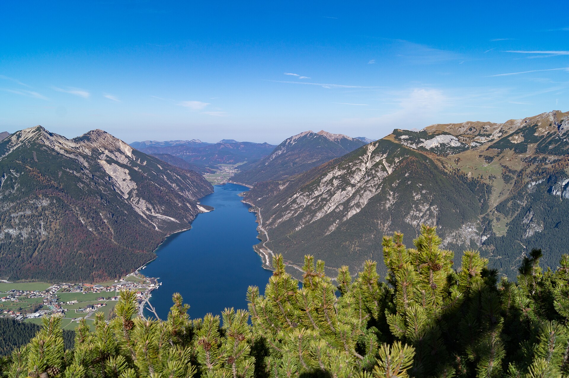
4. Bärenkopf from Maurach / Seespitz via Weißenbachsattel
Snapshot
Itinerary
The route starts at Seespitz in Maurach and follows local roads and paths towards the Weißenbachtal. It passes the Weißenbachhütte and Weißenbachalm before reaching the Weißenbachsattel. From the saddle, the route turns right towards Bärenkopf, continuing through mountain pine and then steeper terrain before easing near the broad summit area. The descent completes the loop back towards Maurach.
Why it is essential
Bärenkopf is one of the classic Achensee viewpoints, with a high perch above the lake and a direct relationship to the Karwendel landscape. It adds a summit route to the regional selection and contrasts well with the Engalm–Falkenhütte hut approach.
Equipment
- Sturdy boots
- Weatherproof layer
- Warm layer
- Water and food
- Map or GPS
- Sun protection
- First-aid kit
- Mobile phone
- Trekking poles
Hazards and notes
- The summit area requires sure-footedness and a head for heights.
- In wet weather, limestone and rooty forest sections can become slippery.
- The route lies in the Achensee / Karwendel protected landscape context.
- Marked paths and local conservation rules should be respected.
GPX / KML links
| Source | URL | Format | Notes |
|---|---|---|---|
| Official Tyrol route page | tyrol.com | GPX link exposed on page | Official GPX link found, but direct file URL not resolved |
| Achensee official route page | achensee.com | Source route / map variants | Useful source for route variants and protected-area context |
Sources
- Official Tyrol route page
- Official Achensee Bärenkopf page
- Alpenvereinaktiv secondary route page
- Wikimedia Commons image page
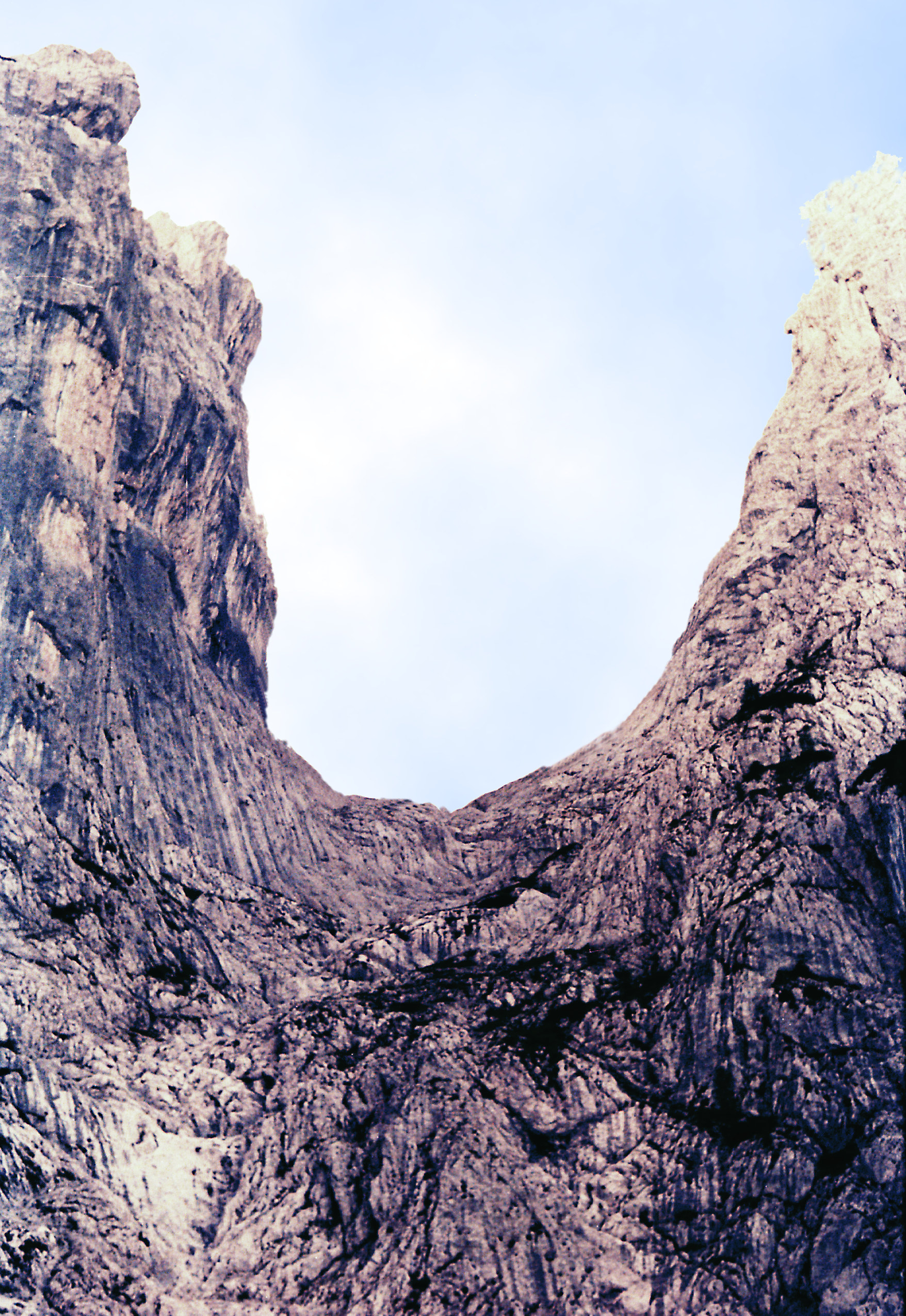
5. Ellmauer Tor from Wochenbrunner Alm
Snapshot
Itinerary
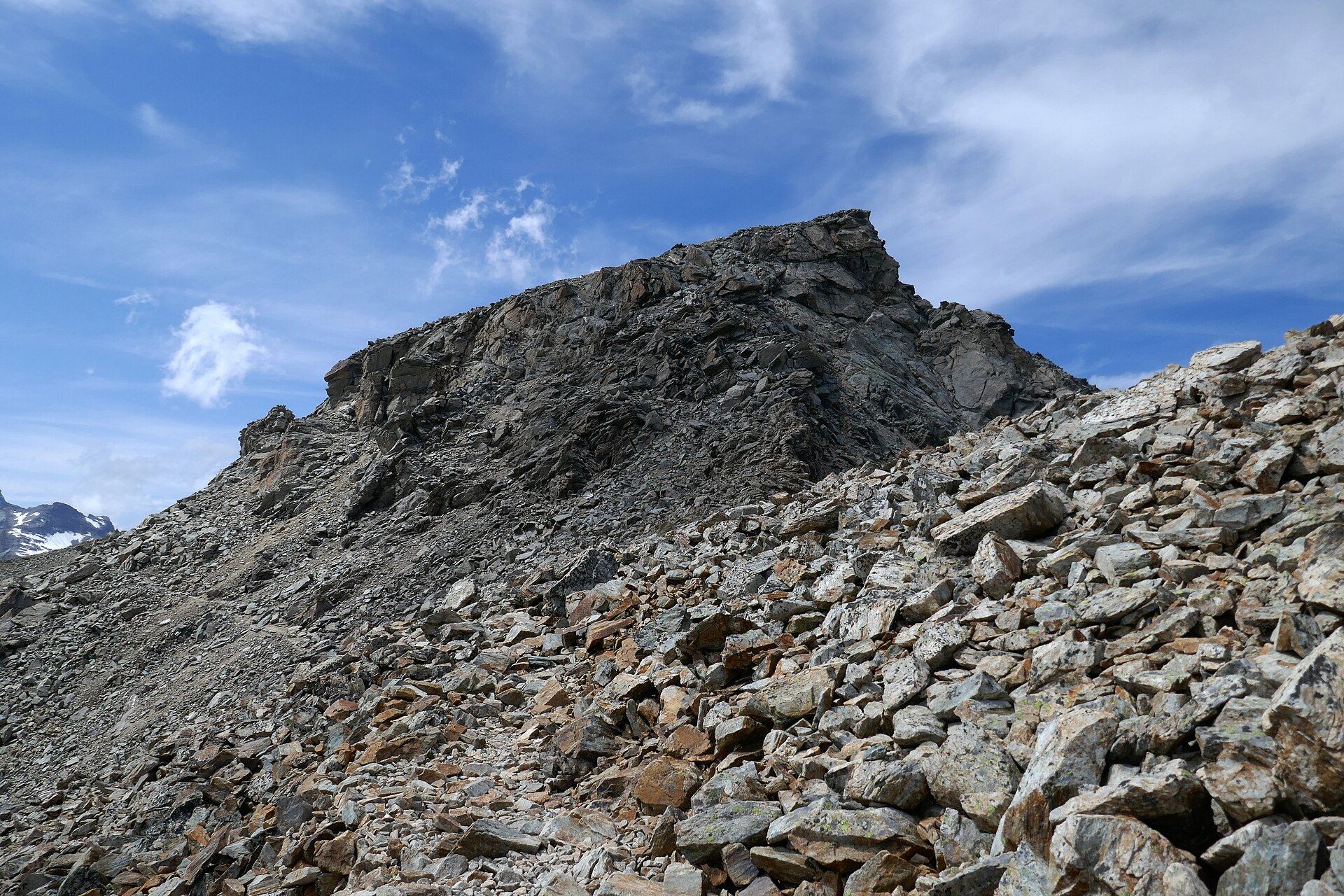
The hike starts at Wochenbrunner Alm and climbs to Gaudeamushütte. From there, trail 812 continues over alpine meadows and through mountain-pine terrain into the Wilder Kaiser limestone. The upper route crosses rocky and scree passages, including a short rope-secured section, before reaching Ellmauer Tor between the Kaiser peaks. The return follows the same route back to Wochenbrunner Alm.
Why it is essential
Ellmauer Tor is one of the landmark passes of the Wilder Kaiser. The route provides a compact but dramatic introduction to the range: hut approach, limestone amphitheatre, scree basin, and a high pass between the Kaiser walls. It is more technical underfoot than the Wetterstein and Karwendel pasture routes, but remains a recognised day hike in normal summer conditions.
Equipment
- Sturdy boots
- Waterproof clothing
- Warm layer
- First-aid kit
- Map or GPS
- Food and sufficient water
- Sun protection
- Trekking poles if comfortable on scree
Hazards and notes
- The route includes rocky passages, scree, and a short rope-secured section.
- Snow or ice can make the upper gully and pass substantially more serious.
- More difficult neighbouring variants, including routes via Eggersteig or onward summit scrambles, should not be conflated with this out-and-back pass hike.
- Public transport and parking access at Wochenbrunner Alm are seasonal or locally regulated.
GPX / KML links
| Source | URL | Format | Notes |
|---|---|---|---|
| Official Wilder Kaiser route page | wilderkaiser.info | GPX/PDF link exposed on page | Official download link found, but direct file URL not resolved |
| Outdooractive-hosted Wilder Kaiser route page | outdooractive.com | GPX/KML/FIT listed | Useful secondary route source; legal reuse unresolved |
| Outdooractive-hosted Wilder Kaiser route page, alternate listing | outdooractive.com | GPX/KML/FIT listed | Useful secondary route source; legal reuse unresolved |
Sources
- Official Wilder Kaiser route page
- Outdooractive-hosted Wilder Kaiser route page
- Kitzbüheler Alpen page for neighbouring variants
- Wikimedia Commons image page
Region-level sources
| Source | Use | URL |
|---|---|---|
| Garmisch-Partenkirchen official route page: Höllentalklamm via Höllentalangerhütte | Wetterstein gorge | gapa-tourismus.de |
| Höllentalklamm seasonal-access information | Gorge opening status | hoellentalklamm-info.de |
| Garmisch-Partenkirchen official route page: Königsweg to Königshaus am Schachen | Wetterstein royal route | gapa-tourismus.de |
| Alpenvereinaktiv: Königshaus am Schachen secondary route statistics | Wetterstein royal route | alpenvereinaktiv.com |
| DAV München & Oberland: Großer Ahornboden to Falkenhütte | Karwendel hut approach | alpenverein-muenchen-oberland.de |
| Alpenvereinaktiv: Großer Ahornboden to Falkenhütte | Karwendel hut approach | alpenvereinaktiv.com |
| Official Tyrol route page: Maurach–Weißenbachsattel–Bärenkopf–Maurach | Achensee summit | tyrol.com |
| Achensee official Bärenkopf page | Achensee summit | achensee.com |
| Official Wilder Kaiser route page: Ellmauer Tor | Wilder Kaiser pass | wilderkaiser.info |
| Outdooractive-hosted Wilder Kaiser route page: Ellmauer Tor | Wilder Kaiser pass | outdooractive.com |