Regional overview
This region covers some of Austria’s highest and most glaciated walking terrain: the Ötztal Alps, Stubai Alps, Zillertal Alps and Hohe Tauern. The walking character is high-alpine, with glacier forelands, stone-pine forests, waterfalls, historic huts, balcony trails and major national-park landscapes.
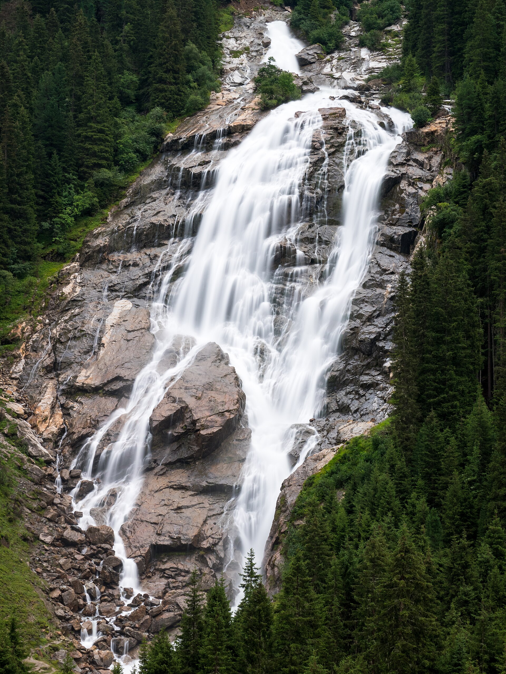
The Stubai selection is shaped by the WildeWasserWeg, a staged water trail linking cataracts, Grawa Waterfall, Sulzenaualm, Sulzenauhütte and glacier terrain. The Zillertal Alps add classic hut approaches and protected high-mountain landscapes, including the Nature Park Zillertal Alps.
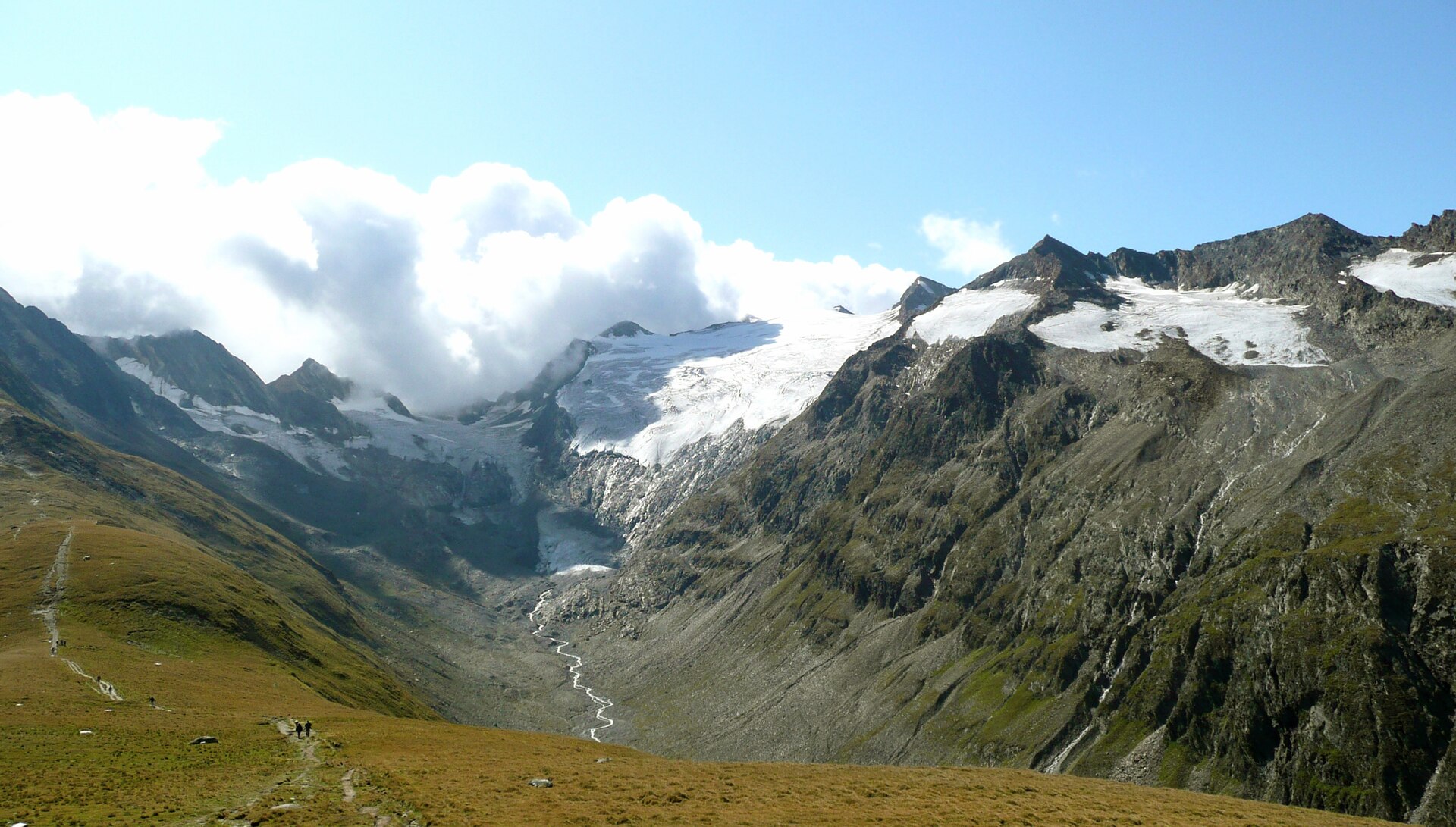
The Hohe Tauern hikes are strongly glacier-focused. Hohe Tauern National Park protects one of Europe’s largest high-mountain protected landscapes, with major glacier systems, waterfalls, streams and alpine ecological belts. The main walking season is normally late June to September, but snow, rockfall, glacier retreat, cable-car schedules and access-road conditions can affect routes.
Selection rationale
These five hikes were selected to represent the region’s main day-hiking identities: an Ötztal glacier-balcony route, a Stubai waterfall-and-hut route, a historic Zillertal hut approach, an East Tyrol glacier-forefield trail and a Grossglockner/Pasterze glacier-view route. The selection avoids technical glacier travel and prioritises routes published by official tourism, national park or verified local sources.
Summary table
| # | Hike | Country | Route type | Distance | Gain | Max elevation | Difficulty |
|---|---|---|---|---|---|---|---|
| 1 | Obergurgl – Hohe Mut – Rotmoostal | Austria | Loop / optional lift-assisted | 12–14.8 km | 893–915 m | 2,701–2,715 m | Moderate mountain hike |
| 2 | WildeWasserWeg Stage 2: Grawa Waterfall – Sulzenauhütte | Austria | Out-and-back day variant | 8.5 km approx. | 676 m | 2,192 m | Moderate |
| 3 | Breitlahner – Berliner Hütte | Austria | Out-and-back | 17.9 km | 800 m | 2,042 m | Medium |
| 4 | Innergschlöss Glacier Trail / Schlatenkees | Austria | Loop | 9.4 km | 680 m | 2,287 m | Medium to challenging |
| 5 | Glocknerhaus – Pasterze – Franz-Josefs-Höhe – Gamsgrubenweg to Tunnel 6 | Austria | Point-to-point plus tunnel out-and-back | 8.1 km | 462 m | 2,369 m | Moderate / red mountain trail |
Note on route files. Route links are source references and may be replaced with project-owned GPX/KML files later.
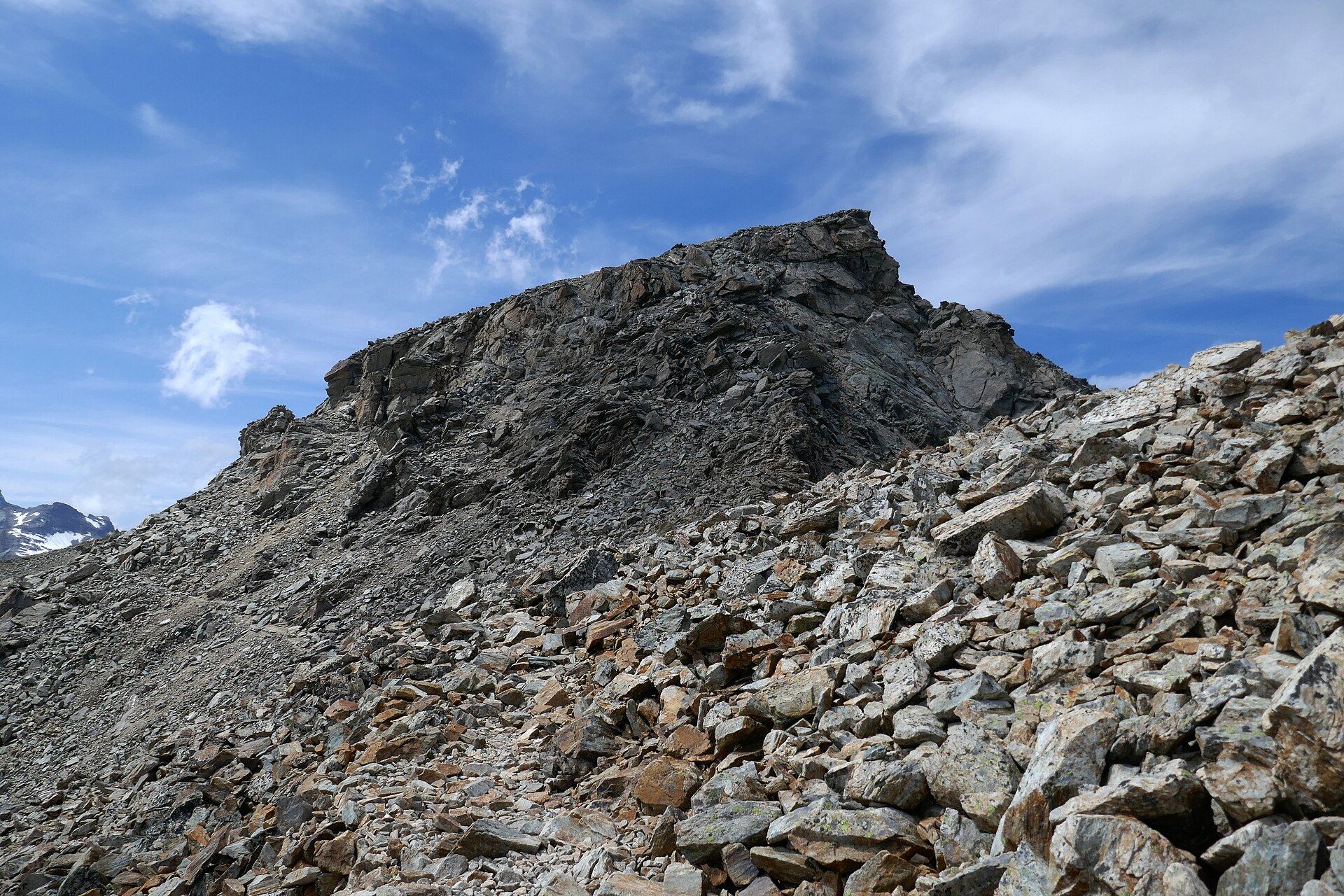
1. Obergurgl – Hohe Mut – Rotmoosferner – Rotmoostal
Snapshot
Itinerary
The route starts in Obergurgl and climbs, or uses the Hohe Mut Bahn variant, towards Hohe Mut. From the high viewpoint, the path continues towards the Rotmoosferner glacier area and the Rotmoostal. The descent follows the valley past glacier-foreland terrain and returns through the natural stone-pine forest to Obergurgl. The official Ötztal route description identifies the line via Hohe Mut, the Rotmoosferner stamp station, the Rotmoostal and the stone-pine forest. Official statistics are inconsistent: the Ötztal page lists 14.8 km, 4 hours, 915 m ascent, 893 m descent and a high point of 2,701 m, while its own author note describes a no-cable-car variant of 14.8 km, 6 hours and 893 m ascent. Bergfex lists 14.92 km, 4 hours, 894 m ascent and a high point of 2,715 m.
Why it is essential
This is the Ötztal selection because it combines a classic high viewpoint above Obergurgl with a glacier-foreland descent and the Rotmoostal landscape. It gives a compact day-hike sample of the Ötztal Alps: lift access, high alpine views, glacier terrain and stone-pine forest.
Equipment
- Sturdy boots
- Weatherproof layer
- Warm layer
- Food and water
- Map/GPS
- Sun protection
- Navigation backup
- Trekking poles recommended for the descent
- Microspikes may be useful if snow remains early in the season
Hazards and notes
The route is high enough for snow to persist into early summer. Weather changes can be rapid. The upper section is exposed to wind and poor visibility. Hohe Mut Bahn operating dates need confirmation. The exact no-lift versus lift-assisted line should be confirmed before travel.
GPX / KML links
| Source | URL | Format | Notes |
|---|---|---|---|
| Ötztal official route page | oetztal.com | GPX / KML / FIT listed on source page | Licence terms not resolved. Route-file availability identified; direct file URL unresolved. |
| Bergfex / Ötztal route source | bergfex.sk | GPX / KML listed on source page | Licence terms not resolved. Route-file availability identified; direct file URL unresolved. |
Further reading
2. WildeWasserWeg Stage 2 — Grawa Waterfall to Sulzenauhütte
Snapshot
Itinerary
The route follows the second stage of the Stubai WildeWasserWeg. From the Grawa Waterfall area, it climbs on an old pasture path towards Sulzenaualm. The path is steep and can be wet. It passes viewpoints over the waterfall, reaches the Sulzenegg area at about 1,800 m, crosses a valley basin shaped by waterfalls and meanders, and then climbs by serpentines past Sulzenaufall to Sulzenauhütte. The official stage is published as a 4.27 km one-way route with 676 m ascent, 2 h 30 min walking time and a maximum elevation of 2,192 m. For a day-hike catalogue, the practical route is the same path out and back unless continuing as part of the multi-stage trail.
Why it is essential
This is the Stubai selection because it links two defining features of the valley: Grawa Waterfall and the high water-and-glacier landscape around Sulzenaualm and Sulzenauhütte. Grawa Waterfall is described by Stubai tourism as the widest waterfall in the Eastern Alps and a natural monument.
Equipment
- Sturdy boots with good grip
- Waterproof layer
- Warm layer
- Food and water
- Map/GPS
- Sun protection
- Trekking poles useful on steep wet sections
Hazards and notes
The path is steep and can be slippery near waterfalls and wet ground. Sure-footedness, stamina and proper hiking boots are advised by the official Stubai route description. Early-season snow may remain near Sulzenauhütte. Waterfall spray can make sections damp even in summer.
GPX / KML links
| Source | URL | Format | Notes |
|---|---|---|---|
| Stubai official route page | stubai.at | GPX (route page) | Licence terms not resolved. Official GPX link identified. |
| Stubai GPX direct | tirol.mapservices.eu | GPX (direct generator URL) | Licence terms not resolved. Direct file URL captured. |
Further reading
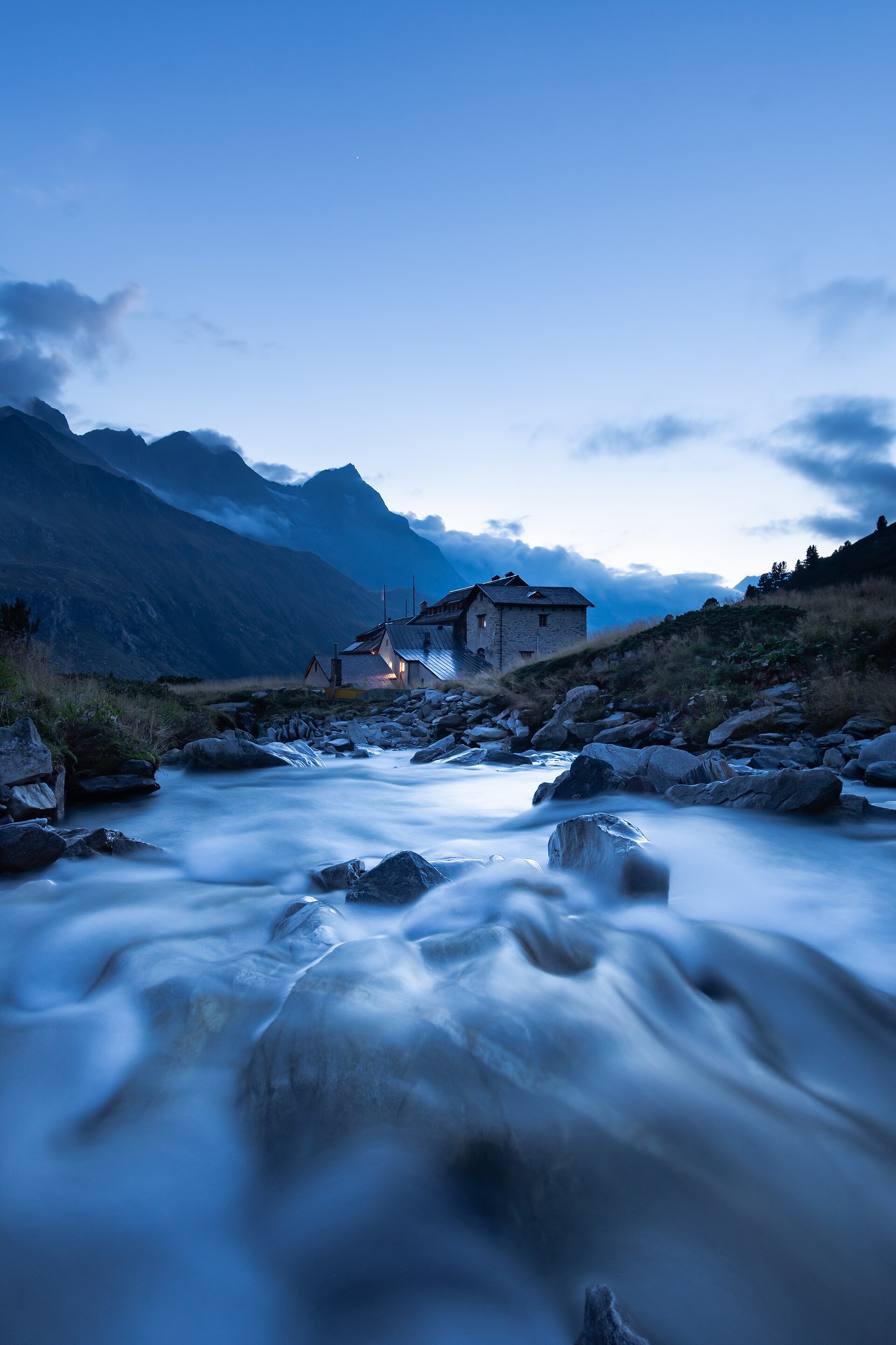
3. Ginzling / Breitlahner – Berliner Hütte
Snapshot
Itinerary
The route begins at Alpengasthaus Breitlahner and follows the Zemmgrund valley towards Berliner Hütte. It passes Klausenalm, follows forest trail 523, then continues via Grawandhütte and Alpenrosenhütte before reaching the Berliner Hütte. The same route is used for the return to Breitlahner. Tyrol tourism gives 17.9 km, 6 hours, 800 m ascent, 800 m descent and a highest point of 2,042 m.
Why it is essential
This is the Zillertal selection because Berliner Hütte is one of the most culturally important huts in the Austrian Alps and gives a classic non-technical approach into the Zillertal Alps. The route combines valley walking, historic hut culture and high-mountain scenery without requiring glacier equipment.
Equipment
- Sturdy boots
- Weatherproof layer
- Warm layer
- Food and water
- Map/GPS
- Sun protection
- Headtorch if starting late
- Trekking poles useful for the return
- Extra warm clothing outside midsummer
Hazards and notes
The route is technically moderate but long. The day includes 800 m of ascent and descent. Weather can deteriorate quickly above the valley. Snow or ice may remain in early summer or return in autumn. Public-transport times and hut opening dates should be checked before travel.
GPX / KML links
| Source | URL | Format | Notes |
|---|---|---|---|
| Tyrol official route page | tyrol.com | GPX (route page) | Licence terms not resolved. Official GPX link identified. |
| Tyrol GPX direct | tirol.mapservices.eu | GPX (direct generator URL) | Licence terms not resolved. Direct file URL captured. |
Further reading
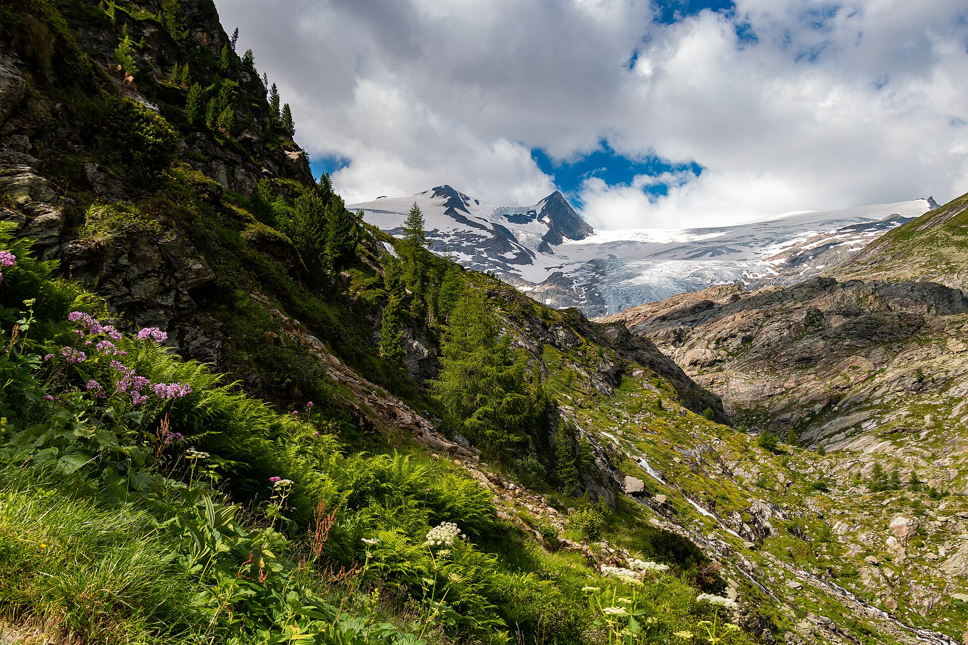
4. Innergschlöss Glacier Trail / Schlatenkees
Snapshot
Itinerary
The glacier trail begins at Innergschlöss and climbs into the glacier-forefield landscape below the Großvenediger group. It is a circular alpine route with educational interpretation on glacier retreat, glacier foreland, alpine vegetation and high-mountain ecology. The route reaches a maximum elevation of 2,287 m before returning to Innergschlöss. Tyrol tourism lists the loop as 9.4 km with 680 m ascent and descent and a walking time of 4 h 50. Hohe Tauern National Park describes the route as a steep alpine circular route requiring good equipment and sure-footedness; walking time is 4–5 h from Innergschlöss or about 7 h if starting from Matreier Tauernhaus without taxi assistance.
Why it is essential
This hike gives one of the clearest day-walk experiences of glacier retreat and glacier-foreland terrain in the Hohe Tauern. It is non-glaciated as a walking route but still provides close contact with the Schlatenkees landscape and the Großvenediger environment.
Equipment
- Sturdy boots
- Warm layer
- Waterproof layer
- Food and water
- Navigation backup
- Sun protection
- Hat and gloves outside midsummer
- Trekking poles
- Microspikes may be useful if snow remains early in the season
Hazards and notes
The route is steep, partly exposed and weather-sensitive. Good equipment and sure-footedness are mandatory. Some sections are exposed. Access logistics vary: walking from Matreier Tauernhaus makes a longer day, while the summer taxi to Innergschlöss shortens the approach.
GPX / KML links
| Source | URL | Format | Notes |
|---|---|---|---|
| Tyrol official route page | tyrol.com | GPX (route page) | Licence terms not resolved. Official GPX link identified. |
| Tyrol GPX direct | tirol.mapservices.eu | GPX (direct generator URL) | Licence terms not resolved. Direct file URL captured. |
Further reading
- Tyrol — Gletscherweg Innergschlöss / Schlatenkees
- Hohe Tauern National Park — Innergschlöss Glacier Trail
5. Glocknerhaus – Pasterze – Franz-Josefs-Höhe – Gamsgrubenweg to Tunnel 6

Snapshot
Itinerary
The route starts near Glocknerhaus and crosses the high-alpine reservoir and moraine landscape towards the Pasterze area. It passes the Glocknertor, Margeritz reservoir, Elisabeth Rock, a suspension bridge over the Möll, Sander lake and moraine terrain before climbing towards Franz-Josefs-Höhe. The hike is then combined with the Gamsgrubenweg tunnel nature trail, but only as far as the exit of Tunnel 6. The verified local route source lists 8.1 km, 4 h 30, 462 m ascent/descent and a highest point of 2,369 m. Hohe Tauern National Park separately describes the Gamsgrubenweg from Kaiser-Franz-Josefs-Höhe as an approximately 2.5 km trail, normally open from June to September.
Why it is essential
This is the Grossglockner/Pasterze selection because it combines the most famous glacier landscape of the Hohe Tauern with the visitor infrastructure at Kaiser-Franz-Josefs-Höhe and the protected Gamsgrubenweg nature trail. It is one of the most recognisable glacier-view day walks in Austria.
Equipment
- Sturdy boots
- Waterproof layer
- Warm layer
- Food and water
- Sun protection
- Map/GPS
- Navigation backup
Hazards and notes
The Gamsgrubenweg is affected by rockfall closure beyond Tunnel 6. The listed hike stops at Tunnel 6. Snow, ice, road opening dates, storms and glacier-edge terrain can affect access. Local closure information must be checked shortly before travel.
GPX / KML links
| Source | URL | Format | Notes |
|---|---|---|---|
| Outdooractive route (Hohe Tauern / Nationalpark-Region in Kärnten partner) | outdooractive.com | GPX / KML / FIT listed on source page | Outdooractive terms not evaluated. Route-file controls verified; direct download URL unresolved. |
Further reading
- Outdooractive — Glacier route to the Pasterze with Gamsgrubenweg
- Hohe Tauern National Park — Gamsgrube nature trail
Further reading
| Source | URL |
|---|---|
| Ötztal Nature Park | oetztal.com |
| Ötztal — Rotmoostal route | oetztal.com |
| Bergfex — Rotmoostal route | bergfex.sk |
| Stubai — WildeWasserWeg | stubai.at |
| Stubai — WildeWasserWeg Stage 2 | stubai.at |
| Tyrol — Berliner Hütte route | tyrol.com |
| Zillertal Alps Nature Park | mayrhofen.at |
| Tyrol — Innergschlöss Glacier Trail | tyrol.com |
| Hohe Tauern — Innergschlöss Glacier Trail | hohetauern.at |
| Outdooractive — Pasterze / Gamsgrubenweg route | outdooractive.com |
| Hohe Tauern — Gamsgrubenweg | hohetauern.at |