Regional overview
This region covers three different but connected hiking landscapes: the Dolomites of Veneto, South Tyrol and Trentino; the Adamello-Brenta area around Madonna di Campiglio; and the Slovenian Julian Alps around Bohinj and Triglav National Park. The walking character ranges from pale limestone towers and rifugio-to-rifugio balcony paths to high granite lake basins and karst valleys.
Main hiking centres include Cortina d’Ampezzo, Misurina and Auronzo for the eastern Dolomites; Val Gardena / St. Christina for the Odle–Seceda area; Madonna di Campiglio for Adamello-Brenta; and Bohinj / Stara Fužina for the Julian Alps. Summer access is often shaped by cable cars, toll roads, shuttle buses and protected-area rules. Tre Cime’s main road access uses a reservation or ticket system, while the classic hiking season there is generally late June to late September when trails and huts are normally open.
Terrain is mostly mountain hiking rather than alpinism, but early-season snow, thunderstorms, scree, exposed traverses, fixed cables and crowds are recurring issues. In Triglav National Park, high-mountain lake bathing, wild camping and dogs swimming in high-mountain waters are prohibited, and dogs must be kept on a leash.
Selection rationale
The five selected hikes give a balanced regional cross-section: one globally recognised Dolomite icon, one turquoise lake and cirque route, one Dolomite ridge-and-pasture balcony, one Adamello-Brenta high-lake traverse, and one classic Julian Alps / Triglav National Park lake-valley hike.
Summary table
| # | Hike | Country | Route type | Distance | Gain | Max elevation | Difficulty |
|---|---|---|---|---|---|---|---|
| 1 | Tre Cime di Lavaredo loop | Italy | Loop | 9–10 km | c. 390–400 m | 2,454 m | Moderate |
| 2 | Lago di Sorapiss from Passo Tre Croci | Italy | Out-and-back | 12.9 km | 556 m | 1,942 m | Moderate, exposed sections |
| 3 | UNESCO hike at the foot of the Odle: Col Raiser–Mastlé–Pieralongia–Seceda | Italy | Lift-assisted loop | 7.4 km | 400 m | 2,454 m | Moderate |
| 4 | Giro dei Cinque Laghi di Madonna di Campiglio | Italy | Lift-assisted traverse / long circuit | 17.2 km | 526 m | 2,490 m | Difficult |
| 5 | Triglav Lakes Valley from Planina Blato | Slovenia | Out-and-back / lollipop | 15.2 km | 1,051 m | 1,851 m | Moderate |
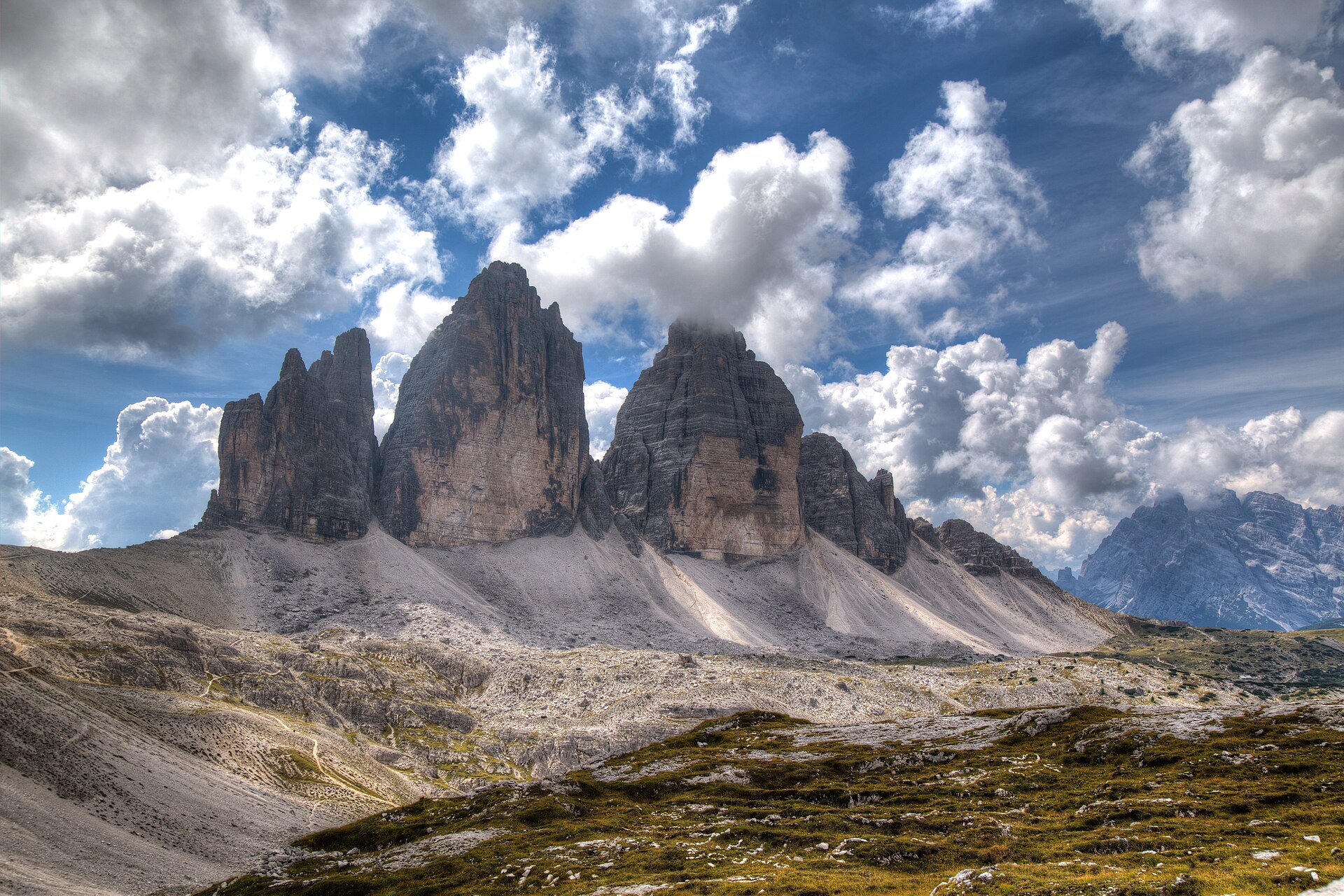
1. Tre Cime di Lavaredo loop
Snapshot
Itinerary
The classic loop starts at Rifugio Auronzo and follows path 101 east below the south faces of the Tre Cime. The route passes Rifugio Lavaredo and climbs gently to Forcella Lavaredo, then continues towards Rifugio Locatelli / Dreizinnenhütte for the most famous northern view of the three towers. From the Locatelli area, the loop descends past the Laghi dei Piani and continues towards Malga Langalm before returning to Rifugio Auronzo. Official Auronzo tourism gives the route as 9–10 km with about 400 m of ascent and 3–4 hours; Outdooractive maps a 9 km version with +391 m / -393 m.
Why it is essential
This is the benchmark Dolomite day-hike: short enough for a broad range of fit walkers, but centred on one of the most recognisable mountain groups in the Alps. It also provides a compact introduction to Dolomite rifugio culture, First World War terrain, limestone towers, scree basins and high passes.
Equipment
- Sturdy boots or hiking shoes
- Weatherproof layer
- Warm layer
- Sun protection
- Water and food
- Map/GPS and navigation backup
- Trekking poles useful on loose descents
- Microspikes may be needed if snow lingers early in the season
Hazards and notes
The main route is not a via ferrata, but several nearby wartime tunnels, ladders and Monte Paterno variants are more serious and should not be confused with the standard loop. The area is very exposed to storms and sun. Outside the normal summer season, snow and ice may make the route significantly more serious, and huts may be closed. Road access to Rifugio Auronzo is regulated by ticket or reservation.
GPX / KML links
| Source | URL | Format | Notes |
|---|---|---|---|
| Outdooractive route map | outdooractive.com | Source map / route page | Outdooractive terms; GPX reuse not confirmed. No official GPX found; use as source route pending replacement |
| Official Auronzo description | auronzomisurina.it | Written itinerary | Official tourism page; no downloadable GPX found. Suitable for manual route verification, not a route file |
Sources
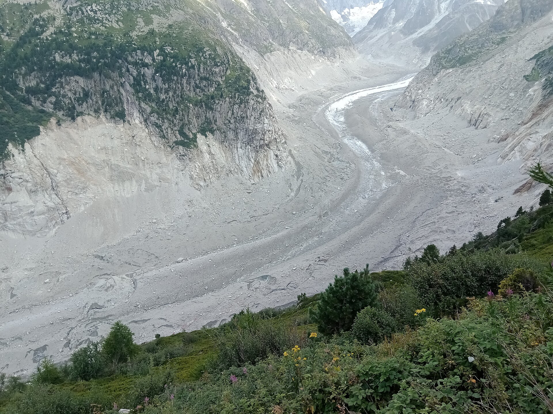
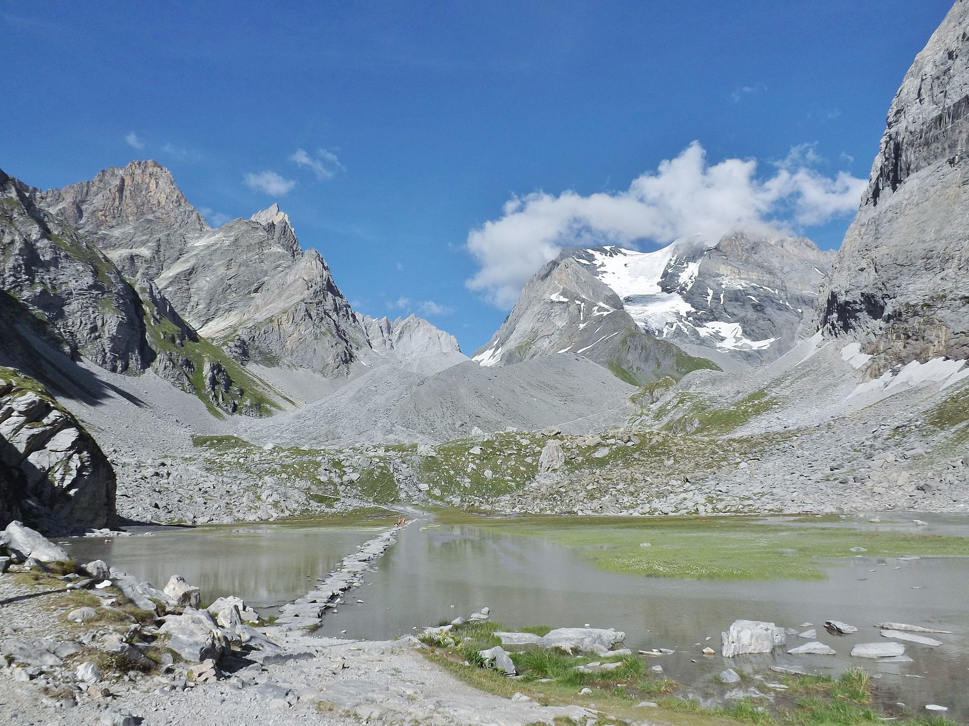
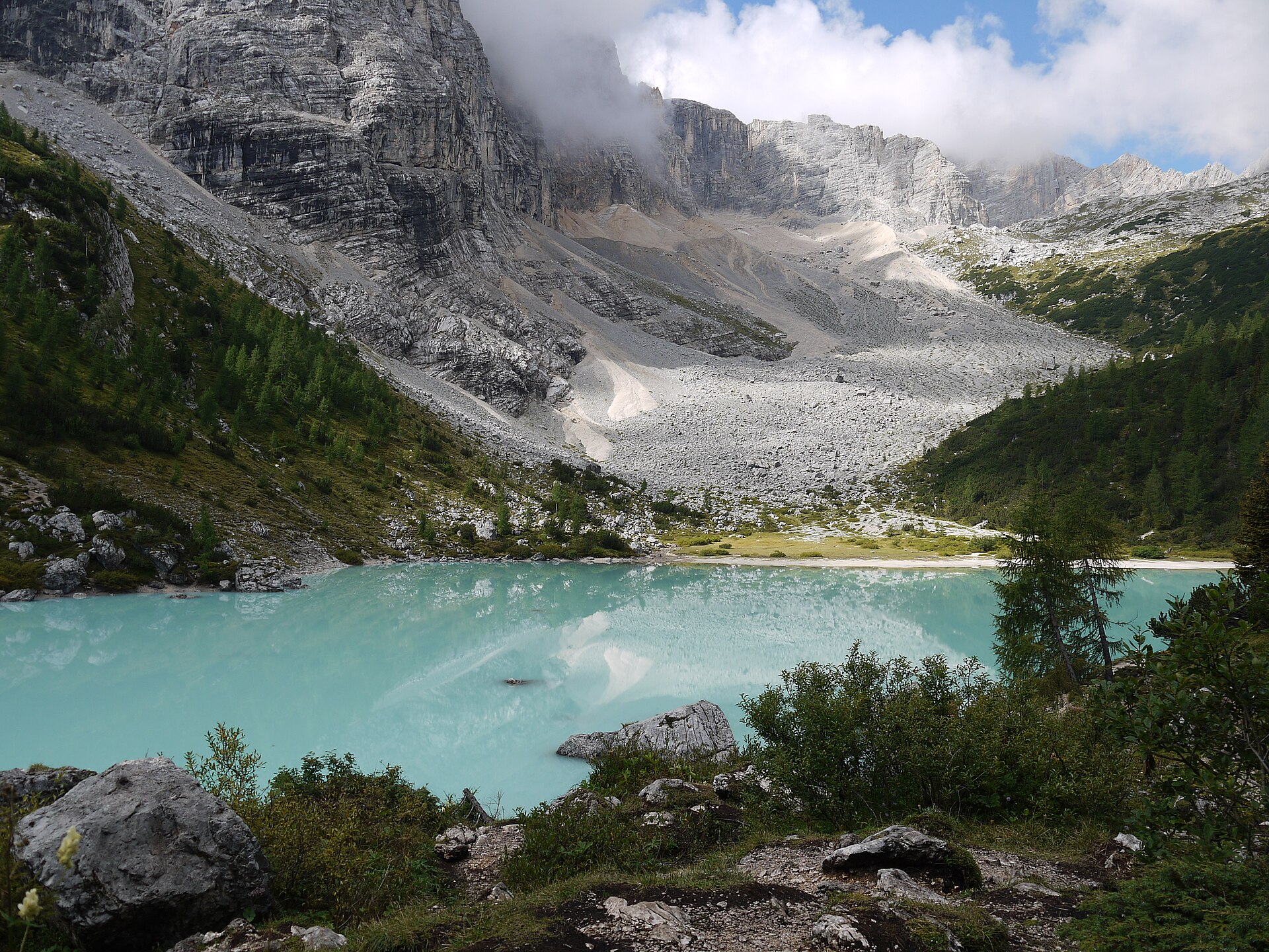
2. Lago di Sorapiss from Passo Tre Croci
Snapshot
Itinerary
The route starts at Passo Tre Croci and follows signposted path 215 towards Rifugio Vandelli and Lago di Sorapiss. The path traverses wooded slopes and then crosses rockier ground beneath the Sorapiss group before reaching the turquoise lake basin and the Vandelli hut area. The return follows the same route. The Pustertal / Drei Zinnen tourism route page gives 12.9 km, 556 m ascent and descent, an altitude range of 1,726–1,942 m, and an estimated time of 5 hours.
Why it is essential
Lago di Sorapiss is one of the most recognisable lake destinations in the eastern Dolomites. The hike adds a different Dolomite character from Tre Cime: forest approach, traversing path, pale rock amphitheatre and a glacially coloured lake below high walls.
Equipment
- Sturdy boots or shoes with good grip
- Weatherproof layer
- Warm layer
- Sun protection
- Water and food
- Map/GPS and navigation backup
- Trekking poles useful, but may be awkward on narrow traverses
- Microspikes may be required if early-season snow remains
Hazards and notes
The standard trail includes narrow and exposed sections, with fixed aids on some variants or sections described by secondary guide sources. Sure-footedness and a head for heights are important. The path is popular, so passing on narrow sections can slow progress. Early snow, wet rock or thunderstorms can make the hike more serious. Vandelli hut opening dates and any local restrictions should be checked before departure.
GPX / KML links
| Source | URL | Format | Notes |
|---|---|---|---|
| Pustertal / Drei Zinnen tourism route page | pustertal.org | Route page with GPX download link | Terms not clearly stated on the route page. Route and statistics verified; reuse of downloaded geometry unresolved |
| GPX endpoint from source page | pustertal.org | GPX | Terms not clearly stated. Endpoint identified from the source page; replace later with own route geometry |
Sources
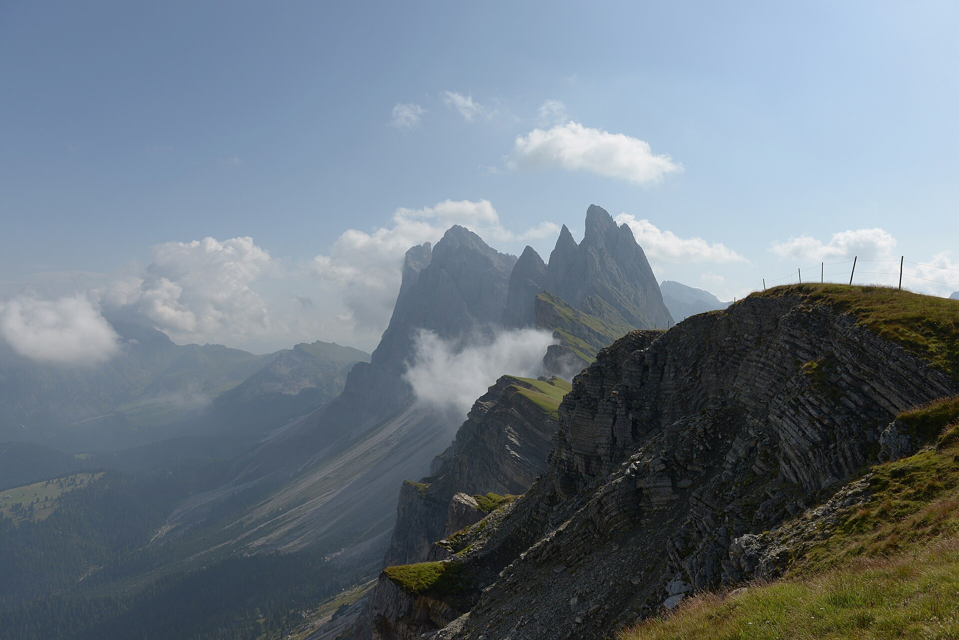
3. UNESCO hike at the foot of the Odle: Col Raiser–Mastlé–Pieralongia–Seceda
Snapshot
Itinerary
From the Col Raiser gondola mountain station, the route follows the official Val Gardena itinerary towards the UNESCO Mastlé viewpoint, then continues below the Fermeda / Odle towers towards Pieralongia. It reaches the Seceda area before returning by the Mastlé alpine pasture to Col Raiser. The official Val Gardena route page gives 7.4 km, 400 m ascent and descent, 3 hours, and a high point of 2,454 m.
Why it is essential
This hike is the region’s classic Odle balcony: grassy alpine pastures, sharply layered Dolomite walls, the Mastlé UNESCO viewpoint, Pieralongia and the Seceda ridge landscape. It represents the gentler but still high and dramatic side of the Dolomites, with cable-car access making the route feasible as a shorter mountain day.
Equipment
- Sturdy boots or hiking shoes
- Weatherproof layer
- Warm layer
- Water and food
- Sun protection
- Map/GPS and navigation backup
- Trekking poles useful on pasture and gravel sections
- Check cable-car operating times before starting
Hazards and notes
The official route page states that there are no particular risks but notes that snow can remain at the beginning of summer. Navigation is generally straightforward in clear weather, but mist can reduce visibility across open pastures. Access depends on the Col Raiser lift and local shuttle/bus schedules.
GPX / KML links
| Source | URL | Format | Notes |
|---|---|---|---|
| Official Val Gardena route page | valgardena.it | Source map; page lists GPX, KML and FIT options | Terms not clearly stated on the route page. Official route and statistics verified; direct GPX/KML file URL not captured |
Sources
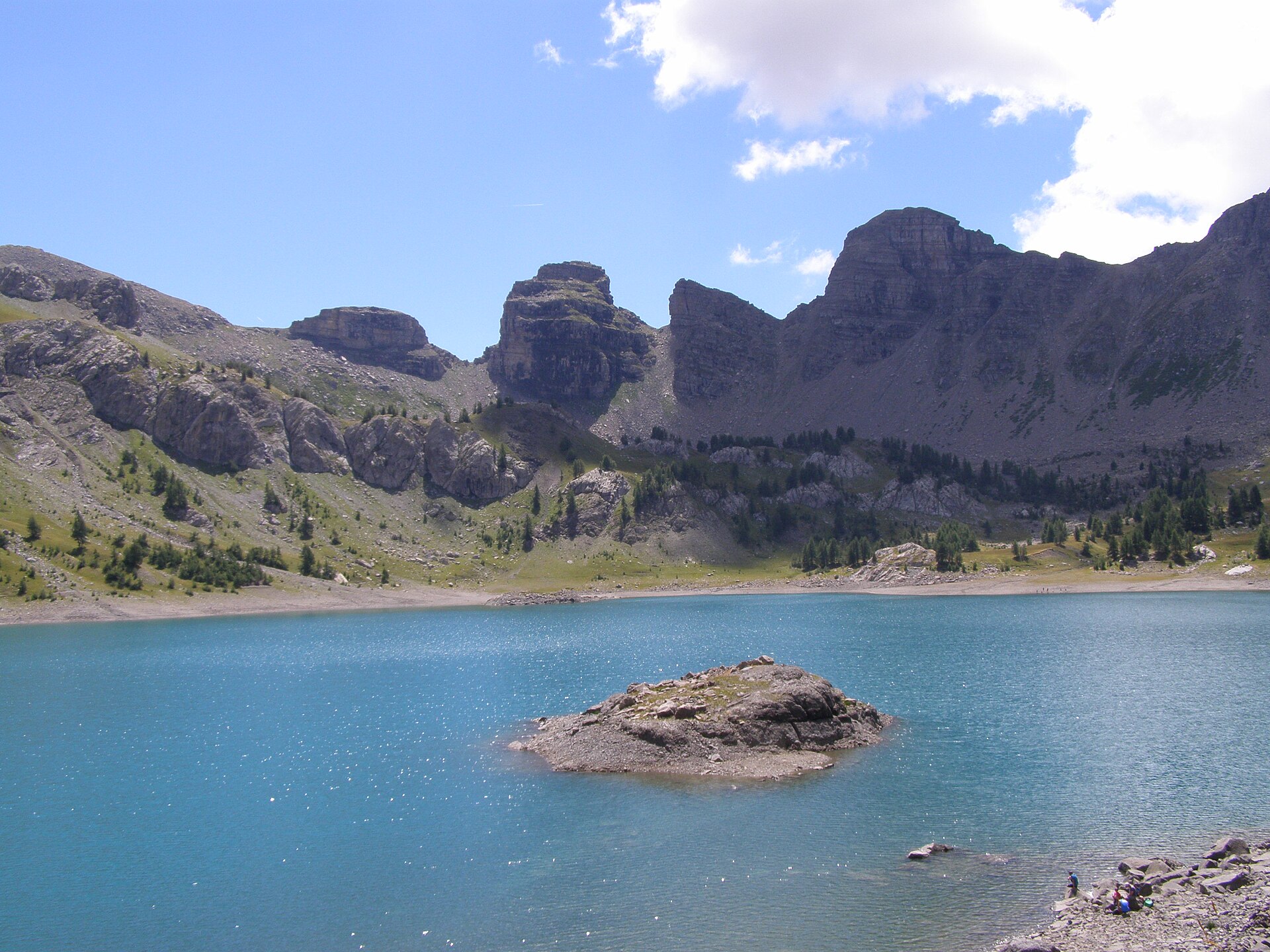
4. Giro dei Cinque Laghi di Madonna di Campiglio
Snapshot
Itinerary
The route starts from the 5 Laghi cable-car mountain station and follows SAT paths through the high lake country above Madonna di Campiglio. The Trentino route description gives a sequence via Lago Ritorto, Lago Lambin, Lago Serodoli, Lago Gelato, Bocchetta dei Tre Laghi, the Tre Laghi area, Lago Alto and Lago delle Malghette before descending by path 201 towards Campo Carlo Magno / Madonna di Campiglio. The route page gives 17.2 km, +526 m / -1,083 m, an altitude range of 1,512–2,490 m, and about 6 hours.
Why it is essential
This hike represents the Adamello-Brenta part of the region: a long high-level lake traverse across granite and glacially carved basins, with broad views towards the Brenta Dolomites. It adds a more strenuous lake-and-pass day to the catalogue, contrasting with the limestone towers of the Dolomites and the karst lakes of Slovenia.
Equipment
- Sturdy boots
- Weatherproof layer
- Warm layer
- Hat/gloves outside midsummer
- Water and food
- Sun protection
- Map/GPS and navigation backup
- Headtorch
- Carry enough water, as long stretches have no refreshment points
Hazards and notes
This is a long hike at nearly 2,500 m and should be started early. The Trentino route description warns that the section between Bocchetta dei Tre Laghi and the Tre Laghi area is not very well marked and that the GPX track should be followed. The same source also warns not to continue onto the Sentiero Bozzetto via ferrata when reaching its junction. Weather, mist and lingering snow can make navigation more serious.
GPX / KML links
| Source | URL | Format | Notes |
|---|---|---|---|
| Trentino.com route page | trentino.com | Route page with GPX download link | Terms not clearly stated on the route page. Route and statistics verified; reuse of downloaded geometry unresolved |
| GPX endpoint from source page | trentino.com | GPX | Terms not clearly stated. Endpoint identified from the source page; replace later with own route geometry |
Sources
- Trentino.com Five Lakes route
- Campiglio Dolomiti 5 Lakes Tour
- Adamello Brenta Park route context
- Wikimedia Commons photo
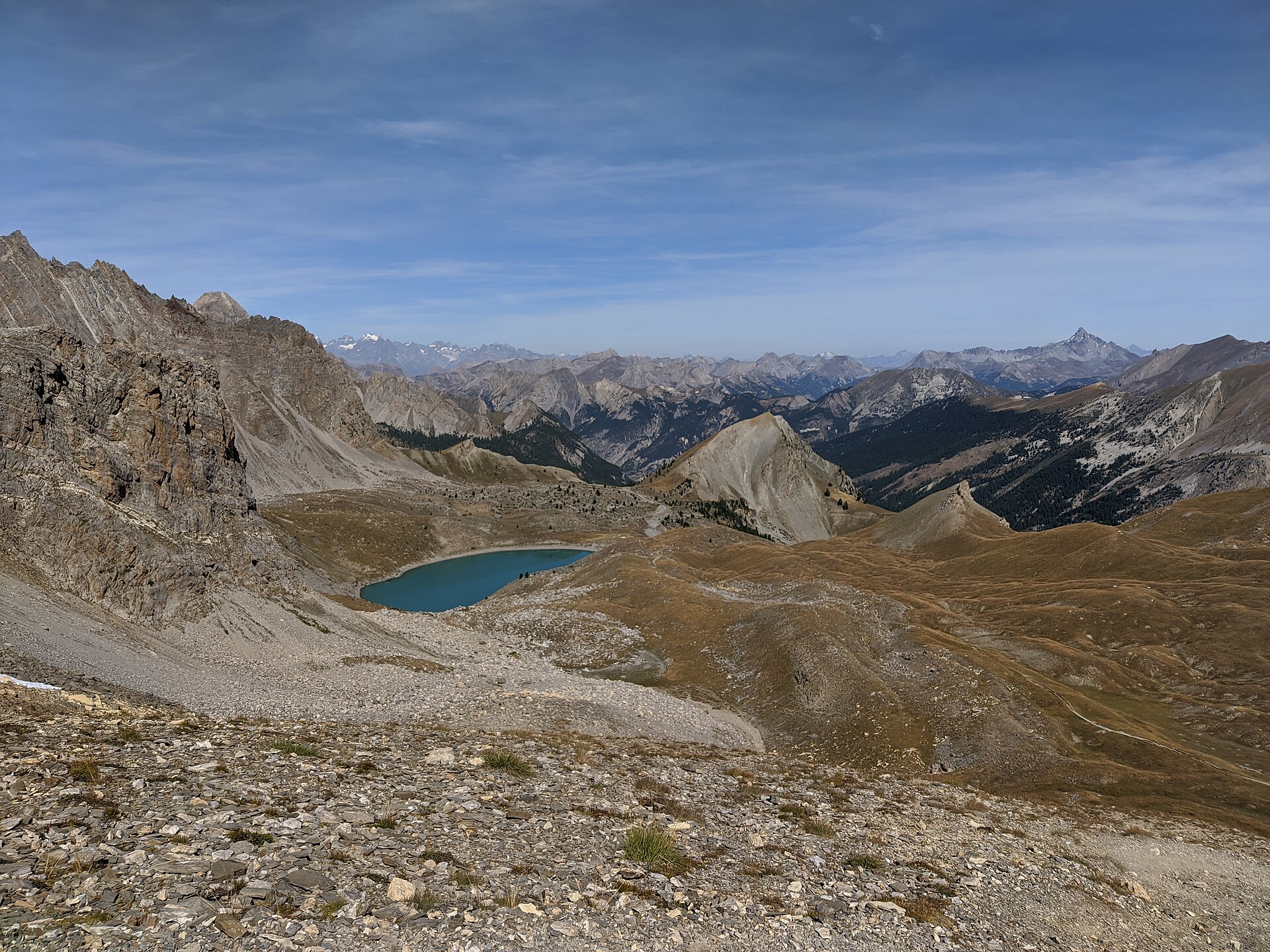
5. Triglav Lakes Valley from Planina Blato
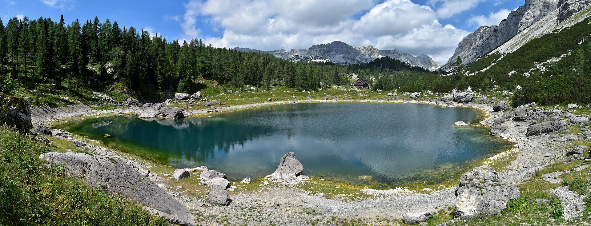
Snapshot
Itinerary
From Planina Blato, the route climbs through forest to Koča na Planini pri Jezeru, then continues through Dedno Polje and Ovčarija towards Štapce. The Štapce variant descends by a steeper section with fixed cable towards Dvojno Jezero and Koča pri Triglavskih jezerih. The return can follow the same route or make a lollipop via the Viševnik route described by the hiking source. The detailed route source gives 15.2 km, +1,051 m / -1,051 m, about 6 hours, and a high point of 1,851 m.
Why it is essential
The Triglav Lakes Valley is one of the defining landscapes of the Slovenian Julian Alps: alpine pastures, limestone karst, high-mountain lakes and classic Triglav National Park scenery. This day version reaches the Double Lake / Koča pri Triglavskih jezerih area without committing to the full multi-day traverse.
Equipment
- Sturdy boots
- Weatherproof layer
- Warm layer
- Water and food
- Sun protection
- Map/GPS and navigation backup
- Trekking poles
- Headtorch recommended because the route is long
- Microspikes may be needed if snow remains on shaded upper sections early in the season
Hazards and notes
The Štapce route includes a short secured passage and is steeper than the Prodov alternative. High-mountain weather, mist and wet rock can make navigation and descent more serious. Triglav National Park rules prohibit swimming or recreational activity in high-mountain lakes and streams, wild camping outside designated areas, and dogs swimming in high-mountain waters; dogs must be on a leash.
GPX / KML links
| Source | URL | Format | Notes |
|---|---|---|---|
| Wikiloc route: Planina Blato – Dedno Polje – Koča pri Triglavskih jezerih | wikiloc.com | GPX / source route page | Wikiloc terms; route licence not confirmed. Download availability identified; replace later with own route geometry |
| Komoot route source | komoot.com | Source map / GPX behind platform account flow | Komoot terms; unrestricted reuse not confirmed. Secondary route source only; replace later with own route geometry |
Sources
- Moon & Honey Travel Triglav Lakes Valley route
- Triglav National Park visitor rules
- Wikiloc route source
- Komoot route source
- Wikimedia Commons photo
Region-level sources
| Source | Use | URL |
|---|---|---|
| Official Auronzo Misurina tourism: Tre Cime di Lavaredo loop | Tre Cime context | auronzo.info |
| Outdooractive: Tre Cime mapped route | Tre Cime route source | outdooractive.com |
| Pustertal / Drei Zinnen tourism: Lago di Sorapiss | Sorapiss route source | pustertal.org |
| Val Gardena official route portal: Odle UNESCO hike | Odle / Seceda route source | valgardena.it |
| Trentino.com: Five Lakes tour | Five Lakes route source | trentino.com |
| Campiglio Dolomiti: 5 Lakes Tour | Five Lakes context | campigliodolomiti.it |
| Adamello Brenta Park: Giro dei 5 Laghi Campiglio | Five Lakes park context | pnab.it |
| Moon & Honey Travel: Triglav Lakes Valley route | Triglav route description | moonhoneytravel.com |
| Triglav National Park code of conduct | Triglav park rules | tnp.si |