Regional overview
The Queyras, Monviso and Cottian Alps form a dry, high, transboundary mountain region between the southern French Alps and Piedmont. The Queyras side is known for marked trails, larch forests, high pastures, lakes, ridges and cols. The area ranges from the Écrins foothills to the “Viso steps”, with flowered pastures, larch forest, wild ridges and varied geology.
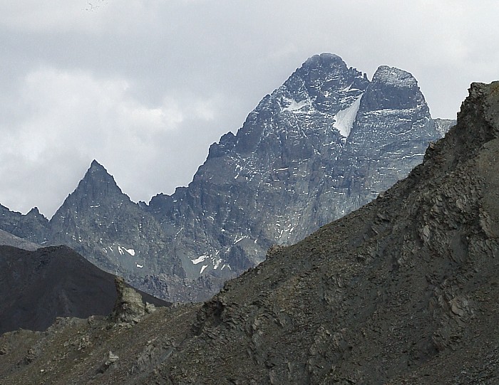
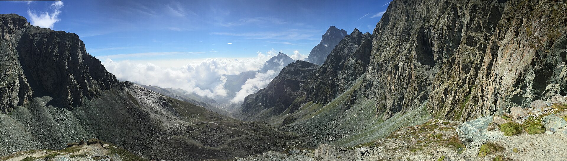
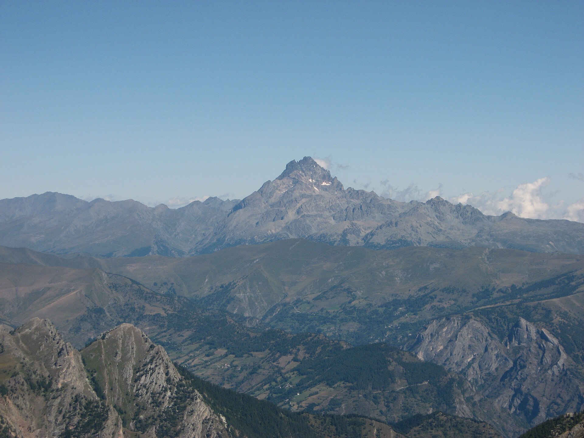
The Monviso sector is centred on Monte Viso / Monviso, 3,841 m. The massif sits between the Alps and the Mediterranean, with glacial cirques, high-altitude lakes, cembra pine forest and the source area of the Po at Pian del Re. The Italian Parco del Monviso and the French Queyras Regional Nature Park jointly manage the transboundary UNESCO Monviso Biosphere Reserve.
The Cottian / Occitan valleys on the Italian side, especially Valle Maira and the Gardetta plateau, add limestone towers, old military tracks, Occitan villages and strong geological interest. The Gardetta plateau is also notable for fossil dinosaur footprints discovered and identified in 2008–2009.
The normal hiking season is late June to October, but snow can linger on cols, north-facing slopes, tunnels and scree gullies. Several routes start above 2,000 m, so weather, cold wind, afternoon storms and early-season snow can make apparently moderate hikes more serious.
Selection rationale
These five hikes give a balanced sample of the region: a classic Queyras lake-and-col route, a high Queyras lake basin below the Italian frontier, an accessible 3,000 m summit, the historic Buco di Viso / Traversette crossing below Monviso, and the limestone landscape of Rocca la Meja and the Gardetta plateau.
Summary table
| # | Hike | Country | Route type | Distance | Gain | Max elevation | Difficulty |
|---|---|---|---|---|---|---|---|
| 1 | Lac Sainte-Anne and Col Girardin, Ceillac | France | Loop | 9.6–10.7 km | +742–743 m | 2,699 m | Moderate |
| 2 | Lacs Foréant and Egorgéou via Col Vieux | France | Out-and-back | 10.3 km | +578 m | 2,780 m | Fairly difficult |
| 3 | Pic de Caramantran via Col de Chamoussière | France / Italy border | Out-and-back | 6.0–6.7 km | +386–425 m | 3,025 m | Moderate mountain hike |
| 4 | Pian del Re, Buco di Viso and Colle delle Traversette | Italy / France border | Out-and-back | 10.2 km | +930 m | 2,938–2,950 m | E / short EE sections |
| 5 | Rocca la Meja and Gardetta Plateau loop | Italy | Loop | 13.4 km | +700 m | Hard |
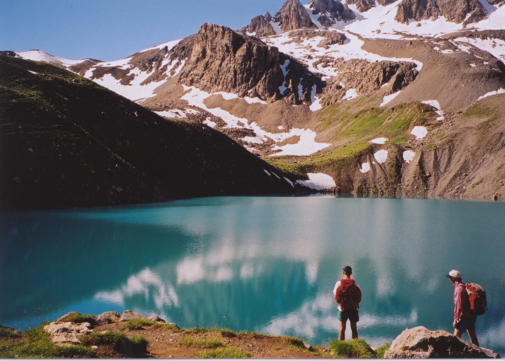
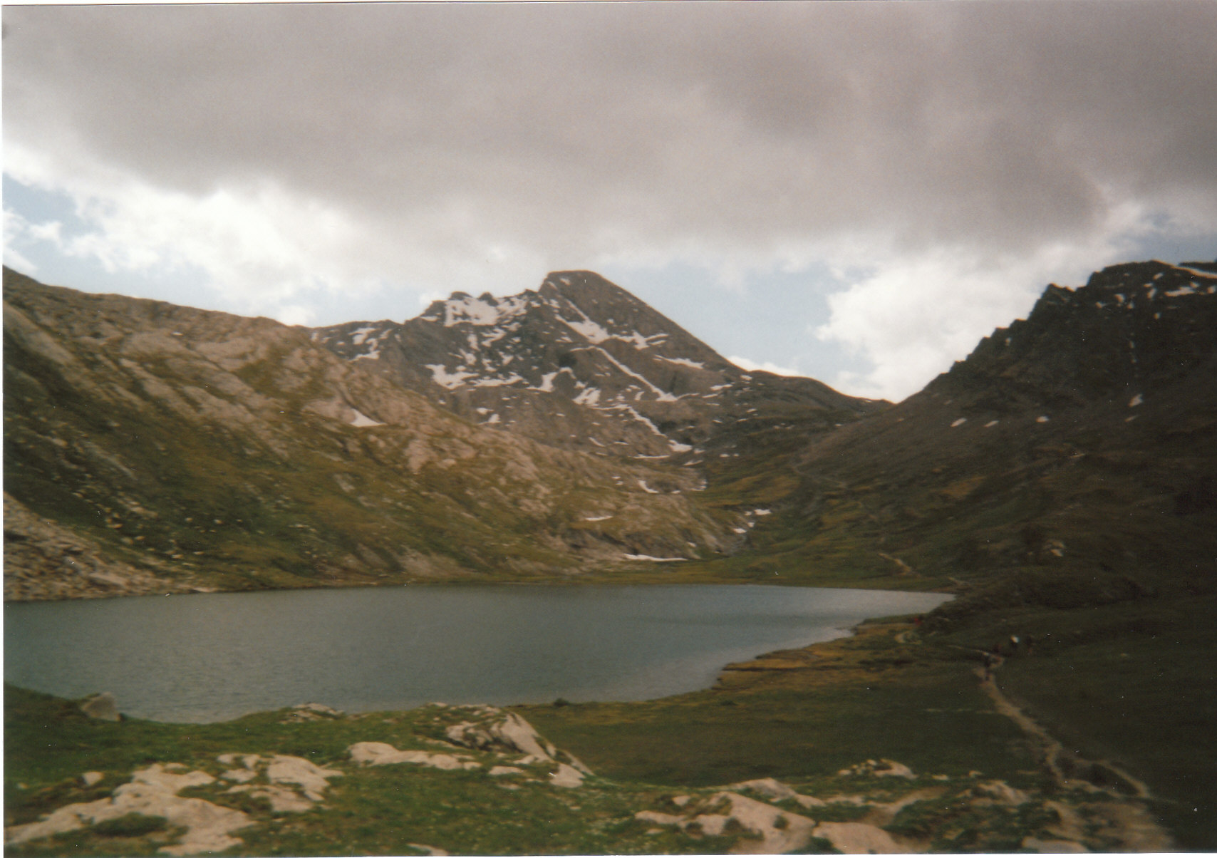
1. Lac Sainte-Anne and Col Girardin, Ceillac
Snapshot
Itinerary
The route climbs from Ceillac towards the high valley above the village, reaching Lac Sainte-Anne before continuing to Col Girardin. The lake sits at about 2,415 m, while the col reaches 2,699 m and gives a high crossing viewpoint over the Queyras and neighbouring valleys. The return completes a loop back towards Ceillac.
Why it is essential
This is one of the classic Queyras lake-and-col day walks: a turquoise high lake, a named pass, broad alpine views and a feasible distance for a fit day hiker. It represents the Ceillac sector especially well.
Equipment
- Sturdy boots
- Waterproof layer
- Warm layer
- Sun protection
- Water and food
- Map / GPS and navigation backup
- Trekking poles useful for the descent
- Microspikes may be useful if early-season snow remains near the col
Hazards and notes
- Snow can persist near Col Girardin in early summer.
- The route reaches nearly 2,700 m, so weather changes, cold wind and afternoon thunderstorms matter.
- The descent should be treated cautiously if wet or snow-covered.
GPX / KML links
| Source | URL | Format | Notes |
|---|---|---|---|
| Chemins des Parcs GPX | admin.cheminsdesparcs.fr | GPX | Official route export |
| Chemins des Parcs KML | admin.cheminsdesparcs.fr | KML | Official route export |
| Hautes-Alpes Rando GPX | geotrek-cd05-aggregator.makina-corpus.net | GPX | Official route export |
| Hautes-Alpes Rando KML | geotrek-cd05-aggregator.makina-corpus.net | KML | Official route export |
| Chemins des Parcs source page | cheminsdesparcs.fr | Source page | Route description |
| Hautes-Alpes Rando source page | alpesrando.net | Source page | Route description |
Further reading
- Chemins des Parcs — Ceillac, Lac Sainte-Anne et Col Girardin
- Hautes-Alpes Rando — Ceillac, Lac Sainte-Anne et Col Girardin
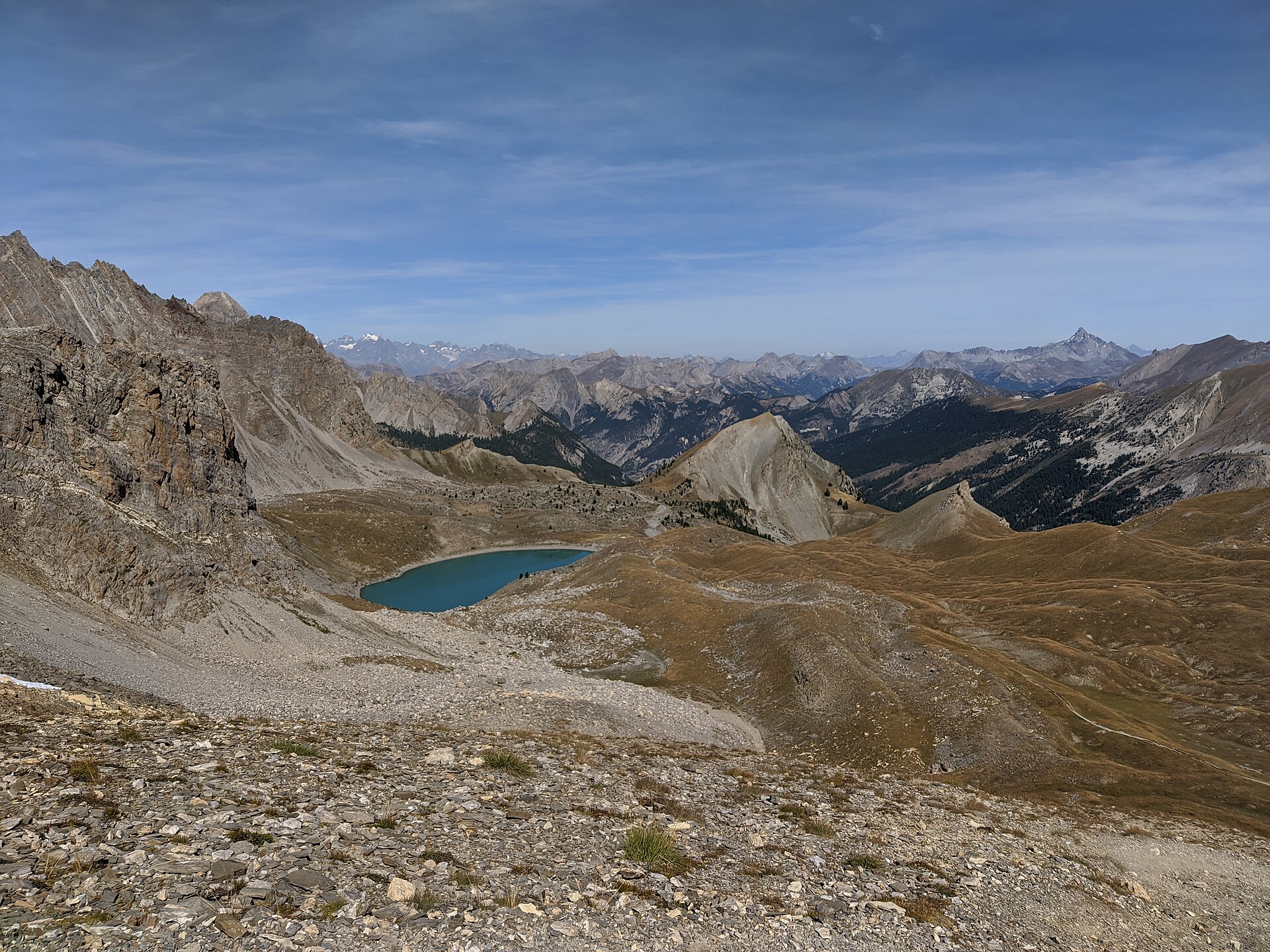
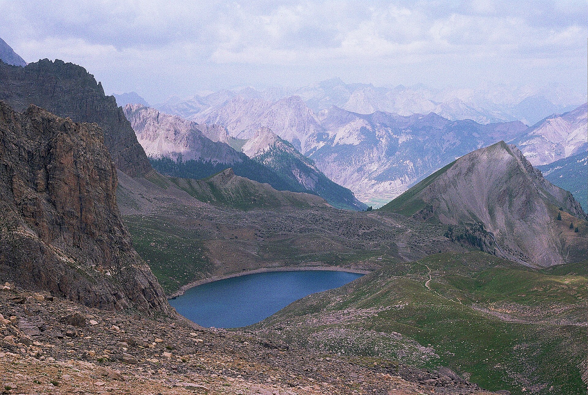
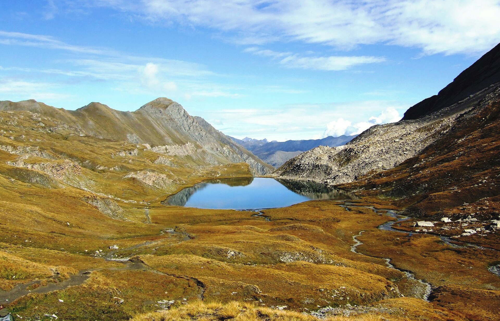
2. Lacs Foréant and Egorgéou via Col Vieux
Snapshot
Itinerary
From the Agnel road parking area, the route climbs to Col Vieux. It then descends towards Lac Foréant, set in a high open basin below the Italian frontier. The route can continue down to Lac Egorgéou, adding roughly 40 minutes from Foréant according to the official description, before returning by the same line.
Why it is essential
This is a compact high-mountain route showing the Queyras at its most characteristic: bright lakes, open alpine basins, a frontier pass and views towards the Monviso / Pain de Sucre sector.
Equipment
- Sturdy boots
- Warm and waterproof layers
- Map / GPS
- Water and food
- Sun protection
- Trekking poles
- Microspikes may be needed if snow remains near Col Vieux
Hazards and notes
- The route is high from the start, with limited shelter.
- Early snow, hard névé, poor visibility and thunderstorms can make the col and upper basins more serious.
- The official route page notes that dogs are accepted on a lead.
GPX / KML links
| Source | URL | Format | Notes |
|---|---|---|---|
| Le Queyras / Apidae | static.apidae-tourisme.com | GPX | Route export |
| Le Queyras source page | lequeyras.com | Source page | Route description |
| KML | Not found | KML | Add later if located |
Further reading
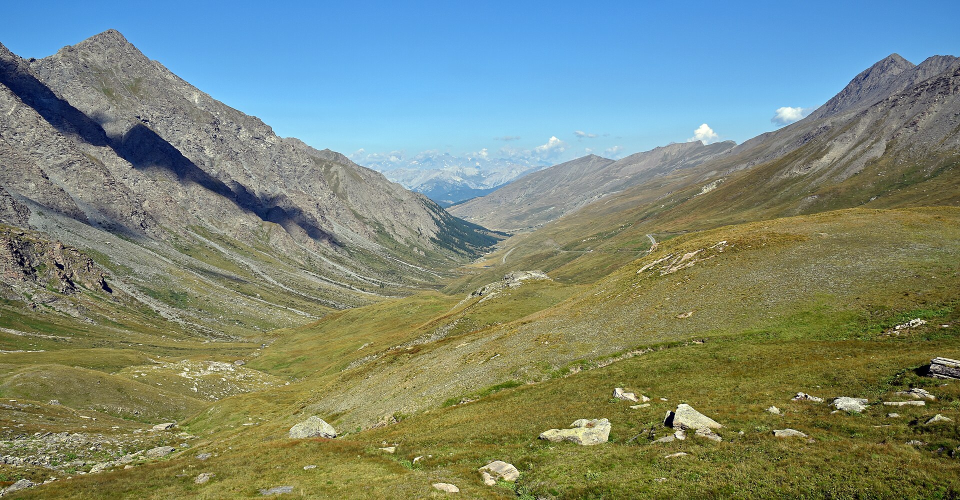
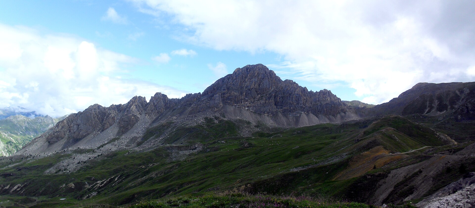
3. Pic de Caramantran via Col de Chamoussière
Snapshot
Itinerary
From the parking area below Col Agnel, the path follows the GR58 towards Col de Chamoussière. From the col, a cairned but less formal mountain path climbs the upper slopes to Pic de Caramantran. The summit gives a high frontier viewpoint over the Queyras, Pain de Sucre, Tête des Toillies and Monviso sector. The return normally follows the same route.
Why it is essential
Pic de Caramantran is one of the region’s most accessible 3,000 m summits. It adds a summit objective to the lake-and-pass walks elsewhere in the selection and gives a broad view across the French–Italian borderlands.
Equipment
- Sturdy boots
- Warm and waterproof layers
- Hat / gloves outside high summer
- Sun protection
- Water and food
- Map / GPS and navigation backup
- Microspikes may be needed if old snow remains
- Trekking poles useful, though the final summit section may require hands for balance
Hazards and notes
- The last metres may require use of the hands but are normally easy and not especially exposed in dry summer conditions.
- Fog and poor weather can make navigation more difficult.
- Sensitive alpine pasture areas may require walkers to stay within marked or protected trail lines.
GPX / KML links
| Source | URL | Format | Notes |
|---|---|---|---|
| Le Queyras / Apidae | static.apidae-tourisme.com | GPX | Route export |
| Le Queyras source page | lequeyras.com | Source page | Route description |
| Altituderando source page | altituderando.com | Source page | Secondary description; GPX download requires login |
| KML | Not found | KML | Add later if located |
Further reading
- Le Queyras — Pic de Caramantran par le Col de Chamoussière
- Altituderando — Pic de Caramantran 3025 m par le Col Agnel
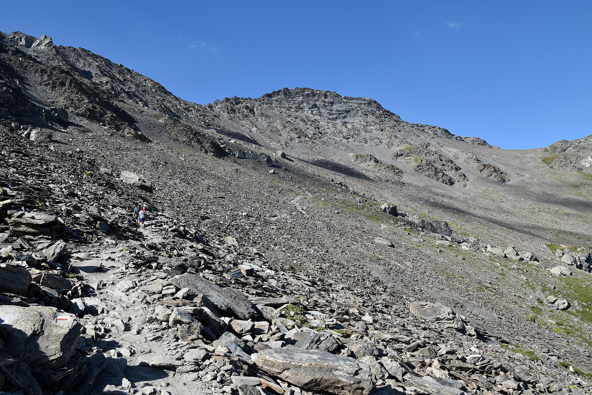
4. Pian del Re, Buco di Viso and Colle delle Traversette
Snapshot
Itinerary
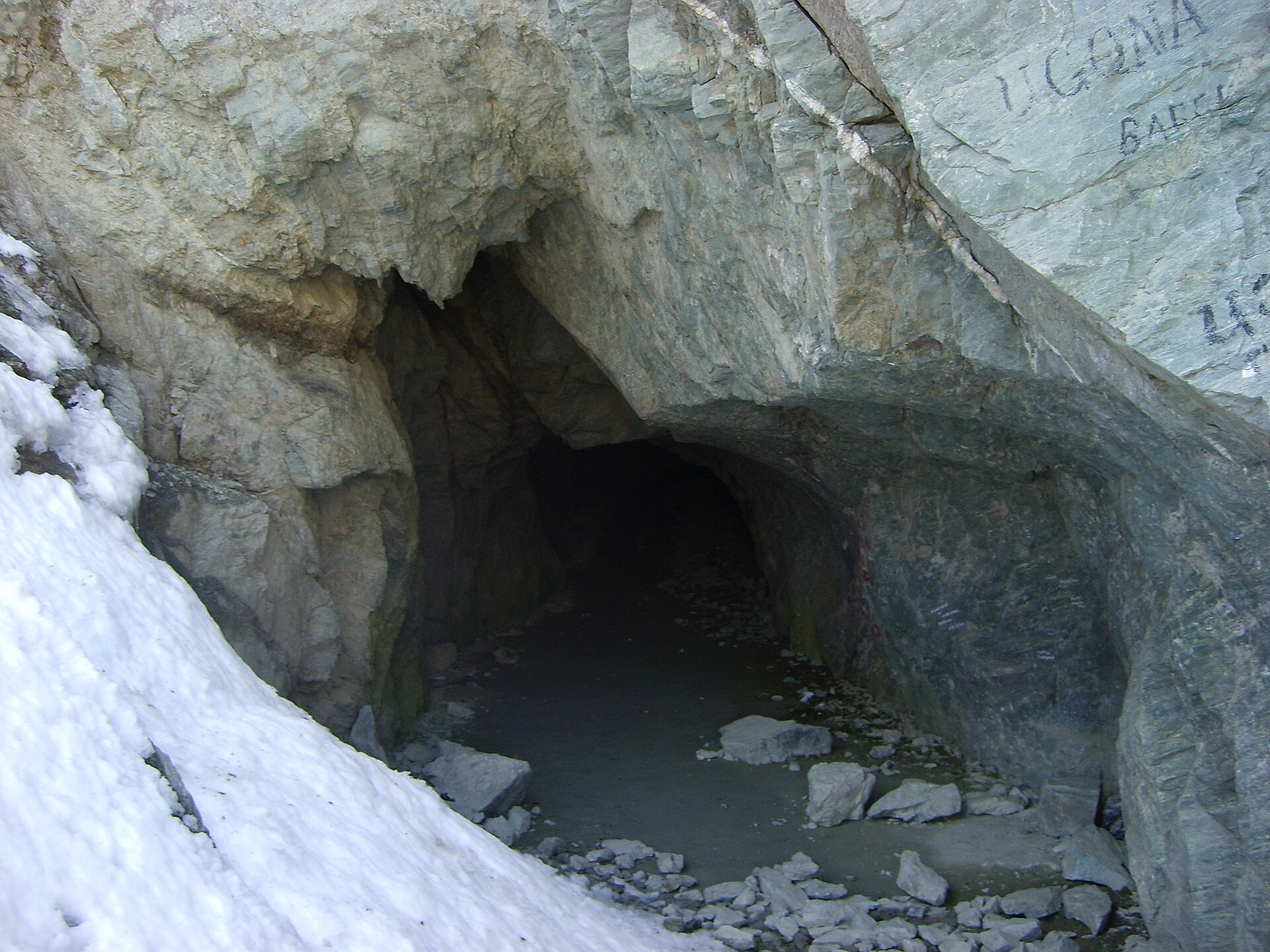
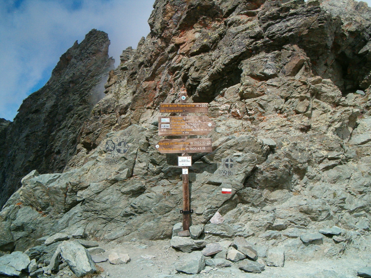
From Pian del Re, the route follows the old mule track / military-road line towards Pian Armoine, Pian Mait and the upper Traversette basin. The route reaches the historic Buco di Viso tunnel at about 2,860–2,880 m and can continue to Colle delle Traversette before returning. The tunnel should be crossed with a torch. Snowfields may remain near the upper route until late summer.
Why it is essential
This is the historic day-hike of the Monviso borderlands. The Buco di Viso is widely described as one of the earliest Alpine tunnels, built to ease trade between the Saluzzo and French sides and avoid the more dangerous col crossing. It combines Monviso scenery, high pass terrain and major cultural history.
Equipment
- Sturdy boots
- Warm and waterproof layers
- Headtorch or torch for the tunnel
- Water and food
- Map / GPS
- Trekking poles
- Microspikes may be needed in early season, or a decision to turn back if snow is hard or steep
Hazards and notes
- The upper section has scree, possible snowfields, wet or slippery ground, and a short more exposed line near the col.
- Care is required between the Buco di Viso entrance and Colle delle Traversette in slippery conditions.
- The tunnel is normally open from June to October depending on snow; the French side is closed in winter because of snow and ice.
GPX / KML links
| Source | URL | Format | Notes |
|---|---|---|---|
| Parco del Monviso | parcomonviso.eu | GPX | Official route export |
| Parco del Monviso source page | parcomonviso.eu | Source page | Route description |
| AlpiCuneesi | alpicuneesi.it | GPX | Alternative route file |
| AlpiCuneesi source page | alpicuneesi.it | Source page | Technical route description |
| KML | Not found | KML | Add later if located |
Further reading
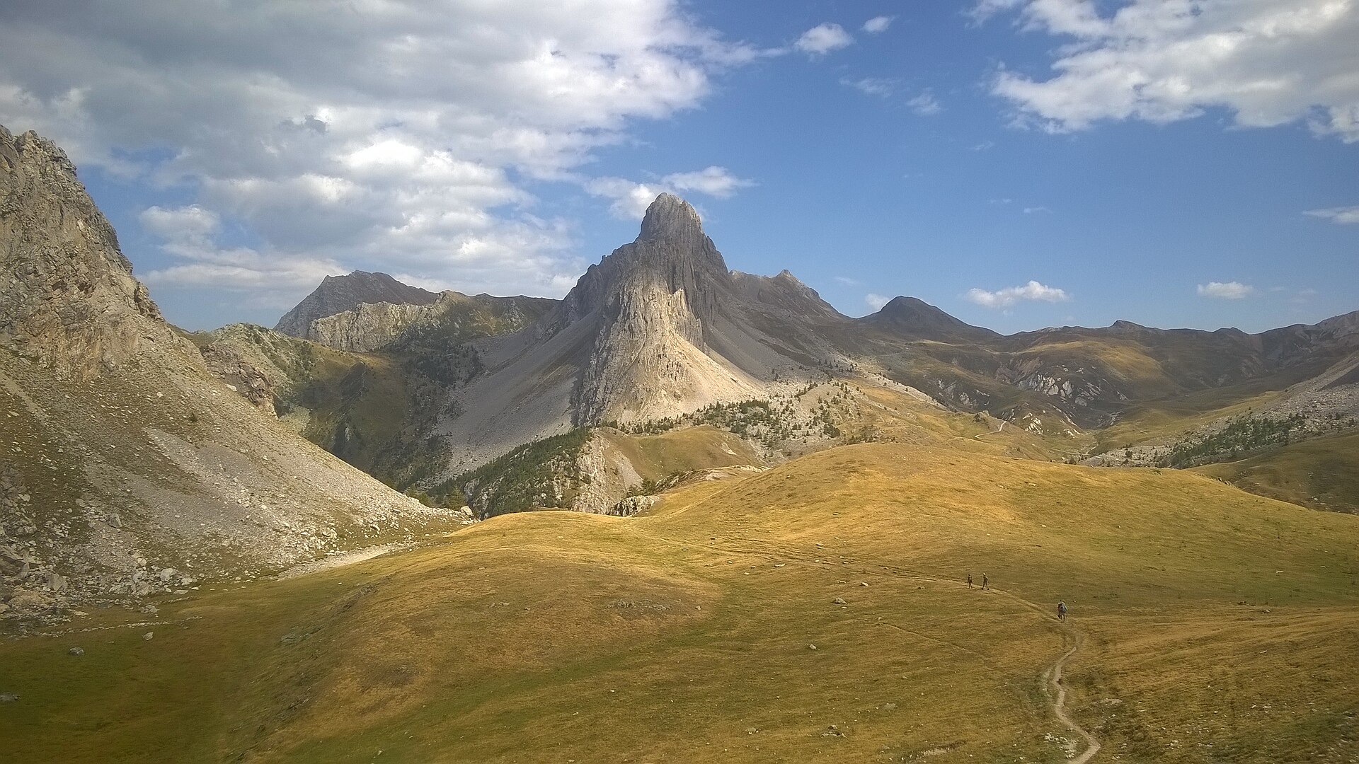
5. Rocca la Meja and Gardetta Plateau loop
Snapshot
Itinerary
From the Colle del Preit car park, the route follows the road towards the Margherina pass, then reaches Gias Margherina and Colle d’Ancoccia. It continues past Lago della Meja and towards Colle del Mulo before returning by paths beside Rocca la Meja and the passage of Preit. The official description notes scree slopes and route-finding that is not always obvious, making suitable mountain footwear important.
Why it is essential
Rocca la Meja is one of the symbolic limestone forms of the Gardetta plateau. The surrounding plateau combines open high pasture, pale dolomite and limestone walls, old military-road landscapes and major geological interest, including dinosaur footprints identified from discoveries made in 2008–2009.
Equipment
- Sturdy boots
- Weatherproof layer
- Warm layer
- Water and food
- Map / GPS
- Sun protection
- Navigation backup
- Trekking poles recommended
Hazards and notes
- The official Valle Maira description warns of stony slopes and directions that may not always be clear.
- Navigation should not rely only on waymarking.
- The area is exposed to storms and wind, and the limestone terrain can be slippery when wet.
- Current access rules for the Colle del Preit road and parking were not verified.
GPX / KML links
| Source | URL | Format | Notes |
|---|---|---|---|
| Valle Maira | vallemaira.org | GPX | Route download |
| Valle Maira source page | vallemaira.org | Source page | Route description |
| KML | Not found | KML | Add later if located |
Further reading
Further reading
| Source | URL |
|---|---|
| Guillestrois–Queyras official hiking overview | lequeyras.com |
| UNESCO Monviso Biosphere Reserve | unesco.org |
| Parco del Monviso official site | parcomonviso.eu |
| Lacs Foréant and Egorgéou official route page | lequeyras.com |
| Pic de Caramantran official route page | lequeyras.com |
| Lac Sainte-Anne and Col Girardin, Chemins des Parcs | cheminsdesparcs.fr |
| Lac Sainte-Anne and Col Girardin, Hautes-Alpes Rando | alpesrando.net |
| Buco di Viso, Parco del Monviso | parcomonviso.eu |
| Buco di Viso / Traversette, AlpiCuneesi | alpicuneesi.it |
| Valle Maira overview | visitcuneese.it |
| Rocca la Meja route page | vallemaira.org |
| Rocca la Meja / Gardetta attraction page | vallemaira.org |