Regional overview
This region is one of the densest high-alpine hiking areas in Europe: the north side of the Mont Blanc massif above Chamonix, the Aiguilles Rouges balcony opposite Mont Blanc, the upper Chamonix valley around Le Tour and Vallorcine, and the Italian Val Ferret above Courmayeur.
The walking character is strongly shaped by cable cars, cog railways, glacier views, high balcony paths, and steep but non-technical mountain trails. The main hiking centres are Chamonix, Les Praz / La Flégère, Argentière, Le Tour, Vallorcine, Montenvers, Courmayeur and Val Ferret.
Many classic walks are lift-assisted, but they still cross serious mountain terrain. Snow, thunderstorms, exposure, lift timetables and sudden weather changes matter. For mid- and high-mountain outings, hikers should check current mountain conditions before departure.
The Aiguilles Rouges Nature Reserve has specific restrictions. Dogs and other pets are prohibited, camping and campfires are restricted, and walkers should remain on the main paths. Swimming is prohibited at Lac Blanc and the Lacs des Chéserys.
Selection rationale
These five hikes were selected to give a balanced picture of the region: Lac Blanc from La Flégère for the iconic Aiguilles Rouges lake-and-Mont-Blanc panorama; the Grand Balcon Nord for the classic Mont Blanc-side balcony traverse; the Aiguillette des Posettes for a compact summit and ridge viewpoint above Le Tour; Refuge Albert 1er from Col de Balme for a high-alpine glacier-view hut walk; and Lavachey – Rifugio Bonatti – Col Entre-deux-Sauts for the Italian Val Ferret side of the Mont Blanc massif.
Summary table
| # | Hike | Country | Route type | Distance | Gain | Max elevation | Difficulty |
|---|---|---|---|---|---|---|---|
| 1 | Lac Blanc from La Flégère | France | Lift-assisted out-and-back | 7 km | 500 m | 2,352 m | Difficult |
| 2 | Grand Balcon Nord: Plan de l’Aiguille to Montenvers | France | Lift/rail-assisted point-to-point | 5.7 km | 140 m | 2,310 m | Medium |
| 3 | Aiguillette des Posettes from Le Tour | France | Out-and-back / ridge summit | 7 km | 721 m | 2,201 m | Difficult |
| 4 | Refuge Albert 1er from Col de Balme | France | Lift-assisted out-and-back | 8 km | 511 m | 2,702 m | Difficult |
| 5 | Lavachey – Rifugio Bonatti – Col Entre-deux-Sauts | Italy | Out-and-back | 9.5 km approx. | 806 m | 2,521 m | E / mountain hike |
1. Lac Blanc from La Flégère
Snapshot
Itinerary
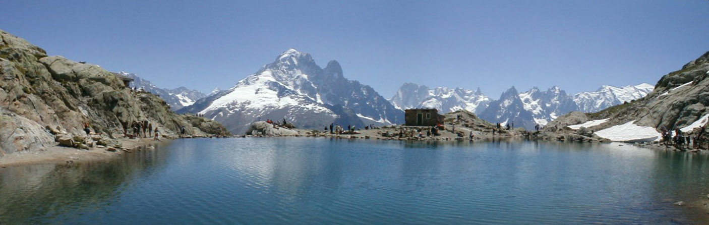
From the La Flégère upper station, the path descends into the Combe de la Chavanne, then climbs past the Chalets et Lac de la Flégère at 2,027 m. It continues below the Tête du Aubuy, skirts a ridge, joins the path coming from Argentière, and reaches Lac Blanc in a high rocky basin opposite the Mont Blanc massif. The Chéserys lakes make a possible descent variant, but the official 7 km statistics correspond to the Flégère–Lac Blanc return route.
Why it is essential
Lac Blanc is the emblematic Aiguilles Rouges viewpoint: a high mountain lake directly opposite Mont Blanc, the Aiguille Verte, the Drus and the Chamonix aiguilles. It is the most recognisable lake walk in the Chamonix valley.
Equipment
- Sturdy hiking boots
- Weatherproof layer
- Warm layer
- Water and food
- Map or GPS
- Sun protection
- Navigation backup
- Trekking poles recommended
- Microspikes or crampons may be needed if snow remains
Hazards and notes
High mountain weather exposure and early-season snow may remain on the upper path. Dogs are prohibited in the Aiguilles Rouges Nature Reserve, and swimming is prohibited at Lac Blanc and the Lacs des Chéserys. Current trail status should be checked before travel or departure.
GPX / KML links
| Source | URL | Format | Notes |
|---|---|---|---|
| Official Chamonix GPX | apidae-tourisme.com | GPX | Direct GPX download from the official Chamonix route page |
| Chamonix official route page | en.chamonix.com | Source page | Use for current trail status and route verification |
Sources
- Chamonix — Hike to Lac Blanc from La Flégère
- Wikimedia Commons — Panorama du Lac Blanc des Aiguilles Rouges
2. Grand Balcon Nord: Plan de l’Aiguille to Montenvers
Snapshot
Itinerary
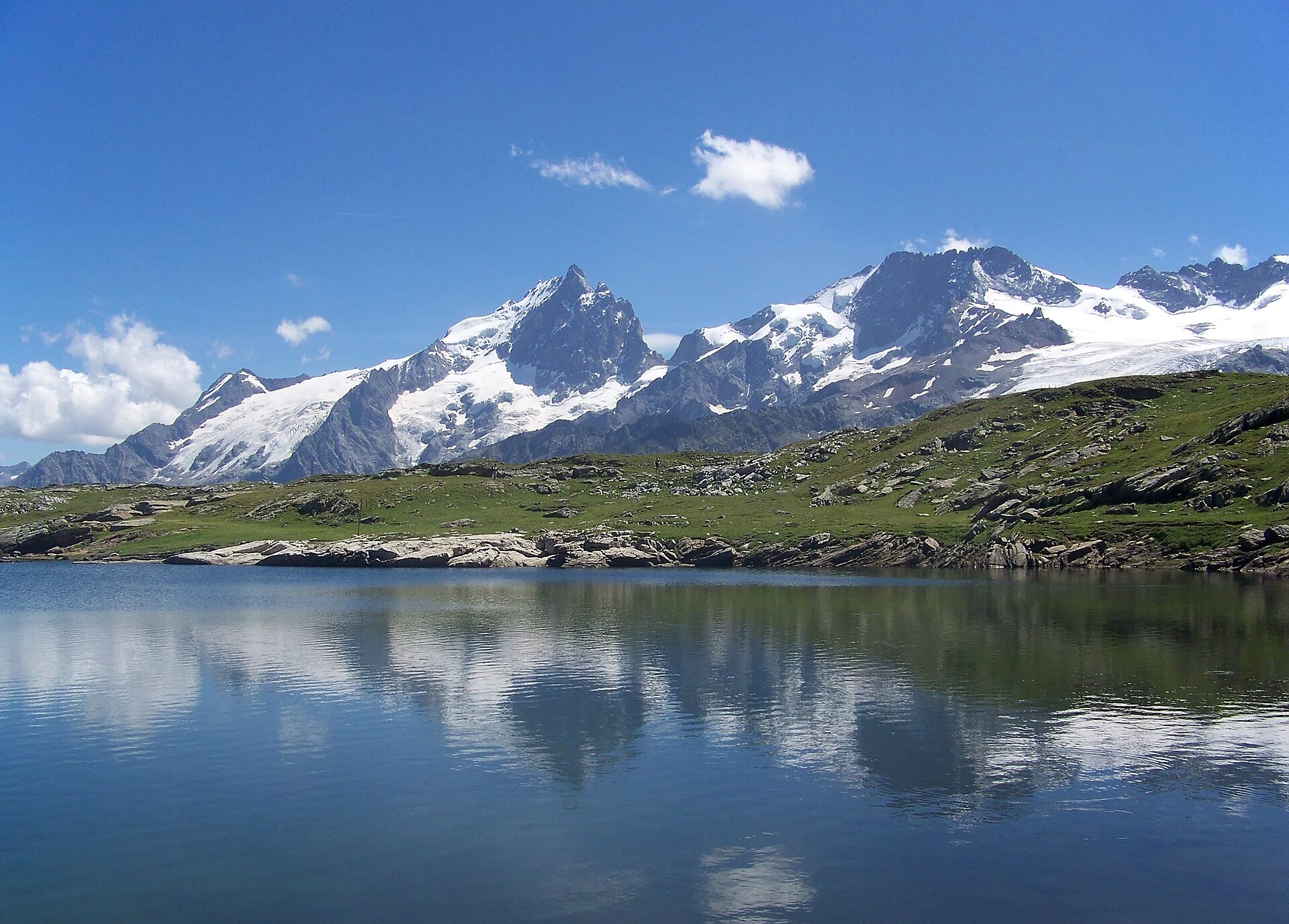
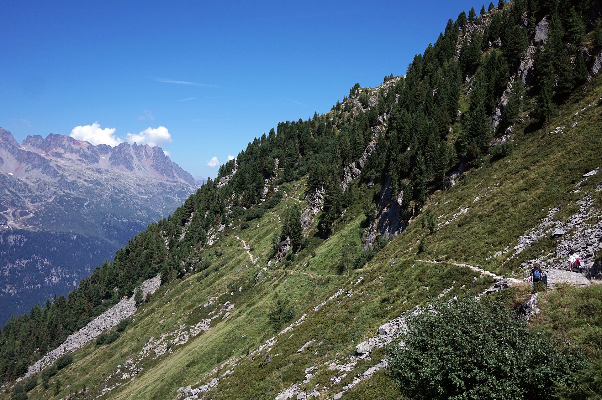
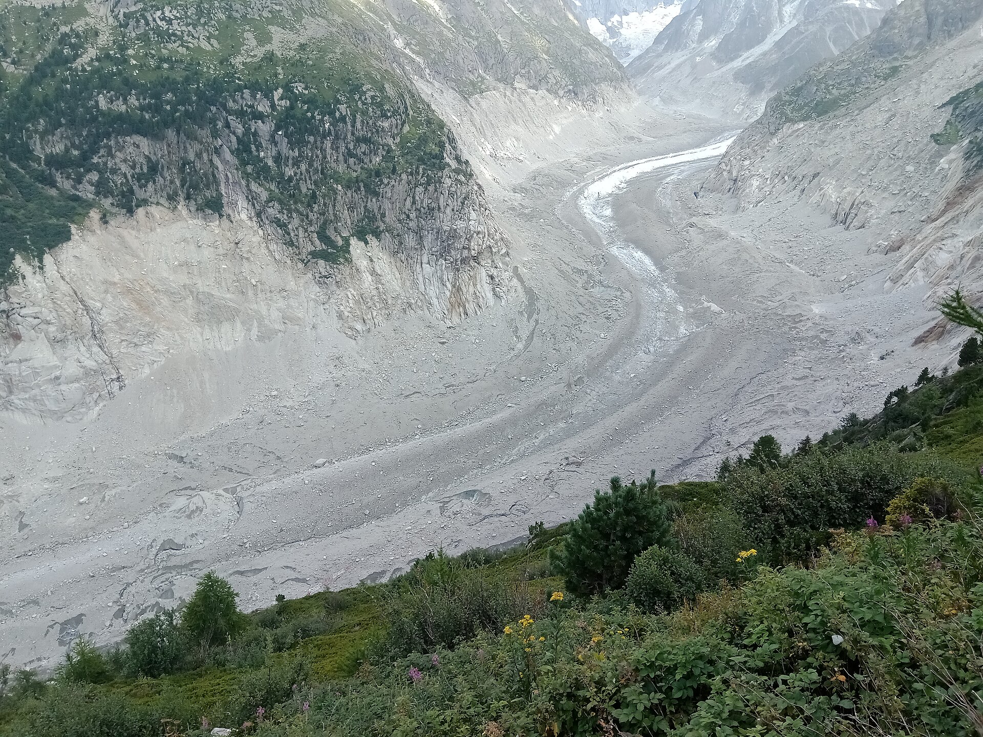
From the Plan de l’Aiguille cable-car station, the path drops towards the Refuge du Plan de l’Aiguille, then traverses across the slopes below the Blaitière and Nantillons glaciers. It continues across the Grépon torrent, reaches the fork below Signal Forbes, and follows the panoramic line rather than the steep shortcut through couloirs. The final section descends to Montenvers, with views changing from the Aiguilles de Chamonix to the Drus, Aiguille Verte, Grandes Jorasses and Mer de Glace.
Why it is essential
This is the classic Mont Blanc-side balcony walk. It gives close views of the Chamonix aiguilles and then a dramatic arrival above the Mer de Glace, linking two of the valley’s best-known mountain transport sites.
Equipment
- Sturdy hiking shoes or boots
- Weatherproof layer
- Warm layer
- Water and food
- Sun protection
- Map or GPS
- Plan for lift and train timetables
- Trekking poles useful for the descent
Hazards and notes
The steep shortcut to Montenvers crosses dangerous couloirs in snow; use the standard panoramic path when conditions are uncertain. Lift and railway schedules are essential. Avoid in thunderstorms, hard snow or poor visibility.
GPX / KML links
| Source | URL | Format | Notes |
|---|---|---|---|
| Official Chamonix GPX | apidae-tourisme.com | GPX | Direct GPX download from the official Chamonix route page |
| Chamonix official route page | en.chamonix.com | Source page | Use for current trail status and route verification |
Sources
- Chamonix — Grand Balcon Nord: Plan de l’Aiguille du Midi to Montenvers
- Wikimedia Commons — Grand Balcon Nord 4
- Wikimedia Commons — Mer de Glace at Grand Balcon Nord
3. Aiguillette des Posettes from Le Tour
Snapshot
Itinerary
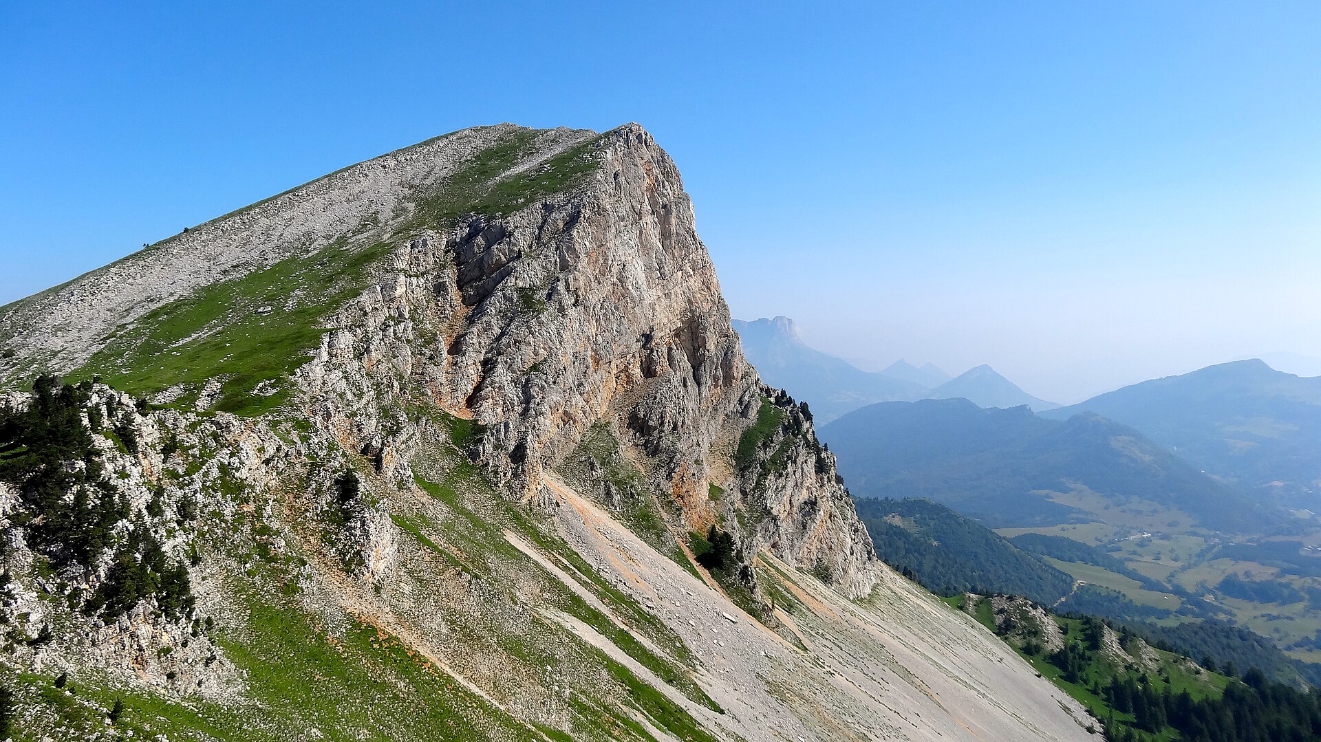
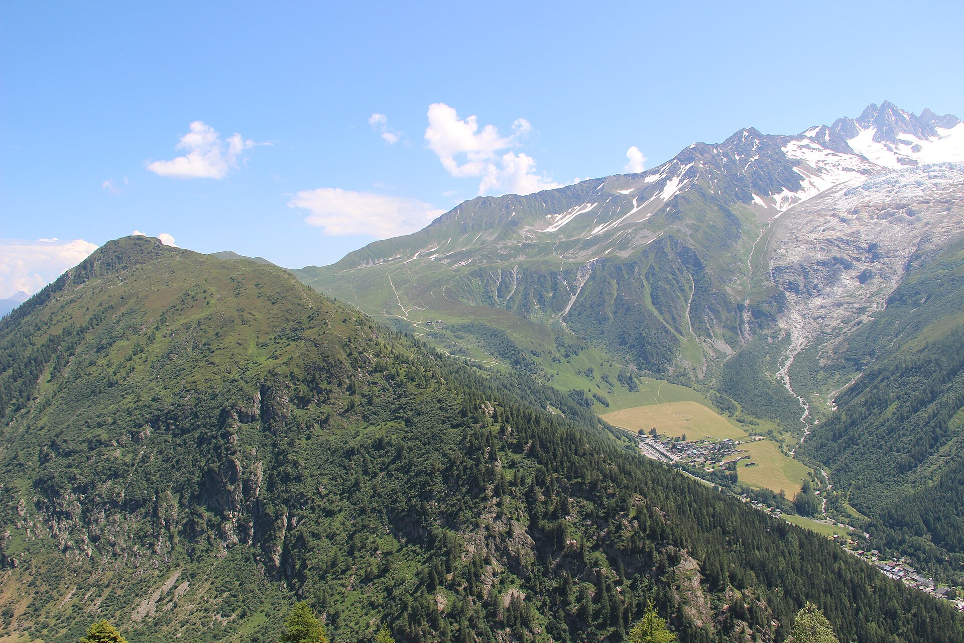
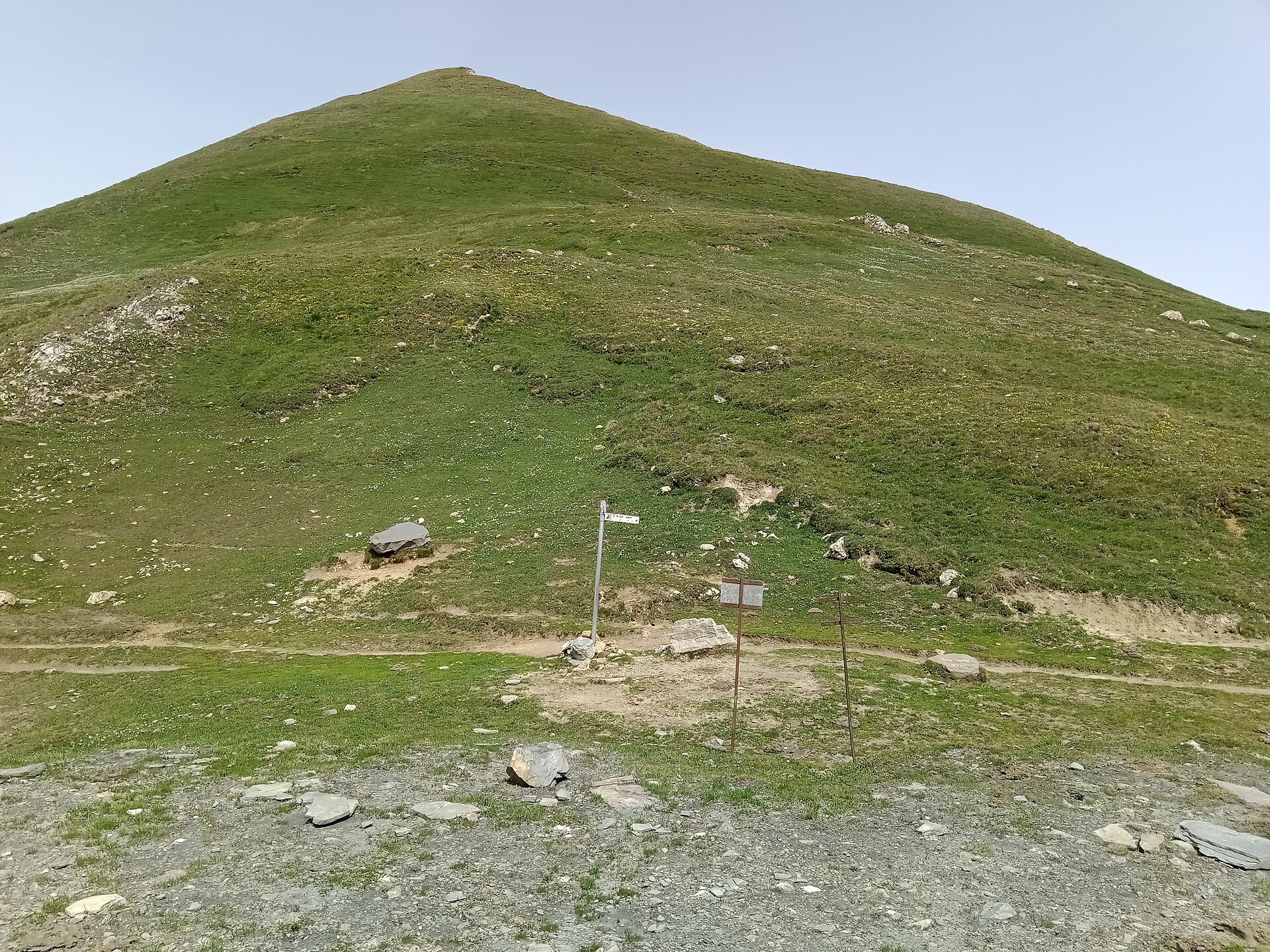
From Le Tour, the route climbs from near the bridge on the right bank of the Arve. It enters light forest, reaches the Pierre-Fendue junction at about 1,950 m, then climbs right past avalanche-protection structures and old slate quarries. The final section follows the ridge to the Aiguillette des Posettes, with views towards Mont Blanc, the Tour Glacier, Le Buet, Les Perrons, Vallorcine and the upper Chamonix valley.
Why it is essential
Aiguillette des Posettes is one of the most efficient summit walks in the Chamonix area: steep, compact and panoramic. It represents the Le Tour / Vallorcine end of the valley and gives a different angle on the Mont Blanc massif.
Equipment
- Sturdy hiking boots
- Weatherproof layer
- Warm layer
- Food and water
- Sun protection
- Map or GPS
- Trekking poles recommended
Hazards and notes
Steep climb with weather exposure on the ridge. Avoid the ridge in thunderstorms or strong wind. Early-season snow or wet grass can make the route more serious.
GPX / KML links
| Source | URL | Format | Notes |
|---|---|---|---|
| Official Chamonix GPX | apidae-tourisme.com | GPX | Direct GPX download from the official Chamonix route page |
| Chamonix official route page | en.chamonix.com | Source page | Use for current trail status and route verification |
Sources
4. Refuge Albert 1er from Col de Balme
Snapshot
Itinerary
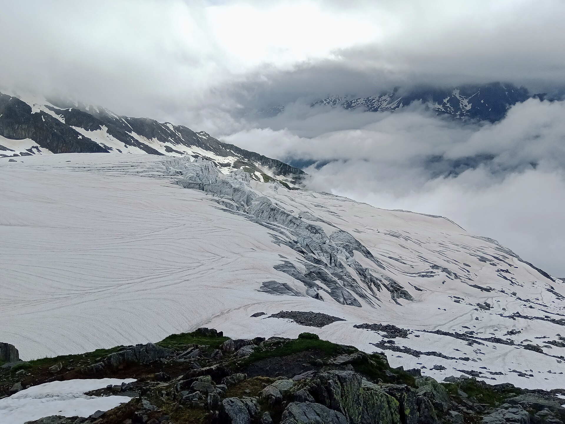
From the Autannes chairlift arrival area, the path heads right, passes near the outlet of Lac de Charamillon, and traverses the mountainside towards the Glacier du Tour. It rounds a spur, crosses a slope above a tricky ravine protected by ramps, then reaches the moraine below Refuge Albert 1er. The hut stands near the Glacier du Tour and is a starting point for higher alpine routes, but this day-hike stops at the refuge and avoids glacier travel.
Why it is essential
This is the most accessible non-glacial day hike in the selection for close views of the Glacier du Tour. It gives a high-alpine atmosphere without requiring ropework in normal summer conditions, provided the hiker remains on the marked path and does not continue onto glacier terrain.
Equipment
- Sturdy hiking boots
- Weatherproof layer
- Warm layer
- Hat and gloves outside stable midsummer weather
- Water and food
- Navigation backup
- Trekking poles
- Microspikes or crampons may be needed in early season if snow remains
Hazards and notes
The route includes a traverse above a ravine and moraine terrain near a glacier. Do not continue onto glacier terrain without proper alpine equipment and skills. Snow on the ravine section can make the route significantly more serious. Avoid in low visibility or unstable weather.
GPX / KML links
| Source | URL | Format | Notes |
|---|---|---|---|
| Official Chamonix GPX | apidae-tourisme.com | GPX | Direct GPX download from the official Chamonix route page |
| Chamonix official route page | en.chamonix.com | Source page | Use for current trail status and route verification |
Sources
- Chamonix — Hike to the Refuge Albert 1er from the Col de Balme
- Wikimedia Commons — Glacier du Tour at Refuge Albert Ier
5. Lavachey – Rifugio Bonatti – Col Entre-deux-Sauts
Snapshot
Itinerary
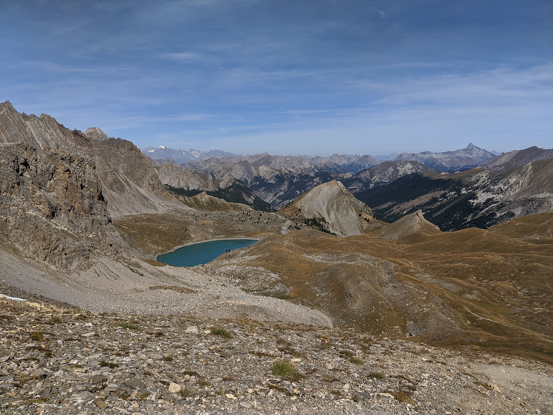
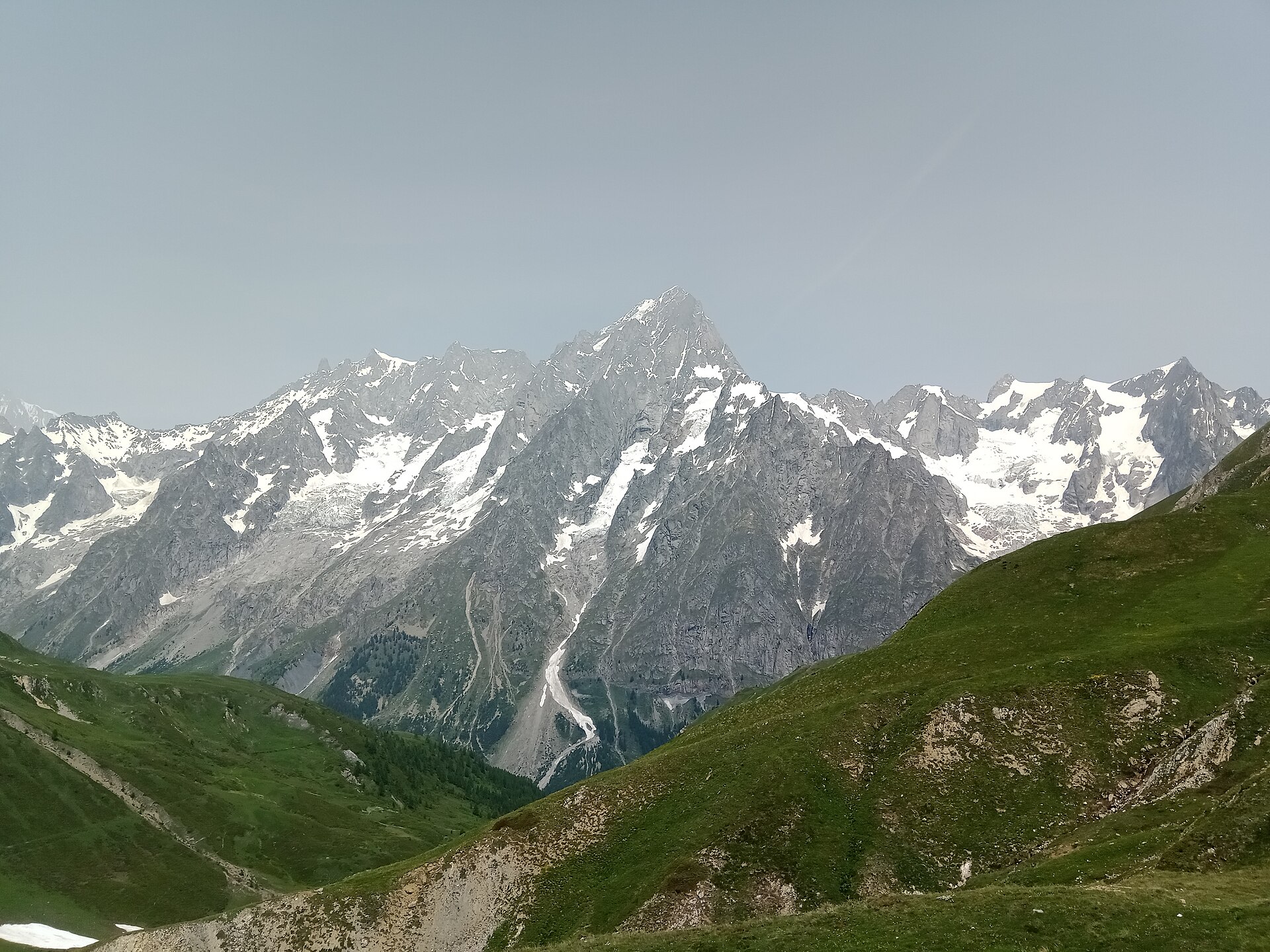
From Courmayeur, the access road enters Val Ferret. The walking route begins beyond Lavachey, just before the Malatrà stream, where trail 42 leaves the road on the right. It climbs to Rifugio Bonatti, continues through the pastures of Malatrà Inferiore and Malatrà Superiore, ignores the left branch towards Col Malatrà, then crosses a broad upper basin before climbing to Pas / Col Entre-deux-Sauts at about 2,520 m.
Why it is essential
This route gives the Italian counterpart to the Chamonix-side classics: a Val Ferret balcony and pass route beneath the Grandes Jorasses side of the Mont Blanc massif, with Rifugio Bonatti as a key landmark on the Tour du Mont Blanc and Alta Via context.
Equipment
- Sturdy hiking boots
- Weatherproof layer
- Warm layer
- Food and water
- Sun protection
- Map or GPS
- Trekking poles recommended
Hazards and notes
Lingering snow possible in early summer and rapid weather changes in the upper basin. Follow route 42 carefully where it divides from the Col Malatrà branch. Confirm hut services and Val Ferret transport before departure.
GPX / KML links
| Source | URL | Format | Notes |
|---|---|---|---|
| Official LoveVDA GPX | lovevda.it | GPX | Direct GPX download from the official LoveVDA route page |
| Official LoveVDA KML | lovevda.it | KML | Direct KML download from the official LoveVDA route page |
| LoveVDA official route page | lovevda.it | Source page | Use for current trail status and route verification |
Sources
- LoveVDA — Lavachey – Rifugio Bonatti – Col Entre-deux-Sauts
- Arriva Courmayeur Mont Blanc transport
- Courmayeur visitor transport information
- Wikimedia Commons — Col Entre Deux Sauts
- Wikimedia Commons — Grandes Jorasses at Col Entre Deux Sauts
Region-level sources
| Source | URL |
|---|---|
| Chamonix official Lac Blanc route page | en.chamonix.com |
| Chamonix official Grand Balcon Nord route page | en.chamonix.com |
| Chamonix official Aiguillette des Posettes route page | en.chamonix.com |
| Chamonix official Refuge Albert 1er route page | en.chamonix.com |
| LoveVDA official Lavachey – Bonatti – Col Entre-deux-Sauts route page | lovevda.it |
| Aiguilles Rouges Nature Reserves | reserves-aiguilles-rouges.com |
| Mont Blanc Natural Resort annual openings | montblancnaturalresort.com |
| Arriva Courmayeur Mont Blanc transport | aosta.arriva.it |
| Courmayeur visitor transport information | courmayeurmontblanc.it |