Regional overview
The Écrins, Oisans, Belledonne and wider Dauphiné Alps form one of the most rugged high-mountain walking regions in the French Alps. The area combines steep glacial valleys, high alpine lakes, schist and granite terrain, historic mountain hamlets, long refuge approaches and open balcony routes facing some of the most dramatic summits in the French Alps.
The Écrins National Park is the core mountain landscape of the region, with more than 700 km of maintained paths and terrain rising from deep valleys to the 4,102 m Barre des Écrins. Oisans provides classic access from Bourg-d’Oisans, Vénosc, La Grave and the Vénéon valley. Belledonne, above Grenoble and Chamrousse, adds a different character: darker rock, lake basins, alpages and the GR®738 Haute Traversée de Belledonne.
The normal hiking season is from mid-June or July to September, with some lower or south-facing routes possible into October. Early summer snow may remain on high passes, north-facing slopes and shaded lake basins. Thunderstorms are a particular concern on open terrain such as the Plateau d’Emparis and Belledonne.
Protected-area rules apply in the Écrins National Park core zone. Dogs are not allowed, even on a lead. Bivouac is regulated, camping and fires are prohibited, and all waste must be carried out.
Selection rationale
These five hikes were selected to give a balanced cross-section of the region: Lac Lauvitel as a classic Oisans lake and protected-area setting; Refuge du Glacier Blanc as an accessible glacier-view route into the high Écrins; Lac de la Muzelle as a demanding Vénéon valley lake and refuge route; Lac Noir and Lac Lérié from Le Chazelet as the iconic Plateau d’Emparis balcony over La Meije; and the GR®738 Chamrousse “L’Alpage” Lacs Robert loop as a representative Belledonne lake-and-rock route.
Summary table
| # | Hike | Sub-region | Route type | Distance | Gain | Max elevation | Difficulty | Photos |
|---|---|---|---|---|---|---|---|---|
| 1 | Lac Lauvitel from Les Ougiers / La Danchère | Oisans / Écrins | Loop | 8.9 km | 701 m | 1,530 m | Difficult | Open-licence image found |
| 2 | Refuge du Glacier Blanc from Pré de Madame Carle | Vallouise-Pelvoux / Écrins | Out-and-back | 9.1 km | 720 m | 2,538 m | Moderate | Open-licence image found |
| 3 | Lac de la Muzelle from L’Alleau / Vénosc | Vénéon valley / Écrins | Out-and-back | 11.8 km | 1,261 m | 2,147 m | Difficult | Open-licence image found |
| 4 | Lac Noir and Lac Lérié from Le Chazelet | La Grave / Plateau d’Emparis | Loop | 16.3 km | 845 m | 2,445 m | Moderate | Open-licence image found |
| 5 | GR®738 Chamrousse “L’Alpage”: Lacs Robert loop | Belledonne / Chamrousse | Loop | 7.5 km | 550 m | c. 2,050 m | Difficult | Open-licence image found |
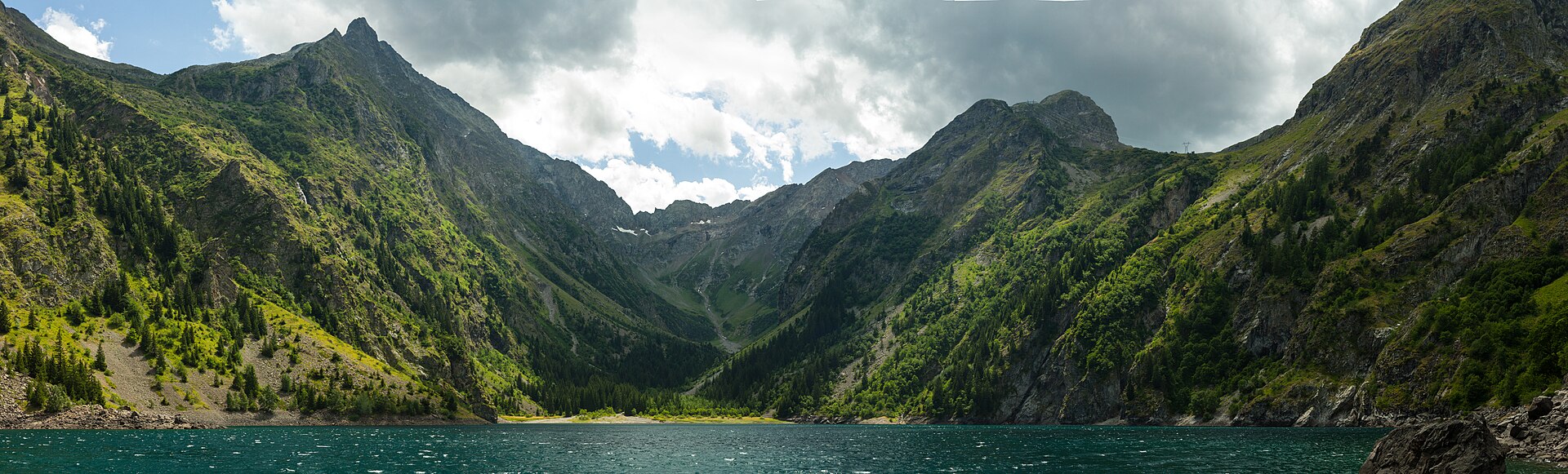
1. Lac Lauvitel from Les Ougiers / La Danchère
Snapshot
Itinerary
The route starts at Les Ougiers, follows the D530 briefly, crosses towards the hamlet of La Danchère, then climbs on the traditional paved Lauvitel path. The ascent follows the right bank of the Lauvitel stream before crossing higher ground through deciduous woodland, spruce and open meadows. The path reaches the lake at about 1,530 m. The return follows the opposite side of the loop, descending by the right-hand path near the lake cabins and returning through La Danchère to Les Ougiers.
Why it is essential
Lac Lauvitel is one of the signature lakes of the Oisans side of the Écrins. The route combines a steep traditional approach, a glacially influenced lake basin, mountain hamlets and the protected context of the Réserve intégrale du Lauvitel.
Equipment
- Sturdy hiking boots
- Weatherproof layer
- Warm layer
- Water and food
- Sun protection
- Map or GPS
- Navigation backup
- Trekking poles recommended
Hazards and notes
- The Lauvitel valley is avalanche-prone outside normal summer conditions.
- Rockfall risk can affect access; check current municipal orders before departure.
- The south side of the lake and valley head are part of the integral reserve and are closed to public access.
- Écrins National Park core-zone rules apply.
- Dogs are not allowed in the park core zone, even on a lead.
GPX / KML links
| Source | URL | Format | Notes |
|---|---|---|---|
| Destination Parc national des Écrins | destination.ecrins-parcnational.fr | Route page | Official Geotrek route page for Lac Lauvitel |
| Geotrek admin GPX export | geotrek-admin.ecrins-parcnational.fr | GPX | Direct GPX export endpoint; reuse terms not explicit |
| Geotrek admin KML export | geotrek-admin.ecrins-parcnational.fr | KML | Direct KML export endpoint; reuse terms not explicit |
Sources
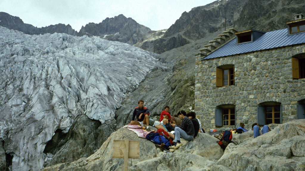
2. Refuge du Glacier Blanc from Pré de Madame Carle
Snapshot
Itinerary
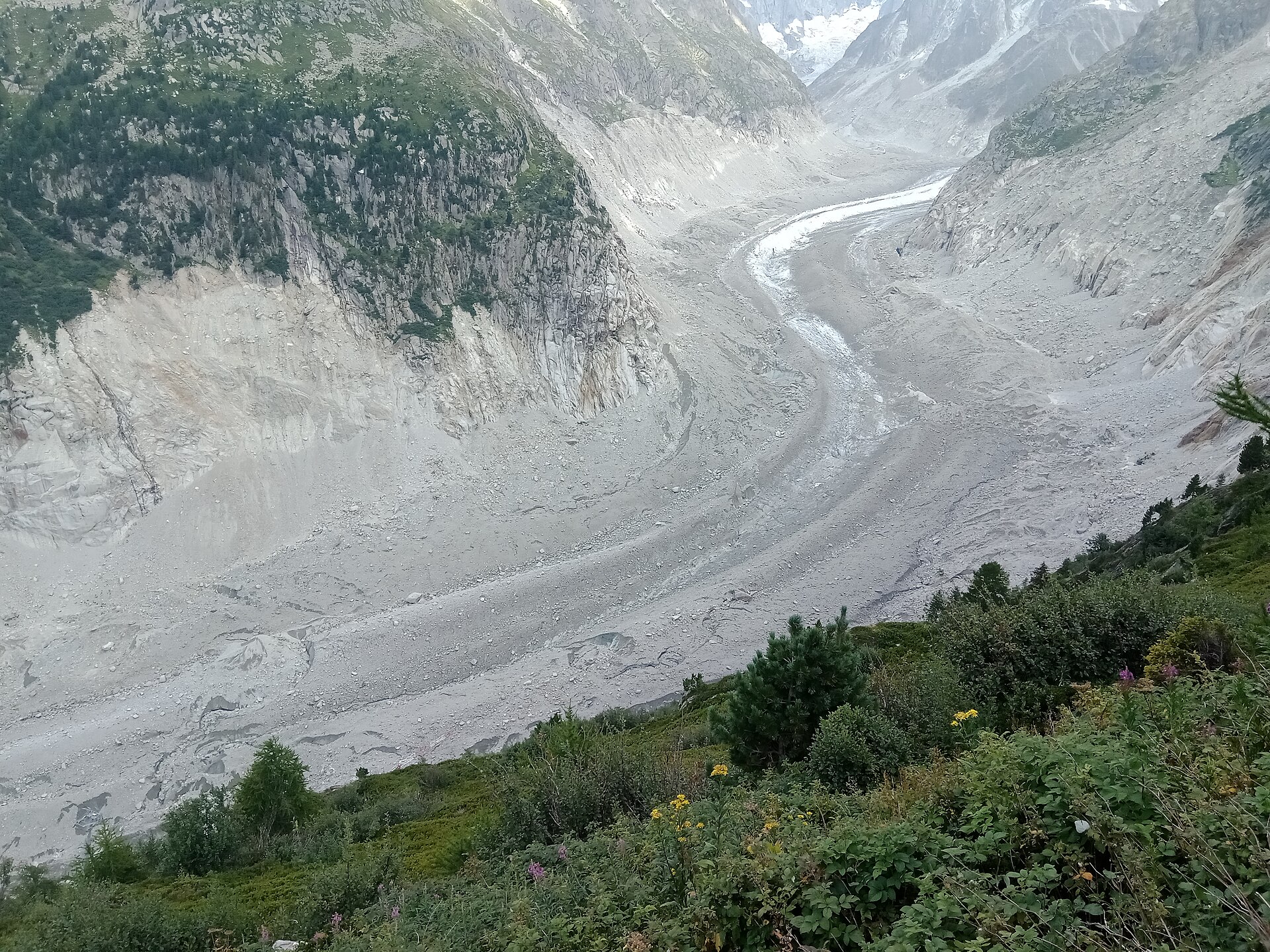
From Pré de Madame Carle, the path heads north-east from the chalet-hotel area and crosses footbridges over the Torrent de la Momie and the Glacier Noir torrent. The route climbs over glacially smoothed rock, passes the junction for the Glacier Noir itinerary, then continues in zigzags. After crossing the Glacier Blanc torrent, the path follows the left bank, climbs past the former Refuge Tuckett and reaches the Refuge du Glacier Blanc. The return follows the same path back to Pré de Madame Carle.
Why it is essential
This is one of the most accessible day routes into the glacial heart of the Écrins. It gives close views of Glacier Blanc, Glacier Noir, Barre des Écrins and the historic alpinism landscape of Ailefroide and Pré de Madame Carle without requiring glacier travel.
Equipment
- Sturdy boots
- Warm layer
- Waterproof shell
- Sun protection
- Water and food
- Map or GPS
- Navigation backup
- Microspikes only if snow remains on the walking path
Hazards and notes
- Check that the Pré de Madame Carle access road is open.
- Check that torrent footbridges have been installed for the season.
- Sleeping overnight in the car park is prohibited.
- Weather changes quickly around the glacier basin.
- Écrins National Park core-zone rules apply.
GPX / KML links
| Source | URL | Format | Notes |
|---|---|---|---|
| Rando Pays des Écrins | rando.paysdesecrins.com | Route page | Official Geotrek route page |
| Geotrek admin GPX export | geotrek-admin.ecrins-parcnational.fr | GPX | Direct GPX export endpoint; reuse terms not explicit |
| Geotrek admin KML export | geotrek-admin.ecrins-parcnational.fr | KML | Direct KML export endpoint; reuse terms not explicit |
Sources
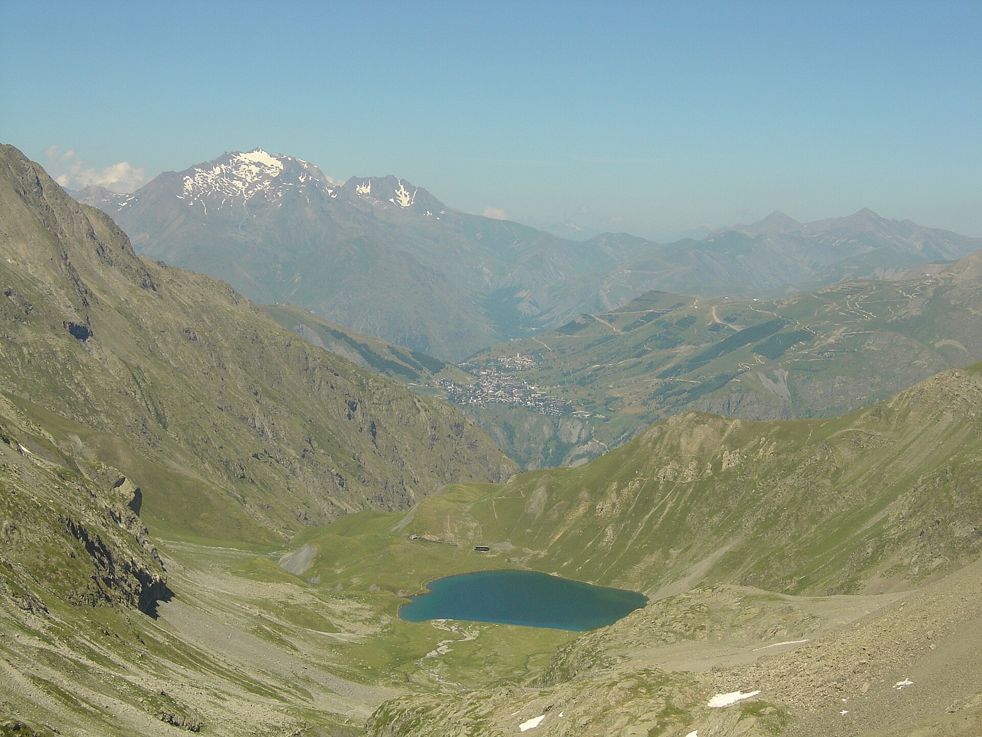
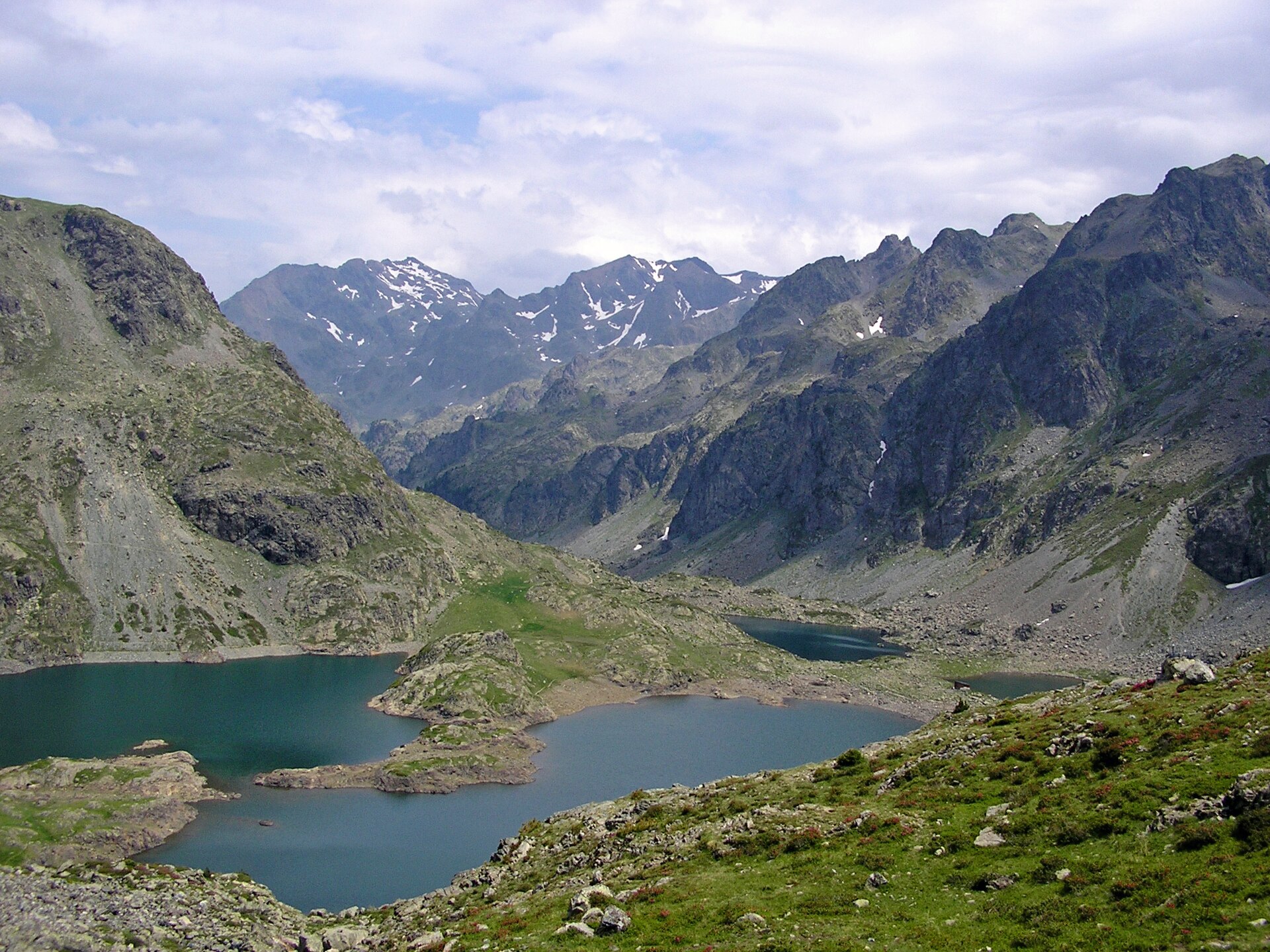
3. Lac de la Muzelle from L’Alleau / Vénosc
Snapshot
Itinerary
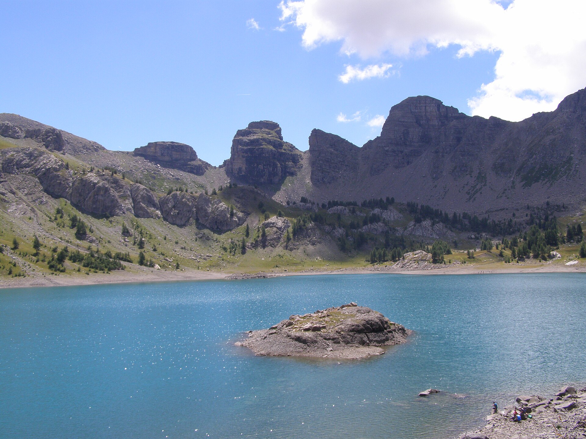
The route starts from the parking area on the left bank of the Vénéon just after the bridge at L’Alleau. It passes through the hamlet, crosses a small bridge and climbs steeply on a paved path through forest. After several bends, the path traverses towards the ruins of Le Cerisier, then follows the Muzelle torrent. Higher up, the path crosses the torrent at the foot of a schist slope and climbs in many zigzags to reach grassland, a peat-bog basin and finally the lake and refuge. The descent follows the same route.
Why it is essential
Lac de la Muzelle is a demanding but representative Écrins high-lake route: steep valley ascent, waterfall sections, schist terrain, a high basin, a refuge, a glacial backdrop and a historically important crossing towards Valbonnais.
Equipment
- Sturdy boots
- Waterproof layer
- Warm layer
- Water and food
- Sun protection
- Map or GPS
- Navigation backup
- Trekking poles recommended
- Microspikes only if snow remains in early season
Hazards and notes
- Long and steep ascent.
- Schist slope and potentially loose terrain.
- Hot lower sections in summer.
- Livestock protection dogs may be present in the alpage.
- Écrins National Park core-zone rules apply.
- Dogs are not allowed in the park core zone.
GPX / KML links
| Source | URL | Format | Notes |
|---|---|---|---|
| Destination Parc national des Écrins | destination.ecrins-parcnational.fr | Route page | Official Geotrek route page |
| Geotrek admin GPX export | geotrek-admin.ecrins-parcnational.fr | GPX | Direct GPX export endpoint; reuse terms not explicit |
| Geotrek admin KML export | geotrek-admin.ecrins-parcnational.fr | KML | Direct KML export endpoint; reuse terms not explicit |
Sources
4. Lac Noir and Lac Lérié from Le Chazelet
Snapshot
Itinerary
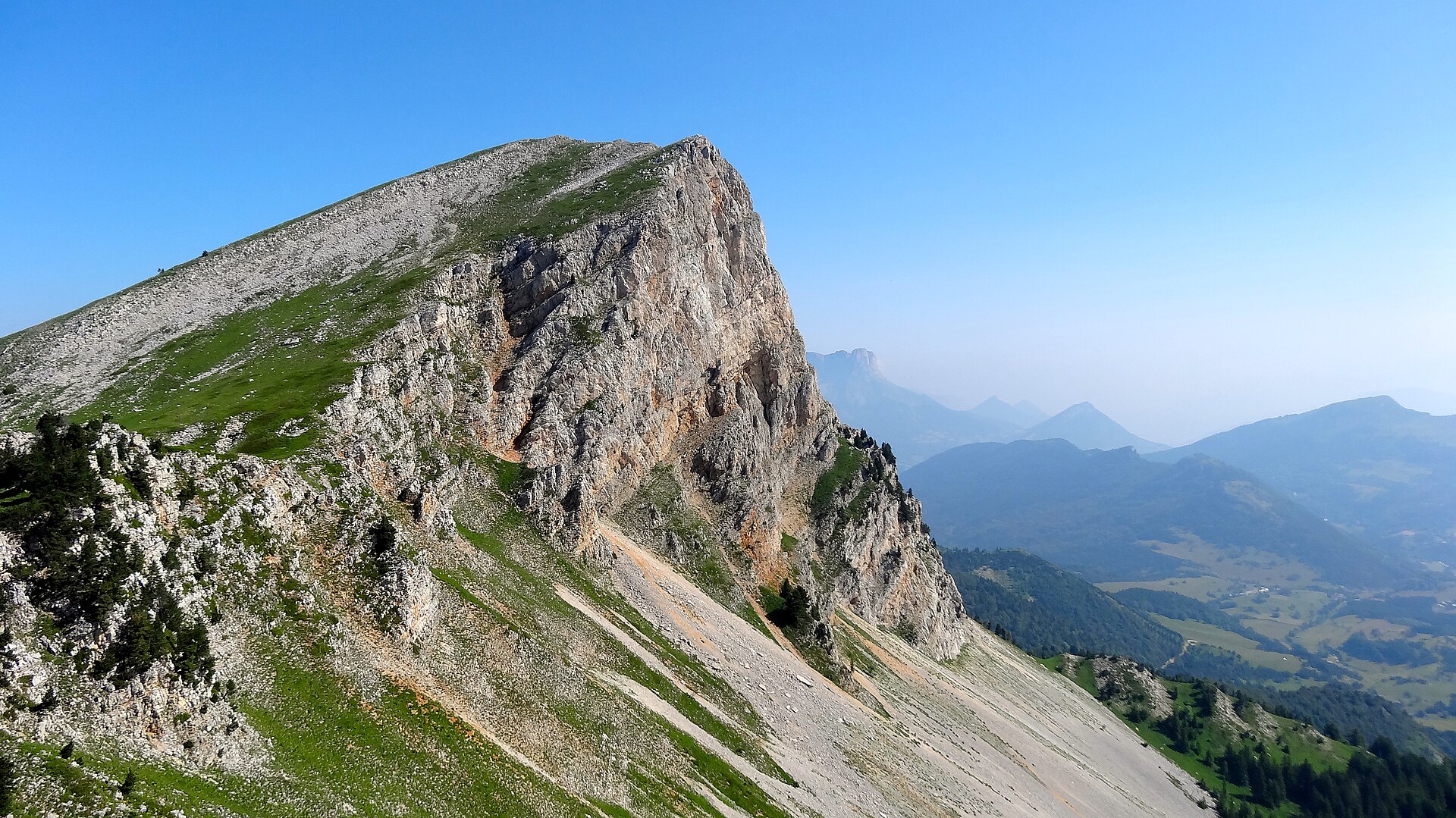
From the Chazelet starting point at about 1,770 m, the route descends towards the village edge, turns towards the base of the lifts, crosses Le Gâ and climbs in broad bends up the east side of the Plateau d’Emparis on the GR54. It passes Les Bancs at 2,060 m, continues towards Col du Souchet, then leaves the main GR line to reach Lac Noir. From Lac Noir the path continues east towards Lac Lérié, follows its shore and returns towards the col. The descent follows the GR54 back towards Le Chazelet.
Why it is essential
This route is the classic non-technical balcony over La Meije, the Râteau and the glaciers above La Grave. It also represents the pastoral side of the Dauphiné Alps, combining alpine pasture, high lakes, GR54 heritage and one of the region’s most recognisable viewpoints.
Equipment
- Sturdy boots
- Waterproof layer
- Warm layer
- Hat and gloves outside midsummer
- Water and food
- Sun protection
- Map or GPS
- Navigation backup
- Trekking poles recommended
Hazards and notes
- The Plateau d’Emparis is exposed to wind, sun, thunderstorms and poor visibility.
- Snow can linger into early summer.
- Carry enough water in hot conditions.
- Stay on marked paths around sensitive alpine environments.
GPX / KML links
| Source | URL | Format | Notes |
|---|---|---|---|
| Destination Parc national des Écrins | destination.ecrins-parcnational.fr | Route page | Official Geotrek route page |
| Geotrek admin GPX export | geotrek-admin.ecrins-parcnational.fr | GPX | Direct GPX export endpoint; reuse terms not explicit |
| Geotrek admin KML export | geotrek-admin.ecrins-parcnational.fr | KML | Direct KML export endpoint; reuse terms not explicit |
Sources
- Destination Parc national des Écrins — Lac Noir et Lac Lérié depuis Le Chazelet
- Wikimedia Commons image page
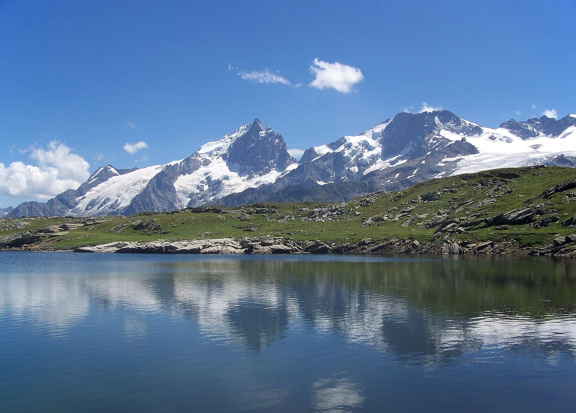
5. GR®738 Chamrousse “L’Alpage”: Lacs Robert loop
Snapshot
Itinerary
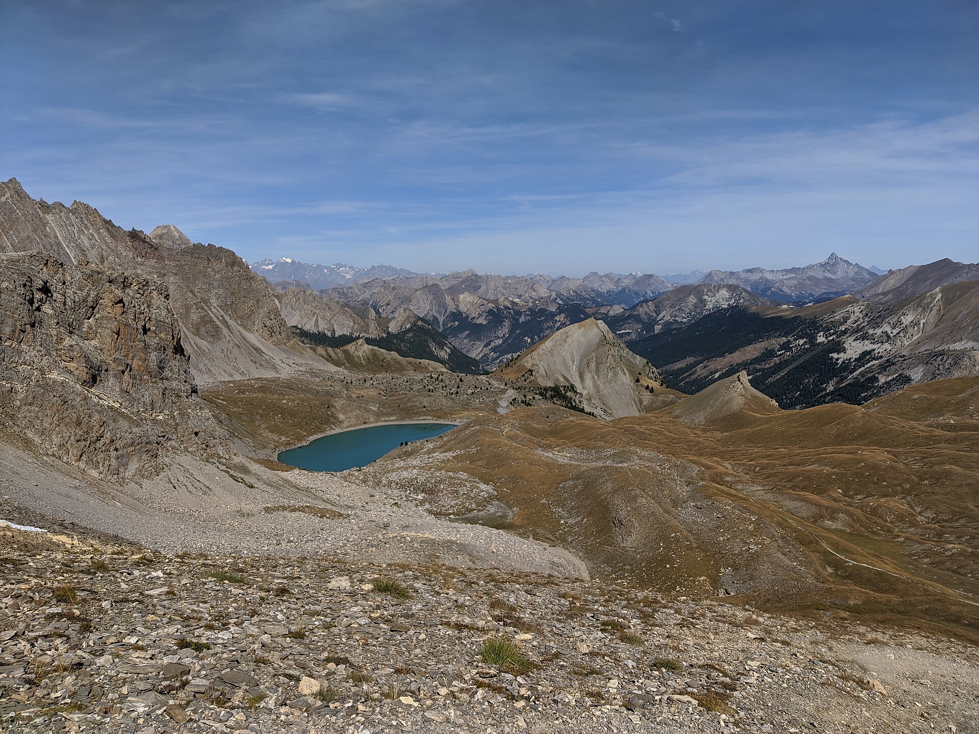
The route starts in Chamrousse 1650 at Recoin and follows the GR®738 towards Col de la Balme. It continues to the Lacs Robert, where the landscape becomes more mineral and the lake water contrasts with the dark rock. After circling the two largest lakes, the path leaves by the Brèche Nord, passes through blocky terrain and reaches Lac des Pourettes. It then returns towards Recoin, with views towards the Vercors and Mont Aiguille near the final descent.
Why it is essential
This route represents the Belledonne part of the region: high lakes, rocky cols, alpage terrain and the GR®738 Haute Traversée de Belledonne. It is a compact day-hike version of the wider Belledonne traverse landscape.
Equipment
- Sturdy boots
- Weatherproof layer
- Warm layer
- Water and food
- Sun protection
- Map or GPS
- Navigation backup
- Trekking poles recommended
Hazards and notes
- Snow conditions may affect the route outside the listed summer season.
- The Brèche Nord and blocky sections require care.
- Herding dogs may be present.
- Dogs are allowed on summer paths and in the gondola if kept on a lead, according to the source page.
- Avoid crossing flocks and do not feed or touch working dogs.
GPX / KML links
| Source | URL | Format | Notes |
|---|---|---|---|
| Chamrousse official route page | chamrousse.com | Route page | Official route page with downloads |
| Chamrousse GPX download | chamrousse.com | GPX | Official GPX endpoint |
| Chamrousse KML download | chamrousse.com | KML | Inferred endpoint pattern; should be tested before travel |
Sources
- Chamrousse — GR®738 boucle à la journée de Chamrousse : L’Alpage / Lacs Robert
- Wikimedia Commons image page
Region-level sources
| Source | URL |
|---|---|
| Destination Parc national des Écrins — Lac Lauvitel | destination.ecrins-parcnational.fr |
| Rando Pays des Écrins — Refuge du Glacier Blanc | rando.paysdesecrins.com |
| Destination Parc national des Écrins — Lac de la Muzelle | destination.ecrins-parcnational.fr |
| Destination Parc national des Écrins — Lac Noir et Lac Lérié depuis Le Chazelet | destination.ecrins-parcnational.fr |
| Chamrousse — GR®738 boucle à la journée : L’Alpage / Lacs Robert | chamrousse.com |
| Wikimedia Commons — Lac du Lauvitel Panorama | commons.wikimedia.org |
| Wikimedia Commons — Refuge Glacier Blanc | commons.wikimedia.org |
| Wikimedia Commons — Lac de la Muzelle | fr.wikipedia.org |
| Wikimedia Commons — Plateau d’Emparis / La Meije from Lac Noir | commons.wikimedia.org |
| Wikimedia Commons — Lacs Robert | commons.wikimedia.org |