Five essential day-hikes through national-park high country, Beaufortain ridges, alpine lakes, historic passes and Gran Paradiso refuge routes.
Regional overview
This region links three classic western Alpine walking areas: the glaciated Vanoise around Pralognan-la-Vanoise, the pastoral and ridge country of the Beaufortain, and the Italian high valleys of Gran Paradiso. The landscape alternates between limestone and schist ridges, alpine pastures, high lakes, historic mule tracks, refuge approaches, and views toward major glacier systems.
The Vanoise and Gran Paradiso sections are protected national-park landscapes. The Vanoise core zone has strict regulations, including a general ban on dogs in the park core, even on a lead, except for specified working or assistance dogs. Gran Paradiso is Italy’s first national park and ranges from valley floors around 800 m to Gran Paradiso at 4,061 m; its walking routes pass through larch woods, alpine meadows, rocky basins and ibex/chamois habitat.
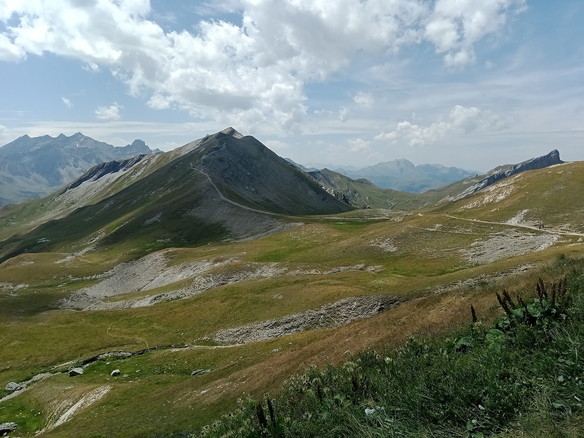
The Beaufortain is less glaciated but highly distinctive: open grazing country, Beaufort cheese chalets, lake basins, and narrow historic ridges such as the Crête des Gittes. The Tour du Beaufortain is around 140 km, and late June to early July can still involve snow on high cols.
Best conditions are usually from late June or July to September, but snow can remain on high passes, north-facing approaches and hut basins into early summer. Thunderstorms, rapid temperature changes, snow patches, exposed traverses, and protected-area rules are the main recurring issues.
Selection rationale
These five hikes were selected to cover the region’s essential walking character: one iconic Vanoise lake-and-pass circuit, two Beaufortain routes representing both ridge history and the Pierra Menta landscape, and two Gran Paradiso classics combining wildlife valleys, refuge approaches and glacier viewpoints.
Summary table
| # | Hike | Country | Route type | Distance | Gain | Max elevation | Difficulty |
|---|---|---|---|---|---|---|---|
| 1 | Tour of the Aiguille de la Vanoise and Col de la Vanoise | France | Loop | 15.9 km | +1,242 m | 2,519 m | Difficult |
| 2 | Crête des Gittes to Refuge du Col de la Croix du Bonhomme | France | Out-and-back | 12 km | +720 m | approx. 2,530–2,540 m | Moderate to difficult |
| 3 | Lac d’Amour below Pierra Menta from Treicol | France | Out-and-back | approx. 7 km | approx. +545 m | 2,251 m | Moderate |
| 4 | Valnontey to Rifugio Vittorio Sella | Italy | Out-and-back | approx. 10 km | +921 m | 2,584 m | Moderate / E |
| 5 | Rifugio Vittorio Emanuele II – Rifugio Chabod loop | Italy | Loop | 19.1 km | +1,218 m | 2,718 m | Difficult / E–T2 |
1. Tour of the Aiguille de la Vanoise and Col de la Vanoise
Snapshot
Itinerary
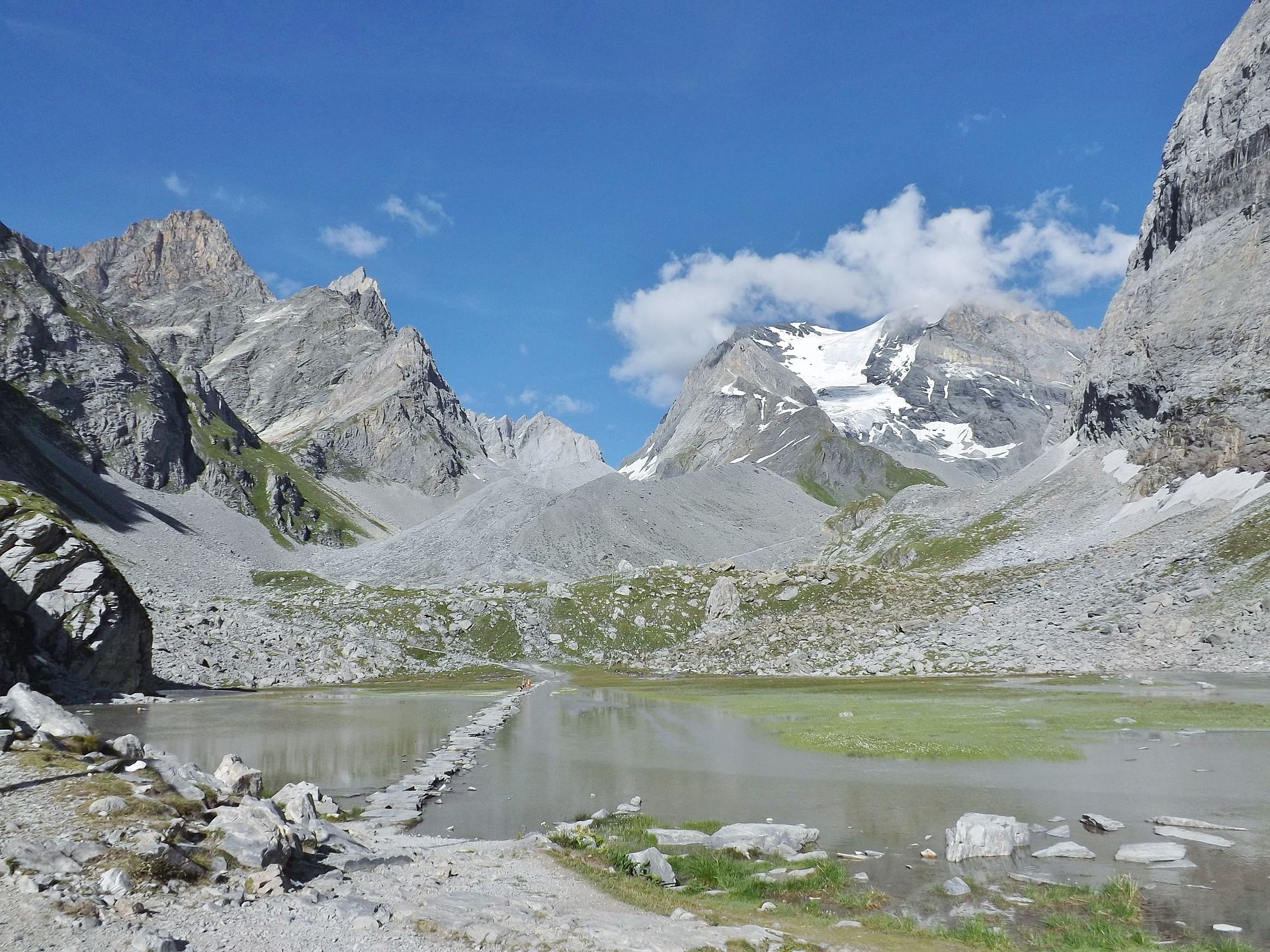
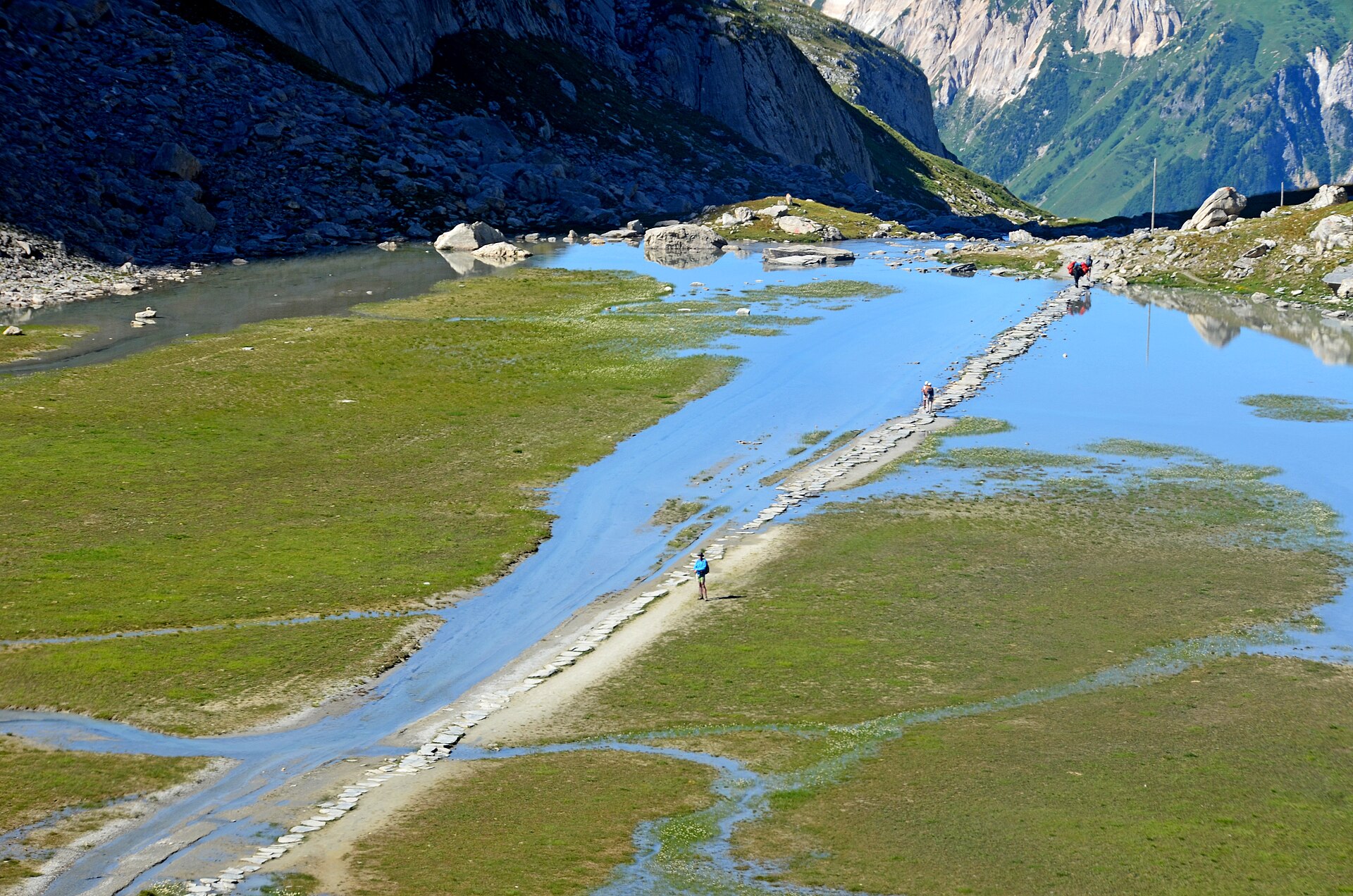
The route starts from Maison de la Vanoise in Pralognan-la-Vanoise and climbs through Bieux and Les Fontanettes toward the Refuge des Barmettes. From the Pont de la Glière, it follows the historic high route toward the Lac des Vaches crossing, one of the best-known stone-paved lake crossings in the Vanoise.
Above the lake, the path continues toward the Col de la Vanoise and the refuge area below the Aiguille de la Vanoise. The return circuit passes Lac Rond and the Col de la Vanoise sector before descending by the GR55 line, with Lac Long and Lac des Vaches on the return toward Les Fontanettes and Pralognan.
Why it is essential
This is one of the defining day circuits of the Vanoise: a high limestone-and-glacier landscape, the Col de la Vanoise, the Aiguille de la Vanoise, Lac des Vaches, and a historic transalpine route formerly associated with salt and cheese movement.
Equipment
Mountain hiking equipment:
- Sturdy boots
- Warm layer
- Waterproof layer
- Sun protection
- Food and water
- Map/GPS
- Trekking poles recommended
Early season snow may require microspikes or turning back.
Hazards and notes
This is a long high-mountain hike with more than 1,200 m of ascent. Snow patches can persist around the col and lake basins in early summer. The Lac des Vaches crossing uses stone slabs and should be treated cautiously when wet, icy or crowded. Vanoise National Park core rules apply; dogs are generally forbidden in the park core, even on a lead.
GPX / KML links
| Source | URL | Format |
|---|---|---|
| Rando Vanoise | adminrando.vanoise.com | GPX |
| Rando Vanoise | adminrando.vanoise.com | KML |
Sources
- rando.vanoise.com — Tour of the Aiguille de la Vanoise and Col de la Vanoise
- vanoise-parcnational.fr — Park core regulations
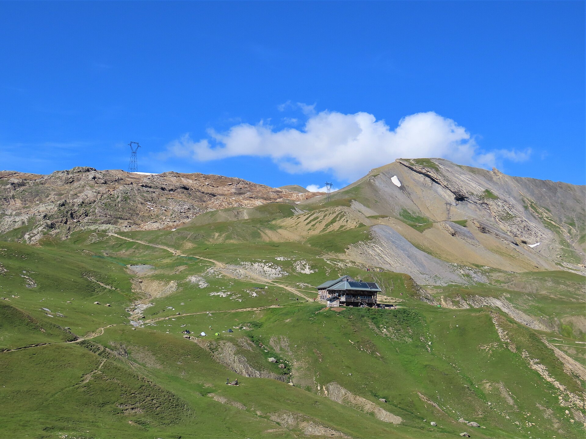
2. Crête des Gittes to Refuge du Col de la Croix du Bonhomme
Snapshot
Itinerary
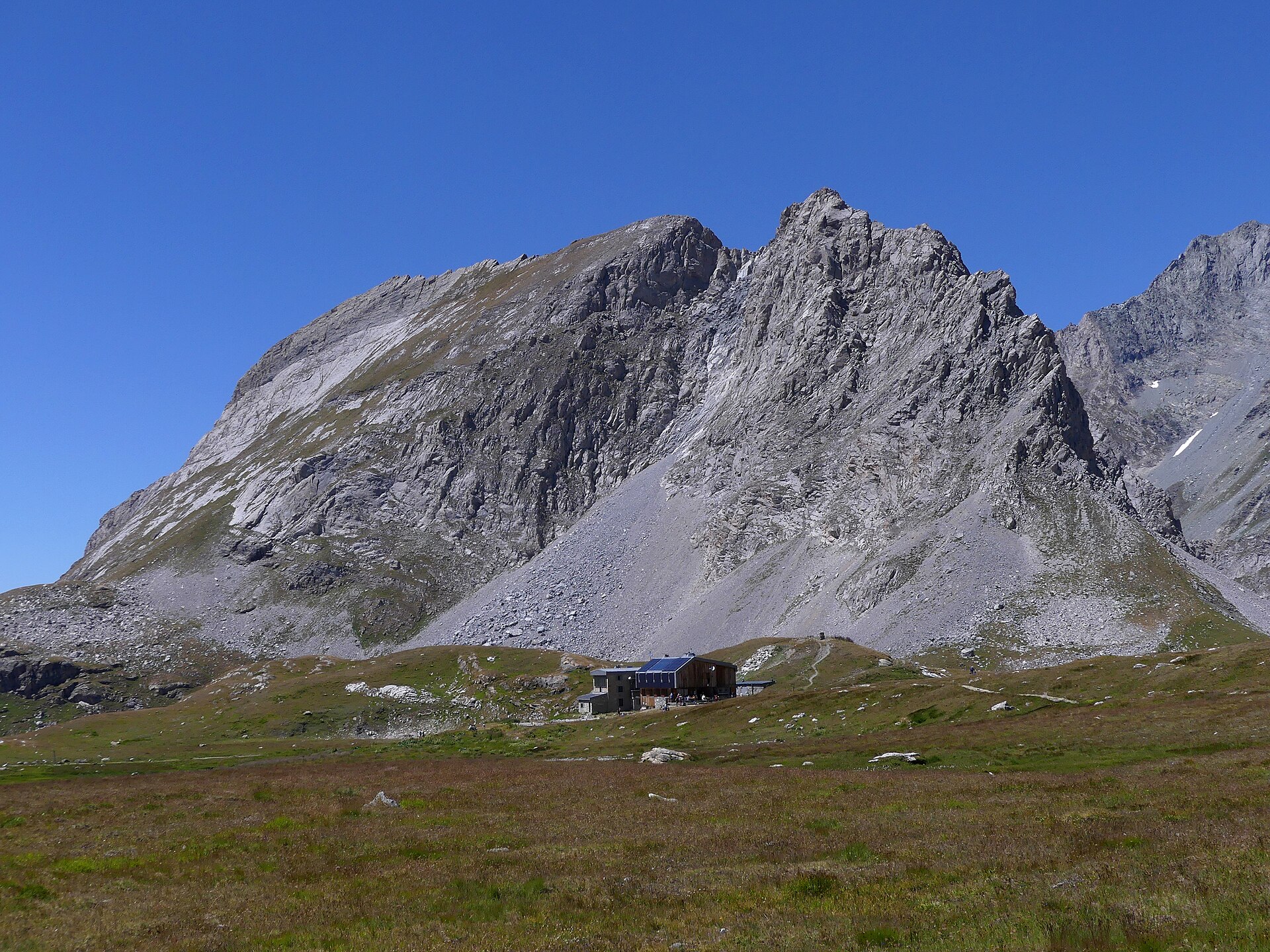
From Plan de la Lai, the route follows signs toward Col de la Sauce and Refuge du Col de la Croix du Bonhomme. The path crosses pasture and stream terrain before climbing toward Chalet Bel Air and Col de la Sauce at 2,307 m. It then follows the Crête des Gittes, a narrow historic path cut into schist, toward the Refuge du Col de la Croix du Bonhomme.
The usual day-hike version returns by the same route to Plan de la Lai.
Why it is essential
This hike gives the Beaufortain its ridge-and-pasture identity in a single outing: Roselend high country, the Col de la Sauce, the historic Crête des Gittes, and the major long-distance route junction at the Croix du Bonhomme.
Equipment
Mountain hiking equipment:
- Sturdy boots
- Windproof/waterproof layer
- Warm layer
- Map/GPS
- Food and water
- Trekking poles recommended
Lingering snow or ice on the ridge makes the route significantly more serious.
Hazards and notes
The Crête des Gittes is not a technical climb, but it is exposed and unsuitable in snow, ice, storms, strong wind or poor visibility. High cols in the Beaufortain can remain snowy around late June and early July.
GPX / KML links
| Source | URL | Format |
|---|---|---|
| Arêches-Beaufort GPX wrapper | areches-beaufort.com | GPX |
| Arêches-Beaufort / Apidae likely direct file | apidae-tourisme.com | GPX |
Sources
- areches-beaufort.com — Refuge du Col de la Croix du Bonhomme
- mongr.fr — GR de pays Tour du Beaufortain
- altituderando.com — Col du Bonhomme, Crête des Gittes et col de la Sauce
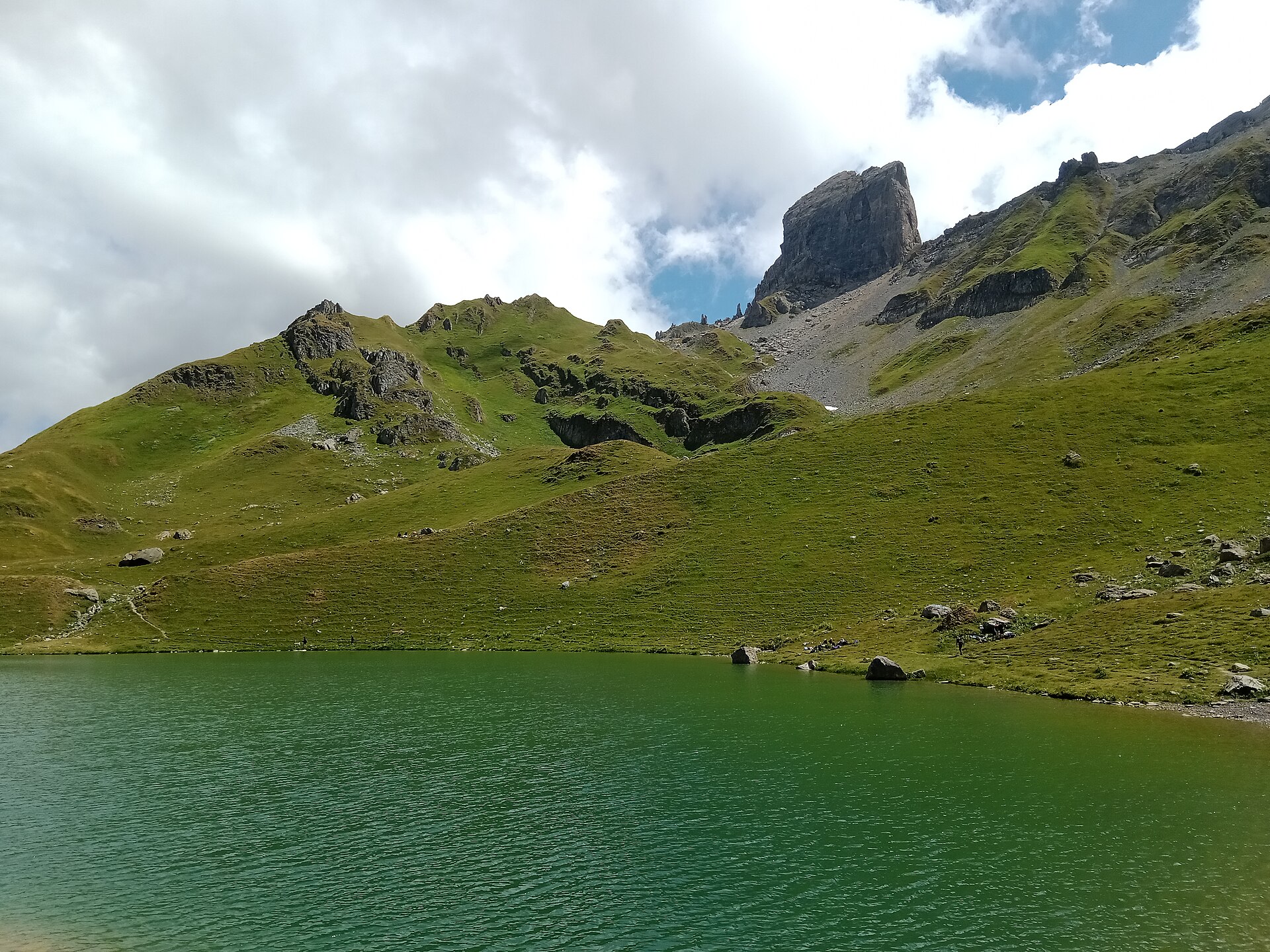
3. Lac d’Amour below Pierra Menta from Treicol
Snapshot
Itinerary
From Treicol, the route follows pasture tracks and paths toward the Ruines de Presset and the upper Ruisseau du Coin basin. It climbs through open alpage terrain toward Lac d’Amour, directly below the Pierra Menta massif. The return follows the same line to Treicol.
Why it is essential
The Pierra Menta is one of the visual symbols of the Beaufortain. Lac d’Amour gives a relatively compact day-hike approach to that landscape: alpine pasture, a high lake, and the rock architecture around Pierra Menta and Presset.
Equipment
Standard to mountain hiking equipment:
- Hiking boots or shoes with good grip
- Waterproof layer
- Warm layer
- Sun protection
- Water
- Food
- Map/GPS
- Trekking poles useful on descent
Hazards and notes
The basic Treicol–Lac d’Amour route is non-technical in summer, but navigation can be less obvious in open pasture and cairned upper ground. Extensions toward Refuge de Presset, Passeur de la Mintaz or higher terrain are more serious and can involve snow equipment early in the season.
GPX / KML links
| Source | URL | Format |
|---|---|---|
| VisuGPX short Treicol–Lac d’Amour trace | visugpx.com | GPX/KML download endpoint |
| VisuGPX longer Pierra Menta / Lac d’Amour / Presset variant | visugpx.com | GPX/KML download endpoint |
| Visorando Pierra Menta and Lac d’Amour route | visorando.com | Source route page; direct GPX URL not extracted |
Sources
- areches-beaufort.com — Lakes and emblematic places
- altituderando.com — Lac d’Amour 2248m
- altituderando.com — Lac d’Amour 2284m et Refuge de Presset
- visugpx.com — Trace 1312810442
- visugpx.com — Trace ab9pctbCLw
- visorando.com — Pierra Menta et le Lac d’Amour
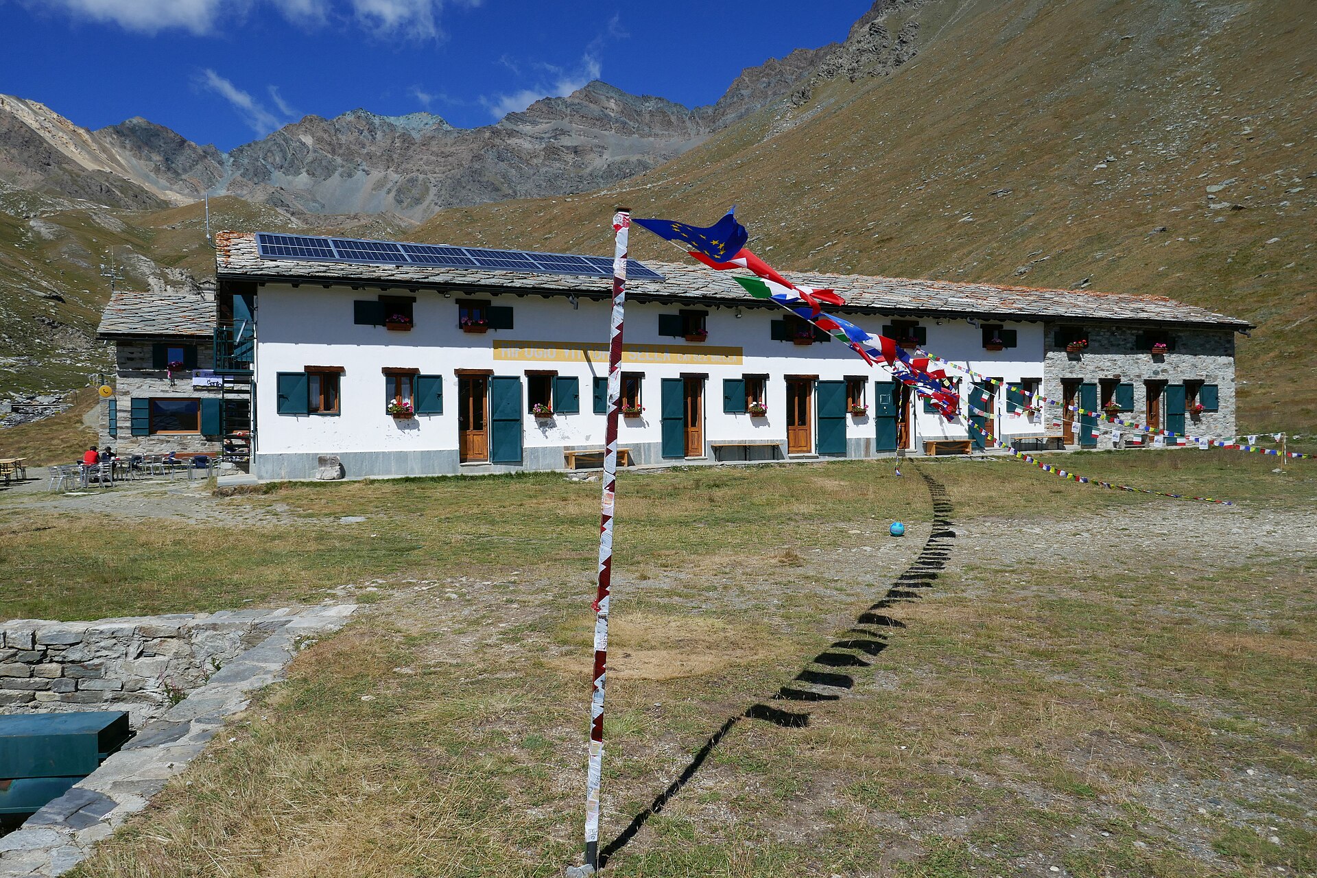
4. Valnontey to Rifugio Vittorio Sella
Snapshot
Itinerary
The route starts in Valnontey beside the Paradisia Alpine Garden. It first passes through forest, then climbs into high-altitude meadows where ibex, chamois and marmots are commonly associated with the park landscape. Before the hut, the route passes the Lauson alpine pastures and continues to Rifugio Vittorio Sella at 2,584 m.
Why it is essential
This is one of the classic walking routes into the heart of Gran Paradiso National Park: a historic refuge approach, strong wildlife potential, high meadows, and views into the Lauson and Gran Paradiso mountain environment without requiring glacier travel.
Equipment
Mountain hiking equipment:
- Sturdy boots
- Warm layer
- Waterproof layer
- Sun protection
- Food and water
- Map/GPS
- Trekking poles recommended
- Headtorch sensible for late starts or delays
Hazards and notes
This is a sustained climb of more than 900 m. Snow can remain high on the route early in the season. Wildlife should be observed from a distance. Gran Paradiso has specific dog restrictions, with some route-specific and seasonal allowances. Check current park regulation before taking a dog.
GPX / KML links
| Source | URL | Format |
|---|---|---|
| Gran Paradiso National Park | pngp.it | GPX |
Sources
- pngp.it — Rifugio Vittorio Sella route
- pngp.it — Walking dogs in the park
- balteus.lovevda.it — Parco Nazionale del Gran Paradiso
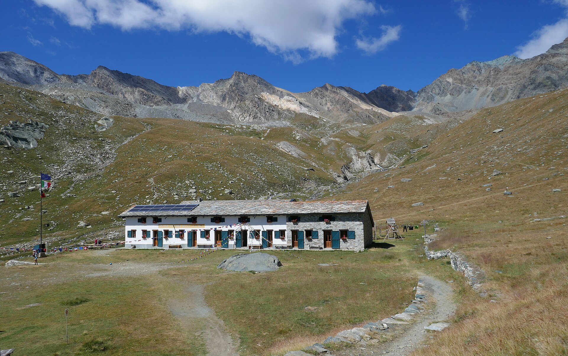
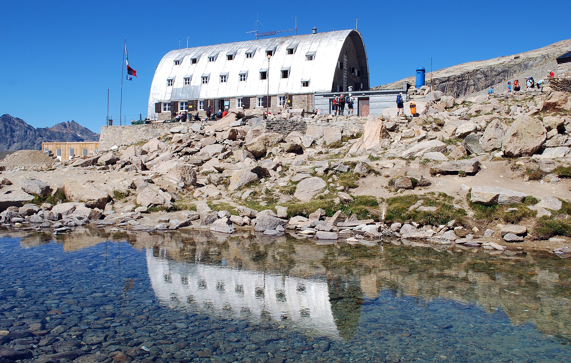
5. Rifugio Vittorio Emanuele II – Rifugio Chabod loop
Snapshot
Itinerary
The loop links the two great Gran Paradiso refuge approaches above Valsavarenche. From the Pont side, the path climbs through larch forest and rocky upper terrain to Rifugio Vittorio Emanuele II beside its high lake basin. The traverse then follows the hillside connector toward Rifugio Federico Chabod. From Chabod, the route descends through pastures and forest toward Pravieux/Terré, with a final valley-road or path return to the starting point.
Why it is essential
This is the strongest non-glacial Gran Paradiso day circuit in the selection: two major refuges, high views toward the Gran Paradiso massif, a classic traverse, and a demanding but non-technical loop for fit walkers.
Equipment
Mountain hiking equipment:
- Sturdy boots
- Weatherproof shell
- Warm layer
- Hat/gloves outside midsummer
- Sun protection
- Food and water
- Map/GPS
- Navigation backup
- Headtorch
- Trekking poles recommended
Hazards and notes
The loop is long and commits walkers to a high traverse. Do not continue from either refuge onto glacier or summit routes without appropriate alpinism equipment, skills and conditions. Dog access is restricted in Gran Paradiso and varies by route and date; check current park rules before departure.
GPX / KML links
Use these files to reconstruct the full loop from its component parts.
| Source | URL | Format |
|---|---|---|
| Gran Paradiso National Park: Pont–Rifugio Vittorio Emanuele II | pngp.it | GPX |
| Gran Paradiso National Park: Pravieux–Rifugio Chabod | pngp.it | GPX |
| LoveVDA: Rifugio Vittorio Emanuele II – Rifugio Chabod traverse | lovevda.it | GPX |
| LoveVDA: Rifugio Vittorio Emanuele II – Rifugio Chabod traverse | lovevda.it | KML |
| Outdooractive full loop source page | outdooractive.com | Source route page |
Sources
- pngp.it — Pont–Rifugio Vittorio Emanuele II
- pngp.it — Pravieux–Rifugio Chabod
- lovevda.it — Rifugio Vittorio Emanuele II – Rifugio F. Chabod
- outdooractive.com — Rifugio V. Emanuele and Rifugio Chabod from Pont
- pngp.it — Walking dogs in the park
GPX and KML source files
The following GPX/KML links are source-route files found during research. They are included as practical references for later replacement with project-owned route geometry.
| Hike | GPX links | KML links | Source pages |
|---|---|---|---|
| Tour of the Aiguille de la Vanoise and Col de la Vanoise | GPX | KML | rando.vanoise.com |
| Crête des Gittes to Refuge du Col de la Croix du Bonhomme | GPX wrapper; GPX direct | Not found | areches-beaufort.com |
| Lac d’Amour below Pierra Menta from Treicol | GPX 1; GPX 2 | Same download endpoints may provide KML depending on platform options | visugpx.com 1; visugpx.com 2; visorando.com |
| Valnontey to Rifugio Vittorio Sella | GPX | Not found | pngp.it |
| Rifugio Vittorio Emanuele II – Rifugio Chabod loop | GPX Pont–Emanuele; GPX Pravieux–Chabod; GPX traverse | KML traverse | pngp.it node 7134; pngp.it node 7131; lovevda.it |