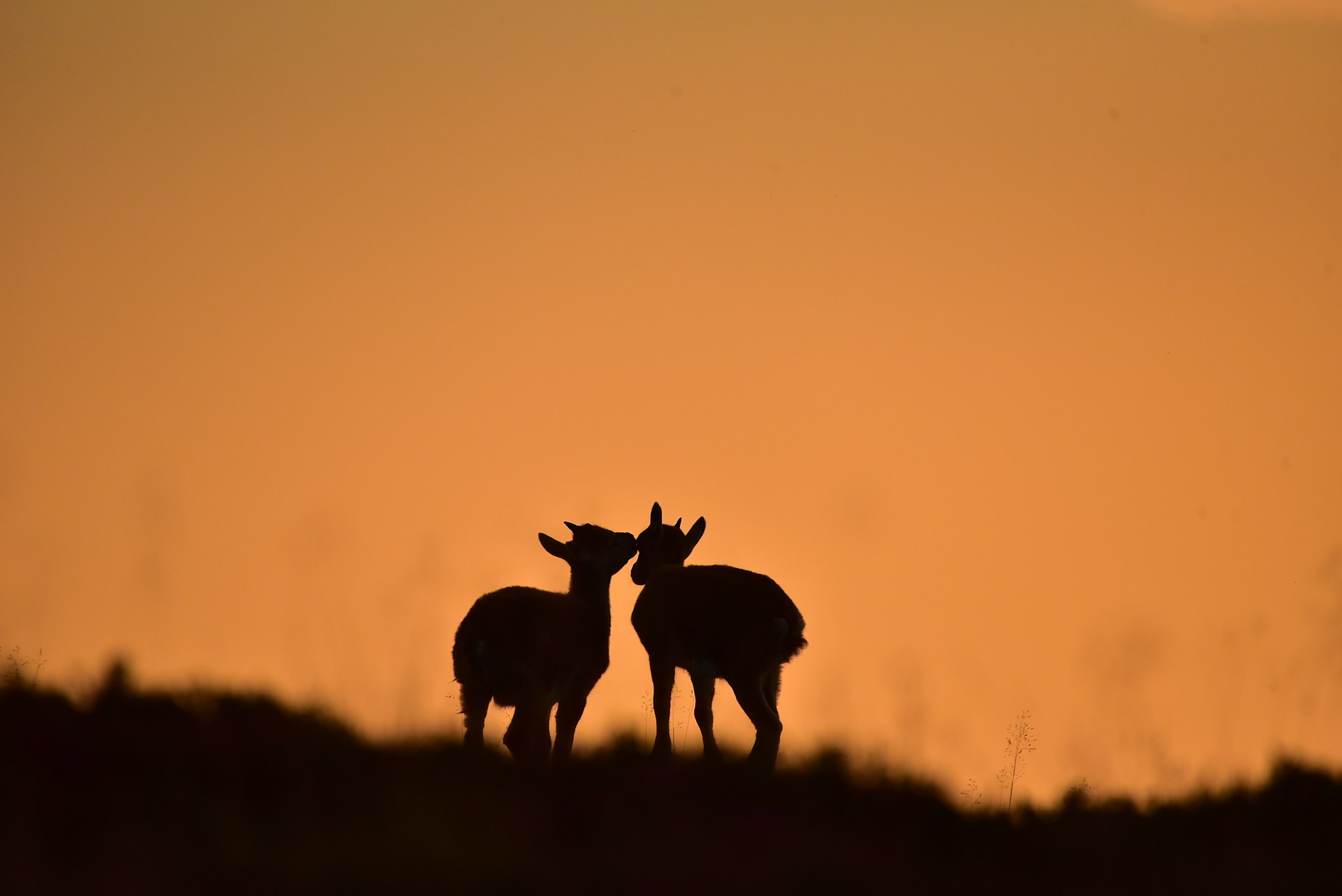
Regional overview
The Bernese Oberland is one of the most concentrated high-mountain hiking regions in the Alps, with glacier basins, limestone ridges, lake balconies, historic pass routes, and close views of the Eiger, Mönch, Jungfrau, Finsteraarhorn and Blüemlisalp groups. The main hiking centres for this selection are Grindelwald, Wengen / Lauterbrunnen, Kandersteg, Beatenberg / Niederhorn and the Grimsel Pass area.
The region is unusually well served by mountain railways, cable cars, PostBus routes and lake/valley rail links. Several classic hikes are lift-assisted or public-transport traverses rather than valley-to-summit ascents. This makes high routes accessible, but also makes timetable checks essential, especially for late-afternoon descents and seasonal pass services.
Normal hiking season is broadly June to October, with higher or north-facing routes often not reliably snow-free until July. Early-season snow, thunderstorms, wet limestone, exposed ridge sections, cable-assisted paths and rapid weather changes are recurring safety issues. Several routes below are mountain hikes rather than simple valley walks.
Selection rationale
These five hikes were selected to give a balanced Bernese Oberland set: an iconic Eiger North Face trail, a long Jungfrau-region high route, a lake-and-glacier cirque route above Oeschinensee, a Lake Thun ridge panorama, and a historic mule-track route over the Grimsel area.
Summary table
| # | Hike | Sub-region | Route type | Distance | Gain | Max elevation | Difficulty | Photos |
|---|---|---|---|---|---|---|---|---|
| 1 | Eiger Trail: Eigergletscher – Alpiglen | Jungfrau Region / Grindelwald | Lift / rail-assisted point-to-point | 6.0–6.1 km | 78–100 m | 2,320–2,346 m | Medium mountain hike | Commons CC BY 4.0 |
| 2 | Schynige Platte – Faulhorn – Bachalpsee – First | Jungfrau Region / Grindelwald | Lift / rail-assisted point-to-point | 16.0 km | 835 m | 2,672 m | Medium; long high-level | Commons CC BY-SA 3.0 |
| 3 | Oeschinensee Heuberg Panorama Circuit | Kandersteg / Oeschinensee | Lift-assisted loop | 8.1–9.0 km | 453 m | 1,987 m | Medium | Commons CC BY-SA 4.0 |
| 4 | Niederhorn Panoramaweg: Niederhorn – Güggisgrat – Waldegg | Lake Thun / Beatenberg | Lift-assisted point-to-point ridge | 11.0 km | 400 m | 2,063 m | Medium technical; physically difficult | Commons CC BY-SA 4.0 |
| 5 | ViaSbrinz: Grimsel Pass – Handegg mule track | Haslital / Grimsel Pass | Public-transport / pass-road point-to-point | 9.0 km | 76 m | 2,161 m | Medium | Commons CC BY-SA 4.0 |
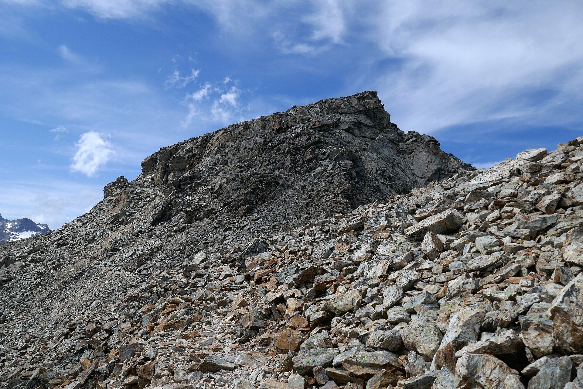
1. Eiger Trail: Eigergletscher – Alpiglen
Snapshot
Itinerary
The route starts at Eigergletscher station and follows the signed trail beneath the Eiger North Face. It traverses alpine pastures, crosses streams and waterfall runnels, then descends in zigzags to Alpiglen. MySwitzerland describes the trail as running directly below the north face, with sections secured by ropes, before the final descent to Alpiglen.
Why it is essential
This is the classic close-up hiking route beneath the Eiger Nordwand. It gives a short but concentrated view of one of the most famous mountain walls in the Alps, while remaining a non-glacier day hike for fit walkers in summer conditions.
Equipment
- Sturdy boots
- Weatherproof layer
- Warm layer
- Water and food
- Map/GPS
- Sun protection
- Trekking poles recommended for the descent
Hazards and notes
The route is short but still alpine. Wet grass, loose path sections, lingering snow near Eigergletscher early in the season, and sudden weather changes can make the descent more serious. The Jungfrau source notes that walking is at the hiker’s own responsibility.
GPX / KML links
| Source | URL | Format | Notes |
|---|---|---|---|
| Outdooractive route page | outdooractive.com | Source page with GPX / KML / FIT controls | Use as route-file source page; direct download URL not resolved |
| MySwitzerland / SwitzerlandMobility Route 353 | myswitzerland.com | Official source-map / route page | Use for manual route verification |
Sources
2. Schynige Platte – Faulhorn – Bachalpsee – First

Snapshot
Itinerary
The route starts at Schynige Platte and crosses the high ground above the Jungfrau Region towards Oberberg, Louchera, Güwtürli, Egg and Männdlenen. It then climbs to the Faulhorn and descends past Bachalpsee to First. Jungfrau Region describes the route as a six-hour high-altitude hike with views of the Jungfrau massif, Lake Brienz, Sägistalsee and Bachalpsee.
Why it is essential
This is one of the great non-glacier high traverses of the Jungfrau Region. It combines panoramic railway access, limestone and alpine pasture terrain, the historic Faulhorn summit area, Bachalpsee and a cable-car finish at First.
Equipment
- Sturdy boots
- Trekking poles
- Warm and weatherproof layers
- Navigation backup
- Sun protection
- Food and sufficient water
- Headtorch recommended because the hike is long and depends on transport connections
Hazards and notes
This is a long high route with limited escape options once committed. Weather changes, fog, thunderstorms and early-season snow can make navigation and timing difficult. Cable-car and mountain railway operating dates and last descents must be checked before departure.
GPX / KML links
| Source | URL | Format | Notes |
|---|---|---|---|
| Outdooractive / Grindelwald Tourismus route page | outdooractive.com | Source page with GPX / KML / FIT controls | Use as route-file source page; direct download URL not resolved |
| Bergfex route page | bergfex.com | GPX / KML candidate source page | Candidate route-file page; manual extraction or replacement needed |
Sources
- Jungfrau Region — Schynige Platte to Faulhorn to First
- Outdooractive — Schynige Platte – Männdlenen – Faulhorn – First
- Bergfex — Schynige Platte – Berghaus Männdlenen – Faulhorn – First
3. Oeschinensee Heuberg Panorama Circuit
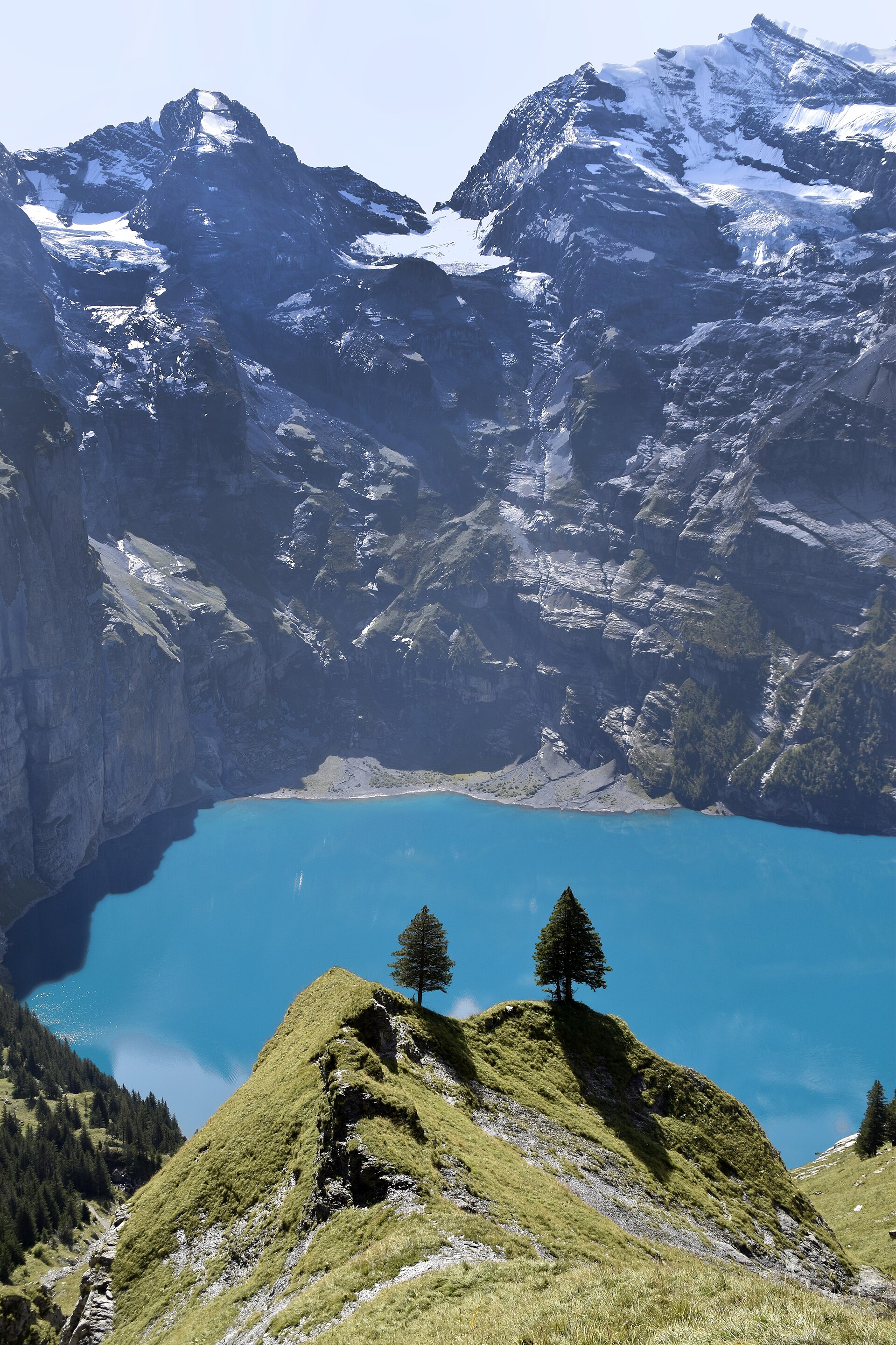
Current closure note. The official Oeschinensee status page listed Mountain Hiking Trail G: Läger–Heuberg–Oberbärgli as closed because of avalanche danger, with reopening indicated for June 2026. Check live status before travel or use.
Snapshot
Itinerary
The circuit starts at the Oeschinen gondola mountain station and follows the panoramic line via Läger and Heuberg above Oeschinensee. It then continues towards Oberbärgli / Underbärgli, descends towards the lake, and returns to the gondola mountain station. The official route description flags steep slopes, deep views and the need for a head for heights and sure-footedness.
Why it is essential
Oeschinensee is one of the defining lake-and-glacier landscapes of the Bernese Oberland. The Heuberg route gives the classic elevated view over the lake towards the surrounding cirque, rather than only visiting the lakeshore.
Equipment
- Sturdy boots
- Trekking poles
- Warm and waterproof layers
- Water and food
- Map/GPS
- Sun protection
- Microspikes only if local conditions indicate lingering snow
Hazards and notes
This route crosses steep slopes and is not suitable in snow, ice, heavy rain or poor visibility. The route was marked closed in the verification pass, so a live-status check is essential before publishing it as open.
GPX / KML links
| Source | URL | Format | Notes |
|---|---|---|---|
| Adelboden-Lenk-Kandersteg / Outdooractive embedded route page | adelboden-lenk-kandersteg.ch | Source page with visible GPX link | Direct GPX retrieval unresolved; use as route source page |
| Oeschinensee official hiking / status page | oeschinensee.ch | Official status and trail information page | Use for closure and safety status, not as a GPX source |
| Outdooractive Heuberg Oeschinensee page | outdooractive.com | Route source page | Candidate secondary route source |
Sources
- Adelboden-Lenk-Kandersteg — Heuberg Oeschinensee
- Oeschinensee — Hiking and live trail status
- Outdooractive — Heuberg Oeschinensee
4. Niederhorn Panoramaweg: Niederhorn – Güggisgrat – Waldegg
Snapshot
Itinerary
From Niederhorn, the route follows the ridge of Güggisgrat with views over Lake Thun and towards the Eiger, Mönch and Jungfrau. It climbs to Burgfeldstand at 2,063 m, crosses a short exposed section secured with ropes, reaches Gemmenalphorn, then continues over open ridge and pasture terrain towards Chüematte and Waldegg.
Why it is essential
This hike represents the Lake Thun side of the Bernese Oberland: a lower but very panoramic ridge with wildlife interest and a direct view into the high Bernese Alps. It also adds a ridge-walking route to the regional set, distinct from the Jungfrau and Kandersteg classics.
Equipment
- Sturdy boots
- Windproof and waterproof layers
- Warm layer
- Food and water
- Map/GPS
- Trekking poles for the descent
- Head for heights required for the exposed roped section
Hazards and notes
The ridge is weather-sensitive. Thunderstorms, strong wind, snow patches or wet ground can make the exposed section more serious. MySwitzerland explicitly notes a section secured with ropes and requiring a head for heights.
GPX / KML links
| Source | URL | Format | Notes |
|---|---|---|---|
| MySwitzerland / SwitzerlandMobility Route 342 | myswitzerland.com | Official source-map / route page | Use for official route verification; direct GPX not resolved |
| Outdooractive Niederhorn ridge variant | outdooractive.com | Source page with GPX / KML / FIT controls | Shorter 7.7 km variant, not an exact match for the official 11 km route |
Sources
5. ViaSbrinz: Grimsel Pass – Handegg mule track
Snapshot
Itinerary
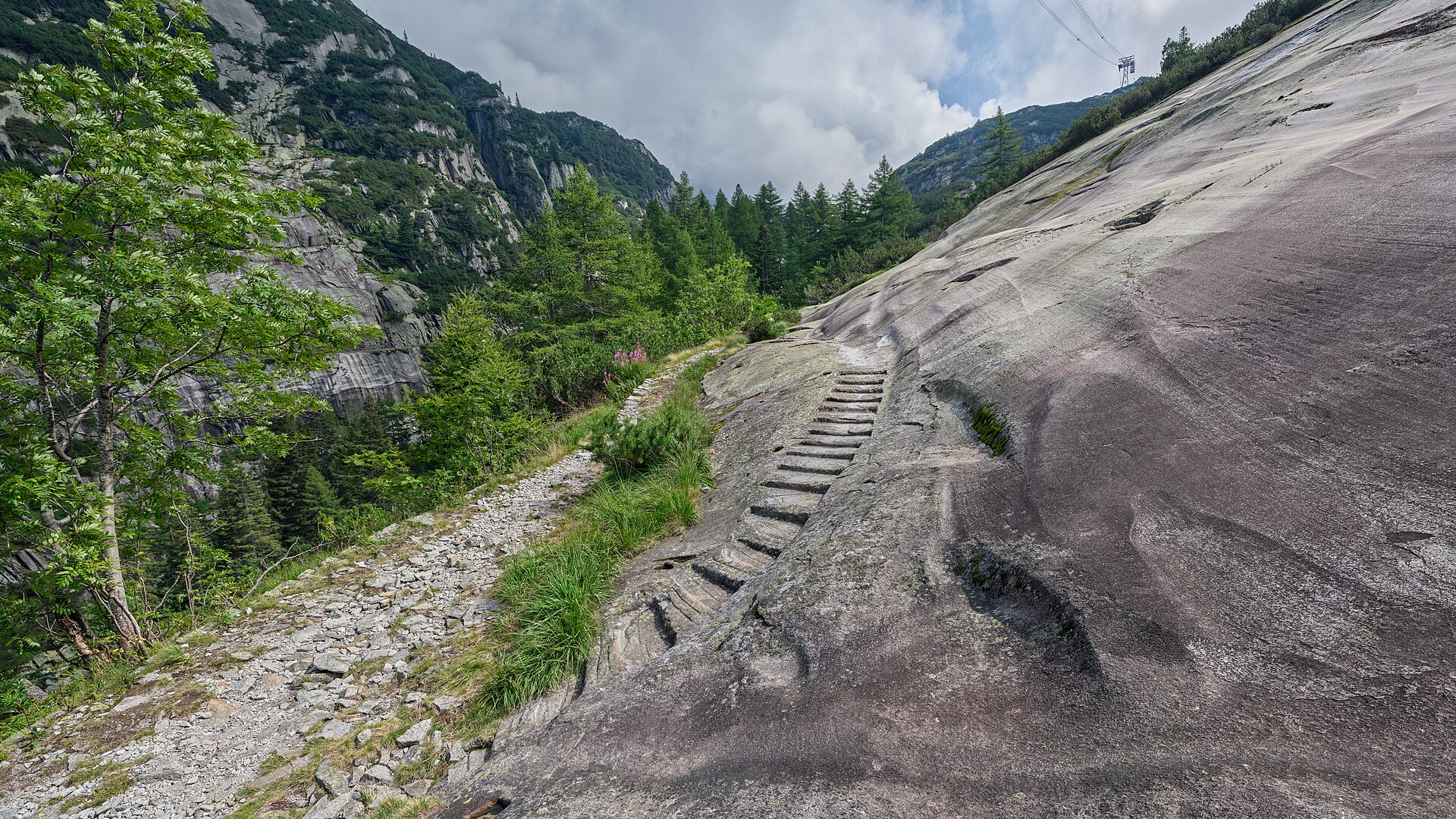
This historic route follows part of the ViaSbrinz mule-track corridor between the Grimsel area and Handegg. The route passes Grimsel hydroelectric infrastructure, lakes and dams, the Böglisbrüggli bridge and the Hählen Platten granite steps before descending to Handegg. MySwitzerland describes it as an old mule track historically linked to Sbrinz cheese transport across the Alps.
Why it is essential
The hike adds the cultural and historical dimension of the Bernese Oberland: not only peaks and lakes, but also transalpine trade, engineered pass landscapes, mule tracks, bridges, granite steps and the Grimsel hydroelectric setting.
Equipment
- Sturdy shoes or boots
- Weatherproof layer
- Warm layer
- Water and food
- Map/GPS
- Sun protection
- Trekking poles useful on the long descent
Hazards and notes
The route lies in high pass terrain and is strongly weather-dependent. Granite slabs and old stone steps can be slippery when wet or icy. The Grimsel road and public transport are seasonal, so both access and exit logistics need checking. The Gerstenegg crystal cavern is accessible only on an official tour, according to the MySwitzerland route description.
GPX / KML links
| Source | URL | Format | Notes |
|---|---|---|---|
| MySwitzerland ViaSbrinz / Grimsel Pass route page | myswitzerland.com | Source-map / route page | Use for selected day-section verification; direct GPX not found on this page |
| SwitzerlandMobility ViaSbrinz route context | schweizmobil.ch | Long-distance source-map context | Useful for wider ViaSbrinz context; selected day section still needs replacement GPX |
| Bergwelten candidate route | bergwelten.com | GPX candidate source page | Candidate route-file page; availability or access restrictions not resolved |
Sources
- MySwitzerland — ViaSbrinz Grimsel Pass to Handegg mule track
- SwitzerlandMobility — ViaSbrinz route 40
- Bergwelten — ViaSbrinz candidate
Region-level sources
| Source | URL |
|---|---|
| Jungfrau Region official hiking pages | jungfrau.ch |
| MySwitzerland / SwitzerlandMobility route pages | myswitzerland.com |
| Outdooractive route pages | outdooractive.com |
| Oeschinensee official hiking and live status page | oeschinensee.ch |
| Adelboden-Lenk-Kandersteg route pages | adelboden-lenk-kandersteg.ch |
| Wikimedia Commons | commons.wikimedia.org |