The Valais Alps around Zermatt, Saas-Fee and Val d’Anniviers form one of Switzerland’s highest and most dramatic hiking regions. The area combines Matterhorn lake views, balcony paths above Zermatt, high traverses in the Saas valley, turquoise reservoirs, glacier basins, larch forests, alpine huts and close views of many 4,000 m peaks.
Most routes are best treated as summer mountain hikes. Snow can linger into early summer, lift schedules affect access, and weather changes quickly at altitude. The five routes below are selected as representative, high-value day hikes rather than technical alpine climbs.
Regional overview
This part of the Valais Alps is centred on three major hiking bases: Zermatt, Saas-Fee/Saastal and Val d’Anniviers. Zermatt provides iconic Matterhorn-view routes and demanding balcony walks above the village. Saas-Fee and Saas-Grund offer high traverses beneath the Mischabel range. Val d’Anniviers adds wilder reservoir, moraine and glacier-view terrain around Moiry and Zinal.
The terrain ranges from accessible lift-assisted lake paths to long mountain loops with over 1,000 m of ascent. Typical surfaces include alpine paths, balcony trails, forest roads, moraine tracks, pasture paths, reservoir-side trails and occasionally exposed mountain-path sections with bridges, ladders or chains.
The normal hiking season is roughly July to September, depending on snow, trail condition and lift operation. Earlier in the season, snow patches can make upper paths more serious. In late summer and early autumn, conditions are often more stable, but cold weather, early snowfalls and reduced lift schedules remain possible.
Selection rationale
These five hikes were selected to represent the main walking character of the region:
- An iconic Matterhorn lake route: Zermatt 5-Lake Route / 5-Seenweg
- A demanding Zermatt balcony classic: Edelweiss Path / Höhbalmen
- A Saastal high traverse: Höhenweg Almagelleralp
- A Val d’Anniviers reservoir-and-glacier loop: Tour du Lac de Moiry
- A Zinal glacier-view hut walk: Zinal — Cabane du Petit Mountet
Routes requiring glacier travel, roped alpinism or climbing equipment are excluded.
Summary table
| # | Hike | Area | Route type | Distance | Gain | Max elevation | Difficulty |
|---|---|---|---|---|---|---|---|
| 1 | Zermatt 5-Lake Route / 5-Seenweg | Zermatt | Lift-assisted point-to-point | 11.3 km | 265 m | 2,617 m | Moderate |
| 2 | Edelweiss Path / Höhbalmen | Zermatt | Loop | 20.1 km | 1,190 m | 2,745 m | Demanding |
| 3 | Höhenweg Almagelleralp | Saastal | Lift-assisted traverse | 11 km | 320 m | c. 2,523 m | Medium technical / physically difficult |
| 4 | Tour du Lac de Moiry | Val d’Anniviers | Loop | 14 km | 840 m | c. 2,594 m | Medium |
| 5 | Zinal — Cabane du Petit Mountet | Val d’Anniviers | Out-and-back | 10.8 km return | c. 468 m | 2,141 m | Easy to moderate |
1. Zermatt 5-Lake Route / 5-Seenweg
Snapshot
Description
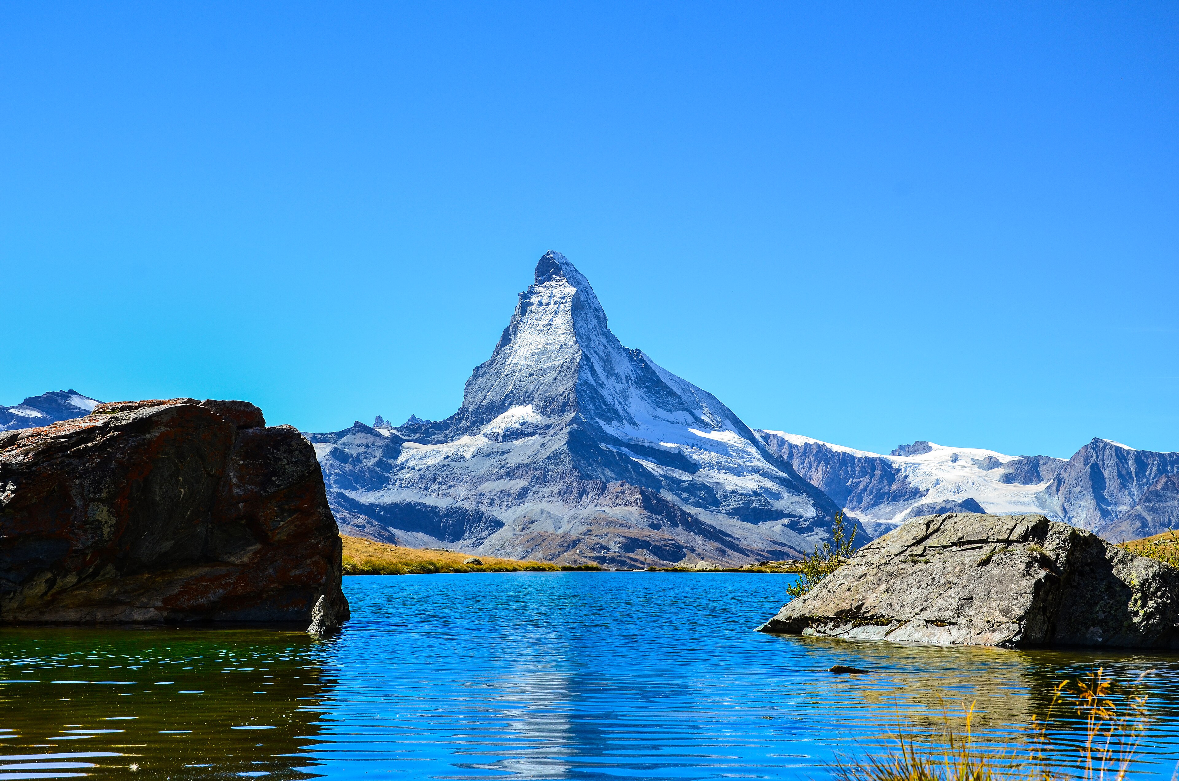
The Zermatt 5-Lake Route starts at Blauherd and descends through a chain of five alpine lakes: Stellisee, Grindjisee, Grünsee, Moosjisee and Leisee. In calm conditions, several of the lakes can reflect the Matterhorn. The route finishes at Sunnegga, where the mountain railway returns to Zermatt.
The walk is varied rather than technically difficult. It crosses open alpine terrain, lake basins, short climbs and descending paths, with extensive views towards the Matterhorn and surrounding Zermatt peaks.
Why it is essential
This is the representative Matterhorn lake hike for Zermatt. It combines easy lift access, classic views, a clear lake-to-lake itinerary and one of the most recognisable photographic landscapes in the Valais Alps.
Equipment
Standard hiking equipment:
- Hiking shoes or boots
- Weatherproof layer
- Warm layer
- Water
- Food
- Map or GPS
- Sun protection
- Trekking poles recommended for descents
Hazards and seasonal notes
Early-season snow may remain around the higher lakes. The route depends on lift operation, so timetables and last descent times should be checked before departure. In poor visibility, the lake-to-lake sequence is less obvious and navigation backup is recommended.
Route-file links
Replace these links later with project-owned GPX/KML files.
| Source | Format | URL |
|---|---|---|
| Zermatt official route page | Source page / official route | zermatt.swiss |
| Outdooractive / Zermatt-Matterhorn | GPX/KML/FIT export page | outdooractive.com |
| TouriSpo | Direct GPX | Download GPX |
| TouriSpo | Direct KML | Download KML |
| Komoot | GPX download page | komoot.com |
| Wikiloc | GPX download page | wikiloc.com |
| Visorando variant | GPX/PDF route page | visorando.com |
2. Edelweiss Path / Höhbalmen
Snapshot
Description
The Edelweiss Path / Höhbalmen route leaves Zermatt station and climbs steeply through Alterhaupt and the Edelweiss area to Trift. From there, the path continues to the high balcony of Höhbalmen before descending by way of Zmutt and returning to Zermatt.
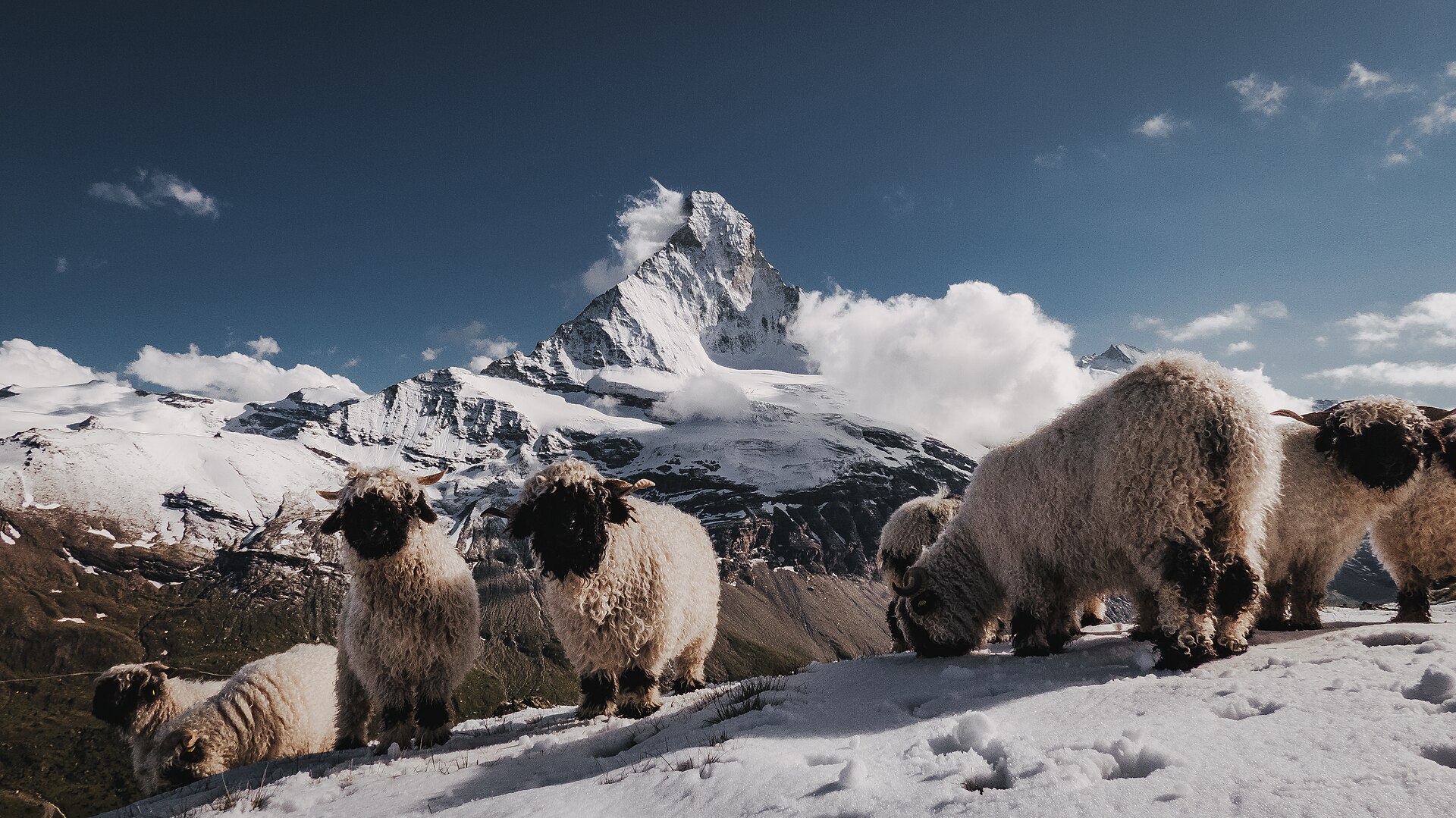
From Höhbalmen, the route gives broad views of the Matterhorn’s north face and Zmutt ridge, as well as the Breithorn, Liskamm and Monte Rosa massif.
Why it is essential
This is a demanding Zermatt balcony classic. It provides a more strenuous and wild-feeling alternative to the lift-assisted lake routes, with a long ascent, botanical interest and one of the major Matterhorn viewpoints above Zermatt.
Equipment
Mountain hiking equipment:
- Sturdy hiking boots
- Weatherproof layer
- Warm layer
- Food and water for a long day
- Map/GPS and navigation backup
- Trekking poles recommended
- Sun protection
- Headtorch
- Hat and gloves outside stable midsummer weather
Hazards and seasonal notes
This is a long mountain day with substantial ascent and descent. Weather deterioration can make the high balcony section serious. Snow patches may remain early in the season. The route is best suited to fit walkers with mountain-path experience.
Route-file links
Replace these links later with project-owned GPX/KML files.
| Source | Format | URL |
|---|---|---|
| Zermatt official route page | Source page / official route | zermatt.swiss |
| Outdooractive / Zermatt-Matterhorn | GPX/KML/FIT export page | outdooractive.com |
| Valais / Outdooractive | Direct GPX | Download GPX |
| Valais / Outdooractive | Direct KML | Download KML |
| Valais route page | Source page | valais.ch |
| Komoot | GPX download page | komoot.com |
| Bergwelten | GPX member-download page | bergwelten.com |
| Hiking Project / onX | GPX download page | hikingproject.com |
3. Höhenweg Almagelleralp
Snapshot
Description
The Höhenweg Almagelleralp starts at Kreuzboden above Saas-Grund and traverses towards Almagelleralp. The route crosses alpine pasture and high mountain terrain before descending through the Almagellertal towards Furggstalden and Saas-Almagell.
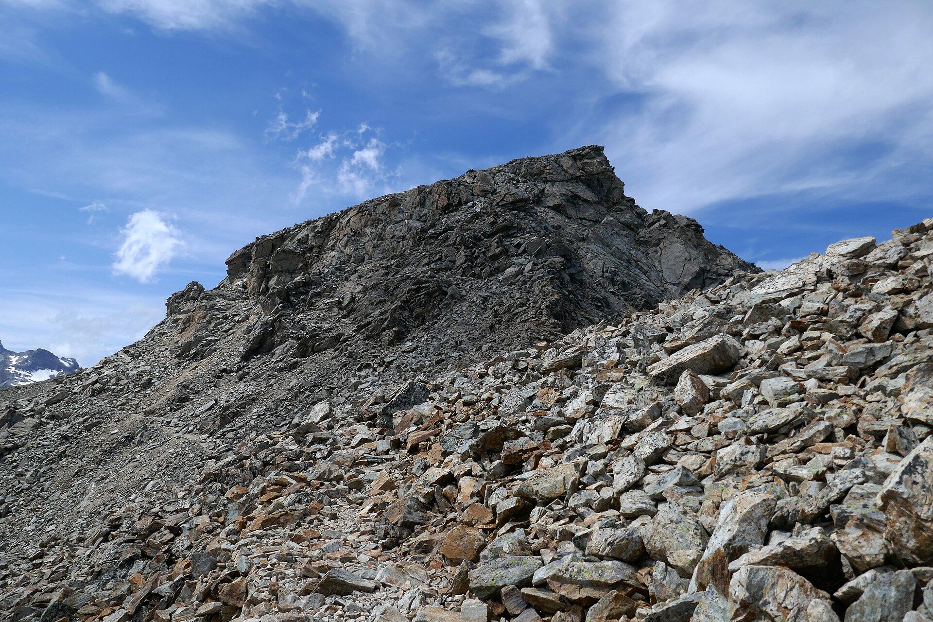
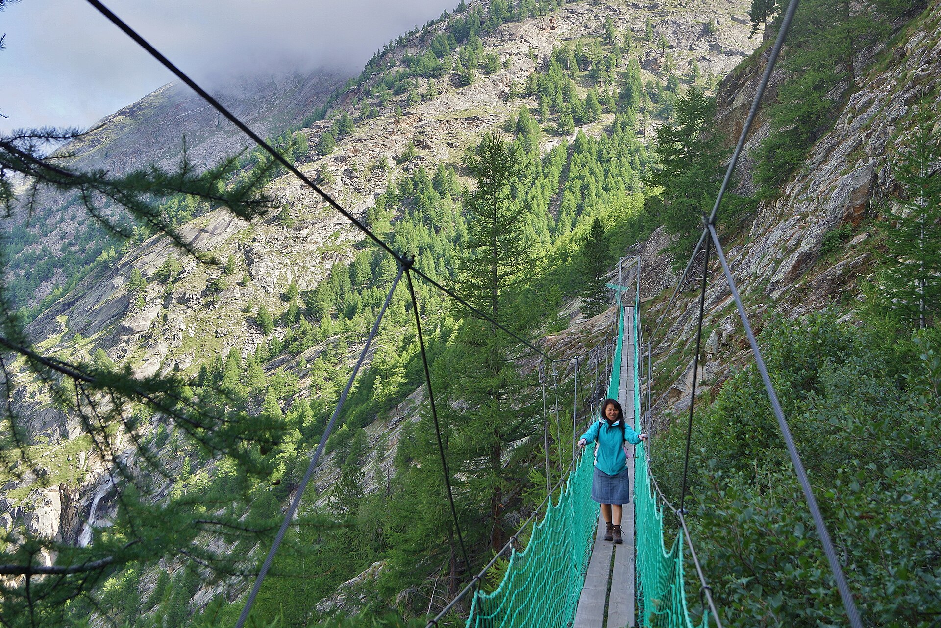
The route is known for views across the Saas valley and towards the Mischabel range. It includes an adventurous mountain-path section with ladders, stairs and a suspension bridge. Sure-footedness and a head for heights are required.
Why it is essential
This is the representative Saastal high traverse in the selection. It combines lift access, alpine flora, balcony walking, valley descent and a more adventurous high-route character without requiring glacier travel or climbing equipment.
Equipment
Mountain hiking equipment:
- Sturdy boots
- Weatherproof layer
- Warm layer
- Food and water
- Sun protection
- Map/GPS
- Trekking poles
- Head for heights required
No via ferrata kit is normally described for the hiking route, but walkers uncomfortable with ladders, bridges or exposure should avoid the adventure-trail variant.
Hazards and seasonal notes
The exposed sections, ladders, stairs and suspension bridge make this route more serious than an easy balcony walk. Falling rocks, slipping, sudden weather changes and lingering snow can all increase risk. Check local trail status before setting out.
Route-file links
Replace these links later with project-owned GPX/KML files.
| Source | Format | URL |
|---|---|---|
| MySwitzerland / SwitzerlandMobility | Source page / official route | myswitzerland.com |
| Valais / Outdooractive | Source page | valais.ch |
| Valais / Outdooractive | Direct GPX | Download GPX |
| Valais / Outdooractive | Direct KML | Download KML |
| Bergfex | Direct GPX | Download GPX |
| Bergfex | Direct KML | Download KML |
| Outdooractive | Export page | outdooractive.com |
| Komoot | GPX download page | komoot.com |
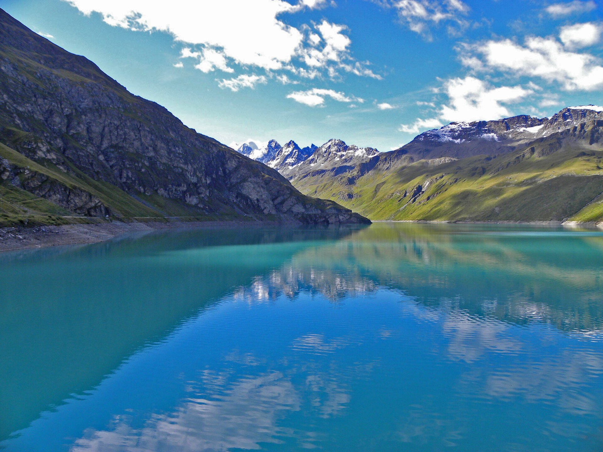
4. Tour du Lac de Moiry
Snapshot
Description
The Tour du Lac de Moiry starts at the Moiry dam and circles the turquoise reservoir on a high-altitude trail. The route climbs above the lake, gives repeated views back to the dam and continues towards the upper Moiry valley and the Moiry Glacier backdrop.
The walk passes through the wilder upper Moiry landscape near Châteaupré, crosses the Gougra area, and returns by way of moraine terrain and small lakes such as Bayenna and Louché.
Why it is essential
This is the key Val d’Anniviers lake-and-glacier landscape route. It combines hydroelectric infrastructure, high alpine pasture, moraine, turquoise water and glacier views in a single feasible day loop.
Equipment
Mountain hiking equipment:
- Sturdy boots
- Weatherproof layer
- Warm layer
- Food and water
- Sun protection
- Navigation backup
- Trekking poles
Early or late season conditions may justify microspikes if snow or hard névé remains. Check current conditions locally.
Hazards and seasonal notes
The route is high for a lake circuit and weather-sensitive. Snow can linger into early summer. Moraine and stream-crossing areas can be unstable after storms or snowmelt. The nearby via ferrata is not part of this hike. Access is affected by seasonal road and bus operation.
Route-file links
Replace these links later with project-owned GPX/KML files.
| Source | Format | URL |
|---|---|---|
| MySwitzerland / SwitzerlandMobility | Source page / official route | myswitzerland.com |
| Valais / Outdooractive | Source page | valais.ch |
| Valais / Outdooractive | Direct GPX | Download GPX |
| Valais / Outdooractive | Direct KML | Download KML |
| Bergfex | Direct GPX | Download GPX |
| Bergfex | Direct KML | Download KML |
| Syris / Valais | Direct GPX | Download GPX |
| Syris / Valais | Direct KML | Download KML |
| Syris / Valais | Source page | syris.iigweb.hevs.ch |
| OpenRunner | Export route page | openrunner.com |
| Komoot | GPX download page | komoot.com |
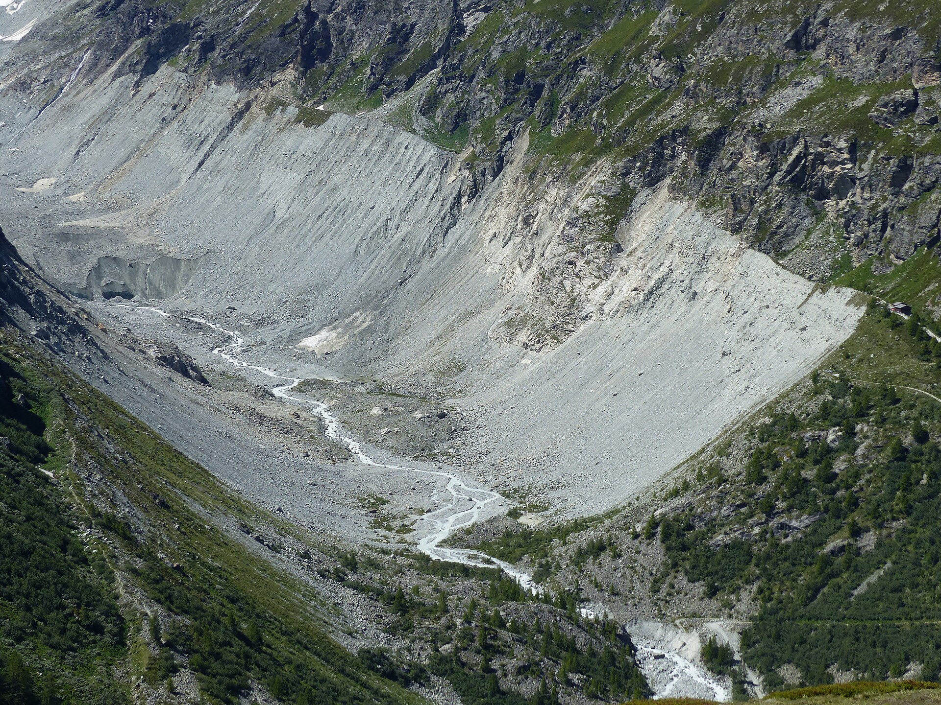
5. Zinal — Cabane du Petit Mountet
Snapshot
Description
From Zinal, the route follows the Navisence valley towards Plats de la Lée. At Plats de la Lée, the path takes the forest road climbing to the right, with views of waterfalls, and continues to Cabane du Petit Mountet above the glacier landscape at the head of the valley.
The direct hut route is suitable as the main catalogue route. Loop variants exist, but some include slippery passages and chains and should be presented as more serious alternatives.
Why it is essential
This is the most accessible Zinal glacier-view hut walk in the selection. It gives a classic Val d’Anniviers valley-to-hut experience without using the more serious higher routes towards Grand Mountet or glacier terrain.
Equipment
Standard to light mountain hiking equipment:
- Hiking shoes or boots
- Weatherproof layer
- Warm layer
- Water
- Food
- Sun protection
- Map/GPS
- Trekking poles recommended if wet or using variants
Hazards and seasonal notes
Riverbanks and riverbeds can flood several times a day in this valley environment. Chain-assisted loop variants are more exposed and slippery than the direct out-and-back route. The direct hut route should be used as the normal non-technical catalogue version.
Route-file links
Replace these links later with project-owned GPX/KML files.
| Source | Format | URL |
|---|---|---|
| Outdooractive / Val d’Anniviers | Source/export page | outdooractive.com |
| Syris / Valais | Source page | syris.iigweb.hevs.ch |
| Syris / Valais | Direct GPX | Download GPX |
| Syris / Valais | Direct KML | Download KML |
| Intersoc | GPX route page | intersoc.be |
| Bergfex winter variant | GPX/KML route page | bergfex.fr |
| Wikiloc | GPX route page | fr.wikiloc.com |
| Komoot longer loop variant | GPX route page | komoot.com |
| Visorando variant | GPX/PDF route page | visorando.com |
Consolidated direct route-file links
These links should be treated as temporary placeholders. Replace them with project-owned route files later.
Zermatt 5-Lake Route / 5-Seenweg
- GPX: Download GPX
- KML: Download KML
Edelweiss Path / Höhbalmen
- GPX: Download GPX
- KML: Download KML
Höhenweg Almagelleralp
- GPX: Download GPX
- KML: Download KML
- GPX alternative: Download GPX
- KML alternative: Download KML
Tour du Lac de Moiry
- GPX: Download GPX
- KML: Download KML
- GPX alternative: Download GPX
- KML alternative: Download KML
- GPX alternative: Download GPX
- KML alternative: Download KML
Zinal — Cabane du Petit Mountet
- GPX: Download GPX
- KML: Download KML