This 6-day Tour du Mont Blanc itinerary follows the full circuit from Les Houches back to Les Houches. It is designed for trail runners and fastpackers who can move quickly over long mountain stages, including running or fast descending where conditions allow. It is not suitable for standard walkers or most trekkers.
Overview
- Start: Les Houches, Chamonix Valley, France
- Finish: Les Houches, Chamonix Valley, France
- Duration: 6 days
- Route style: Complete Tour du Mont Blanc circuit
- Best suited to: Trail runners, fastpackers, and very fit mountain hikers with experience on long alpine days
Main stages
- Les Houches – Val Montjoie
- Val Montjoie – Val Veny
- Val Veny – Val Ferret
- Val Ferret – Champex-Lac / Relais d’Arpette
- Champex-Lac / Relais d’Arpette – Tré-le-Champ
- Tré-le-Champ – Les Houches via Lac Blanc
This itinerary compresses the standard Tour du Mont Blanc into six demanding days. Several stages combine what are normally separate TMB days. The route includes high passes, variant trails, long descents, and sections where transport or lift options can shorten the day.
Important route notes
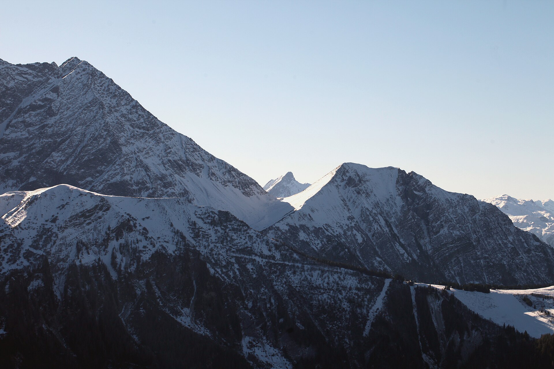
This itinerary should only be attempted by people with strong mountain fitness, good descending ability, and experience judging weather and terrain. The Col des Fours and Fenêtre d’Arpette variants require stable weather and good visibility. Early-season snow may affect the Col du Bonhomme, Col de la Croix du Bonhomme, Col des Fours, Grand Col Ferret, and Fenêtre d’Arpette. In some early-season conditions, hiking crampons may be required.
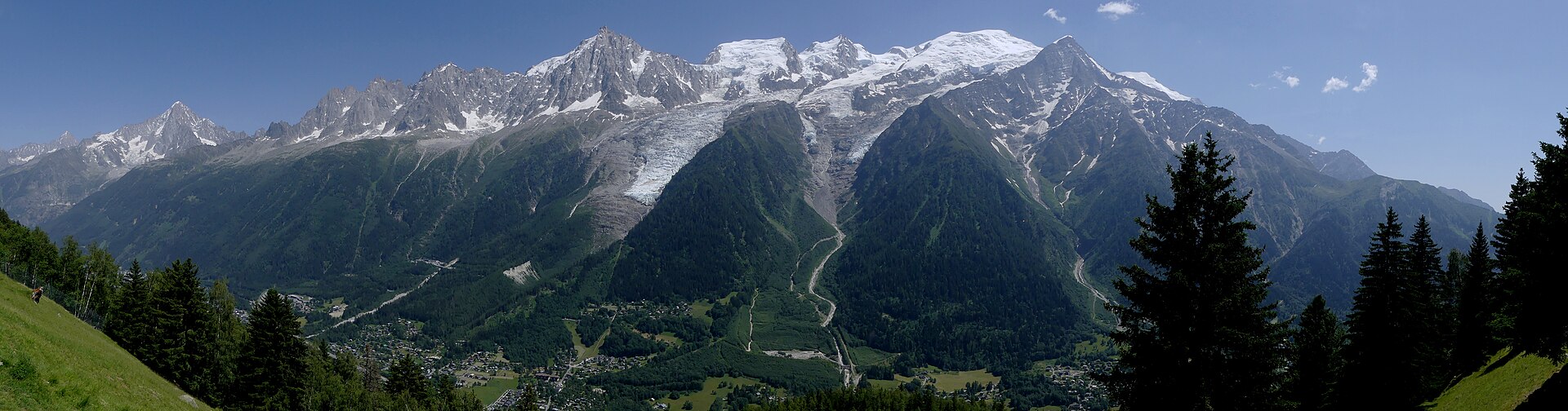
Day 1: Les Houches to Val Montjoie via Col du Tricot
- From Les Houches to Refuge de la Balme: 24.1 km, +2,004 m / -1,311 m, 6–7 hrs
- From Bellevue Plateau to Refuge de la Balme: 18.9 km, +1,222 m / -1,320 m, 5–6 hrs
The route begins in Les Houches. The Bellevue cable car can be used to avoid the lower ascent and start from the Bellevue Plateau. From there, the trail follows the Col du Tricot variant, crossing the suspension bridge near the Bionnassay Glacier before climbing to the grassy saddle of the Col du Tricot.
The descent from the Col du Tricot into the Miage Valley is steep and requires care, especially with tired legs or wet ground. Refuge Miage is reached shortly after arriving on the valley floor. The route then climbs briefly to Auberge du Truc before descending through forest towards Les Contamines.
From Les Contamines, the route continues to Notre-Dame-de-la-Gorge either on foot along the river or by seasonal shuttle in July and August. The climb from Notre-Dame-de-la-Gorge follows the old Roman road towards Refuge Nant Borrant, then continues further up the valley to Refuge de la Balme.
Suggested lunch stops: Refuge Miage, Auberge du Truc, or Les Contamines
Overnight: Refuge de la Balme, Refuge Nant Borrant, or Refuge des Prés
Day 2: Val Montjoie to Val Veny
- Via Les Chapieux to Rifugio Elisabetta: 24.4 km, +1,820 m / -1,335 m, 7–8 hrs
- Via Col des Fours to Rifugio Elisabetta: 21.9 km, +1,764 m / -1,279 m, 7–8 hrs
This stage crosses from France into Italy and includes several major passes. From Refuge de la Balme, the route climbs to the Col du Bonhomme and then to the Col de la Croix du Bonhomme. Snow patches may remain here from late June into July, and the traverse between the two cols can require extra care when snow-covered.
In good weather, the Col des Fours variant offers a higher alternative before descending into the Vallée des Glaciers. This variant bypasses Les Chapieux and rejoins the route near Ville des Glaciers. It should not be attempted in poor weather, low cloud, or unstable conditions.
The standard route descends to Les Chapieux, where food and shuttle options may be available. The trail then continues towards Refuge des Mottets and climbs to the Col de la Seigne, the border between France and Italy. From the pass, the route descends into the Vallon de la Lée Blanche and Val Veny.
Suggested lunch: Packed lunch, Auberge de la Nova, or Refuge des Mottets
Overnight: Rifugio Elisabetta or Cabane Combal
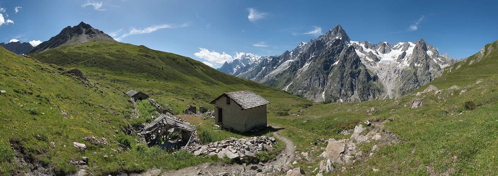
Day 3: Val Veny to Val Ferret
- Approximate distance: 28.1 km
- Elevation: +1,663 m / -1,829 m
- Time: 9–10 hrs
This long stage crosses the Italian side of the Tour du Mont Blanc. Although it does not include a major col, the distance and accumulated ascent make it a demanding day.
The trail climbs from Val Veny to the high balcony route below the southern side of the Mont Blanc massif, reaching the Mont Favre spur at around 2,430 m. The route then continues towards Maison Vieille, above Courmayeur.
During the lift operating season, the Maison Vieille chairlift and Dolonne cable car can be used to reduce the descent into Courmayeur. This is a practical option because the descent is long and hard on the knees. Courmayeur is the main resupply and meal stop on this section.
After Courmayeur, the route climbs steeply to Rifugio Bertone, then follows the balcony trail towards Rifugio Bonatti in the Italian Val Ferret.
Suggested lunch stops: Rifugio Maison Vieille or Courmayeur
Overnight: Rifugio Bonatti, or alternatives such as Hotel Lavachey or Courmayeur if Bonatti is unavailable
Day 4: Val Ferret to Champex-Lac or Relais d’Arpette
- To Relais d’Arpette: 35.5 km, +1,636 m / -2,035 m, 10–11 hrs
This is one of the longest stages of the itinerary. The route climbs from the Italian Val Ferret to the Grand Col Ferret, the border between Italy and Switzerland. The descent from the col enters the Swiss Val Ferret and passes through open alpine pasture before reaching Ferret and La Fouly.
Some trekkers shorten this part of the TMB by taking public transport from Ferret or La Fouly to Champex-Lac. For a complete route on foot, the trail continues down the valley through Swiss villages and pastureland before climbing again towards Champex-Lac.
Champex-Lac is a lakeside village often used as the overnight stop before the next major variant. Relais d’Arpette lies further up the trail and is better positioned for the Fenêtre d’Arpette route on the following day.
Suggested lunch: Packed lunch or La Fouly
Overnight: Champex-Lac or Relais d’Arpette
Day 5: Champex-Lac / Relais d’Arpette to Tré-le-Champ
- Approximate distance: 28.5 km
- Elevation: +1,886 m / -2,114 m
- Time: 9–10 hrs
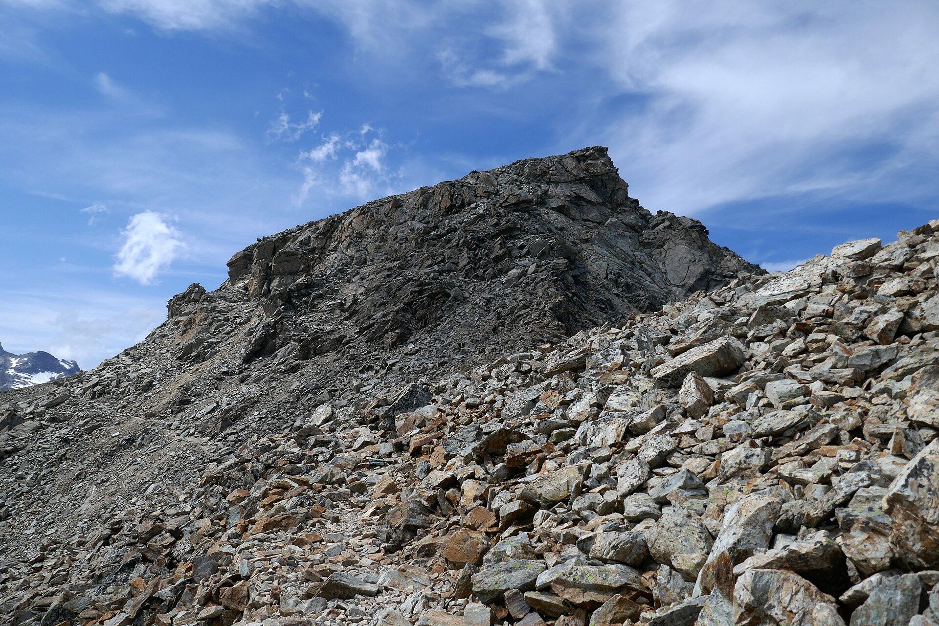
This stage combines two demanding variant sections and is one of the hardest days of the 6-day itinerary. The Fenêtre d’Arpette is the most technical section of the route and should only be attempted in stable weather and good visibility. The upper approach includes rough ground, boulder fields, loose rock, and less obvious waymarking than the standard TMB route.
After crossing the Fenêtre d’Arpette, the route descends near the Trient Glacier. The descent is steep and rocky in places. The trail then reaches the Buvette du Glacier area before climbing again towards Refuge Les Grands.
From Refuge Les Grands, the route continues high above the valley towards the Col de Balme, the border between Switzerland and France. The day finishes by descending towards Tré-le-Champ. To shorten the stage, accommodation near the Col de Balme can be used instead.
Required: Packed lunch and extra water
Alternative in poor weather: Standard Bovine route
Overnight: Tré-le-Champ, or Refuge du Col de Balme / nearby accommodation to shorten the day
Day 6: Tré-le-Champ to Les Houches via Lac Blanc
- Full route to Les Houches: 25.5 km, +1,801 m / -2,187 m, 8–9 hrs
- Using Plan Praz cable car descent: 15.5 km, +2,138 m / -1,065 m, 5–6 hrs
The final stage crosses the north side of the Chamonix Valley through the Aiguilles Rouges area. From Tré-le-Champ, the route climbs towards the TMB ladders, a series of fixed ladders and metal steps built into the rock. This section is exposed and may be difficult for people with vertigo.
At Tête aux Vents, the route can either continue towards La Flégère or detour to Lac Blanc. Lac Blanc is one of the best-known viewpoints on the Tour du Mont Blanc, but it can be busy during lift operating hours.
Several exit options are available on this final day. The La Flégère lift descends to Les Praz, with bus access to Chamonix. The route can also continue along the balcony trail to Plan Praz, where the gondola descends to central Chamonix.
For a full Les Houches-to-Les Houches circuit, the route continues from Plan Praz towards Le Brévent and then descends to Les Houches. This is a long, strenuous finish with a major descent at the end of an already compressed itinerary.
Possible exits: La Flégère, Plan Praz, Le Brévent, or full descent to Les Houches
Finish: Chamonix or Les Houches, depending on the chosen descent