Te Araroa is New Zealand’s long-distance walking route, linking Te Rerenga Wairua / Cape Reinga in the far north with Motupōhue / Bluff in the south. The route spans roughly 3,000 km and crosses beaches, forests, farmland, river corridors, towns, cities, volcanic landscapes, mountain passes, and the Southern Alps.
Key facts
Official trail maps and GPS data Official trail notes
Overview
Te Araroa can be walked as a full through-tramp, as one island, or as individual sections. The route combines backcountry tramping with urban walking, rural tracks, beaches, river valleys, forests, and alpine terrain.
The official trail notes are written from a southbound perspective. The official app and current trail notes should be used for up-to-date maps, warnings, huts, campsites, route changes, and offline topographic mapping.
Ways to walk
| Option | Description |
|---|---|
| Section walking | Individual sections can be walked over days, years, or decades. |
| One-island journey | Either the North Island or South Island can be walked as a major long-distance route. |
| Full through-walk | The complete Cape Reinga to Bluff route is a multi-month journey. |
One island generally takes around 50 – 80 days, depending on pace, weather, rest days, route conditions, and logistics.
Walking season and direction
| Route | Earliest start | Latest start | Latest finish |
|---|---|---|---|
| Southbound full trail | Late September | December | April |
| Northbound full trail | November | January | May |
| South Island only | November | February | April |
| North Island only, southbound | Late September | February | April |
| North Island only, northbound | November | February | April |
The South Island, the Tararua Ranges, and the Tongariro Crossing should not generally be attempted between May and October because of snow, avalanche risk, and heavy rain. Seasonal closures, especially on private land during lambing, can also affect the route.
Safety
Te Araroa requires careful preparation. Walkers should carry suitable clothing, food, emergency supplies, navigation tools, and a personal locator beacon. Mobile phone coverage is not reliable across the whole route.
New Zealand weather can change quickly. Rivers can rise fast, and remote backcountry sections may require navigation, river-crossing skills, and sound judgement. Trail alerts and official updates should be checked before and during the walk.
Accommodation and Trail Pass
Accommodation includes DOC huts and campsites, private huts and campsites, lodges, motels, and B&Bs. A tent remains advisable even when planning to use huts, because huts can be full and weather, injury, or delays may alter plans.
About 1,800 km of the route is on Public Conservation Land managed by DOC. The Trail Pass gives access or discounts to more than 100 DOC huts and campsites, and is required for full-trail walkers and South Island through-walkers as part of registration.
Route sections
Te Rerenga Wairua – Motupōhue
The complete route runs from the spiritual northern cape of Te Rerenga Wairua / Cape Reinga to Motupōhue / Bluff. Across roughly 3,000 km, it links mountain passes, volcanoes, rivers, plains, towns, cities, remote landscapes, and coastal terrain.
Te Tai Tokerau – Northland
Most southbound through-walkers begin in Northland. The region includes Cape Reinga, long beaches, steep bush, remote forests, water crossings, and coastal towns. Ninety Mile Beach is a major early feature, and some sections require tide awareness and careful planning for water and camping.
Tāmaki Makaurau – Auckland
The trail enters Auckland from the north after coastal and semi-rural walking, then moves through suburban routes and ferries into the central city. It crosses the isthmus from the Pacific Ocean side toward Manukau Harbour and the Tasman Sea side.
Waikato
The Waikato section follows the Waikato River, visits the Hakarimata Range, passes through Hamilton, climbs Mt Pirongia, crosses King Country farmland, passes Waitomo, and moves toward the central North Island forests near Mt Tongariro.
Whanganui – Manawatū
This region carries the trail from mountains to sea, through Tongariro and Whanganui national parks, then through pastoral landscapes, Feilding, Palmerston North, and toward the Tararua Ranges. The route combines river travel, bush, tussock, road walking, and harder tramping.
Te Whanganui a Tara – Wellington
This section includes the Tararua Ranges, one of New Zealand's more challenging tramping areas, before descending toward the Kāpiti Coast. Exposed ridgelines and coastal walking lead into Wellington, the capital and a natural resupply, rest, or transition point between islands.
Te Tau Ihu – Marlborough
The South Island begins with the Marlborough Sounds. From historic Ship Cove, the trail follows the Queen Charlotte Track through forested ridges, bays, lodges, and water-taxi-accessible sections. This is one of the more accessible and comfortable South Island introductions.
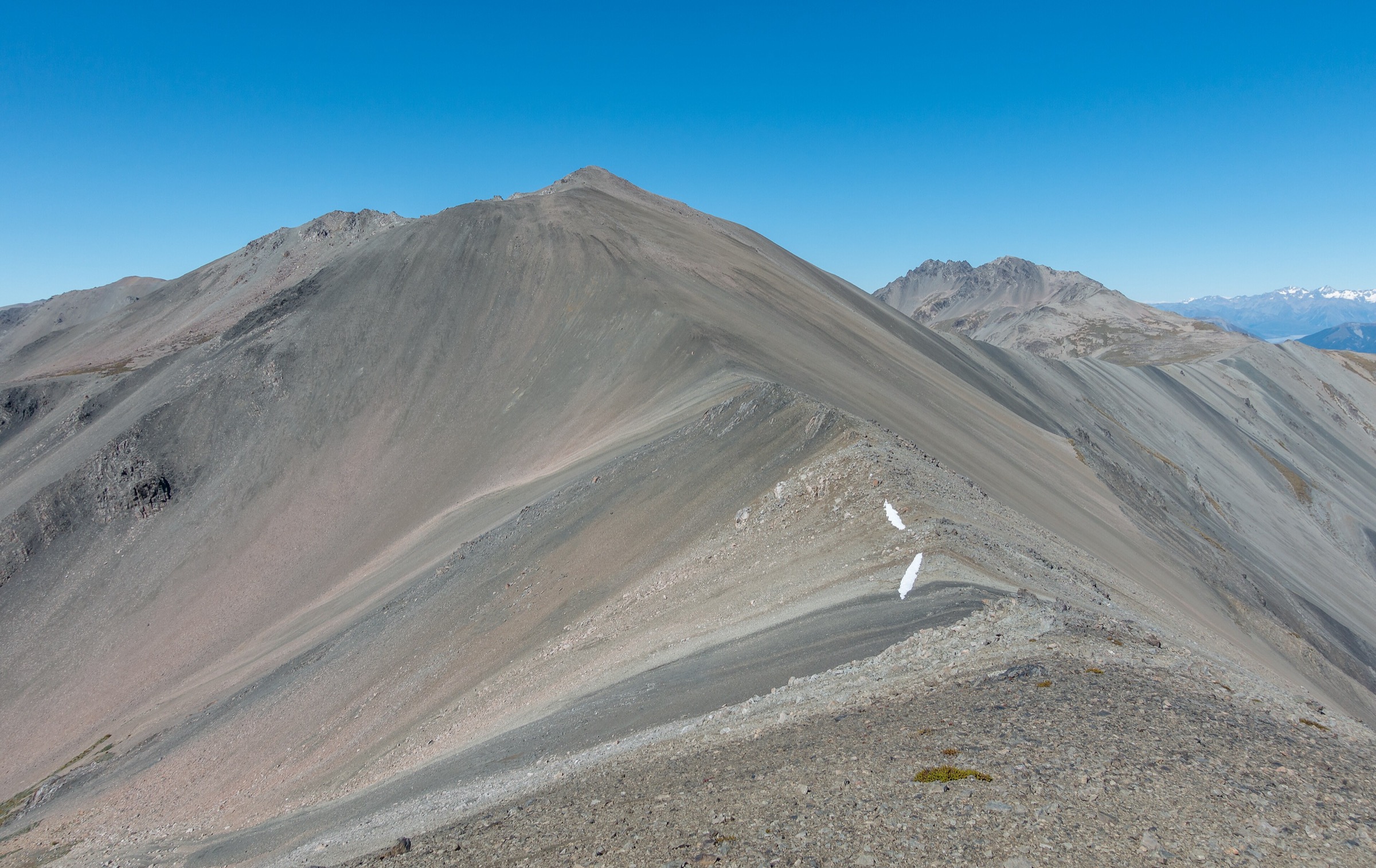
Te Tai o Aorere – Tasman
This is among the hardest tramping on Te Araroa. The Richmond Alpine Track is steep, exposed, and unformed in places, with summits above 1,500 m and multiple stream crossings. Waiau Pass is a major alpine highlight in summer, but winter and spring can bring snow and avalanche danger.
Waitaha – Canterbury
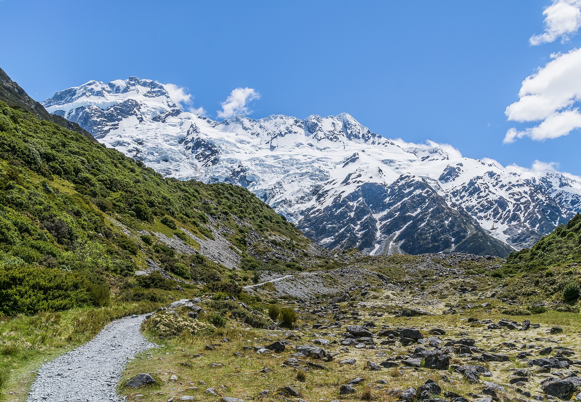
The Canterbury route enters the Southern Alps via Harper Pass, crosses beech forest, rivers, merino stations, and Crown land, then reaches the large braided Rakaia and Rangitata rivers. These rivers are safety zones and are not part of the trail proper; they should not be crossed on foot. The route continues through the Mackenzie Basin, turquoise lakes, views toward Aoraki / Mount Cook, Twizel, and the Ohau Range.
Ōtākou – Otago
Otago combines lakes, mountains, forests, goldmining history, resort towns, and river trails. The walking ranges from easier sections beside the Hāwea and Clutha rivers to the more demanding Motatapu Track. The route passes near Wānaka and Queenstown, then leaves Otago via the Mavora Walkway and Greenstone Track.
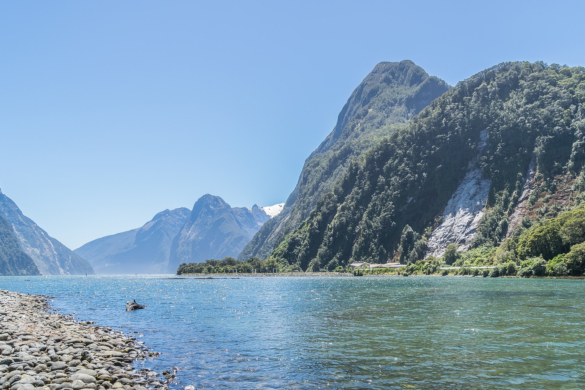
Murihiku – Southland
The southern section includes Mavora Lakes, Takitimu Forest, open tops, coastal walking, Riverton, Invercargill, and the final approach to Stirling Point at Bluff. After reaching the south coast near Colac Bay, the trail continues east along the coast before reaching its southern terminus.
Official route files and maps
The official map release for the 2025 – 26 season is v44, updated 19 August 2025. Te Araroa states that GPS files are updated in November, February, May, and August.
GPX and KMZ route files
- GPX Tracks GPX Trail shown as individual tracks with kilometre waypoints and elevation information.
- GPX Kilometre Points Only GPX Waypoints only, without a route line; suited to confident navigators needing occasional reassurance.
- GPX Section Routes GPX Section route files aligned with the trail sections; compatible with smartwatches, Garmin Connect, Strava, and similar tools.
- GPX North & South Island GPX Trail line only, including river hazard bypasses, split by island and optimised for Garmin Connect.
- KMZ Google Earth KMZ Entire trail route, bypasses, kilometre marks, huts, campsites, and other planning data for Google Earth.
The official page lists a KMZ file rather than a KML file.
North and South Island map downloads
- Mobile PDF North Island Mobile 86-page mobile map set for the North Island.
- Mobile PDF South Island Mobile 78-page mobile map set for the South Island.
- Print PDF North Island High-Res Print 86-page high-resolution print map set for the North Island.
- Print PDF South Island High-Res Print 78-page high-resolution print map set for the South Island.
Regional map downloads
Regional map sets for each section of the trail are available from the official trail maps page.
- RegionalTe Tai Tokerau – Northland
- RegionalTāmaki Makaurau – Auckland
- RegionalWaikato
- RegionalManawatū – Whanganui
- RegionalTe Whanganui a Tara – Wellington
- RegionalTe Tau Ihu – Marlborough
- RegionalTe Tai o Aorere – Tasman
- RegionalWaitaha – Canterbury
- RegionalŌtākou – Otago
- RegionalMurihiku – Southland
Conduct on the trail
Te Araroa crosses culturally significant places, private properties, conservation areas, farms, forests, and fragile ecosystems. Walkers should stay on marked tracks, camp only where permitted, remove rubbish, respect wildlife, avoid contaminating waterways, clean gear to reduce the spread of diseases such as kauri dieback, leave gates as found, and respect local Māori culture and customs.