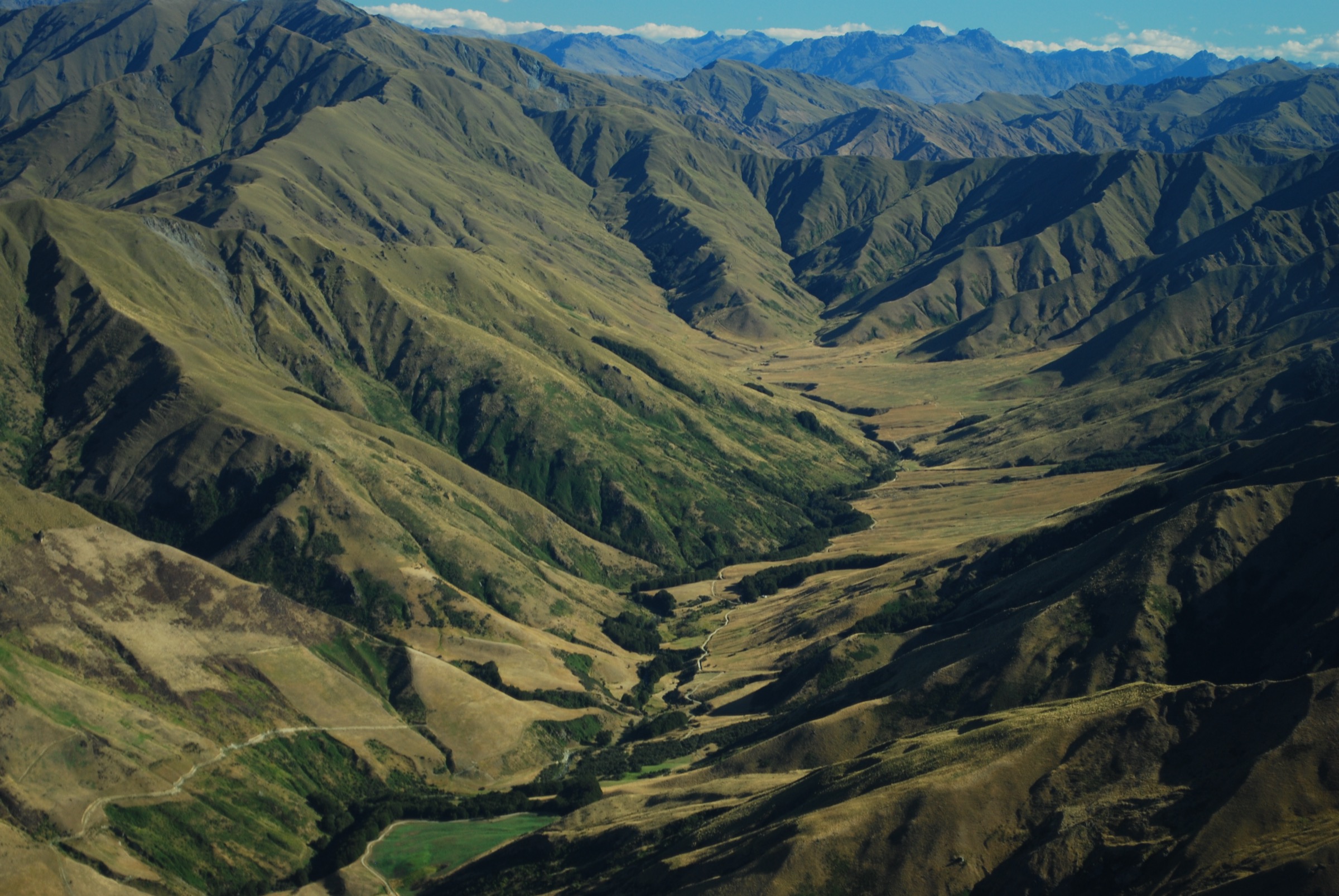
Regional overview
The Mount Cheeseman area sits on the south-eastern side of the Craigieburn Range above Castle Hill Basin. It includes Castle Hill Village access, Texas Flat, Forest Lodge, Dracophyllum Flat, Cockayne Alley, the Mount Cheeseman ski-field road, Snowline Lodge, Mount Cockayne, Tarn Basin, and the 2,031 m Mount Cheeseman summit on the main range crest.
The walking character is a blend of maintained shared-use tracks, ski-field access-road terrain, forested mountain-bike links, and unmarked alpine ridges. Lower routes such as Hogs Back, Dracophyllum Flat, and Cockayne Alley connect beech forest, streams, and tussock flats. Higher objectives from Snowline Lodge and Texas Flat quickly become navigation-dependent scree and ridge routes, with no continuous formed walking track to Mount Cheeseman.
The best season is summer and early autumn when snow is absent from the upper slopes. DOC’s Craigieburn avalanche advice specifically identifies Cockayne Alley above the bushline as complex avalanche terrain, and the Mount Cheeseman operator warns that Tarn Basin and Mount Cheeseman exits are avalanche-prone and dangerous with snow on the ground. Weather can change rapidly, summer heat can be strong on open tussock, and wasps can be common from January to March.
Access is by private vehicle from SH73 and the Mount Cheeseman ski-field road. The road has gates that may be locked or seasonally controlled; DOC notes a locked gate near the 1,289 m high point and another lower gate near the ice-skating rink that may close for safety reasons. Summer lodge access and road/gate status should be checked with Mount Cheeseman before planning routes from Snowline or Forest Lodge.
Selection rationale
These five hikes represent the Mount Cheeseman area’s essential day-hike spectrum: the Castle Hill-to-Texas Flat Hogs Back link, the Dracophyllum Flat connector, the steep Cockayne Alley forest-to-road track, the Snowline/Tarn Basin alpine basin walk, and the strenuous Mount Cheeseman summit from Texas Flat. The selection distinguishes maintained tracks from unmarked alpine routes and marks unresolved statistics clearly.
Summary table
| # | Hike | Country | Route type | Distance | Gain | Max elevation | Difficulty |
|---|---|---|---|---|---|---|---|
| 1 | Hogs Back Track: Castle Hill Village to Texas Flat | New Zealand | Point-to-point | 7.4–8.2 km depending on source/variant | 259 m on AllTrails; 354 m Trailforks variant | ca. 1,050 m | Moderate |
| 2 | Dracophyllum Flat Track: Texas Flat to Jacks Pass | New Zealand | Point-to-point | 6.0 km | 262 m on AllTrails | Moderate | |
| 3 | Cockayne Alley Track | New Zealand | Point-to-point / out-and-back variant | 4.0 km one way | Road high point near 1,289 m; exact route max unresolved | Hard walking; Grade 5 MTB | |
| 4 | Tarn Basin from Snowline Lodge | New Zealand | Out-and-back alpine route | short alpine side trip from ridge | Ridge above Cheeseman ski field; exact high point unresolved | Hard / unmarked alpine route | |
| 5 | Mount Cheeseman from Texas Flat | New Zealand | Out-and-back | 13.0–13.5 km depending on source | 1,200–1,238 m | 2,031 m | Expert / strenuous |
1. Hogs Back Track: Castle Hill Village to Texas Flat
Snapshot
Itinerary
From Thomas Bush car park, walk along Water Intake Road and use the Easy Up Track, which DOC recommends for walkers and cyclists. The route climbs through beech forest to Long Spur and joins Hogs Back Track.
The track then follows the spur, descends across open flats, passes through beech forest at Long Creek, climbs near Waterfall Creek, and traverses toward the western side of the Hogs Back. The final section drops to Texas Flat on the Mount Cheeseman road.
Why it is essential
Hogs Back is the essential Castle Hill-to-Cheeseman approach track and a major shared-use link in the Craigieburn Trails network. It gives a moderate, scenic way into the Mount Cheeseman area without committing to unmarked alpine terrain.
Equipment
- Trail shoes or boots
- Weatherproof layer and warm layer
- Water and food
- Sun protection
- Map/GPS
- Extra water in hot weather
- Plan transport for the point-to-point finish
Hazards and notes
- Track is shared with mountain bikers
- Avoid muddy conditions and respect any seasonal track closures
- DOC prohibits horses, motorbikes, and fires
- The road-return option uses Mount Cheeseman Road and SH73 and is less suitable for walkers than a shuttle or out-and-back
GPX / KML links
| Source | URL | Format / access | Reuse status |
|---|---|---|---|
| DOC: Hogs Back Track | doc.govt.nz | Official route page / map source | DOC website terms; no GPX found |
| Craigieburn Trails: Hogs Back Track | craigieburntrails.org.nz | Local trail page / embedded map | Site copyright applies; route-file reuse not stated |
| AllTrails: Hogs Back Track | alltrails.com | Route page / app map | AllTrails terms apply; GPX export terms not verified |
External links
2. Dracophyllum Flat Track: Texas Flat to Jacks Pass
Snapshot
Itinerary
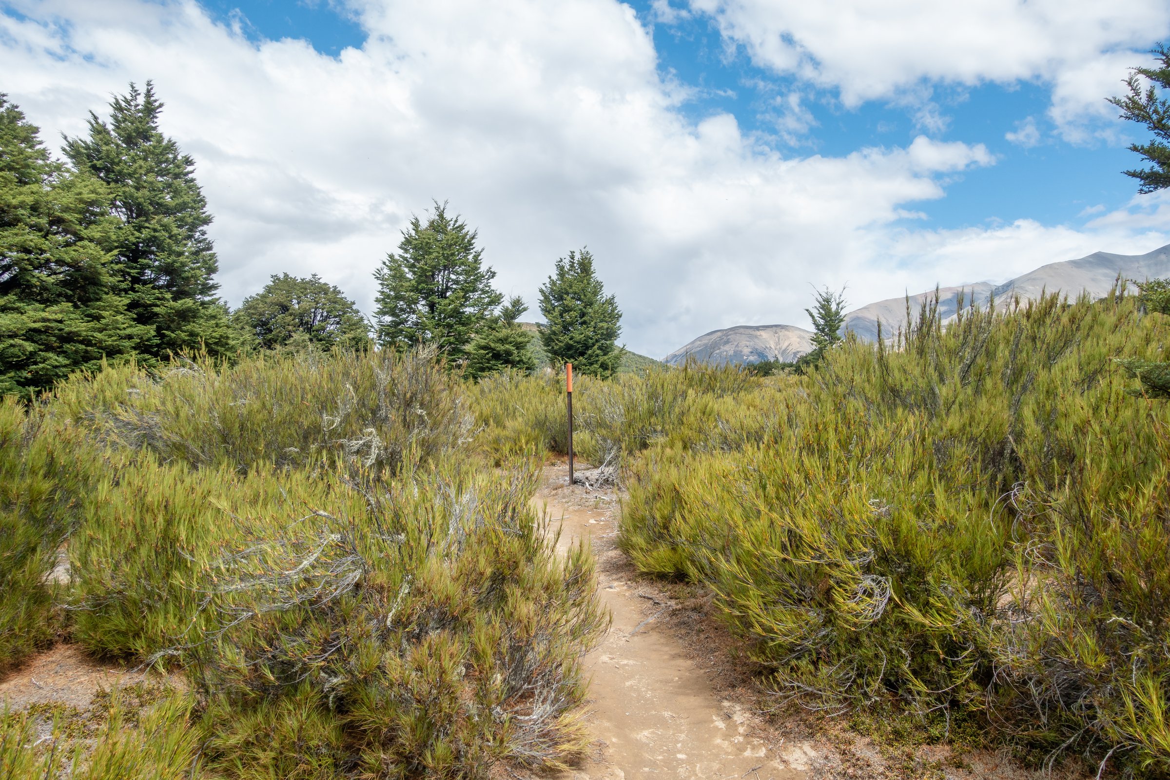
From Texas Flat, the track leaves the Mount Cheeseman road and crosses open scrub and tussock before entering beech forest and crossing small streams and boggier sections. It traverses Dracophyllum Flat, a sheltered clearing named for the red-brown Dracophyllum plants growing there.
The route descends to Broken River, crosses it by bridge, and climbs to Jacks Pass on Broken River Road. It can be walked in either direction; the Broken River-to-Cheeseman direction generally gives more descent early and a final climb to Texas Flat.
Why it is essential
Dracophyllum Flat is the key connector between the Mount Cheeseman and Broken River sides of the Craigieburns. It is also one of the area’s most characteristic lower-elevation walks, linking forest, frost-flat vegetation, stream crossings, and ski-field-road access.
Equipment
- Sturdy shoes or boots
- Raincoat and warm layer
- Food and water
- Sun protection
- Map/GPS
- Poles help around stream and boggy sections
Hazards and notes
- Cuckoo Creek and Tims Stream can become problematic during or after heavy rain
- Track is shared with mountain bikers
- Avoid muddy conditions and check Craigieburn Trails status before using it
- No fires are permitted in Craigieburn Forest Park
GPX / KML links
| Source | URL | Format / access | Reuse status |
|---|---|---|---|
| Craigieburn Trails: Dracophyllum Flat Track | craigieburntrails.org.nz | Local trail page / embedded map | Site copyright applies; route-file reuse not stated |
| Plan My Walk: Dracophyllum Flat Track | planmywalk.nz | Route planning page / source map | Terms not checked; no downloadable GPX found in this pass |
| AllTrails: Dracophyllum Flat Track | alltrails.com | Route page / app map | AllTrails terms apply; GPX export terms not verified |
External links
- Craigieburn Trails — Dracophyllum Flat Track
- Plan My Walk — Dracophyllum Flat Track
- AllTrails — Dracophyllum Flat Track
- Mt Cheeseman — walking tracks page
3. Cockayne Alley Track
Snapshot
Itinerary
From the lower end near Dracophyllum Flat Track, Cockayne Alley climbs the Tims Stream side of the Mount Cheeseman road corridor. DOC describes the route from the top downward: it descends from Cheeseman Road through open terrain, enters bush, drops steeply toward Tims Stream, crosses the ski-field access road, and ends soon after at the Dracophyllum Flat Track junction.
For walkers based at Forest Lodge, the Mount Cheeseman walking page describes using local access to join the track, climbing steadily and steeply until it exits the bush on the ridgeline, then continuing toward the old Middle Hut / “Lunch Tree” area before returning by the same route, a spur variant, the road, or Toboggan Track.
Why it is essential
Cockayne Alley is the steep forest-to-ski-road link that anchors the Mount Cheeseman lower walking network. It provides the most direct walking connection from Forest Lodge and Dracophyllum Flat toward the Snowline/Middle Hut access corridor.
Equipment
- Boots or grippy trail shoes
- Raincoat and warm layer
- Sun protection
- Water and food
- Map/GPS and navigation backup
- Use caution around mountain bikes and avoid descending blind corners in the centre of the track
Hazards and notes
- DOC grades this as Expert Grade 5 for mountain bikers and identifies complex avalanche terrain above the bushline, with simple avalanche terrain to the bushline
- Track is steep, shared-use, and can be slippery
- Gates on the Mount Cheeseman road may be closed for winter or safety reasons
- Avoid the route when snow is present unless equipped and trained for avalanche terrain
GPX / KML links
| Source | URL | Format / access | Reuse status |
|---|---|---|---|
| DOC: Cockayne Alley Track | doc.govt.nz | Official route page / map source | DOC website terms; no GPX found |
| Craigieburn Trails: Cockayne Alley | craigieburntrails.org.nz | Local trail page / embedded map | Site copyright applies; route-file reuse not stated |
| OpenStreetMap search: Cockayne Alley Track | openstreetmap.org | OSM map/source geometry | OSM data is ODbL; geometry cross-check only |
External links
- DOC — Cockayne Alley Track
- DOC — Be avalanche alert in Craigieburn Range
- Craigieburn Trails — Cockayne Alley
- Mt Cheeseman — walking tracks page
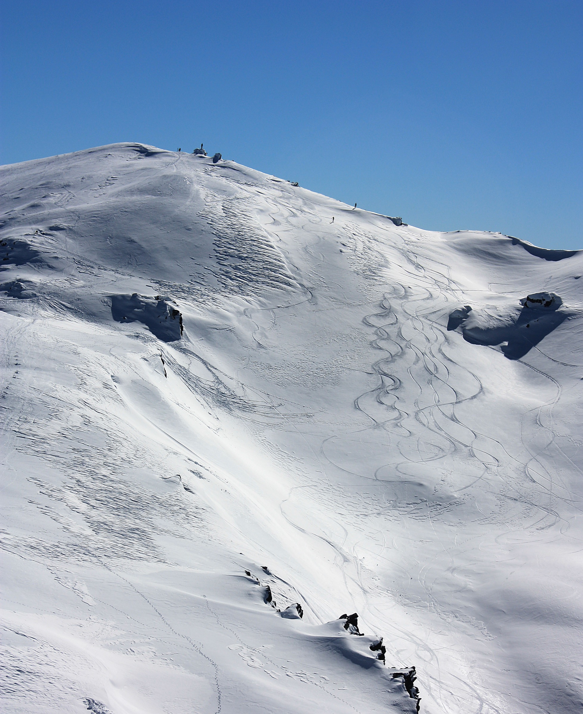
4. Tarn Basin from Snowline Lodge
Snapshot
Itinerary
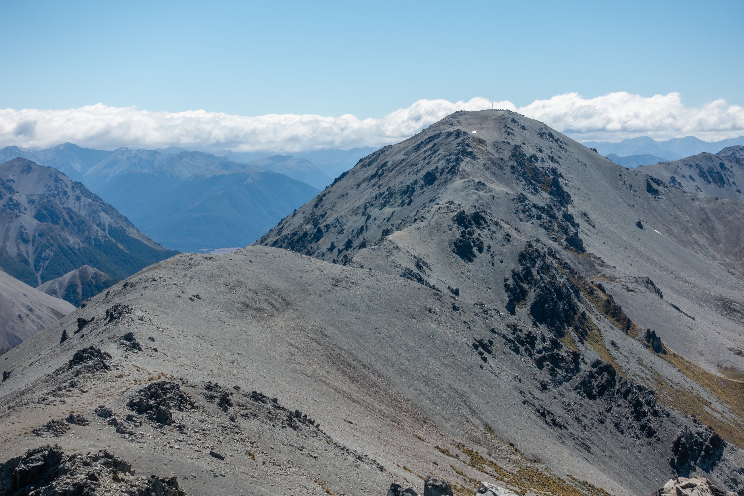
From Snowline Lodge, the Mount Cheeseman walking page describes climbing Hinman Highway and the ski-field cat track as it zigzags left of the main T-bar and continues toward the ridge. From the ridge, Tarn Basin is reached by dropping over the back of the ski-field ridge. The return reverses the route to the lodge.
The page also notes a lower saddle under the Top T-bar used by ski tourers, but this is unformed. For a day-hike catalogue route, the conservative version is an out-and-back from Snowline Lodge to the ridge and Tarn Basin, returning before any scree exit toward Big Bend or Timms Creek.
Why it is essential
Tarn Basin is the most distinctive alpine basin walk from the Mount Cheeseman ski-field side: a short but serious route from lodge terrain into the back side of the range, with tarn, scree, and main-crest scenery.
Equipment
- Boots
- Warm/windproof layer and waterproof shell
- Sun protection
- Food and water
- Map and compass, GPS
- Headtorch
- Emergency shelter and PLB
- In snow, treat as avalanche terrain requiring appropriate equipment and training
Hazards and notes
- Not a formed DOC walking track
- Mount Cheeseman warns that Tarn Basin exits and the Mount Cheeseman route are avalanche-prone in winter and dangerous with snow on the ground
- Scree, unmarked terrain, mist, strong wind, and poor visibility can make the route difficult
- Road gates and lodge access must be confirmed before departure
GPX / KML links
| Source | URL | Format / access | Reuse status |
|---|---|---|---|
| Mt Cheeseman walking tracks page | mtcheeseman.co.nz | Local route description / images | Website terms not checked; no GPX found |
| OpenStreetMap search: Tarn Basin Mount Cheeseman | openstreetmap.org | OSM search/map | OSM data is ODbL; geometry cross-check only |
External links
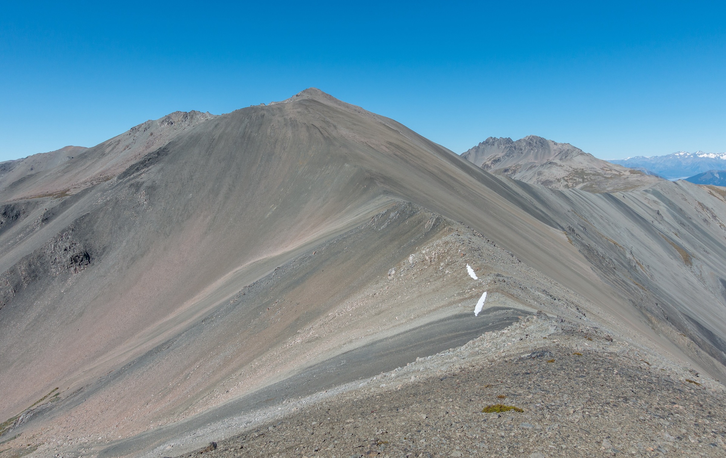
5. Mount Cheeseman from Texas Flat

Snapshot
Itinerary
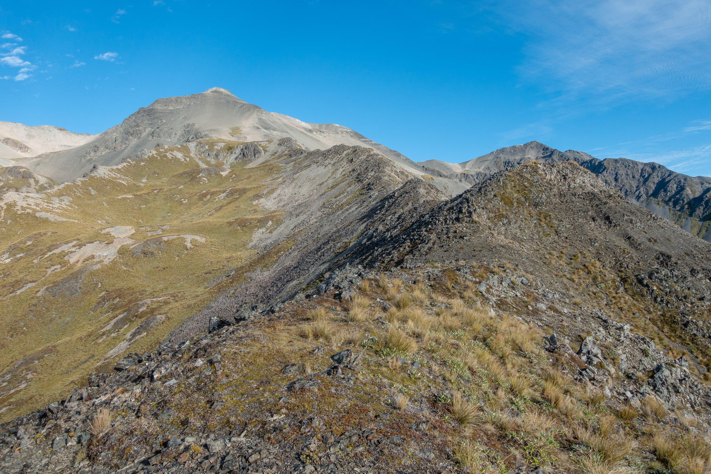
From Texas Flat, start on Hogs Back Track and continue past point 1056 m. Plan My Walk describes continuing straight through a beech-forest patch to the base of the mountain, then climbing steeply through grass to point 1556 m.
From point 1556 m, follow the ridge toward the Mount Cheeseman summit. The route includes steep grass, scree, loose rock, and occasional easy scrambling. Return by the same route to Texas Flat.
Why it is essential
Mount Cheeseman is the named 2,031 m summit above the Cheeseman area and the most substantial day-hike objective in this sub-region. It gives the catalogue a true Craigieburn main-crest summit rather than only lower shared-use tracks and ski-field approaches.
Equipment
- Sturdy boots and trekking poles
- Waterproof/windproof layers and warm layer
- Hat/gloves outside midsummer
- Sun protection
- At least 2 litres of water
- Food
- Map and compass, GPS
- Headtorch
- Emergency shelter, first-aid kit and PLB
- In snow or ice, treat as an alpine mountaineering/avalanche problem, not a normal hike
Hazards and notes
- Plan My Walk states that good navigation skills are required because only the first part of the route is marked
- Steep, exposed climb, partly on scree/loose rock
- Snow, avalanche danger, wind, cloud, and heat are major decision factors
- Dogs are not allowed on the Plan My Walk route listing
- Start early and carry enough water; there is no reliable water on the upper ridge
GPX / KML links
| Source | URL | Format / access | Reuse status |
|---|---|---|---|
| Plan My Walk: Mount Cheeseman from Texas Flat | planmywalk.nz | Route planning page / map | Terms not checked; no downloadable GPX found in this pass |
| AllTrails: Mount Cheeseman from Texas Flat | alltrails.com | Route page / app map | AllTrails terms apply; GPX export terms not verified |
| OpenStreetMap search: Mount Cheeseman | openstreetmap.org | OSM map/source geometry | OSM data is ODbL; geometry cross-check only |
External links
- Plan My Walk — Mount Cheeseman from Texas Flat
- AllTrails — Mount Cheeseman from Texas Flat
- Mt Cheeseman — walking tracks page
- ClimbNZ — Mt Cheeseman
Missing data and follow-up
- No official GPX/KML downloads were found for the Mount Cheeseman area routes in this pass.
- Tarn Basin route distance, gain, maximum elevation, and exact safe summer line need field/GIS verification before publication.
- Cockayne Alley elevation gain/loss and maximum elevation need GIS backfill from legal route geometry.
- Mount Cheeseman route should be checked against current local access, road-gate, and lodge information before publication.
- Several Mount Cheeseman walking-page variants explicitly request further verification from fit trampers; those variants should remain candidate material until measured.
External links
| Source | URL |
|---|---|
| DOC — Craigieburn Forest Park | doc.govt.nz |
| DOC — Be avalanche alert in Craigieburn Range | doc.govt.nz |
| DOC — Hogs Back Track | doc.govt.nz |
| DOC — Cockayne Alley Track | doc.govt.nz |
| Craigieburn Trails — Hogs Back Track | craigieburntrails.org.nz |
| Craigieburn Trails — Dracophyllum Flat Track | craigieburntrails.org.nz |
| Craigieburn Trails — Cockayne Alley | craigieburntrails.org.nz |
| Craigieburn Trails — track status | craigieburntrails.org.nz |
| Plan My Walk — Dracophyllum Flat Track | planmywalk.nz |
| Plan My Walk — Mount Cheeseman from Texas Flat | planmywalk.nz |
| Mt Cheeseman — walking tracks page | mtcheeseman.co.nz |
| ClimbNZ — Mt Cheeseman | climbnz.org.nz |
| ClimbNZ — Mt Cockayne | climbnz.org.nz |
| AllTrails — Hogs Back Track | alltrails.com |
| AllTrails — Dracophyllum Flat Track | alltrails.com |
| AllTrails — Mount Cheeseman from Texas Flat | alltrails.com |