Regional overview
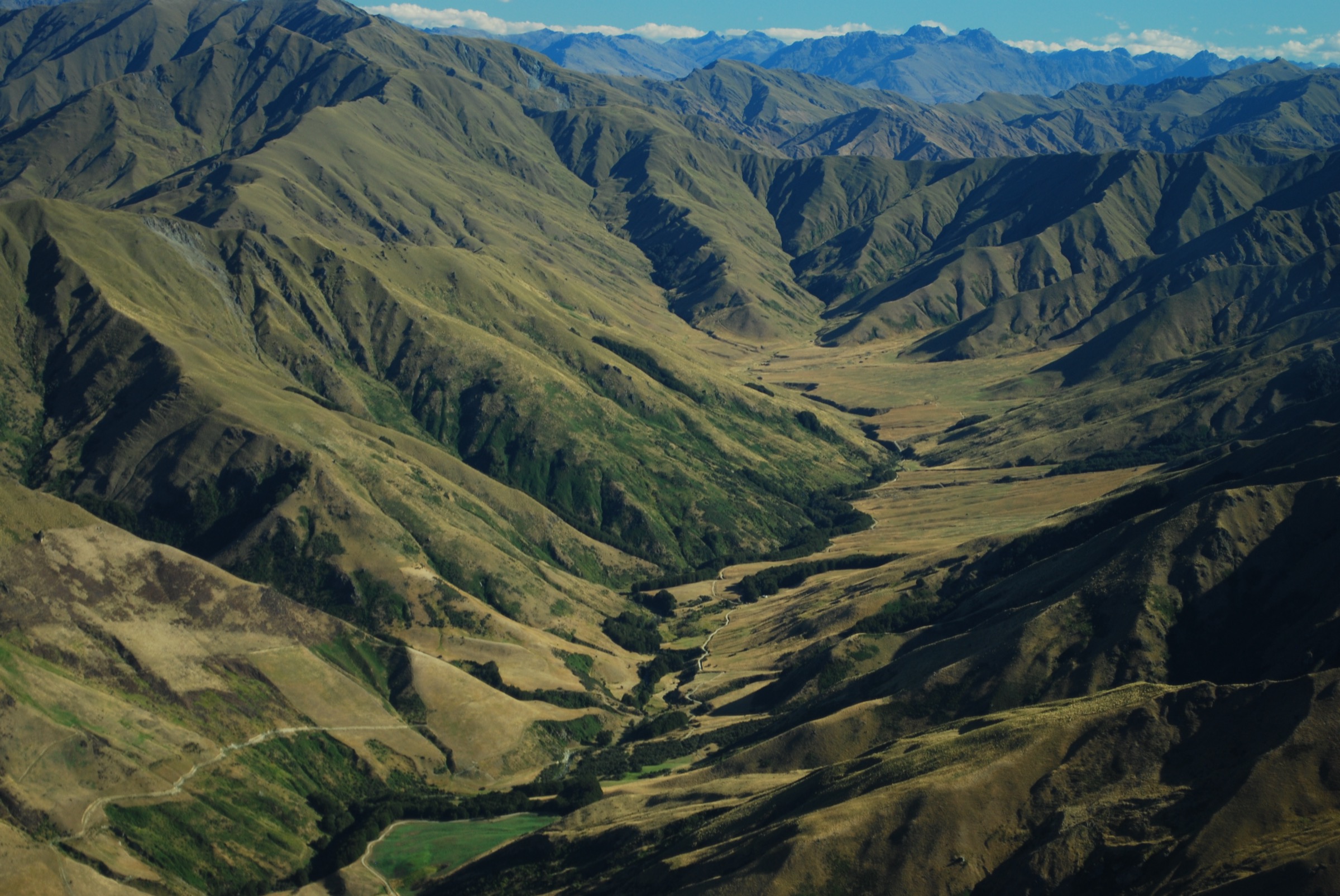
The Cardrona area sits in the dry high-country corridor between Wānaka and Queenstown, with Cardrona Valley below Mount Cardrona and the Crown Range to the west, and the Criffel / Pisa country rising on the opposite side of the valley. The walking character is open Central Otago tussock, exposed ridgelines, old pack tracks, ski-area service terrain, public-access easements across working stations, and remnant beech or shrub pockets in stream gullies.
The main access points are Cardrona village, Cardrona Alpine Resort, the Snow Farm / Waiorau access road, Tuohys Gully, Avalon and The Larches car parks on Cardrona Valley Road, and the Wānaka-side Motatapu and Spotts Creek approaches. Many routes cross private land before reaching conservation land; staying on marked tracks, leaving gates as found, and checking current DOC access notes are essential.
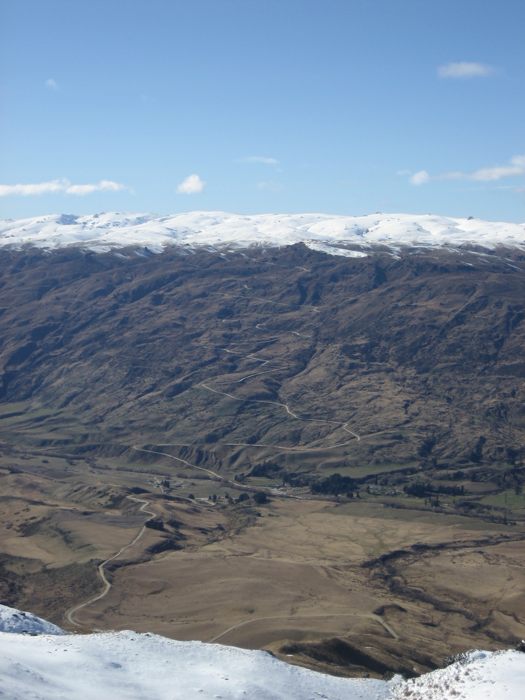
The best general season is late spring to autumn, with summer heat, wind and limited water as common problems. In winter and spring, DOC warns that several Pisa / Cardrona access tracks enter avalanche terrain, and high ridges can require mountaineering judgement. The Crown Range Road and ski-field access roads can be affected by snow, ice, gates, fees or seasonal operating dates.
Selection rationale
These five hikes represent the Cardrona walking area rather than a single compact park: a hard historic goldfields summit on Little Criffel, the old Roaring Meg pack route to Meg Hut, the Kirtle Burn hut approach from Snow Farm, the Mount Cardrona resort summit route, and the long Mount Alpha / Spotts Creek skyline traverse finishing in Cardrona Valley. The selection favours legal public routes and published route records; several statistics still need GIS backfill.
Summary table
| # | Hike | Country | Route type | Distance | Gain | Max elevation | Difficulty |
|---|---|---|---|---|---|---|---|
| 1 | Little Criffel Track | New Zealand | Loop / point-to-point traverse | 18–21.1 km depending on variant | 1,183 m on AllTrails loop; DOC gain not stated | 1,341 m | Hard |
| 2 | Roaring Meg Pack Track to Meg Hut | New Zealand | Out-and-back day section | 14 km return | Approx. 650 m; needs GIS check | Tuohys Saddle 1,140 m | Hard |
| 3 | Kirtle Burn Hut from Snow Farm | New Zealand | Out-and-back | 16 km return | Start at about 1,500 m; high point unresolved | Hard | |
| 4 | Mount Cardrona from Cardrona Alpine Resort | New Zealand | Out-and-back / resort-accessed summit | 6.3 km | 648 m | 1,936 m | Hard |
| 5 | Mount Alpha / Spotts Creek Skyline to Cardrona Valley | New Zealand | Point-to-point traverse | 23–25.7 km depending on source | 1,415 m on AllTrails Cardrona variant | Approx. 1,630 m | Very hard |
1. Little Criffel Track
Snapshot
Itinerary
From Avalon car park, the route crosses the Cardrona River and follows markers and stiles up the steep, unformed hillside toward Little Criffel. The climb is direct and exposed, with views opening across the Upper Clutha Basin, Cardrona Valley and the Southern Alps / Kā Tiritiri o te Moana. Around the tops, old Criffel Diggings features include water races, tailings and remains of miners’ dwellings.
For the traverse, the marked route continues from Little Criffel toward The Larches car park, using mostly 4WD track apart from the Larches Conservation Area and the special lease access section between conservation blocks. Loop variants using local track combinations are longer and should be checked carefully against DOC maps before departure.
Why it is essential
Little Criffel is the strongest Cardrona Valley day hike on the Pisa / Criffel side: a hard summit, a goldfields landscape, and a high viewpoint over both the Cardrona and Wānaka basins. It also gives the catalogue a route that is not ski-area dependent.
Equipment
- Mountain hiking equipment: sturdy boots, weatherproof and windproof layers, warm layer
- Hat/gloves outside midsummer
- Sun protection
- Map/GPS and navigation backup
- Food and plenty of water
- Trekking poles are useful on the steep unformed ground
Hazards and notes
- The Cardrona River crossing is unbridged and can be unsafe after rain.
- DOC warns of hot, dry summer conditions, alpine conditions at any time, winter avalanche terrain, private-land easement rules, no camping before the conservation boundary, and no dogs on the access track.
- The Larches access closes for lambing in spring; current dates should be checked on DOC before planning the traverse.
GPX / KML links
| Source | URL | Format / access | Reuse status |
|---|---|---|---|
| DOC Little Criffel Track | doc.govt.nz | Official route page / map source | DOC website terms; route geometry reuse not stated |
| DOC Wānaka outdoor pursuits brochure | doc.govt.nz | Official PDF map and route notes | DOC PDF terms not checked; source-map reference only |
| AllTrails: Little Criffel Track | alltrails.com | Route page / app map | AllTrails terms apply; GPX export terms not verified |
External links
- DOC — Little Criffel Track
- DOC — Wānaka outdoor pursuits brochure (PDF)
- AllTrails — Little Criffel Track
2. Roaring Meg Pack Track to Meg Hut
Snapshot
Itinerary
From Tuohys Gully car park, the route climbs steadily on a 4WD track to Tuohys Saddle. The left fork descends about 200 m to Meg Hut, a standard hut in open tussock country. The return reverses the route and requires climbing back to the saddle before descending to the car park.
The full Roaring Meg Pack Track continues from Tuohys Saddle toward the Kawarau Gorge, descending through the Roaring Meg / Te Wai a Korokio gorge to the Roaring Meg power station. That full 18 km one-way traverse is better treated as a shuttle day or overnight trip; the Meg Hut section is the more practical Cardrona day-hike objective.
Why it is essential
This is the most approachable legal day section of the old pack route linking Cardrona Valley with the Kawarau side of the Pisa Range. It gives access to a high-country hut, the Tuohys Saddle crossing, and the dry-gold tussock character of the Cardrona backcountry.
Equipment
- Mountain hiking equipment with sturdy boots
- Windproof/waterproof layers, warm layer
- Sun protection
- Map/GPS
- Food and ample water
- Carry a headtorch and emergency layer because the exposed return climb can be slow in wind or heat
Hazards and notes
- DOC notes hot, dry summer conditions, rapid weather change, hypothermia risk even in summer, winter avalanche terrain from May into November, and private-land access rules.
- The full Roaring Meg continuation includes stream crossings that may be impassable during or after heavy rain, and a private working-farm section where dogs, mountain bikes and firearms are not permitted.
GPX / KML links
| Source | URL | Format / access | Reuse status |
|---|---|---|---|
| DOC Roaring Meg Pack Track | doc.govt.nz | Official route page / map source | DOC website terms; route geometry reuse not stated |
| DOC Wānaka outdoor pursuits brochure | doc.govt.nz | Official PDF map and route notes | Route-file reuse not stated |
| OpenStreetMap search | openstreetmap.org | OSM search/map | OSM data is ODbL; geometry cross-check only |
External links
3. Kirtle Burn Hut from Snow Farm
Snapshot
Itinerary
The route starts from the Snow Farm area and uses the marked easement track beside the Snow Farm Lodge to reach Pisa Conservation Area. DOC describes two marked options from the easement track to Kirtle Burn Hut: one following the valley stream and one on the ridge above the stream. The day-hike returns by the same line or by the alternate marked branch if conditions and navigation are clear.
This is a high, open route rather than a sheltered valley walk. It gives quick access to Pisa tops scenery from the Cardrona side, but the access road and easement arrangements are part of the route planning.
Why it is essential
Kirtle Burn is the Cardrona area’s hut-and-high-plateau option. It represents the Snow Farm / Pisa side of the valley and gives a legal summer walking route into the high tussock landscape without committing to the longer Cardrona-Cromwell or Roaring Meg traverses.
Equipment
- Mountain hiking equipment: sturdy boots, windproof/waterproof layers, warm layer
- Sun protection
- Food and water
- Map/GPS and navigation backup
- In marginal conditions, carry extra insulation and a distress beacon
Hazards and notes
- DOC notes that a road toll is required for the Snow Farm / SHPG access road and that foot access on the toll road is not permitted.
- Access to Pisa Conservation Area from the Snow Farm car park is via Snow Farm or by prior arrangement through the SHPG easement.
- Alpine weather, whiteout, snow, avalanche conditions, and limited water should be assumed possible outside the stable summer period.
GPX / KML links
| Source | URL | Format / access | Reuse status |
|---|---|---|---|
| DOC Wānaka outdoor pursuits brochure, Kirtle Burn Hut listing | doc.govt.nz | Official PDF map and route notes | Route geometry reuse not stated |
| Plan My Walk: Kirtle Burn Track | planmywalk.nz | Route planning page | Terms not checked; source-map candidate only |
| OpenStreetMap search | openstreetmap.org | OSM search/map | OSM data is ODbL; geometry cross-check only |
External links
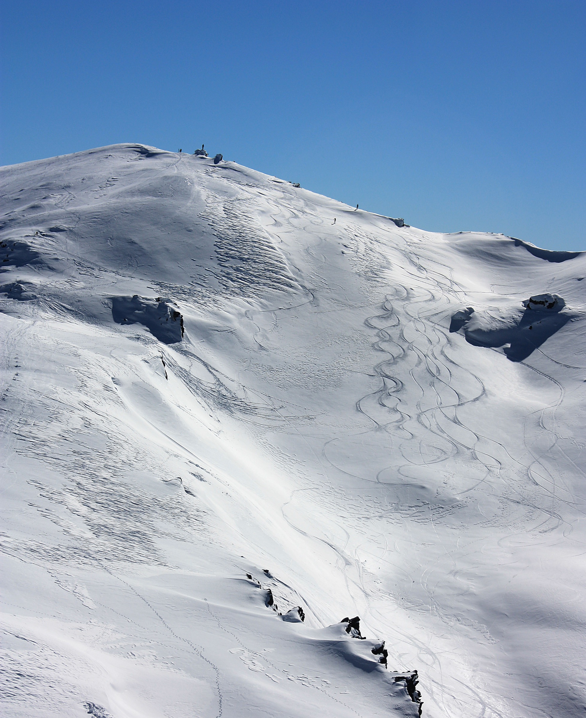
4. Mount Cardrona from Cardrona Alpine Resort
Snapshot
Itinerary
The route uses Cardrona Alpine Resort summer access, then follows open ski-area and service-track terrain toward the high ridge and Mount Cardrona summit area. The AllTrails route titled “Mt Cardrona from Captains Express Station” records a short but steep out-and-back. Wilderness Magazine also describes a summer Mount Cardrona walk through ski-field terrain, crossing mountain-bike and carting trails before higher rocky ground.
Because the route lies inside an operating resort environment, walkers should use only open walking routes, obey summer bike-park separation rules, and confirm the current trail map, lift status and access permissions.
Why it is essential
Mount Cardrona is the defining high point above the valley and ski area. It gives the most direct summit experience in the Cardrona area, with views across the Southern Alps, Wakatipu, Crown Range, Pisa country and the Harris / Motatapu backcountry.
Equipment
- Mountain hiking equipment: sturdy boots, windproof/waterproof layer, warm layer
- Sun protection
- Food and water
- Map/GPS and navigation backup
- In early summer, carry microspikes only if current resort/local advice reports firm lingering snow
Hazards and notes
- The route crosses or approaches ski-area, mountain-bike and mountain-cart terrain. Use only open walking tracks and keep clear of operational trails.
- Cardrona’s official walking page advises water, sunscreen, sturdy footwear and clothing layers because mountain conditions change quickly.
- Gondola operation is seasonal; the 2025/26 summer page stated 13 December 2025 to 1 March 2026, but future dates need confirmation.
GPX / KML links
| Source | URL | Format / access | Reuse status |
|---|---|---|---|
| AllTrails: Mt Cardrona from Captains Express Station | alltrails.com | Route page / app map | AllTrails terms apply; GPX export terms not verified |
| Cardrona summer walking and hiking | cardrona-treblecone.com | Official resort walking page / current trail-map pointer | Resort terms; route geometry reuse not stated |
| Wilderness Magazine: Mount Cardrona, Otago | wildernessmag.co.nz | Guide-style route description | Copyrighted article; secondary verification only |
External links
- Cardrona & Treble Cone — Summer Walking & Hiking
- AllTrails — Mt Cardrona from Captains Express Station
- Wilderness Magazine — Mount Cardrona, Otago
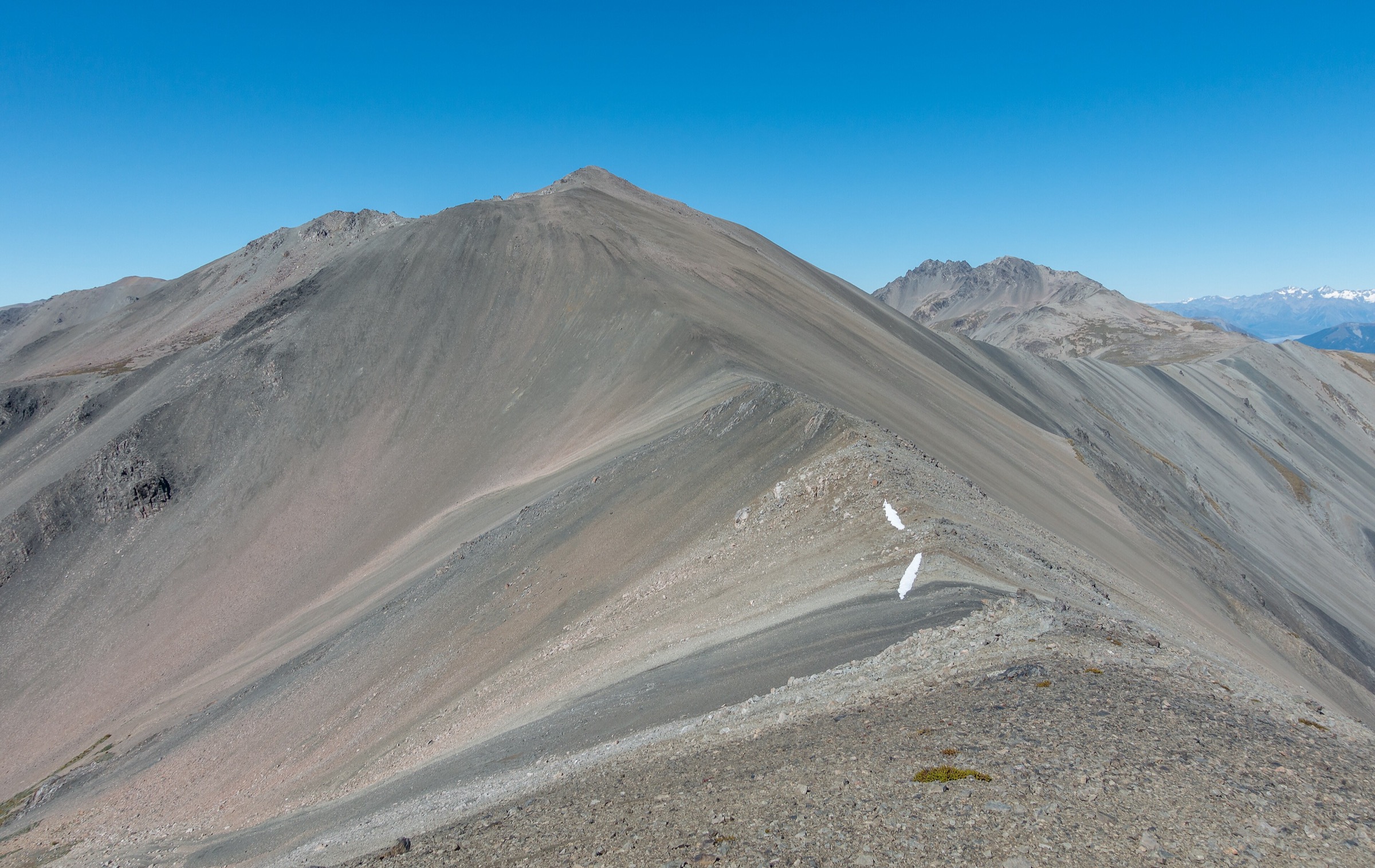
5. Mount Alpha / Spotts Creek Skyline to Cardrona Valley
Snapshot
Itinerary
DOC’s Wānaka brochure describes the Spotts Creek Track, also known as the Skyline Track, as a challenging tramp beginning with the Roys Peak Track. From Roys Peak, the route follows the ridgeline over Mount Alpha, then descends through snow tussock to a 4WD track and follows a poled route to Cardrona Valley Road.
The AllTrails “Mount Alpha from Cardona Valley Road” record represents a Cardrona Valley approach variant. Both versions are long, exposed and navigation-dependent. This is a demanding day for experienced walkers rather than a casual Cardrona outing.
Why it is essential
This traverse links the Wānaka skyline with Cardrona Valley and gives the strongest Harris Mountains ridge day associated with the Cardrona area. It balances the ski-area and Pisa-side hikes with a serious high ridgeline route.
Equipment
- Mountain hiking equipment with sturdy boots
- Full windproof/waterproof layers, warm layer
- Hat/gloves
- Sun protection
- 2–3 litres of water
- Food
- Map/GPS and navigation backup
- Emergency shelter
- Headtorch and a distress beacon strongly recommended
Hazards and notes
- DOC warns that the track is prone to low cloud, is not recommended in winter, and passes through challenging and complex avalanche terrain.
- Safari hunting occurs on Spotts Creek Station, especially during the March–May roar; walkers should stay visible.
- The route is exposed to wind, heat, cold and whiteout; water availability on the ridgeline is limited.
GPX / KML links
| Source | URL | Format / access | Reuse status |
|---|---|---|---|
| DOC Wānaka outdoor pursuits brochure, Spotts Creek Track | doc.govt.nz | Official PDF route note and map | Route geometry reuse not stated |
| AllTrails: Mount Alpha from Cardona Valley Road | alltrails.com | Route page / app map | AllTrails terms apply; GPX export terms not verified |
| OpenStreetMap search | openstreetmap.org | OSM search/map | OSM data is ODbL; geometry cross-check only |
External links
External links
| Source | URL |
|---|---|
| DOC — Wānaka outdoor pursuits brochure (PDF) | doc.govt.nz |
| DOC — Little Criffel Track | doc.govt.nz |
| DOC — Roaring Meg Pack Track | doc.govt.nz |
| Cardrona & Treble Cone — Summer Walking & Hiking | cardrona-treblecone.com |
| NewZealand.com — Cardrona | newzealand.com |
| Wilderness Magazine — Mount Cardrona, Otago | wildernessmag.co.nz |
| Plan My Walk — Kirtle Burn Track | planmywalk.nz |
| AllTrails — Little Criffel Track | alltrails.com |
| AllTrails — Mt Cardrona from Captains Express Station | alltrails.com |
| AllTrails — Mount Alpha from Cardona Valley Road | alltrails.com |