Regional overview
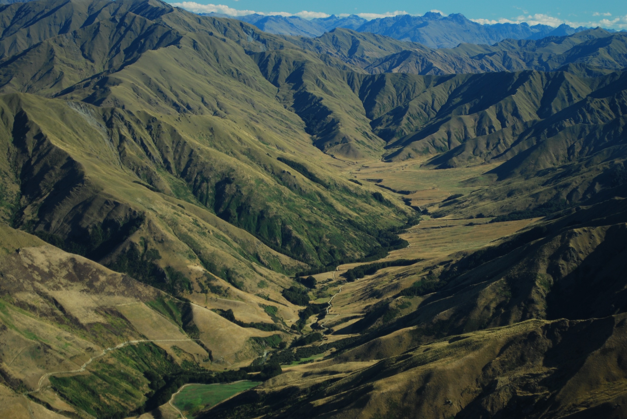
The Broken River area is the northern-central day-hiking gateway into Craigieburn Forest Park, reached from SH73 by Broken River Road. It combines sheltered mountain beech forest, the Craigieburn picnic/Mistletoe Flats area, Cave Stream terraces, Dracophyllum Flat, Camp Saddle, the Broken River ski-field basin, and ridge routes toward Nervous Knob, Mount Wall, and the Craigieburn Valley side.
The walking style is mixed. Lower routes use maintained DOC and Craigieburn Trails tracks shared with mountain bikers, while the higher Broken River ski-field basin and Nervous Knob routes are informal alpine tramping routes above the bushline. DOC describes the ski-field basins as harsh alpine areas with no marked routes beyond the bushline; buildings are private ski-field property and should not be entered unless access has been arranged.
The best hiking season is summer and early autumn when snow is absent. In winter and spring, the Broken River area is avalanche terrain and several normal walking links become much more serious. DOC’s Craigieburn avalanche page classifies Camp Saddle above the bushline, the Luge link to Craigieburn Edge, and nearby ski-basin terrain as avalanche-relevant. Weather can change quickly, heat and sun exposure are significant in summer, and wasps can be common from January to March.
Access is normally by private vehicle on Broken River Road. The road is narrow and winding, and in winter may require chains. Broken River Ski Area notes that its signposted access road is about 7.5 km beyond Castle Hill Village and climbs through native beech forest to the Hanomag car park; campervans are not suitable for the road. Summer lodge or ski-field access should be checked directly with the operator if entering operational areas.
Selection rationale
These five hikes focus on Broken River’s core walking experiences: the lower Mistletoe-Lyndon-Helicopter viewpoint, the Broken River ski-field basin approach, the main-ridge objective of Nervous Knob, the Camp Saddle alpine access route, and the Dracophyllum Flat connector toward Texas Flat. The selection favours legally described DOC/Craigieburn routes, with the ski-basin and ridge routes clearly marked as less formal and more condition-dependent.
Summary table
| # | Hike | Country | Route type | Distance | Gain | Max elevation | Difficulty |
|---|---|---|---|---|---|---|---|
| 1 | Mistletoe Track, Lyndon Saddle and Helicopter Hill | New Zealand | Out-and-back | 5.6 km | 440 m | 1,256 m | Moderate-hard |
| 2 | Broken River Ski Field Basin from the Locked Gate | New Zealand | Out-and-back / road-and-bush-track loop | Distance unresolved; DOC gives 2-3 hr return to huts | Ski-field basin around 1,400-1,600 m | Moderate-hard | |
| 3 | Broken River Ski Field to Nervous Knob | New Zealand | Out-and-back alpine route | Distance unresolved; DOC gives ski field to main ridge 4-5 hr return | 1,820 m at Nervous Knob | Hard / expert route | |
| 4 | Camp Saddle from Broken River Road | New Zealand | Out-and-back | Approx. 7.0 km return including road approach | Approx. 500-600 m; needs GIS check | Approx. 1,500 m | Hard |
| 5 | Dracophyllum Flat Track: Jacks Pass to Texas Flat | New Zealand | Point-to-point | 6.0 km | 262 m on AllTrails; route undulates | Approx. 1,100 m at Jacks Pass | Moderate |
1. Mistletoe Track, Lyndon Saddle and Helicopter Hill

Snapshot
Itinerary
Mistletoe Track begins at the shelter near the Craigieburn picnic area. It crosses Cave Stream and grassy terraces before climbing through regenerating mountain beech forest to Lyndon Saddle. At the saddle, turn onto Helicopter Hill Track and climb a steep, exposed ridge through beech openings and scree to the summit.
The descent reverses the ascent to Lyndon Saddle and the picnic area. The Luge and Craigieburn Edge links make longer alternatives possible, but they enter shared-use and avalanche-prone terrain.
Why it is essential
This is the Broken River area’s most accessible summit walk: a well-documented DOC route with a high viewpoint over Castle Hill Basin, the Torlesse Range, Broken River Road, and the Craigieburn Range.
Equipment
- Sturdy footwear
- Raincoat and warm layer
- Sun protection
- Water (more than expected on hot days) and food
- Map/GPS and navigation backup
Hazards and notes
- DOC warns that avalanches from Helicopter Hill can cross Mistletoe Track when snow is present.
- The summit ridge is exposed to heat, wind, rain, cold, and winter ice.
- Mistletoe and Helicopter Hill are walking-only tracks; no mountain biking is allowed.
- Wasp numbers can be high in summer and early autumn.
GPX / KML links
| Source | URL | Format / access | Reuse status |
|---|---|---|---|
| DOC: Mistletoe Track | doc.govt.nz | Official route page / map source | DOC website terms; no GPX found |
| DOC: Helicopter Hill Track | doc.govt.nz | Official route page / map source | DOC website terms; no GPX found |
| AllTrails: Helicopter Hill Track | alltrails.com | Route page / app map | AllTrails terms apply; GPX export terms not verified |
External links
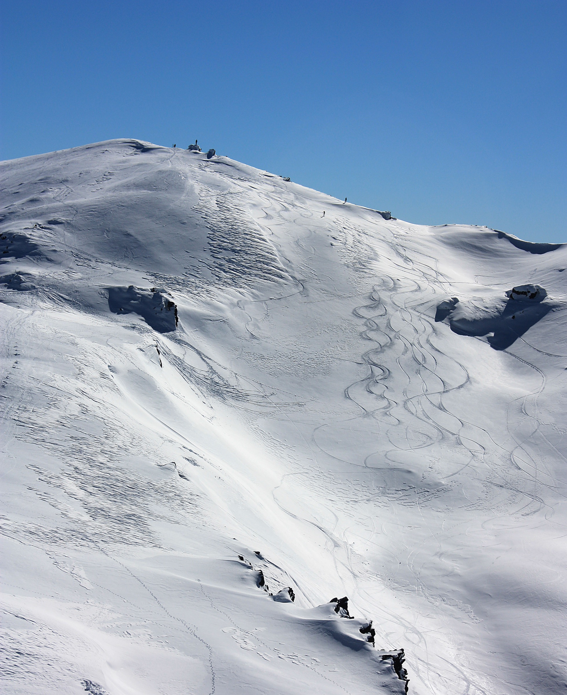
2. Broken River Ski Field Basin from the Locked Gate
Snapshot
Itinerary
From the locked gate on Broken River Road, walk up the ski-field road toward the accommodation huts. DOC notes that a bush track beside the inclinator / goods lift zigzags directly up to the huts, while the vehicle road gives a gentler return option.
The normal day-walk objective is the hut and rope-tow area rather than private buildings. Continue only where public walking access is clear, avoid entering ski-field structures, and respect any seasonal operational restrictions.
Why it is essential
The Broken River ski-field basin is the area’s defining human and alpine landmark: a club-field basin in beech-and-tussock country with historic access infrastructure, summer lodge context, and direct views toward the main Craigieburn ridge.
Equipment
- Boots or sturdy shoes
- Raincoat and warm layer
- Sun protection
- Water and food
- Map/GPS and navigation backup
In winter, this becomes ski-field and avalanche terrain; walking parties should not treat it as an ordinary summer track.
Hazards and notes
- Broken River Road is narrow and winding; the ski area states the road is not suitable for campervans and chains are needed in winter.
- Ski-field buildings and operational areas are private/managed property.
- Above the huts there are no marked DOC walking routes.
- Weather, snow, avalanche risk, and summer heat are all relevant.
GPX / KML links
| Source | URL | Format / access | Reuse status |
|---|---|---|---|
| DOC Craigieburn Forest Park day-walks brochure | doc.govt.nz | Official PDF route notes / map | DOC PDF terms; no GPX found |
| Rankers: Broken River Skifield Basin track | rankers.co.nz | Secondary route page | Terms not checked; route-file reuse not stated |
| OpenStreetMap search: Broken River Ski Area | openstreetmap.org | OSM map/source geometry | OSM data is ODbL |
External links
- DOC — Craigieburn Forest Park day-walks brochure (PDF)
- Broken River Ski Area — Getting Here
- Broken River Ski Area — Summer
- Rankers — Broken River Skifield Basin track
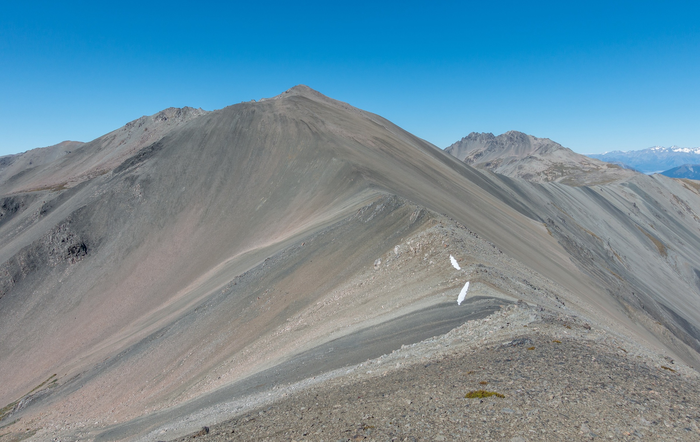
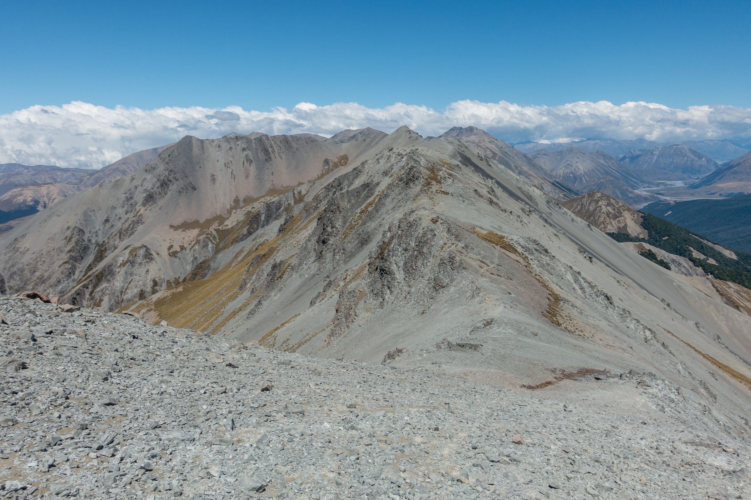
3. Broken River Ski Field to Nervous Knob
Snapshot
Itinerary
From the Broken River ski-field huts, DOC describes a vehicle track sidling up into the tussock basin. Beyond the bushline there are no marked DOC routes. Obvious lines climb from the basin toward the main ridge and Nervous Knob.
The route is best treated as an alpine out-and-back from the ski field, using map, compass/GPS, and current conditions to choose a safe line. Return by the same route unless a traverse has been planned with transport and experienced parties.
Why it is essential
Nervous Knob is the signature high point above Broken River Ski Area and gives the strongest day-sized alpine objective on the Broken River side of the Craigieburn Range. It links the club-field basin with the main ridge and broad views toward Hamilton Peak, Mount Wall, the Harper catchment, and the Southern Alps.
Equipment
- Sturdy boots
- Warm/windproof layers and waterproof shell
- Map and compass, GPS, headtorch
- Emergency shelter and first-aid kit
- Personal locator beacon
- In snow: avalanche transceiver, shovel, probe (and the skills to use them); crampons/ice axe may be relevant depending on conditions
Hazards and notes
- This is not a marked track. Route-finding, loose scree, rockfall, exposure to wind/cold, whiteout, and avalanche conditions are the main hazards.
- DOC recommends alternative tracks for people without navigation skills and confidence in untracked terrain.
- Broken River’s backcountry guidance stresses checking conditions, not travelling alone, and using avalanche rescue equipment outside controlled areas in winter.
GPX / KML links
| Source | URL | Format / access | Reuse status |
|---|---|---|---|
| DOC Craigieburn Forest Park day-walks brochure | doc.govt.nz | Official PDF route notes / map | DOC PDF terms; no GPX found |
| Broken River: Backcountry Access | brokenriver.co.nz | Ski-field/backcountry information page | Website terms not checked; no route file |
| OpenStreetMap search: Nervous Knob | openstreetmap.org | OSM map/source geometry | OSM data is ODbL |
External links
- DOC — Craigieburn Forest Park day-walks brochure (PDF)
- Broken River Ski Area — Backcountry Access
- Broken River Ski Area — Terrain
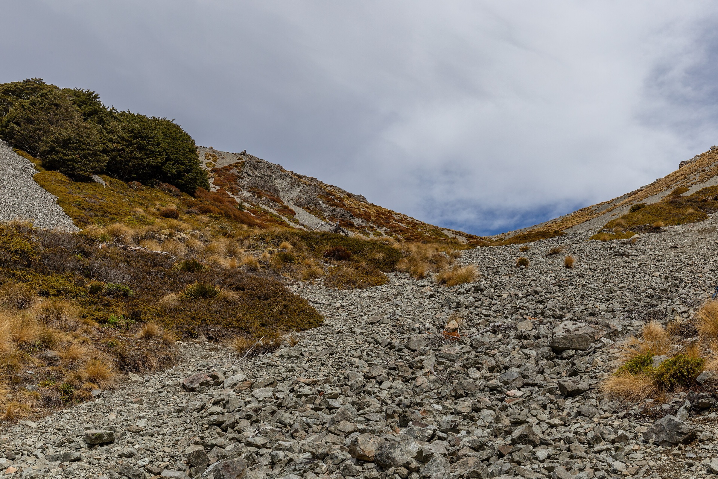
4. Camp Saddle from Broken River Road
Snapshot
Itinerary
From the locked gate where Broken River Road crosses Camp Stream, walk 1 km along the road to the signposted Camp Saddle Track opposite the ski club tractor shed. The route follows an old four-wheel-drive line that narrows and climbs steadily through beech forest.
Above the forest the route enters open tussock, where poles mark the final section to Camp Saddle. Return by the same line. Untracked continuations toward Lyndon Saddle or Craigieburn Edge Track are possible only for experienced trampers.
Why it is essential
Camp Saddle is the Broken River area’s most important non-ski alpine pass objective. It gives direct access to the range crest environment without committing to the more complex Nervous Knob or Hamilton Peak traverses.
Equipment
- Boots
- Raincoat, warm layer, windproof layer
- Water, food, sun protection
- Map/GPS and navigation backup
- PLB for any untracked extension
Hazards and notes
- DOC notes avalanche risk on this route, including complex terrain above the bushline.
- Snow, rockfall, loose scree, strong winds, whiteout, and rapid cold changes can make the saddle serious.
- No fires are permitted.
- Wasps can be an issue in summer and early autumn.
GPX / KML links
| Source | URL | Format / access | Reuse status |
|---|---|---|---|
| DOC: Camp Saddle Track | doc.govt.nz | Official route page / map source | DOC website terms; no GPX found |
| DOC Craigieburn Forest Park day-walks brochure | doc.govt.nz | Official PDF route notes / map | DOC PDF terms; no GPX found |
| OpenStreetMap search: Camp Saddle Craigieburn | openstreetmap.org | OSM map/source geometry | OSM data is ODbL |
External links
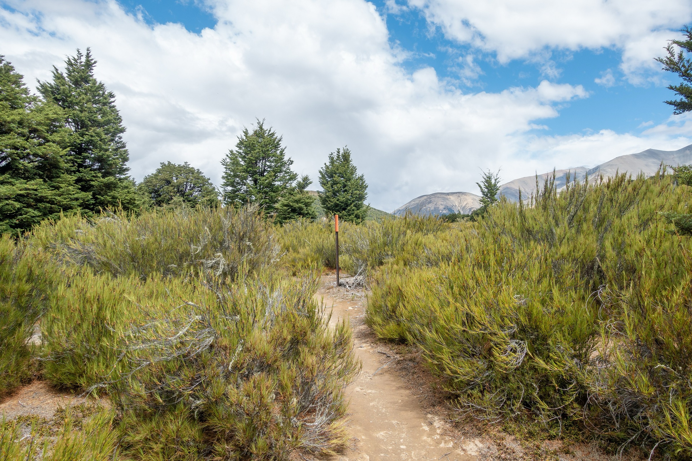
5. Dracophyllum Flat Track: Jacks Pass to Texas Flat
Snapshot
Itinerary
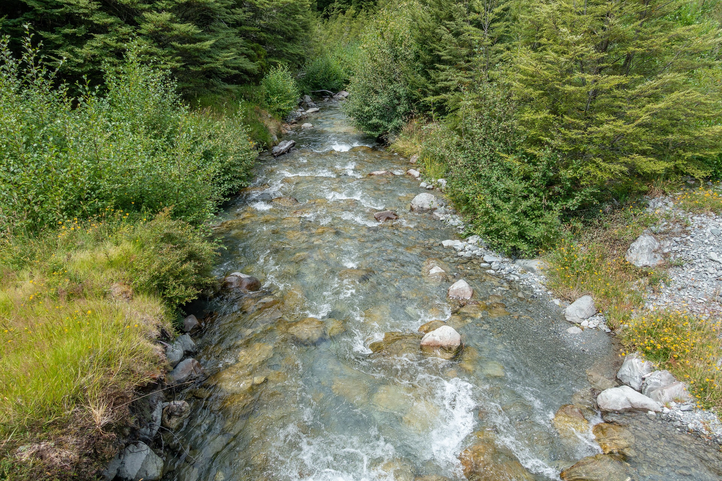
From Jacks Pass on Broken River Road, the track descends through beech forest to Broken River and crosses it by bridge. It then climbs briefly to Dracophyllum Flat, a sheltered clearing of red-brown Dracophyllum, tussock, herbs, and ground-cover plants.
The track re-enters beech forest, crosses boggy and muddy sections with bridges over many minor streams, then traverses open scrub and tussock before dropping to Tims Stream. After fording Tims Stream, it climbs out to Texas Flat on Mt Cheeseman Road.
Why it is essential
Dracophyllum Flat is the key Broken River-to-Cheeseman connector and the best moderate traverse through the lower Craigieburn basin. It links two ski-field roads while showing the park’s beech gullies, frost flats, stream crossings, and distinctive Dracophyllum vegetation.
Equipment
- Trail shoes or boots
- Raincoat and warm layer
- Water and food
- Sun protection
- Map/GPS
- Poles can help at stream approaches
- Carry enough water if extending to Hogs Back or other tracks
Hazards and notes
- Plan My Walk and Craigieburn Trails note stream and creek crossings; Cuckoo Creek can flood and become impassable during or after heavy rain.
- The track is shared with mountain bikers.
- Avoid muddy conditions to reduce track damage.
- Wasp numbers can be high in summer and early autumn.
GPX / KML links
| Source | URL | Format / access | Reuse status |
|---|---|---|---|
| Craigieburn Trails: Dracophyllum Flat Track | craigieburntrails.org.nz | Local trail page / embedded map | Site copyright applies unless otherwise indicated; route-file reuse not stated |
| Plan My Walk: Dracophyllum Flat Track | planmywalk.nz | Route planning page / source map | Terms not checked; no downloadable GPX found in this pass |
| AllTrails: Dracophyllum Flat Track | alltrails.com | Route page / app map | AllTrails terms apply; GPX export terms not verified |
External links
- Craigieburn Trails — Dracophyllum Flat Track
- Plan My Walk — Dracophyllum Flat Track
- AllTrails — Dracophyllum Flat Track
- Mt Cheeseman — walking tracks
Missing data and follow-up
- No official GPX/KML downloads were found for the Broken River routes in this pass.
- Broken River ski-field basin and Nervous Knob route distances/gains need GIS measurement from lawful route geometry.
- Access rules around Broken River ski-field operational areas should be reconfirmed directly with the ski club before publication.
- Current track status should be checked before publication because the area was affected by the December 2024 wildfire and seasonal/frost-heave closures.
- Public transport to the SH73 access-road entrance is possible only by arrangement according to Broken River; it was not verified as a dependable trailhead service.
External links
| Source | URL |
|---|---|
| DOC — Craigieburn Forest Park | doc.govt.nz |
| DOC — Craigieburn Forest Park day-walks brochure (PDF) | doc.govt.nz |
| DOC — Mistletoe Track | doc.govt.nz |
| DOC — Helicopter Hill Track | doc.govt.nz |
| DOC — Camp Saddle Track | doc.govt.nz |
| DOC — Be avalanche alert in Craigieburn Range | doc.govt.nz |
| Broken River Ski Area — Getting Here | brokenriver.co.nz |
| Broken River Ski Area — Backcountry Access | brokenriver.co.nz |
| Broken River Ski Area — Terrain | brokenriver.co.nz |
| Broken River Ski Area — Summer | brokenriver.co.nz |
| Craigieburn Trails — Dracophyllum Flat Track | craigieburntrails.org.nz |
| Plan My Walk — Dracophyllum Flat Track | planmywalk.nz |
| Mt Cheeseman — walking tracks | mtcheeseman.co.nz |
| AllTrails — Helicopter Hill Track | alltrails.com |
| AllTrails — Dracophyllum Flat Track | alltrails.com |
| Rankers — Broken River Skifield Basin track | rankers.co.nz |