Regional overview
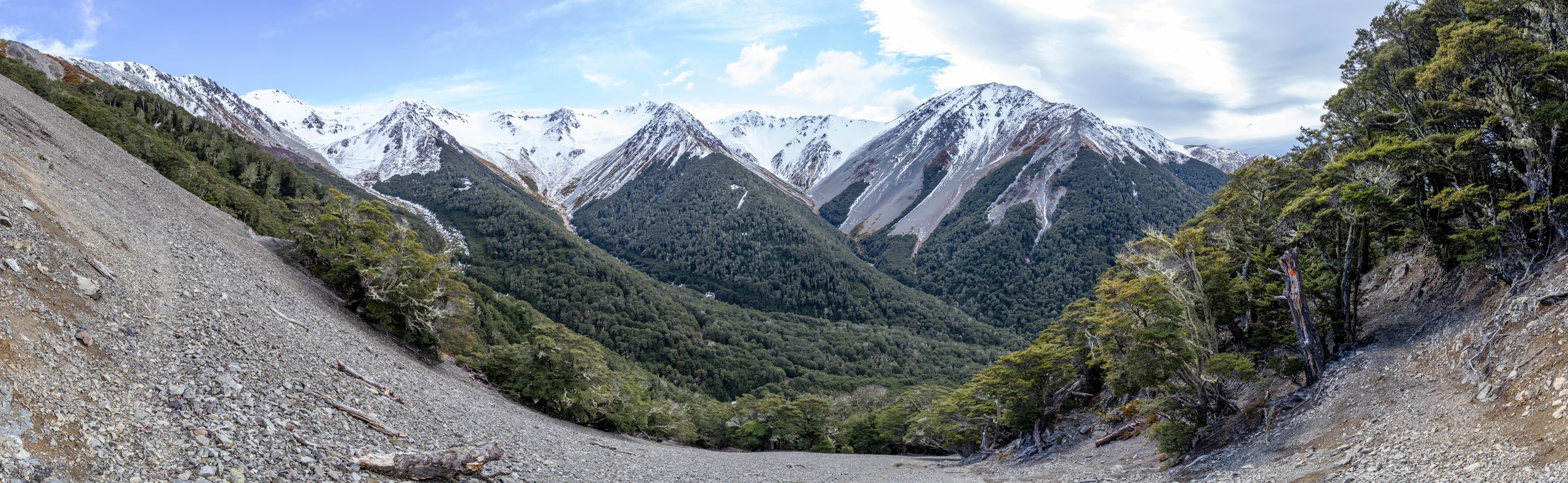
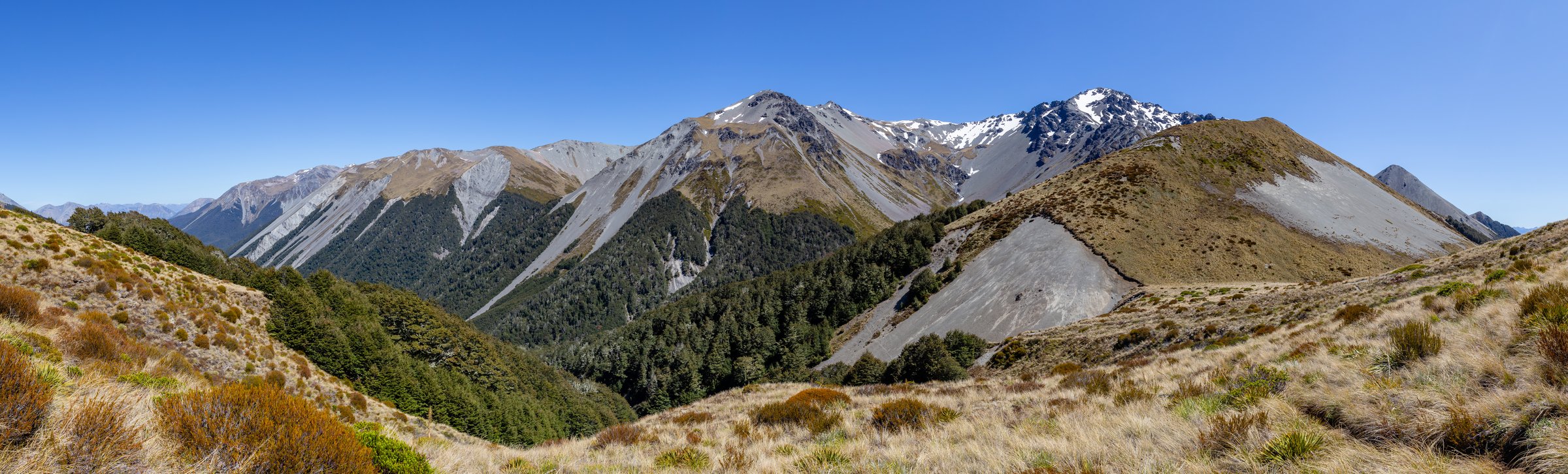
Craigieburn Forest Park lies beside State Highway 73 between Christchurch and Arthur’s Pass, extending from the Waimakariri River toward the Wilberforce country. Its walking character is distinctively dry Canterbury high country: mountain beech forest on sheltered lower slopes, open tussock above the bushline, glacial terraces, limestone-basin views, and loose grey scree on the higher Craigieburn Range.
The main day-walk cluster is near Castle Hill, Mistletoe Flats, Broken River Road, Craigieburn Valley Road, Texas Flat, and the Mount Cheeseman access road. DOC notes that the park has tracks and huts throughout, but the best short-to-full-day walks are concentrated close to SH73, where picnic areas, campsites, ski-field roads, and the Craigieburn Trails network give practical access.
The usual walking season is late spring to autumn, with summer often hot and dry and winter snow common. DOC treats routes above the bushline as alpine terrain: weather changes rapidly, tracks can be exposed to wind and cold, and avalanches are most common from May to November. Wasp numbers can be high from January to March. No fires are permitted in the park, and several shared-use tracks require care around mountain bikers.
Access is usually by private vehicle. Some bus services on SH73 may drop passengers by arrangement for the Cass-Lagoon corridor, but most trailheads need a car, shuttle, or ski-field-road access. After the December 2024 wildfire, DOC and Craigieburn Trails reported damage and staged reopenings; current DOC and Craigieburn Trails status should be checked before departure.
Selection rationale
These five hikes cover the most representative day-hike experiences in Craigieburn Forest Park: the classic Helicopter Hill viewpoint, the historic Craigieburn Edge access track to Craigieburn Valley ski field, the botanical and alpine Camp Saddle approach, the Hogs Back traverse from Castle Hill to Texas Flat, and the longer Cass-Lagoon day section over Lagoon Saddle to Bealey Hut / SH73. The set balances family-accessible tops, forest and tussock traverses, ski-field heritage, and a more remote Craigieburn backcountry route.
Summary table
| # | Hike | Country | Route type | Distance | Gain | Max elevation | Difficulty |
|---|---|---|---|---|---|---|---|
| 1 | Helicopter Hill via Mistletoe Track | New Zealand | Out-and-back | 5.6 km | 440 m | 1,256 m | Moderate-hard |
| 2 | Craigieburn Edge Track to Craigieburn Valley Ski Area | New Zealand | Out-and-back or road-return loop | 9.0 km out-and-back; 2-3 hr loop via road | 503 m on AllTrails out-and-back | ski-field hut area around bushline | Moderate |
| 3 | Broken River Road to Camp Saddle | New Zealand | Out-and-back | Approx. 7.0 km return including road approach; DOC lists track as 2.5 km one way after 1 km road approach | Approx. 500-600 m; needs GIS check | Approx. 1,500 m at Camp Saddle | Hard |
| 4 | Hogs Back Track: Castle Hill Village to Texas Flat | New Zealand | Point-to-point | 7.4-8.2 km depending on source/variant | 259 m on AllTrails point-to-point; 354 m on Trailforks route variant | Approx. 1,050 m on Trailforks | Moderate |
| 5 | Lagoon Saddle to Bealey Hut / SH73 | New Zealand | Point-to-point day section | 6.3 km | 175 m on AllTrails | Lagoon Saddle area approx. 1,100 m | Moderate |
1. Helicopter Hill via Mistletoe Track

Snapshot
Itinerary
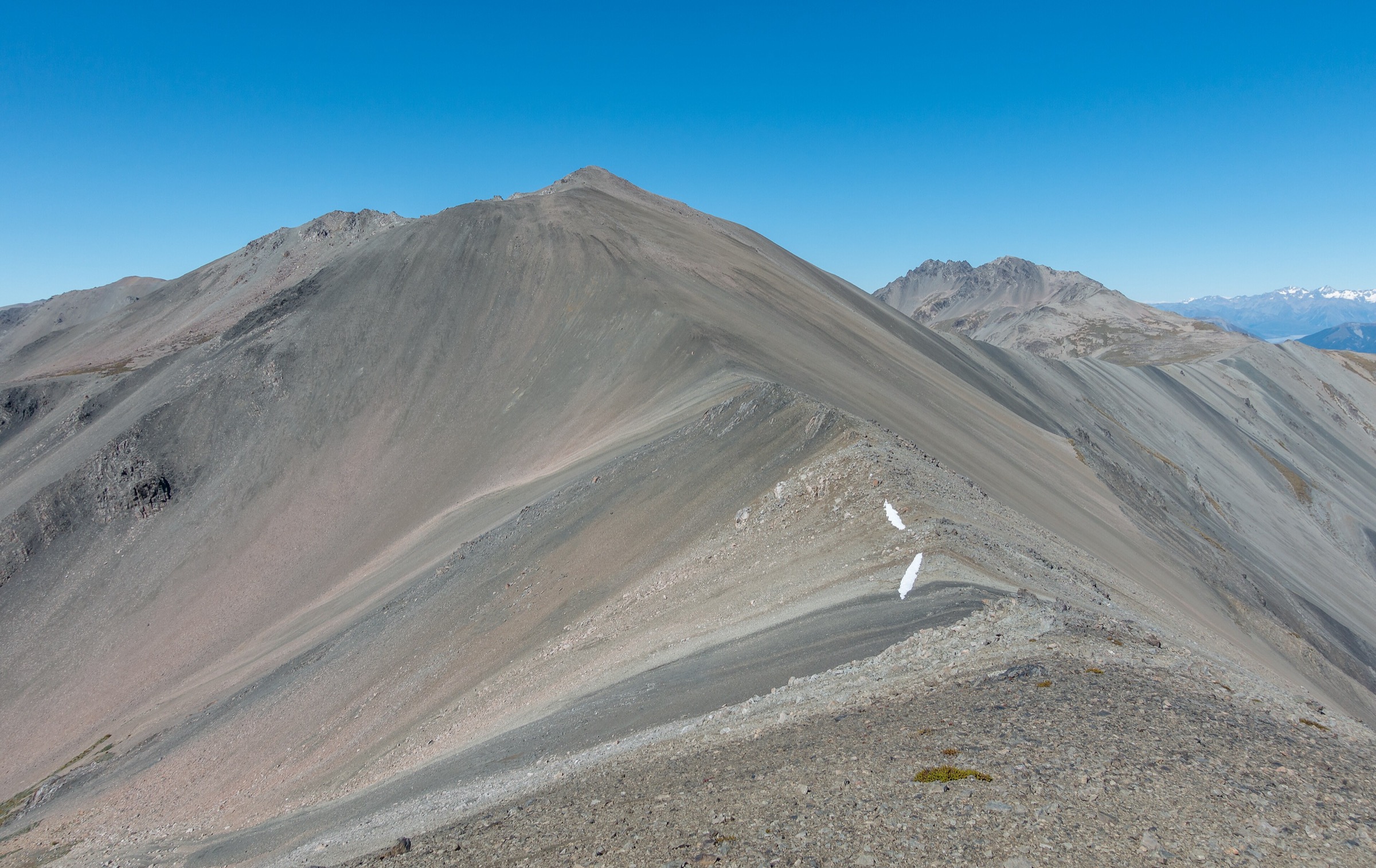
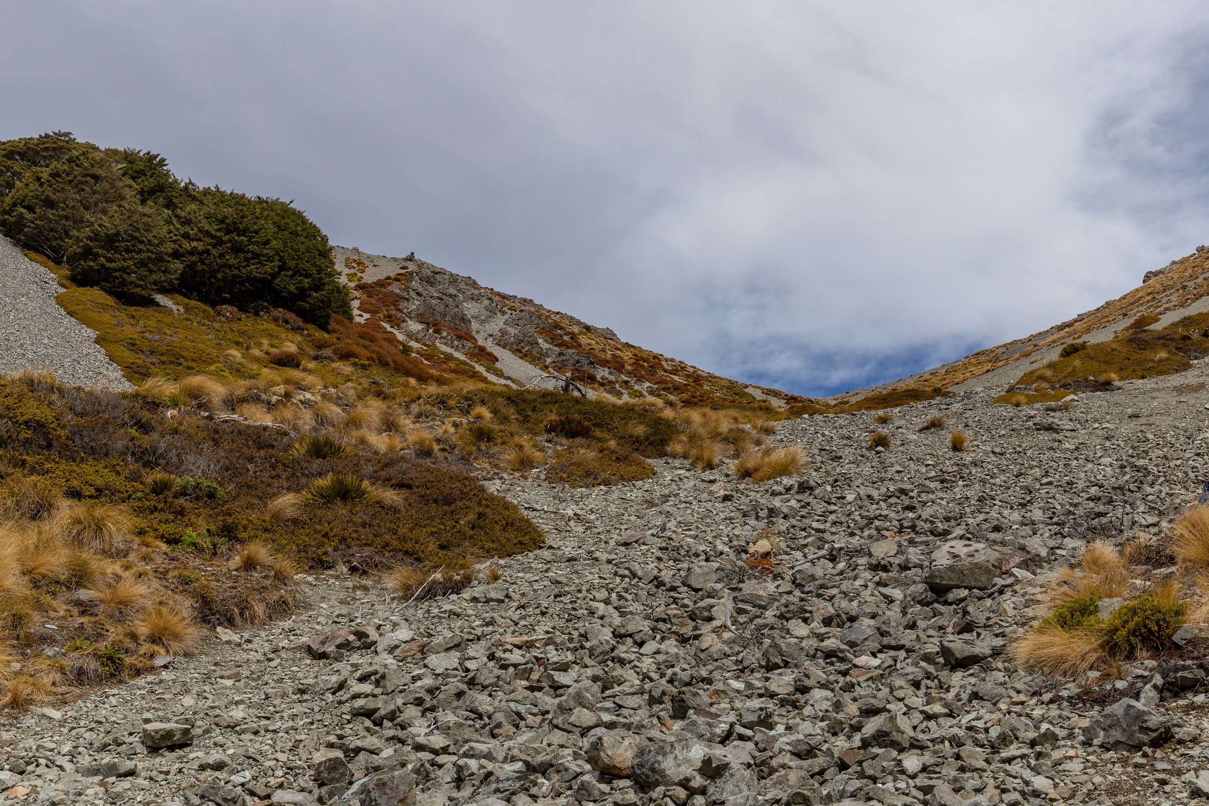
From the Craigieburn picnic area, Mistletoe Track crosses Cave Stream and grassy terraces before climbing through regenerating mountain beech forest to Lyndon Saddle. At the saddle junction, Helicopter Hill Track leaves the shared track network and climbs steeply along an exposed ridge with open scree sections between beech forest patches.
The summit is a tussock and low-shrub top with views across Castle Hill Basin, the Torlesse Range, the Craigieburn Range, and nearby limestone country. Return by the same route to Lyndon Saddle and descend Mistletoe Track to the picnic area.
Why it is essential
Helicopter Hill is the most compact Craigieburn summit viewpoint: short enough for a half-day but high enough to show the park’s full pattern of beech forest, grey scree, tussock tops, ski-field basins, and Castle Hill limestone basin.
Equipment
Mountain hiking equipment: sturdy shoes or boots, weatherproof layer, warm layer, sun protection, water, food, map/GPS, and navigation backup. Trekking poles are useful on the steeper descent. In winter or when snow is present, use avalanche-aware decision-making and carry traction only if conditions justify it.
Hazards and notes
DOC warns that Mistletoe Track can be exposed to avalanches from Helicopter Hill when snow is present, even if the track itself is snow-free. The Helicopter Hill summit ridge is exposed to wind, heat, rain, cold, and ice. No mountain biking is allowed on Mistletoe Track or Helicopter Hill Track. Expect wasps in summer and early autumn. No fires are permitted in Craigieburn Forest Park.
GPX / KML links
| Source | URL | Format / access | Reuse status |
|---|---|---|---|
| DOC: Mistletoe Track | doc.govt.nz | Official route page / map source | DOC website terms; no GPX found; source-map reference only |
| DOC: Helicopter Hill Track | doc.govt.nz | Official route page / map source | DOC website terms; no GPX found; source-map reference only |
| AllTrails: Helicopter Hill Track | alltrails.com | Route page / app map | AllTrails terms apply; GPX export terms not verified; secondary source-map reference |
External links
2. Craigieburn Edge Track to Craigieburn Valley Ski Area
Snapshot
Itinerary
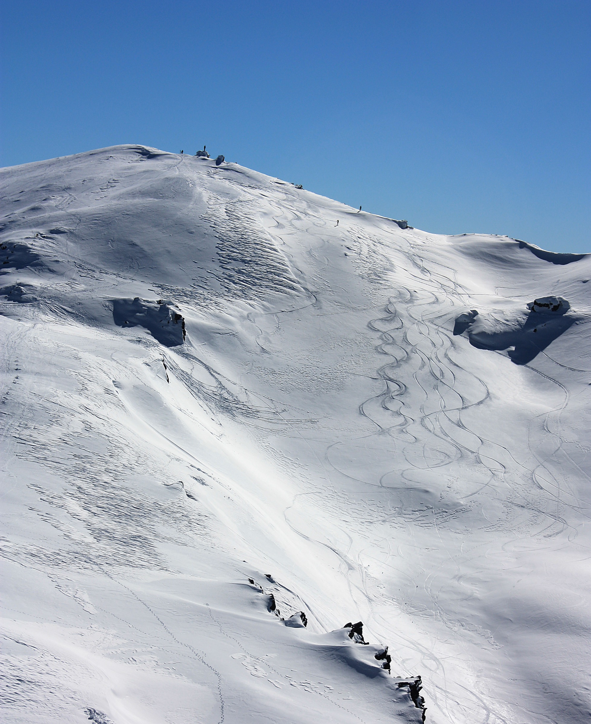
The track begins on Craigieburn Valley Road and sidles along the edge of Craigieburn Valley, gaining height through mountain beech forest. After about 20 minutes it passes the junction with The Luge Track, which links to Lyndon Saddle and the Broken River side of the park.
The route continues through beech forest and emerges into alpine tussock near the Craigieburn Valley ski-field huts and car park. Return by reversing the track, or make the DOC-described loop by descending the ski-field road to the start point.
Why it is essential
Craigieburn Edge Track is the historic walking access to Craigieburn Valley Ski Area; DOC notes that before the road was built in 1961, club members carried materials for early huts and tows up this route. It is also one of the best medium-length forest-to-tussock routes in the central park.
Equipment
Mountain hiking equipment: boots or sturdy trail shoes, raincoat, warm layer, water, food, sun protection, map/GPS, and navigation backup. Carry extra water on hot days. A headtorch is sensible if adding side trips or starting late.
Hazards and notes
DOC states that the track passes through complex avalanche terrain from the Luge/Edge junction to the ski field when snow is present, with large unmarked avalanche paths possible from May to November. The track is shared with mountain bikers. Craigieburn Valley Road can require chains in winter and should be checked with the ski-field operator. No fires are permitted.
GPX / KML links
| Source | URL | Format / access | Reuse status |
|---|---|---|---|
| DOC: Craigieburn Edge Track | doc.govt.nz | Official route page / map source | DOC website terms; no GPX found; source-map reference only |
| AllTrails: Craigieburn Edge Track | alltrails.com | Route page / app map | AllTrails terms apply; GPX export terms not verified; secondary source-map reference |
| OpenStreetMap search: Craigieburn Edge Track | openstreetmap.org | OSM map/source geometry | OSM data is ODbL; geometry cross-check only |
External links
3. Broken River Road to Camp Saddle
Snapshot
Itinerary
From the locked gate and car park on Broken River Road, walk about 1 km up the road to the signposted Camp Saddle Track opposite the ski club tractor shed. The route follows an old four-wheel-drive alignment that narrows as it climbs steadily through beech forest.
Above the bushline the track enters open tussock, where poles mark the route to Camp Saddle. Return by the same route. Experienced trampers may continue into untracked terrain toward Lyndon Saddle or Craigieburn Edge Track, but those extensions are not formed DOC tracks.
Why it is essential
Camp Saddle is the simplest legal walking approach to the alpine interior of the central Craigieburns. It gives a short but serious transition from beech forest to tussock saddle, with botanical interest on the rocky tops and direct views into the surrounding ski-field basins and Craigieburn ridges.
Equipment
Mountain hiking equipment: sturdy boots, waterproof and windproof layers, warm layer, sun protection, food, water, map/GPS, and navigation backup. A personal locator beacon is recommended for parties considering any untracked continuation. In snow, avalanche rescue equipment and training are required.
Hazards and notes
DOC warns of avalanches on Camp Saddle Track, including below the bushline, with complex avalanche terrain above the bushline. The route beyond Camp Saddle is untracked and requires confident map-and-compass navigation. Rockfall, loose scree, strong wind, whiteout, and sudden cold are realistic hazards. Wasps can be common in summer and early autumn.
GPX / KML links
| Source | URL | Format / access | Reuse status |
|---|---|---|---|
| DOC: Camp Saddle Track | doc.govt.nz | Official route page / map source | DOC website terms; no GPX found; source-map reference only |
| DOC Craigieburn Forest Park day-walks brochure | doc.govt.nz | Official PDF map and route notes | DOC PDF terms; no GPX found; source-map reference only |
| OpenStreetMap search: Camp Saddle Craigieburn | openstreetmap.org | OSM map/source geometry | OSM data is ODbL; geometry cross-check only |
External links
- DOC — Camp Saddle Track
- DOC — Craigieburn Forest Park day-walks brochure
- DOC — Be avalanche alert in Craigieburn Range
4. Hogs Back Track: Castle Hill Village to Texas Flat
Snapshot
Itinerary
From Thomas Bush car park near Castle Hill Village, walk along Water Intake Road and use the Easy Up Track, which DOC recommends for walkers and cyclists accessing the Hogs Back. The route climbs through beech forest onto Long Spur and joins the main Hogs Back Track.
The track follows the ridgeline, crosses open flats below Long Spur, passes through beech forest around Long Creek, climbs near Waterfall Creek, and traverses the western side of the Hogs Back before descending to Texas Flat via Ernie’s Mistake. Return options include reversing the route or arranging a shuttle; the road-return option uses Mt Cheeseman Road and SH73 and is less attractive for walkers.
Why it is essential
Hogs Back is the key Castle Hill-to-Cheeseman walking link and one of the park’s best shared-use ridge-and-forest traverses. It gives a moderate day outing with beech forest, open tussock, basin viewpoints, and a practical connection to Dracophyllum Flat and the Mount Cheeseman side of the range.
Equipment
Standard to mountain hiking equipment: trail shoes or boots, weatherproof layer, warm layer, water, food, sun protection, and map/GPS. Carry enough water for the exposed sections and respect mountain-bike traffic on shared-use singletrack.
Hazards and notes
The route is shared with mountain bikers; walkers should stay alert at bends and narrow sections. Craigieburn Trails notes that many tracks are not all-weather and should be avoided when muddy or after recent rain. DOC prohibits horses, motorbikes, and fires on this track. A point-to-point walk needs transport planning.
GPX / KML links
| Source | URL | Format / access | Reuse status |
|---|---|---|---|
| DOC: Hogs Back Track | doc.govt.nz | Official route page / map source | DOC website terms; no GPX found; source-map reference only |
| Craigieburn Trails: Hogs Back Track | craigieburntrails.org.nz | Local trail page / embedded map | Site copyright applies unless otherwise indicated; route-file reuse not stated; source-map reference only |
| AllTrails: Hogs Back Track | alltrails.com | Route page / app map | AllTrails terms apply; GPX export terms not verified; secondary source-map reference |
External links
5. Lagoon Saddle to Bealey Hut / SH73
Snapshot
Itinerary
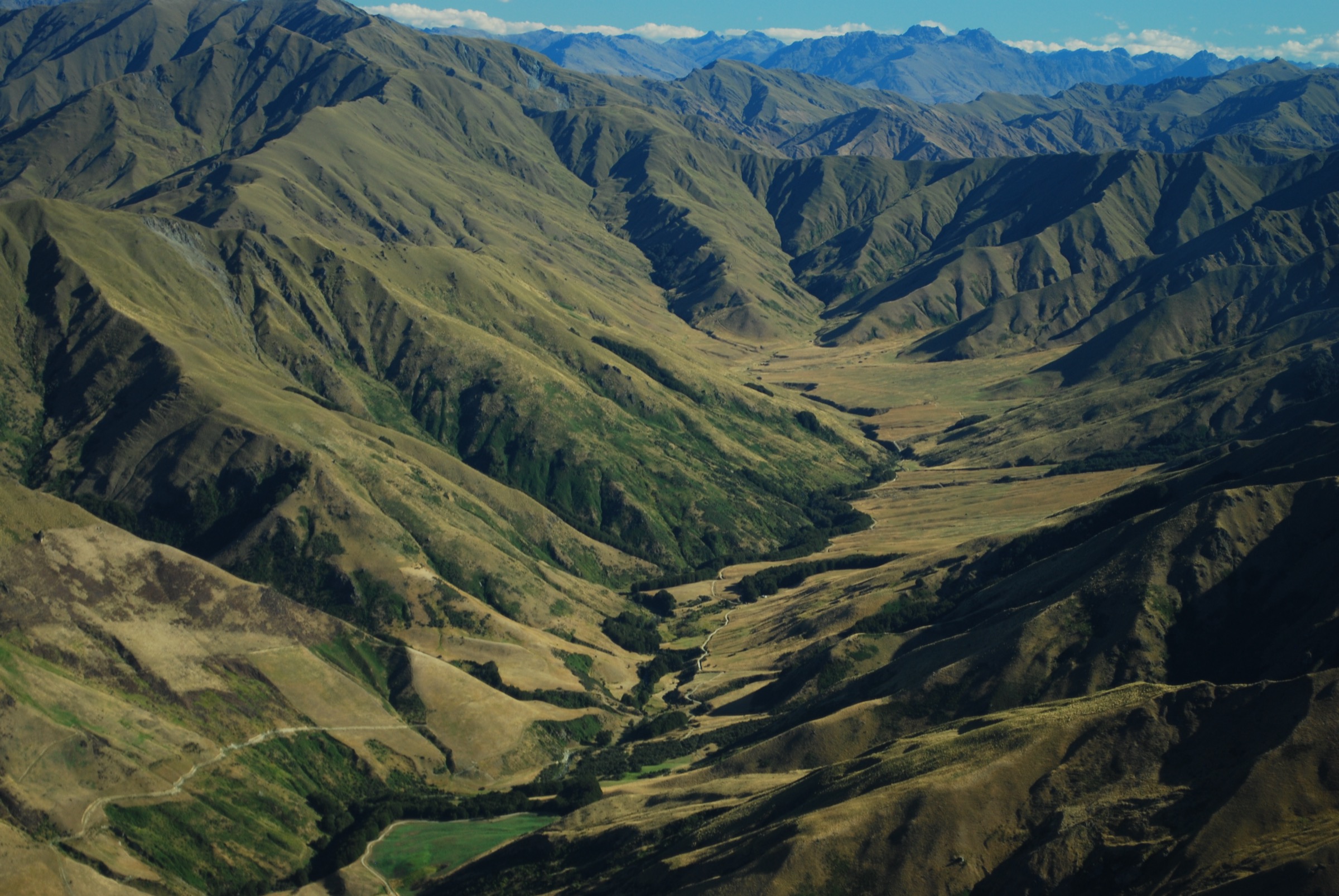
From Lagoon Saddle Hut, the route climbs gradually through patches of beech forest above the tarns on Lagoon Saddle. It is marked by poles and markers. Once on the northern face of Mount Bruce, the track descends through tussock with views toward Arthur’s Pass National Park and the braided Waimakariri River.
The track then descends through beech and exotic forest to Bealey Hut. From the hut it is a short walk to the car park by Cora Lynn Station and SH73.
Why it is essential
This is the best day-sized sample of the Cass-Lagoon backcountry route, one of Craigieburn Forest Park’s major tramping corridors and part of Te Araroa. It adds tarns, forest, open tussock, and Waimakariri views to a catalogue otherwise centred on the Castle Hill/Broken River/Cheeseman tracks.
Equipment
Mountain hiking equipment: boots, waterproof layer, warm layer, food, water, map/GPS, navigation backup, and headtorch. River-crossing equipment is not normally central to this short section, but the wider Cass-Lagoon route includes unbridged rivers and requires full tramping preparation.
Hazards and notes
DOC identifies avalanche and flooded rivers as hazards on the full Cass-Lagoon route and recommends late spring to early autumn. Avalanche terrain is simple between Bealey Hut and Hamilton Hut, but snow can change the seriousness of the route. Car break-ins have been reported at Arthur’s Pass track ends; valuables should not be left in vehicles.
GPX / KML links
| Source | URL | Format / access | Reuse status |
|---|---|---|---|
| DOC: Cass-Lagoon Saddle Track | doc.govt.nz | Official route page / map source | DOC website terms; no GPX found; source-map reference only |
| DOC Cass-Lagoon Saddles route guide PDF | doc.govt.nz | Official PDF map and route notes | DOC PDF terms; no GPX found; source-map reference only |
| AllTrails: Cass-Lagoon Saddle Track: Lagoon Saddle Hut to Bealey Hut and SH73 | alltrails.com | Route page / app map | AllTrails terms apply; GPX export terms not verified; secondary source-map reference |
External links
- DOC — Cass-Lagoon Saddle Track
- DOC — Cass-Lagoon Saddles route guide PDF
- AllTrails — Cass-Lagoon Saddle Track: Lagoon Saddle Hut to Bealey Hut and SH73
External links
| Source | URL |
|---|---|
| DOC — Craigieburn Forest Park | doc.govt.nz |
| DOC — Craigieburn Forest Park day-walks brochure | doc.govt.nz |
| DOC — Be avalanche alert in Craigieburn Range | doc.govt.nz |
| DOC — Helicopter Hill Track | doc.govt.nz |
| DOC — Mistletoe Track | doc.govt.nz |
| DOC — Craigieburn Edge Track | doc.govt.nz |
| DOC — Camp Saddle Track | doc.govt.nz |
| DOC — Hogs Back Track | doc.govt.nz |
| DOC — Cass-Lagoon Saddle Track | doc.govt.nz |
| Craigieburn Trails — track status | craigieburntrails.org.nz |
| Craigieburn Trails — Hogs Back Track | craigieburntrails.org.nz |
| AllTrails — Craigieburn Forest Park trails | alltrails.com |