The Milford Track is a 53.5 km one-way Great Walk through Fiordland National Park. The route is normally walked over four days and three nights, travelling from Glade Wharf at the head of Lake Te Anau to Sandfly Point on Milford Sound/Piopiotahi.
Key facts
- Overview
- Season and difficulty
- Route summary
- Day 1: Glade Wharf to Clinton Hut
- Day 2: Clinton Hut to Mintaro Hut
- Day 3: Mintaro Hut to Dumpling Hut
- Day 4: Dumpling Hut to Sandfly Point
- Accommodation
- Fees and bookings
- Access and transport
- Safety and suitability
- Weather, flooding and avalanche risk
- Equipment and food
- Conservation and biosecurity
- Historical notes
- Official route files, maps and PDFs
- Visitor information
Overview
The track passes through glacial valleys, beech forest, rainforest, river flats, alpine terrain and waterfall country. The main high point is Omanui/McKinnon Pass, followed by a long descent into the Arthur Valley.
Independent walkers stay in DOC huts at Clinton Hut, Mintaro Hut and Dumpling Hut. Camping is not permitted, and the track can only be walked in one direction.
Season and difficulty
During the Great Walks season, DOC manages the Milford Track as an intermediate tramping route with booked huts, resident rangers, facilities and managed hazard systems.
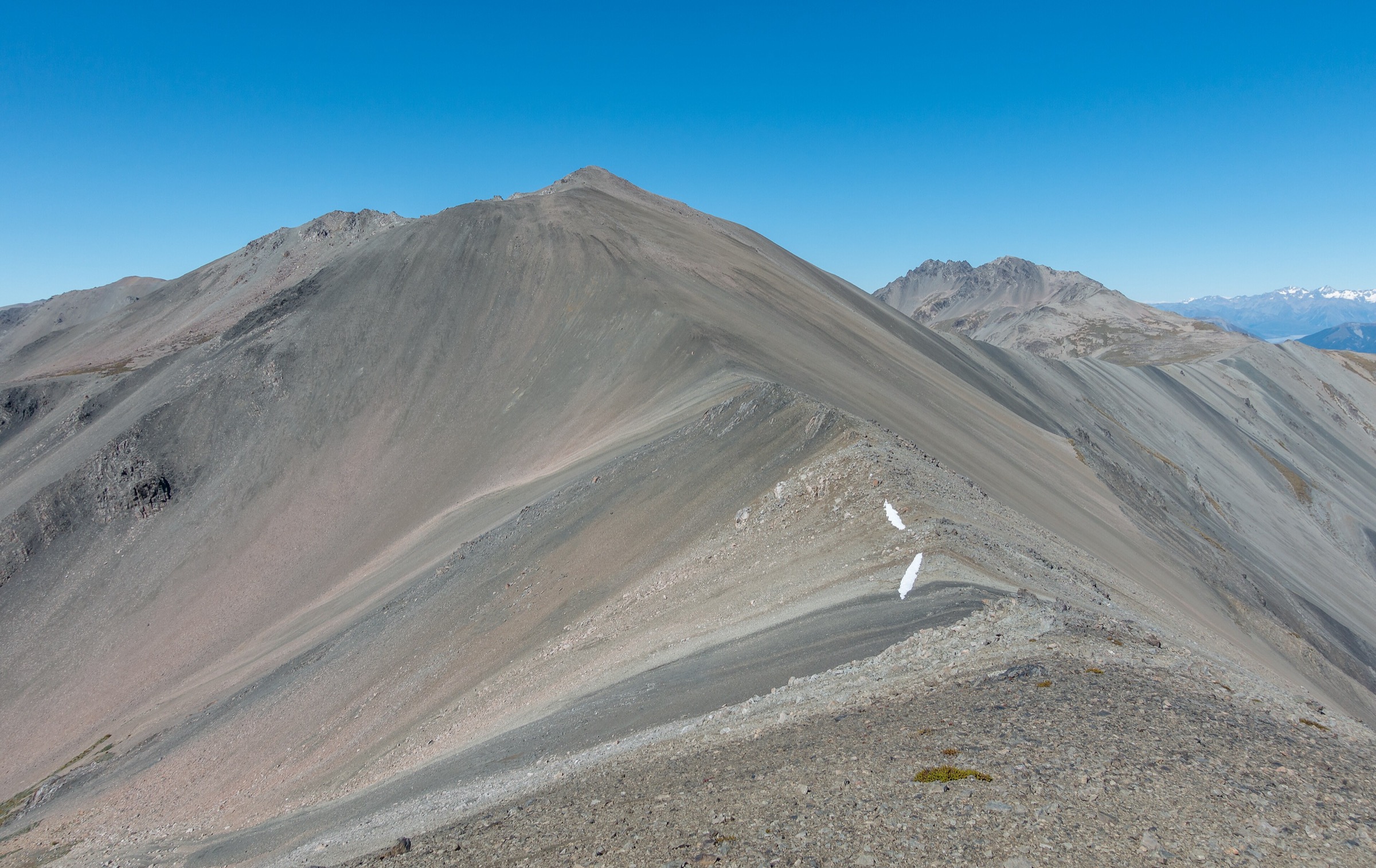
Outside the Great Walks season, conditions become substantially more serious. The route is suitable only for fit, experienced and well-equipped trampers with alpine, navigation and river-crossing skills. Facilities are reduced, daylight is shorter, snow and ice are likely, and avalanche risk is not managed in the same way as during the main season.
Outside the Great Walks season, the Milford Track should be treated as an alpine tramping route. Carry appropriate equipment, check DOC conditions and be prepared for snow, ice, flooding and avalanche terrain.
Route summary
| Day | Section | Distance | Walking time | Overnight / finish |
|---|---|---|---|---|
| 1 | Glade Wharf to Clinton Hut | 5 km | 1 – 1 hr 30 min | Clinton Hut |
| 2 | Clinton Hut to Mintaro Hut | 17.5 km | 6 hr | Mintaro Hut |
| 3 | Mintaro Hut to Dumpling Hut | 13 km | 6 – 7 hr | Dumpling Hut |
| 4 | Dumpling Hut to Sandfly Point | 18 km | 5 hr 30 min – 6 hr | Finish at Sandfly Point |
Day 1: Glade Wharf to Clinton Hut
Distance: 5 km
Time: 1 – 1 hr 30 min
After the boat trip from Te Anau Downs to Glade Wharf, the first walking day is short and gentle. The route follows the Clinton River through beech forest, crossing suspension bridges and passing Glade House before reaching Clinton Hut.
Nearby swimming holes and the short Wetland Walkway make this a gentle acclimatisation stage.
Side trip: Wetland Walkway — 15 min return. This short side trip branches off shortly before Clinton Hut.
Day 2: Clinton Hut to Mintaro Hut
Distance: 17.5 km
Time: 6 hr
The second day follows the Clinton Valley upstream, climbing gradually towards Lake Mintaro and the foot of Omanui/McKinnon Pass.
Notable points include Clinton Forks, Dead Lake, Hirere Falls, the open prairie area, Bus Stop Shelter and views towards the Pompolona icefield. Some sections between Dead Lake and Hirere Falls can be affected by flooding after heavy rain.
Day 3: Mintaro Hut to Dumpling Hut
Distance: 13 km
Time: 6 – 7 hr
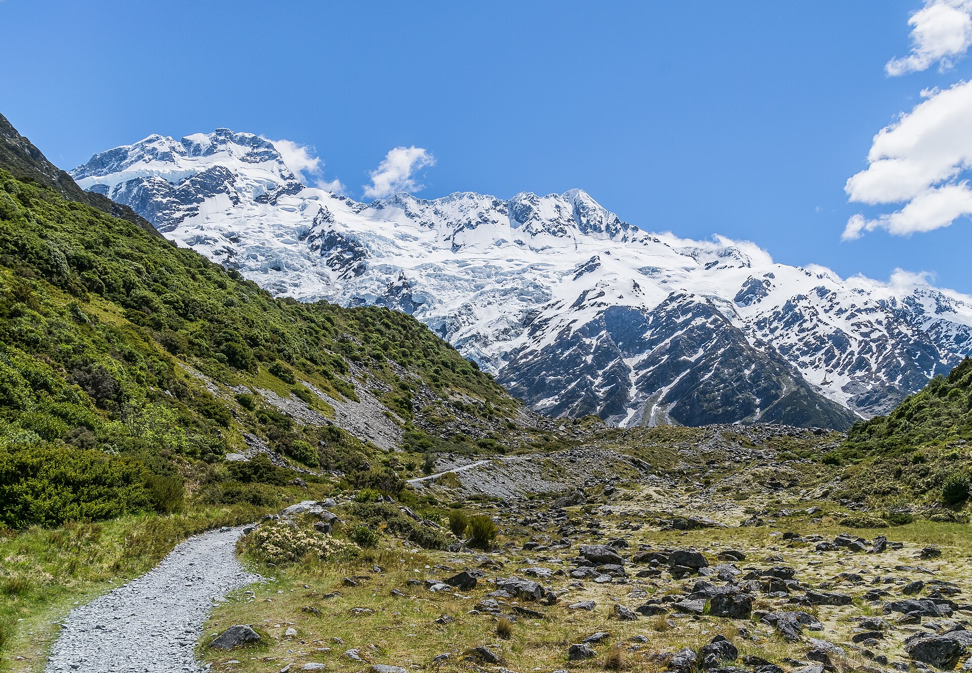
Day 3 is the main mountain stage. From Mintaro Hut, the track climbs in zigzags to the McKinnon Memorial, then continues to Omanui/McKinnon Pass Shelter at about 1,154 m, the highest point of the route.
The descent into the Arthur Valley is long and steep, dropping roughly 970 m over rocky and sometimes slippery terrain. The route passes the Roaring Burn, Andersons Cascade Shelter and Quintin Shelter before continuing to Dumpling Hut.
In severe weather, walkers may be directed onto an emergency track.
Side trip: Sutherland Falls — 1 hr 30 min return from Quintin Shelter. The falls drop 580 m from Lake Quill in three leaps and are one of the major highlights of the Milford Track.
Day 4: Dumpling Hut to Sandfly Point
Distance: 18 km
Time: 5 hr 30 min – 6 hr
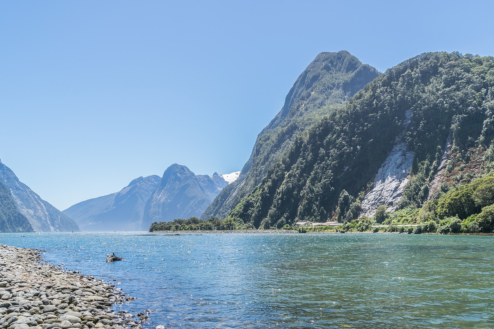
The final day follows the Arthur River past the historic Boatshed, Mackay Falls, Bell Rock, Lake Ada and Giant Gate Falls.
Rock cuttings beside the Arthur River and Lake Ada reflect the early construction history of the route. The final smooth section to Sandfly Point was built in the late 19th century.
The track finishes at Sandfly Point, where a boat transfers walkers to Milford Sound/Piopiotahi. Walkers must reach Sandfly Point in time for their booked boat connection.
Accommodation
DOC operates three huts on the Milford Track:
- Clinton Hut
- Mintaro Hut
- Dumpling Hut
Each hut has 40 bunks. During the Great Walks season, huts have bunks, mattresses, heating, toilets, basic cooking facilities, solar-powered lighting and cold running water. A DOC ranger is resident. Cooking utensils and showers are not provided.
During the Great Walks season, huts must be booked in advance. Without a valid booking, a walker may be charged a penalty or turned away if the hut is full. Outside the Great Walks season, facilities are reduced and different hut-ticket arrangements apply.
Fees and bookings
Milford Track hut fees vary by season, age and residency status. Bookings are essential during the Great Walks season and should be made through DOC’s official booking system.
Access and transport
The Milford Track has no vehicle or private access at either end.
Typical access:
- Te Anau to Te Anau Downs by bus or private transfer
- Te Anau Downs to Glade Wharf by boat, about 1 hr 15 min
- Sandfly Point to Milford Sound/Piopiotahi by boat, about 20 min
- Milford Sound/Piopiotahi to Te Anau or Queenstown by bus
Transport must be booked in advance. DOC does not provide transport services, but lists transport information and approved operators for Fiordland.
For details, see transport services in Fiordland.
Safety and suitability
The Milford Track is not recommended by DOC for children under 10 because of the exposed mountain environment and frequent adverse weather.
The third day includes a climb of more than 500 m to Omanui/McKinnon Pass and a descent of about 1,000 m to Dumpling Hut. The fourth day requires an 18 km walk to meet the afternoon boat.
There is no cellphone coverage on the track. A distress beacon is strongly advisable, and a satellite communication device is worth considering, especially outside the Great Walks season.
Weather, flooding and avalanche risk
Fiordland is extremely wet, with very high annual rainfall. Cold temperatures, snow, heavy rain and strong wind can occur in any season. Track closures are possible and can affect onward travel plans.
Flooding is a recurring hazard. The Clinton and Arthur valleys can become impassable after heavy rain, and some side streams rise quickly. Unbridged rivers or streams should not be crossed when flooded, when safe entry and exit points cannot be identified, or when there is any doubt.
Avalanche risk can extend into December. During the Great Walks season, DOC manages avalanche risk to a low level, but walkers may be flown over hazardous sections at their own cost. Outside the Great Walks season, DOC does not manage avalanche risk, and numerous avalanche paths may affect the route.
Equipment and food
Standard equipment:
- 40 – 60 litre pack
- Pack liner
- 3 – 4 season sleeping bag
- Torch or headlamp
- First-aid kit
- Survival items
- Map and compass
- Warm layers
- Waterproof jacket and trousers
- Broken-in boots
- Hat and gloves
- Spare dry clothing
- Cooking and eating gear
- Drink bottle
- Matches or lighter
Food cannot be purchased on the track. All meals, snacks and emergency food must be carried. Lightweight, high-energy, quick-cooking food is the most practical choice. Food should be stored securely against rodents.
Outside the Great Walks season, additional equipment is required, including food for at least two extra days, stove and gas, alpine gear such as ice axe and crampons, avalanche transceiver, probe and shovel, personal locator beacon, and preferably a satellite messenger.
Conservation and biosecurity
Didymo is present in Lake Te Anau and Milford Sound but not in the Clinton and Arthur rivers. Walkers should follow Check, Clean, Dry procedures, especially when moving between lake, river and sound environments.
Native wildlife highlights include northern Fiordland tokoeka, whio/blue duck, pāteke/brown teal, tuna/longfin eel and seasonal alpine flowers such as Mount Cook buttercup, mountain daisy and gentian. Predator-control work in the Clinton and Arthur valleys supports recovering birdlife along the track.
Historical notes
The search for a route through the Clinton and Arthur valleys began in 1888, when government-funded expeditions were sent to find access to Milford Sound. Quintin McKinnon and Ernest Mitchell found the pass that same year, and McKinnon became closely associated with early guiding on the track.
Later construction included difficult rock-blasting around Lake Ada, completed by contract labourers by 1898 after an unsuccessful attempt to use prison labour.
Official route files, maps and PDFs
- PDF Milford Track brochure Overview, route profile, access, hut and safety information.
- PDF Milford Track walking guide Route map, mile markers, shelters, huts, side trips and daily route notes. The map is a guide only and is not for navigation.
- JPG Milford Track elevation profile Elevation profile from Glade Wharf to Sandfly Point, including huts and shelters.
- PDF Milford Track transport map Bus and ferry links between Te Anau, Te Anau Downs, Glade Wharf, Sandfly Point and Milford Sound.
No official DOC GPX or KML route file was found for the Milford Track. Use the official DOC maps and current route information for planning, and carry appropriate navigation tools.
Visitor information
For current conditions, weather warnings, hut information and route advice, contact Te Rua-o-te-moko / Fiordland National Park Visitor Centre in Te Anau.
- Phone: +64 3 249 7924
- Email: fiordlandvc@doc.govt.nz
Based on official information from the New Zealand Department of Conservation.