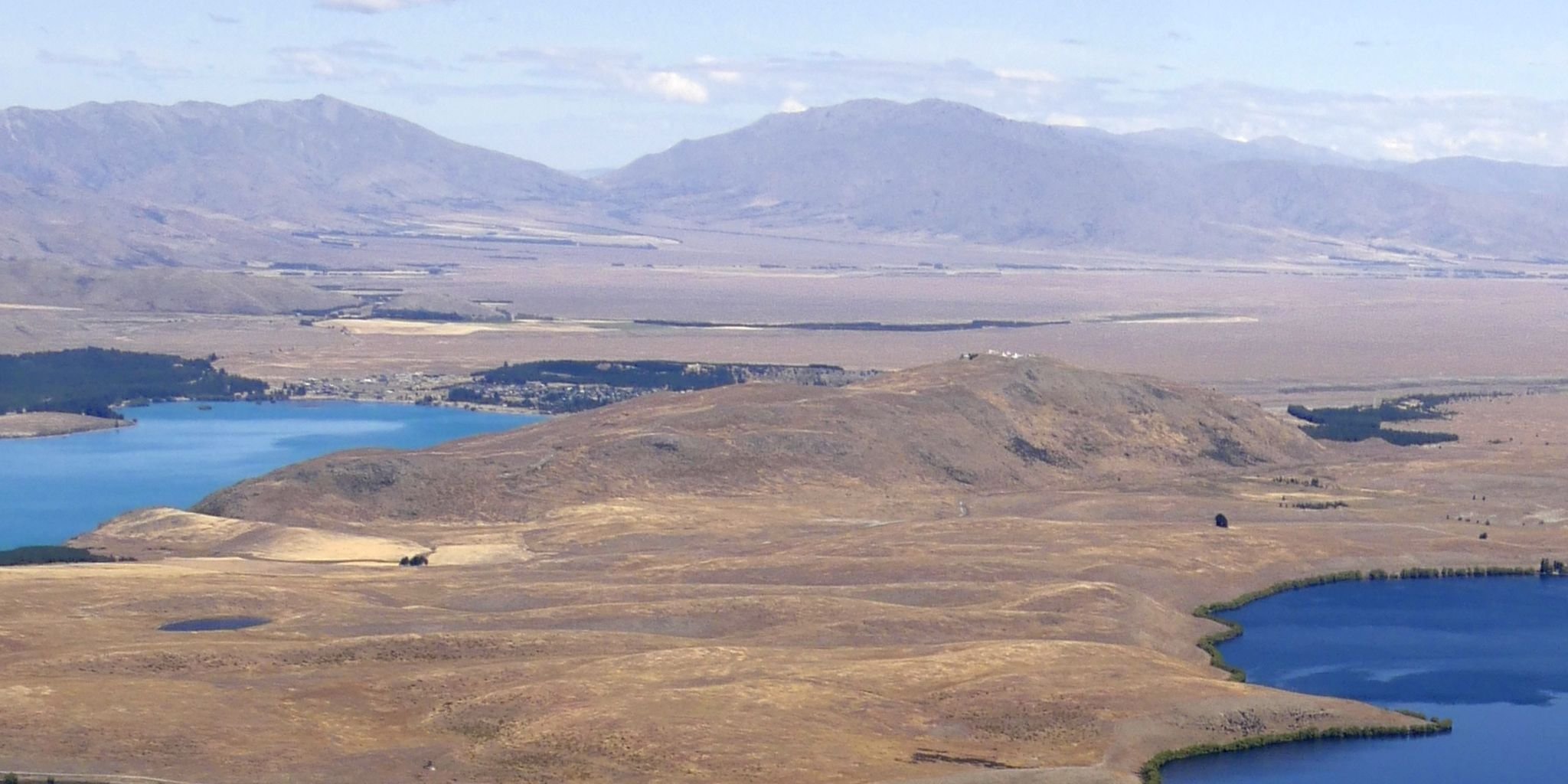
Regional overview
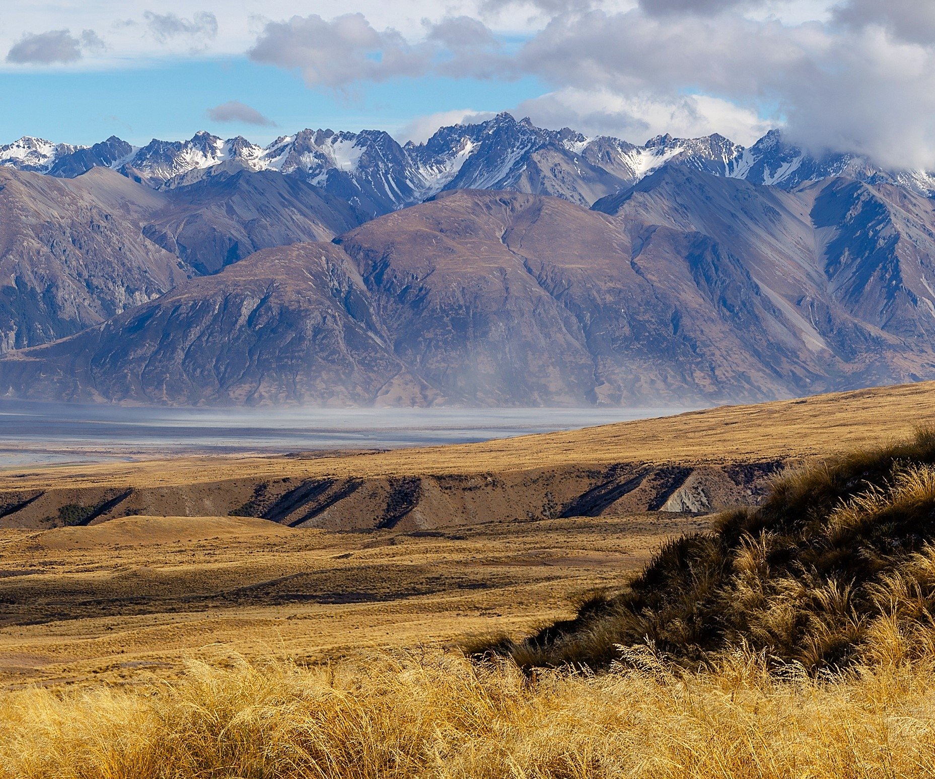
The southern Two Thumb Range is the South Canterbury end of Te Kahui Kaupeka Conservation Park, reached from the Lake Tekapo / Fairlie side by the Opuha access routes and from the Rangitata side by Bush Stream near Mesopotamia. The terrain is open tussock, working-station access, old farm tracks, steep river valleys, unbridged crossings, scree slopes, avalanche-prone hut basins and remote Te Araroa route sections.
This is not a compact signed day-walk area. DOC’s material describes hut approaches and multi-day route sections rather than a full set of polished day hikes. The best day objectives are therefore North Opuha to Spurs Hut, South Opuha Hut approaches and crossings, and Bush Stream / Crooked Spur sections of the Te Araroa route. Several entries remain partially verified because official distances and elevation gains are incomplete.
The best season is summer to early autumn in settled weather and low-water conditions. Bush Stream, Opuha crossings and side streams can become dangerous after heavy rain or during spring snowmelt. Winter and spring introduce avalanche run-out zones, with Stone Hut specifically noted by DOC as high avalanche risk. Cell coverage is patchy and a personal locator beacon is strongly recommended.
Selection rationale
The five hikes represent the southern access pattern: North Opuha and Spurs Hut as the clearest hut day, South Opuha as the southern valley approach, the South Opuha-North Opuha crossing, Bush Stream to Crooked Spur Hut as the Rangitata-side day section, and Crooked Spur to Stone/Royal Hut as the harder Te Araroa continuation.
Summary table
| # | Hike | Country | Route type | Distance | Gain | Max elevation | Difficulty |
|---|---|---|---|---|---|---|---|
| 1 | Spurs Hut via North Opuha Track | New Zealand | Out-and-back | DOC: 7 km one way; AllTrails: 15.8 km return | 365 m on AllTrails | Not verified | Moderate-hard |
| 2 | South Opuha Hut approach | New Zealand | Out-and-back / long approach | No complete distance found; DOC gives 5-6 hr one way total | Not verified | Not verified | Hard / candidate |
| 3 | South Opuha Hut to North Opuha and Spurs Hut | New Zealand | Point-to-point | 9 km one way, DOC brochure | Not published | Not verified | Expert route |
| 4 | Bush Stream car park to Crooked Spur Hut | New Zealand | Out-and-back | Distance not published on current DOC page; older brochure/source notes 5.5 km one way need confirmation | Not verified | Not verified | Advanced |
| 5 | Crooked Spur Hut to Stone Hut and Royal Hut | New Zealand | Point-to-point hut section | 14.5 km one way in DOC brochure; current DOC page gives 5 hr + 2 hr | Not published | Not verified | Expert / long day section |
1. Spurs Hut via North Opuha Track
Snapshot
Itinerary
From the North Opuha car park, cross the river and follow the marked easement across working-farm access. The route climbs and sidles east, then descends toward the North Opuha. Follow markers and poles to the conservation land boundary and continue up the riverbed route to Spurs Hut. Return by the same line.
Why it is essential
Spurs Hut is the clearest southern Two Thumb hut day. It gives a manageable entry into the North Opuha valley while still representing the remote, river-crossing character of the range.
Equipment
Mountain hiking equipment: boots, warm/waterproof layers, wind protection, sun protection, map/GPS, navigation backup, headtorch, emergency shelter, spare food, first aid and PLB. River-crossing skills are important.
Hazards and notes
The access easement crosses a working farm; no camping is allowed on or off the easement. River crossings and route-finding on riverbed sections require care. Conditions can become unsafe after rain or snowmelt. Check current DOC and land-access notes before travel.
GPX / KML links
| Source | URL | Format / access | Reuse status |
|---|---|---|---|
| DOC Te Kahui Kaupeka Conservation Park brochure | doc.govt.nz | Official PDF map and route notes | DOC website/PDF terms; no GPX found; official source-map reference |
| DOC Spurs Hut page | doc.govt.nz | Official hut/access page | DOC website terms; no GPX found; access and hut source |
| AllTrails: Spurs Hut via North Opuha Track | alltrails.com | Route page / app map | AllTrails terms apply; secondary route source only |
External links
- DOC — Te Kahui Kaupeka Conservation Park brochure (PDF)
- DOC — Spurs Hut
- AllTrails — Spurs Hut via North Opuha Track
2. South Opuha Hut Approach
Snapshot
Itinerary
From the locked gate, follow the road line toward the South Opuha valley. DOC notes a long flat road approach before reaching the private/public land boundary, then an old farm-track route toward South Opuha Hut. The current conservation boundary and access details should be checked carefully because the brochure notes that the easement was not yet fully formed.
Why it is essential
South Opuha Hut is the southern valley’s key hut objective and provides the most direct walking representation of the south end of the Two Thumb Range from the Lake Tekapo side.
Equipment
Mountain hiking equipment: boots, warm/waterproof layers, sun protection, map/GPS, navigation backup, headtorch, emergency shelter, spare food, first aid and PLB. Carry enough water and river-crossing knowledge.
Hazards and notes
River crossings can become difficult or impassable after heavy rain or snowmelt. Access across private land must be respected, and the route should not be treated as fully publication-ready until the current easement, boundary signage and distance are confirmed.
GPX / KML links
| Source | URL | Format / access | Reuse status |
|---|---|---|---|
| DOC Te Kahui Kaupeka Conservation Park brochure | doc.govt.nz | Official PDF map and route notes | DOC website/PDF terms; no GPX found; official source-map reference only |
| OpenStreetMap search: South Opuha Hut | openstreetmap.org | OSM search / map | OSM data is ODbL; geometry cross-check candidate only |
External links
3. South Opuha Hut to North Opuha and Spurs Hut
Snapshot
Itinerary
From South Opuha Hut, the route crosses toward the North Opuha and Spurs Hut using mostly unmarked riverbed and range-foot travel. DOC describes multiple creek and river crossings, unmarked terrain and a large scree slope that can become impassable after heavy snow and may be avalanche-prone.
Why it is essential
This is the key internal link between the South Opuha and North Opuha valleys. It records the southern Two Thumb range-crossing character that cannot be represented by an out-and-back hut approach alone.
Equipment
Full remote mountain equipment: boots, warm/waterproof layers, map and compass/GPS, PLB, emergency shelter, headtorch, spare food, first aid and water treatment. Avalanche gear may be required in snow conditions; avoid the route in avalanche-prone periods unless appropriately trained and equipped.
Hazards and notes
DOC states that travel over the range is unmarked and can be dangerous. Creeks may be difficult during snowmelt or heavy rain. The scree slope and snow conditions are major hazards. This is a candidate for experienced trampers only and should not be marketed as a standard day walk.
GPX / KML links
| Source | URL | Format / access | Reuse status |
|---|---|---|---|
| DOC Te Kahui Kaupeka Conservation Park brochure | doc.govt.nz | Official PDF map and route notes | DOC website/PDF terms; no GPX found; official source-map reference only |
| OpenStreetMap search: South Opuha North Opuha Spurs Hut | openstreetmap.org | OSM search / map | OSM data is ODbL; geometry cross-check candidate only |
External links
4. Bush Stream Car Park to Crooked Spur Hut
Snapshot
Itinerary
From Bush Stream car park, follow the Te Araroa / DOC route toward Crooked Spur Hut. The route uses marked and poled sections, crosses or travels near Bush Stream, and climbs into more remote tussock and spur terrain before reaching the hut. Return by the same route unless continuing on the longer Two Thumb Track.
Why it is essential
Crooked Spur Hut is the southern range’s most accessible Te Araroa hut objective from the Rangitata side and gives a strong day-sized entry into the Bush Stream corridor.
Equipment
Mountain hiking equipment: boots, warm/waterproof layers, wind protection, map/GPS, navigation backup, headtorch, emergency shelter, spare food, first aid, water treatment and PLB. River-crossing skills are required.
Hazards and notes
DOC warns that Bush Stream can be difficult to cross and should not be attempted in flood or when heavy rain is forecast; spring snowmelt can also raise the stream. Take care around Sawtooth Bluff, where Bush Stream is narrow, steep and deep. Cell coverage is patchy.
GPX / KML links
| Source | URL | Format / access | Reuse status |
|---|---|---|---|
| DOC Bush Stream and Camp Stream tracks | doc.govt.nz | Official route page / source map | DOC website terms; no GPX found; official route and hazard source |
| Te Araroa Canterbury GPX | teararoa.g2digital.co.nz | GPX | Te Araroa official 2025-26 GIS data; reuse/attribution terms need checking |
| Te Araroa Canterbury KMZ | teararoa.g2digital.co.nz | KMZ | Te Araroa official 2025-26 GIS data; reuse/attribution terms need checking |
External links
5. Crooked Spur Hut to Stone Hut and Royal Hut
Snapshot
Itinerary
From Crooked Spur Hut, continue on the Two Thumb / Te Araroa route toward Stone Hut. DOC gives five hours for this section and notes serious avalanche exposure around Stone Hut. The route then continues for about two hours to Royal Hut. For a day catalogue, Stone Hut may be the more realistic turn-around; Royal Hut is a long point-to-point section unless combined with an overnight plan.
Why it is essential
This is the southern Two Thumb route’s classic internal Te Araroa continuation, linking the Bush Stream approach with the Royal Hut basin and the later Stag Saddle route toward Lake Tekapo.
Equipment
Full remote mountain equipment: boots, warm/waterproof layers, map and compass/GPS, PLB, emergency shelter, headtorch, spare food, first aid, water treatment and river-crossing capability. Avalanche equipment and training are required if snow conditions exist.
Hazards and notes
DOC states that Stone Hut is subject to a high level of avalanche risk and recommends not using it during winter and spring when there is more than 50 cm of snow on the slope behind the hut. The route is remote, includes unbridged crossings, requires navigation and has patchy or absent cell coverage.
GPX / KML links
| Source | URL | Format / access | Reuse status |
|---|---|---|---|
| DOC Bush Stream and Camp Stream tracks | doc.govt.nz | Official route page / source map | DOC website terms; no GPX found; official route and hazard source |
| Te Araroa Canterbury GPX | teararoa.g2digital.co.nz | GPX | Te Araroa official 2025-26 GIS data; reuse/attribution terms need checking |
| Te Araroa Canterbury KMZ | teararoa.g2digital.co.nz | KMZ | Te Araroa official 2025-26 GIS data; reuse/attribution terms need checking |
External links
- DOC — Bush Stream and Camp Stream tracks
- DOC — Te Kahui Kaupeka Conservation Park brochure (PDF)
- Te Araroa — Trail maps
External links
| Source | URL |
|---|---|
| DOC — Te Kahui Kaupeka Conservation Park brochure (PDF) | doc.govt.nz |
| DOC — Spurs Hut | doc.govt.nz |
| DOC — Bush Stream and Camp Stream tracks | doc.govt.nz |
| Te Araroa — Trail maps | teararoa.org.nz |
| Te Araroa Canterbury GPX | teararoa.g2digital.co.nz |
| Te Araroa Canterbury KMZ | teararoa.g2digital.co.nz |
| AllTrails — Spurs Hut via North Opuha Track | alltrails.com |